From Surf Wiki (app.surf) — the open knowledge base
North Piddle
Civil parish in Worcestershire, England
Civil parish in Worcestershire, England
| Field | Value |
|---|---|
| country | England |
| coordinates | |
| official_name | North Piddle |
| population | 80 |
| shire_district | Wychavon |
| shire_county | Worcestershire |
| region | West Midlands |
| constituency_westminster | Mid Worcestershire |
| postcode_district | WR7 |
| postcode_area | WR |
| post_town | PERSHORE |
| os_grid_reference | SO9662555396 |
| static_image_name | Church Farm, North Piddle - geograph.org.uk - 850633.jpg |
| static_image_caption | Church Farm, North Piddle |
North Piddle is a small civil parish in the Wychavon district of Worcestershire, England. It is located within a loop of Piddle Brook.
North Piddle is a historic parish and a few of the parish's structures have been designated as listed buildings by English Heritage, because they are structures of special architectural and historic interest.
In 1924 797 acre of land were designated to North Piddle – 422 acres (171 ha) were grassland, and the rest was arable land. The field names that are mentioned in the document dating back to the 16th century include Frarye Acre, Husband Acre, Monck Acre, Le Home, Le Deane and Gostell Field.
At the 1821 census there were 133 inhabitants living in the parish, and in 1851 slightly more, at 149. , there are 80 people living in North Piddle.
Origin of the name
William Henry Dugan, in his book Worcestershire Place Names, states that although the word "Piddle" is not listed in any Anglo-Saxon dictionary, it is found in a few places in Anglo-Saxon charters. Dugan believes that the word "Piddle" is an old English word for a small stream. North Piddle was named after Piddle Brook, on which it stands. It has frequently been noted on lists of unusual place names.
History
''Domesday Book'''s records of the great survey of much of England and parts of Wales, completed in 1086, mentions two estates in North Piddle, both of which were held for the abbey of Westminster by Urse d'Abetot.
Through the ages North Piddle manor was connected to many notable and colourful figures, including the Dukes of Norfolk. Thomas de Mowbray, 1st Duke of Norfolk, was banished from England and died of the "pestilence" (bubonic plague) in Venice in 1399. His son and heir Thomas de Mowbray, 4th Earl of Norfolk was beheaded in 1405, and the manor was taken into family ownership and granted for life to Edward Beauchamp. A few years later the manor was once again owned by the Dukes of Norfolk, but the direct line was broken when Anne de Mowbray, 8th Countess of Norfolk, who was married when she was 5 years old to Richard of Shrewsbury, 1st Duke of York, died three years after her marriage. Her husband was murdered in the Tower of London soon after. In 1868 the parish was divided into small farms and by 1924 the manorial rights had lapsed.
The Greenwood brothers' Worcestershire Delineated (1822) says of the parish:
The National Gazetteer of Great Britain and Ireland (1868) says:
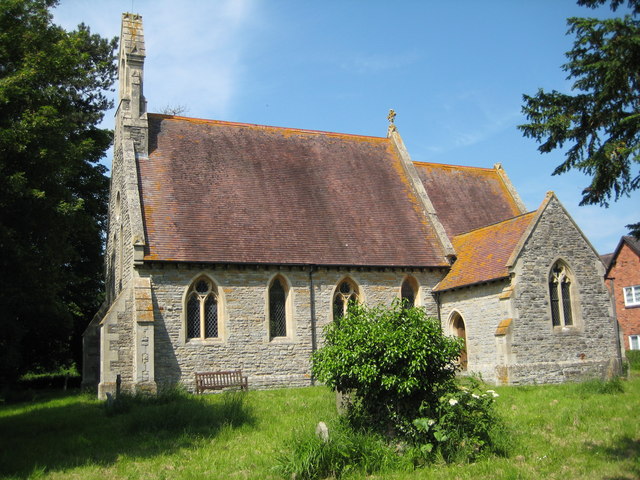
St Michael's, the parish church of North Piddle, was originally built in 1289 but almost nothing survives of the old building; the church was rebuilt in 1876.
On 17 December 1896 there was an earthquake in the region that "exceeded in violence any previous instance of seismic energy there within the present century." The earthquake was preceded by a loud roar "as of thunder" or "a rushing mighty wind", and residents whose windows were facing north saw a "great light", which some attributed to a large meteor. This was probably an earthquake light.
References
References
- Lyall, Sarah. (22 January 2009). "No Snickering: That Road Sign Means Something Else". [[The New York Times]].
- C. and J. Greenwood, ''Worcestershire Delineated: Being a Topographical Description of Each Parish, Chapelry, Hamlet, &c. In the County; with the distances and bearings from their respective market towns, &c.'' (1822)
- [http://www.genuki.org.uk/big/eng/WOR/NorthPiddle/index.html North Piddle] at genuki.org.uk, accessed 16 April 2011
- ''The Times'', Friday 18 December 1896; pg. 9; Issue 35077; col E
- William Henry Dugan. (1905). "Worcestershire Place Names". [[Oxford University Press]].
- "St Michael's – North Piddle".
- (9 May 2009). "North Piddle Billings Directory 1855".
- "Listed Buildings in North Piddle, Worcestershire, England". Listed Buildings in England.
- "'Parishes: North Piddle', in ''A History of the County of Worcester: volume 4'' (1924), pp. 177-180.". [[British History Online]].
- J. Lloyd Bozward. (24 December 1986). "The Earthquake of December 17". Nature.
This article was imported from Wikipedia and is available under the Creative Commons Attribution-ShareAlike 4.0 License. Content has been adapted to SurfDoc format. Original contributors can be found on the article history page.
Ask Mako anything about North Piddle — get instant answers, deeper analysis, and related topics.
Research with MakoFree with your Surf account
Create a free account to save articles, ask Mako questions, and organize your research.
Sign up freeThis content may have been generated or modified by AI. CloudSurf Software LLC is not responsible for the accuracy, completeness, or reliability of AI-generated content. Always verify important information from primary sources.
Report