From Surf Wiki (app.surf) — the open knowledge base
North Epping
Whale_Rock_formation.jpg)
| Field | Value |
|---|---|
| type | suburb |
| name | North Epping |
| city | Sydney |
| state | nsw |
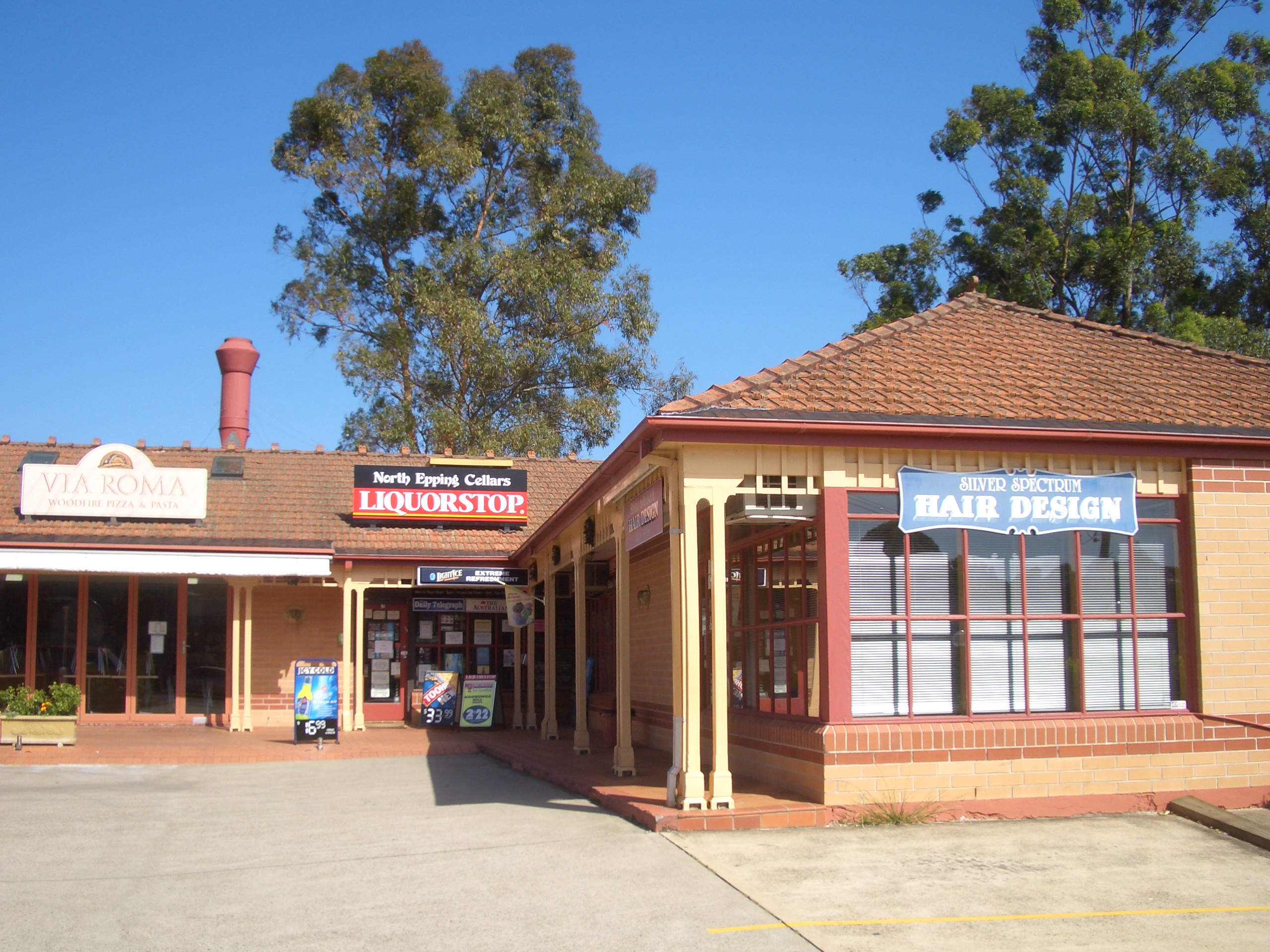
| image | North_epping_village-1w.jpg |
| caption | North Epping retail area |
| alternative_location_map | Australia NSW metro Sydney |
| pushpin_map_caption | Location in metropolitan Sydney |
| coordinates | |
| local_map | yes |
| zoom | 12 |
| lga | Hornsby Shire |
| postcode | 2121 |
| est | 1899 |
| pop | |
| pop_year | |
| pop_footnotes | |
| elevation | 98 |
| area | 2.3 |
| stategov | Epping |
| fedgov | Berowra |
| near-nw | Pennant Hills |
| near-n | Wahroonga |
| near-ne | South Turramurra |
| near-w | Cheltenham |
| near-e | South Turramurra |
| West Pymble | |
| near-sw | Epping |
| near-s | Marsfield |
| near-se | Macquarie Park |
| dist1 | 19 |
| location1 | Sydney CBD |
| near-nw = Pennant Hills | near-n = Wahroonga | near-ne = South Turramurra | near-w = Cheltenham | near-e = South Turramurra West Pymble | near-sw = Epping | near-s = Marsfield | near-se = Macquarie Park
North Epping is a suburb of Sydney, in the state of New South Wales, Australia 19 kilometres north-west of the Sydney central business district in the local government area of Hornsby Shire. North Epping is in the Northern Sydney region, and is often referred to as part of the "North-West" or North Shore. Epping is a separate suburb to the south and under the Parramatta City Council, which shares the postcode of 2121.
North Epping is a leafy suburb, surrounded by bushland of the upper section of Lane Cove National Park.
North Epping is an exclave of Hornsby Shire Council, geographically cut off from the bush land shire by the Lane Cove National Park. North Epping relies on nearby Epping for much of its infrastructure, including transport, libraries, and public swimming pools.
There are many walking trails, including the Great North Walk which also links residing suburbs such as South Turramurra, Marsfield and West Pymble. One of the well known landmarks is Whale Rock.
History
Aboriginal culture
The Wallumedegal Aboriginal tribe lived in the area between the Lane Cove River and Parramatta River, which was known as Walumetta.
European settlement
In 1792 Governor Arthur Phillip began the granting of parcels of lands to marines, and the area was referred to on Phillip's maps as the Field of Mars, named after the Roman Field of Mars probably because of the military link. It contained the area of what is now Epping and North Epping. The name Epping is derived from Epping Forest in Essex, England. The land was broken up into farms and orchards, and after World War II it started to convert to residential use. Areas which had previously been reserved as part of the green belt scheme became available for residential development in 1948. North Epping post office was established in 1954 and the public school in 1960.
Becoming a separate suburb
North Epping was split off from Epping as a separate suburb on 1 December 1995.
Parramatta Council Amalgamation
Following the amalgamation of Epping into the City of Parramatta in 2016, North Epping became a pene-exclave of Hornsby Shire. The Parramatta Council has previously planned to expand to North Epping.
Commercial area
North Epping has a small shopping village located on the corner of Roma Street and Malton Road. It features a number of specialty shops (including one small supermarket), cafes and restaurants. North Epping also has a small primary school - Epping North Public School. North Epping has many parks, many community areas and gatherings.
Transport
The M2 Hills Motorway runs along the southern border to the Sydney central business district. North Epping is connected to adjacent Epping by a single road, Norfolk Road. Norfolk Road runs south towards Epping Road. Almost all areas of the suburb are serviced by Busways route 295. The route is a loop and only goes clockwise around the edge of the suburb - the only place where it runs in both directions is Norfolk Road south of Grayson Road, towards Epping railway station.
Demographics
At the 2021 census, North Epping recorded a population of 4,657. Of these: ; Age distribution : North Epping residents' median age was 44 years, compared to the national median of 38. Children aged 0–14 years made up 18.9% of the population (the national average was 18.2%) and people aged 65 years and over made up 18.6% of the population (the national average was 17.2%). ; Ethnic diversity : 62.1% of people were born in Australia. The most common countries of birth were China 6.9%, India 4.3%, England 3.2%, Hong Kong 3.1% and South Korea 2.4%. 65.0% of people only spoke English at home. Other languages spoken at home included Mandarin 9.4%, Cantonese 5.8%, Korean 3.3%, Hindi 2.1% and Sinhalese 0.7%. ; Religion : The most common responses for religion were No Religion 37.8%, Catholic 18.5% and Anglican 14.7%, Hinduism 4.3% and Christian, nfd 3.2%. ; Income : North Epping is a wealthy area, with an average weekly household income of $3,062, well above the national average of $1,746. ; Housing : The majority of dwellings 92.0% were separate houses. 85.5% were family households and 13.5% were single person households. The average household size was 3.1 people.
Politics
North Epping is under the municipal authority of Ward C in the Hornsby Shire Council, is part of the federal electorate of Bennelong and State electorate of Epping.
Churches
- All Saints Anglican Church (295 Malton Rd), a contemporary Anglican Church.
- Northern District Chinese Christian Church Sydney (41 Boundary Road), a Chinese Evangelical Church.
References
References
- [https://auspost.com.au/postcode/2121 North Epping Postcode] Australia Post
- Smith, Keith Vincent. (2005). "Wallumedegal : an Aboriginal history of Ryde". Community Services Unit, City of Ryde.
- ''The Book of Sydney Suburbs'', Compiled by Frances Pollon, Angus & Robertson Publishers, 1990, Published in Australia {{ISBN. 0-207-14495-8
- Clugston, Niall. (2008). "North Epping". Dictionary of Sydney Trust.
- "GEOGRAPHICAL NAMES REGISTER EXTRACT". Geographical Names Board of New South Wales.
- Catt, David. (2018-05-07). "Parramatta council sizes up Winston Hills expansion {{!}} Daily Telegraph".
- "Route details {{!}} transportnsw.info".
- {{Census 2021 AUS
- (29 January 2018). "Wards and Boundaries". Hornsby Shire Council.
- (19 November 2019). "Profile of the electoral division of Bennelong (NSW)". Australian Electoral Commission.
- (4 October 2023). "The Legislative Assembly District of Epping". NSW Electoral Commission.
- (2025-05-18). "All Saints North Epping – A Bible-based church community in North Epping being transformed by Jesus' love, devoted to loving one another and committed to impacting the world with Christ's love.".
- "NDCCCS".
This article was imported from Wikipedia and is available under the Creative Commons Attribution-ShareAlike 4.0 License. Content has been adapted to SurfDoc format. Original contributors can be found on the article history page.
Ask Mako anything about North Epping — get instant answers, deeper analysis, and related topics.
Research with MakoFree with your Surf account
Create a free account to save articles, ask Mako questions, and organize your research.
Sign up freeThis content may have been generated or modified by AI. CloudSurf Software LLC is not responsible for the accuracy, completeness, or reliability of AI-generated content. Always verify important information from primary sources.
Report