From Surf Wiki (app.surf) — the open knowledge base
Newaygo County, Michigan
County in Michigan, United States
County in Michigan, United States
| Field | Value |
|---|---|
| county | Newaygo County |
| state | Michigan |
| ex image | Newago County Courthouse (White Cloud).jpg |
| ex image cap | Newaygo County Courthouse |
| seal | Newaygo County mi seal.png |
| founded year | 1840 (established) |
| 1851 (organized) | |
| seat wl | White Cloud |
| largest city wl | Fremont |
| area_total_sq_mi | 862 |
| area_land_sq_mi | 813 |
| area_water_sq_mi | 48 |
| area percentage | 5.6% |
| census yr | 2020 |
| pop | 49,978 |
| pop_est_as_of | 2024 |
| population_est | 51504 |
| density_km2 | 22 |
| district | 2nd |
| time zone | Eastern |
| web | newaygocountymi.gov |
1851 (organized)
Newaygo County ( ) is a county in the U.S. state of Michigan. As of the 2020 United States census, the population was 49,978. The county seat is White Cloud. The county was created in 1840, and was organized in 1851. It was either named for an Ojibwe leader who signed the Treaty of Saginaw in 1819 or for an Algonquian word meaning "much water".
Geography
According to the US Census Bureau, the county has an area of 862 sqmi, of which 813 sqmi is land and 48 sqmi (5.6%) is covered by water. The county is considered to be part of West Michigan.
The county has more than 230 natural lakes. The combined total length of all the county's rivers and streams exceeds 350 mi. Three large dams—Croton, Hardy, and Newaygo—were built at the beginning of the 20th century. The Hardy Dam is the largest earthen dam east of the Mississippi River. Over half of the county is in the Manistee National Forest.
Rivers
- Muskegon River
- Pere Marquette River
- Rogue River
- White River
Major highways
- runs east–west through center of county. Passes Hesperia, Aetna, and White Cloud.
- runs north–south through center of county. Passes Bitely, Brohman, White Cloud, Newaygo, Grant, and Ashland.
- runs east–west through southern part of county. Goes through Newaygo. Ends at county line tri-point of Muskegon, Oceana, and Newaygo Counties.
- runs the length of county's west line. Terminates in Hesperia.
County designated highways
Adjacent counties
- Mason County – northwest
- Lake County – north
- Osceola County - northeast
- Mecosta County – east
- Montcalm County – southeast
- Kent County – south
- Muskegon County – southwest
- Oceana County – west
National protected area
- Manistee National Forest (part)
Demographics
|align-fn=center 1790-1960 1900-1990 1990-2000 2010-2018
2020 census
As of the 2020 census, the county had a population of 49,978. The median age was 43.0 years. 22.5% of residents were under the age of 18 and 20.1% of residents were 65 years of age or older. For every 100 females there were 101.7 males, and for every 100 females age 18 and over there were 102.1 males age 18 and over.
The racial makeup of the county was 89.7% White, 0.9% Black or African American, 0.7% American Indian and Alaska Native, 0.4% Asian,
10.3% of residents lived in urban areas, while 89.7% lived in rural areas.
There were 19,414 households in the county, of which 28.4% had children under the age of 18 living in them. Of all households, 52.9% were married-couple households, 18.6% were households with a male householder and no spouse or partner present, and 20.8% were households with a female householder and no spouse or partner present. About 25.4% of all households were made up of individuals and 12.3% had someone living alone who was 65 years of age or older.
There were 24,542 housing units, of which 20.9% were vacant. Among occupied housing units, 83.3% were owner-occupied and 16.7% were renter-occupied. The homeowner vacancy rate was 1.3% and the rental vacancy rate was 5.4%.
2010 census
According to the 2010 American Community Survey, 21.5% of residents were of English ancestry, 20.5% were of German ancestry, 14.4% were of Dutch ancestry, 8.1% were of Irish ancestry, and 5.0% were of Polish ancestry. 95.7% spoke English and 3.2% spoke Spanish as their first language.
2000 census
As of the 2000 United States census, there were 47,874 people, 17,599 households, and 12,935 families in the county. The population density was 57 PD/sqmi. There were 23,202 housing units at an average density of 28 /mi2. The racial makeup of the county was 94.80% White, 1.12% Black or African American, 0.65% Native American, 0.29% Asian, 0.03% Pacific Islander, 1.63% from other races, and 1.48% from two or more races. 3.85% of the population were Hispanic or Latino of any race.
There were 17,599 households, out of which 35.20% had children under the age of 18 living with them, 60.20% were married couples living together, 9.00% had a female householder with no husband present, and 26.50% were non-families. 22.20% of all households were made up of individuals, and 9.00% had someone living alone who was 65 years of age or older. The average household size was 2.68 and the average family size was 3.13.
The county population contained 29.10% under the age of 18, 7.40% from 18 to 24, 27.50% from 25 to 44, 23.20% from 45 to 64, and 12.80% who were 65 years of age or older. The median age was 36 years. For every 100 females, there were 99.60 males. For every 100 females age 18 and over, there were 97.20 males.
The median income for a household in the county was $37,130, and the median income for a family was $42,498. Males had a median income of $35,549 versus $22,738 for females. The per capita income for the county was $16,976. About 9.00% of families and 11.60% of the population were below the poverty line, including 14.60% of those under age 18 and 8.50% of those age 65 or over.
Religion
- The Catholic church – 3,242 members
- The Christian Reformed Church in North America – 7 congregations and 2,056 members
- The United Methodist Church – 7 congregations and 1,600 members
- The Reformed Church in America – 3 congregations and 1,000 members
- The Church of Jesus Christ of Latter-day Saints - 1 meetinghouse in the county.
- The Seventh-day Adventist Church has only one church in Newaygo County.
Newaygo County is part of the Roman Catholic Diocese of Grand Rapids.
Economy
Tourism is the most important economic activity in Newaygo County. Secondly is a blend of agricultural and small manufacturing. International baby food manufacturer Gerber Products Company is currently the county's largest employer with approximately 1,300 employees.
Newaygo County also has a large number of summer cottage residents. Fishermen can find many steelhead in the spring and salmon in the fall within the county's rivers and streams. Camping, hunting, cross country skiing, bicycling, birding and ORVing is common in the Manistee National Forest.
Notable companies
- County of Newaygo - White Cloud
- Dura Automotive Systems - Fremont
- Gerber Memorial Health Services - Fremont
- Gerber Products Company - Fremont
- Magna Donnelly - Newaygo
- North American Refractories - White Cloud
- Valspar Corporation - Fremont
- Wilbur Ellis - Grant
- Newaygo Brewing - Newaygo
Government
Newaygo County has been strongly Republican since the Civil War era. Since 1884, the Republican Party nominee has carried the county vote in 92% of the national presidential elections (33 of 36). It has only supported a Democrat for president once in that time, in 1964. The Democrats have managed even 40 percent of the county's vote only five other times.
Newaygo County operates the County jail, maintains rural roads, operates the major local courts, records deeds, mortgages, and vital records, administers public health regulations, and participates with the state in the provision of social services. The county board of commissioners controls the budget and has limited authority to make laws or ordinances. In Michigan, most local government functions – police and fire, building and zoning, tax assessment, street maintenance etc. – are the responsibility of individual cities and townships.
Elected officials
- Prosecuting Attorney: Worth Stay
- Sheriff: Robert "Bob" Mendham
- County Clerk: Jason VanderStelt
- County Treasurer: Jason O'Connell
- Register of Deeds: Stewart K. Sanders
- Drain Commissioner: Dale Twing (information as of May 2023)
Festivals and events
- Memorial Weekend Arts & Crafts Festival - Newaygo
- River Country Home & Garden Show - Newaygo Middle School
- Newaygo County Kids' Day - Downtown Newaygo
- Trail Town Celebration - Celebrating White Clouds Trails & Waterways
- City-Wide Yard Sales - Grant
- Harvest Celebration - Grant
- Harvest Festival - Fremont
- Logging Festival - Mid-Michigan Lumberjack Competition in Newaygo
- Bitely Homecoming - Bitely
- National Baby Food Festival - Fremont
- Pow Wow - White Cloud
- Santa Parade - Fremont
- West Michigan's Longest Yard Sale - Grant, Newaygo, White Cloud, Bitely
- Winterfest - Newaygo
- Christmas in Newaygo
- Christmas in Grant
- Christmas in White Cloud
Historic sites
In Newaygo County there are 16 locations that the State Historic Preservation Office has designated as historical. Two of the sixteen have been listed with the National Register of Historic Places:
- Big Prairie Grange Hall No. 935 - Goodwell Twp
- Birch Grove School - Lincoln Twp
- Croton Congregational Church - Croton Twp
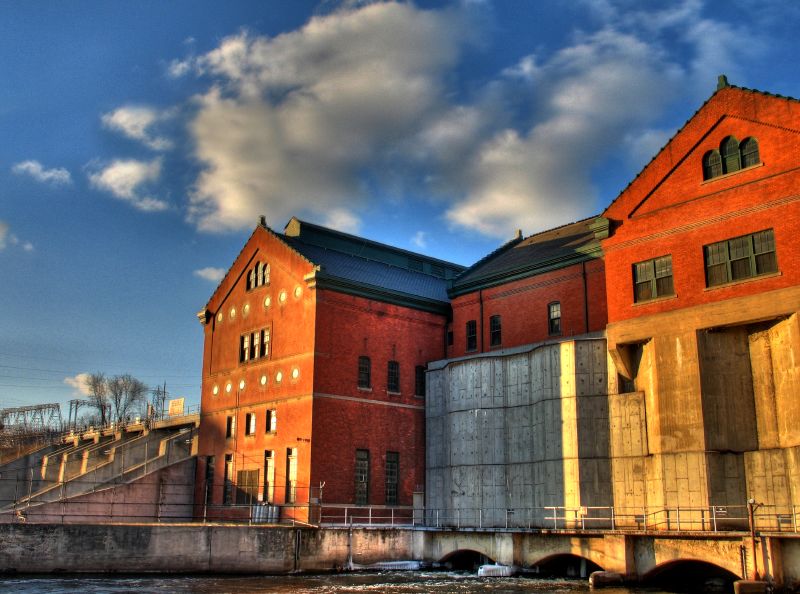
- Croton Hydroelectric Plant - Croton Twp
- Ensley Windmill Tower
- First Christian Reformed Church (Demolished) - Fremont
- Gerber, Cornelius, Cottage - Sheridan Charter Twp
- Grant Depot and Water Tower - Grant
- Hardy Hydroelectric Plant - Big Prairie - Twp
- Lilley District No. 5 School - Lilley Twp
- Oak Grove District No. 3 Schoolhouse - Croton Twp
- Penoyer's Sawmill - Newaygo
- Saint Mark's Episcopal Church - Newaygo
- Weaver, Daniel, House - Denver Twp
- White Cloud Village Hall (Demolished) - White Cloud
- Woods, John F., Residence - Newaygo
Communities
Cities
- Fremont
- Grant
- Newaygo
- White Cloud (county seat)
Village
- Hesperia (partially)
Unincorporated communities
- Aetna
- Big Prairie
- Bitely
- Brohman
- Brunswick (partially)
- Croton
- Ensley Center
- Lilley
- Riverview
- Woodland Park
- Woodville
- Wooster
Charter township
- Sheridan Charter Township
Civil townships
- Ashland Township
- Barton Township
- Beaver Township
- Big Prairie Township
- Bridgeton Township
- Brooks Township
- Croton Township
- Dayton Township
- Denver Township
- Ensley Township
- Everett Township
- Garfield Township
- Goodwell Township
- Grant Township
- Home Township
- Lilley Township
- Lincoln Township
- Merrill Township
- Monroe Township
- Norwich Township
- Sherman Township
- Troy Township
- Wilcox Township
Education
The Newaygo County Regional Educational Service Agency, based in Fremont, services the districts in the county. The intermediate school district offers regional special education services and technical career programs for its students.
Newaygo County is served by the following regular public school districts:
- Big Jackson School District
- Fremont Public School District
- Grant Public School District
- Hesperia Community Schools
- Newaygo Public School District
- White Cloud Public Schools
Newaygo County has the following private schools:
- Cornerstone Christian Academy
- Fremont Christian School
- Grant Christian School
References
References
- "State & County QuickFacts". US Census Bureau.
- "Find a County". National Association of Counties.
- George Dawson. (1840). "Acts of the Legislature of the State of Michigan Passed at the Annual Session of 1840".
- "Bibliography on Newaygo County". Clarke Historical Library, Central Michigan University.
- "Michigan government on county names".
- (August 22, 2012). "2010 Census Gazetteer Files". US Census Bureau.
- "Newaygo County government".
- "Newaygo County MI".
- "Population and Housing Unit Estimates Tables". United States Census Bureau.
- "US Decennial Census". US Census Bureau.
- "Historical Census Browser". University of Virginia Library.
- "Population of Counties by Decennial Census: 1900 to 1990". US Census Bureau.
- "Census 2000 PHC-T-4. Ranking Tables for Counties: 1990 and 2000". US Census Bureau.
- (2021). "2020 Decennial Census Demographic Profile (DP1)".
- (2021). "2020 Decennial Census Redistricting Data (Public Law 94-171)".
- (2023). "2020 Decennial Census Demographic and Housing Characteristics (DHC)".
- "2010 Data Release – Data & Documentation – American Community Survey – US Census Bureau".
- "U.S. Census website". US Census Bureau.
- "The Association of Religion Data Archives - Maps & Reports". thearda.com.
- [https://www.lds.org/maps/meetinghouses/@43.554863,-86.027716,10s&cid=HP16FDM&lang=eng LDS.org ''Find a Meetinghouse'' (accessed 15 September 2018)]
- "Fremont SDA Church".
- "Diocese of Grand Rapids MI".
- (June 2, 2014). "Newaygo County: 1920-2000". Arcadia Publishing.
- [http://www.ncedo.org/PDFs/newaygo-emp.pdf Michigan Works! West Central]{{dead link. (February 2018)
- [http://uselectionatlas.org/RESULTS US Election Atlas]
- "Newaygo County website".
- "State Historical Site Listings".
- "What is a Regional Educational Service Agency (RESA)?". [[Newaygo County Regional Educational Service Agency]].
- [[National Center for Education Statistics]]. "Search for Public School Data - Newaygo County, MI". [[Institute of Education Sciences]].
- National Center for Education Statistics. "Search for Private Schools - Newaygo County, MI". Institute of Education Sciences.
This article was imported from Wikipedia and is available under the Creative Commons Attribution-ShareAlike 4.0 License. Content has been adapted to SurfDoc format. Original contributors can be found on the article history page.
Ask Mako anything about Newaygo County, Michigan — get instant answers, deeper analysis, and related topics.
Research with MakoFree with your Surf account
Create a free account to save articles, ask Mako questions, and organize your research.
Sign up freeThis content may have been generated or modified by AI. CloudSurf Software LLC is not responsible for the accuracy, completeness, or reliability of AI-generated content. Always verify important information from primary sources.
Report