From Surf Wiki (app.surf) — the open knowledge base
Newark and Sherwood
Non-metropolitan local government district in Nottinghamshire, England

Non-metropolitan local government district in Nottinghamshire, England
| Field | Value | |||
|---|---|---|---|---|
| name | Newark and Sherwood | |||
| type | Non-metropolitan district | |||
| image_skyline | {{multiple image | |||
| border | infobox | perrow = 1/2/2/1 | total_width = 260 | align=center |
| image1 | Sherwood Forest (9526).jpg | |||
| image2 | Ollerton - Church from Station Road - geograph.org.uk - 2369314.jpg | |||
| image3 | Rufford Abbey Cistercian monastery, monastic precinct, water-management works, pre-monastic open-field system and post-medieval (2).jpg | |||
| image4 | SyerstonTower-203.jpg | |||
| image5 | The Spire of St Mary Magdalene Church viewed from The Market Square, Newark - geograph.org.uk - 4558800.jpg | |||
| image6 | Southwell Minster.jpg | |||
| image_caption | ||||
| blank_emblem_size | 150px | |||
| image_map | Newark and Sherwood UK locator map.svg | |||
| map_caption | Shown within Nottinghamshire | |||
| mapsize | 160px | |||
| subdivision_type | Sovereign state | |||
| subdivision_name | United Kingdom | |||
| subdivision_type1 | Constituent country | |||
| subdivision_name1 | England | |||
| subdivision_type2 | Region | |||
| subdivision_name2 | East Midlands | |||
| subdivision_type3 | Administrative county | |||
| subdivision_name3 | Nottinghamshire | |||
| seat_type | Admin. HQ | |||
| seat | Newark-on-Trent | |||
| government_type | Newark and Sherwood District Council | |||
| leader_title2 | MPs: | |||
| leader_name2 | Robert Jenrick, | |||
| Michelle Welsh | ||||
| established_title | Founded | |||
| area_rank | [](list-of-english-districts-by-area) | |||
| area_total_km2 | ||||
| latd | latm= | lats= | latNS= | |
| longd | longm= | longs= | longEW= | |
| population_as_of | ||||
| population_total | ||||
| population_rank | Ranked | |||
| population_density_km2 | auto | |||
| demographics_type1 | Ethnicity (2021) | |||
| demographics1_footnotes | ||||
| demographics1_title1 | Ethnic groups | |||
| demographics_type2 | Religion (2021) | |||
| demographics2_footnotes | ||||
| demographics2_title1 | Religion | |||
| timezone | Greenwich Mean Time | |||
| utc_offset | +0 | |||
| timezone_DST | British Summer Time | |||
| utc_offset_DST | +1 | |||
| postal_code_type | Postcode | |||
| postal_code | ||||
| blank_name | ISO 3166-2 | |||
| blank_info | ||||
| blank1_name | ONS code | |||
| blank1_info | 37UG (ONS) | |||
| E07000175 (GSS) | ||||
| blank2_name | OS grid reference | |||
| blank2_info | ||||
| blank3_name | NUTS 3 | |||
| blank3_info | ||||
| blank4_name | Ethnicity | |||
| blank4_info | 98.5% White |
Michelle Welsh | 96.3% White | 1.1% Asian | 1.5% Mixed | 0.7% Black | 0.5% other | 54.5% Christianity | 43.7% no religion | 1.2% other | 0.6% Islam E07000175 (GSS) Newark and Sherwood is a local government district in Nottinghamshire, England. It is the largest district by area in the county. The council is based in Newark-on-Trent, the area's largest town. The district also includes the towns of Southwell and Ollerton along with a large rural area containing many villages. Much of the district lies within the ancient Sherwood Forest and there are also extensive forestry plantations in the area.
The neighbouring districts are Rushcliffe, Gedling, Ashfield, Mansfield, Bassetlaw, West Lindsey, North Kesteven, South Kesteven and Melton. In 2021 it had a population of 123,383.
History
The district was created on 1 April 1974 under the Local Government Act 1972, covering three former districts which were all abolished at the same time:
- Newark Municipal Borough
- Newark Rural District
- Southwell Rural District
The new district was initially named Newark, after its largest town. The name was changed to Newark and Sherwood in 1985.
Governance
Labour
Labour
;Administration (19)
:
:
;Other parties (20)
:
:
:
Newark and Sherwood District Council provides district-level services. County-level services are provided by Nottinghamshire County Council. The whole district is also covered by civil parishes, which form a third tier of local government.
Political control
The council has been under no overall control since the 2023 election, being run by a partnership of Labour, the "Independents for Newark and District" group of independent councillors, and the Liberal Democrats.
The first election to the council was held in 1973, initially operating as a shadow authority alongside the outgoing authorities before coming into its powers on 1 April 1974. Since 1974 political control of the council has been as follows:
| Party in control | Years | |
|---|---|---|
Leadership
The leaders of the council since 2003 have been:
| Councillor | Party | From | To | ||||||
|---|---|---|---|---|---|---|---|---|---|
| last1=Buckland | first1=Laurey | title=Leader takes a back seat | url=https://www.newarkadvertiser.co.uk/news/leader-takes-a-back-seat-9020218/ | access-date=20 August 2022 | work=Newark Advertiser | date=18 April 2012}} | 2003 | 15 May 2012 | |
| title=Roger Blaney | url=https://www.newarkconservatives.org.uk/Roger%20Blaney | website=Newark Conservatives | access-date=18 June 2025}} | 15 May 2012 | May 2018 | ||||
| David Lloyd | May 2018 | May 2023 | |||||||
| Paul Peacock | 23 May 2023 |
Composition
Following the 2023 election, and subsequent changes of allegiance up to May 2025, the composition of the council was:
| Party | Councillors | Total | 39 |
|---|---|---|---|
| 14 | |||
| 10 | |||
| 10 | |||
| 3 | |||
| 2 |
Of the ten independent councillors, six sit together as the "Independents for Newark and District" group, which forms part of the council's administration with Labour and the Liberal Democrats. Another two independents form the "Newark and Sherwood District Independents" group, and the other two do not belong to any group. The next election is due in 2027.
Elections
Since the last full review of boundaries in 2015 the council has comprised 39 councillors representing 21 wards, with each ward electing one, two or three councillors. Elections are held every four years.
The district is covered by two parliamentary constituencies: Newark, created in 1885, which has been represented by Robert Jenrick, a Conservative, since 2014; and has been held by the Conservative Party since 2001; and Sherwood Forest, created in 1983, represented by Michelle Welsh, a Labour MP, elected in 2024.
Premises
The council is based at Castle House, on Great North Road in Newark, adjacent to Newark Castle Railway station. The building was purpose-built for the council and opened in 2017.
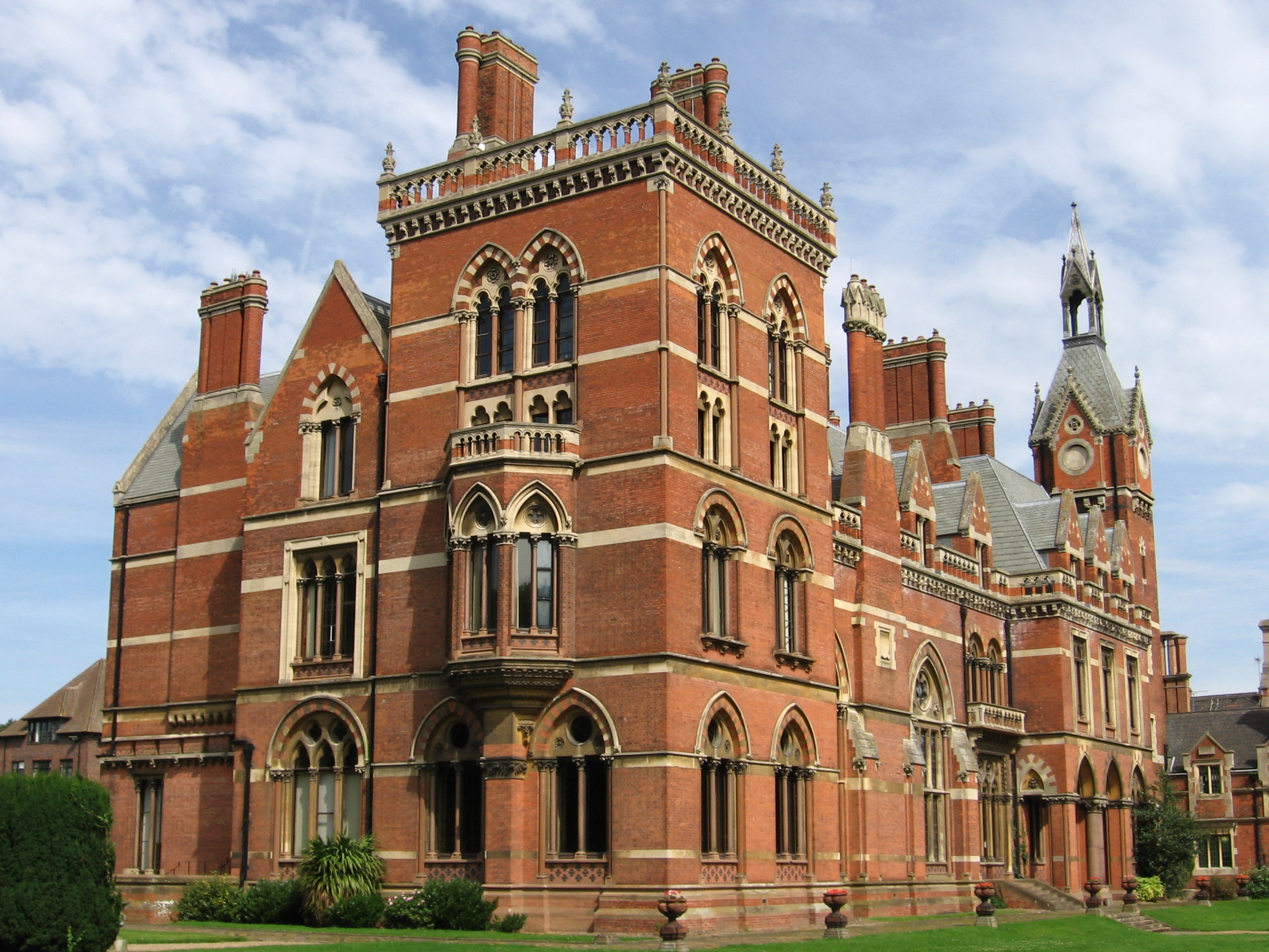
The council was previously based at Kelham Hall in the village of Kelham, which had been purchased early in 1974 as part of preparations for the local government reorganisation later that year.
Settlements


.jpg)
The whole district is divided into civil parishes. The parish councils for the three parishes of Newark, Ollerton and Boughton, and Southwell have declared their parishes to be towns, allowing them to take the style "town council".
Newark-on-Trent, together with Balderton, forms the largest urban area in the district. Newark-on-Trent has many important historic features including Newark Castle, St Mary's Magdalene Church, Georgian architecture and a defensive earthwork from the British Civil Wars. Other important towns in the district include Ollerton and Southwell which is home to Southwell Minster and Southwell Racecourse. Other settlements in the district include:
:Averham :Balderton, Bathley, Beacon, Bilsthorpe, Blidworth, Boughton, Bridge, Brough :Carlton-on-Trent, Castle, Caunton, Clipstone, Collingham, Cromwell :Devon :Eakring, Edingley, Edwinstowe, Egmanton :Farndon, Farnsfield, Fernwood, Fiskerton :Gunthorpe :Halam, Halloughton, Hawton, Hockerton :Kelham, Kirklington, Kirton, Kneesall :Laxton, Little Carlton, Lowdham :Magnus, Maplebeck, Morton :North Muskham, Norwell :Ossington, Oxton :Perlethorpe :Rainworth, Rolleston :Sleaford, South Muskham, Sutton-on-Trent :Thurgarton :Upton :Walesby, Wellow, Weston, Winkburn
Media
Television
The area is served by BBC East Midlands and ITV Central with television signals are received from the Waltham TV transmitter, BBC Yorkshire and Lincolnshire and ITV Yorkshire can also be received from the Belmont TV transmitter.
Radio
Radio stations that broadcast to the area are:.
BBC Local Radio
- BBC Radio Nottingham Independent Radio
- Capital East Midlands
- Smooth East Midlands
- Greatest Hits Radio Midlands
- Lincs FM (covering Newark) Community Radio
- Radio Newark (serving Newark)
- Bowe Radio (for Ollerton and Edwinstowe)
References
References
- "Castle House". Newark and Sherwood District Council.
- "Newark and Sherwood see Local Authority".
- {{cite legislation UK. (1972)
- {{cite legislation UK. (1973)
- "Historical information on changes to electoral arrangements of Local authorities, Parliamentary areas and European Parliamentary boundaries". Ordnance Survey.
- (22 May 2025). "Linda Tift, of the Rainworth North and Rufford ward, voted new chairman of Newark and Sherwood District Council, with Dover Beck ward member Roger Jackson as vice chairman". Newark Advertiser.
- (6 April 2018). "New chief executive for district council". Newark Advertiser.
- {{cite legislation UK. (1972)
- (24 May 2023). "Labour's Paul Peacock appointed as executive leader of Newark and Sherwood District Council after shock election saw Conservatives lose majority". Newark Advertiser.
- "Compositions Calculator". University of Exeter.
- "Newark & Sherwood". [[BBC News Online]].
- (18 April 2012). "Leader takes a back seat". Newark Advertiser.
- "Roger Blaney".
- (24 May 2018). "Use the three Ls for priorities". Newark Advertiser.
- (24 May 2023). "Labour's Paul Peacock appointed as executive leader of Newark and Sherwood District Council after shock election saw Conservatives lose majority". Newark Advertiser.
- "Council minutes, 23 May 2023".
- "Local elections 2023: live council results for England". The Guardian.
- "Your Councillors by Party".
- "Newark and Sherwood". Thorncliffe.
- {{cite legislation UK. (2014)
- (2014-05-13). "Newark by-election candidate names confirmed". BBC News.
- (2011-10-15). "Electdata 2001".
- (5 September 2017). "New Council Offices to open 25th September". Radio Newark.
- (14 January 1974). "Kelham Hall bid accepted". Nottingham Evening Post.
- (2014-11-27). "Grade I-listed Kelham Hall conversion 'will create 80 jobs'". BBC News.
- (2014-06-25). "Kelham Hall sale confirmed by Newark council". BBC News.
- "Parish and Town Councils".
- (1 May 2004). "Full Freeview on the Waltham (Leicestershire, England) transmitter".
- (1 May 2004). "Belmont (Lincolnshire, England) Full Freeview transmitter".
- "Local news and radio". Nottinghamshire County Council.
- "Radio Newark".
- "Bowe Radio".
This article was imported from Wikipedia and is available under the Creative Commons Attribution-ShareAlike 4.0 License. Content has been adapted to SurfDoc format. Original contributors can be found on the article history page.
Ask Mako anything about Newark and Sherwood — get instant answers, deeper analysis, and related topics.
Research with MakoFree with your Surf account
Create a free account to save articles, ask Mako questions, and organize your research.
Sign up freeThis content may have been generated or modified by AI. CloudSurf Software LLC is not responsible for the accuracy, completeness, or reliability of AI-generated content. Always verify important information from primary sources.
Report