From Surf Wiki (app.surf) — the open knowledge base
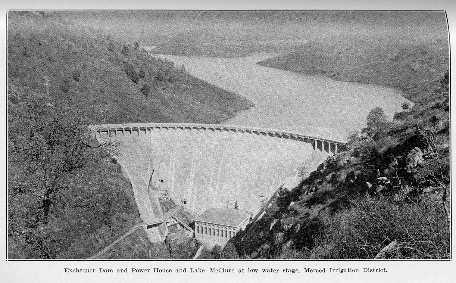
New Exchequer Dam
| Field | Value |
|---|---|
| name | New Exchequer Dam |
| image | Lake_McClure_(822109715).jpg |
| image_caption | New Exchequer Dam and Lake McClure viewed from the air |
| coordinates | |
| country | United States |
| location | Mariposa County, California |
| construction_began | |
| opening | |
| owner | Merced Irrigation District |
| dam_type | Concrete–faced rockfill |
| dam_height | 490 ft |
| dam_length | 1220 ft |
| dam_elevation_crest | 879 ft |
| dam_crosses | Merced River |
| spillway_count | Gated ogee crest |
| res_name | Lake McClure |
| res_capacity_total | 1024600 acre.ft |
| res_catchment | 1040.1 mi2 |
| res_surface | 7147 acre |
| res_elevation | 867 ft |
| res_max_length | 29 mi |
| plant_hydraulic_head | 437 ft |
| plant_capacity | 94.5 MW |
| plant_annual_gen | 279,065,000 KWh (2001–2012) |
New Exchequer Dam is a concrete–faced, rock-fill dam on the Merced River in central California in the United States. It forms Lake McClure, which impounds the river for irrigation and hydroelectric power production and has a capacity of more than 1000000 acre feet. The Merced Irrigation District (MID) operates the dam and was also responsible for its construction.
Built between 1964 and 1967, the dam replaced the old arch type Exchequer Dam and stands 490 ft high. At the time of completion, it was the largest dam of its kind in the world. The dam is named for the town of Exchequer which now lies under the reservoir, while the reservoir is named for Wilbur F. McClure, the State Engineer of California during construction.
History
In 1926, after five years of planning and construction, MID completed the Exchequer or "Great Exchequer" Dam{{cite journal |url-status = dead
By the 1950s, it became apparent that the limited storage capacity at Exchequer was no longer enough to serve the needs of farmers in the Merced River valley. A high dam was proposed to be built just downstream, creating a reservoir nearly four times the size of Exchequer.
Construction of New Exchequer Dam began on July 8, 1964, directly downstream from the old concrete arch dam. Tudor Engineering Company of San Francisco was responsible for the design of the new dam.{{cite journal
As the new reservoir filled, it inundated an additional 15 mi of the Merced River canyon and buried sections of the historic Yosemite Valley Railroad and the mining town of Bagby under 50 ft of water.{{cite web
The dam has been able to halt major floods in many instances, such as the New Year's Day Flood of 1997. However, it has not always been able to weather the worst droughts – such as in 1977, when the reservoir fell to just 75000 acre feet, a fourteenth of capacity, and in 1991, which saw historic low water levels of 66100 acre feet.{{cite web
Dimensions and usage

New Exchequer Dam stands 490 ft high from the foundations and 479 ft above the Merced River. The dam is 1220 ft long, 18 ft wide at the crest, 1000 ft wide at the base and is composed of 5169000 yd3 of fill. High water releases are controlled by an ogee-type, gated overflow spillway located about 2 mi north of the dam. The dam's power station has a capacity of 94.5 megawatts and generates about 316 million kilowatt hours annually.
The reservoir has a storage capacity of 1024600 acre feet, of which 350000 acre feet is reserved for flood control. At full pool, the reservoir has an elevation of 867 ft, with 7147 acre of water and 82 mi of shoreline.{{cite web |url-status = dead |url-status = dead
MID has proposed raising the spillway gates of the dam, which would provide up to 70000 acre.ft of additional storage. However, this has met with controversy because it would result in part-time flooding of a portion of the Merced River designated Wild and Scenic.{{cite web|url=http://www.mercedid.org/_images/69_spillway%20modification%20fact%20sheet.pdf
Lake McClure is also extensively developed for recreational activities, with 515 campsites, four boat ramps and two marinas. In 1992, the lake received 606,000 visitor-days, mostly from May to September.{{cite web
References
References
- "New Exchequer–Lake McClure (EXC)". California Department of Water Resources.
- (2012-03-16). "Merced River Hydroelectric Project Relicensing". Federal Register.
- (February 2012). "Appendix X: Hydropower and Electric Grid Analysis of Lower San Joaquin River Flow Alternatives". California State Water Resources Control Board.
- "California Hydroelectric Statistics & Data". California Energy Commission.
This article was imported from Wikipedia and is available under the Creative Commons Attribution-ShareAlike 4.0 License. Content has been adapted to SurfDoc format. Original contributors can be found on the article history page.
Ask Mako anything about New Exchequer Dam — get instant answers, deeper analysis, and related topics.
Research with MakoFree with your Surf account
Create a free account to save articles, ask Mako questions, and organize your research.
Sign up freeThis content may have been generated or modified by AI. CloudSurf Software LLC is not responsible for the accuracy, completeness, or reliability of AI-generated content. Always verify important information from primary sources.
Report