From Surf Wiki (app.surf) — the open knowledge base
Navi Mumbai
City in Maharashtra, India

City in Maharashtra, India
| Field | Value | |
|---|---|---|
| name | Navi Mumbai | |
| native_name | Navī Muṁbaī (Marathi) | |
| other_name | Previously: New Bombay | |
| settlement_type | City | |
| image_skyline | {{multiple image | |
| border | infobox | |
| total_width | 270 | |
| perrow | 1/2/2/2 | |
| image2 | Dronagiri night skyline.jpg | |
| caption2 | Dronagiri skyline | |
| image3 | Utsav Chauk, Kharghar Navi Mumbai.jpg | |
| caption3 | Utsav Chauk | |
| image4 | Greenscape building photo 1, Vashi, Navi Mumbai.jpg | |
| caption4 | Vashi sector 30A | |
| image1 | Vashi_Skyline.jpg | |
| caption1 | Navi Mumbai skyline | |
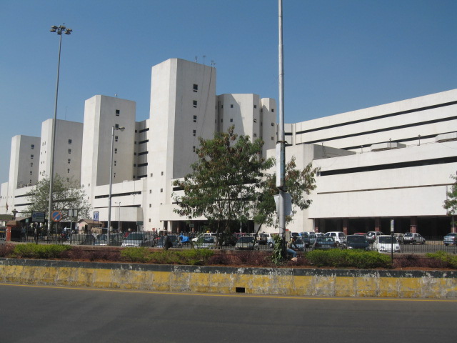
| image6 | Navi Mumbai Municipality Corporation.jpeg | |
| caption6 | NMMC headquarter | |
| image5 | Vashi Railway Station.jpg | |
| caption5 | Vashi Railway Station | |
| image7 | Flamingoes at Navi Mumbai.jpg | |
| caption7 | Flamingos at Navi Mumbai lake | |
| image8 | PKPAirol Mum Patni Entrance View.jpg | |
| caption8 | Patni Computer Systems Knowledge Park | |
| image9 | Pandavkada-Watefall4.jpg | |
| caption9 | Pandavkada Falls | |
| image10 | Wonders Park, Navi Mumbai.jpg | |
| caption10 | Wonders Park | |
| image11 | Rajiv Gandhi Park, Navi Mumbai Photo 1.jpg | |
| caption11 | Rajiv Gandhi Park | |
| caption12 | Skyline across Sanpada Palm Beach Road | |
| image_alt | Mumbai | |
| map_alt | Mumbai | |
| map_caption | Navi Mumbai | |
| pushpin_map | India Maharashtra#India#India Mumbai | |
| pushpin_relief | y | |
| mapframe | yes | |
| pushpin_map_alt | Mumbai | |
| mapframe-geomask-fill | red | |
| mapframe-zoom | 10 | |
| mapframe-area_km2 | 343 | |
| coordinates | ||
| subdivision_type | Country | |
| subdivision_name | India | |
| subdivision_type1 | State | |
| subdivision_type2 | Division | |
| subdivision_type3 | District | |
| subdivision_name1 | Flag of Maharashtra.svg Maharashtra | |
| subdivision_name2 | Konkan | |
| subdivision_name3 | {{plainlist | |
| established_title | Planned and Developed by | |
| established_date | City and Industrial Development Corporation | |
| government_type | Municipal Corporation | |
| elevation_m | 14 | |
| population_total | 1,618,000 | |
| population_demonym | Navi Mumbaikar | |
| registration_plate | MH-43 (Thane district) | |
| MH-46 (Raigad district) | ||
| governing_body | {{plainlist | |
| nickname | Flamingo City | |
| timezone1 | IST | |
| utc_offset1 | +5:30 | |
| unit_pref | Metric | |
| area_total_km2 | 343.70 |
Navi Mumbai Skyline.jpg | mapframe-geomask-fill = red | mapframe-zoom = 10 | mapframe-area_km2 = 343
- Thane district
- Raigad district MH-46 (Raigad district)
- Navi Mumbai Municipal Corporation 109.59Sqkm (Thane district)
- Panvel Municipal Corporation 110 Sqkm (Raigad district)
- CIDCO 233.7 Sqkm (Raigad district)
Navi Mumbai (; also known as New Bombay, its official name until 1995) is a city in the Mumbai Metropolitan Area, located in the Konkan division of the western Indian state of Maharashtra. Navi Mumbai is situated on the Indian mainland, opposite Salsette Island and the city of Mumbai, and is part of Thane district and Raigad district.
The area within the Navi Mumbai Municipal Corporation has been ranked third among 73 cities surveyed for cleanliness and hygiene by the Union Ministry of Urban Development and the Quality Council of India as part of Swachh Bharat Abhiyan, and is being modified through various projects and developments. Navi Mumbai has, for two consecutive years (2022 and 2023), held on to the third rank in the Indian Commonwealth Cleanliness Survey (Swachh Survekshan) — a nationwide sanitation survey of cities — while Mumbai's ranking slipped to 37 in 2023 from 31 in 2022.
Navi Mumbai is home to various educational institutions. Several multinational corporations have their head offices or branches across the city, making it an active business hub. Thane–Belapur Road and Palm Beach Road are major business attractions and upmarket residential areas.
History
In the late 1500s, the Siddis of Janjira built the Belapur Killa, located atop a small hill near the mouth of the Panvel Creek. In 1682, the fort was captured by the Portuguese, who had managed to annex the regions controlled by the Siddis.
In 1733, the Marathas, led by Chimaji Appa, wrested control of the fort from the Portuguese. Appa had made a vow that if it were to be successfully recaptured from the Portuguese, he would place a garland of beli leaves in the nearby Amruthaishwar temple, and after the victory, the fort was christened as Belapur Fort. The Marathas ruled the area until 23 June 1817, when it was captured by Captain Charles Gray of the British East India Company. The British partially destroyed the fort under their policy of razing any Maratha stronghold in the area.
Navi Mumbai’s journey began in the early 1970s, when the Maharashtra government recognized the need for an alternative urban area to relieve the growing pressure on Mumbai, which was then struggling with issues like overcrowding, inadequate housing, and strained infrastructure.
Planning and development


The population of Greater Mumbai doubled from three to nearly six million between 1951 and 1971. The population growth led to a deteriorating quality of life for many in the city.
The Maharashtra Regional and Town Planning Act was passed in 1966, and the Bombay Metropolitan Region was created in June 1967 and finalized in 1970. The plan called for development, of a twin city across the harbour, on the mainland to the east.
Before Navi Mumbai was made Railway was linked to Panvel railway station with Diva in 1964, in 1966 it was extended to Apta via Rasayani, then in the 1980s to Roha and in phases was linked to the Konkan Railway by 1998, in 1990s Harbour line of Suburban Railway reached Navi Mumbai connecting Vashi, Nerul.
The Board recommended that the new metro-centre or Navi Mumbai as it is now called, be developed to accommodate a population of 2.1 million.
The planning of Navi Mumbai began in 1971 and involved leading architects and urban planners including Adi Kanga, Charles Correa, Shirish Patel, Pravina Mehta and R. K. Jha. The City and Industrial Development Corporation (CIDCO) was created as part of these efforts.
The area covered 150 km of the Konkan coast. Privately owned land consisting of 86 villages covering within the present limits of Navi Mumbai were acquired by the government of Maharashtra. Navi Mumbai covers the southern part of Thane taluka (from Thane District) and part of Panvel and Uran talukas (from Raigad District).
CIDCO carved out 19 small nodes with a view towards facilitating comprehensive development. These nodes were named Airoli, Ghansoli, Kopar Khairane, Vashi, Turbhe, Sanpada, Juinagar, Nerul, Seawoods, CBD Belapur, Kharghar, Kamothe, New Panvel, Kalamboli, Ulwe, Dronagiri and Taloja. Sanpada is the smallest node of Navi Mumbai at 8.6 km2.
CIDCO planned and constructed railway stations, roads, and public spaces in Navi Mumbai and developed nearby areas commercially. In 1973, the Vashi bridge was opened to the public for residents of Vashi, CBD Belapur and Nerul. The Sion-Panvel Highway was built to reduce the time taken to travel from Sion to Panvel. Major changes took place only after 1990, with the commissioning of a wholesale agricultural produce market at Turbhe and the construction of a commuter railway line from Mankhurd to Vashi in May 1992. These developments caused a sudden growth in economic activities and population in Navi Mumbai.
The city originally planned to create affordable housing for people who could not afford living in Mumbai, with planners intent on preventing the growth of slums in the city. However, according to the 2001 census, a fifth to a third of the population of municipalized Navi Mumbai live in slums and gaothans (urban villages),
By the end of the 1990s, the planning authority of Navi Mumbai sought to attract private developers to the city. A new rail link between Nerul and Uran was opened on 11 November 2018.
Southern Navi Mumbai is developing rapidly in the modern nodes of Kharghar, Kamothe, Panvel, and Kalamboli. These nodes are experiencing major infrastructural developments due to their proximity to the Navi Mumbai International Airport (Phase 1) started operations on 25th December 2025.{{Cite news |access-date = 17 January 2026
Navi Mumbai has, been ranked 5th best “National Clean Air City” in India.
Flora and fauna
A significant percentage of flamingos that settle in the Greater Mumbai Region are found in Navi Mumbai. Navi Mumbai also contains a stretch of mangroves.
Administration
CIDCO
The City and Industrial Development Corporation (CIDCO) was responsible for maintenance, tax collection, and development of the city since its inception in the 1970s.
CIDCO planned 14 areas for the city. The seven areas in the North were Airoli node, Ghansoli node, Kopar Khairane node, Vashi node, Sanpada node, Nerul node and Belapur node. The seven areas in the South were Kharghar node, Kamothe node, Kalamboli node, Pushpak Nagar node, Panvel node, Ulwe node and Dronagiri node. Two additional municipal bodies were created, Navi Mumbai Municipal Corporation (NMMC) in the North and Panvel Municipal Corporation in the South. Each area is divided into smaller groups called sectors.
CIDCO initially developed areas like Juhu Nagar (Vashi), Nerul, and CBD Belapur with homes, schools, and roads. Later, due to a growing population with the railway extension in the 1990s, CIDCO shifted focus to Kharghar, Kamothe, New Panvel and Kopar Khairane. Private builders played a large role in developing these areas. CIDCO, as of 2015, runs newer areas in South Navi Mumbai.

Navi Mumbai Municipal Corporation
On 17 December 1991, Navi Mumbai Municipal Corporation (NMMC) was constituted by the state government for maintaining some of the developed nodes of Navi Mumbai.
Local self-government started on 1 January 1992. NMMC was handed seven of the 14 nodes of the Navi Mumbai project area for its jurisdiction. However, CIDCO, as a planning authority, has rights on the open plots in these seven nodes.
The NMMC jurisdiction starts at Digha Gaon in the North and ends at Belapur in the South. The NMMC area is planned into seven nodes (zones) - Belapur, Nerul, Sanpada, Vashi, Kopar Khairane, Ghansoli and Airoli.

Navi Mumbai Municipal Corporation is rated amongst the richest corporations in Maharashtra.
The Municipal Corporation is headed by a Municipal Commissioner and an elected Mayor.
Tourism
Navi Mumbai has emerged as a regional tourism and recreation destination due to its planned urban layout, coastal landscape, mangroves, hills, and cultural landmarks. The city offers a mix of natural attractions, religious sites, and modern leisure spaces.
Natural attractions
- Central Park, Kharghar – One of the largest urban parks in Asia, developed by CIDCO, featuring landscaped gardens, jogging tracks, amphitheatre, and viewpoints.
- Pandavkada Falls – A seasonal waterfall located near Kharghar Hills, popular for trekking and monsoon tourism.
- Kharghar Hills – Part of the Western Ghats foothills, offering panoramic views, trekking trails, and biodiversity.
- Parsik Hill – A forested hill range between Belapur and Thane, known for scenic views and nature walks.
- TS Chanakya Wetland (NRI Wetland) – A restored mangrove wetland in Seawoods–Nerul, recognized for birdwatching and ecological conservation.
- Bendkhal Wetland – A coastal wetland area in Uran Taluka, known for flamingo sightings and migratory birds.
Beaches and coastal areas
- Uran Beach – A seaside destination in Raigad district with views of Mumbai Harbour.
- Karanja Rewas Coast – A traditional coastal area with ferry connectivity and fishing villages.
Religious and cultural sites
- ISKCON Kharghar – A major Krishna temple complex serving as a spiritual and cultural center.
- Utsav Chowk – A prominent public square in Kharghar hosting cultural events and gatherings.
- Balaji Temple, Nerul – A popular Hindu temple visited by devotees from across the Mumbai Metropolitan Region.
- Panchmukhi Hanuman Temple, Ghansoli – Known for its five-faced Hanuman idol.
Urban and recreational destinations
- Wonder Park, Nerul – An amusement and theme park featuring rides and replicas of global landmarks.
- Golf Course, Kharghar – An 18-hole golf course developed by CIDCO.
- DY Patil Stadium, Nerul – An international sports stadium that also hosts concerts and large-scale events.
- Seawoods Grand Central Mall – One of the largest shopping and lifestyle destinations in Navi Mumbai.
Eco-tourism
- Flamingo Point, Nerul – A seasonal birdwatching location attracting flamingos and other migratory birds.
- Thane Creek Flamingo Sanctuary, Airoli – Known for its rich mangrove ecosystem and as a seasonal habitat for thousands of migratory flamingos. Declared Maharashtra’s first flamingo sanctuary in 2015, it supports diverse birdlife and plays a vital role in biodiversity conservation and coastal ecology.
Demographics
According to Census India, the population of Navi Mumbai in 2011 is 1,120,547, out of which males and females are 610,060 and 510,487 respectively. Meanwhile, its metropolitan population is 18,414,288, of which 9,894,088 are males and 8,520,200 are females. At least 60% of the population speaks the Marathi language.
Transport and infrastructure


Navi Mumbai has a robust infrastructure, is well connected to other parts of the state and country and is less polluted compared to Mumbai. The city has a good public transportation system with NMMT, the transport wing of NMMC, serving bus commuters, the Mumbai suburban railway serving train commuters and a large fleet of auto rickshaws for intra-nodal commute. The Mumbai-Pune Expressway starts at Kalamboli in Navi Mumbai. The Mumbai Trans Harbour Link (MTHL), also known as the Sewri-Nhava Sheva Trans Harbour Link, is a 22 km long freeway grade road bridge connecting South Mumbai with Navi Mumbai. It opened on 12 January 2024, after Prime Minister Narendra Modi inaugurated the bridge.
The Mumbai suburban railway network covers most of the populated regions of the city. The most important suburban stations are Vashi, Nerul, Belapur and Panvel. The stations are planned as major railway junctions. Panvel is the only mainline station as well as the busiest railway station in Navi Mumbai. All outstation trains halt here for time periods varying from five to 20 minutes. It is an important junction; railway lines come and meet here and it is connected to almost all parts of India. A new broad gauge line is functional between Karjat & Panvel.
Brihanmumbai Electric Supply and Transport (BEST) buses run from various area of Mumbai to Navi Mumbai & Navi Mumbai Municipal Transport (NMMT) buses run all over Navi Mumbai and various area in Mumbai, Thane, Bhiwandi, Kalyan-Dombivli-Badlapur, Panvel-Khopoli-Taloja, Uran-Ulwe etc. The Palm Beach Marg, a 10 km long six lane road connects Vashi to CBD Belapur running parallel to the Thane Creek.
Auto rickshaws provide inter- and intra-nodal public transport across the city. Taxis operating from designated taxi stands provide the means to travel to further destinations. Taxis charge a fixed rate approved by the R. T. O., details of which can be found on popular local transit apps of the city.
Navi Mumbai has the second-largest container terminal in India after Mundra Port, Jawaharlal Nehru Port at Nhava Sheva near Uran. It is well connected by road and rail and handles approximately 56.13% of India's container traffic. The city will be served by the newly inaugurated Navi Mumbai International Airport.
International airport
Main article: Navi Mumbai International Airport
The Navi Mumbai International Airport is located in southern Panvel near Ulwe. The project was executed by Navi Mumbai International Airport Limited (NMIAL), a special-purpose vehicle formed by the Adani Airports Holdings Limited and CIDCO. It is being built in three phases. The first phase, now complete, features Terminal 1, designed to handle 20 million passengers annually. The foundation stone for the project was laid by Prime Minister Narendra Modi on 18 February 2018, and construction was started in August 2021. Phase 1 was inaugurated on 8 October 2025 by Prime Minister Narendra Modi, and flights commenced on 25 December 2025. NMIA is set to become the first airport in the country with multimodal connectivity through metro, rail and road. The airport will be connected to three roads: NH 4B (348), the Sion Panvel Highway and through MTHL. The railway connection will be through Targhar railway station, and metro connectivity will be via Mumbai Metro Line 8 (Gold Line) and the Navi Mumbai Metro Line 1.
Metro
Main article: Navi Mumbai Metro
The Navi Mumbai Metro is a new rapid transit system serving the city. A network of as many as five lines has been planned, of which four lines will be constructed by CIDCO in the Navi Mumbai south region, while the second and third lines of the metro system will be constructed by NMMC and MMRDA, respectively. The first line of the metro system was completed by CIDCO and was opened to the public on 17 November 2023, after several delays spanning for around a decade due to various construction and land acquisition issues. This line includes three phases. In the first phase, the line joins the CBD Belapur station on the Mumbai suburban railway and Pendhar village. In the second phase, the line will join Taloja MIDC and Khandeshwar node (which will be extended to the newly inaugurated Navi Mumbai International Airport in Ulwe node of the city), and in the third phase, the line will link the Pendhar and Taloja MIDC metro stations. The cost of the metro project has risen from 4,163 crore for 21.45 km in 2011 to 8,904 crore for 26.26 km in 2018.
Other infrastructure
The city boasts a reliable supply of electricity from various sources, and excellent motoring conditions, with numerous flyovers, broad roads, and parking lots. A hovercraft service from Vashi to Colaba and the CBD to Colaba did not succeed due to the high cost of tickets and maintenance. CIDCO is planning to relaunch its hovercraft service from Vashi, Belapur, Nerul and Airoli to Gateway of India.
Commerce
The Navi Mumbai Special Economic Zone (SEZ), located in the nodes of Dronagiri, Ulwe and Kalamboli, are planned to provide commercial growth and employment to the city. Positioned en route to the proposed Navi Mumbai Airport, this megaproject has attracted investments of close to 60,000 crores. Navi Mumbai is a new hub for newly incorporated companies & start ups to establish their base in Mumbai.
Sport

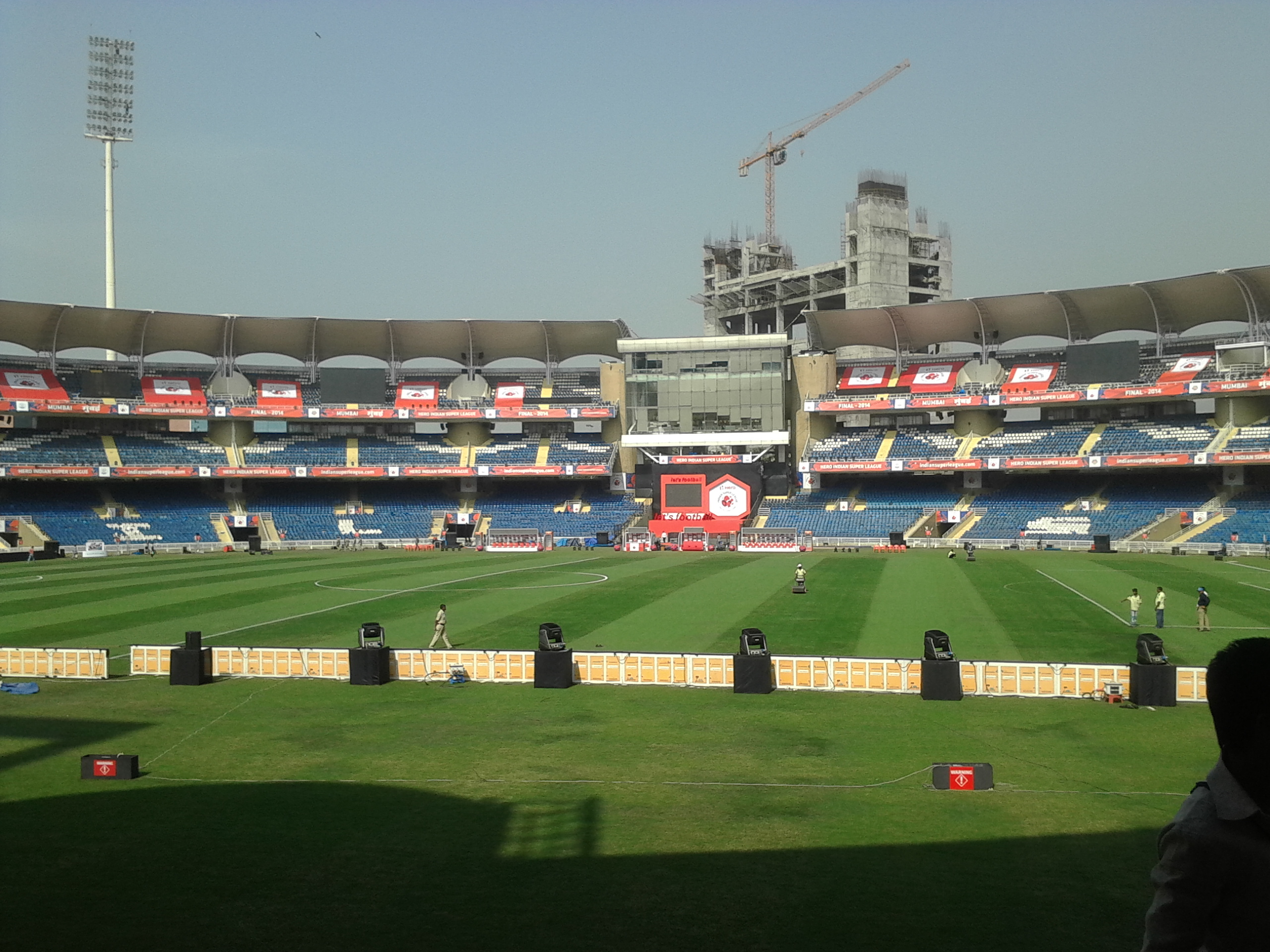
Cricket is the most popular sport in the city. Navi Mumbai has its own International Cricket Stadium in Shiravne (Nerul) called the DY Patil Stadium which hosts IPL T-20 matches, including hosting the 2008 and 2010 IPL finals. It was one of the two venues for the inaugural edition of the Women's Premier League (WPL) in 2023. It is also the home ground for the Indian Super League football club Mumbai City FC. The Fr. Agnel Stadium in Vashi is the training ground of the team.
Navi Mumbai was one of the host cities of the 2017 FIFA U-17 Men's World Cup and the 2022 FIFA U-17 Women's World Cup with the DY Patil Stadium hosting the final of the event in 2022.
Navi Mumbai Sports Association is the oldest sports complex in Navi Mumbai; NMSA has contributed significantly to the sports world by creating international level athletes from Navi Mumbai. Navi Mumbai has an Olympic-size swimming pool at Nerul. CIDCO has proposed two 18-hole golf course academies at Nerul and Kharghar. There are plans to have sports facilities in the proposed 80 hectare Central Park being developed in Kharghar. The CIDCO has also constructed an 11-hole golf course in Kharghar near Central Park.
Education
Main article: Schools and Colleges in Navi Mumbai
Provision of schools and colleges was a priority in the planning of Navi Mumbai. The nodes (townships) were designed to provide one primary school per 5,000 people, one high school for 12,500 people and one college for 50,000 people.
Each of the nodes is self-sufficient in terms of providing quality education. Students are given access to various syllabi, including the State Education Board, CBSE, IGCSE, IB and CISCE patterns. Other than these, CIDCO encouraged private institutions as well.
About 22.5% of the total population is considered to be school-going children. Most students attend school and college within their node (township). 76% of the students walk to their school or college, 12% use public transport, 10% use bicycles and only 2% travel by school bus.
A number of premier schools and colleges have been set up in Navi Mumbai. Even beyond local students, students from Mumbai and even outside come to Navi Mumbai in their quest for quality education. As such, Navi Mumbai is quickly acquiring the title of educational hub. Some of these premium institutions have been listed below.
Colleges and universities
- Amity University
- Chhatrapati Shivaji Maharaj University
- Dr.K M Vasudevan Pillai Campus
- Indian Maritime University Navi Mumbai
- ITM Group of Institutions
- NIFT Mumbai
Engineering colleges
- Fr. Conceicao Rodrigues Institute of Technology, Vashi
- Datta Meghe College of Engineering, Airoli
- Indian Institution of Industrial Engineering, Belapur
- Lokmanya Tilak College of Engineering, Koparkhairane
- Pillai College of Engineering, New Panvel
- Ramrao Adik Institute of Technology, Nerul
- SIES Graduate School of Technology, Nerul
Medical colleges
- Bharati Vidyapeeth Dental College, Kharghar
- DY Patil School of Medicine, Navi Mumbai
- MGM Institute of Health Sciences, Kalamboli
- Terna Medical College, Nerul
Schools
- Avalon Heights International School
- Dayanand Anglo Vedic Public School, Airoli
- Fr. Agnel Multipurpose School and Junior College, Vashi
- Vishwajyot High School, Kharghar
References
References
- (5 January 1985). "Bombay, New Bombay, and Metropolitan Region: Growth Process and Planning Lessons".
- "Swachh Survekshan −2016 – ranks of 73 cities".
- "CIDCO :: Evolution of Navi Mumbai".
- (9 June 2013). "Master class with Charles Correa". Mumbai Mirror.
- Mehta, H.: [https://timesofindia.indiatimes.com/city/ahmedabad/Man-who-built-Navi-Mumbai-is-in-Gujarat/articleshow/5598045.cms Man who built Navi Mumbai is in Gujarat] {{Webarchive. link. (2 February 2014 ''[[The Times of India]]'', 21 February 2010. Accessed 27 January 2014.)
- (7 July 2014). "Urban Villages in Globalized India: Degenerative Growth Processes in Navi Mumbai". Journal of the Kolkata Centre for Contemporary Studies.
- "NMMC".
- "History".
- "Slum population-- 2001 Census".
- (15 December 2012). "Slum-hub". Afternoon Despatch & Courier, Mumbai.
- Vijapurkar, Mahesh. (18 June 2015). "Navi Mumbai was Charles Correa's dream: Here's how it turned into a nightmare". [[Firstpost]].
- "Slum and Non-Slum Population, Sex ratio and Literacy rate by City/ Towns, in Maharashtra State 2001". ENVIS Centre on Population and Environment (Ministry of Environment & Forests, Govt. of India).
- (12 April 2013). "23,000 illegal two-storey buildings in Navi Mumbai". Free Press Journal.
- (11 November 2018). "uran rail line commissioned: Mumbai: First phase of Nerul-Seawoods-Uran rail line commissioned".
- (7 September 2024). "Swachh Vayu Sarvekshan 2024".
- Mohta, Payal. (26 March 2019). "'A double-edged sword': Mumbai pollution 'perfect' for flamingos". The Guardian.
- (2 May 2020). "Over 100,000 Flamingos Reportedly Descend on Mumbai Amid India's Strict Coronavirus Lockdown".
- "Flamingos turn Mumbai lakes into 'sea of pink'". BBC News.
- (19 December 2017). "Development Plan".
- (3 December 2015). "CIDCO announces Rs 34,000-crore smart city project". [[The Hindu]].
- BS Reporter. (5 December 2015). "Cidco launches Navi Mumbai smart city project". [[Business Standard]].
- "Zoning".
- "Navi Mumbai Population 2011".
- "Table C-16 Population by Mother Tongue: Maharashtra (Town level)". [[Registrar General and Census Commissioner of India]].
- "Mumbai Trans-Harbour Link May Be Ready Before 2022 Deadline, Says Chief Minister Uddhav Thackeray". [[BloombergQuint]].
- (11 January 2024). "Speed limit 100 km/Hr, no bikes and autos: All about India's longest sea bridge".
- (12 January 2024). "Atal Setu news: PM Modi to inaugurate Mumbai Trans Harbour Link today".
- (29 June 2015). "Good news for the daily commuter". Mid-Day.
- (7 April 2010). "India's major ports see 6.7 percent growth in container volumes". JOC.com..
- "JNPT's 12-lane freight corridor to ease traffic snarls around Mumbai". The Hindu.
- "JNPT".
- "About Us". Adani Group.
- (7 October 2025). "PM Modi to inaugurate Phase 1 of Navi Mumbai airport on Oct 8: Details".
- (18 February 2018). "PM Narendra Modi lays foundation stone of Rs 16,700 cr Navi Mumbai International Airport project". The Financial Express.
- (6 October 2025). "Navi Mumbai airport to see international flights from day 1 of ops". The Hindu Businessline.
- (14 January 2024). "Navi Mumbai Airport to be India's first with multimodal connectivity: Scindia". The Hindustan Times.
- (2012). "Introduction". CIDCO.
- Assainar, Raina. (25 October 2023). "Residents miffed as Navi Mumbai Metro awaits inauguration". Hindustan Times.
- Ganapatye, Mayuresh. (17 November 2023). "Navi Mumbai Metro Starts Today After 12-Year Wait, First Service at 3pm from Pendhar-Belapur Terminal". News18.
- (2018-02-01). "Navi Mumbai SEZ to start operations in 2019".
- (2023-02-01). "State allows foreign educational institutions to set up campuses in Navi Mumbai SEZ".
- "New| upcoming Companies in Navi Mumbai List".
- Sengupta, Somini. (7 May 2008). "Bright Lights and Big Money in India's New Cricket League". The New York Times.
- (14 February 2023). "Mumbai Indians, Gujarat Giants to kick off WPL 2023 in Navi Mumbai on March 4".
- (2023-12-24). "City school football team bags hat-trick at annual tournament, wins in all categories". The Times of India.
- (21 September 2017). "Navi Mumbai transforms from educational hub to football bastion for FIFA U-17 World Cup".
- (15 June 2022). "FIFA U-17 Women's World Cup 2022: Navi Mumbai to host final, India to play group stage in Bhubaneswar".
- Gajaria, Vishal. "India to host another ITF event". Tennis World USA.
- "CIDCO :: Educational Infrastructure".
This article was imported from Wikipedia and is available under the Creative Commons Attribution-ShareAlike 4.0 License. Content has been adapted to SurfDoc format. Original contributors can be found on the article history page.
Ask Mako anything about Navi Mumbai — get instant answers, deeper analysis, and related topics.
Research with MakoFree with your Surf account
Create a free account to save articles, ask Mako questions, and organize your research.
Sign up freeThis content may have been generated or modified by AI. CloudSurf Software LLC is not responsible for the accuracy, completeness, or reliability of AI-generated content. Always verify important information from primary sources.
Report