From Surf Wiki (app.surf) — the open knowledge base
Muldoanich
Uninhabited island in Scotland
Uninhabited island in Scotland
| Field | Value |
|---|---|
| coordinates | |
| location_map | Scotland Outer Hebrides |
| caption | Muldoanich shown within the Outer Hebrides |
| Image | Vatersay - geograph.org.uk - 924275.jpg |
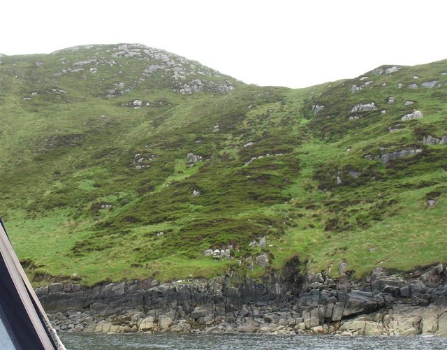
| ImageCaption | Muldoanich seen from Vatersay |
| GridReference | NL688940 |
| celtic name | Maol Dòmhnaich |
| meaning of name | Duncan's rounded hill |
| area | 78 ha |
| area rank | 164= |
| highest elevation | Cruachan na h-àin, 153 m |
| Population | 0 |
| island group | Uist and Barra |
| local authority | Comhairle nan Eilean Siar |
| references |
Muldoanich is an uninhabited island in the Barra Isles archipelago at the southern extremity of the larger island chain of the Outer Hebrides in Scotland. It is 78 ha in area and rises to a maximum height of 153 m at the peak of Cruachan na h-àin ("midday hill").
Muldoanich is about 4 km southeast of Castlebay, the main port on the island of Barra. It is a prominent landmark for the approaching ferry and other craft and has no level ground. There are no census records, but the southern headland of Vanish (meaning "headland of the house" or "sacred place" in Gaelic) may indicate habitation at some time in the past.
Etymology
The name "Muldoanich" is probably the anglicised version of the meaning "Duncan's rounded hill". It is shown with that name on Ordnance Survey maps. Mul Domhnach, meaning "Sunday island", is another possible derivation. Writing in the 16th century, Dean Munro referred to the island as "Scarp" and it appears as "Scarpa" on Blaeu's atlas of 1654.
Martin Martin refers to "Muldonish" in his 1695 voyage around the Western Isles, stating "about a mile in circumference; it is high in the middle, covered over with heath and grass, and is the only forest here for maintaining the deer, being commonly about seventy or eighty in number."
References
References
- [http://www.gro-scotland.gov.uk/statistics/publications-and-data/occpapers/occasional-paper-10.html "Occasional Paper No 10: Statistics for Inhabited Islands"] {{webarchive. link. (2010-04-02 (28 November 2003) General Register Office for Scotland. Edinburgh. Retrieved 15 September 2007.)
- {{Haswell-Smith. 216-218
- "1:50,000". [[Ordnance Survey]].
- "Pàrlamaid na h-Alba placenames".
- [[Martin Martin. Martin, Martin]] (1703) "[http://www.appins.org/martin.htm ''A Description of The Western Islands of Scotland''] {{webarchive. link. (2007-03-13 . Appin Regiment/Appin Historical Society. Retrieved 3 March 2007.)
This article was imported from Wikipedia and is available under the Creative Commons Attribution-ShareAlike 4.0 License. Content has been adapted to SurfDoc format. Original contributors can be found on the article history page.
Ask Mako anything about Muldoanich — get instant answers, deeper analysis, and related topics.
Research with MakoFree with your Surf account
Create a free account to save articles, ask Mako questions, and organize your research.
Sign up freeThis content may have been generated or modified by AI. CloudSurf Software LLC is not responsible for the accuracy, completeness, or reliability of AI-generated content. Always verify important information from primary sources.
Report