From Surf Wiki (app.surf) — the open knowledge base
Mont Saint-Bruno
Mountain in Montérégie, Quebec, Canada
Mountain in Montérégie, Quebec, Canada
| Field | Value |
|---|---|
| name | Mont Saint-Bruno |
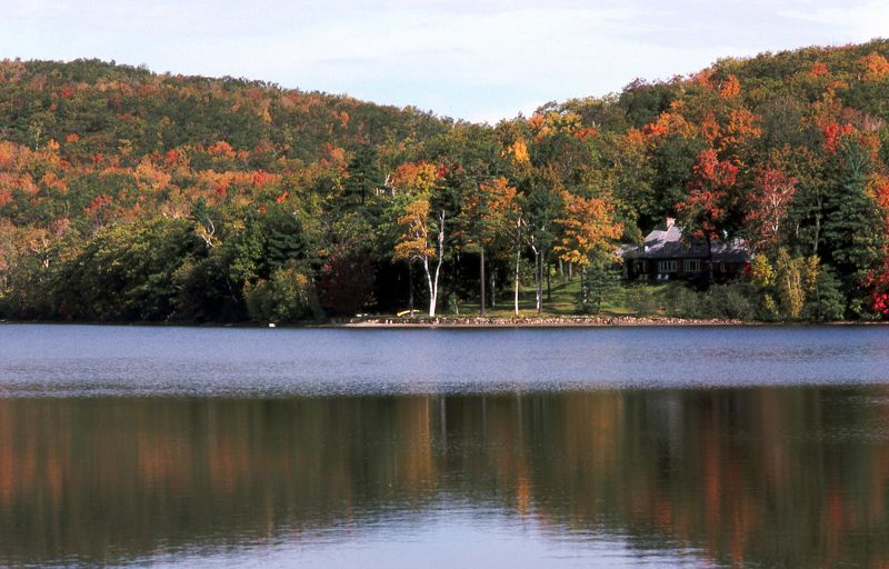
| photo | Mont-saint-bruno-2021-01.jpg |
| elevation_m | 218 |
| elevation_ref | |
| range | Monteregian Hills |
| location | Saint-Bruno-de-Montarville, Montreal, Quebec, Canada |
| map | Canada Quebec |
| coordinates | |
| coordinates_ref | |
| topo | NTS |
| type | Intrusive stock |
| age | Early Cretaceous |
| volcanic_arc/belt =
Mont Saint-Bruno (; also known as Mount Saint Bruno in English) is part of the Monteregian Hills in southern Quebec, Canada. Its summit stands 218 m high and lies 23 km east of downtown Montreal.
This mountain has a ski resort, a natural area, and an apple orchard. Forests of beech, maple, oak, hickory, ironwood, hemlock and pine cover those slopes which have not been cleared for agriculture or skiing. The apple orchard is an agricultural research station operated by IRDA (The Research and Development Institute for the Agri-Environment of Québec).
Mont-Saint-Bruno National Park encompasses part of the mount, which also contains ski slopes Ski Mont Saint-Bruno. A quarry also occupies part of it. Mont Saint-Bruno is also home to a small Canadian Forces training camp where new recruits from the Canadian Forces Leadership and Recruit School learn navigation and topography.
NOTOC
Geology
Mont Saint-Bruno might be the deep extension of a vastly eroded ancient volcanic complex, which was probably active about 125 million years ago. The mountain was created when the North American Plate moved westward over the New England hotspot, along with the other mountains of the Monteregian Hills. As a result, Mont Saint-Bruno forms part of the Great Meteor hotspot track. Its igneous rock consists mostly of pyroxenite and gabbro.
References
References
- {{cite opentopomap. Mount Saint-Bruno. 45.55667. -73.32567. 2023-08-18
- {{cite cgndb
- [http://www.oceanexplorer.noaa.gov/explorations/05stepstones/background/geologic_history/geologic_history.html A Hundred-Million Year History of the Corner Rise and New England Seamounts] {{Webarchive. link. (2006-05-03 Retrieved on 2007-08-01)
This article was imported from Wikipedia and is available under the Creative Commons Attribution-ShareAlike 4.0 License. Content has been adapted to SurfDoc format. Original contributors can be found on the article history page.
Ask Mako anything about Mont Saint-Bruno — get instant answers, deeper analysis, and related topics.
Research with MakoFree with your Surf account
Create a free account to save articles, ask Mako questions, and organize your research.
Sign up freeThis content may have been generated or modified by AI. CloudSurf Software LLC is not responsible for the accuracy, completeness, or reliability of AI-generated content. Always verify important information from primary sources.
Report