From Surf Wiki (app.surf) — the open knowledge base
Monrovia, California
City in California, United States

City in California, United States
| Field | Value | |
|---|---|---|
| name | Monrovia, California | |
| settlement_type | City | |
| image_skyline | Monrovia CA San Gabriel Mountains i210.JPG | |
| image_caption | I-210 in Monrovia with San Gabriel Mountains in the background | |
| image_flag | Flag of Monrovia, California.gif | |
| image_seal | Monrovia_CA_seal.jpg | |
| image_map | LA County Incorporated Areas Monrovia highlighted.svg | |
| mapsize | 250x200px | |
| map_caption | Location of Monrovia in Los Angeles County, California | |
| pushpin_map | USA | |
| pushpin_map_caption | Location in the United States | |
| pushpin_relief | 1 | |
| subdivision_type | Country | |
| subdivision_name | United States | |
| subdivision_type1 | State | |
| subdivision_name1 | California | |
| subdivision_type2 | County | |
| subdivision_name2 | Los Angeles | |
| government_type | Council-Manager | |
| leader_title | Mayor | |
| leader_name | Becky A. Shevlin | |
| leader_title1 | Mayor Pro Tem | |
| leader_name1 | Dr. Tamala P. Kelly | |
| leader_title2 | City Council | |
| leader_name2 | {{Plain list | |
| leader_title3 | City Manager | |
| leader_name3 | Dylan Feik | |
| leader_title4 | City Treasurer | |
| leader_name4 | Janet Wall | |
| established_title | Incorporated | |
| established_date | December 15, 1887{{cite web | |
| url | http://www.calafco.org/docs/Cities_by_incorp_date.doc | |
| title | California Cities by Incorporation Date | |
| format | Word | |
| publisher | California Association of Local Agency Formation Commissions | |
| access-date | August 25, 2014 | |
| archive-url | https://web.archive.org/web/20141103002921/http://www.calafco.org/docs/Cities_by_incorp_date.doc | |
| archive-date | November 3, 2014 | |
| url-status | dead | |
| df | mdy-all | |
| unit_pref | Imperial | |
| area_footnotes | ||
| area_total_sq_mi | 13.74 | |
| area_land_sq_mi | 13.63 | |
| area_water_sq_mi | 0.11 | |
| area_total_km2 | 35.59 | |
| area_land_km2 | 35.31 | |
| area_water_km2 | 0.28 | |
| area_water_percent | 0.79 | |
| elevation_m | 174 | |
| elevation_ft | 571 | |
| coordinates | ||
| population_as_of | 2020 | |
| population_footnotes | ||
| population_total | 37931 | |
| population_density_km2 | 1074.2 | |
| timezone | PST | |
| utc_offset | −8 | |
| timezone_DST | PDT | |
| utc_offset_DST | −7 | |
| postal_code_type | ZIP Codes | |
| postal_code | 91016–91017 | |
| area_code | 626 | |
| area_code_type | Area code | |
| blank_name | FIPS code | |
| blank_info | 06-48648 | |
| blank1_name | GNIS feature ID | |
| blank1_info | ||
| website |
- Larry Spicer
- Sergio Jimenez
- Edward Belden | access-date = August 25, 2014 | archive-url = https://web.archive.org/web/20141103002921/http://www.calafco.org/docs/Cities_by_incorp_date.doc | archive-date = November 3, 2014 | url-status = dead
Monrovia is a city in the foothills of the San Gabriel Mountains in the San Gabriel Valley of Los Angeles County, California, United States. Monrovia is the fourth-oldest general-law city in Los Angeles County and the L.A. Basin (after Los Angeles, Santa Monica, and Pasadena, all now charter cities). Incorporated in 1887, it has grown from a sparse community of orange ranches to a residential community of over 37,000. The population was 37,931 at the 2020 census.
History

The San Gabriel Valley was first inhabited by the Tongva whose traditional lands extended throughout the area of modern-day greater Los Angeles. While Juan Rodríguez Cabrillo first discovered California for Spain in 1542, Spanish colonization did not begin until 1769 with the Portolá expedition. In 1771, the entire valley, including present-day Monrovia, came under the domain of the newly established Mission San Gabriel, initially located along the San Gabriel River near the southern edge of the valley. The mission utilized the lower portion of the valley for raising cattle and farming while the uplands, including Monrovia, remained untouched.
Following Mexico's independence from Spain and the Mexican Congress's enactment of secularization laws in 1833, the government of Alta California began the process of secularizing missions and dispersing their property. On April 16, 1841, Hugo Reid, a naturalized Mexican citizen from Great Britain, was provisionally granted ownership of Rancho Santa Anita, which included most of present-day Monrovia to the west of Norumbega Drive, and received a fee simple title to the land in 1845. Rancho Santa Anita then changed hands several times before Lucky Baldwin acquired it on April 8, 1875. In 1884, William N. Monroe purchased a 120-acre plot from Baldwin in present-day Monrovia that encompassed both sides of White Oak Avenue (now Foothill Boulevard). Monroe acquired an additional 90 acres in 1885.
In 1886, Monroe partnered with Edward F. Spence, John D. Bicknell, and James F. Crank to form a 120-acre town centered around Myrtle Avenue and present-day Colorado Boulevard; the first sale of townsite lots began on May 17, 1886. Within nineteen months, several banks, hotels, churches, and schools were built. In 1887, Monrovia reached a population of 500 and was incorporated on December 15, making it the fourth incorporated city in Los Angeles County after Los Angeles, Santa Monica, and Pasadena. Monrovia was connected to Los Angeles by rail in 1888 through the efforts of the San Gabriel Valley Rapid Transit Railroad Company. The Los Angeles Terminal Railway briefly assumed control over the rail line in 1892 before selling the railway to Southern Pacific in 1893.[[Image:Monrovia-1903.jpg|left|thumb|Pacific Electric in Monrovia, 1903]] In 1903, the Pacific Electric railway opened a line to Monrovia. The expansion of this interurban railway, which served the greater Los Angeles area, allowed residents to visit the beach for the day, commute to downtown Los Angeles, and travel the region. It also contributed to Monrovia's growth with the population nearly tripling over a decade to 3,576 in 1910. After construction stagnated during World War I, it increased in the post-war years with a record number of building permits being issued in 1923. From 1920 to 1930, Monrovia's population increased from 5,480 to 10,890. [[Image:Monrovia-May-16-1914.jpg|thumb|Monrovia, 1914 (Myrtle Avenue, looking north)]] In 1905, Carnegie funds became available and, with the help of the Board of Trade (forerunner to the Chamber of Commerce) and the Monrovia Women's Club, a bond issue was passed to purchase the Granite Bank Building to be used as a city hall, and to acquire property for a public park. The Granite Building has served as the city hall, fire and police department facilities since 1961 and the fire department since 1974. In 1956, the old Carnegie library building was torn down and a new library was constructed. In March 2007, a new library was voted on by the people of Monrovia. It won with 70% yes votes. The library now has 190,000 books, a heritage room for historical documents, and areas for children, teens, and adults.
A city council–manager type government was instituted in 1923.
In 1930, the Monrovia Airport, also known as the Foothill Flying Club, was commercially established. The small airstrip claimed to have had 12,000 paying customers use the airfield in 1932 and on May 19, 1938, the first airmail flight took off from Monrovia Airport. Ownership of the airport changed hands several times while it was in operation; pilots remembered it as "the friendliest little airport in the country." Apart from usage by Riley Brothers, TWA Captain and former airshow pilot Kalman Irwin, and Pancho Barnes, the airfield is well known for its use as a movie-filming location. The first movie filmed at the Monrovia Airport was The Fighting Pilot. Other films shot at the airfield include 20,000 Men a Year, The Great Plane Robbery, and most notably, The Big Noise, featuring Laurel and Hardy. The 35-acre airfield, used as a runway as well as an airplane repair and storage service, was forced to close in 1953 after being sold to Consolidated Engineering Corporation for redevelopment as a result of increased land values.
Monrovia was the home to the precursor to McDonald's. In 1937, Patrick McDonald opened a food stand on Huntington Drive (Route 66) near the old Monrovia Airport called "The Airdrome" (hamburgers were ten cents, and all-you-can-drink orange juice was five cents); it remained there until 1940, when he and his two sons, Maurice and Richard, moved the building 40 mi east to San Bernardino to the corner of West 14th Street and 1398 North E Street, renaming it "McDonald's".
In 1995, Monrovia received the All America City Award from the National Civic League.
Geography and ecology
According to the United States Census Bureau, the city has an area of 35.5 km2. 13.6 sqmi of it is land and 0.1 sqmi of it (0.79%) is water.
Wildlife is abundant in the adjacent San Gabriel Mountains, including mammals like black bears, bobcats, coyotes, gray foxes, mountain lions, and mule deer, many of which roam area neighborhoods and visit backyards. In 2024, a mother black bear and her young cubs began regularly visiting a home in Monrovia situated close to the mountains to cool-off and play in the property's swimming pool. By May, the bear family had become such regular visitors, with the homeowners posting numerous videos online, that it was reported on by multiple local, national and international news outlets, including Sky News Australia.
Surrounding areas
: unincorporated Los Angeles County : unincorporated Los Angeles County [[Image:Up arrow left.svg|20px]] [[Image:Up-1.svg|30px]] [[Image:Up arrow right.svg|20px]] Duarte : Arcadia [[Image:Left.svg|30px]] [[Image:Right.svg|30px]] Bradbury : Arcadia [[Image:Down arrow left.svg|20px]] [[Image:Down arrow.svg|30px]] [[Image:Down arrow right.svg|20px]] Duarte : Mayflower Village / South Monrovia Island
Demographics
|align-fn=center 1860–1870 1880–1890 1900 1910 1920 1930 1940 1950 1960 1970 1980 1990 2000 2010 2020
Monrovia first appeared as a town in the 1890 U.S. Census; and as a city in the 1900 U.S. Census.
| Race / Ethnicity (NH = Non-Hispanic) | title=P004: Hispanic or Latino, and Not Hispanic or Latino by Race – 2000: DEC Summary File 1 – Monrovia city, California | url=https://data.census.gov/table?g=160XX00US0648648&tid=DECENNIALSF12000.P004 | website=United States Census Bureau | access-date= }} | title=P2: Hispanic or Latino, and Not Hispanic or Latino by Race – 2010: DEC Redistricting Data (PL 94-171) – Monrovia city, California | url=https://data.census.gov/cedsci/table?q=p2&g=160XX00US0648648&tid=DECENNIALPL2010.P2 | website=United States Census Bureau | access-date= }} | % 2000 | % 2010 |
|---|---|---|---|---|---|---|---|---|---|---|
| White alone (NH) | 17,211 | 15,023 | 12,903 | 46.61% | ||||||
| Black or African American alone (NH) | 3,074 | 2,346 | 1,955 | 8.32% | ||||||
| Native American or Alaska Native alone (NH) | 133 | 89 | 66 | 0.36% | ||||||
| Asian alone (NH) | 2,531 | 3,997 | 6,210 | 6.85% | ||||||
| Native Hawaiian or Pacific Islander alone (NH) | 34 | 69 | 30 | 0.09% | ||||||
| Other race alone (NH) | 73 | 93 | 227 | 0.20% | ||||||
| Mixed race or Multiracial (NH) | 861 | 930 | 1,553 | 2.33% | ||||||
| Hispanic or Latino (any race) | 13,012 | 14,043 | 14,987 | 35.24% | ||||||
| Total | 36,929 | 36,590 | 37,931 | 100.00% |
2020
The 2020 United States census reported that Monrovia had a population of 37,931. The population density was 2,782.5 PD/sqmi. The racial makeup of Monrovia was 41.3% White, 5.6% African American, 1.2% Native American, 16.7% Asian, 0.1% Pacific Islander, 18.5% from other races, and 16.5% from two or more races. Hispanic or Latino of any race were 39.5% of the population.
The census reported that 99.4% of the population lived in households, 0.4% lived in non-institutionalized group quarters, and 0.2% were institutionalized.
There were 14,556 households, out of which 30.5% included children under the age of 18, 45.6% were married-couple households, 6.6% were cohabiting couple households, 30.2% had a female householder with no partner present, and 17.6% had a male householder with no partner present. 26.4% of households were one person, and 10.6% were one person aged 65 or older. The average household size was 2.59.
The age distribution was 19.4% under the age of 18, 7.8% aged 18 to 24, 29.1% aged 25 to 44, 27.9% aged 45 to 64, and 15.8% who were 65years of age or older. The median age was 40.5years. For every 100 females, there were 91.3 males.
There were 15,241 housing units at an average density of 1,118.0 /mi2, of which 14,556 (95.5%) were occupied. Of these, 46.4% were owner-occupied, and 53.6% were occupied by renters.
In 2023, the US Census Bureau estimated that the median household income was $97,083, and the per capita income was $47,622. About 7.0% of families and 10.5% of the population were below the poverty line.
2010
The 2010 United States census reported that Monrovia had a population of 36,590. The population density was 2,668.1 PD/sqmi. The racial makeup of Monrovia was 21,932 (59.9%) White (41.1% Non-Hispanic White), 4,107 (11.2%) Asian, 2,500 (6.8%) African American, 279 (0.8%) Native American, 76 (0.2%) Pacific Islander, 5,818 (15.9%) from other races, and 1,878 (5.1%) from two or more races. Hispanic or Latino of any race were 14,043 persons (38.4%).
The census reported that 36,434 people (99.6% of the population) lived in households, 61 (0.2%) lived in non-institutionalized group quarters, and 95 (0.3%) were institutionalized.
There were 13,762 households, out of which 4,725 (34.3%) had children under the age of 18 living in them, 6,295 (45.7%) were opposite-sex married couples living together, 2,073 (15.1%) had a female householder with no husband present, 778 (5.7%) had a male householder with no wife present. There were 793 (5.8%) unmarried opposite-sex partnerships, and 131 (1.0%) same-sex married couples or partnerships. 3,649 households (26.5%) were made up of individuals, and 1,276 (9.3%) had someone living alone who was 65 years of age or older. The average household size was 2.65. There were 9,146 families (66.5% of all households); the average family size was 3.24.
The population was spread out, with 8,514 people (23.3%) under the age of 18, 3,084 people (8.4%) aged 18 to 24, 10,733 people (29.3%) aged 25 to 44, 10,018 people (27.4%) aged 45 to 64, and 4,241 people (11.6%) who were 65 years of age or older. The median age was 37.9 years. For every 100 females, there were 91.6 males. For every 100 females age 18 and over, there were 87.0 males.
There were 14,473 housing units at an average density of 1,055.4 /mi2, of which 6,809 (49.5%) were owner-occupied, and 6,953 (50.5%) were occupied by renters. The homeowner vacancy rate was 1.3%; the rental vacancy rate was 4.9%. 18,478 people (50.5% of the population) lived in owner-occupied housing units and 17,956 people (49.1%) lived in rental housing units.
According to the 2010 United States census, Monrovia had a median household income of $71,768, with 9.8% of the population living below the federal poverty line.
Mapping L.A.
Mapping L.A. reported that in 2000, Mexican (27.0%) and German (7.9%) were the most common ancestries. Mexico (48.1%) and the Philippines (8.6%) were the most common foreign places of birth.
Economy
Original Tommy's, Trader Joe's, Green Dot and Naked Juice are based in Monrovia. Monrovia has a "Technology Corridor", which includes AeroVironment, Tanner Research, Parasoft, Xencor, and ITT Deep Space Division.
Top employers
According to the city's 2021 Annual Comprehensive Financial Report, the top employers in the city are:
| # | Employer | # of employees |
|---|---|---|
| 1 | Monrovia Unified School District | 724 |
| 2 | Trader Joe's | 341 |
| 3 | STAAR Surgical | 254 |
| 4 | Sierra Autocars | 244 |
| 5 | City of Monrovia | 238 |
| 6 | WorleyParsons | 218 |
| 7 | Home Depot | 209 |
| 8 | Ducommun | 182 |
| 9 | Vinyl Technology | 179 |
| 10 | Amada Myachi America | 164 |
Arts and culture
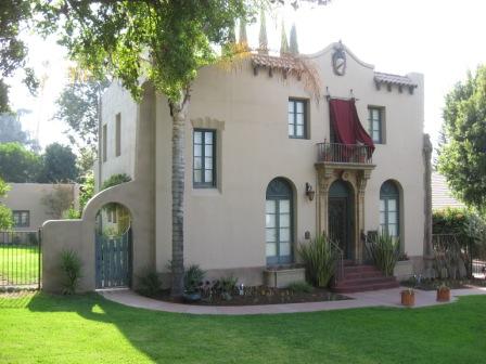
Upton Sinclair House, home to author Upton Sinclair, is in Monrovia and is a National Historic Landmark.
Government
In the California State Legislature, Monrovia is in , and in . A small portion of the city is in .
In the United States House of Representatives, Monrovia is mostly within with a small portion of the city in .{{cite web |access-date = September 27, 2014 |archive-url = https://web.archive.org/web/20130930184128/http://wedrawthelines.ca.gov/downloads/meeting_handouts_072011/handouts_20110729_q2_cd_finaldraft_splits.zip |archive-date = September 30, 2013 |url-status = dead
Education
Public schools

The Monrovia Unified School District operates 12 public schools, consisting of 5 elementary schools, 2 middle schools, 1 alternative school, 1 independent study school, and 1 adult school:
Preschools (Pre-K)
- Canyon Early Learning Center
Elementary schools (TK–5th)
- Bradoaks Elementary Science Academy
- Mayflower Elementary School
- Monroe Elementary School
- Plymouth Elementary School
- Wildrose School of Creative Arts
Middle schools (6th–8th)
- Clifton Middle School
- Santa Fe Computer Science Magnet School
High schools (9th–12th)
- Monrovia High School (MHS)
Alternative schools (7th–12th)
- Canyon Oaks High School
Independent-study schools (K–12th)
- Mountain Park School
Adult schools
- Monrovia Community Adult School
Colleges and universities
The city is a part of the Citrus Community College District.
Media
Newspapers with offices in Monrovia include the San Gabriel Valley Tribune, which publishes community news, and Monrovia Weekly, a community newspaper. Public access television is provided by KGEM-TV, which is available primarily to cable viewers, with some content online.
Infrastructure
Transportation

Monrovia's main roads include Foothill Boulevard and Huntington Drive (historic Route 66). It is also served by the Foothill Freeway (I-210).
In 2016, Metro opened a new at-grade light rail station in Monrovia, Monrovia station, at the intersection of Myrtle Avenue and Duarte Road. It is served by the Metro A Line. It is at the location of the former Santa Fe Depot, which still stands.
Health care
The Los Angeles County Department of Health Services operates the Monrovia Health Center in Monrovia.
Notable people
- Allen Allensworth, American chaplain, colonel, and founder of Allensworth, Tulare County
- Kenny Baker, singer and actor
- Corie Blount, basketball player, Los Angeles Lakers, Chicago Bulls
- Cisco Carlos, Major League Baseball pitcher
- Jason Earles, actor
- Mary Ford, vocalist and guitarist
- Jim Fuller, guitarist for The Surfaris (of "Wipeout" fame)
- Prince Gomolvilas, playwright
- Dean R. Hirsch, president of World Vision International
- Ernie Johnson, former baseball player and member of the New York Yankees first World Series championship team 1923
- Ian Johnson, American football player
- Katie Johnson, Mexican-American soccer player for the San Diego Wave in the NWSL
- Anna H. Jones, African American educator and activist
- Kiyoshi Kuromiya, gay rights activist
- Ellis McCarthy, defensive tackle for Miami Dolphins
- Corky King, founder of Summum
- Scott Land, puppeteer/actor
- Don Mankiewicz, screenwriter and novelist
- Francis M. Pottenger, Jr., nutrition researcher
- Kim Rhode, three-time Olympic gold medalist (six medals total) in trap and skeet shooting
- Thomas J. Sargent, 2011 Nobel Prize in Economics, graduated from Monrovia High School in 1961
- Upton Sinclair and Mary Craig Sinclair, authors and producers
- Jacob Smith, actor
- William A. Spinks (1865–1933), champion carom billiards pro, co-inventor of modern billiards cue chalk, oil investor, and flower and avocado farmer (developer of the Spinks avocado cultivar); also maintained home and farm in nearby Duarte
- Leslie Van Houten, Monrovia High School graduate, Charles Manson follower
- Henry B. Walthall (1878–1936), actor
- The Fabulous Wonder Twins, entertainers
- Ashley Sanchez Professional Soccer Player for the Washington Spirit in the NWSL and the USWNT
In popular culture
- The house seen in the 1986 horror-comedy cult film House is at 329 Melrose Avenue in Monrovia.
- The exterior house seen in the 2018 post-apocalyptic horror thriller film Bird Box, which was streamed worldwide on Netflix, is at 304 North Canyon Boulevard and the corner of East Greystone Avenue in Monrovia.
- Miranda July's novel All Fours is set in large part in a Monrovia motel.
References
References
- [http://www.cacities.org/resource_files/24827.Electedcitytreasurers06.rtf California League of Cities, Elected City Treasurers] {{Webarchive. link. (February 12, 2012 )
- "2019 U.S. Gazetteer Files". United States Census Bureau.
- "Monrovia (city) QuickFacts". [[United States Census Bureau]].
- "Charter_Cities List".
- "Census - Geography Profile: Monrovia city, California". [[United States Census Bureau]].
- Sepulveda, Charles. (January 2018). "Our Sacred Waters: Theorizing Kuuyam as a Decolonial Possibility". Decolonization: Indigeneity, Education & Society.
- Servin, Manuel P.. (Winter 1973). "California’s Hispanic Heritage: A View Into the Spanish Myth". [[Journal of San Diego History]].
- Robinson, W.W.. (1936). "Monrovia : A Calendar of Events in the Making of a City". Title Guarantee and Trust Co..
- Ryan, MaryEllen. "Secularization and the Ranchos, 1826-1846". Monterey County Historical Society.
- {{harvp. Robinson. 1936
- {{harvp. Robinson. 1936
- {{harvp. Robinson. 1936
- Davis, Shannon. (2018). "City of Monrovia Historic Context Statement". ASM Affiliates, Inc..
- {{harvp. Robinson. 1936
- {{harvp. Davis. Novell. Taylor Kung. Voisin George. 2018
- "Early Monrovia History". Monrovia Historical Preservation Group.
- {{harvp. Davis. Novell. Taylor Kung. Voisin George. 2018
- {{harvp. Davis. Novell. Taylor Kung. Voisin George. 2018
- (January 27, 2011). "Monrovia Public Library – Monrovia Patch – Patch.com". Monrovia.patch.com.
- "Abandoned & Little-Known Airfields: California, East Los Angeles area".
- Money, Luke. (February 21, 2020). "'Old lady' bear tranquilized after walkabout in Monrovia neighborhood".
- Rand, Jory. (December 27, 2022). "Mountain lion sighting in Monrovia sparks excitement as SoCal mourns loss of P-22".
- (May 7, 2024). "Watch: Bear and cubs enjoy pool day in Monrovia".
- "Decennial Census by Decade".
- "1870 Census of Population - Population of Civil Divisions less than Counties - California - Almeda County to Sutter County".
- "1870 Census of Population - Population of Civil Divisions less than Counties - California - Tehama County to Yuba County".
- "1890 Census of Population - Population of California by Minor Civil Divisions".
- "1900 Census of Population - Population of California by Counties and Minor Civil Divisions".
- "1910 Census of Population - Supplement for California".
- "1920 Census of Population - Number of Inhabitants - California".
- "1930 Census of Population - Number and Distribution of Inhabitants - California".
- "1940 Census of Population - Number of Inhabitants - California".
- "1950 Census of Population - Number of Inhabitants - California".
- "1960 Census of Population - General population Characteristics - California".
- "1970 Census of Population - Number of Inhabitants - California".
- "1980 Census of Population - Number of Inhabitants - California".
- "1990 Census of Population - Population and Housing Unit Counts - California".
- "2000 Census of Population - Population and Housing Unit Counts - California".
- "2010 Census of Population - Population and Housing Unit Counts - California".
- "P004: Hispanic or Latino, and Not Hispanic or Latino by Race – 2000: DEC Summary File 1 – Monrovia city, California".
- "P2: Hispanic or Latino, and Not Hispanic or Latino by Race – 2010: DEC Redistricting Data (PL 94-171) – Monrovia city, California".
- "P2: Hispanic or Latino, and Not Hispanic or Latino by Race – 2020: DEC Redistricting Data (PL 94-171) – Monrovia city, California".
- "Monrovia city, California; DP1: Profile of General Population and Housing Characteristics - 2020 Census of Population and Housing".
- "Monrovia city, California; P16: Household Type - 2020 Census of Population and Housing".
- "Monrovia city, California; DP03: Selected Economic Characteristics - 2023 ACS 5-Year Estimates Comparison Profiles".
- "2010 Census Interactive Population Search: CA - Monrovia city". U.S. Census Bureau.
- "US Census Quick Facts".
- "Monrovia".
- "Technology Corridor". Cityofmonrovia.ws.
- (April 1, 2015). "City of Monrovia General Plan Amendment Land Use Element".
- (June 30, 2021). "City of Monrovia Annual Comprehensive Financial Report".
- "Statewide Database". [[Regents of the University of California]].
- "About KGEM-TV".
- "Foothill Gold Line Pasadena to Azusa".
- (December 6, 2017). "Here's what developers are planning for Monrovia's restored 1926 Santa Fe train depot".
- "[http://publichealth.lacounty.gov/phn/docs/HealthCenter/monrovia.pdf Monrovia Health Center]." [[Los Angeles County Department of Health Services]]. Retrieved on March 27, 2010.
- "About the Park". California State Parks.
- (30 September 2019). "Happy Birthday, Kenny Baker!". Radio Spirits.
- "Former UC and NBA star returns to UC to complete his degree". University Relations, University of Cincinnati.
- (2020). "AIDS infrastructures, queer networks: Architecting the critical path". First Monday.
- (26 April 2015). "Don Mankiewicz dies at 93; novelist and Oscar-nominated screenwriter". Los Angeles Times.
- "Film locations for House (1986)". Movie-locations.com.
- (December 23, 2018). "Bird Box (2018) Film Locations". globalfilmlocations.net.
- Krueger, Alyson. (May 12, 2024). "All Fours Review". The New York Times.
This article was imported from Wikipedia and is available under the Creative Commons Attribution-ShareAlike 4.0 License. Content has been adapted to SurfDoc format. Original contributors can be found on the article history page.
Ask Mako anything about Monrovia, California — get instant answers, deeper analysis, and related topics.
Research with MakoFree with your Surf account
Create a free account to save articles, ask Mako questions, and organize your research.
Sign up freeThis content may have been generated or modified by AI. CloudSurf Software LLC is not responsible for the accuracy, completeness, or reliability of AI-generated content. Always verify important information from primary sources.
Report