From Surf Wiki (app.surf) — the open knowledge base
Molkenmarkt
Public square in Berlin
Public square in Berlin

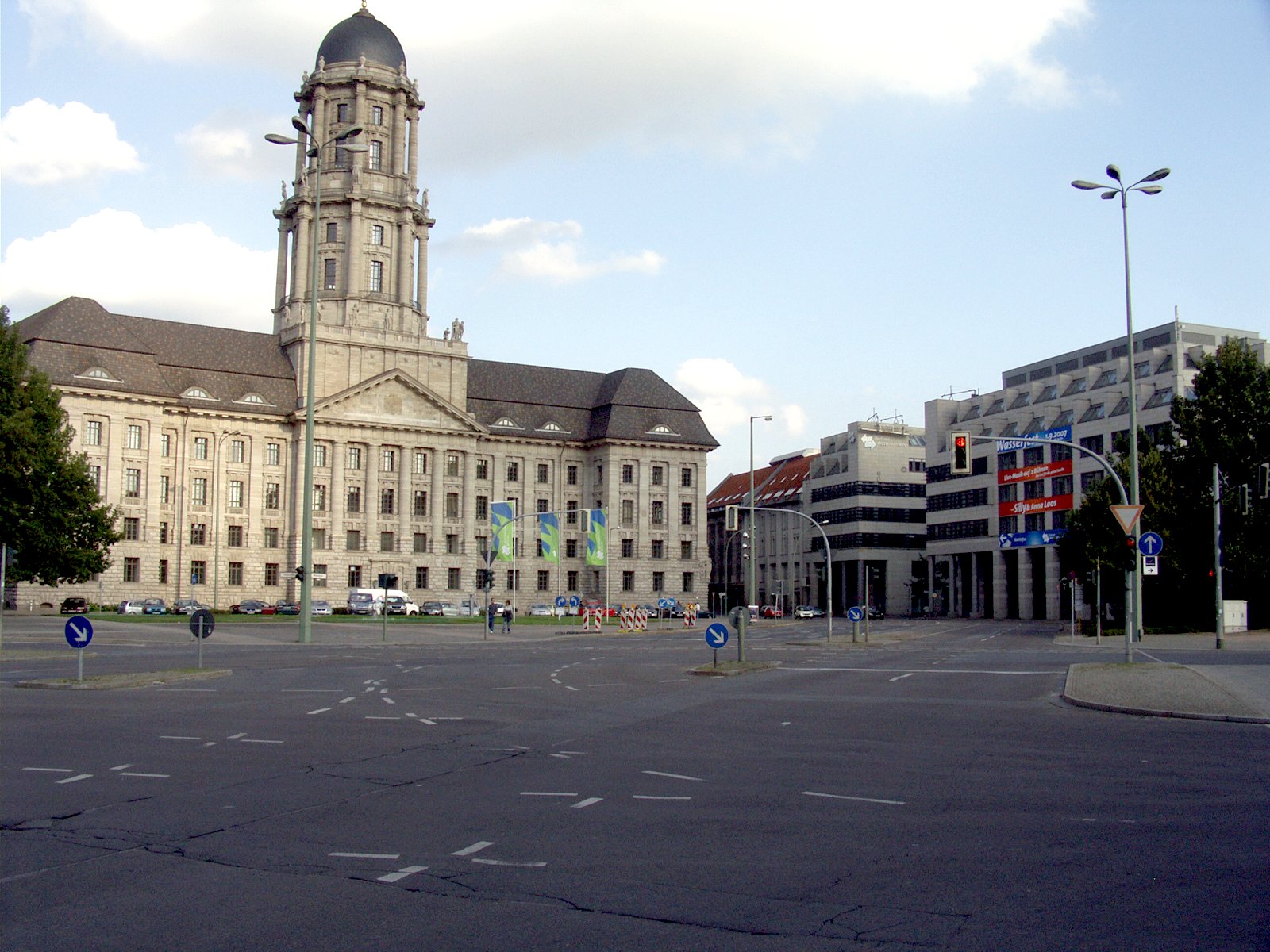
Molkenmarkt (literally: "whey market") is the oldest square in Berlin. It is located in the Alt-Berlin quarter of the Mitte district, in the historic centre of the city. With approximately 9200 sqm in size, it is today a major traffic junction, dominated by the large Altes Stadthaus administrative building on its southeastern side.
History
During the initial settlement around the Mühlendamm causeway across the Spree river about 1200 AD, the site developed as the central trading place. In the late 13th century, however, the venue became too small and a new marketplace beneath St. Mary's Church arose, which soon became more popular. The former site was thereafter known as Olde Markt or Alter Markt (Old Market) until 1685, when it was renamed to Mulkenmarkt, later to change to Molkenmarkt, possibly named after dairy products sold here or after nearby watermills on the Spree river. In the late 17th century, the trading place was finally closed by order of Elector Frederick III of Brandenburg. The area around the square was densely populated until World War II, when much of Berlin's city centre was destroyed by strategic bombing. In addition, the Nazi authorities had cleared many buildings in preparation of their Welthauptstadt Germania plans, with the intention of creating an administrative Gauforum around the Altes Stadthaus, which was originally separated from the square by several residential buildings along Jüdenstraße. In 1959, under the East German rule, the broad Grunerstraße was relocated, running through the square to Alexanderplatz.
Recent urban plans developed by the Senate of Berlin envisage a complete redesign of the location according to its historic condition, including narrower streets and new built-up areas on the available spaces.
Image:Rosenberg Molkenmarkt 1785.jpg|Molkenmarkt, about 1785 Image:Berlin, Jüdenstraße Richtung Stralauer Straße.jpg|Jüdenstraße, ca. 1890 Image:1811.Molkenmarkt 1 14.3068.tif|Map with Molkenmarkt, Nikolaiviertel and Parochialkirche, 1811 Image:Three Administration Buildings Comparison.png|Map with Molkenmarkt and Jüdenstraße, 2012 Image:Berlin Stadthaus.jpg|Aerial view with Molkenmarkt and Jüdenstraße, 2005
References
References
- (1 March 2009). "Berlin". Lonely Planet.
- [http://luise-berlin.de/strassen/bez01h/O68.htm Olde Markt], Berlingeschichte.de, [[Luisenstadt]] edition, 2008, retrieved 1 July 2012 {{in lang. de
- [http://www.stadtentwicklung.berlin.de/cgi-bin/hidaweb/getdoc.pl?DOK_TPL=lda_doc.tpl&KEY=obj%2009011265 Altes Stadthaus], Denkmale in Berlin, Ministry of City Administration and the Environment, [[Senate of Berlin]], 25 March 2008.
- de, p. 21.
This article was imported from Wikipedia and is available under the Creative Commons Attribution-ShareAlike 4.0 License. Content has been adapted to SurfDoc format. Original contributors can be found on the article history page.
Ask Mako anything about Molkenmarkt — get instant answers, deeper analysis, and related topics.
Research with MakoFree with your Surf account
Create a free account to save articles, ask Mako questions, and organize your research.
Sign up freeThis content may have been generated or modified by AI. CloudSurf Software LLC is not responsible for the accuracy, completeness, or reliability of AI-generated content. Always verify important information from primary sources.
Report