From Surf Wiki (app.surf) — the open knowledge base
Mole Valley

| Field | Value |
|---|---|
| timezone | GMT |
| utc_offset | 0 |
| timezone_DST | BST |
| utc_offset_DST | +1 |
| settlement_type | Non-metropolitan district |
| subdivision_type | Sovereign state |
| subdivision_type1 | Constituent country |
| subdivision_type2 | Region |
| subdivision_type3 | Non-metropolitan county |
| subdivision_type4 | Status |
| subdivision_type5 | Admin HQ |
| subdivision_name | United Kingdom |
| subdivision_name1 | England |
| subdivision_name4 | Non-metropolitan district |
| government_type | Non-metropolitan district council |
| leader_title | Leadership |
| leader_title1 | MPs |
| established_title1 | Incorporated |
| population_density_km2 | auto |
| blank1_name | ONS code |
| blank2_name | OS grid reference |
| official_name | Mole Valley District |
| image_skyline | Leatherhead Bridge - geograph.org.uk - 5410353.jpg |
| imagesize | 200px |
| image_caption | Bridge over the River Mole at Leatherhead |
| blank_emblem_size | 200px |
| motto | Ministrando vigilans |
| (Latin: Vigilant in our serving) | |
| image_map | Mole Valley UK locator map.svg |
| mapsize | 150px |
| map_caption | Mole Valley shown within Surrey |
| subdivision_name2 | South East England |
| subdivision_name3 | Surrey |
| subdivision_name5 | Dorking |
| established_date1 | 1 April 1974 |
| governing_body | Mole Valley District Council |
| area_total_km2 | 258.3 |
| area_rank | (of ) |
| population_total | |
| population_as_of | |
| population_rank | (of ) |
| demographics_type1 | Ethnicity (2021) |
| demographics1_footnotes | |
| demographics1_title1 | Ethnic groups |
| demographics_type2 | Religion (2021) |
| demographics2_footnotes | |
| demographics2_title1 | Religion |
| blank1_info | 43UE (ONS) |
| E07000210 (GSS) | |
| blank2_info |
(Latin: Vigilant in our serving) Highest point : Leith Hill | 92.7% White | 3% Asian | 2.5% Mixed | 0.9% other | 0.8% Black | 52.2% Christianity | 38.4% no religion | 6.3% not stated | 1.2% Islam | 0.7% Hinduism | 0.4% other | 0.4% Buddhism | 0.2% Judaism | 0.1% Sikhism E07000210 (GSS)
Mole Valley is a local government district in Surrey, England. Its council is based in Dorking, and the district's other town is Leatherhead. The largest villages are Ashtead, Fetcham and Great Bookham, in the northern third of the district.
Most of the district is on the escarpments of or adjoins the Surrey Hills, a designated Area of Outstanding Natural Beauty, which cover parts of the North Downs and Greensand Ridge, including locally Leith Hill, Polesden Lacey and Box Hill. Denbies Wine Estate, the largest vineyard in the country, is on the hills north-west of Dorking. The Pilgrims' Way footpath runs along the North Downs. There are stations on the London–Worthing and Reading–Gatwick Airport railways, and in the northern third, a commuter stopping-service pattern line, London–Guildford (via Epsom) line.
The A24 road and the M25 motorway are the main thoroughfares and relative to London the incidence of car ownership is high. Between 2011 and its final iteration in 2019, the area hosted hill-focused sub-laps of the London–Surrey Classic cycling tour, an event established as preparation for the visit to Mole Valley of the 2012 Olympic Games Road Races.
The neighbouring districts are Epsom and Ewell, Reigate and Banstead, Crawley, Horsham, Waverley, Guildford, Elmbridge and the London borough Kingston upon Thames.
History
The district was created on 1 April 1974 under the Local Government Act 1972, covering three former districts which were all abolished at the same time:
- Dorking and Horley Rural District (except Horley and Salfords and Sidlow which went to Reigate and Banstead and parts of the parishes of Charlwood and Horley around Gatwick Airport which went to Crawley)
- Dorking Urban District
- Leatherhead Urban District The new district was named after the River Mole, which flows through the area.
Governance
- See main article: Mole Valley District Council
Towns and parishes
The former Leatherhead Urban District, which included Ashtead, Fetcham, Great Bookham and Little Bookham, is an unparished area, as is the majority of the former Dorking Urban District.
The rest of the district is covered by civil parishes:
- Abinger
- Betchworth
- Brockham
- Buckland
- Capel
- Charlwood
- Headley
- Holmwood
- Leigh
- Mickleham
- Newdigate
- Ockley
- Wotton
Demographics
A Legatum Prosperity Index published by the Legatum Institute in October 2016 showed Mole Valley as the second most prosperous council area in the United Kingdom, after the nearby Borough of Waverley.
Churches graded II* or above

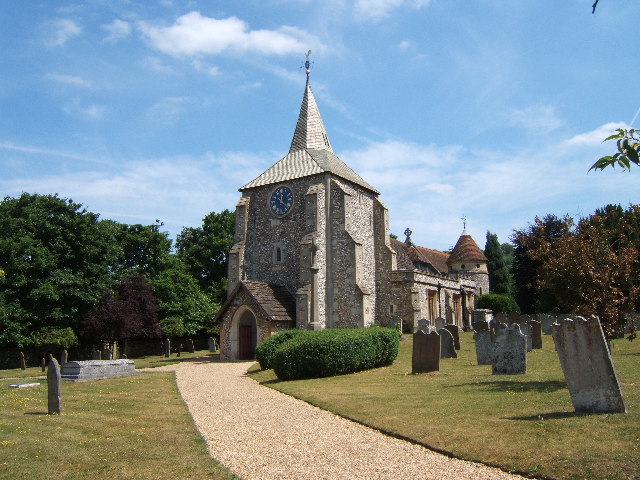

| Church | Place | Listed building |
|---|---|---|
| Class | ||
| St Michael | Betchworth | I |
| St Nicolas | Great Bookham | I |
| All Saints | Little Bookham | II* |
| St Nicholas | Charlwood | I |
| St Michael | Mickleham | I |
| St John the Evangelist | Wotton | I |
| St Mary & St Nicholas | Leatherhead | II* |
| St Barnabas | Ranmore Common | II* |
| St Mary | Pixham | II* |
| St Martin | Dorking | II* |
| St Mary | Fetcham | II* |
| St Giles | Ashtead | II* |
| St James | Abinger Common | II* |
| Holy Trinity | Westcott | II* |
| St Bartholomew | Leigh | II* |
| St Margaret | Ockley | II* |
| St John the Baptist | Walliswood | II* |
Emergency services
Mole Valley is served by these emergency services:
- Surrey Police. Dorking Police Station is the lead station in Mole Valley Division, Leatherhead Police Station is now closed.
- South East Coast Ambulance Service The district has two Ambulance Stations – one in North Holmwood (1 mi south of Dorking), and the other in Leatherhead.
- Surrey Fire & Rescue Service, The district has two Fire Stations one in North Holmwood and the other in Leatherhead.
- SURSAR, The district is covered by Surrey Search & Rescue
- Hospital, Each town has a small NHS Hospital with no A&E. They are used for outpatients and rehabilitation.
Freedom of the District
- DMRC Headley Court received the Freedom of the District on 25 May 2010.
References
References
- "Mole Valley Local Authority".
- "Government information about visitor attractions at Denbie's". Surrey County Council.
- {{cite legislation UK. (1972)
- {{cite legislation UK. (1974)
- {{cite legislation UK. (1973)
- "Election Maps". Ordnance Survey.
- "Surrey: Diagram showing administrative boundaries, 1971". Ordnance Survey.
- "Surrey County Council website".
- "Parish Councils".
- (13 October 2016). "Scots authority named amongst UK's top 10 most prosperous – as neighbouring city props up table". HeraldScotland.
- {{National Heritage List for England
- {{National Heritage List for England
- {{NHLE
- {{National Heritage List for England
- {{National Heritage List for England
- {{National Heritage List for England
- {{National Heritage List for England
- {{National Heritage List for England
- {{National Heritage List for England
- {{National Heritage List for England
- {{National Heritage List for England
- {{National Heritage List for England
- {{National Heritage List for England
- {{National Heritage List for England
- {{National Heritage List for England
- {{National Heritage List for England
- Martin, Guy. (2 July 2013). "Headley Court granted district's highest honour". Surrey Live.
This article was imported from Wikipedia and is available under the Creative Commons Attribution-ShareAlike 4.0 License. Content has been adapted to SurfDoc format. Original contributors can be found on the article history page.
Ask Mako anything about Mole Valley — get instant answers, deeper analysis, and related topics.
Research with MakoFree with your Surf account
Create a free account to save articles, ask Mako questions, and organize your research.
Sign up freeThis content may have been generated or modified by AI. CloudSurf Software LLC is not responsible for the accuracy, completeness, or reliability of AI-generated content. Always verify important information from primary sources.
Report