From Surf Wiki (app.surf) — the open knowledge base
Mission Bend, Texas
| Field | Value | |
|---|---|---|
| official_name | Mission Bend, Texas | |
| settlement_type | Census-designated place | |
| motto | ||
| image_skyline | WaterTower.JPG | |
| image_caption | A Mission Bend water tower | |
| image_seal | ||
| image_map | Harris County Texas incorporated and unincorporated areas Mission Bend highlighted.svg | |
| mapsize | 260px | |
| map_caption | Location in Harris County and the state of Texas | |
| <!-- Location --> | subdivision_type | Country |
| subdivision_name | United States | |
| subdivision_type1 | State | |
| subdivision_name1 | Texas | |
| subdivision_type2 | Counties | |
| subdivision_name2 | Fort Bend, Harris | |
| established_date | ||
| unit_pref | Imperial | |
| area_total_km2 | 12.7 | |
| area_land_km2 | 12.6 | |
| area_water_km2 | 0.1 | |
| area_water_sq_mi | ||
| population_as_of | 2020 | |
| population_footnotes | ||
| population_total | 36914 | |
| population_density_km2 | auto | |
| population_density_sq_mi | ||
| timezone | Central (CST) | |
| utc_offset | -6 | |
| timezone_DST | CDT | |
| utc_offset_DST | -5 | |
| elevation_m | 29 | |
| elevation_ft | 95 | |
| coordinates | ||
| blank_name | FIPS code | |
| blank_info | 48-48772 | |
| blank1_name | GNIS feature ID | |
| blank1_info | 1867556 |
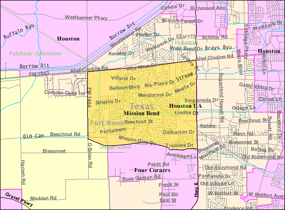
Mission Bend is a census-designated place (CDP) around Texas State Highway 6 within the extraterritorial jurisdiction of Houston in Fort Bend and Harris counties in the U.S. state of Texas; Mission Bend is 4 mi northwest of the city hall of Sugar Land and 20 mi southwest of Downtown Houston. The population was 36,914 at the 2020 census.
History
Mission Bend began in the early 1980s. The area gained population between 1980 and 1990. In 1990, the community had 24,945 residents. By 2000, many of the area's residents commuted to Houston.
The City of Houston did a limited purpose annexation of a portion of the Mission Bend area after the year 2000, therefore reducing the CDP's territory.
Geography
Mission Bend is located at (29.693667, -95.661721).
According to the United States Census Bureau, the CDP has a total area of 12.6 sqkm, of which 12.6 sqkm is land and 0.1 sqkm, or 0.41%, is water.
Demographics
|align-fn=center 1850–1900 1910 1920 1930 1940
1950 1960 1970 1980 1990 2000 2010 2020
Mission Bend first appeared as a census designated place in the 1990 U.S. census.
2020 census
| Race / Ethnicity (NH = Non-Hispanic) | title=P004: Hispanic or Latino, and Not Hispanic or Latino by Race – 2000: DEC Summary File 1 – Mission Bend CDP, Texas | url=https://data.census.gov/table?g=160XX00US4848772&tid=DECENNIALSF12000.P004 | publisher=United States Census Bureau | access-date= }} | title=P2: Hispanic or Latino, and Not Hispanic or Latino by Race – 2010: DEC Redistricting Data (PL 94-171) – Mission Bend CDP, Texas | url=https://data.census.gov/cedsci/table?q=p2&g=160XX00US4848772&tid=DECENNIALPL2010.P2 | publisher=United States Census Bureau | access-date= }} | % 2000 | % 2010 |
|---|---|---|---|---|---|---|---|---|---|---|
| White alone (NH) | 9,806 | 4,975 | 3,646 | 31.81% | ||||||
| Black or African American alone (NH) | 6,546 | 10,581 | 9,933 | 21.23% | ||||||
| Native American or Alaska Native alone (NH) | 50 | 55 | 56 | 0.16% | ||||||
| Asian alone (NH) | 5,025 | 5,510 | 5,873 | 16.88% | ||||||
| Native Hawaiian or Pacific Islander alone (NH) | 21 | 11 | 6 | 0.07% | ||||||
| Other Race alone (NH) | 108 | 109 | 148 | 0.35% | ||||||
| Mixed race or Multiracial (NH) | 752 | 542 | 679 | 2.44% | ||||||
| Hispanic or Latino (any race) | 8,343 | 14,718 | 16,573 | 27.06% | ||||||
| Total | 30,831 | 36,501 | 36,914 | 100.00% |
As of the 2020 United States census, there were 36,914 people, 10,864 households, and 8,997 families residing in the CDP.
As of the census of 2000, there were 30,831 people, 8,978 households, and 7,864 families residing in the CDP. The population density was 5,900.1 PD/sqmi. There were 9,202 housing units at an average density of 1,761.0 /sqmi. The racial makeup of the CDP was 46.32% White, 21.50% African American, 0.31% Native American, 16.96% Asian, 0.08% Pacific Islander, 10.63% from other races, and 4.20% from two or more races. Hispanic or Latino of any race were 27.06% of the population.
There were 8,978 households, out of which 55.7% had children under the age of 18 living with them, 70.5% were married couples living together, 12.5% had a female householder with no husband present, and 12.4% were non-families. 9.5% of all households were made up of individuals, and 1.1% had someone living alone who was 65 years of age or older. The average household size was 3.43 and the average family size was 3.67.
In the CDP, the population was spread out, with 33.7% under the age of 18, 8.1% from 18 to 24, 32.9% from 25 to 44, 21.4% from 45 to 64, and 3.9% who were 65 years of age or older. The median age was 32 years. For every 100 females, there were 97.2 males. For every 100 females age 18 and over, there were 92.2 males.
The median income for a household in the CDP was $60,222, and the median income for a family was $60,999. Males had a median income of $39,323 versus $31,119 for females. The per capita income for the CDP was $20,029. About 4.5% of families and 5.7% of the population were below the poverty line, including 7.5% of those under age 18 and 8.9% of those age 65 or over.
Government and infrastructure
The Harris County Sheriff's Office serves the Harris County side. It operates the Mission Bend Storefront in an unincorporated area in the International District adjacent to the CDP.
Community Volunteer Fire Department Station #4 is located adjacent to the CDP, in a limited purpose annexed part of Houston. As of the 2000 U.S. census and before, this area was in the Mission Bend CDP.
Harris Health serves as the hospital district for Harris County. Fort Bend County does not have a hospital district. OakBend Medical Center serves as the county's charity hospital which the county contracts with. Other medical facilities in the area include the 24-hour SignatureCare Emergency Center located on Highway 6 and Beechnut Street.
Education
Primary and secondary schools
Public schools

Mission Bend CDP residents in Fort Bend County are zoned to schools in the Fort Bend Independent School District. Mission Bend CDP residents in Harris County are zoned to schools in the Alief Independent School District.
The Fort Bend County section is within the West Division, controlling school board slots 1 through 3.
Elementary schools serving the FBISD section of the Mission Bend CDP and within the Mission Bend CDP include: Hodges Bend Middle School, located in the Four Corners CDP, serves almost all of the FBISD portion of the CDP, while Crockett Middle School, outside of the Mission Bend CDP, serves a small portion. George Bush High School, located in the Mission Bend CDP, serves the FBISD section of the Mission Bend CDP.
Alief schools that serve Harris County areas in the Mission Bend CDP include Petrosky Elementary School (in the CDP), Miller Intermediate School (outside of the CDP) for non-bilingual and bilingual students, and Albright Middle School (inside the CDP). Elementary school bilingual students are zoned to Rees Elementary School. Alief ISD students are randomly assigned to either Elsik, Hastings, or Taylor high schools. None of the high schools are within the Mission Bend CDP. The district also maintains two magnet schools, Kerr High School and Alief Early College High School.
In 2023 Mission Bend and Glen elementary schools consolidated, due to decreased enrollments.
There is a charter K-8 school, International Leadership of Westpark, in Mission Bend CDP.
File:FBISD Mission Bend Elem School.jpg|Mission Bend Elementary School File:FBISD Mission West Elem School.jpg|Mission West Elementary School
Private schools
Iman Academy Southwest is currently in the limited purpose Houston city limits. Previously it was in Mission Bend CDP.
Mission Bend Christian Academy is located north of the CDP.
Colleges and universities
The Texas Legislature designated Houston Community College System (HCC) as serving Alief ISD. Additionally, it specifies that the HCC boundary includes "the part of the Fort Bend Independent School District that is not located in the service area of the Wharton County Junior College District and that is adjacent to the Houston Community College System District." Wharton College's boundary within FBISD is defined only as the City of Sugar Land and the ETJ of Sugar Land, and the Fort Bend portion is in the Houston ETJ, not the Sugar Land ETJ.
Libraries
Fort Bend County Libraries operates the Mission Bend Branch.
Parks and recreation
Fort Bend County owns and operates the Mission West Park in Mission Bend. The park includes a baseball blacktop, a play area, tables, a walking track, and a volleyball court.
Transportation
Metropolitan Transit Authority of Harris County, Texas (METRO) operates public bus services in the area. The agency operates the Mission Bend Park and Ride in an unincorporated area of Harris County, near Mission Bend.
References
References
- "Mission Bend CDP, Texas". [[United States Census Bureau]].
- "U.S. Census website". [[United States Census Bureau]].
- (2007-10-25). "US Board on Geographic Names". [[United States Geological Survey]].
- "2020 CENSUS - CENSUS BLOCK MAP: Mission Bend CDP, TX". [[U.S. Census Bureau]].
- "Fort Bend County Cities & ETJs". Fort Bend County.
- {{Handbook of Texas
- Rodriguez, Lori. "[http://www.chron.com/CDA/archives/archive.mpl?id=1991_768298 Census tracks rapid growth of suburbia]." ''[[Houston Chronicle]]''. Sunday March 10, 1991. Section A, Page 1.
- "Annexations in Houston". City of Houston.
- "CENSUS 2000 BLOCK MAP: MISSION BEND CDP". [[U.S. Census Bureau]].
- (2011-02-12). "US Gazetteer files: 2010, 2000, and 1990". [[United States Census Bureau]].
- "Geographic Identifiers: 2010 Demographic Profile Data (G001): Mission Bend CDP, Texas". [[United States Census Bureau]].
- "Decennial Census by Decade".
- "1900 Census of Population - Population of Texas By Counties And Minor Civil Divisions".
- "1910 Census of Population - Supplement for Texas".
- "1920 Census of Population - Number of Inhabitants - Texas".
- "1930 Census of Population - Number of Inhabitants - Texas".
- "1940 Census of Population - Number of Inhabitants - Texas".
- "1950 Census of Population - Number of Inhabitants - Texas".
- "1960 Census of Population - Number of Inhabitants - Texas".
- "1970 Census of Population - Number of Inhabitants - Texas".
- "1980 Census of Population - Number of Inhabitants - Texas".
- "1990 Census of Population - Population and Housing Unit Counts - Texas".
- "2000 Census of Population - Population and Housing Unit Counts - Texas".
- "2010 Census of Population - Population and Housing Unit Counts - Texas".
- "P004: Hispanic or Latino, and Not Hispanic or Latino by Race – 2000: DEC Summary File 1 – Mission Bend CDP, Texas". [[United States Census Bureau]].
- "P2: Hispanic or Latino, and Not Hispanic or Latino by Race – 2010: DEC Redistricting Data (PL 94-171) – Mission Bend CDP, Texas". [[United States Census Bureau]].
- "P2: Hispanic or Latino, and Not Hispanic or Latino by Race – 2020: DEC Redistricting Data (PL 94-171) – Mission Bend CDP, Texas". [[United States Census Bureau]].
- "[http://www.imdhouston.org/wp-content/gallery/maps/brians-presentation.jpg International District Boundaries] {{webarchive. link. (2011-07-26 ." [[International Management District]]. Retrieved on May 2, 2010.)
- "[http://www.hcso.hctx.net/contact.asp Contact Information] {{webarchive. link. (2010-03-03 ." [[Harris County Sheriff's Office]]. Retrieved on May 28, 2010.)
- (November 2018). "City of Houston and ETJ". City of Houston.
- Knipp, Bethany. (2016-11-02). "Fort Bend County lacks hospital district". [[Community Impact Newspaper]].
- "2020 CENSUS - SCHOOL DISTRICT REFERENCE MAP: Fort Bend County, TX". [[U.S. Census Bureau]].
- "2020 CENSUS - SCHOOL DISTRICT REFERENCE MAP: Harris County, TX". [[U.S. Census Bureau]].
- "[http://www.fortbend.k12.tx.us/board/documents/electing.pdf 2007-2008 Operating Procedures] {{webarchive. link. (2008-12-09 ." ''[[Fort Bend Independent School District]]''. Retrieved on December 8, 2008.)
- "[http://www.fortbend.k12.tx.us/board/meet.cfm Contacting Your School Board Members] {{webarchive. link. (2008-12-04 ." ''[[Fort Bend Independent School District]]''. Retrieved on December 8, 2008.)
- [http://www.fortbendisd.com/cmf/var/tidbits/Tidbits_parentlinks_20090820_1545.pdf 2009-2010 Middle School Boundary] {{webarchive. link. (2010-01-03 . ''[[Fort Bend Independent School District]]''. Retrieved on August 30, 2009.)
- [http://www.fortbendisd.com/cmf/var/tidbits/Tidbits_parentlinks_20090820_1545_2.pdf 2008-2009 High School Boundary] {{webarchive. link. (2010-01-03 . ''[[Fort Bend Independent School District]]''. Retrieved on August 30, 2009.)
- "[https://www.aliefisd.net//cms/lib/TX01917308/Centricity/Domain/1971/2015ElementaryAttendanceBoundaryMap.pdf Elementary School Attendance Zones]." [[Alief Independent School District]]. 2015. Retrieved on December 1, 2018.
- "[https://www.aliefisd.net//cms/lib/TX01917308/Centricity/Domain/1971/2014IntermediateAttendanceBoundaryMap.pdf Intermediate School Attendance Zones]." [[Alief Independent School District]]. 2014. Retrieved on December 1, 2018.
- "[https://www.aliefisd.net//cms/lib/TX01917308/Centricity/Domain/1971/2014IntermediateBilingualAttendanceBoundaryMap.pdf Intermediate School Bilingual Attendance Zones]." [[Alief Independent School District]]. 2014. Retrieved on December 1, 2018.
- "[https://www.aliefisd.net//cms/lib/TX01917308/Centricity/Domain/1971/2014MiddleSchoolAttendanceBoundaryMap.pdf Middle School Attendance Zones]." [[Alief Independent School District]]. 2014. Retrieved on December 1, 2018.
- "[https://www.aliefisd.net//cms/lib/TX01917308/Centricity/Domain/1971/2014ElementaryBilingualAttendanceBoundaryMap.pdf Elementary School Bilingual Attendance Zones]." [[Alief Independent School District]]. 2014. Retrieved on December 1, 2018.
- "[http://www.aliefisd.net/Page/5212 Alief ISD High School Information]." [[Alief Independent School District]]. Retrieved on February 15, 2017.
- "Fort Bend ISD Board approves construction managers for elementary school rebuilds as part of 2023 Bond package (6/27/2023)". [[Fort Bend Independent School District]].
- "MISSION BEND ELEMENTARY REBUILD (Prop A)". [[Fort Bend Independent School District]].
- "Home". International Leadership of Westpark.
- [https://imanacademy.org/ Home]. [[Iman Academy]]. Retrieved on May 23, 2019. "Iman Academy Southwest 6240 Highway 6 South Houston, TX 77083"
- "City of Houston City limits". City of Houston.
- "Census 2000 Block Map: Mission Bend CDP". [[U.S. Census Bureau]].
- "Contact Us". Iman Academy.
- [http://www.missionbendchristianacademy.org Home Page]. Mission Bend Christian Academy. Retrieved on September 5, 2009.
- "Sec. 130.182. HOUSTON COMMUNITY COLLEGE SYSTEM DISTRICT SERVICE AREA.".
- "Sec. 130.211. WHARTON COUNTY JUNIOR COLLEGE DISTRICT SERVICE AREA.".
- "Mission Bend". [[Fort Bend County Libraries]].
- link. (2009-04-12 ." Fort Bend County. Retrieved on October 11, 2009.)
- "[http://www.ridemetro.org/SchedulesMaps/ParkRide/Missionbend.aspx Mission Bend Park and Ride]." [[Metropolitan Transit Authority of Harris County, Texas]]. Retrieved on January 24, 2010.
This article was imported from Wikipedia and is available under the Creative Commons Attribution-ShareAlike 4.0 License. Content has been adapted to SurfDoc format. Original contributors can be found on the article history page.
Ask Mako anything about Mission Bend, Texas — get instant answers, deeper analysis, and related topics.
Research with MakoFree with your Surf account
Create a free account to save articles, ask Mako questions, and organize your research.
Sign up freeThis content may have been generated or modified by AI. CloudSurf Software LLC is not responsible for the accuracy, completeness, or reliability of AI-generated content. Always verify important information from primary sources.
Report