From Surf Wiki (app.surf) — the open knowledge base
Milltown, New Jersey
Borough in Middlesex County, New Jersey, US
Borough in Middlesex County, New Jersey, US
| Field | Value |
|---|---|
| name | Milltown, New Jersey |
| settlement_type | Borough |
| image_skyline | Mill_Condos_in_Milltown_(1899).jpg |
| imagesize | 250x200px |
| image_caption | The historic Milltown India Rubber Factory, now converted to condominiums |
| image_seal | Milltown Seal.png |
| mapframe | yes |
| image_map | Middlesex_County_New_Jersey_Incorporated_and_Unincorporated_areas_Milltown_Highlighted.svg |
| mapsize | 250x200px |
| map_caption | Location of Milltown in Middlesex County highlighted in red (left). Inset map: Location of Middlesex County in New Jersey highlighted in orange (right). |
| image_map1 | Census_Bureau_map_of_Milltown,_New_Jersey.png |
| mapsize1 | 250x200px |
| map_caption1 | Census Bureau map of Milltown, New Jersey |
| pushpin_map | USA New Jersey Middlesex County#USA New Jersey#USA |
| pushpin_label | Milltown |
| pushpin_map_caption | Location in Middlesex County##Location in New Jersey##Location in the United States |
| pushpin_relief | yes |
| subdivision_type | Country |
| subdivision_name | United States |
| subdivision_type1 | State |
| subdivision_name1 | New Jersey |
| subdivision_type2 | County |
| subdivision_name2 | Middlesex |
| government_footnotes | |
| government_type | Borough |
| governing_body | Borough Council |
| leader_title | Mayor |
| leader_name | George Murray (R, term ends December 31, 2027) |
| leader_title1 | Municipal clerk |
| leader_name1 | Gretchen McCarthy |
| established_title | Incorporated |
| established_date | January 29, 1889 |
| unit_pref | Imperial |
| area_footnotes | |
| area_total_km2 | 4.13 |
| area_land_km2 | 4.02 |
| area_water_km2 | 0.11 |
| area_total_sq_mi | 1.59 |
| area_land_sq_mi | 1.55 |
| area_water_sq_mi | 0.04 |
| area_water_percent | 2.56 |
| area_rank | 441st of 565 in state |
| 22nd of 25 in county | |
| population_as_of | 2020 |
| population_footnotes | |
| population_total | 7037 |
| population_rank | 317th of 565 in state |
| 22nd of 25 in county | |
| population_density_km2 | auto |
| population_density_sq_mi | 4528.3 |
| population_density_rank | 129th of 565 in state |
| 10th of 25 in county | |
| population_est | 6968 |
| pop_est_as_of | 2023 |
| pop_est_footnotes | |
| timezone | Eastern (EST) |
| utc_offset | −05:00 |
| timezone_DST | Eastern (EDT) |
| utc_offset_DST | −04:00 |
| elevation_footnotes | |
| elevation_ft | 36 |
| coordinates_footnotes | |
| coordinates | |
| postal_code_type | ZIP Code |
| postal_code | 08850 |
| area_code | 732 |
| blank_name | FIPS code |
| blank_info | 3402346620 |
| blank1_name | GNIS feature ID |
| blank1_info | 0885303 |
| website |
22nd of 25 in county
22nd of 25 in county 10th of 25 in county
Milltown is a borough in Middlesex County, in the U.S. state of New Jersey. The borough is nestled within the heart of the Raritan Valley region, with Lawrence Brook (a Raritan river tributary) flowing through the center of the community. As of the 2020 United States census, the borough's population was 7,037,
Milltown was incorporated as a borough by an act of the New Jersey Legislature on January 29, 1889, from portions of North Brunswick, based on the results of a referendum held three days earlier. The borough was reincorporated by resolution of the borough council on May 2, 1896. A portion of East Brunswick Township was annexed in 1902. Originally known as Bergen's Mill, named for Jacob I. Bergen who owned the grist mill, the name is believed to have become "Milltown" from residents "going to the mill in town".
As of the 2000 Census, the center of population for New Jersey was located in Milltown, at Milltown Road, just east of the New Jersey Turnpike (see map of location). Based on the results of the 2010 census, the center of population had shifted to East Brunswick.
History
Long before the arrival of the first Europeans, the Lenape Native Americans had established settlements along the Lawrence Brook. The discovery of many artifacts in the area above today's municipal building (now a small county park) suggests the presence of a Native American settlement. In 1678, Thomas Lawrence, a New York baker, acquired a large area around the Lawrence Brook, which likely included today's Milltown. The Lawrence Brook was then called Piscopeek (and on later maps, Lawrence's Brook). The names and marks of several Native Americans (Quemareck, Quesiacs, Isarick, Metapis, Peckawan and Turantaca) appear on the bill of sale. In 1769, Fulcard Van Nordstrand advertised the sale of a large gristmill on the bank of Lawrence Brook. It would soon be called Lawrence Brook Mill. The 1903 classic western film The Great Train Robbery was shot in Milltown.
After the end of World War I, the Michelin Illustrated Guides to the Battlefields (1914-1918) of the Western Front were published in Milltown.
In March 2010, the Milltown Borough Council voted against changing the name of Petain Avenue, citing the difficulties that the street's residents would endure if the name changed. Petain Avenue is named for Philippe Pétain, a French World War I general who became the leader of the Vichy France government during World War II. The Vichy Regime willfully collaborated with Nazi Germany, taking state action against "undesirables", including Jews, Protestants, gays, gypsies, and left-wing activists. In total, the Vichy government participated in the deportation of 76,000 Jews to German extermination camps, although this number varies depending on the account; only 2,500 survived the war. After the war, Petain was charged with perjury and sentenced to death, though this was commuted to life imprisonment due to his advanced age. By contrast, in France itself, the French government has since changed the name of every street formerly named after Petain.
The groundbreaking anxiolytic and sedative drug Miltown (meprobamate) developed by Carter Products, which became available to the public in the mid-1950s, was named for the borough.
After the death of Milltown Mel in 2021, who had been featured at Groundhog Day events that drew as many as a thousand spectators, a bill was passed by the legislature to allow groundhogs to be purchased from outside the state, but the bill was vetoed in January 2026 by Governor Phil Murphy over concerns that the imported animals might have rabies.
Geography
According to the United States Census Bureau, the borough had a total area of 1.60 square miles (4.13 km2), including 1.55 square miles (4.02 km2) of land and 0.04 square miles (0.11 km2) of water (2.56%).
The borough borders North Brunswick to the west and East Brunswick to the east.
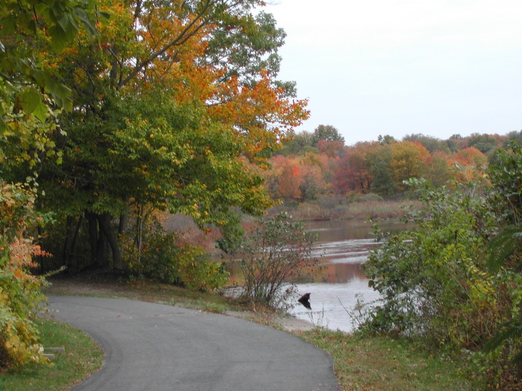
The Lawrence Brook, a tributary of the Raritan River, flows through the borough after exiting the Farrington Lake; a dam, under Main Street, creates a reservoir, the Mill Pond. The brook's watershed covers 48 sqmi that includes Milltown and East Brunswick, New Brunswick, North Brunswick and South Brunswick.
Climate
The climate in the area is characterized by hot, humid summers and generally cold winters. According to the Köppen Climate Classification system, Milltown has a humid continental climate, abbreviated "Dfa" on climate maps.
Demographics
1900–1910 1910–1930 1940–2000 2000 2020
2010 census
The 2010 United States census counted 6,893 people, 2,599 households, and 1,915 families in the borough. The population density was 4,443.0 per square mile (1,715.5/km2). There were 2,698 housing units at an average density of 1,739.0 per square mile (671.4/km2). The racial makeup was 92.44% (6,372) White, 1.23% (85) Black or African American, 0.13% (9) Native American, 3.37% (232) Asian, 0.00% (0) Pacific Islander, 1.58% (109) from other races, and 1.25% (86) from two or more races. Hispanic or Latino of any race were 6.46% (445) of the population.
Of the 2,599 households, 31.1% had children under the age of 18; 60.9% were married couples living together; 9.3% had a female householder with no husband present and 26.3% were non-families. Of all households, 20.7% were made up of individuals and 8.6% had someone living alone who was 65 years of age or older. The average household size was 2.65 and the average family size was 3.10.
21.8% of the population were under the age of 18, 7.3% from 18 to 24, 26.0% from 25 to 44, 30.1% from 45 to 64, and 14.8% who were 65 years of age or older. The median age was 41.6 years. For every 100 females, the population had 97.1 males. For every 100 females ages 18 and older there were 93.5 males.
The Census Bureau's 2006–2010 American Community Survey showed that (in 2010 inflation-adjusted dollars) median household income was $89,457 (with a margin of error of +/− $14,398) and the median family income was $103,750 (+/− $7,631). Males had a median income of $63,377 (+/− $5,321) versus $41,029 (+/− $3,358) for females. The per capita income for the borough was $33,472 (+/− $2,034). About 2.9% of families and 3.0% of the population were below the poverty line, including 3.9% of those under age 18 and 5.3% of those age 65 or over.
2000 census
As of the 2000 United States census there were 7,000 people, 2,627 households, and 1,943 families residing in the borough. The population density was 4,452.0 PD/sqmi. There were 2,670 housing units at an average density of 1,698.1 /sqmi. The racial makeup of the borough was 93.86% White, 0.76% African American, 0.16% Native American, 3.07% Asian, 1.16% from other races, and 1.00% from two or more races. Hispanic or Latino of any race were 3.73% of the population.
There were 2,627 households, out of which 31.7% had children under the age of 18 living with them, 60.9% were married couples living together, 9.9% had a female householder with no husband present, and 26.0% were non-families. 21.4% of all households were made up of individuals, and 9.7% had someone living alone who was 65 years of age or older. The average household size was 2.66 and the average family size was 3.12.
In the borough the population was spread out, with 22.9% under the age of 18, 6.8% from 18 to 24, 29.5% from 25 to 44, 25.1% from 45 to 64, and 15.7% who were 65 years of age or older. The median age was 40 years. For every 100 females, there were 93.2 males. For every 100 females age 18 and over, there were 90.2 males.
The median income for a household in the borough was $68,429, and the median income for a family was $77,869. Males had a median income of $50,338 versus $38,220 for females. The per capita income for the borough was $29,996. About 1.3% of families and 2.3% of the population were below the poverty line, including 3.3% of those under age 18 and 1.3% of those age 65 or over.
Government
Local government
Milltown is governed under the borough form of New Jersey municipal government, which is used in 218 municipalities (of the 564) statewide, making it the most common form of government in New Jersey. The governing body is comprised of the mayor and the borough council, with all positions elected at-large on a partisan basis as part of the November general election. A mayor is elected directly by the voters to a four-year term of office. The borough council includes six members elected to serve three-year terms on a staggered basis, with two seats coming up for election each year in a three-year cycle.The borough form of government used by Milltown is a "weak mayor / strong council" government in which council members act as the legislative body with the mayor presiding at meetings and voting only in the event of a tie. The mayor can veto ordinances subject to an override by a two-thirds majority vote of the council. The mayor makes committee and liaison assignments for council members, and most appointments are made by the mayor with the advice and consent of the council.
, the mayor of Milltown is Republican George Murray, whose term of office ends December 31, 2027. Members of the Milltown Borough Council are Frank Manco (R, 2026), Deborah A. Miller (R, 2028), Gary Posnansky (R, 2026), Patricia Payne (D, 2027), David Potter (D, 2027) and Felipe "Phil" Zambrana (D, 2028).
Federal, state and county representation
Milltown is located in the 12th Congressional District and is part of New Jersey's 18th state legislative district.
Politics
As of March 2011, there were a total of 5,075 registered voters in Milltown, of which 1,609 (31.7%) were registered as Democrats, 823 (16.2%) were registered as Republicans and 2,643 (52.1%) were registered as Unaffiliated. There were no voters registered to other parties.
|}
In the 2020 presidential election, Republican Donald J. Trump received 50% of the vote (2,135 cast), ahead of Democrat Joseph Biden with 47.8% (2,043 votes), and other candidates with 1.4% (53 votes), among the 4,344 ballots cast by the borough's 5,569 registered voters, for a turnout of 78%. In the 2012 presidential election, Republican Mitt Romney received 49.9% of the vote (1,828 cast), ahead of Democrat Barack Obama with 48.7% (1,784 votes), and other candidates with 1.4% (53 votes), among the 3,706 ballots cast by the borough's 5,159 registered voters (41 ballots were spoiled), for a turnout of 71.8%. In the 2008 presidential election, Republican John McCain received 52.0% of the vote (2,112 cast), ahead of Democrat Barack Obama with 45.5% (1,848 votes) and other candidates with 1.6% (65 votes), among the 4,058 ballots cast by the borough's 5,250 registered voters, for a turnout of 77.3%.
|}
In the 2013 gubernatorial election, Republican Chris Christie received 64.6% of the vote (1,650 cast), ahead of Democrat Barbara Buono with 33.5% (855 votes), and other candidates with 2.0% (51 votes), among the 2,586 ballots cast by the borough's 5,180 registered voters (30 ballots were spoiled), for a turnout of 49.9%. In the 2009 gubernatorial election, Republican Chris Christie received 55.9% of the vote (1,684 ballots cast), ahead of Democrat Jon Corzine with 32.6% (982 votes), Independent Chris Daggett with 8.7% (261 votes) and other candidates with 1.6% (47 votes), among the 3,011 ballots cast by the borough's 5,096 registered voters, yielding a 59.1% turnout.
Education
The Milltown Public Schools serves students in public school for pre-kindergarten through eighth grade. As of the 2023–24 school year, the district, comprised of two schools, had an enrollment of 815 students and 76.9 classroom teachers (on an FTE basis), for a student–teacher ratio of 10.6:1. Schools in the district (with 2023–24 enrollment data from the National Center for Education Statistics) are Parkview School with 370 students in grades PreK–3 and Joyce Kilmer School with 436 students in grades 4–8.
For ninth through twelfth grades, public school students attend Spotswood High School in Spotswood as part of a sending/receiving relationship with the Spotswood Public Schools, which also serves students from Helmetta. As of the 2023–24 school year, the high school had an enrollment of 773 students and 57.0 classroom teachers (on an FTE basis), for a student–teacher ratio of 13.6:1.
The community is also served by the Greater Brunswick Charter School, a K–8 charter school serving students from Milltown, Edison, Highland Park and New Brunswick. As of the 2021–22 school year, the school had an enrollment of 399 students and 32.5 classroom teachers (on an FTE basis), for a student–teacher ratio of 12.3:1.
Eighth grade students from all of Middlesex County are eligible to apply to attend the high school programs offered by the Middlesex County Magnet Schools, a county-wide vocational school district that offers full-time career and technical education at its schools in East Brunswick, Edison, Perth Amboy, Piscataway and Woodbridge Township, with no tuition charged to students for attendance.
Our Lady of Lourdes School (PreK–8), which operated under the supervision of Roman Catholic Diocese of Metuchen, closed in June 2013 due to dropping enrollment.
Transportation
Roads and highways
_from_the_overpass_for_Middlesex_County_Route_606_(South_Main_Street)_in_Milltown,_Middlesex_County,_New_Jersey.jpg)
, the borough had a total of 27.37 mi of roadways, of which 23.74 mi were maintained by the municipality, 2.59 mi by Middlesex County and 1.04 mi by the New Jersey Turnpike Authority.
Ryders Lane (County Route 617) is a major artery serving the borough along the eastern border. The New Jersey Turnpike (Interstate 95) passes through for about a mile, but the closest interchange is in neighboring East Brunswick. Also, U.S. Route 1 is outside in neighboring North Brunswick.
Public transportation
On weekdays, NJ Transit provides local bus service on the 811 route.
Coach USA Suburban Transit provides rush-hour commuter service on the 400 route to the Port Authority Bus Terminal in Midtown Manhattan.
The Raritan River Railroad ran through Milltown, but is now defunct along this part of the line. The track and freight station still remain. Proposals have been made to use the line as a light rail route.
Notable people
People who were born in, residents of, or otherwise closely associated with Milltown include:
- J. Edward Crabiel (1916–1992), politician who served in the New Jersey Senate and as New Jersey Secretary of State, until forced to resign
- Josephine Figlo (1923–2011), All-American Girls Professional Baseball League outfielder who played for the Milwaukee Chicks and Racine Belles in 1944
- Joe Gallo (born 1980), college basketball head coach for the Merrimack Warriors men's basketball team
- Al Hermann (1899–1980), Major League Baseball infielder who played for the Boston Braves
- David Kikoski (born 1961), jazz pianist
- Leroy Lins (1913–1986), professional basketball player who played for the Akron Goodyear Wingfoots in the National Basketball League
- Danny Pintauro (born 1976), actor who got started as a child actor on the television soap opera As the World Turns, and in the movie Cujo, and came to prominence on the television series Who's the Boss?
- David Schwendeman (1924–2012), last full-time chief taxidermist of the American Museum of Natural History from 1959 to 1988, who was a lifelong resident of Milltown
- Geno Zimmerlink (born 1963), former American football tight end who played in the National Football League for the Atlanta Falcons
References
References
- [https://data.nj.gov/Government-Finance/NJ-Mayors-Directory/gkt3-i954/data_preview NJ Mayors Directory], [[New Jersey Department of Community Affairs]]. Accessed January 1, 2026.
- [https://www.milltownnj.org/152/Clerks-Office Clerk's Office], Borough of Milltown. Accessed January 31, 2026.
- "ArcGIS REST Services Directory". United States Census Bureau.
- [https://www2.census.gov/geo/docs/maps-data/data/gazetteer/2019_Gazetteer/2019_gaz_cousubs_34.txt 2019 Census Gazetteer Files: New Jersey Places], [[United States Census Bureau]]. Accessed July 1, 2020.
- [https://www.nj.gov/labor/labormarketinformation/assets/PDFs/dmograph/est/mcd/density.xlsx Population Density by County and Municipality: New Jersey, 2020 and 2021], [[New Jersey Department of Labor and Workforce Development]]. Accessed March 1, 2023.
- {{Gnis. 885303. Borough of Milltown, [[Geographic Names Information System]]. Accessed March 8, 2013.
- [https://www.census.gov/geographies/reference-files/time-series/geo/gazetteer-files.html US Gazetteer files: 2010, 2000, and 1990], [[United States Census Bureau]]. Accessed September 4, 2014.
- [http://tools.usps.com/go/ZipLookupResultsAction!input.action?resultMode=0&city=milltown&state=NJ Look Up a ZIP Code for Milltown, NJ], [[United States Postal Service]]. Accessed October 26, 2011.
- [http://www.state.nj.us/infobank/njzips.htm Zip Codes], State of [[New Jersey]]. Accessed August 28, 2013.
- [http://www.area-codes.com/search.asp?frmNPA=&frmNXX=&frmState=NJ&frmCity=Milltown Area Code Lookup - NPA NXX for Milltown, NJ], Area-Codes.com. Accessed August 28, 2013.
- [https://mcdc.missouri.edu/applications/geocodes/?state=34 Geographic Codes Lookup for New Jersey], Missouri Census Data Center. Accessed April 1, 2022.
- 2000 census]].[https://www.nj.gov/labor/labormarketinformation/assets/PDFs/census/2010/2010data/table7cm.xls Table 7. Population for the Counties and Municipalities in New Jersey: 1990, 2000 and 2010], [[New Jersey Department of Labor and Workforce Development]], February 2011. Accessed May 1, 2023.
- Snyder, John P. [https://nj.gov/dep/njgs/enviroed/oldpubs/bulletin67.pdf ''The Story of New Jersey's Civil Boundaries: 1606-1968''], Bureau of Geology and Topography; Trenton, New Jersey; 1969. p. 171. Accessed May 30, 2024.
- Clayton, W. Woodford. [https://books.google.com/books?id=WApIAQAAMAAJ&pg=PA749 ''History of Union and Middlesex Counties, New Jersey: With Biographical Sketches of Many of Their Pioneers and Prominent Men''], p. 749. Everts & Peck, 1889. Accessed September 7, 2015. "A grist-mill was built where Milltown now is, on the North Brunswick side of Lawrence's Brook, at a very early day. Soon after the beginning of the present century it was owned by Jacob I. Bergen, and called Bergen's Mill."
- [http://www.milltownnj.org/history.htm History] {{webarchive. link. (2011-05-14 , Borough of Milltown. Accessed September 7, 2015. "Fire destroys the rubber factory and Meyer's home, leaving him penniless. John Ford advances Meyer the money to rebuild. It is in this period of time that the name Bergen's Mill begins to be replaced with Milltown, most likely stemming from people saying they are 'going to the mill in town.'")
- [https://www.census.gov/geo/www/cenpop/statecenters.txt Population and Population Centers by State: 2000] {{webarchive. link. (2001-12-12 , [[United States Census Bureau]]. Accessed November 16, 2006.)
- Stirling, Stephen. [https://www.nj.com/news/2011/03/us_census_shows_nj_turnpike_in.html "U.S. Census shows East Brunswick as statistical center of N.J."], NJ Advance Media for [[NJ.com]], March 31, 2011, updated March 31, 2019. Accessed December 5, 2019. "For any of you who have ever lain awake at night asking: Where, oh where is the statistical center of New Jersey, there really is an answer. Nenninger Lane, East Brunswick.... Over the last several decades, New Jersey’s statistical center has gradually crept its way south and west along the New Jersey Turnpike as growth in the southern and western portions of the state has outpaced the north.... Ten years ago, it was at an intersection in Milltown, about a tenth of a mile from the Turnpike and a few paces south of a Home Depot."
- 9780498079603.
- Source : Indian Bill of sale - 1678 ([[New Jersey State Museum]], Trenton).
- [http://www.milltownnj.org/history.htm History of the Mill] {{webarchive. link. (2011-05-14 , Borough of Milltown. Accessed October 26, 2011.)
- [https://nmaahc.si.edu/object/nmaahc_2017.111.24.1 ''Michelin Illustrated Guides to the Battlefields (1914-1918): Verdun and the Battles for its Possession.''], [[National Museum of African American History and Culture]]. Accessed May 28, 2024. "At the bottom of the cover, in smaller lettering is the publisher/author of the book, [Michelin & Cie., Clermont-Ferrand / Michelin Tyre Co. Ltd., 81 Fulham Road, London, S.W. / Michelin Tire Co., Milltown, N.J., U.S.A.]."
- [[Peter Applebome. Applebome, Peter]]. [https://www.nytimes.com/2010/03/08/nyregion/08towns.html "A Local Street and a Lesson in History"], ''[[The New York Times]]'', March 7, 2010. Accessed October 26, 2011. "Just ask local officials, aggrieved residents of a neighboring town and the folks on Petain Avenue, a tiny, two-house side street in this placid central New Jersey borough. All have suddenly had to confront the legacy of the French World War I war hero and World War II Nazi collaborator, for whom the street is named, and the balance between the burdens of the past and the demands of living in the present."
- Chang, Kathy. [http://eb.gmnews.com/news/2010-03-18/Front_Page/Milltown_officials_debate_Petain_street_name_issue.html "Milltown officials debate Petain street name issue "] {{Webarchive. link. (2016-03-03 , ''East Brunswick Sentinel'', March 18, 2010. Accessed October 26, 2011. "No one disputes the facts surrounding the street's namesake, Philippe Pétain, and his link to the Nazis during World War II. However, Mayor Gloria Bradford and Borough Council members said they have been stymied because of the 'hardship' that residents who live on the street would have to endure if the street name is changed.")
- Jean-Luc Einaudi and Maurice Rajsfus (2001), op.cit., p.17
- Tagliabue, John. [https://www.nytimes.com/2011/01/03/world/europe/03petain.html "Both Hero and Traitor, but No Longer on the Map"], ''[[The New York Times]]'', January 2, 2011. Accessed June 27, 2011. "After World War I, virtually every town in France had its Rue or Avenue Pétain. So vast was his fame that a dozen or so towns and cities in the United States also named streets for him. But when the signs here change this month, the last street in France bearing his name will have disappeared."
- via [[Los Angeles Times]]. [http://www.newsday.com/news/obituaries/ny-usberg235623501mar23,0,7225110.story "Frank Berger, leader of mood-drug movement, dies"], ''[[Newsday]]'', March 23, 2008. Accessed April 2, 2008. "He and his colleagues made a short film about the effects of the drug on rhesus monkeys, which created enough interest that Wallace, a subsidiary of Carter Products, brought it to market in May 1955, naming it 'Miltown' after the nearby village of Milltown, N.J."
- [https://www.nytimes.com/2026/01/12/nyregion/new-jersey-groundhog-day-veto.html "Why New Jersey Is Running Out of Groundhogs"], ''[[The New York Times]]'', January 12, 2026. Accessed January 12, 2026. "It has been five years since Milltown Mel dazzled Groundhog Day crowds in New Jersey with his predictions of the springlike or wintry days that lay ahead. The groundhog, the borough’s third Mel, was about 3 years old when he died in late 2021.... On Monday, the hope Mr. Einbinder held of reinvigorating a tradition that sometimes drew as many as 1,000 revelers to Milltown, a borough of about 7,000 residents in central New Jersey, took another hit when Gov. Philip D. Murphy vetoed a bill that would have made it easier to import a furry understudy from another state."
- [https://global.mapit.mysociety.org/area/425124/touches.html Areas touching Milltown], MapIt. Accessed February 27, 2020.
- [http://www.middlesexcountynj.gov/Government/Pages/Municipalities.aspx Municipalities], [[Middlesex County, New Jersey]]. Accessed December 1, 2019.
- [https://www.state.nj.us/transportation/gis/maps/polnoroads.pdf New Jersey Municipal Boundaries], [[New Jersey Department of Transportation]]. Accessed November 15, 2019.
- [http://www.lbwp.org/what-we-do What We Do], Lawrence Brook Watershed Partnership. Accessed November 15, 2019. "The Lawrence Brook Watershed Partnership, Inc. (LBWP) is a not-for-profit organization with the mission to protect the water in a 48-square-mile area, the Lawrence Brook watershed (USGSHUC code: 02030105130); this area extends over parts of 5 municipalities: New Brunswick, East Brunswick, North Brunswick, South Brunswick, and Milltown; it also covers most of Rutgers University's Cook Campus."
- [http://www.weatherbase.com/weather/weather-summary.php3?s=550682&cityname=Milltown%2C+New+Jersey%2C+United+States+of+America&units= Climate Summary for Milltown, New Jersey], Weatherbase. Accessed December 5, 2019.
- [https://dspace.njstatelib.org/xmlui/handle/10929/25218?show=full ''Compendium of censuses 1726-1905: together with the tabulated returns of 1905''], [[New Jersey Department of State]], 1906. Accessed August 6, 2013.
- [https://books.google.com/books?id=T9HrAAAAMAAJ&pg=PA337 ''Thirteenth Census of the United States, 1910: Population by Counties and Minor Civil Divisions, 1910, 1900, 1890''], [[United States Census Bureau]], p. 337. Accessed August 28, 2012.
- [https://books.google.com/books?id=kifRAAAAMAAJ&pg=PA714 ''Fifteenth Census of the United States : 1930 - Population Volume I''], [[United States Census Bureau]], p. 714. Accessed December 19, 2011.
- [https://www.nj.gov/labor/labormarketinformation/assets/PDFs/census/2kpub/njsdcp3.pdf#page=27 Table 6: New Jersey Resident Population by Municipality: 1940 - 2000], Workforce New Jersey Public Information Network, August 2001. Accessed May 1, 2023.
- link. (2020-02-12 , [[United States Census Bureau]]. Accessed December 19, 2011.)
- [http://lwd.dol.state.nj.us/labor/lpa/census/2010/dp/dp1_mid/milltown1.pdf Profile of General Demographic Characteristics: 2010 for Milltown borough] {{Webarchive. link. (2016-01-12 , [[New Jersey Department of Labor and Workforce Development]]. Accessed December 19, 2011.)
- [https://www.census.gov/quickfacts/fact/table/milltownboroughnewjersey/ QuickFacts Milltown borough, New Jersey], [[United States Census Bureau]]. Accessed March 17, 2023
- [https://www.nj.gov/labor/labormarketinformation/assets/PDFs/census/2020/2020%20pl94%20Tables/2020_Mun/MCD%200_All.pdf Total Population: Census 2010 - Census 2020 New Jersey Municipalities], [[New Jersey Department of Labor and Workforce Development]]. Accessed December 1, 2022.
- [http://factfinder.census.gov/bkmk/table/1.0/en/ACS/10_5YR/DP03/0600000US3402346620 DP03: Selected Economic Characteristics from the 2006-2010 American Community Survey 5-Year Estimates for Milltown borough, Middlesex County, New Jersey] {{Webarchive. link. (2020-02-12 , [[United States Census Bureau]]. Accessed August 28, 2012.)
- [http://censtats.census.gov/data/NJ/1603446620.pdf Census 2000 Profiles of Demographic / Social / Economic / Housing Characteristics for Milltown borough, New Jersey] {{Webarchive. link. (2016-01-13 , [[United States Census Bureau]]. Accessed August 28, 2012.)
- [http://factfinder.census.gov/bkmk/table/1.0/en/DEC/00_SF1/DP1/0600000US3402346620 DP-1: Profile of General Demographic Characteristics: 2000 - Census 2000 Summary File 1 (SF 1) 100-Percent Data for Milltown borough, Middlesex County, New Jersey] {{Webarchive. link. (2020-02-12 , [[United States Census Bureau]]. Accessed August 28, 2012.)
- [https://njdatabook.rutgers.edu/sites/njdatabook.rutgers.edu/files/documents/inventory_of_municipal_forms_of_government_in_new_jersey.pdf ''Inventory of Municipal Forms of Government in New Jersey''], [[Rutgers University]] Center for Government Studies, July 1, 2011. Accessed June 1, 2023.
- ''2012 New Jersey Legislative District Data Book'', [[Rutgers University]] [[Edward J. Bloustein School of Planning and Public Policy]], March 2013, p. 63.
- Cerra, Michael F. [https://www.njlm.org/809/3982/Forms-of-Govt-Magazine-Article "Forms of Government: Everything You've Always Wanted to Know, But Were Afraid to Ask"], [[New Jersey State League of Municipalities]], March 2007. Accessed January 1, 2025.
- [https://njdatabook.rutgers.edu/sites/njdatabook.rutgers.edu/files/documents/forms_of_municipal_government_in_new_jersey_9220.pdf#page=6 "Forms of Municipal Government in New Jersey"], p. 6. [[Rutgers University]] Center for Government Studies. Accessed June 1, 2023.
- [https://www.milltownnj.org/194/Borough-Council Borough Council], Borough of Milltown. Accessed January 31, 2026. "Milltown operates under a Borough form of municipal government. The Borough Council, which is the Governing Body, consists of one Mayor, elected at large for a 4 year term and 6 members elected at large for 3-year overlapping terms. At the Annual Reorganization Meeting, the Borough Council will select a Council President."
- [https://www.milltownnj.org/DocumentCenter/View/7189/Milltown-2025-Adopted-Budget 2025 Municipal Data Sheet], Borough of Milltown. Accessed January 31, 2026.
- [https://results.enr.clarityelections.com/NJ/Middlesex/125223/web.345435/#/summary November 4, 2025 General Election Official Results], [[Middlesex County, New Jersey]], updated November 20, 2025. Accessed January 1, 2026.
- [https://results.enr.clarityelections.com/NJ/Middlesex/122847/web.345435/#/summary Tuesday, November 5 General Election Official Results], [[Middlesex County, New Jersey]], updated November 27, 2024. Accessed January 1, 2025.
- [https://results.enr.clarityelections.com/NJ/Middlesex/119048/web.317647/#/summary November 7, 2023 General Election Official Results], [[Middlesex County, New Jersey]], December 7, 2023. Accessed January 1, 2024.
- [https://www.nj.gov/state/elections/assets/pdf/2012-congressional-districts/njcd-2011-plan-components-county-mcd.pdf Plan Components Report], [[New Jersey Redistricting Commission]], December 23, 2011. Accessed February 1, 2020.
- [https://nj1015.com/whats-your-new-nj-legislative-district-20-moved-on-new-map/ Districts by Number for 2023-2031], [[New Jersey Legislature]]. Accessed September 18, 2023.
- [http://www.state.nj.us/state/elections/election-results/2011-middlesex-co-summary-report.pdf Voter Registration Summary - Middlesex], [[New Jersey Department of State]] Division of Elections, March 23, 2011. Accessed November 24, 2012.
- "NJ DOS - Division of Elections - Election Results Archive".
- "Nov 7, 2000 General Election".
- "Presidential November 3, 2020 General Election Results".
- "Number of Registered Voters and Ballots Cast November 3, 2020 General Election Results".
- (March 15, 2013). "Presidential General Election Results - November 6, 2012 - Middlesex County". New Jersey Department of Elections.
- (March 15, 2013). "Number of Registered Voters and Ballots Cast - November 6, 2012 - General Election Results - Middlesex County". New Jersey Department of Elections.
- [http://www.state.nj.us/state/elections/election-results/2008-gen-elect-presidential-results-middlesex.pdf 2008 Presidential General Election Results: Middlesex County], [[New Jersey Department of State]] Division of Elections, December 23, 2008. Accessed November 24, 2012.
- "NJ DOS - Division of Elections - Election Results Archive".
- (January 29, 2014). "Governor - Middlesex County". New Jersey Department of Elections.
- (January 29, 2014). "Number of Registered Voters and Ballots Cast - November 5, 2013 - General Election Results - Middlesex County". New Jersey Department of Elections.
- [http://www.njelections.org/election-results/2009-governor_results-middlesex.pdf 2009 Governor: Middlesex County] {{Webarchive. link. (2012-10-17 , [[New Jersey Department of State]] Division of Elections, December 31, 2009. Accessed November 24, 2012.)
- "NJ DOS - Division of Elections - Election Results Archive".
- "NJ DOS - Division of Elections - Election Results Archive".
- [https://nces.ed.gov/ccd/districtsearch/district_detail.asp?Search=2&details=1&ID2=3410290&DistrictID=3410290 District information for Milltown School District], [[National Center for Education Statistics]]. Accessed December 15, 2024.
- [https://nces.ed.gov/ccd/schoolsearch/school_list.asp?Search=1&DistrictID=3410290 School Data for the Milltown Public Schools], [[National Center for Education Statistics]]. Accessed December 15, 2024.
- [https://pv.milltownps.org/ Parkview School], Milltown Public Schools. Accessed January 9, 2026.
- [https://jk.milltownps.org/ Joyce Kilmer School], Milltown Public Schools. Accessed January 9, 2026.
- [https://www.nj.gov/education/sprreports/202324/District-Detail/23-3220.pdf School Performance Reports for the Milltown School District], [[New Jersey Department of Education]]. Accessed September 1, 2025.
- [https://homeroom6.doe.state.nj.us/directory/school/districtid/3220 New Jersey School Directory for the Milltown Public Schools], [[New Jersey Department of Education]]. Accessed February 1, 2024.
- [https://www.milltownps.org/apps/pages/index.jsp?uREC_ID=1649302&type=d&pREC_ID=1792804 About Milltown], Milltown Public Schools. Accessed January 9, 2026. "Through a formal send–receive contract, approved by the Department of Education, our high school students are sent on a tuition basis to Spotswood High School. Our operating budget supports Parkview School and Joyce Kilmer School, as well as the tuition for students attending Spotswood High School."
- [http://www.nj.gov/education/pr/1415/narrative/23/4970/040.html Spotswood High School 2015 Report Card Narrative], [[New Jersey Department of Education]]. Accessed July 11, 2016. "I want to welcome you to Spotswood High School, a comprehensive institution that focuses on excellence in academics, the arts, athletics, and community service. Spotswood High School has served the residents in Spotswood, Helmetta, and Milltown since 1976."
- [https://shs.spsd.us/ourpages/auto/2022/9/12/9529399460620636440/SHS%20School%20Profile%2022-23.pdf ''School Profile 2022–23''], Spotswood High School. Accessed January 9, 2026. "Spotswood High School has served our residents and the districts of Helmetta and Milltown since 1976."
- [https://nces.ed.gov/ccd/schoolsearch/school_detail.asp?Search=1&DistrictID=3415540&ID=341554003660 School data for Spotswood High School], [[National Center for Education Statistics]]. Accessed December 15, 2024.
- [http://www.greaterbrunswick.org/About-Us/Charter/index.html About Us], [[Greater Brunswick Charter School]]. Accessed December 15, 2019. "The Greater Brunswick Regional Charter School is defined by the broad themes of child-directed learning in the vein of constructivism, Howard Gardner's 'unschooled mind,' and Montessori instruction; multi-age groupings of students; a unique degree of parental and community involvement; and a region of residence serving the entire and contiguous school districts of New Brunswick, Edison, Highland Park, and Milltown."
- [https://nces.ed.gov/ccd/districtsearch/district_detail.asp?Search=2&details=1&ID2=3400047&DistrictID=3400047 District information for Greater Brunswick Charter School], [[National Center for Education Statistics]]. Accessed December 1, 2022.
- Heyboer, Kelly. [https://www.nj.com/news/g66l-2019/02/1b0ab48c995308/how-to-get-your-kid-a-seat-in-one-of-njs-hardesttogetinto-high-schools.html "How to get your kid a seat in one of N.J.'s hardest-to-get-into high schools"], NJ Advance Media for [[NJ.com]], February 23, 2019. Accessed February 8, 2025. "Middlesex County has two stand-alone career academies for high-achieving students: the Academy for Science, Math and Engineering Technology, located on the campus of Middlesex County College in Edison, and the Academy for Allied Health and Biomedical Sciences in Woodbridge. How to apply: Students must attend a mandatory information session and submit an application by November of their 8th grade year."
- [https://www.mcmsnj.net/about About Our Schools], [[Middlesex County Magnet Schools]]. Accessed February 8, 2025. "These high schools are free public schools that offer hands-on, integrated learning opportunities for students in grades 9-12 interested in all types of careers as well as higher education. Any student who resides anywhere in Middlesex County's 25 municipalities student may apply to the school district. If accepted, the home school district will permit the student to attend and will organize daily transportation at no cost to the student's family."
- Chang, Kathy. [https://archive.centraljersey.com/2013/06/20/our-lady-of-lourdes-school-closes-in-milltown/?amp "Our Lady of Lourdes School closes in Milltown"], Centraljersey.com, June 20, 2013. Accessed January 15, 2024. "The dismissal bell at Our Lady of Lourdes School (OLOL) rang for the last time on June 14. The 11 a.m. sounding was met with hugs and tears, as many shared lasting memories of their time at the Catholic school on Cleveland Avenue. The Diocese of Metuchen announced recently that the school would close for good in June.... The community learned in May that the school would be closing for financial reasons associated with declining enrollment."
- [http://www.state.nj.us/transportation/refdata/sldiag/mileage_Middlesex.pdf Middlesex County Mileage by Municipality and Jurisdiction], [[New Jersey Department of Transportation]], May 2010. Accessed July 18, 2014.
- [https://www.state.nj.us/transportation/refdata/sldiag/120000617__-.pdf#page=2 Middlesex County Route 617 Straight Line Diagram], [[New Jersey Department of Transportation]], updated June 2011. Accessed December 5, 2019.
- [https://www.state.nj.us/transportation/gis/maps/middlesex.pdf Middlesex County Road Map], [[New Jersey Department of Transportation]]. Accessed December 1, 2019.
- [https://web.archive.org/web/20090522212321/http://www.njtransit.com/sf/sf_servlet.srv?hdnPageAction=BusRoutesMiddlesexCountyTo Middlesex County Bus / Rail Connections], [[NJ Transit]], backed up by the [[Internet Archive]] as of May 22, 2009. Accessed November 25, 2012.
- [http://www.coachusa.com/CoachUsaAssets/files/99/route400.pdf Route 400], Coach USA [[Suburban Transit]]. Accessed September 28, 2013.
- [http://www.middlesexcountynj.gov/Government/Departments/IM/Documents/Planning%20-%20Transportation/1997_Preserving_Rail_Rights-of-Way.pdf ''Preserving Rail Rights of Way in Middlesex County''], [[Middlesex County, New Jersey]]. Accessed December 3, 2019. "On this basis the following rail lines may merit future investigation on their feasibility for accommodating a light rail and/or busway type of passenger service. Raritan River Railroad. South Amboy, Sayreville, South River, East Brunswick, Milltown, North Brunswick, New Brunswick - This corridor could address some of the east-west travel needs in the central area of the County providing a transit way that would link the City of South Amboy and the City of New Brunswick. This could also provide a viable commuter travel alternative to the heavily used Route 18 Corridor."
- Pace, Eric. [https://www.nytimes.com/1992/06/20/nyregion/j-edward-crabiel-75-who-held-posts-in-new-jersey-government.html "J. Edward Crabiel, 75, Who Held Posts in New Jersey Government"], ''[[The New York Times]]'', June 20, 1992. Accessed September 7, 2015. "J. Edward Crabiel, a New Jersey Democrat who was the state's Secretary of State and the minority leader of the State Senate, died yesterday at St. Peter's Medical Center in New Brunswick, where he was admitted two weeks earlier. He was 75 years old and a lifelong resident of Milltown."
- [https://www.aagpbl.org/index.cfm/profiles/gill-josephine-figlo/391 Josephine Gill (Figlo)], [[All-American Girls Professional Baseball League]]. Accessed May 12, 2017. "Hometown: Milltown, NJ"
- Carino, Jerry. [https://www.app.com/story/sports/college/2020/02/18/merrimack-basketball/4784769002/ "College basketball's biggest surprise? Merrimack and its all-Jersey lineup"], ''[[Asbury Park Press]]'', February 18, 2020. Accessed October 4, 2025. "Leading the way is a coach from Milltown and a starting five who hail exclusively from the Garden State — Paterson, Manasquan, Plainfield, Linden and Jersey City."
- [http://sabr.org/bioproj/person/953f3027 Al Hermann], [[Society for American Baseball Research]]. Accessed February 2, 2017.
- [http://www.davidkikoski.com Biography] {{Webarchive. link. (2017-09-28 , DavidKikosky.com. Accessed April 8, 2007. "David Kikoski was born on October 16, 1965 in Milltown, New Jersey.")
- [http://peachbasketsociety.blogspot.com/2015/08/leroy-lins.html Leroy Lins], Peach Basket Society. Accessed June 28, 2019.
- [http://www.tv.com/danny-pintauro/person/5742/summary.html?tag=stars;read_more;0 Danny Pintauro profile], [[TV.com]]. Accessed April 8, 2007. "Daniel John Pintauro was born on January 6, 1976 in Milltown, New Jersey."
- Hevesi, Dennis. [https://www.nytimes.com/2012/12/02/nyregion/david-schwendeman-museum-taxidermist-dies-at-87.html "David Schwendeman, Museum's Chief Taxidermist, Dies at 87"], ''[[The New York Times]]'', December 1, 2012. Accessed July 12, 2016. "Mr. Schwendeman, the last full-time taxidermist at the 143-year-old museum, died on Monday at the home in Milltown, N.J., where he had lived for all of his 87 years."
- [https://www.profootballarchives.com/playerz/zimm00200.html Geno Zimmerlink], Pro Football Archives. Accessed November 15, 2020. "Born: 3/23/1963 Milltown, NJ; High School: Spotswood (NJ)"
This article was imported from Wikipedia and is available under the Creative Commons Attribution-ShareAlike 4.0 License. Content has been adapted to SurfDoc format. Original contributors can be found on the article history page.
Ask Mako anything about Milltown, New Jersey — get instant answers, deeper analysis, and related topics.
Research with MakoFree with your Surf account
Create a free account to save articles, ask Mako questions, and organize your research.
Sign up freeThis content may have been generated or modified by AI. CloudSurf Software LLC is not responsible for the accuracy, completeness, or reliability of AI-generated content. Always verify important information from primary sources.
Report