From Surf Wiki (app.surf) — the open knowledge base
Miles, Queensland
| Field | Value | ||
|---|---|---|---|
| type | town | ||
| name | Miles | ||
| state | qld | ||
| image | MilesMainStreet.JPG | ||
| caption | The main street of Miles (looking towards Roma and Charleville) | ||
| coordinates | |||
| pop | 1874 | ||
| pop_year | |||
| pop_footnotes | |||
| established | 1878 | ||
| postcode | 4415 | ||
| area | 437.8 | ||
| timezone | AEST | ||
| utc | +10:00 | ||
| dist1 | 406 | ||
| dir1 | E | ||
| location1 | Charleville | ||
| dist2 | 141 | ||
| dir2 | E | ||
| location2 | Roma | ||
| dist3 | 127 | ||
| dir3 | NW | ||
| location3 | Dalby | ||
| dist4 | 210 | ||
| dir4 | NW | ||
| location5 | Brisbane | location4 = Toowoomba | |
| elevation | 302 | ||
| elevation_footnotes | |||
| dist5 | 337 | dir5=WNW | lga = Western Downs Region |
| stategov | Callide | ||
| stategov2 | Warrego | ||
| fedgov | Maranoa | ||
| maxtemp | 27.1 | ||
| mintemp | 12.2 | ||
| rainfall | 650.6 | ||
| near-n | Myall Park | ||
| near-ne | Hookswood | ||
| near-e | Columboola | ||
| near-se | Nangram | ||
| near-s | Condamine | ||
| near-sw | Drillham South | ||
| near-w | Drillham | ||
| near-nw | Dalwogon |
| near-n = Myall Park | near-ne = Hookswood | near-e = Columboola | near-se = Nangram | near-s = Condamine | near-sw = Drillham South | near-w = Drillham | near-nw = Dalwogon Miles is a rural town and locality in the Western Downs Region, Queensland, Australia. In the , the locality of Miles had a population of 1,874 people.
Geography
The town is on the Warrego Highway, 340 km west of Brisbane, the state capital, 211 km west of Toowoomba, 127 km west of Dalby and 48 km west of Chinchilla. It is situated 141 km east of Roma, 221 km east of Mitchell, 306 km east of Morven and 406 km east of Charleville.
History
Formerly known as Dogwood Crossing, the town is situated on Dogwood Creek, named by German explorer Ludwig Leichhardt in 1844. The town was renamed Miles in honour of the Queensland Colonial Secretary, William Miles. Miles Post Office opened on 3 January 1878.
Miles Provisional School opened on 31 May 1880, becoming Miles State School on 18 January 1886.
Condamine Road Provisional School opened on 30 July 1908, becoming Condamine Road State School circa 1910. It closed on 13 October 1925. It was on a 5 acre site on the western side of the Leichhardt Highway (approx ). In 1928, the school building was relocated to the Dogwood State School.
Holy Cross School opened in 1926. It closed on 15 December 1989.
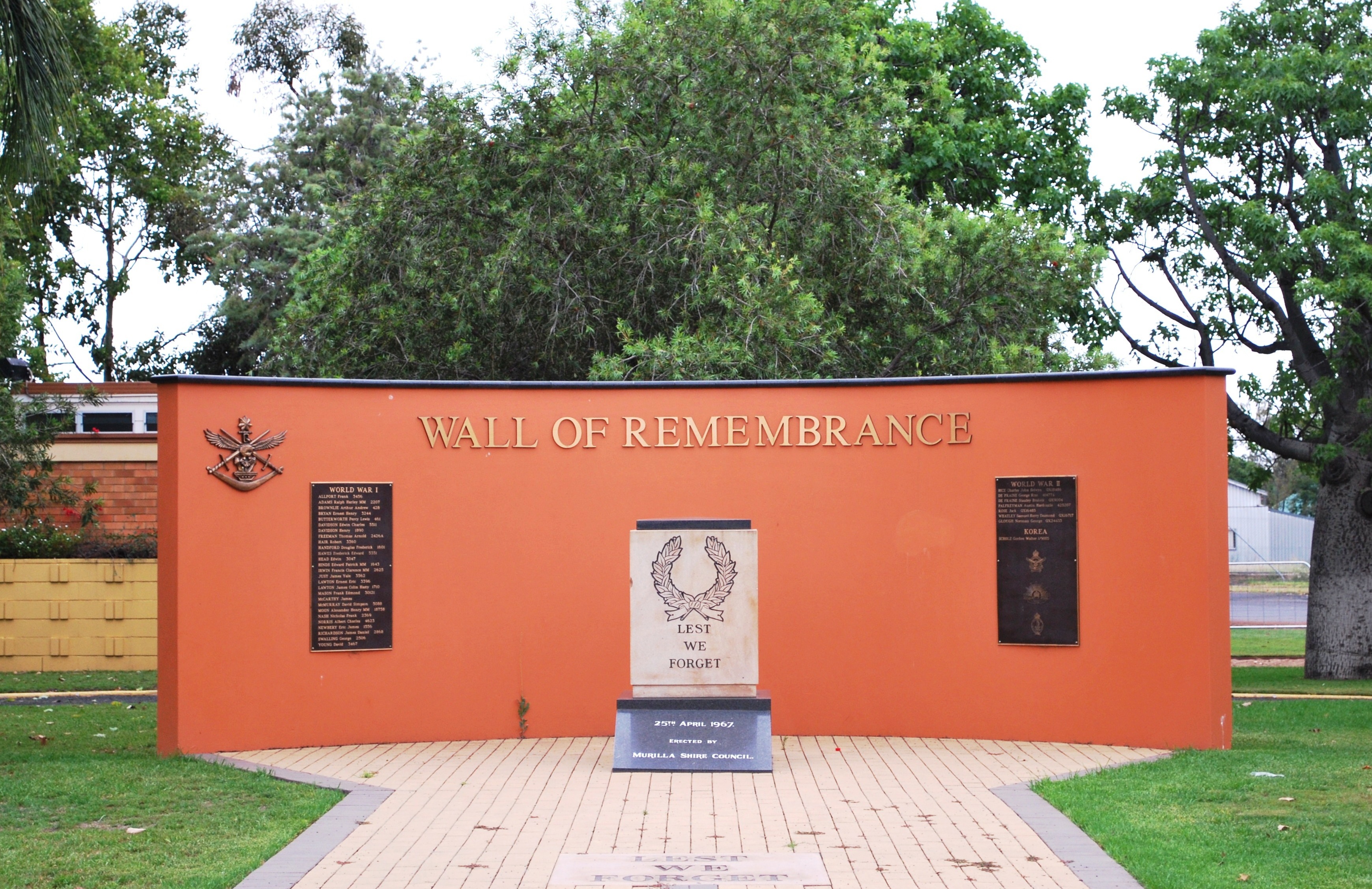
The Miles War Memorial and Wall of Remembrance was erected by the former Murilla Shire Council and dedicated on 25 April 1967.
Miles State High School opened on 30 January 1979.
Miles Library facility opened in 2002. It houses a high-speed ISDN Internet Connection (powered through the National Broadband Network) with Brisbane through the State Library of Queensland.
Demographics
In the , the town of Miles had a population of 1,170 people.
In the , the locality of Miles had a population of 1,746 people.
In the , the locality of Miles had a population of 1,874 people.
Economy

A mining industry utilising rich deposits of bentonite clay is developing.
In addition, there are the following developing industries:
- Coal seam gas
- coal mining
- electricity generation
Education

Miles State School is a government primary (Early Childhood to Year 6) school for boys and girls at Constance Street (). In 2016, the school had an enrolment of 223 students with 18 teachers (16 full-time equivalent) with 12 non-teaching staff (9 full-time equivalent). In 2018, the school had an enrolment of 214 students with 19 teachers (17 full-time equivalent) and 14 non-teaching staff (9 full-time equivalent).
Miles State High School is a government secondary (7–12) school for boys and girls at Pine Street (). In 2016, the school had an enrolment of 190 students with 22 teachers (21 full-time equivalent) and 20 non-teaching staff (13 full-time equivalent). In 2018, the school had an enrolment of 182 students with 18 teachers and 17 non-teaching staff (12 full-time equivalent).
Amenities
Western Downs Regional Council operates Miles Library at Dogwood Crossing on the corner of Dawson and Murilla Streets and has a broadband ISDN Internet Connection to Brisbane (powered through the National Broadband Network) ().
Redeemer Lutheran Church is at 114 Murilla Street ().
The Miles branch of the Queensland Country Women's Association has its rooms in Corbett Drive ().
Attractions
Miles Historical Village Museum is at 141 Murilla Street. It is laid out in the style of town main street in an early Queensland rural town. There are 34 buildings including 15 historic structures relocated from the local area. It regarded as one of the best historical villages in Australia, and is used as a film set and special events venue, in addition to its normal operations as a museum. Every 2 years the town hosts the Miles Back to the Bush Festival in September, in and around the Miles Historical Village. The festival is the town's biggest event and features bush style entertainment with a vintage twist.
Transport
Miles is connected to Brisbane, Toowoomba and Roma by the Warrego Highway and Goondiwindi and Rockhampton by the Leichhardt Highway. Greyhound Australia operates daily bus services between Brisbane and Mount Isa via Longreach and Charleville and between Toowoomba and Rockhampton, via Miles and also to Charleville.
The Westlander train also comes through Miles twice a week, on its way between Brisbane and Charleville, at very early hours of Wednesday & Friday mornings (Westbound Service 3S86) and Thursdays & Saturdays (Eastbound Service 3987).
The town is served by the Miles Airport which is located along the Leichhardt Highway approximately 19 km south of the Leichhardt and Warrego Highway intersection, Miles, Queensland, and 14 km north of the Leichhardt Highway and Roma-Condamine Road intersection, Condamine, Queensland.
Climate
Miles is on the Western Downs, at an elevation of 304 m. The region around Miles has a fairly dry humid subtropical climate (Köppen Cfa) featuring hot summers with mean maximum temperatures in January of 33.4 °C, and mild to warm winters with a maximum of 19.6 °C in July. Winter mornings can be very cold and frost is common. Average rainfall is 609 mm, falling mainly in the period between November and March.
| Jan record high C = 45.6 | Feb record high C = 43.4 | Mar record high C = 41.7 | Apr record high C = 36.7 | May record high C = 33.0 | Jun record high C = 31.2 | Jul record high C = 30.1 | Aug record high C = 36.2 | Sep record high C = 39.9 | Oct record high C = 40.7 | Nov record high C = 42.8 | Dec record high C = 43.9 | year record high C = 45.6 | Jan record low C = 8.9 | Feb record low C = 7.4 | Mar record low C = 4.3 | Apr record low C = -2.1 | May record low C = -4.4 | Jun record low C = -6.1 | Jul record low C = -6.4 | Aug record low C = -5.4 | Sep record low C = -2.8 | Oct record low C = -0.6 | Nov record low C = 3.4 | Dec record low C = 4.4 | year record low C = -6.4
References
References
- "Averages for Miles Post Office". [[Australian Bureau of Meteorology]].
- {{cite QPN. 22031. Miles. town in Western Downs Region
- {{cite QPN. 50108. Miles. locality in Western Downs Region
- Phoenix Auctions History. "Post Office List". Phoenix Auctions.
- "Queensland schools past and present". [[Queensland Family History Society]].
- (26 March 1910). "Advertising". [[Darling Downs Gazette]].
- (19 August 1910). "OFFICIAL NOTIFICATIONS.". [[The Brisbane Courier]].
- (9 July 1910). "LOCAL AND GENERAL.". [[The Toowoomba Chronicle]].
- (1922). "County of Bulwer". [[Queensland Government]].
- (25 April 1928). "WORKS DEPARTMENT.". [[The Brisbane Courier]].
- "Miles War Memorial and Wall of RemembrancePrint Page". Monument Australia.
- (November 2017). "Public Libraries Statistical Bulletin 2016-17". State Library of Queensland.
- {{Census 2011 AUS
- {{Census 2016 AUS
- {{Census 2021 AUS
- link. (22 August 2007 Retrieved 22 October 2006)
- (9 July 2018). "State and non-state school details". [[Queensland Government]].
- "Miles State School".
- "Annual Report 2016".
- "ACARA School Profile 2018". [[Australian Curriculum, Assessment and Reporting Authority]].
- "Miles State High School".
- "Annual Report 2016".
- (6 September 2016). "Miles Library". State Library of Queensland.
- "Miles Lutheran Church".
- "Branch locations".
- "About the Village".
- Queensland Weekender. (2016-07-09). "Living history in Miles".
- [http://www.bom.gov.au/climate/averages/tables/cw_042023.shtml ''Bureau of Meteorology (Australia)''] {{webarchive. link. (27 August 2006 Retrieved 22 October 2006)
- {{BoM Aust stats. (January 2014)
- {{BoM Aust stats. (January 2014)
This article was imported from Wikipedia and is available under the Creative Commons Attribution-ShareAlike 4.0 License. Content has been adapted to SurfDoc format. Original contributors can be found on the article history page.
Ask Mako anything about Miles, Queensland — get instant answers, deeper analysis, and related topics.
Research with MakoFree with your Surf account
Create a free account to save articles, ask Mako questions, and organize your research.
Sign up freeThis content may have been generated or modified by AI. CloudSurf Software LLC is not responsible for the accuracy, completeness, or reliability of AI-generated content. Always verify important information from primary sources.
Report