From Surf Wiki (app.surf) — the open knowledge base
Mercerville, New Jersey
Populated place in Mercer County, New Jersey, US
Populated place in Mercer County, New Jersey, US
| Field | Value |
|---|---|
| official_name | Mercerville, New Jersey |
| settlement_type | Census-designated place |
| image_skyline | Mercerville, NJ - Five Points intersection.jpg |
| imagesize | 250x200px |
| image_caption | The Five Points intersection |
| image_map | Mercer County New Jersey incorporated and unincorporated areas Mercerville highlighted.svg |
| mapsize | 260px |
| map_caption | Location in Mercer County and the state of New Jersey |
| pushpin_map | USA New Jersey Mercer County#USA New Jersey#USA |
| pushpin_label | Mercerville |
| pushpin_map_caption | Location in Mercer County##Location in New Jersey##Location in the United States |
| pushpin_relief | yes |
| subdivision_type | Country |
| subdivision_name | United States |
| subdivision_type1 | State |
| subdivision_name1 | New Jersey |
| subdivision_type2 | County |
| subdivision_name2 | Mercer |
| subdivision_type3 | Township |
| subdivision_name3 | Hamilton |
| unit_pref | Imperial |
| area_footnotes | |
| area_total_km2 | 9.63 |
| area_land_km2 | 9.55 |
| area_water_km2 | 0.08 |
| area_total_sq_mi | 3.72 |
| area_land_sq_mi | 3.69 |
| area_water_sq_mi | 0.03 |
| area_water_percent | 1.14 |
| population_as_of | 2020 |
| population_footnotes | |
| population_total | 13447 |
| population_density_km2 | auto |
| population_density_sq_mi | 3646.1 |
| timezone | Eastern (EST) |
| utc_offset | −05:00 |
| timezone_DST | Eastern (EDT) |
| utc_offset_DST | −04:00 |
| elevation_footnotes | |
| elevation_m | 30 |
| elevation_ft | 98 |
| coordinates | |
| postal_code_type | ZIP Code |
| postal_code | 08619 |
| blank_name | FIPS code |
| blank_info | |
| blank1_name | GNIS feature ID |
| blank1_info | 02389472 |
Mercerville is an unincorporated community and census-designated place (CDP) located within Hamilton Township, in Mercer County, in the U.S. state of New Jersey. As of the 2020 census, the CDP's population was 13,447.
History
Many historical markers in Mercerville detail the path of the Continental Army under the command of George Washington through the area during the American Revolutionary War. Several are related to their night march from the Second Battle of Trenton to the Battle of Princeton.
Originally called "Sandtown", Mercerville is named after General Hugh Mercer, who died on January 12, 1777, due to wounds incurred at the Battle of Princeton. Hamilton Square was renamed after Alexander Hamilton, during a wave of anti-British sentiment at the time of the War of 1812. It previously had been called Nottingham after the British town.
Geography
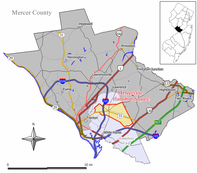
Mercerville is in southern Mercer County, built around a major intersection known as Five Points. It is bordered to the east by Hamilton Square, and the center of Trenton, the state capital, is 4 mi to the west. Five Points is the junction of (starting north and heading clockwise): Quaker Bridge Road (County Route 533), Edinburg Road (CR 535), Nottingham Way (CR 618), White Horse-Mercerville Road (CR 533), and Nottingham Way (CR 535). New Jersey Route 33 runs east and west to the south of this intersection. Except for Nottingham Way east of Five Points, the preceding roads contain most of Mercerville's commercial businesses. Interstate 295 passes through the west side of Mercerville, with access to NJ 33 from Exit 63 and partial access to East State Street from Exit 64.
According to the United States Census Bureau, the Mercerville CDP has a total area of 3.72 sqmi, including 3.69 sqmi of land and 0.03 sqmi of water (0.86%). The community drains north toward Miry Run and south toward Pond Run, both west-flowing tributaries of Assunpink Creek and part of the Delaware River watershed.
Demographics
2010 2020
Mercerville first appeared as a census designated place in the 2010 U.S. census formed from part of the deleted Mercerville-Hamilton Square CDP.
2020 census
| Race / Ethnicity (NH = Non-Hispanic) | title=P2: Hispanic or Latino, and Not Hispanic or Latino by Race – 2010: DEC Redistricting Data (PL 94-171) – Mercerville CDP, New Jersey | url=https://data.census.gov/cedsci/table?q=p2&g=160XX00US3445480&tid=DECENNIALPL2010.P2 | website=United States Census Bureau | access-date= }} | Pop 2020 | % 2010 | % 2020 |
|---|---|---|---|---|---|---|---|
| White alone (NH) | 11,189 | 9,551 | 84.57% | 71.03% | |||
| Black or African American alone (NH) | 491 | 897 | 3.71% | 6.67% | |||
| Native American or Alaska Native alone (NH) | 15 | 12 | 0.11% | 0.09% | |||
| Asian alone (NH) | 486 | 661 | 3.67% | 4.92% | |||
| Native Hawaiian or Pacific Islander alone (NH) | 0 | 5 | 0.00% | 0.04% | |||
| Other race alone (NH) | 17 | 29 | 0.13% | 0.22% | |||
| Mixed race or Multiracial (NH) | 125 | 425 | 0.94% | 3.16% | |||
| Hispanic or Latino (any race) | 907 | 1,867 | 6.86% | 13.88% | |||
| Total | 13,230 | 13,447 | 100.00% | 100.00% |
2010 census
The 2010 United States census counted 13,230 people, 5,028 households, and 3,605 families in the CDP. The population density was 3588.5 /sqmi. There were 5,246 housing units at an average density of 1422.9 /sqmi. The racial makeup was 88.81% (11,749) White, 3.98% (527) Black or African American, 0.22% (29) Native American, 3.67% (486) Asian, 0.04% (5) Pacific Islander, 1.90% (252) from other races, and 1.38% (182) from two or more races. Hispanic or Latino of any race were 6.86% (907) of the population.
Of the 5,028 households, 28.9% had children under the age of 18; 57.8% were married couples living together; 10.1% had a female householder with no husband present and 28.3% were non-families. Of all households, 22.9% were made up of individuals and 11.2% had someone living alone who was 65 years of age or older. The average household size was 2.58 and the average family size was 3.06.
20.7% of the population were under the age of 18, 7.0% from 18 to 24, 25.0% from 25 to 44, 29.6% from 45 to 64, and 17.7% who were 65 years of age or older. The median age was 43.1 years. For every 100 females, the population had 92.9 males. For every 100 females ages 18 and older there were 90.1 males.
Education
All of Hamilton Township, including Mercerville, is served by the Hamilton Township School District.
Most high school students in Mercerville attend Nottingham High School.
References
References
- "2023 U.S. Gazetteer Files: New Jersey". United States Census Bureau.
- [https://www.census.gov/quickfacts/fact/table/mercervillecdpnewjersey/ QuickFacts Mercerville CDP, New Jersey], [[United States Census Bureau]]. Accessed June 24, 2023.
- {{Gnis. 2389472. Mercerville Census Designated Place, [[Geographic Names Information System]]. Accessed November 21, 2012.
- [https://tools.usps.com/zip-code-lookup.htm?citybyzipcode Cities by ZIP Code™: 08619 - Other city names recognized for addresses in this ZIP Code], [[United States Postal Service]]. Accessed June 25, 2024.
- [http://www2.census.gov/geo/docs/maps-data/data/gazetteer/2010_place_list_34.txt Gazetteer of New Jersey Places], [[United States Census Bureau]]. Accessed July 21, 2016.
- [https://www.census.gov U.S. Census website], [[United States Census Bureau]]. Accessed September 4, 2014.
- [https://mcdc.missouri.edu/applications/geocodes/?state=34 Geographic Codes Lookup for New Jersey], Missouri Census Data Center. Accessed June 9, 2023.
- [http://geonames.usgs.gov US Board on Geographic Names], [[United States Geological Survey]]. Accessed September 4, 2014.
- [https://tigerweb.geo.census.gov/tigerwebmain/Files/tab20/tigerweb_tab20_cdp_2020_nj.htmlState of New Jersey Census Designated Places - BVP20 - Data as of January 1, 2020], [[United States Census Bureau]]. Accessed January 1, 2023.
- [http://www.state.nj.us/infobank/localnames.txt Locality Search], State of [[New Jersey]]. Accessed April 19, 2015.
- Until after the [[2000 United States census. 2000 census]], the area was part of the [[Mercerville-Hamilton Square, New Jersey. Mercerville-Hamilton Square]] CDP. For the 2010 Census it was split into two CDPs, Mercerville and [[Hamilton Square, New Jersey
- ''History of Hamilton Township,'' Hamilton Township Historical Society, 1999.
- "Aerial view of Mercerville".
- "Census of Population and Housing". Census.gov.
- "2010 Census of Population - Population and Housing Unit Counts - New Jersey".
- "P2: Hispanic or Latino, and Not Hispanic or Latino by Race – 2010: DEC Redistricting Data (PL 94-171) – Mercerville CDP, New Jersey".
- "P2: Hispanic or Latino, and Not Hispanic or Latino by Race – 2020: DEC Redistricting Data (PL 94-171) – Mercerville CDP, New Jersey".
- [http://factfinder.census.gov/bkmk/table/1.0/en/DEC/10_DP/DPDP1/1600000US3445480 DP-1 - Profile of General Population and Housing Characteristics: 2010 Demographic Profile Data for Mercerville CDP, New Jersey], [[United States Census Bureau]]. Accessed November 21, 2012.
- [https://www2.census.gov/geo/maps/DC2020/PL20/st34_nj/schooldistrict_maps/c34021_mercer/DC20SD_C34021.pdf 2020 Census - School District Reference Map: Mercer County], [[United States Census Bureau]]. Accessed September 24, 2024.
- [https://app.guidek12.com/hamiltontwpnj/school_search/current/ School Finder] Hamilton Township School District. Accessed September 24, 2024.
This article was imported from Wikipedia and is available under the Creative Commons Attribution-ShareAlike 4.0 License. Content has been adapted to SurfDoc format. Original contributors can be found on the article history page.
Ask Mako anything about Mercerville, New Jersey — get instant answers, deeper analysis, and related topics.
Research with MakoFree with your Surf account
Create a free account to save articles, ask Mako questions, and organize your research.
Sign up freeThis content may have been generated or modified by AI. CloudSurf Software LLC is not responsible for the accuracy, completeness, or reliability of AI-generated content. Always verify important information from primary sources.
Report