From Surf Wiki (app.surf) — the open knowledge base
Mendocino County, California
County in the United States
.jpg)
County in the United States
| Field | Value | |||
|---|---|---|---|---|
| name | Mendocino County | |||
| settlement_type | County | |||
| image_skyline | {{multiple image | |||
| total_width | 288 | |||
| border | infobox | |||
| perrow | 1/2/2/1 | |||
| caption_align | center | |||
| image1 | Howard Lake and Anthony Peak (cropped).jpg | |||
| caption1 | Mendocino National Forest | |||
| image2 | Mendocino at dawn II (14267785176).jpg | |||
| caption2 | Mendocino | |||
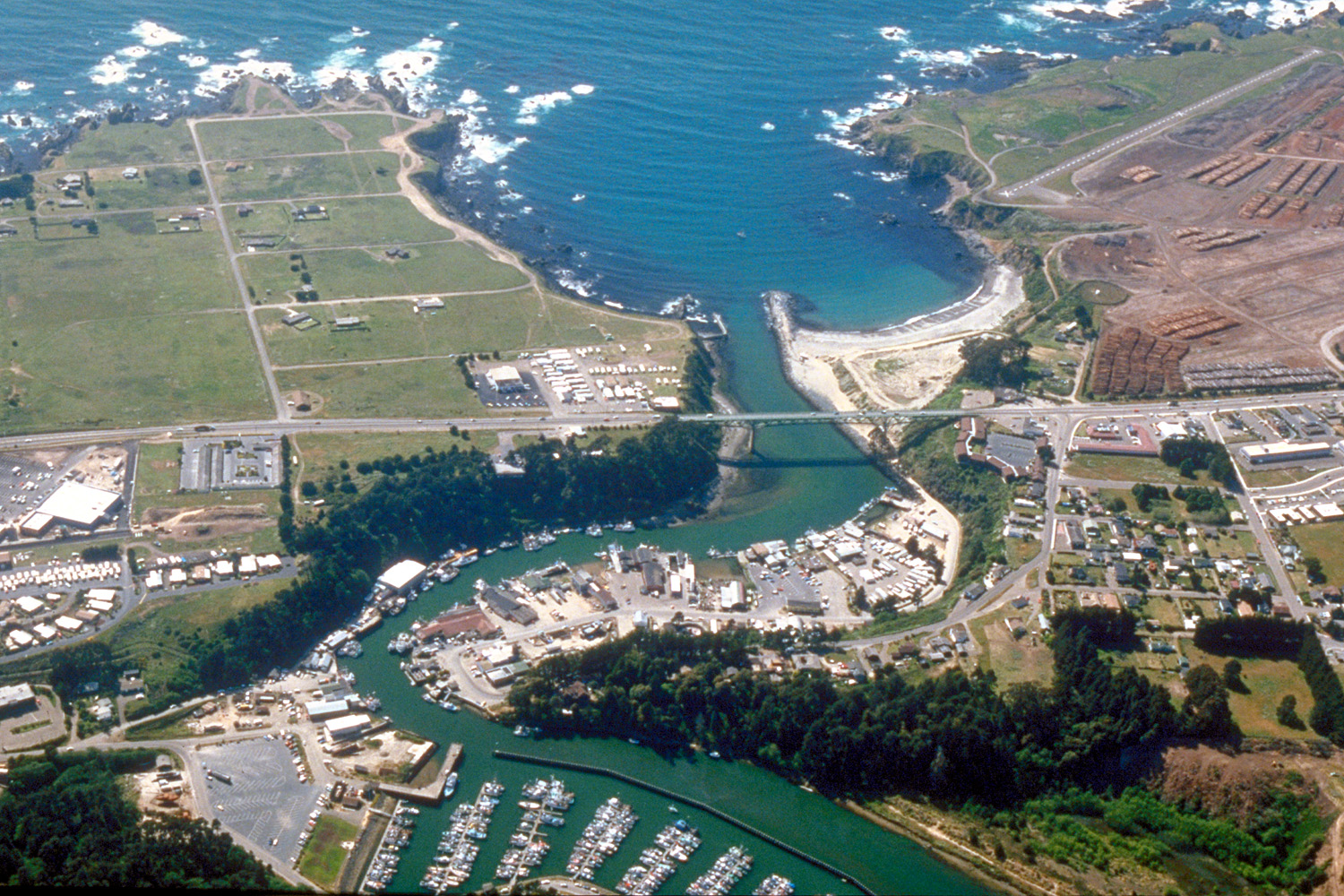
| image3 | Fort Bragg California aerial view.jpg | |||
| caption3 | Noyo Harbor | |||
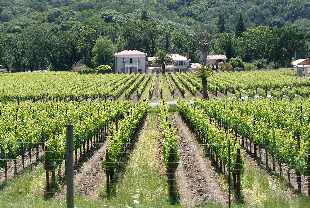
| image4 | Mendocino vineyard.jpg | |||
| caption4 | Hopland | |||
| image5 | Ukiah_Civic_Center.jpg | |||
| caption5 | Ukiah | |||
| image6 | Point Arena Lighthouse with shoreline (cropped).jpg | |||
| caption6 | Point Arena | |||
| image_seal | Seal of Mendocino County, California.png | |||
| seal_size | 125px | |||
| seal_alt | The county's official seal, in chief two redwood trees and the numbers '1850', a breaking wave on the Pacific Ocean and a vineyard set in relief, bordered by a dark brown circle with the words 'Mendocino County' appearing within the border in gold block letters | |||
| named_for | Antonio de Mendoza, Viceroy of New Spain, 1535–42 | |||
| image_map | [{ "type": "ExternalData", "service": "geomask", "ids": "Q108087", "properties": { "fill-opacity":0.4,"stroke":"#808080","stroke-width":2,"fill":"#808080", "title": "Mendocino County, California" } }, { "type": "Feature", "properties": { "title": "Ukiah | |||
| (County seat)", "description": "[[File:World's Largest Redwood Tree Service Station (1936), angle, Route 101, Ukiah, California LOC 37143730483.jpg | 220px]]", "marker-symbol": "town-hall", "marker-size": "large", "marker-color": "#FF0000" }, "geometry": { "type": "Point", "coordinates": [-123.2086, 39.1489] } }, { "type": "Feature", "properties": { "title": "Willits", "description": "[[File:Willits California - panoramio.jpg | 220px]]", "marker-symbol": "town", "marker-size": "medium", "marker-color": "#FFE228" }, "geometry": { "type": "Point", "coordinates": [-123.3556, 39.4097] } }, { "type": "Feature", "properties": { "title": "Fort Bragg", "description": "[[File:Fort Bragg City Hall.JPG | 220px]]", "marker-symbol": "city", "marker-size": "medium", "marker-color": "#800080" }, "geometry": { "type": "Point", "coordinates": [-123.8044, 39.4457] } }, { "type": "Feature", "properties": { "title": "Point Arena", "description": "[[File:Main Street Historic Commercial District-8.jpg | 220px]]", "marker-symbol": "village", "marker-size": "small", "marker-color": "#0000FF" }, "geometry": { "type": "Point", "coordinates": [-123.691, 38.91] } }] |
| map_alt | A map of the boundaries of Mendocino County with markers indicating the location of Ukiah, the county seat, and its three other incorporated cities: Fort Bragg, Point Arena and Willits | |||
| map_caption | Interactive map of Mendocino County with markers for each of its four incorporated cities: Ukiah (red), Fort Bragg (purple), Point Arena (blue), and Willits (yellow) | |||
| coordinates | ||||
| coor_pinpoint | Geographic center of Mendocino County | |||
| subdivision_type | Country | |||
| subdivision_name | United States | |||
| subdivision_type1 | State | |||
| subdivision_name1 | California | |||
| subdivision_type2 | Region | |||
| subdivision_name2 | North Coast | |||
| seat_type | County seat | |||
| seat | Ukiah | |||
| seat1_type | Largest city | |||
| seat1 | Ukiah | |||
| unit_pref | US | |||
| area_total_sq_mi | 3878 | |||
| area_land_sq_mi | 3506 | |||
| area_water_sq_mi | 372 | |||
| elevation_max_footnotes | ||||
| elevation_max_ft | 6958 | |||
| population_as_of | 2020 | |||
| population_footnotes | ||||
| population_total | 91601 | |||
| population_density_sq_mi | 26 | |||
| demographics_type2 | GDP | |||
| demographics2_footnotes | ||||
| demographics2_title1 | Total | |||
| demographics2_info1 | $4.277 billion (2022) | |||
| established_title | Incorporated | |||
| established_date | ||||
| government_type | Council–CEO | |||
| governing_body | Mendocino County Board of Supervisors | |||
| leader_title1 | Chair | |||
| leader_name1 | John Haschak | |||
| leader_title2 | Vice Chair | |||
| leader_name2 | Bernie Norvell | |||
| leader_title3 | Board of Supervisors | |||
| leader_name3 | {{Collapsible list | |||
| title | Supervisors | |||
| frame_style | border:none; padding:0; | |||
| list_style | text-align:left; | |||
| 1 | Madeline Cline | |||
| 2 | Maureen Mulheren | |||
| 3 | John Haschak | |||
| 4 | Bernie Norvell | |||
| 5 | Ted Williams | |||
| leader_title4 | Chief executive officer | |||
| leader_name4 | Darcie Antle | |||
| timezone | Pacific Time Zone | |||
| utc_offset | −8 | |||
| timezone_DST | Pacific Daylight Time | |||
| utc_offset_DST | −7 | |||
| area_code_type | Area code | |||
| area_code | 707 | |||
| image_map1 | Map of California highlighting Mendocino County.svg | |||
| mapsize1 | x250px | |||
| map_caption1 | Mendocino County's location within California | |||
| blank_name_sec1 | Congressional district | |||
| blank_info_sec1 | 2nd | |||
| website |
(County seat)", "description": "[[File:World's Largest Redwood Tree Service Station (1936), angle, Route 101, Ukiah, California LOC 37143730483.jpg|220px]]", "marker-symbol": "town-hall", "marker-size": "large", "marker-color": "#FF0000" }, "geometry": { "type": "Point", "coordinates": [-123.2086, 39.1489] } }, { "type": "Feature", "properties": { "title": "Willits", "description": "[[File:Willits California - panoramio.jpg|220px]]", "marker-symbol": "town", "marker-size": "medium", "marker-color": "#FFE228" }, "geometry": { "type": "Point", "coordinates": [-123.3556, 39.4097] } }, { "type": "Feature", "properties": { "title": "Fort Bragg", "description": "[[File:Fort Bragg City Hall.JPG|220px]]", "marker-symbol": "city", "marker-size": "medium", "marker-color": "#800080" }, "geometry": { "type": "Point", "coordinates": [-123.8044, 39.4457] } }, { "type": "Feature", "properties": { "title": "Point Arena", "description": "[[File:Main Street Historic Commercial District-8.jpg|220px]]", "marker-symbol": "village", "marker-size": "small", "marker-color": "#0000FF" }, "geometry": { "type": "Point", "coordinates": [-123.691, 38.91] } }]
Mendocino County (; Mendocino, Spanish for "of Mendoza") is a county located on the North Coast of the U.S. state of California. As of the 2020 United States census, the population was 91,601. The county seat is Ukiah.
Mendocino County consists wholly of the Ukiah, California Micropolitan Statistical Area (μSA) for the purposes of the U.S. Census Bureau. It is located approximately equidistant from the San Francisco Bay Area and California/Oregon border, separated from the Sacramento Valley to the east by the California Coast Ranges. While smaller areas of redwood forest are found farther south, it is the southernmost California county to be included in the World Wildlife Fund's Pacific temperate rainforests ecoregion, the largest temperate rainforest ecoregion on Earth.
The county is noted for its distinctive Pacific Ocean coastline, its location along California's "Lost Coast", redwood forests, wine production, microbrews, and liberal views about the use of cannabis and support for its legalization. In 2009, it was estimated that roughly one-third of the economy was based on the cultivation of marijuana.{{cite video | people = Regan, Trish | access-date = March 15, 2009
Mendocino is one of three Northern California counties to make up the "Emerald Triangle", along with Humboldt and Trinity counties.
History
Mendocino County was one of the original counties of California, created in 1850 at the time of statehood. Due to an initially minor settler American population, it did not have a separate government until 1859 and was under the administration of Sonoma County prior to that. Some of the county's land was given to Sonoma County between 1850 and 1860.
The county derives its name from Cape Mendocino (most of which is actually located in adjacent Humboldt County), which was probably named in honor of either Antonio de Mendoza, Viceroy of New Spain, 1535–1542 (who sent the Juan Rodríguez Cabrillo Expedition to this coast in 1542), or Lorenzo Suárez de Mendoza, Viceroy from 1580 to 1583. Mendocino is the adjectival form of the family name of Mendoza.
Neither Spanish nor Mexican influence extended into Mendocino County beyond the establishment of two Mexican land grants in southern Mendocino County: Rancho Sanel in Hopland, in 1844 and Rancho Yokaya that forms the majority of the Ukiah Valley, in 1845.
In the 19th century, despite the establishment of the Mendocino Indian Reservation and Nome Cult Farm in 1856, the county witnessed many of the most serious atrocities in the extermination of the Californian Native American tribes who originally lived in the area, like the Yuki, the Pomo, the Cahto, and the Wintun. The systematic occupation of their lands, the reduction of many of their members into slavery and the raids against their settlements led to the Mendocino War in 1859, where hundreds of Indians were killed. Establishment of the Round Valley Indian Reservation on March 30, 1870, did not prevent the segregation that continued well into the 20th century. Other tribes from the Sierra Nevada mountains were also relocated to the Round Valley Indian Reservation during the "California Trail Of Tears", where the Natives were forced to march in bad conditions to their new home in Round Valley. Many of these tribes thrown together were not on good terms with the other tribes they were forced to live with on the reservation, resulting in tensions still evident today.
Boundary dispute with Trinity County
In the first half of the 1850's the California State Legislature established that the boundaries of Mendocino and Trinity counties was the 40th parallel north. Both county boards of supervisors hired the surveyor W.H. Fauntleroy to survey the parallel, which he completed on October 30, 1872. The accuracy of the boundary was doubtful, and by 1891 the Mendocino County Board of Supervisors requested the California surveyor-general to survey the line and establish the boundary between the two counties. The new line, as surveyed by Sam H. Rice and approved by the California Attorney General on December 18, 1891, was found to be two miles north of the common boundary surveyed by Fauntleroy, thereby resulting in Trinity County exercising jurisdiction two miles south of the 40th parallel north. Between 1891 and 1907, both counties claimed that the two-mile-wide strip of land belonged to themselves and not the other, with both counties attempting to levy and collect property taxes on land in the strip. In 1907, Trinity County sued Mendocino County in a Tehama County court to settle the dispute. The trial court in Tehama County ruled in favor of Trinity County, even though the land was situated south of the 40th parallel and state law stated that lands south of that parallel belonged to Mendocino County. The appellate court upheld the ruling of the trial court since Section 10 of the special act of March 30, 1872 (Stats. 1871-2, p. 766), which concerned this boundary and was the act under which Fauntleroy acted under, authorized the survey of the theretofore unknown location of the 40th parallel north, stated that "the lines run out, marked and defined as required by this act are hereby declared to be the true boundary lines of the counties named herein", thereby making the law in the political code which defined the boundary as the 40th parallel north only a suggestion and not a fact. The legislature subsequently affirmed this decision, with the modern statute defining the borders of the two counties referencing the survey of Fauntleroy as being the boundary between the two counties instead of the 40th parallel north.
Geography
According to the U.S. Census Bureau, the county has a total area of 3878 sqmi, of which 3506 sqmi is land and 372 sqmi (9.6%) is water.
Adjacent counties
- Humboldt County – north
- Trinity County – north
- Tehama County – northeast
- Glenn County – east
- Lake County – east
- Sonoma County – south
Rivers
- Albion River
- Alder Creek
- Bear Haven Creek
- Bee Branch Creek
- Bee Tree Creek
- Beebe Creek
- Big River
- Big Salmon Creek
- Eel River (inland)
- Elk Creek
- Gualala River
- Garcia River
- Little River
- Little Salmon Creek
- Navarro River
- Noyo River
- Pudding Creek
- Russian River (inland)
- Ten Mile River
- Virgin Creek
- Usal Creek
Beaches

- Big River Beach
- Caspar Headlands State Beach
- Van Damme Beach
- Greenwood State Beach
- Seaside Beach
- Westport-Union Landing State Beach
- Manchester State Beach
- Navarro Beach
- Portuguese Beach
- Schooner Gulch State Beach
- Long Valley Creek
- 10 Mile Creek
- Glass Beach
National and state protected areas
- Admiral William Standley State Recreation Area
- Caspar Headlands State Recreation Area
- Hendy Woods State Park
- Jug Handle State Reserve
- MacKerricher State Park
- Mailliard Redwoods State Natural Reserve
- Manchester State Park
- Mendocino Coast Botanical Gardens
- Mendocino Headlands State Park
- Mendocino National Forest
- Mendocino Woodlands State Park
- Montgomery Woods State Natural Reserve
- Navarro River Redwoods State Park
- Point Arena State Marine Reserve & Point Arena State Marine Conservation Area
- Point Cabrillo Light Station
- Reynolds Wayside Campground
- Round Valley Indian Reservation
- Russian Gulch State Park
- Saunders Reef State Marine Conservation Area
- Sea Lion Cove State Marine Conservation Area
- Sinkyone Wilderness State Park
- Smythe Redwoods State Reserve
- Standish-Hickey State Recreation Area
- Van Damme State Park
Flora and fauna
Main article: List of species endemic to Mendocino County, California
Demographics
|align-fn=center
1790–1960 1900–1990 1990–2000 2010 2020
2020 census
As of the 2020 census, the county had a population of 91,601. The median age was 43.2 years. 20.6% of residents were under the age of 18 and 23.1% of residents were 65 years of age or older. For every 100 females there were 100.2 males, and for every 100 females age 18 and over there were 99.2 males age 18 and over.
The racial makeup of the county was 65.0% White, 0.7% Black or African American, 5.1% American Indian and Alaska Native, 2.0% Asian, 0.2% Native Hawaiian and Pacific Islander, 13.9% from some other race, and 13.2% from two or more races. Hispanic or Latino residents of any race comprised 26.1% of the population.
51.5% of residents lived in urban areas, while 48.5% lived in rural areas.
There were 36,280 households in the county, of which 27.7% had children under the age of 18 living with them and 28.0% had a female householder with no spouse or partner present. About 30.1% of all households were made up of individuals and 15.9% had someone living alone who was 65 years of age or older.
There were 41,370 housing units, of which 12.3% were vacant. Among occupied housing units, 59.3% were owner-occupied and 40.7% were renter-occupied. The homeowner vacancy rate was 1.3% and the rental vacancy rate was 3.8%.
Racial and ethnic composition
| Race / Ethnicity (NH = Non-Hispanic) | Pop 1980 | Pop 1990 | title=P004: Hispanic or Latino, and Not Hispanic or Latino by Race – 2000: DEC Summary File 1 – Mendocino County, California | url=https://data.census.gov/table?g=050XX00US06045&tid=DECENNIALSF12000.P004 | website=United States Census Bureau | access-date= }} | title=P2: Hispanic or Latino, and Not Hispanic or Latino by Race – 2010: DEC Redistricting Data (PL 94-171) – Mendocino County, California | url=https://data.census.gov/cedsci/table?q=p2&g=050XX00US06045&tid=DECENNIALPL2010.P2 | website=United States Census Bureau | access-date= }} | Pop 2020 | % 1980 | % 1990 | % 2000 | % 2010 | % 2020 |
|---|---|---|---|---|---|---|---|---|---|---|---|---|---|---|---|---|
| White alone (NH) | 59,740 | 67,775 | 64,581 | 60,249 | 56,205 | 89.51% | 84.35% | 74.86% | 68.59% | 61.36% | ||||||
| Black or African American alone (NH) | 334 | 482 | 471 | 544 | 607 | 0.50% | 0.60% | 0.55% | 0.62% | 0.66% | ||||||
| Native American or Alaska Native alone (NH) | 2,375 | 2,900 | 3,438 | 3,486 | 3,528 | 3.56% | 3.61% | 3.99% | 3.97% | 3.85% | ||||||
| Asian alone (NH) | 455 | 866 | 1,006 | 1,402 | 1,730 | 0.68% | 1.08% | 1.17% | 1.60% | 1.89% | ||||||
| Native Hawaiian or Pacific Islander alone (NH) | x | x | 107 | 92 | 110 | 0.12% | 0.10% | 0.12% | 0.10% | 0.12% | ||||||
| Other race alone (NH) | 146 | 74 | 152 | 131 | 592 | 0.22% | 0.09% | 0.18% | 0.15% | 0.65% | ||||||
| Mixed race or Multiracial (NH) | x | x | 2,297 | 2,432 | 4,896 | x | x | 2.66% | 2.77% | 5.34% | ||||||
| Hispanic or Latino (any race) | 3,688 | 8,248 | 14,213 | 19,505 | 23,933 | 5.53% | 10.27% | 16.48% | 22.20% | 26.13% | ||||||
| Total | 66,738 | 80,345 | 86,265 | 87,841 | 91,601 | 100.00% | 100.00% | 100.00% | 100.00% | 100.00% |
2010 census
The 2010 United States census reported that Mendocino County had a population of 87,841. The racial makeup of Mendocino County was 67,218 (76.5%) White, 622 (0.7%) African American, 4,277 (4.9%) Native American, 1,450 (1.7%) Asian, 119 (0.1%) Pacific Islander, 10,185 (11.6%) from other races, and 3,970 (4.5%) from two or more races. Hispanic or Latino of any race were 19,505 persons (22.2%).
| Population reported at 2010 United States census |
|---|
| Mendocino County |
| Fort Bragg |
| Point Arena |
| Ukiah |
| Willits |
| Albion |
| Anchor Bay |
| Boonville |
| Brooktrails |
| Calpella |
| Caspar |
| Cleone |
| Comptche |
| Covelo |
| Hopland |
| Laytonville |
| Leggett |
| Little River |
| Manchester |
| Mendocino |
| Philo |
| Potter Valley |
| Redwood Valley |
| Talmage |
| All others not CDPs (combined) |
2000 census
As of the census of 2000, there were 86,265 people, 33,266 households, and 21,855 families residing in the county. The population density was 25 /mi2. There were 36,937 housing units at an average density of 10 /mi2. The racial makeup of the county was 80.8% White, 0.6% Black or African American, 4.8% Native American, 1.2% Asian, 0.2% Pacific Islander, 8.6% from other races, and 3.9% from two or more races. 16.5% of the population were Hispanic or Latino of any race. 12.2% were of German, 10.8% English, 8.6% Irish, 6.1% Italian and 5.6% American ancestry according to Census 2000. 84.4% spoke English and 13.2% Spanish as their first language.
There were 33,266 households, out of which 31.4% had children under the age of 18 living with them, 48.9% were married couples living together, 11.7% had a female householder with no husband present, and 34.3% were non-families. 27.0% of all households were made up of individuals, and 10.4% had someone living alone who was 65 years of age or older. The average household size was 2.53 and the average family size was 3.04.
In the county, the population was spread out, with 25.5% under the age of 18, 8.1% from 18 to 24, 25.6% from 25 to 44, 27.1% from 45 to 64, and 13.6% who were 65 years of age or older. The median age was 39 years. For every 100 females there were 98.9 males. For every 100 females age 18 and over, there were 97.1 males.
The median income for a household in the county was $35,996, and the median income for a family was $42,168. Males had a median income of $33,128 versus $23,774 for females. The per capita income for the county was $19,443. About 10.9% of families and 15.9% of the population were below the poverty line, including 21.5% of those under age 18 and 7.7% of those age 65 or over.
Government
As of 2026, the District Attorney of Mendocino County is C. David Eyster, the elected Sheriff-Coroner is Matthew C. Kendall and the chief executive officer is Darcie Antle.
Mendocino County is legislatively governed by a board of five supervisors, each with a separate district. The first district is represented by Madeline Cline, and serves the central-eastern region of the county, including Potter Valley, Redwood Valley, Calpella, Talmage, and Hopland. The second district, represented by Maureen Mulheren The fourth district covers the northwestern quadrant of the county, including the coast from Caspar northwards through Fort Bragg and over to Leggett; its supervisor is Bernie Norvell, who previously served as the Mayor of Fort Bragg. The supervisor for the fifth district is Ted Williams; his district covers the southern portion of the county, including the coast from Mendocino to Gualala, the Anderson Valley, and the western outskirts of Ukiah.
Politics
Voter registration statistics
| Population and registered voters | Total population | Registered votersPercentage of registered voters with respect to total population. Percentages of party members with respect to registered voters follow. | Democratic | Republican | Democratic–Republican spread | American Independent | Green | Libertarian | Peace and Freedom | Unknown | Other | No party preference |
|---|---|---|---|---|---|---|---|---|---|---|---|---|
| 91,601 | ||||||||||||
| 53,659 | 58.5% | |||||||||||
| 25,192 | 46.9% | |||||||||||
| 12,544 | 23.4% | |||||||||||
| +12,648 | +23.5% | |||||||||||
| 2,642 | 4.9% | |||||||||||
| 745 | 1.4% | |||||||||||
| 735 | 1.4% | |||||||||||
| 382 | 0.7% | |||||||||||
| 171 | 0.3% | |||||||||||
| 103 | 0.2% | |||||||||||
| 11,145 | 20.8% |
Cities by population and voter registration
| Cities by population and voter registration | City | Population | Registered voters | |||||
|---|---|---|---|---|---|---|---|---|
| Democratic | Republican | D–R spread | No party preference | Cities by population and voter registration | ||||
| Fort Bragg | 6,983 | 56.0% | 52.5% | 17.7% | +34.8% | 20.7% | ||
| Point Arena | 460 | 64.5% | 55.9% | 9.4% | +46.2% | 25.6% | ||
| Ukiah | 16,607 | 53.8% | 46.2% | 23.5% | +22.7% | 22.0% | ||
| Willits | 4,988 | 56.7% | 43.1% | 24.5% | +18.6% | 22.2% |
Overview
Mendocino is a strongly Democratic county in presidential and congressional elections. The last Republican to win a majority in the county was Californian Ronald Reagan in 1984. However, in the 2016 election, Mendocino County gave Hillary Clinton a reduced margin of victory of any Democrat since Al Gore (though support for third-party candidates more than doubled from 2012). In 2020 the county was won by Joe Biden with an increased margin of victory from the previous election.
Federally, Mendocino County is in .
In the state legislature Mendocino is in , and .
As of February 2025, the California Secretary of State reports that Mendocino County has 53,659 registered voters. Of those, 25,192 (46.9%) are registered Democratic; 12,544 (23.4%) are registered Republican; 4,788 (8.1%) are registered with other political parties, and 11,145 (20.8%) declined to state a political party.
In 2000, Mendocino County voters approved Measure G, which calls for the decriminalization of marijuana when used and cultivated for personal use. Measure G passed with a 58% majority vote, making it the first county in the United States to declare prosecution of small-scale marijuana offenses the "lowest priority" for local law enforcement. Measure G does not protect individuals who cultivate, transport or possess marijuana for sale. However, Measure G was passed at the local government level affecting only Mendocino County, and therefore does not affect existing state or federal laws. The city of Berkeley has had a similar law (known as the Berkeley Marijuana Initiative II) since 1979 which has generally been found to be unenforceable.
In 2008, the Mendocino County Board of Supervisors placed Measure B on the June 3 county-wide ballot. After three months of hard-fought campaigning and national attention, voters narrowly approved "B", which repealed the provisions of 2000's Measure G. However, opponents of Measure B intend to continue the challenge in court, as the wording of Measure B relies heavily on S.B. 420's state limitations which were recently ruled unconstitutional by the California supreme court. On July 3, the Sheriff and District Attorneys offices announced that they would not be enforcing the new regulations for the time being, citing pending legal challenges and conflicts with existing state law.
In April 2009, Sheriff Tom Allman issued his department's medical marijuana enforcement policy, which includes the provisions of Measure B and also cites the California Supreme Court Ruling narrowly defining "caregiver" in the state's medical marijuana law.
In 2004, Measure H was passed in Mendocino County with a 56% majority, making it the first county in the United States to ban the production and cultivation of genetically modified organisms.
On November 4, 2008, Mendocino County voted 63.1% against Proposition 8 which amended the California Constitution to define marriage as a union between one man and one woman.
Crime
The following table includes the number of incidents reported and the rate per 1,000 persons for each type of offense.
| Population and crime rates | Population | Violent crime | Homicide | Forcible rape | Robbery | Aggravated assault | Property crime | Burglary | Larceny-theft | Motor vehicle theft | Arson |
|---|---|---|---|---|---|---|---|---|---|---|---|
| 87,525 | |||||||||||
| 520 | 5.94 | ||||||||||
| 5 | 0.06 | ||||||||||
| 31 | 0.35 | ||||||||||
| 46 | 0.53 | ||||||||||
| 438 | 5.00 | ||||||||||
| 777 | 8.88 | ||||||||||
| 469 | 5.36 | ||||||||||
| 792 | 9.05 | ||||||||||
| 99 | 1.13 | ||||||||||
| 22 | 0.25 |
Cities by population and crime rates
| Cities by population and crime rates | City | Population | Violent crimes | Violent crime rate | ||
|---|---|---|---|---|---|---|
| per 1,000 persons | Property crimes | Property crime rate | ||||
| per 1,000 persons | ||||||
| Fort Bragg | 7,317 | 34 | 4.65 | 367 | 50.16 | |
| Ukiah | 16,172 | 108 | 6.68 | 481 | 29.74 | |
| Willits | 4,917 | 32 | 6.51 | 71 | 14.44 |
A coroner's jury ruled that the 2018 Hart family crash in Mendocino County was deliberate.
Media
Mendocino County is considered part of the San Francisco Bay Area television market, and primarily receives the major Bay Area TV stations.
The county is also served by local and regional newspapers as well as a community radio stations. Community radio stations include KZYX, operating out of Philo, and KLLG, operating out of the Little Lake Grange in Willits. The Humboldt County-based KMUD is also receivable in large parts of the county. Local independent newspapers include the online news service The Mendocino Voice, and The Laytonville Observer, the Anderson Valley Advertiser, the Willits Weekly and the Independent Coast Observer. Four formerly independent newspapers are now owned by the national conglomerate media company Digital First Media; they are: The Ukiah Daily Journal, The Mendocino Beacon, the Willits News, and The Fort Bragg Advocate. These four papers have seen a precipitous decline in the size of editorial staff and in coverage over the past several years, in keeping with the nationwide tactics of DFM. The Sonoma County-based Press Democrat also covers the area.
Education
Community colleges
- Mendocino College:
- Main campus, Ukiah
- North County Center, Willits
- Coast Center, Fort Bragg
- Pacific Union College's Albion Biological Field Station
Universities
- Dharma Realm Buddhist University
K-12 education
School districts include:
Unified:
- Anderson Valley Unified School District
- Fort Bragg Unified School District
- Laytonville Unified School District
- Leggett Valley Unified School District
- Mendocino Unified School District
- Potter Valley Community Unified School District
- Round Valley Unified School District
- Southern Humboldt Joint Unified School District
- Ukiah Unified School District
- Willits Unified School District
Secondary:
- Point Arena Joint Union High School District
Elementary:
- Arena Union Elementary School District
- Manchester Union Elementary School District
Transportation
Major highways
- [[File:California 1.svg|20px]] State Route 1
- [[File:US 101 (1961 cutout).svg|25px]] U.S. Route 101
- [[File:California 20.svg|20px]] State Route 20
- [[File:California 128.svg|25px]] State Route 128
- [[File:California 162.svg|25px]] State Route 162
- [[File:California 175.svg|25px]] State Route 175
- [[File:California 222.svg|25px]] State Route 222 (unsigned)
- [[File:California 253.svg|25px]] State Route 253
- [[File:California 271.svg|25px]] State Route 271
Public transportation
Bus
The Mendocino Transit Authority provides local and intercity bus service within Mendocino County. Limited service also connects with transit in Sonoma County. Greyhound Bus Lines currently serves Ukiah.
Amtrak Thruway operates connecting bus service to Ukiah, Willits and Laytonville.
The historic Skunk Train is a heritage railway (that formerly connected Fort Bragg, California with Willits) using steam locomotives.
Airports
- Ukiah Municipal Airport is a general aviation airport owned by the City of Ukiah. It is located south of downtown Ukiah.
- Little River Airport is a general aviation airport serving the Mendocino coast.
- Willits Municipal Airport is a general aviation airport serving the Willits / Little Lake Valley area. Located in the Brooktrails subdivision area west of Willits.
- Round Valley Airport is a general aviation airport serving the Covelo / Round Valley area.
- Boonville Airport (California) is a general aviation airport serving the Boonville / Anderson Valley area.
- Ocean Ridge Airport is a privately owned general aviation airport serving the Gualala area. For commercial service, passengers in Mendocino County need to go to Eureka, one county to the north in Humboldt County, or to Sonoma County Airport in Santa Rosa, Sonoma County, one county to the south. More comprehensive service is available from Sacramento to the east or San Francisco, well to the south.
Emergency services for the largely unincorporated county are coordinated through Howard Forest Station, a local Cal Fire station just south of Willits.
Communities


Cities
- Fort Bragg
- Point Arena
- Ukiah (county seat)
- Willits
Census-designated places
- Albion
- Anchor Bay
- Boonville
- Brooktrails
- Calpella
- Caspar
- Cleone
- Comptche
- Covelo
- Hopland (formerly Sanel)
- Laytonville
- Leggett
- Little River
- Manchester
- Mendocino
- Philo
- Potter Valley
- Redwood Valley
- Talmage
Unincorporated communities
- Branscomb
- Dos Rios
- Elk
- Gualala
- Inglenook
- Longvale
- Navarro
- Noyo
- Old Hopland
- Piercy
- Pine Grove
- Rockport
- Wanhala
- Westport
- Yorkville
Indian reservations
Mendocino County has nine Indian reservations lying within its borders, the fourth-most of any county in the United States (after San Diego County, California; Sandoval County, New Mexico; and Riverside County, California).
- Coyote Valley Reservation
- Guidiville Rancheria
- Hopland Rancheria
- Laytonville Rancheria
- Manchester-Point Arena Rancheria
- Pinoleville Rancheria
- Redwood Valley Rancheria
- Round Valley Reservation (partly in Trinity County)
- Sherwood Valley Rancheria
Population ranking
The population ranking of the following table is based on the 2010 Census and 2020 Census data for Mendocino County.
† county seat
| Rank | City/Town/etc. | Municipal type | Population (2010 Census) | Population (2020 Census) |
|---|---|---|---|---|
| 1 | † Ukiah | City | 16,075 | 16,607 |
| 2 | Fort Bragg | City | 7,273 | 6,983 |
| 3 | Willits | City | 4,888 | 4,988 |
| 4 | Brooktrails | CDP | 3,235 | 3,632 |
| 5 | Redwood Valley | CDP | 1,729 | 1,843 |
| 6 | Covelo | CDP | 1,255 | 1,394 |
| 7 | Laytonville | CDP | 1,227 | 1,152 |
| 9 | Talmage | CDP | 1,130 | 986 |
| 8 | Boonville | CDP | 1,035 | 1,018 |
| 10 | Mendocino | CDP | 894 | 932 |
| 13 | Hopland | CDP | 756 | 661 |
| 11 | Calpella | CDP | 679 | 799 |
| 12 | Potter Valley | CDP | 646 | 665 |
| 14 | Cleone | CDP | 618 | 622 |
| 15 | Caspar | CDP | 509 | 500 |
| 17 | Point Arena | City | 449 | 460 |
| 18 | Round Valley Reservation (partially in Trinity County) | AIAN | 401 | 456 |
| 19 | Philo | CDP | 349 | 319 |
| 16 | Anchor Bay | CDP | 340 | 473 |
| 21 | Redwood Valley Rancheria | AIAN | 238 | 238 |
| 25 | Laytonville Rancheria | AIAN | 212 | 155 |
| 22 | Manchester-Point Arena Rancheria | AIAN | 212 | 188 |
| 24 | Manchester | CDP | 195 | 159 |
| 26 | Albion | CDP | 168 | 153 |
| 29 | Sherwood Valley Rancheria | AIAN | 168 | 119 |
| 23 | Comptche | CDP | 159 | 167 |
| 28 | Coyote Valley Reservation | AIAN | 144 | 127 |
| 27 | Pinoleville Rancheria | AIAN | 129 | 142 |
| 31 | Leggett | CDP | 122 | 77 |
| 30 | Little River | CDP | 117 | 94 |
| 32 | Guidiville Rancheria | AIAN | 52 | 50 |
| 20 | Hopland Rancheria (Pomo Indians) | AIAN | 38 | 253 |
In popular culture
"Mendocino" by the Sir Douglas Quintet was released in December 1968 and reached number 27 in the U.S. Billboard Hot 100 by early 1969, spending 15 weeks on the chart.
Kate McGarrigle's song "(Talk to Me of) Mendocino" is one of the songs on the McGarrigles' 1975 debut album; it has been covered by Linda Ronstadt on her 1982 album Get Closer, by English singer-songwriter John Howard on his 2007 EP, and by Bette Midler on her 2014 album It's the Girls.
A song written by Matt Serletic and Bernie Taupin, "Mendocino County Line", which was released in 2002, is about a love that could not last and cites the Mendocino County Line in the chorus.
Many films and movies have been filmed in and around Mendocino County, including Dying Young, The Russians Are Coming, Overboard, The Dunwich Horror, The Karate Kid Part III, Dead & Buried, Forever Young, Same Time Next Year, Racing with the Moon, Pontiac Moon, and The Majestic.
Notes
References
References
- "Anthony Peak".
- "QuickFacts - Mendocino County, California". [[United States Census Bureau]].
- "Gross Domestic Product: All Industries in Mendocino County, CA". [[Federal Reserve Bank of St. Louis]].
- "Chronology".
- "Board of Supervisors | Mendocino County, CA".
- Sanchez, Nellie Van de Grift. (August 11, 1914). "Spanish and Indian Place Names of California: Their Meaning and Their Romance". A.M. Robertson.
- "Mendocino County, California".
- "NACo County Explorer – Mendocino County, California".
- "Northern California coastal forests {{!}} Ecoregions".
- "History of Mendocino County". County of Mendocino.
- (May 26, 2015). "The Creation of Our 58 Counties".
- https://archive.org/stream/bub_gb_m8FQAQAAIAAJ/bub_gb_m8FQAQAAIAAJ_djvu.txt Cape Mendocino was named in honor of Antonio de Mendoza, the first Viceroy of New Spain. He was appointed by the emperor, and, arriving in the city of Mexico in 1535, ordered a survey of the coast of California, wherein the cape was discovered. The county was named after the cape. ''History of Northern California'', p. 138.
- Aanestad, Christina. (September 19, 2007). "Native Americans walk the California Trail of Tears". indybay.org.
- {{cite court. (). link
- (1947). "California Government Code § 23153". [[California Office of Legislative Counsel]].
- (August 22, 2012). "2010 Census Gazetteer Files". United States Census Bureau.
- "County Population Totals and Components of Change: 2020-2024". United States Census Bureau.
- "Census of Population and Housing from 1790-2000". [[US Census Bureau]].
- "Historical Census Browser". University of Virginia Library.
- (March 27, 1995). "Population of Counties by Decennial Census: 1900 to 1990". United States Census Bureau.
- (April 2, 2001). "Census 2000 PHC-T-4. Ranking Tables for Counties: 1990 and 2000". United States Census Bureau.
- (2021). "2020 Decennial Census Demographic Profile (DP1)".
- (2021). "2020 Decennial Census Redistricting Data (Public Law 94-171)".
- (2023). "2020 Decennial Census Demographic and Housing Characteristics (DHC)".
- "California: 1980, General Social and Economic Characteristics, Part 1 - Table 59: Persons by Race, Hispanic Origin, and Sex".
- "California: 1990, Part 1 - Table 5: Race and Hispanic Origin".
- "P004: Hispanic or Latino, and Not Hispanic or Latino by Race – 2000: DEC Summary File 1 – Mendocino County, California".
- "P2: Hispanic or Latino, and Not Hispanic or Latino by Race – 2010: DEC Redistricting Data (PL 94-171) – Mendocino County, California".
- "P2: Hispanic or Latino, and Not Hispanic or Latino by Race – 2020: DEC Redistricting Data (PL 94-171) – Mendocino County, California".
- included in the Asian category in the 1980 Census
- included in the Asian category in the 1990 Census
- not an option in the 1980 Census
- not an option in the 1990 Census
- {{USCensus2010CA
- "U.S. Census website". [[United States Census Bureau]].
- "District Attorney". The County of Mendocino.
- "Mendocino County Sheriff's Office".
- "Executive Office : Welcome". The County of Mendocino.
- "Mendocino County district boundaries". Mendocino County Government.
- "Board of Supervisors - Board Members". Mendocino County.
- "Board of Supervisors {{!}} Mendocino County, California".
- U.S. Census Bureau. American Community Survey, 2011 American Community Survey 5-Year Estimates, Table B02001. [https://www.census.gov U.S. Census website]. Retrieved October 26, 2013.
- California Secretary of State. [https://elections.cdn.sos.ca.gov/ror/ror-odd-year-2025/politicalsub.pdf February 10, 2025 – Report of Registration], {{webarchive. link. (July 27, 2013. Retrieved October 31, 2013.)
- "Mendocino County, California".
- Leip, David. "Dave Leip's Atlas of U.S. Presidential Elections".
- {{Cite GovTrack. CA. 2
- "Senators". State of California.
- "Members Assembly". State of California.
- (November 8, 2000). "Mendocino County Personal Use of Marijuana Initiative". California [[National Organization for the Reform of Marijuana Laws]].
- La Barre, Suzanne. (March 31, 2006). "Legal Limbo for Pot Users?". Berkeley Daily Planet.
- "Measure B on the June 3 ballot". Ballotpedia.
- Burgess, Rob. (June 21, 2008). "It's official: Marijuana reform effort passes". Ukiah Daily Journal.
- Geniella, Mike. (July 3, 2008). "Mendocino County won't enforce pot measure". [[The Press Democrat]].
- (April 3, 2009). "Directive on Medical Marijuana 2009-04-03-NO.1". Mendocino County Sheriff's Office.
- (March 3, 2004). "Mendocino Becomes First County in Nation to Ban Genetically Modified Crops".
- (December 2, 2008). "Election Summary Report – COUNTY OF MENDOCINO CONSOLIDATED GENERAL ELECTION – NOVEMBER 4, 2008".
- Office of the Attorney General, Department of Justice, State of California. [http://stats.doj.ca.gov/cjsc_stats/prof09/00/11.pdf Table 11: Crimes – 2009] {{webarchive. link. (December 2, 2013 . Retrieved November 14, 2013.)
- Only larceny-theft cases involving property over $400 in value are reported as property crimes.
- United States Department of Justice, Federal Bureau of Investigation. [https://www.fbi.gov/about-us/cjis/ucr/crime-in-the-u.s/2012/crime-in-the-u.s.-2012/tables/8tabledatadecpdf/table-8-state-cuts/table_8_offenses_known_to_law_enforcement_by_california_by_city_2012.xls Crime in the United States, 2012, Table 8 (California)]. Retrieved November 14, 2013.
- Holcombe, Madeline. (April 6, 2019). "Jennifer Hart drove her six children to their deaths as her wife looked up how much they would suffer, a jury says". [[CNN]].
- "The Mendocino Voice | Mendocino County, California".
- "Anderson Valley Advertiser – Mendocino County News".
- "Willits Weekly – The Local Paper".
- ""Invest or Sell": Digital First Media Workers Protest Outside Alden Global Capital's New York Office".
- "2020 CENSUS – SCHOOL DISTRICT REFERENCE MAP: Mendocino County, California". [[U.S. Census Bureau]].
- "amtrak.com Thruway map".
- "Census Coverage Measurement".
- "Explore - Data Commons".
- "American Indian and Alaska Native Area Appendix - Where people in prison come from - California (2020)".
- "2010 Census Interactive Population Search : Round Valley Reservation".
- "2010 Census Interactive Population Search : Redwood Valley Rancheria".
- "2010 Census Interactive Population Search : Laytonville Rancheria".
- "2010 Census Interactive Population Search : Manchester-Point Arena Rancheria".
- "2010 Census Interactive Population Search : Sherwood Valley Rancheria".
- "2010 Census Interactive Population Search : Coyote Valley Reservation".
- "2010 Census Interactive Population Search : Pinoleville Rancheria".
- "2010 Census Interactive Population Search : Guidiville Rancheria".
- "2010 Census Interactive Population Search : Hopland Rancheria".
This article was imported from Wikipedia and is available under the Creative Commons Attribution-ShareAlike 4.0 License. Content has been adapted to SurfDoc format. Original contributors can be found on the article history page.
Ask Mako anything about Mendocino County, California — get instant answers, deeper analysis, and related topics.
Research with MakoFree with your Surf account
Create a free account to save articles, ask Mako questions, and organize your research.
Sign up freeThis content may have been generated or modified by AI. CloudSurf Software LLC is not responsible for the accuracy, completeness, or reliability of AI-generated content. Always verify important information from primary sources.
Report