From Surf Wiki (app.surf) — the open knowledge base
Meiser
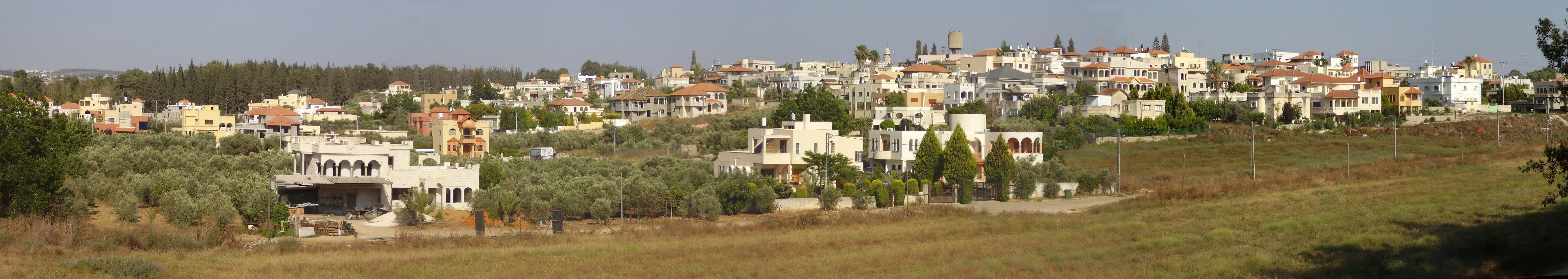
Arab village in northern Israel
Arab village in northern Israel
| Field | Value |
|---|---|
| name | Meiser |
| image | File:Mijsserre061 (4).jpg |
| hebname | |
| arname | ميسر |
| altUnoSp | Shaykh Maysar, Shaykh Maysir, Khirbat Maysar |
| meaning | Sheikh Meisir, p.n.; meaning a certain gambling game with arrows. |
| country | |
| district | haifa |
| council | Menashe |
| popyear | |
| population | |
| population_footnotes | |
| pushpin_map | Israel haifa#Israel |
| pushpin_mapsize | 250 |
| pushpin_label_position | top |
| coordinates | |
| palgrid | 154/205 |
| ITMgrid | 203/705 |
Meiser (; , also known as Shaykh Maysar or Khirbat Maysar) is an Arab village in northern Israel. Located half a kilometre west of the Green Line, north of the city of Baqa al-Gharbiyye in the triangle area of Wadi Ara, it is one of three Arab villages under the jurisdiction of Menashe Regional Council. In it had a population of .
History
Antiquity
Remains from the Early Roman era (end of the first century BCE–beginning of the first century CE) have been found here.
Three strata from the Roman-Byzantine periods was excavated in the centre of the village. A bathhouse, dating from the same time, has also been found.
Ceramics and other remains from the Byzantine era have been found here.
An excavation revealed remains dating from the end of the Byzantine period (7th century CE), and above it were remains of a residential house from the Abbasid period (9th–10th centuries CE).
Ottoman era
In 1882, the PEF's Survey of Western Palestine (SWP) found at Sheikh Meisir "foundations near a modern Mukam" (Muslim tomb). In spite of this, Andrew Petersen, who inspected the Maqam in 1994, suggested "that the building may be considerably older than the nineteenth century."
British Mandate era
In the 1922 census of Palestine, conducted by the British Mandate authorities, Kherbet Maisir had a population of 49 Muslims.
In the 1945 statistics Meiser was counted with Qaffin and Kh. el Aqaba, together they had a population of 1,570 Muslims, with a land area of 23,755 dunams, according to an official land and population survey. Of this, 5,863 dunams were plantations and irrigable land, 8,371 were used for cereals, while 40 dunams were built-up (urban) land.
File:Meisar 1942.jpg|Meiser 1942 1:20,000 File:Qaffin 1945.jpg|Meiser 1945 1:250,000
References
Bibliography
- {{cite book
- {{cite book
- {{cite journal
- {{cite book
- {{cite book
- {{cite book
- {{cite journal
- {{cite journal
- {{cite book
- {{cite book
- {{cite journal
- {{cite journal
- {{cite journal
- {{cite book
References
- Palmer, 1881, p. [https://archive.org/stream/surveyofwesternp00conduoft#page/152/mode/1up 152]
- Dagot, 2007, [http://www.hadashot-esi.org.il/report_detail_eng.aspx?id=464&mag_id=112 Horbat Mesar]
- Zertal, 2016, pp. [https://books.google.com/books?id=XytzCwAAQBAJ&pg=PA292 292]-[https://books.google.com/books?id=XytzCwAAQBAJ&pg=PA294 294]
- Massarwa, 2010, [http://www.hadashot-esi.org.il/report_detail_eng.aspx?id=1365&mag_id=117 Horbat Mesar]
- Sa‘id, 2009, [http://www.hadashot-esi.org.il/report_detail_eng.aspx?id=1283&mag_id=115 Horbat Mesar]
- Tabar and Gendelman, 2013, [http://www.hadashot-esi.org.il/report_detail_eng.aspx?id=6468&mag_id=120 Horbat Mesar]
- Dauphin, 1998, p. 752
- Massarwa, 2009, [http://www.hadashot-esi.org.il/report_detail_eng.aspx?id=1126&mag_id=115 Horbat Mesar (North)]
- Sa‘id, 2008, [http://www.hadashot-esi.org.il/report_detail_eng.aspx?id=986&mag_id=114 Horbat Mesar]
- Conder and Kitchener, 1882, SWP II, p. [https://archive.org/stream/surveyofwesternp02conduoft#page/68/mode/1up 68]
- Petersen, 2001, p. 283
- Barron, 1923, Table IX, Sub-district of Jenin, p. [https://archive.org/stream/PalestineCensus1922/Palestine%20Census%20%281922%29#page/n32/mode/1up 30]
- Department of Statistics, 1945, p. [http://users.cecs.anu.edu.au/~bdm/yabber/census/VSpages/VS1945_p21.jpg 21]
- Government of Palestine, Department of Statistics. ''Village Statistics, April, 1945.'' Quoted in Hadawi, 1970, p. [http://www.palestineremembered.com/download/VillageStatistics/Table%20I/Tulkarm/Page-076.jpg 76]
- Government of Palestine, Department of Statistics. ''Village Statistics, April, 1945.'' Quoted in Hadawi, 1970, p. [http://www.palestineremembered.com/download/VillageStatistics/Table%20II/Tulkarm/Page-127.jpg 127]
- Government of Palestine, Department of Statistics. ''Village Statistics, April, 1945.'' Quoted in Hadawi, 1970, p. [http://www.palestineremembered.com/download/VillageStatistics/Table%20III/Tulkarm/Page-177.jpg 177]
This article was imported from Wikipedia and is available under the Creative Commons Attribution-ShareAlike 4.0 License. Content has been adapted to SurfDoc format. Original contributors can be found on the article history page.
Ask Mako anything about Meiser — get instant answers, deeper analysis, and related topics.
Research with MakoFree with your Surf account
Create a free account to save articles, ask Mako questions, and organize your research.
Sign up freeThis content may have been generated or modified by AI. CloudSurf Software LLC is not responsible for the accuracy, completeness, or reliability of AI-generated content. Always verify important information from primary sources.
Report