From Surf Wiki (app.surf) — the open knowledge base
McKean County, Pennsylvania
County in Pennsylvania, United States

County in Pennsylvania, United States
| Field | Value |
|---|---|
| county | McKean County |
| state | Pennsylvania |
| seal | Seal of McKean County, Pennsylvania.png |
| founded date | September 1 |
| founded year | 1826 |
| seat wl | Smethport |
| largest city wl | Bradford |
| area_total_sq_mi | 984 |
| area_land_sq_mi | 979 |
| area_water_sq_mi | 5.0 |
| area percentage | 0.5% |
| census yr | 2020 |
| pop | 40,432 |
| pop_est_as_of | 2024 |
| population_est | 39,478 |
| pop_est_footnotes | |
| density_sq_mi | 41 |
| web | https://www.mckeancountypa.gov/ |
| ex image | McKean County Courthouse.jpg |
| ex image size | 215 |
| ex image cap | McKean County Courthouse |
| time zone | Eastern |
| district | 15th |
| named for | Thomas McKean |
McKean County is a rural county in the Commonwealth of Pennsylvania. As of the 2020 census, the population was 40,432. Its county seat is Smethport. The county was created in 1804 and organized in 1826. It was named in honor of former Pennsylvania Governor and Declaration of Independence signer Thomas McKean. The county is part of the North Central Pennsylvania region of the state.
McKean County comprises the Bradford, Pennsylvania micropolitan statistical area. It includes the Allegheny National Forest and borders New York. The Allegheny River flows through much of the eastern portion of the county, and the Allegheny Reservoir is accessible on the county’s western border. McKean County boasts of being "The Black Cherry Capital of the World."
McKean County was settled because of its natural resources of oil and timber, both of which continue to provide significant input to the local economy. Today, a university, rural medical center, federal prison and numerous manufacturing companies balance the area's economy.
Geography
According to the U.S. Census Bureau, the county has an area of 984 sqmi, of which 979 sqmi is land and 5.0 sqmi (0.5%) is water. It has a warm-summer humid continental climate (Dfb) and average monthly temperatures in downtown Bradford range from 23.0 °F in January to 67.6 °F in July, while in Mount Jewett they range from 21.2 °F in January to 65.1 °F in July.
Adjacent counties
- Cattaraugus County, New York (north)
- Allegany County, New York (northeast)
- Potter County (east)
- Cameron County (southeast)
- Elk County (south)
- Forest County (southwest)
- Warren County (west)
Major highways
National protected area
- Allegheny National Forest (part)
- Allegheny National Recreation Area (part)
Demographics
1790–1960 1900–1990 1990–2000 2010–2017 | align-fn = center
As of the 2000 census, there were 45,936 people, 18,024 households, and 12,094 families residing in the county. The population density was 47 /mi2. There were 21,644 housing units at an average density of 22 /mi2. The racial makeup of the county was 96.46% White, 1.87% Black, 0.32% Native American, 0.30% Asian, 0.02% Pacific Islander, 0.40% from other races, and 0.61% from two or more races. 1.06% of the population were Hispanic or Latino of any race. 35.0% German, 22.2% Irish, 14.6% Italian, 12.3% English, 10.0% Swedish, 8.6% American, 5.8% Polish, and 3.7% French ancestry.
There were 18,024 households, out of which 30.50% had children under the age of 18 living with them, 52.50% were married couples living together, 10.10% had a female householder with no husband present, and 32.90% were non-families. 28.30% of all households were made up of individuals, and 13.30% had someone living alone who was 65 years of age or older. The average household size was 2.40 and the average family size was 2.93.
In the county, the age distribution of the population shows 23.70% under the age of 18, 7.90% from 18 to 24, 28.50% from 25 to 44, 23.20% from 45 to 64, and 16.70% who were 65 years of age or older. The median age was 39 years. For every 100 females there were 100.40 males. For every 100 females age 18 and over, there were 98.70 males.
2020 census
As of the 2020 census, the county had a population of 40,432. The median age was 44.0 years. 20.1% of residents were under the age of 18 and 20.7% of residents were 65 years of age or older. For every 100 females there were 103.2 males, and for every 100 females age 18 and over there were 102.1 males age 18 and over.
The racial makeup of the county was majority White, with smaller Black or African American, American Indian and Alaska Native, Asian, Pacific Islander, some other race, and multiracial populations, while Hispanic or Latino residents of any race comprised 1.6% of the population.
27.6% of residents lived in urban areas, while 72.4% lived in rural areas.
There were 16,470 households in the county, of which 25.7% had children under the age of 18 living in them. Of all households, 45.1% were married-couple households, 20.6% were households with a male householder and no spouse or partner present, and 25.4% were households with a female householder and no spouse or partner present. About 31.5% of all households were made up of individuals and 14.7% had someone living alone who was 65 years of age or older.
There were 19,416 housing units, of which 15.2% were vacant. Among occupied housing units, 74.2% were owner-occupied and 25.8% were renter-occupied. The homeowner vacancy rate was 1.9% and the rental vacancy rate was 9.4%.
| Race / Ethnicity (NH = Non-Hispanic) | title=P004: Hispanic or Latino, and Not Hispanic or Latino by Race – 2000: DEC Summary File 1 – McKean County, Pennsylvania | url=https://data.census.gov/table/DECENNIALSF12000.P004?q=P004:+HISPANIC+OR+LATINO,+AND+NOT+HISPANIC+OR+LATINO+BY+RACE+[73]&g=050XX00US42083 | publisher=United States Census Bureau | access-date= }} | title=P2 Hispanic or Latino, and Not Hispanic or Latino by Race – 2010: DEC Redistricting Data (PL 94-171) - McKean County, Pennsylvania | url=https://data.census.gov/table/DECENNIALPL2010.P2?q=p2&g=050XX00US42083 | website=United States Census Bureau}} | % 2000 | % 2010 |
|---|---|---|---|---|---|---|---|---|---|
| White alone (NH) | 44,078 | 41,039 | 36,991 | 95.95% | |||||
| Black or African American alone (NH) | 829 | 1,008 | 849 | 1.80% | |||||
| Native American or Alaska Native alone (NH) | 132 | 83 | 102 | 0.28% | |||||
| Asian alone (NH) | 138 | 191 | 193 | 0.30% | |||||
| Pacific Islander alone (NH) | 6 | 3 | 2 | 0.01% | |||||
| Other race alone (NH) | 29 | 13 | 82 | 0.06% | |||||
| Mixed race or Multiracial (NH) | 239 | 356 | 1,571 | 0.52% | |||||
| Hispanic or Latino (any race) | 485 | 757 | 642 | 1.05% | |||||
| Total | 45,936 | 43,450 | 40,432 | 100.00% |
Micropolitan Statistical Area
The United States Office of Management and Budget has designated McKean County as the Bradford, PA micropolitan statistical area (USA). As of the 2010 U.S. census the micropolitan area ranked 13th most populous in Pennsylvania and the 277th most populous in the United States with a population of 43,450.
Law and government
|}
Voter registration
As of February 21, 2022, there are 24,893 registered voters in McKean County.
- Democratic: 6,037 (24.25%)
- Republican: 15,357 (61.69%)
- Independent: 2,296 (9.22%)
- Third Party: 1,203 (4.83%)
State Senate
- Cris Dush, Republican, Pennsylvania's 25th Senatorial District
State House of Representatives
- Martin T. Causer, Republican, Pennsylvania's 67th Representative District
United States House of Representatives
- Glenn Thompson, Republican, Pennsylvania's 15th congressional district
United States Senate
- John Fetterman, Democrat
- Dave McCormick, Republican
Education
Public school districts
- Bradford Area School District
- Kane Area School District (also covers part of Elk County)
- Oswayo Valley School District (majority of which is in Potter County, covers small portion in McKean County)
- Otto-Eldred School District
- Port Allegany School District (also covers part of Potter County)
- Smethport Area School District
Private schools
As reported by EdNA, Pennsylvania Department of Education, June 2010.
- Bradford Area Christian Academy, Bradford
- Custer City Private School
- Learning Center Inc, Bradford
- United Christian Academy, Smethport
Libraries
- Bradford Area Public Library
- Friends Memorial Public Library - Kane
- Hamlin Memorial Library - Smethport
- Mount Jewett Memorial Library
- Samuel W Smith Memorial Public Library - Port Allegany
Other education entities
- Beacon Light Behavioral Health Systems - Custer City
- McKean County Historical Society's Museum at the Old Jail - Smethport
- Seneca Highlands Career and Technical Center - Port Allegany
- Seneca Highlands IU 9 - Smethport
- University of Pittsburgh at Bradford
Recreation
There is one Pennsylvania state park in McKean County. Kinzua Bridge State Park is between U.S. Route 6 and Pennsylvania Route 59, just east of the Allegheny National Forest near Mount Jewett. When it was built, it was the highest and longest railroad bridge in the world. It was chosen by the Pennsylvania Department of Conservation and Natural Resources (DCNR) and its Bureau of Parks as one of "Twenty Must-See Pennsylvania State Parks" and is a Historic Civil Engineering Landmark. A tornado destroyed much of the bridge in 2003, and a skywalk and viewing platform have since been installed on its remnants.
Communities
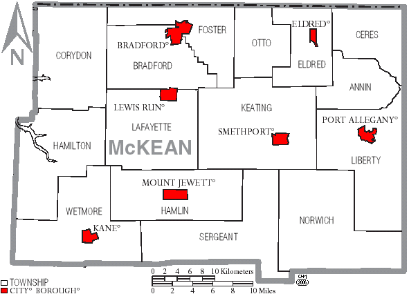
Under Pennsylvania law, there are four types of incorporated municipalities: cities, boroughs, townships, and, in at most two cases, towns. The following cities, boroughs and townships are located in McKean County:
City
- Bradford
Boroughs
- Eldred
- Kane
- Lewis Run
- Mount Jewett
- Port Allegany
- Smethport (county seat)
Townships
- Annin
- Bradford
- Ceres
- Corydon
- Eldred
- Foster
- Hamilton
- Hamlin
- Keating
- Lafayette
- Liberty
- Norwich
- Otto
- Sergeant
- Wetmore
Census-designated places
- Foster Brook
- Rew
- University of Pittsburgh Bradford
Unincorporated communities
- Burning Well
- Coryville
- Cyclone
- Derrick City
- Farmers Valley
- Gifford
- Ludlow
Population ranking
The population ranking of the following table is based on the 2010 census of McKean County.
† county seat
| Rank | City/Town/etc. | Municipal type | Population (2010 Census) |
|---|---|---|---|
| 1 | Bradford | City | 8,770 |
| 2 | Kane | Borough | 3,730 |
| 3 | Port Allegany | Borough | 2,157 |
| 4 | † Smethport | Borough | 1,655 |
| 5 | Foster Brook | CDP | 1,251 |
| 6 | Mount Jewett | Borough | 919 |
| 7 | Eldred | Borough | 875 |
| 8 | Lewis Run | Borough | 617 |
| 9 | Rew | CDP | 199 |
References
References
- "McKean County, Pennsylvania".
- "Census - Geography Profile: McKean County, Pennsylvania". [[United States Census Bureau]].
- "Find a County". National Association of Counties.
- (2008). "Pennsylvania: Individual County Chronologies". The Newberry Library.
- Gannett, Henry. (1905). "The Origin of Certain Place Names in the United States". U.S. Government Printing Office.
- (August 22, 2012). "2010 Census Gazetteer Files". United States Census Bureau.
- "PRISM Climate Group at Oregon State University".
- "U.S. Decennial Census". United States Census Bureau.
- "Historical Census Browser". University of Virginia Library.
- (March 24, 1995). "Population of Counties by Decennial Census: 1900 to 1990". United States Census Bureau.
- (April 2, 2001). "Census 2000 PHC-T-4. Ranking Tables for Counties: 1990 and 2000". United States Census Bureau.
- "State & County QuickFacts". United States Census Bureau.
- "Census 2020 - McKean County, Pennsylvania".
- "U.S. Census website". [[United States Census Bureau]].
- (2021). "2020 Decennial Census Demographic Profile (DP1)".
- (2021). "2020 Decennial Census Redistricting Data (Public Law 94-171)".
- (2023). "2020 Decennial Census Demographic and Housing Characteristics (DHC)".
- "P004: Hispanic or Latino, and Not Hispanic or Latino by Race – 2000: DEC Summary File 1 – McKean County, Pennsylvania". [[United States Census Bureau]].
- "P2 Hispanic or Latino, and Not Hispanic or Latino by Race – 2010: DEC Redistricting Data (PL 94-171) - McKean County, Pennsylvania".
- "P2 Hispanic or Latino, and Not Hispanic or Latino by Race – 2020: DEC Redistricting Data (PL 94-171) - McKean County, Pennsylvania".
- "Office of Management and Budget - The White House".
- "Businesses that Received Forms in 2012: Pennsylvania - U.S. Census Bureau".
- "2010 U.S. Census website". [[United States Census Bureau]].
- Leip, David. "Dave Leip's Atlas of U.S. Presidential Elections".
- (November 5, 2024). "2024 Senate Election (Official Returns)".
- "Voter registration statistics by county". Dos.state.pa.us.
- Center, Legislativate Data Processing. "Find Your Legislator".
This article was imported from Wikipedia and is available under the Creative Commons Attribution-ShareAlike 4.0 License. Content has been adapted to SurfDoc format. Original contributors can be found on the article history page.
Ask Mako anything about McKean County, Pennsylvania — get instant answers, deeper analysis, and related topics.
Research with MakoFree with your Surf account
Create a free account to save articles, ask Mako questions, and organize your research.
Sign up freeThis content may have been generated or modified by AI. CloudSurf Software LLC is not responsible for the accuracy, completeness, or reliability of AI-generated content. Always verify important information from primary sources.
Report