From Surf Wiki (app.surf) — the open knowledge base
Maryland Route 222
Highway in Maryland

Highway in Maryland
| Field | Value | |||||
|---|---|---|---|---|---|---|
| state | MD | |||||
| type | MD | |||||
| route | 222 | |||||
| map | ||||||
| map_custom | yes | |||||
| map_notes | Maryland Route 222 highlighted in red | |||||
| length_mi | 11.36 | |||||
| length_round | 2 | |||||
| length_ref | ||||||
| tourist | [[File:MD scenic byway.svg | 20px | alt= | link=]] Lower Susquehanna Scenic Byway | ||
| established | 1972 | |||||
| direction_a | South | |||||
| terminus_a | in Perryville | |||||
| junction | {{plainlist | |||||
| *{{jct | state | MD | US | 40}} in Perryville | ||
| *{{jct | state | MD | MD | 824}} in Perryville | ||
| *{{jct | state | MD | I | 95}} in Perryville | ||
| *{{jct | state | MD | MD | 275 | MD | 824}} in Perryville |
| *{{jct | state | MD | MD | 276}} in Port Deposit | ||
| direction_b | North | |||||
| terminus_b | near Conowingo | |||||
| counties | Cecil | |||||
| previous_type | US | |||||
| previous_route | 222 | |||||
| next_type | MD | |||||
| next_route | 223 |
- in Perryville
- in Perryville
- in Perryville
- in Perryville
- in Port Deposit
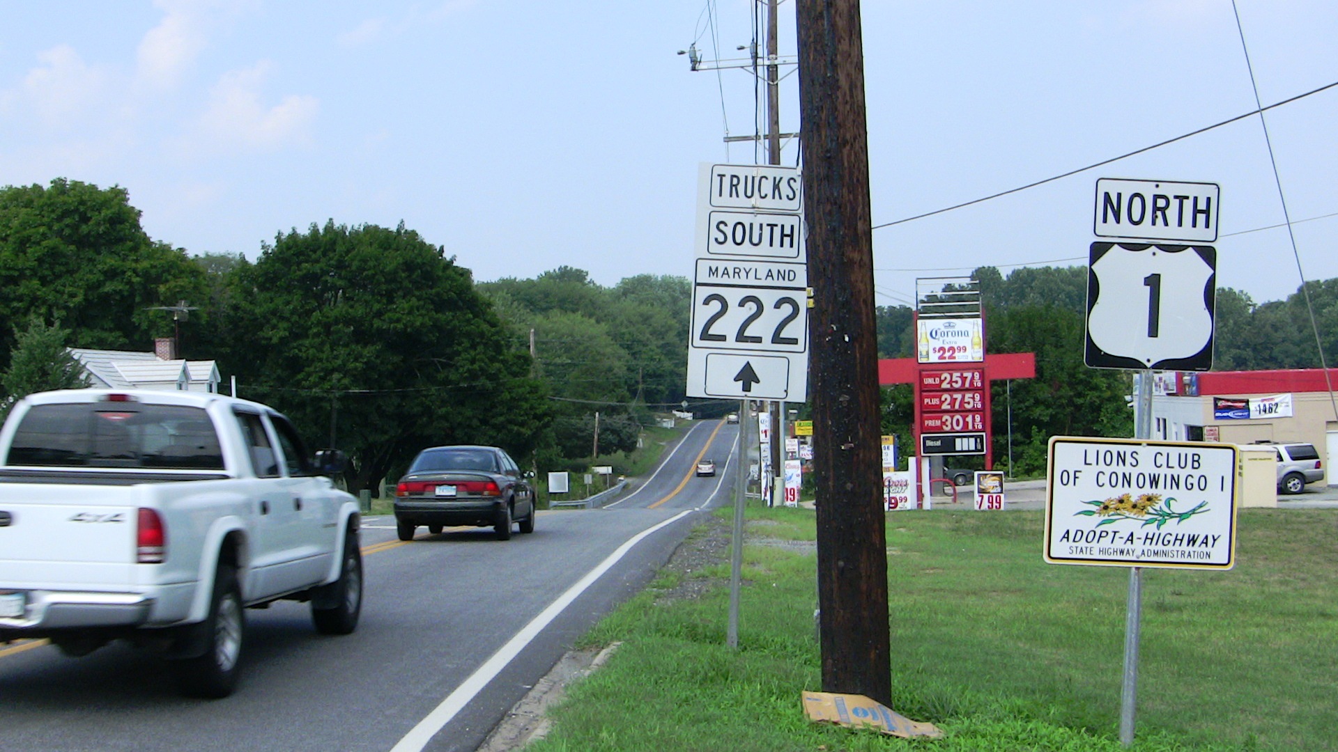
Maryland Route 222 (MD 222) is a state highway in the U.S. state of Maryland. The highway runs 11.36 mi from MD 7 in Perryville north to U.S. Route 1 (US 1) near Conowingo. MD 222 connects Perryville, Port Deposit, and Conowingo along its route paralleling the Susquehanna River in western Cecil County. Due to limitations in the highway in Port Deposit, including a steep hill and a low-clearance railroad bridge, trucks are directed to use MD 275, MD 276, and US 1 through Woodlawn and Rising Sun to connect Interstate 95 (I-95) with US 222 in Conowingo.
MD 222 was built as MD 268, a number presently assigned to North Street in Elkton. The state highway was paved from Perryville to Port Deposit in the late 1910s and early 1920s. MD 268 was extended north to Conowingo in the early 1930s. In 1938, MD 268 was superseded when US 222 was extended south from US 1 in Conowingo to US 40 in Perryville. US 222 was widened from Perryville to Port Deposit in the early 1940s and rebuilt around 1960. The highway was moved for the construction of I-95 interchange in the early 1960s and rebuilt south to Perryville in the late 1960s. MD 222 was established in 1972 on the portion of US 222 between MD 7 and US 40. The designation was extended from Perryville to Conowingo in 1995 when US 222 was rolled back to its former and present terminus at US 1 in Conowingo.
Route description
MD 222 begins at an intersection with MD 7 (Broad Street) in the town of Perryville. The highway heads north as two-lane undivided Aiken Avenue, which reaches its northern end at US 40 (Pulaski Highway) immediately to the east of the Thomas J. Hatem Memorial Bridge over the Susquehanna River. MD 222 continues northeast past US 40 as Perryville Road, which crosses over CSX's Philadelphia Subdivision railroad line. The highway curves north and leaves the town of Perryville, passing west of Perryville High School. MD 222 intersects the southern end of MD 824 (Reservoir Road) and the entrance to the former Perryville Outlet Center to the west before meeting I-95 (John F. Kennedy Memorial Highway) at a four-ramp partial cloverleaf interchange. At the north end of the interchange, the highway briefly re-enters the town of Perryville and intersects the ramps to and from southbound I-95 and Chesapeake Overlook Parkway, which serves as the entrance road to Hollywood Casino Perryville and the Great Wolf Lodge resort to the west. Past here, the road passes west of a park and ride lot before it reaches a four-way intersection with the northern end of MD 824 (Blythedale Road) and the southern end of MD 275 (Perrylawn Drive). At this intersection, MD 222 turns west onto Bainbridge Road toward Port Deposit.
_at_Maryland_State_Route_276_(Center_Street)_in_Port_Deposit,_Cecil_County,_Maryland.jpg)
MD 222 is a part of the National Highway System as a principal arterial from US 40 north to MD 275 within Perryville.
History
What is now MD 222 was originally designated MD 268. MD 268 was replaced by a southern extension of US 222 from US 1 at Conowingo to US 40 (now MD 7) in Perryville in 1938. The Susquehanna River Road section of US 222 was transferred from state to county maintenance through a May 8, 1958, road transfer agreement. However, that section was returned to state control through an August 23, 1961, agreement after Cecil County requested it be returned to the state. The American Association of State Highway and Transportation Officials (AASHTO) approved rolling back the southern end of the US 222 designation from US 40 to US 1 at their April 1995 spring meeting. The Maryland State Highway Administration proposed and AASHTO approved the redesignation of US 222 to MD 222 from US 40 to US 1 in February 1996; however, the new designation had already been enacted officially and marked publicly in 1995. The redesignation did not apply to Aiken Avenue; indeed, Aiken Avenue's designation was changed from US 222 to MD 222 in 1972.
The first stretch of the Perryville–Conowingo highway to be improved was in Perryville, where Cecil County constructed with state aid a macadam road from the Aikin station on the Baltimore and Ohio Railroad south toward the Post Road (now MD 7) by 1910. Cecil County extended the macadam road to the Post Road by 1919. The highway from the Aikin railroad crossing to Port Deposit was paved as a 15 ft concrete road in two sections: from the railroad to near Port Deposit by 1921 and through Port Deposit by 1923. MD 268 was paved as a concrete road from Port Deposit to US 1 at Conowingo Dam between 1930 and 1933; the construction work included repurposing a railroad bridge across Octoraro Creek as a highway bridge. MD 268's bridge across the Baltimore and Ohio Railroad was constructed between 1931 and 1934. The old highway approaching the Aikin grade crossing became MD 449.
MD 268 was proposed to be widened to 20 ft from US 40 to US 1 in 1934. The portion of US 222 from US 40 to near Port Deposit was expanded to improve access between the U.S. Highway and United States Naval Training Center Bainbridge, east of Port Deposit in 1942 and 1944. US 222 was widened and resurfaced between what is now the MD 222–MD 275—MD 824 intersection and Port Deposit in 1959 and 1960. The U.S. Highway was relocated as part of the construction of its original diamond interchange with I-95 in 1962 and 1963. The old alignment of US 222 east of its I-95 interchange became MD 824. The highway was resurfaced with bituminous concrete from MD 7 to US 40 and reconstructed and widened from US 40 to the southern MD 824 intersection in 1968 and 1969. The widening work included widening US 222's bridge across the Baltimore and Ohio Railroad, which was removed and replaced between 1987 and 1989. The I-95 interchange was converted from a standard diamond to a four-ramp partial cloverleaf with all four ramps east of MD 222 between 1993 and 1994. Aiken Avenue was reconstructed in an urban streetscape project in 2001 and 2002.
Junction list
Related routes
Former truck route
Maryland Route 222 Truck was a signed 12.49 mi truck bypass of MD 222 from MD 222 in Perryville to US 1 and US 222 in Conowingo. The signed route followed MD 275 from MD 222 in Perryville north to MD 276 in Woodlawn. MD 222 Truck continued north on MD 276 from Woodlawn north to US 1 west of Rising Sun. The truck route then headed west on US 1 (in a wrong-way concurrency) to US 222's southern terminus in Conowingo. MD 222 Truck was first signed by 2002. Signs for MD 222 Truck were removed by 2016 and replaced with signs directing trucks to I-95 and US 40 southbound and to US 222 northbound.
Junction list
Auxiliary routes
MD 222 has three auxiliary routes that are maintained by the Maryland Transportation Authority (MDTA) and provide access to the authority's facilities around I-95's interchange with MD 222 and the John F. Kennedy Memorial Highway toll plaza to the east of the Millard E. Tydings Memorial Bridge. The highways were created as part of the reconstruction of MD 222's interchange with I-95 in 1993 and 1994.
- MD 222A is the designation for Chesapeake Overlook Parkway, a 0.09 mi spur west from the intersection of MD 222 and the ramps to and from southbound I-95. This spur intersects MD 222B near its western end and serves as the entrance to Hollywood Casino Perryville and the Great Wolf Lodge resort. MD 222A was assigned in 1994, and the highway received its name in 2010.
- MD 222B is the designation for Turnpike Drive, a 0.89 mi service road that heads south from MD 222A and veers west to parallel the southbound lanes of I-95. The state highway provides access to the MDTA administration building, the Perryville barracks of the Maryland State Police, and the adjacent truck weigh station on southbound I-95. MD 222B follows part of the course of what was the entrance ramp from MD 222 to southbound I-95.
- MD 222C is the designation for G.R. Dawson Drive, a 0.48 mi service road that heads west from MD 222 and parallels the northbound lanes of I-95. The state highway provides access to a truck weigh station on northbound I-95. MD 222C follows part of the course of what was the northbound I-95 exit ramp to MD 222. The designation was assigned in 1995, and the highway received its name in 2006.
References
References
- Planning and Programming Division. (July 1, 1952). "Control Section Listings for State Maintained Highways". Maryland State Roads Commission.
- {{Maryland HLR. (2015)
- {{Maryland grid map
- (October 1, 2012). "National Highway System: Maryland". Federal Highway Administration.
- {{Maryland SRC report. (1934)
- {{Maryland road map. (1938)
- (May 8, 1958). "Excerpt from Minutes of Meeting of the State Roads Commission". Maryland State Roads Commission.
- (August 23, 1961). "Memorandum of Action of State Roads Commission of Maryland". Maryland State Roads Commission.
- {{AASHTO minutes. (1995S)
- {{Maryland road map. (1995)
- Bureau of Highway Statistics. (December 31, 1995). "Highway Location Reference, Volume 1". Maryland State Highway Administration.
- Bureau of Highway Statistics. (July 1972). "Control Section Listings for the State Highway System". Maryland State Roads Commission.
- Bureau of Highway Statistics. (July 1972). "Control Section Listings for the State Highway System". Maryland State Highway Administration.
- {{Maryland road map. (1910)
- {{Maryland SRC report. (1919)
- {{Maryland road map. (1921)
- {{Maryland SRC report. (1923)
- {{Maryland road map. (1923)
- {{Maryland SRC report. (1930)
- {{Maryland road map. (1933)
- (December 28, 1966). "Memorandum of Action of State Roads Commission of Maryland". Maryland State Roads Commission.
- {{Maryland SRC report. (1942)
- {{Maryland SRC report. (1944)
- "Havre de Grace, MD quadrangle". United States Geological Survey.
- (December 27, 1979). "Memorandum of Action of Director Neil J. Pedersen". Maryland State Highway Administration.
- {{Maryland road logbook
- {{Maryland road logbook
- "Havre de Grace, MD quadrangle". United States Geological Survey.
- "Havre de Grace, MD quadrangle". United States Geological Survey.
- Bureau of Highway Statistics. (December 31, 1994). "Highway Location Reference, Volume 1". Maryland State Highway Administration.
- {{Maryland HLR. (2010)
- {{Maryland HLR. (2006)
- "Maryland Route 222 Truck".
- Reichard, Timothy. (1995-04-23). "US 1/MD 222 Truck Multiplex". Central PA/MD Roads.
This article was imported from Wikipedia and is available under the Creative Commons Attribution-ShareAlike 4.0 License. Content has been adapted to SurfDoc format. Original contributors can be found on the article history page.
Ask Mako anything about Maryland Route 222 — get instant answers, deeper analysis, and related topics.
Research with MakoFree with your Surf account
Create a free account to save articles, ask Mako questions, and organize your research.
Sign up freeThis content may have been generated or modified by AI. CloudSurf Software LLC is not responsible for the accuracy, completeness, or reliability of AI-generated content. Always verify important information from primary sources.
Report