From Surf Wiki (app.surf) — the open knowledge base
Marthalen
| Field | Value | ||
|---|---|---|---|
| subject_name | Marthalen | ||
| municipality_type | municipality | ||
| image_photo | Marthalen Kirche.JPG | ||
| imagepath_coa | CHE Marthalen COA.svg | ||
| imagepath_flag | CHE Marthalen Flag.svg | ||
| canton | Zurich | ||
| iso-code-region | CH-ZH | ||
| district | Andelfingen | ||
| coordinates | |||
| postal_code | 8460 | ||
| municipality_code | 0035 | ||
| area | 14.11 | ||
| elevation | 457 | elevation_description= | |
| population | populationof = | popofyear = | |
| website | www.marthalen.ch | ||
| mayor | mayor_asof= | mayor_party= | |
| mayor_title | list_of_mayors = | ||
| neighboring_municipalities | Benken, Buchberg (SH), Flaach, Kleinandelfingen, Lottstetten (DE-BW), Rheinau, Rüdlingen (SH), Trüllikon |
| iso-code-region = CH-ZH |}}
Marthalen is a municipality in the district of Andelfingen in the canton of Zürich in Switzerland.
History
Marthalen is first mentioned in 858 as Martella.
Geography
Marthalen has an area of 14.2 km2. Of this area, 49.3% is used for agricultural purposes, while 39.4% is forested. Of the rest of the land, 10% is settled (buildings or roads) and the remainder (1.3%) is non-productive (rivers, glaciers or mountains).
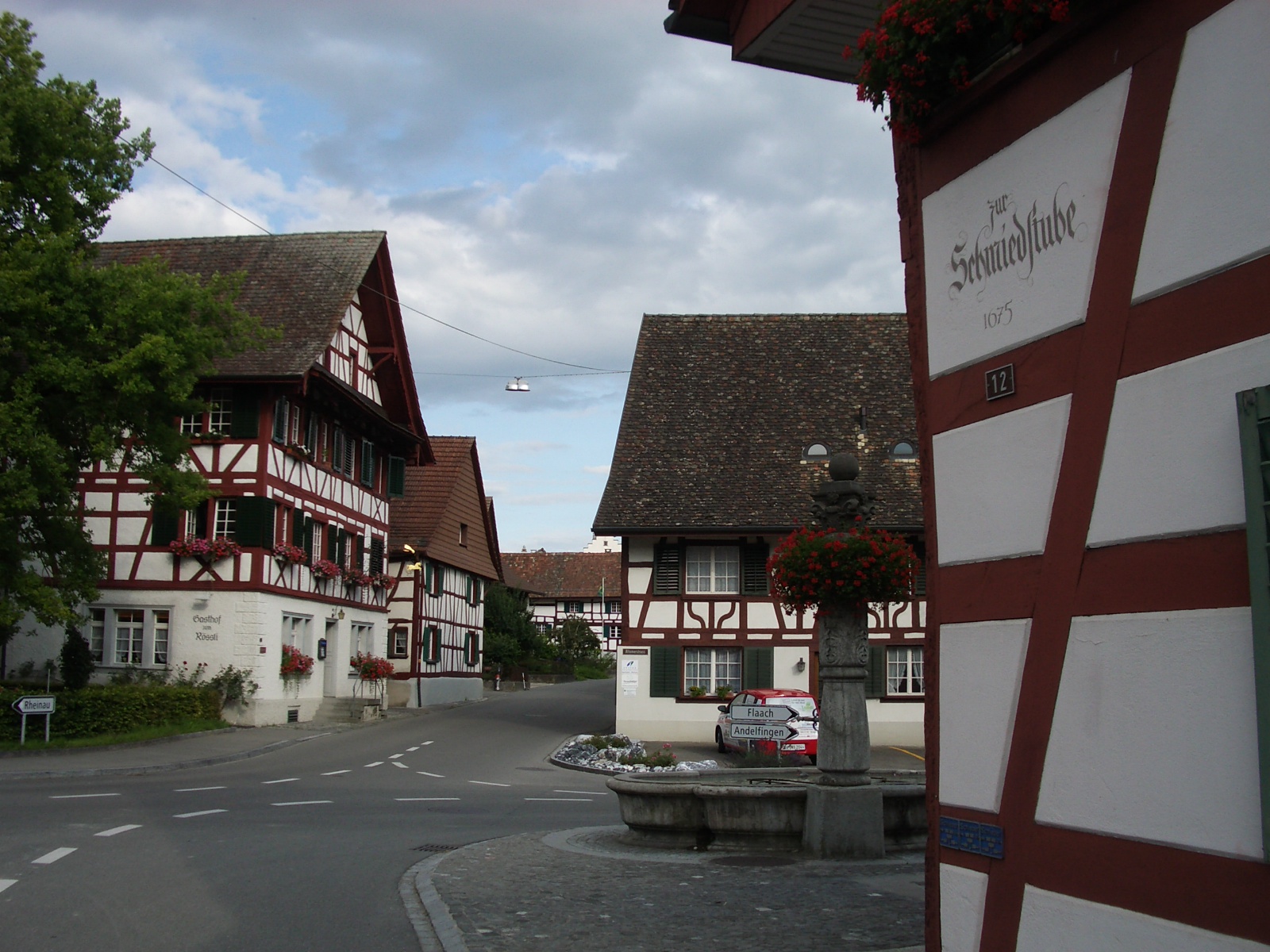
The municipality is located in the Zürcher Weinland (Zurich's vineyards) between the Thur and Rhine Rivers. The village is known for its half-timbered houses. The municipality also includes the village of Ellikon am Rhein, and the hamlets of Niedermarthalen and Radhof.
Demographics
Marthalen has a population (as of ) of . , 7.5% of the population was made up of foreign nationals. Over the last 10 years the population has grown at a rate of 5.1%. Most of the population () speaks German (95.6%), with French (0.6%) and Italian being third (0.6%) most common languages.
In the 2007 election the most popular party was the SVP, which received 54.3% of the vote. The next three most popular parties were the SPS (11.5%), the Green Party (10.3%), and the CSP (9.4%).
The age distribution of the population () is children and teenagers (0–19 years old) make up 25.7% of the population, while adults (20–64 years old), make up 59.9% and seniors (over 64 years old) make up 14.4%. In Marthalen about 81.3% of the population (between age 25-64) have completed either non-mandatory upper secondary education or additional higher education (either university or a Fachhochschule).
Marthalen has an unemployment rate of 0.87%. , there were 110 people employed in the primary economic sector and about 39 businesses involved in this sector. 231 people are employed in the secondary sector and there are 37 businesses in this sector. 453 people are employed in the tertiary sector, with 62 businesses in this sector. The historical population is given in the following table:
| year | population |
|---|---|
| 1464 | 27 Households |
| 1649 | 862 |
| 1771 | 1,012 |
| 1850 | 1,401 |
| 1900 | 1,164 |
| 1920 | 1,296 |
| 1950 | 1,215 |
| 1980 | 1,259 |
| 2000 | 1,803 |
: Ellikon is not included in the number of households.
Transport
Marthalen railway station is a stop of the S-Bahn Zürich on the line S33.
Buildings and structures
- Marthalen Landi-Silo
References
References
- [http://www.bfs.admin.ch/bfs/portal/en/index/regionen/02/key.html Swiss Federal Statistical Office] {{webarchive. link. (2016-01-05 accessed 28-Jul-2009)
- {{HDS. 29. Marthalen
This article was imported from Wikipedia and is available under the Creative Commons Attribution-ShareAlike 4.0 License. Content has been adapted to SurfDoc format. Original contributors can be found on the article history page.
Ask Mako anything about Marthalen — get instant answers, deeper analysis, and related topics.
Research with MakoFree with your Surf account
Create a free account to save articles, ask Mako questions, and organize your research.
Sign up freeThis content may have been generated or modified by AI. CloudSurf Software LLC is not responsible for the accuracy, completeness, or reliability of AI-generated content. Always verify important information from primary sources.
Report