From Surf Wiki (app.surf) — the open knowledge base
Marsa Alam
Town in the Red Sea Governorate, Egypt
Town in the Red Sea Governorate, Egypt
| Field | Value |
|---|---|
| coordinates | |
| name | Marsa Alam |
| native_name | مرسى علم |
| settlement_type | town |
| image_skyline | {{Photomontage |
| photo1a | Marsa Alam Port Ghalib landscape.jpg |
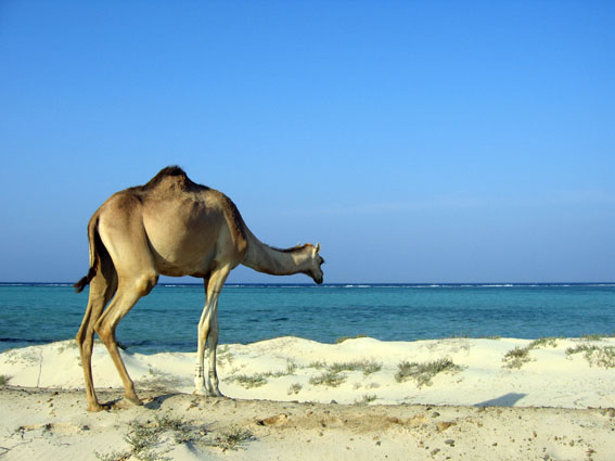
| photo2a | Dromedar Marsa Alam.jpg |
| photo2b | Up through black coral bush.jpg |
| photo3a | Marsa Alam, Egypt 2007feb08 byDanielCsorfoly.JPG |
| photo3b | Marsa Alam R23.jpg |
| size | 280 |
| spacing | 2 |
| color | transparent |
| border | 0 |
| image_caption | Overview of Marsa Alam |
| pushpin_map | Egypt |
| pushpin_label_position | bottom |
| pushpin_map_caption | Location in Egypt |
| subdivision_type | Country |
| subdivision_name | Egypt |
| subdivision_type1 | Governorate |
| subdivision_name1 | Red Sea Governorate |
| leader_title1 | |
| established_title | |
| unit_pref | Imperial |
| area_footnotes | |
| area_total_km2 | 14,184 |
| area_land_km2 | |
| population_as_of | 2021 |
| population_footnotes | |
| population_total | 9,001 |
| population_density_km2 | auto |
| population_density_sq_mi | auto |
| population_density_metro_km2 | auto |
| population_density_metro_sq_mi | auto |
| population_blank1_title | Ethnicities |
| population_density_blank1_km2 | auto |
| population_density_blank1_sq_mi | auto |
| timezone | EET |
| utc_offset | +2 |
| timezone_DST | EEST |
| utc_offset_DST | +3 |
| elevation_footnotes | |
| elevation_m | 18 |
| postal_code_type |
|
Marsa Alam ( ar , Classical Arabic ) is a tourist town in south-eastern Egypt, located on the western shore of the Red Sea. It is described as a "popular" tourist destination. Due to its crystal clear water and its white sandy beaches, it is also known as the "Egyptian Maldives."
Marsa Alam is a relatively recently built town; its development began in 1995 through the investments of the Kuwaiti Al-Kharafi Group, which established the town and its initial facilities, resorts and infrastructure. Its growth was accelerated by the opening of Marsa Alam International Airport in 2003.
Geography
The region covers an area of 38,433 km2 and sits at an elevation of approximately 60 meters above sea level. It is located 274 km south of Hurghada and 134 km south of Qusayr. It is inhabited by about 11,497 residents.
Climate
Despite being over 135 mi north of the tropical zone, the city experiences a tropical hot desert climate (Köppen: BWh), with steadier temperatures than places to the north such as Hurghada and Sharm el Sheikh. Among major Egyptian cities and resorts, Marsa Alam, Kosseir and Sharm el-Sheikh have the warmest nighttime temperatures. Average maximum temperatures during January typically range from 22 to and in August 33 to.
The temperature of the Red Sea at this location during the year ranges from 22 to.
The highest record temperature was 45 C, recorded on May 10, 2010, while the lowest record temperature was 5 C, recorded on January 3, 2008.
|Jan record high C=29 |Feb record high C=32 |Mar record high C=35 |Apr record high C=39 |May record high C=45 |Jun record high C=43 |Jul record high C=43 |Aug record high C=42 |Sep record high C=39 |Oct record high C=38 |Nov record high C=34 |Dec record high C=31
|Jan record low C=5 |Feb record low C=8 |Mar record low C=11 |Apr record low C=15 |May record low C=16 |Jun record low C=19 |Jul record low C=22 |Aug record low C=20 |Sep record low C=19 |Oct record low C=15 |Nov record low C=12 |Dec record low C=10
| Jan | Feb | Mar | Apr | May | Jun | Jul | Aug | Sep | Oct | Nov | Dec |
|---|---|---|---|---|---|---|---|---|---|---|---|
| 73 °F | 72 °F | 72 °F | 73 °F | 77 °F | 81 °F | 82 °F | 84 °F | 82 °F | 81 °F | 79 °F | 75 °F |
Tourism
Beaches near Marsa Alam include Abu Dabba. There, tourists report seeing turtles, dolphins, sharks and marine wildlife like crocodilefish and octopuses.
Marsa Alam is also known a kitesurfing destination and starting point for safaris. The town is located near some historic emerald mines and the Temple of Seti I at Khanais.
Wadi El Gemal National Park
Main article: Wadi El Gemal National Park

The Wadi El Gemal National Park covers an area of approximately 7,450 km2, including a land area of 4,770 km2, and a marine area of 2,100 km2. It covers 60 km of the Red Sea coast and includes the Wadi El Gemal islands, coral reefs and seaweed clusters, in addition to Mount Hamata, which is located at the beginning of the reserve. A flowing freshwater source mixes with seawater and forms a low-salinity marsh.
The reserve is divided into several areas: the Wadi El Gemal Island area, which has the second largest population of the sooty falcon; the Hankawareb area, which is 18 km south of Wadi El Gemal, is characterized by beaches and coral reefs; and the Qalaan area, 9 km north of the village. The Hamata area is characterized by the presence of vast areas of mangrove and many types of endemic and migratory birds. The Hamata Islands area, located two miles from the beach opposite the village of Hamata, is characterized by places for swimming and diving activities.
The valley was given its name due to the presence of a plant in that area that is palatable to camels.
Wildlife and marine life are active in the reserve, including mountain goat “ibex”, dorcas gazelle, which is also known as the afri, the aril gazelle, which is one of the smallest and most common species of deer, ibex, antelope, and more than 13 species of birds, including the sunset falcon. Marine life includes four species of sea crab, dugong, green turtles, whale shark, mermaid fish, dolphin, and more than 13 species of small fish. The local fauna includes 141 species of plants, including mangrove trees, swamp herbs, and doum palms.
The area also includes the antique Temple of Sket, located 60 km inside Wadi El Gemal. The reserve has four entrances, and three administrative offices have been established, in addition to a museum for the Ababda tribes in which the tools they use are displayed. Tribal women are also taught how to market and sell handicrafts. The Ministry of Environment provides patrols to enforce environmental law and provide environmental monitoring.
Transport
Air
Main article: Marsa Alam International Airport

Work began on Marsa Alam International Airport in March 1999. It was opened for commercial aviation in October 2001, and it was officially opened in October 2003 with a capacity of up to 600 passengers/hour. It was established with the aim of serving the coastal region in the south of Red Sea from the city of Al-Qusayr to the city of Marsa Alam, with a length of 120 km. The airport is 34 nautical miles northwest of Marsa Alam, and 210 km south of Hurghada. Flights include origins in Italy, Germany, France and England for the purpose of tourism. The airport includes a passenger building located on an area of 5,000 square meters.
The airport is managed and operated by IMAC Airport Management and Operations Company, one of the Kuwait Al-Kharafi Group, using the build–operate–transfer system.
Yacht Marina

Marsa Alam Bahri Marina or Port Ghalib Marina is located 65 km north of Marsa Alam City, 75 km south of El Quseir City, and 4 km south of Marsa Alam International Airport. Its total area is 315,872 m2, with a marine area of 277,872 m2. The combined length of its piers is 5,200 meters, and the ground area around the piers is 35,000 m2. The main activity of the marina is to receive foreign and local tourist yachts. It operates 24 hours a day. It is frequented annually by an average of about 2,000 yachts, its capacity is up to 1,050 yachts.
The marina was established and managed by the Marsa Alam Tourism Development Company. The marina is equipped with yacht repair facilities, electronic navigation aids, ship waste reception facilities, yacht feeding units with fresh water, electricity and communications, refueling services, security and safety tools, environmental preservation, and fire and pollution control. It has a main navigational approach shaft, illuminated electronically at night, deep in the sea, 60 meters from the beginning of the navigational channel, to guide yachts in their approach to the navigational channel.
References
References
- "Marsā 'Alam (Kism (urban and rural parts), Egypt) - Population Statistics, Charts, Map and Location".
- Oberholtz, Chris. (2024-12-30). "Shark attack kills EU official in Egypt's Red Sea during birthday scuba dive celebration: reports".
- (20 April 2017). "In photos: Marsa Alam, Sharm el-Sheikh among 10 best beaches in Middle East – TripAdvisor". [[Egypt Independent]].
- "Discover Marsa Alam, Also Known As The Egyptian Maldives".
- "18,000 Tourists Just Landed in Hurghada & Marsa Alam for the Summer".
- "محمية وادي url". الهيئة المصرية للسياحة.
- "مرسى علم". [[:ar:الهيئة العامة للاستعلامات (مصر).
- دينا وادي. (30 June 2004). "مرسى علم قرية صغيرة مصرية بمواصفات عالمية يمارس زوارها جميع أنواع السياحة". [[:ar:الشرق الأوسط (جريدة).
- ميرفت رشاد. (25 July 2010). "مرسى علم.. رحلة الاستمتاع تبدأ تحت مياه البحر الأحمر". [[:ar:اليوم السابع]].
- "Climate: Marsa Alam - Climate graph, Temperature graph, Climate table". climate-data.org.
- ["Marsa Alam/ El Quseir - Holiday facts and Information"](http://www.holidaycheck.com/di/ab21632a-310f-3bdc-b6cc-f04d9d87b7e1 ). HolidayCheck.com.
- "Marsa Alam, Egypt". Voodoo Skies.
- "Marsa Alam, Egypt: Climate, Global Warming, and Daylight Charts and Data". Weather2Travel.
- "MARSA ALAM WEATHER". MarsaAlam.com.
- Vincent, Jessica. (2023-10-25). "A Scuba Diving Getaway in Egypt Where You Can Help Heal the Red Sea".
- "Egyptian Tourism Authority".
- "Emerald mines, Umm Kabu, Red Sea Governorate, Egypt".
- (2022-08-22). "Restoration of Amun-Ra’s shrine in Temple of Seti I completed".
- "محمية وادي url". الهيئة المصرية للسياحة.
- محيي العبادي. (12 May 2013). "بالصور.. محمية وادي الجمال تحقق طفرة جديدة في السياحة البيئية". [[:ar:اليوم السابع]].
- (13 December 2015). "بالصور.. محمية "وادي الجمال" طبيعة فاتنة وطقس خلاب في انتظار الزائرين". [[:ar:الشروق الجديد (جريدة مصرية).
- عماد عرفة. (14 December 2015). "إنشاء أحدث محطة أرصاد جوية بالشرق الأوسط في مطار مرسى علم". [[:ar:اليوم السابع]].
- "مارينا بورت غالب الدولي". [[:ar:وزارة النقل (مصر).
- "مارينـا بورت غالب". [[:ar:الهيئة العامة لموانئ البحر الأحمر]].
This article was imported from Wikipedia and is available under the Creative Commons Attribution-ShareAlike 4.0 License. Content has been adapted to SurfDoc format. Original contributors can be found on the article history page.
Ask Mako anything about Marsa Alam — get instant answers, deeper analysis, and related topics.
Research with MakoFree with your Surf account
Create a free account to save articles, ask Mako questions, and organize your research.
Sign up freeThis content may have been generated or modified by AI. CloudSurf Software LLC is not responsible for the accuracy, completeness, or reliability of AI-generated content. Always verify important information from primary sources.
Report