From Surf Wiki (app.surf) — the open knowledge base
Marnhull
Village and civil parish in Dorset, England
Village and civil parish in Dorset, England
| Field | Value |
|---|---|
| country | England |
| static_image_name | Marnhull church - geograph.org.uk - 5352279.jpg |
| static_image_caption | Parish church of St Gregory |
| coordinates | |
| official_name | Marnhull |
| population | 2,035 |
| population_ref | (2021 census) |
| civil_parish | Marnhull |
| unitary_england | Dorset |
| lieutenancy_england | Dorset |
| region | South West England |
| constituency_westminster | North Dorset |
| post_town | Sturminster Newton |
| postcode_area | DT |
| postcode_district | DT10 |
| os_grid_reference | ST782188 |
Marnhull ( ) is a village and civil parish in Dorset, southern England. It lies in the Blackmore Vale, 3 mi north of Sturminster Newton and 18 mi north of Dorchester. Marnhull is sited on a low ridge of Corallian limestone above the valley of the River Stour, which forms the northern and western boundaries of the parish. In the 2021 census the parish had a population of 2,035.
Marnhull consists of several conjoined hamlets, connected by a network of minor roads. The village presents a mix of architectural styles, with post-war developments existing alongside properties dating back to Tudor times and earlier. It has three churches (Anglican, Roman Catholic and Methodist), two primary schools, two public houses, a GP surgery, a village hall and a recreation ground, as well as various small shops and services. The parish church of St Gregory has a 15th-century tower which is a landmark and has been described as "the finest in the Vale."
History
Saxon charters show that Marnhull existed as a village in the 10th century, although the village's site has seen human occupation as early as the Iron Age, The eastern part of Marnhull parish used to be a separate parish, named Thorton, until the 16th century.
Governance
Marnhull is in the constituency of North Dorset, currently represented in the UK parliament by the Conservative Simon Hoare.
Marnhull is part of the Stalbridge and Marnhull ward which elects 1 member to Dorset Council.
Geography
Marnhull civil parish covers about 3800 acre The western boundary of the parish is formed by the River Stour and the eastern by the Key Brook, a tributary of the Stour. The central part of the parish is drained by Chivrick's Brook, a tributary of the Key Brook. These watercourses all drain north to south. From west to east the geology of the parish comprises a thin strip of Oxford clay around the Stour, a long ridge of Corallian sand and limestone between the Stour and Chivrick's Brook, then lower-lying Kimmeridge clay between Chivrick's Brook and the eastern boundary. Marnhull village is sited on the ridge of Corallian beds, which form the highest part of the parish and are the source of the building stone extensively used throughout it.
Culture
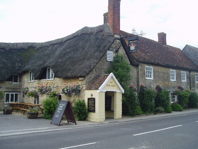
Thomas Hardy described Marnhull as 'Marlott' in his novel Tess of the d'Urbervilles. The Crown Inn is described by Hardy as 'The Pure Drop Inn', and The Blackmore Vale Inn is described as 'Rollivers' - a disreputable and illegal drinking house, where secret ale drinking groups gathered upstairs. The television adaptation of the book was filmed in the village.
Demographics
Notable residents
- Catherine Parr the last of Henry VIII's wives was given the original manor of Nash Court in 1544. From her it passed to Edward VI and then to Elizabeth I after which it passed through the families of several noblemen and eminent civilians.
- Giles Hussey was born here and lived at Nash House before studying art in Italy.
- William Gosling (footballer) was living at Lovells Court, Marnhull, at the 1911 Census.
- Sir Peter Harding, GCB, (born 2 December 1933) is a retired Royal Air Force Chief of the Air Staff, and Chief of Defence Staff.
References
References
- Ralph Wightman. (1983). "Portrait of Dorset". Robert Hale Ltd.
- Grierson, Jamie. (16 May 2025). "Residents of Dorset village that inspired Thomas Hardy fight back against expansion". The Guardian.
- Roland Gant. (1980). "Dorset Villages". Robert Hale Ltd.
- North Dorset District Council. (c. 1983). "North Dorset District Official Guide". Home Publishing Co. Ltd..
- "'Marnhull', in An Inventory of the Historical Monuments in Dorset, Volume 3, Central (London, 1970), pp. 148-160". University of London.
- Ayres, Ken. (February 2016). "Marnhull: A photo essay". Dorset Life Magazine.
- "Dorset North Parliamentary constituency". BBC.
- "Area profile for Stalbridge & Marnhull - Dorset Council".
- [http://www1.dorsetcc.gov.uk/LIVING/FACTS/Census2001.nsf/6cadf4da179fc19500256663004afece/5af732007c81137180256ec50042d124?OpenDocument Census data]
- "Area: Marnhull (Parish). Key Figures for 2011 Census: Key Statistics". Office for National Statistics.
- "Parish Profiles". Office for National Statistics.
- {{DNB Cite
This article was imported from Wikipedia and is available under the Creative Commons Attribution-ShareAlike 4.0 License. Content has been adapted to SurfDoc format. Original contributors can be found on the article history page.
Ask Mako anything about Marnhull — get instant answers, deeper analysis, and related topics.
Research with MakoFree with your Surf account
Create a free account to save articles, ask Mako questions, and organize your research.
Sign up freeThis content may have been generated or modified by AI. CloudSurf Software LLC is not responsible for the accuracy, completeness, or reliability of AI-generated content. Always verify important information from primary sources.
Report