From Surf Wiki (app.surf) — the open knowledge base
Mandi Bahauddin

| Field | Value | ||||||
|---|---|---|---|---|---|---|---|
| <!-- Basic info ----------------> | name | Mandi Bahauddin | |||||
| native_name | |||||||
| settlement_type | City | ||||||
| <!-- images and maps -----------> | image_skyline | {{Photomontage | |||||
| photo1a | Jamia Masjid Ghausia Rizvia.jpg | ||||||
| photo2a | Mian Waheed Ud Din Park.jpg | ||||||
| photo2b | GCT-Rasul (photo).jpg | photo3a=Mandi Bahauddin (35001616).jpeg | photo3b=Rasul Barrage at River Jhelum.jpg | photo4a=Hakim Mall Mandi Bahauddin.jpg | size =280 | border = 0 | position=center}} |
| image_size | 280 | ||||||
| image_caption | **Clockwise from top: | ||||||
| ** Jamia Masjid Ghausia Rizvia, University of Engineering & Technology, Rasul, Rasul Barrage, Hakim Mall, Jhelum River, Mian Waheed Ud Din Park | |||||||
| pushpin_map | Punjab Pakistan#Pakistan | ||||||
| pushpin_label_position | left | ||||||
| pushpin_map_caption | Location within Punjab | ||||||
| pushpin_mapsize | |||||||
| subdivision_type | Country | ||||||
| subdivision_name | |||||||
| subdivision_type1 | Province | ||||||
| subdivision_name1 | Punjab, Pakistan Punjab | ||||||
| subdivision_type2 | Division | ||||||
| subdivision_name2 | Gujrat | ||||||
| subdivision_type3 | District | ||||||
| subdivision_name3 | Mandi Bahauddin | ||||||
| <!-- Smaller parts (e.g. boroughs of a city) and seat of government --> | seat_type | NA/PP | |||||
| seat | 2/5 N.A (85,86) P.P(65,66,67,68) | ||||||
| parts_type | No. of Towns | ||||||
| parts_style | |||||||
| p1 | Phalia | ||||||
| government_type | Municipal Committee | ||||||
| leader_title | Union Councils | ||||||
| leader_name | 27 | ||||||
| leader_title1 | |||||||
| established_title | Established | ||||||
| established_date | 1506 AD | ||||||
| Notified_date | |||||||
| area_footnotes | |||||||
| area_total_km2 | |||||||
| elevation_footnotes | tags-- | ||||||
| elevation_m | 204 | ||||||
| elevation_min_ft | |||||||
| population_as_of | 2023 | ||||||
| population_footnotes | |||||||
| population_total | 232,361 | ||||||
| population_rank | 41st, Pakistan | ||||||
| population_density_km2 | auto | ||||||
| population_demonym | Mandi Aala | ||||||
| <!-- General information ---------------> | timezone | PST | |||||
| utc_offset | +5 | ||||||
| coordinates | |||||||
| <!-- Area/postal codes & others --------> | postal_code | 50400 | |||||
| postal_code_type | Postal code | ||||||
| area_code_type | Dialling code | ||||||
| area_code | 0546 | ||||||
| website |
** Jamia Masjid Ghausia Rizvia, University of Engineering & Technology, Rasul, Rasul Barrage, Hakim Mall, Jhelum River, Mian Waheed Ud Din Park Default is list if up to 5 items, coll if more than 5--| up to p50: for separate parts to be listed--
Mandi Bahauddin (Punjabi / ; ) is a city in Punjab, Pakistan. It is also called "The City of Lions". It is also the capital of Mandi Bahauddin District. It is the 43rd most populous city in Pakistan, according to the 2023 census. The city is about 220 metres above sea level and is located between the rivers Jhelum (north 12 km) and Chenab (south 39 km).
The name of the town originates from two sources, Mandi was a prefix because it was a grain market and Bahauddin was a Sufi saint.
History
Foundation of Mandi Bhauddin
In 1506 C.E. a Gondal tribal Chief named Bahauddin established a settlement namely Pindi Bahauddin, after his migration from Pindi Shahjahanian to this area.
Early history
The recorded history of Mandi Bahauddin goes back to the era of Alexander the Great. Some 8 km northwest of the modern-day Mandi Bahauddin town, at the village Mong on the southern bank of the Jhelum River (Greek: Hydaspes), the battle Battle of the Hydaspes River was fought between Raja Porus (Sanskrit: Paurava) and Alexander the Great in 326 BCE. The kingdom of Raja Porus was situated in the northern Punjab of modern Pakistan. This was the last major fight of Alexander's career; the Macedonians, after finding a fierce resistance by Porus, and having heard of a massive 4,000 elephant force mustered by eastern kingdoms, refused to march further toward the Ganges Plains. The Sadar Gate built during the British era in 1933 is present here.
Administration
Mandi Bahauddin, the capital of the district, is also the Tehsil headquarters. Mandi Bahauddin was raised to the level of Municipal Committee in 1941. It was given the status of Municipal Committee after the implementation of Punjab Local Government Ordinance 2001. Municipal Committee of Mandi Bahauddin Tehsil is subdivided into three tehsils and eighty Union Councils:
| Name of Tehsil | url=https://mbdin.com/union-counsils-and-villages-in-tehsil-mandi-bahauddin/ | title=Tehsils & Unions in the District of Mandi Bahauddin | access-date=30 July 2021 | archive-url=https://web.archive.org/web/20210422202434/https://mbdin.com/union-counsils-and-villages-in-tehsil-mandi-bahauddin/ | archive-date=22 April 2021 | url-status=dead | date=2 August 2007}} |
|---|---|---|---|---|---|---|---|
| Malakwal | 20 | ||||||
| Mandi Bahauddin | 30 | ||||||
| Phalia | 30 | ||||||
| Total | 80 |
Demographics
Population
According to 2023 census, Mandi Bahauddin had a population of 232,361. As per the 1998 Census of Pakistan, the population of city was recorded as 99,496 while at the 2017 Census, the population of city had risen to 198,609 with an increase of over 99.62% in 19 years.
Religion
| Religious | ||||||||||
|---|---|---|---|---|---|---|---|---|---|---|
| group | 1941 | 2017 | Pop. | % | Pop. | % | Total population | 12,752 | 217,232 | |
| Hinduism [[File:Om.svg | 15px]] | 6,146 | 86 | |||||||
| Sikhism [[File:Khanda.svg | 15px]] | 4,277 | ||||||||
| Islam [[File:Star and Crescent.svg | 15px]] | 2,268 | 214,722 | |||||||
| Christianity [[File:Christian cross.svg | 15px]] | 61 | 2,191 | |||||||
| Ahmadiyya [[File:Liwa-e-Ahmadiyya_1-2.svg | 15px]] | 214 | ||||||||
| Others | 0 | 19 |
Geography
The district forms a central portion of the Chaj Doab lying between the Jhelum and Chenab rivers. It lies from 30° 8' to 32° 40' N and 73° 36' to 73° 37' E. The tehsil headquarters towns of Phalia and Malikwal are 22.5 and from Mandi Bahauddin, respectively. It is bounded on the north by the Jhelum river, which separates it from Jhelum district; on the west by Sargodha district; on the south by the river Chenab (which separates it from the Gujranwala and Hafizabad districts); and on the east by Gujrat district. The total area of the district is 2673 km2. The district comprises the Mandi Bahauddin Tehsil, Phalia Tehsil, and Malikwal Tehsils.
Climate
This district has a moderate climate, hot in summer and cold in winter. During the peak of summer, the temperature may rise to 48 °C during the day, but in the winter months, the minimum temperature may fall below 3 °C. The average rainfall in the district is 988 mm and mainly resonates with the weather in Islamabad.
Languages
The primary tongue spoken in the Mandi Bahauddin as per the 2023 census, is Punjabi, spoken as the first language by 79.53% of the population, followed by at Urdu 17.51%, Pashto 2.47% and 0.49% spoke Other languages (mostly Sindhi and Saraiki).
Transport
- Road-Links: Mandi Bahauddin District has road links with the Lahore–Islamabad Motorway (Salam & Bhera Interchanges), Gujranwala District, Hafizabad, Gujrat, Jhelum, and Sargodha. These inter-district roads are maintained by the Provincial Highways Department.
- Railways: From Lalamusa the standard-gauge railway line to the west of the Punjab serves Mandi Bahauddin District with stations at Chak Sher Muhammad railway station, Chillianwala, Mandi Bahauddin, and Ahla onwards to Malakwal
- Helipad: A facility of Helipad used for VIP movements is also available at city Mandi Bahauddin maintained by Pakistan Rangers, Mandi Bahauddin.
Educational institutions
Schools in the city include,
- Beaconhouse School System
- Punjab College of Science
- Punjab Group of Colleges
- The Superior College
- District Jinnah Mandi Bahuddin
Medical facilities
- District Headquarter Hospital, Mandi Bahauddin
- Government Children Hospital Mandi Bahauddin
Tourism
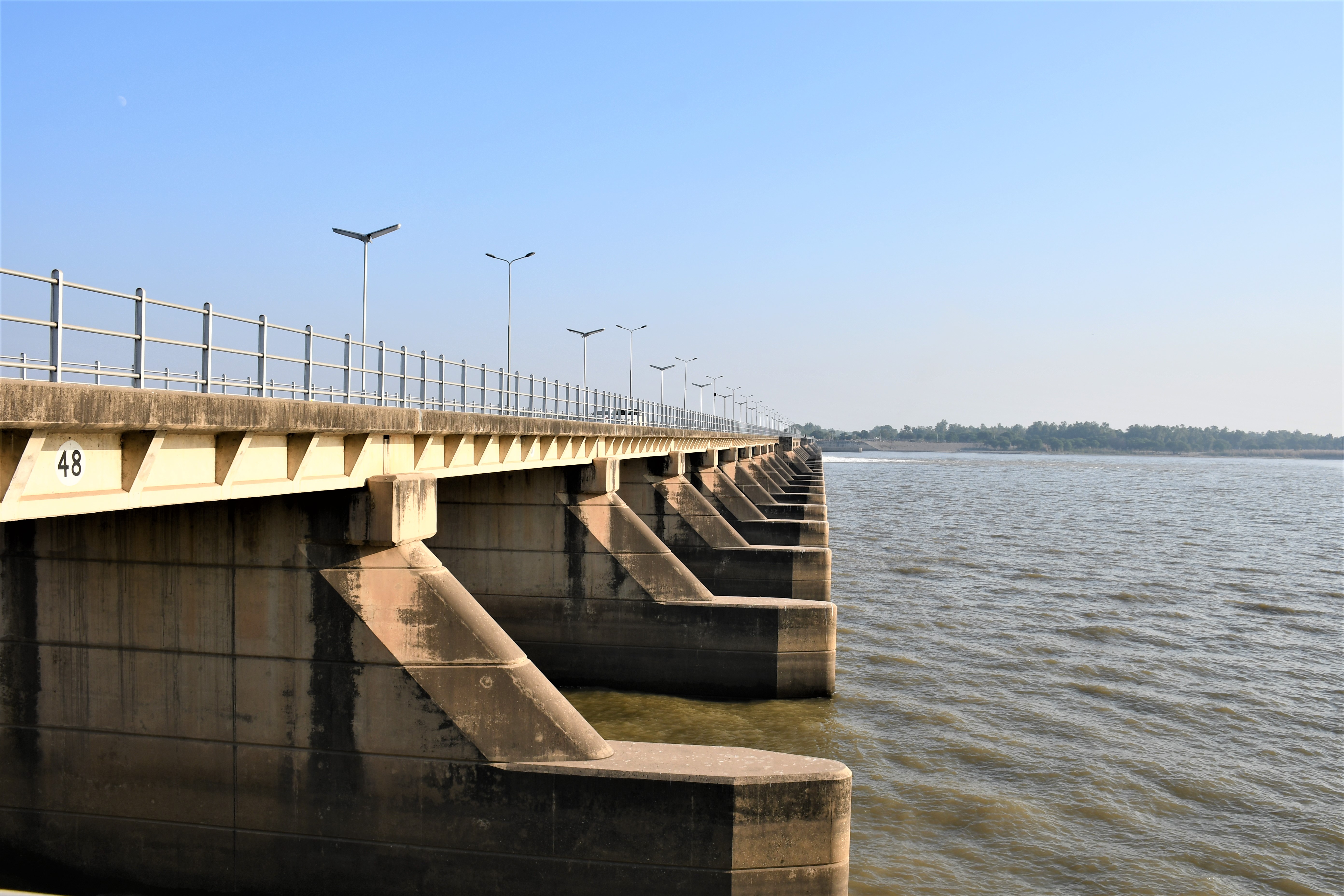
- Rasul Barrage
- Gurudwara Bhai Bannu at Mangat, Distt Mandi Bahauddin
- Mian Waheed-Uddin Park
- Canal View Public Park
Notes
References
References
- (25 September 2011). "MANDI BAHAUDDIN DISTRICT AT A GLANCE".
- (29 August 2017). "Ten major cities' population up by 74pc (from 1998 to 2017)". Pakistan Today (newspaper).
- "District overview".
- "Mandi Bahauddin".
- (6 January 2009). "History of Pindi-Bahauddin (known as Purrani Pindi)".
- Kaushik Roy, ''India's historic battles: from Alexander the great to Kargil'', Delhi: Permanent Black, 2004, p. 11
- Ruth Sheppard, ''Alexander the Great at War: His Army – His Battles – His Enemies'', Oxford: Osprey Publishing, 2008, p. 206
- (2 August 2007). "Tehsils & Unions in the District of Mandi Bahauddin".
- (August 2025). "Population by administrative units 1951-1998". [[Pakistan Bureau of Statistics]] }}{{Dead link.
- "DISTRICT WISE CENSUS RESULTS CENSUS 2017". pbscensus.gov.pk.
- "CENSUS OF INDIA, 1941 VOLUME VI PUNJAB".
- "Final Results (Census-2017)".
- "Average Rainfall & Temperature in Mandi Bahauddin". World Weather Online website.
- "First Digital Census: Understanding Its Importance and Process - Pakistan Bureau of Statistics population".
- "Mother tongue": defined as the language of communication between parents and children, but still everyone can speak [[Urdu]] language easily.
- (27 March 2007). "Mandi Bahauddin District Information".
- (August 2025). "Medical Departments".
- "Govt Children Hospital".
- "Gurudwara Bhai Bannu at Mangat, District Mandi Bahauddin".
- "Mian Waheed-ud-Din Park (منڈی بهاؤالدین)".
- (10 September 2020). "Renovation and Rehabilitation of Canal View Public Park Mandi Bahauddin".
This article was imported from Wikipedia and is available under the Creative Commons Attribution-ShareAlike 4.0 License. Content has been adapted to SurfDoc format. Original contributors can be found on the article history page.
Ask Mako anything about Mandi Bahauddin — get instant answers, deeper analysis, and related topics.
Research with MakoFree with your Surf account
Create a free account to save articles, ask Mako questions, and organize your research.
Sign up freeThis content may have been generated or modified by AI. CloudSurf Software LLC is not responsible for the accuracy, completeness, or reliability of AI-generated content. Always verify important information from primary sources.
Report