From Surf Wiki (app.surf) — the open knowledge base
Makanza Territory
| Field | Value |
|---|---|
| name | Makanza |
| native_name_lang | |
| settlement_type | Territory |
| mapframe | on |
| mapframe-height | 270 |
| mapframe-point | on |
| mapframe-marker | circle-stroked |
| mapframe-frame-coord | |
| mapframe-zoom | 4 |
| mapframe-geomask | P131 |
| subdivision_type | Country |
| subdivision_name | DR Congo |
| subdivision_type1 | Province |
| subdivision_name1 | Équateur |
| subdivision_type2 | Territory |
| seat | Makanza |
| unit_pref | Metric |
| area_footnotes | |
| area_total_km2 | 7,570 |
| population_footnotes | |
| population_total | 250,549 |
| population_density_km2 | auto |
| timezone1 | West Africa Time |
| utc_offset1 | +1 |
| website |
| mapframe-height = 270
| mapframe-point = on
| mapframe-marker = circle-stroked
| mapframe-frame-coord =
| mapframe-zoom = 4
| mapframe-geomask = P131
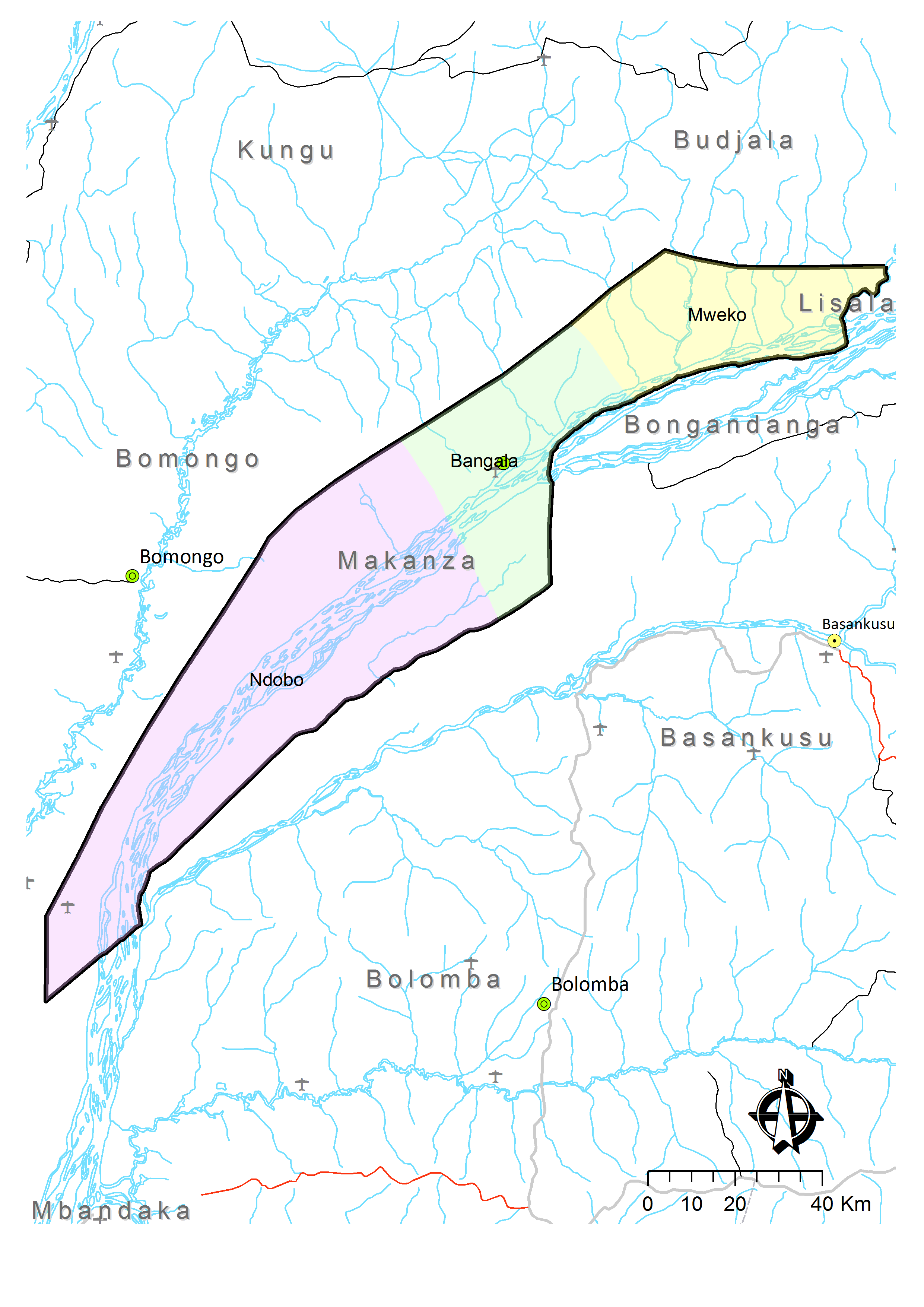
Makanza or Mankanza Territory is an administrative area in Équateur Province in the Democratic Republic of the Congo. It lies along the main channel of the Congo River. Headquarters for the territory is the town of Makanza. The territory was created by presidential order on 6 October 1976.
In the early 21st century, bandits operated in the area.
Climate
The average temperature is between 23° and 25°C. The average annual rainfall is between 1700 mm and 1900 mm.
Administrative divisions
In addition to the town of Makanza, officially a commune, the territory is divided into three sectors: :Bangala, with four groupings (groupements) of 34 villages; :Mweko, with two groupings (groupements) of 21 villages; :Ndobo, with four groupings (groupements) of 17 villages.
Towns
The main towns are:
- Bolombo
- Mabanga
- Makanza, HQ
- Malele
- Malundja
- Mobeka
- Lusenge
References
- "Cellule d'Analyses des Indicateurs de Développement".
- Kyalangilwa, Joseph M.. (22 January 2007). "Nouvelles entités provinciales".
- "Administrative Zones of the Democratic Republic of Congo (Congo Kinshasa)". Statoids.
- (6 October 1976). "Portant création de la zone de Makanza dans la sous-région de l'Équateur, région de l'Équateur, Ordonnance Présidentielle n°76-295".
- (21 April 2010). "Makanza: des bandits armés attaquent trois bateaux". Radio Okapi.
- "Territoire de Makanza: Données géographiques". Cellule d'Analyses des Indicateurs de Développement (CAID).
- "Territoire de Makanza: Carte administrative". Cellule d'Analyses des Indicateurs de Développement (CAID).
This article was imported from Wikipedia and is available under the Creative Commons Attribution-ShareAlike 4.0 License. Content has been adapted to SurfDoc format. Original contributors can be found on the article history page.
Ask Mako anything about Makanza Territory — get instant answers, deeper analysis, and related topics.
Research with MakoFree with your Surf account
Create a free account to save articles, ask Mako questions, and organize your research.
Sign up freeThis content may have been generated or modified by AI. CloudSurf Software LLC is not responsible for the accuracy, completeness, or reliability of AI-generated content. Always verify important information from primary sources.
Report