From Surf Wiki (app.surf) — the open knowledge base
Madera County, California
County in California, United States
County in California, United States
| Field | Value |
|---|---|
| name | Madera County |
| settlement_type | County |
| image_skyline | {{multiple image |
| total_width | 280 |
| border | infobox |
| perrow | 1/2/2/1 |
| caption_align | center |
| image1 | Mt_Banner_and_Thousand_Island_Lake.jpg |
| caption1 | Banner Peak in Sierra National Forest |
| image2 | Madera County Courthouse - rear view.JPG |
| caption2 | Madera |
| image3 | Devils_Postpile_National_Monument_near_Mammoth_Lakes.jpg |
| caption3 | Devils Postpile |
| image4 | WV banner Madera County Landscape near Chowchilla (cropped).jpg |
| caption4 | Chowchilla |
| image5 | Bass Lake California Duceys on the Lake.jpg |
| caption5 | Bass Lake |
| image6 | Millerton Lake 1 (cropped).jpg |
| caption6 | Millerton Lake |
| image_flag | Flag of Madera County, California.png |
| image_seal | 2018 Madera County Logo.png |
| named_for | Spanish word meaning "wood" |
| subdivision_type | Country |
| subdivision_name | United States |
| subdivision_type1 | State |
| subdivision_name1 | California |
| subdivision_type2 | Regions |
| subdivision_name2 | San Joaquin Valley & Sierra Nevada |
| subdivision_type3 | Metropolitan area |
| subdivision_name3 | Metropolitan Fresno |
| seat_type | County seat |
| seat | Madera |
| seat1_type | Largest city |
| seat1 | Madera |
| unit_pref | US |
| area_total_sq_mi | 2153 |
| area_land_sq_mi | 2137 |
| area_water_sq_mi | 16 |
| elevation_max_ft | 13143 |
| population_as_of | 2020 |
| population_total | 156255 |
| population_density_sq_mi | auto |
| demographics_type2 | GDP |
| demographics2_footnotes | |
| demographics2_title1 | Total |
| demographics2_info1 | $7.738 billion (2022) |
| established_title | Incorporated |
| established_date | 1893 |
| government_type | Council–CAO |
| governing_body | Board of Supervisors |
| leader_title1 | Chair |
| leader_name1 | Leticia Gonzalez |
| leader_title2 | Chair Pro Tem |
| leader_name2 | Robert Macaulay |
| leader_title3 | Board of Supervisors |
| leader_name3 | {{Collapsible list |
| title | Supervisors |
| frame_style | border:none; padding:0; |
| list_style | text-align:left; |
| 1 | Jordon Wamhoff |
| 2 | David Rogers |
| 3 | Robert L Poythress |
| 4 | Leticia Gonzalez |
| 5 | Robert Macaulay |
| leader_title4 | County Administrative Officer |
| leader_name4 | Jay Varney |
| timezone | Pacific Time Zone |
| utc_offset | −8 |
| timezone_DST | Pacific Daylight Time |
| utc_offset_DST | −7 |
| postal_code_type | |
| image_map | |
| map_caption | Interactive map of Madera County |
| image_map1 | Map of California highlighting Madera County.svg |
| mapsize1 | 200px |
| map_caption1 | Location in the state of California |
| blank_name_sec1 | FIPS code |
| blank_info_sec1 | 06-039 |
| blank1_name_sec1 | GNIS feature ID |
| blank1_info_sec1 | |
| blank2_name_sec1 | Congressional districts |
| blank2_info_sec1 | 5th, 13th |
| website |
Madera County (; Madera, Spanish for "Wood"), officially the County of Madera, is a county located at the geographic center of the U.S. state of California. It features a varied landscape, encompassing the eastern San Joaquin Valley and the central Sierra Nevada, with Madera serving as the county seat. Established in 1893 from part of Fresno County, Madera County reported a population of 156,255 in the 2020 census.
The name Madera is Spanish for "wood," a reference to the county’s early lumber industry.{{cite news |title=How Counties In State Got Their Names |url=https://cdnc.ucr.edu/?a=d&d=SAJ19351021.2.122&srpos=6&e=-------en--20--1--txt-txIN-madera+county+name+origin-------
According to the United States Census Bureau, 59.6% of Madera County’s population identifies as Hispanic or Latino, and 20.3% of residents are foreign-born, both above the national averages. Nearly half of the county’s residents speak a language other than English at home. The area also has a significant Native American population, and its history includes immigration and migration dating back to the California Gold Rush.
Etymology
Madera is the Spanish term for wood. The county derives its name from the town of Madera, named when the California Lumber Company built a log flume to carry lumber to the Central Pacific Railroad there in 1876.
History
Madera County was formed in 1893 from Fresno County during a special election held in Fresno on May 16, 1893. Citizens residing in the area that was to become Madera County voted 1,179 to 358 for separation from Fresno County and the establishment of Madera County.
The Madera County Sheriff's Department employed the first woman in California to die in the line of duty as a sworn law enforcement officer—Tulare native Lucille Helm (1914–1959). For 15 years, the Madera housewife and mother of four worked on call as a "matron" assisting with female transfers.
Human history
Native People
.jpg)
The region now known as Madera County was historically inhabited by the Mono, Chukchansi, and Miwok. The Mono lived along the upper San Joaquin River, including areas near North Fork and Crane Valley. The Chukchansi occupied lands around present-day Oakhurst, Coarsegold, Ahwahnee, and the lower foothills of the San Joaquin Valley. The Miwok lived in the areas of Ahwahnee, Wawona, Mariposa, and the Yosemite Valley.
Following the California Gold Rush, many Native American communities were displaced during events such as the Mariposa War and by the Act for the Government and Protection of Indians.{{cite book |last=Freeman |first=Marcia Penner |date=2013 |title=Willow Creek History: Tales of Cow Camps, Shake Makers & Basket Weavers |url=https://www.arcadiapublishing.com/
Immigration and Migration
Early United States Era
Following the Mexican–American War, the region retained a significant population of residents of Mexican descent.{{cite web |last1=Nateras |first1=Myrna Martínez |last2=Stanley |first2=Eduardo |title=Latino Immigrant Civic and Political Participation in Fresno and Madera, California |url=https://www.wilsoncenter.org/sites/default/files/media/documents/publication/Fresno%20Eng.pdf
20th century
In the 1930s, Madera County received significant numbers of refugees from the Dust Bowl, particularly from Oklahoma and Arkansas.{{cite web |title=Dust Bowl Refugees in Madera |url=https://maderamethod.com/dust-bowl-refugees-in-madera/
During the mid-20th century, the Bracero Program brought agricultural laborers from Mexico to address shortages during World War II and the Korean War. The Madera County Chamber of Commerce supported extending the program, which ended in 1964.{{cite news |title=Mexican Labor Slated To Arrive In August |url=https://cdnc.ucr.edu/?a=d&d=MT19510302.2.17&srpos=4&e=-------en--20--1--txt-txIN-%22madera%22+Mexican+immigrants-------1
Geography
.jpg)
Madera County includes portions of the San Joaquin Valley, the Sierra Nevada foothills, and the Sierra Nevada mountains. Part of Yosemite National Park lies within the county. Major waterways include sections of the San Joaquin River and several reservoirs.
The county has a total area of 2153 sqmi, of which 2137 sqmi is land and 16 sqmi, or 0.8 percent, is water. The highest point is Mount Ritter, at 13149 ft.
Climate ranges from arid in the valley to alpine in the higher elevations of the Sierra Nevada.
Madera County is part of the Madera AVA wine region.
National protected areas
- Devils Postpile National Monument
- Inyo National Forest (part)
- Sierra National Forest (part)
- Yosemite National Park (part)
Demographics
|align-fn=center 1790–1960 1900–1990 1990–2000 2010 2020
2020 Census
As of the 2020 census, the county had a population of 156,255 and a median age of 35.0 years; 27.5 percent of residents were under the age of 18 and 14.7 percent were 65 years of age or older. For every 100 females there were 99.4 males, and for every 100 females age 18 and over there were 98.0 males age 18 and over.
The racial makeup of the county was 41.8% White, 2.9% Black or African American, 4.9% American Indian and Alaska Native, 2.5% Asian, 0.1% Native Hawaiian and Pacific Islander, 31.6% from some other race, and 16.2% from two or more races. Hispanic or Latino residents of any race comprised 59.6% of the population.
61.4% of residents lived in urban areas, while 38.6 percent lived in rural areas.
There were 45,607 households in the county, of which 42.6 percent had children under the age of 18 living with them and 23.5 percent had a female householder with no spouse or partner present. About 17.2 percent of all households were made up of individuals and 9.3 percent had someone living alone who was 65 years of age or older.
There were 49,572 housing units, of which 8.0 percent were vacant. Among occupied housing units, 64.0 percent were owner-occupied and 36.0 percent were renter-occupied. The homeowner vacancy rate was 1.4 percent and the rental vacancy rate was 3.1 percent.
2022 American Community Survey
According to the 2022 American Community Survey 1-Year Estimates, the county’s median household income was $76,920, compared to $91,551 for California and $69,717 nationally, and the poverty rate was 24.3 percent, higher than the state average of 12.2 percent and the national average of 22.0 percent.{{cite web |title=2022 American Community Survey 1-Year Estimates |url=https://data.census.gov/profile/Madera_County,_California?g=050XX00US06039 The homeownership rate was 69.0 percent, compared with 55.8 percent statewide, and median gross rent was $1,189, below the California average of $1,870. Educational attainment was below the state average, with 21.4 percent of residents holding a bachelor’s degree or higher. In 2022, 59.6 percent of residents identified as Hispanic or Latino, 20.3 percent of the population was foreign-born, and about 46.5 percent reported speaking a language other than English at home.
Immigration estimates
Estimates place the number of undocumented immigrants in the county between 12,500 and 15,000.{{cite web |url=https://www.ppic.org/wp-content/uploads/content/pubs/jtf/JTF_UndocumentedImmigrantsJTF.pdf |access-date=February 3, 2024}}
Racial and ethnic composition
The following table presents racial and ethnic composition across multiple decennial censuses.
| Race / Ethnicity (NH = Non-Hispanic) | Pop 1980 | Pop 1990 | title=P004: Hispanic or Latino, and Not Hispanic or Latino by Race – 2000: DEC Summary File 1 – Madera County, California | url=https://data.census.gov/table?g=050XX00US06039&tid=DECENNIALSF12000.P004 | website=United States Census Bureau | access-date= }} | title=P2: Hispanic or Latino, and Not Hispanic or Latino by Race – 2010: DEC Redistricting Data (PL 94-171) – Madera County, California | url=https://data.census.gov/cedsci/table?q=p2&g=050XX00US06039&tid=DECENNIALPL2010.P2 | website=United States Census Bureau | access-date= }} | Pop 2020 | % 1980 | % 1990 | % 2000 | % 2010 | % 2020 |
|---|---|---|---|---|---|---|---|---|---|---|---|---|---|---|---|---|
| White alone (NH) | 42,136 | 52,974 | 57,391 | 57,380 | 48,399 | 66.76% | 60.14% | 46.62% | 38.03% | 30.97% | ||||||
| Black or African American alone (NH) | 2,072 | 2,294 | 4,710 | 5,009 | 4,131 | 3.28% | 2.60% | 3.83% | 3.32% | 2.64% | ||||||
| Native American or Alaska Native alone (NH) | 1,045 | 1,165 | 1,694 | 1,790 | 1,738 | 1.66% | 1.32% | 1.38% | 1.19% | 1.11% | ||||||
| Asian alone (NH) | 625 | 1,084 | 1,480 | 2,533 | 3,581 | 0.99% | 1.23% | 1.20% | 1.68% | 2.29% | ||||||
| Native Hawaiian or Pacific Islander alone (NH) | x | x | 160 | 107 | 122 | 0.13% | 0.07% | 0.13% | 0.07% | 0.08% | ||||||
| Other race alone (NH) | 322 | 173 | 287 | 649 | 723 | 0.51% | 0.20% | 0.23% | 0.43% | 0.46% | ||||||
| Mixed race or Multiracial (NH) | x | x | 2,872 | 2,405 | 4,383 | x | x | 2.33% | 1.59% | 2.81% | ||||||
| Hispanic or Latino (any race) | 16,916 | 30,400 | 54,515 | 80,992 | 93,178 | 26.80% | 34.51% | 44.28% | 53.69% | 59.63% | ||||||
| Total | 63,116 | 88,090 | 123,109 | 150,865 | 156,255 | 100.00% | 100.00% | 100.00% | 100.00% | 100.00% |
| Place | Total Population | Bachelors Degree or Higher (%) | Total Housing Units | Total Households | Median Household Income | Employment Rate (%) | Without Health Care Coverage (%) |
|---|---|---|---|---|---|---|---|
| Ahwahnee | 2,296 | 30.3 | 1,000 | 785 | $79,250 | 45.6 | 2.8 |
| Bass Lake | 575 | 59.9 | 868 | 139 | $145,083 | 38.8 | 12.6 |
| Chowchilla | 23,377 | 13 | 5,765 | 5,399 | $69,139 | 37.7 | 8.2 |
| Coarsegold | 4,144 | 22.7 | 1,837 | 1,738 | $81,814 | 49.8 | 4.9 |
| Fairmead | 1,235 | 9.5 | 374 | 394 | $53,203 | 45.3 | 10.1 |
| La Vina | 637 | 0 | 161 | 157 | 43.4 | 2.6 | |
| Madera | 97,838 | 13.2 | 27,454 | 25,497 | $70,272 | 54 | 8.2 |
| Madera Acres | 9,162 | 11.4 | 2,554 | 2,599 | $80,221 | 51.3 | 6.8 |
| Madera Ranchos | 24.6 | 3,010 | $82,292 | 53.1 | 4.0 | ||
| Nippinawasse | 434 | 0 | 188 | 172 | $71,622 | 44.9 | 27.6 |
| Oakhurst | 5,945 | 29.4 | 3,134 | 2,180 | $73,333 | 53.3 | 6.2 |
| Parksdale | 3,234 | 7.4 | 784 | 611 | $45,281 | 43.8 | 8.9 |
| Yosemite Lakes | 5,022 | 36.6 | 2,153 | 1,909 | $99,491 | 53.6 | 6.4 |
Economy
19th and 20th century

Gold
Gold mining in Madera County began during the California Gold Rush. When the county was created in 1893 from a portion of Fresno County, it included many of the region’s productive mines. These were located along the contact between the Sierra Nevada batholith and older schist and slate formations, extending from Grub Gulch to Hildreth.{{cite web |last1=Koschmann |first1=A. H. |last2=Bergendahl |first2=M. H. |title=Madera County California Gold Production |year=1968 |publisher=USGS |url=https://westernmininghistory.com/library/39/page1/ |access-date=}}
Grub Gulch developed in the late 19th century as a mining settlement near present-day Highway 49. At its peak, the town supported several businesses, including saloons, a general store, a post office, and a boarding house.{{cite news |title=Monument Requested For Once Roaring Grub Gulch |url=https://cdnc.ucr.edu/?a=d&d=MT19660405.2.131&e=-------en--20--1--txt-txIN--------
By the 1950s, production had declined to dredging operations along the Fresno, Chowchilla, and San Joaquin Rivers, with little activity after 1959.
Tungsten
In the mid-20th century, tungsten was mined in Madera County’s High Sierra near Mammoth Lakes, Central Camp, and Fish Camp. The Strawberry Tungsten Mine was valued at $1 million in 1955 and by 1981 had the capacity to process 310 metric tons of ore daily.{{cite news |title=Plans Told To Reopen Local Mine |url=https://cdnc.ucr.edu/?a=d&d=MT19650416.2.3&srpos=1&e=------196-en--20--1--txt-txIN-%22strawberry+tungsten+mine%22-------
Mining in the region declined in the 1980s due to lower tungsten prices and competition from imports, particularly from China. Tungsten production in Madera County and the Sierra Nevada has since ceased.{{cite book |last1=Carroll |first1=Thomas R. |last2=Schmeda |first2=German |last3=Karl |first3=Nick A |last4=Burger |first4=Meredith H. |last5=Long |first5=Keith R |last6=Reyes |first6=Tyler A |title=Tungsten Deposits in the United States |chapter=Mineralogy |year=2020 |publisher=USGS |chapter-url=https://www.usgs.gov/data/tungsten-deposits-united-states
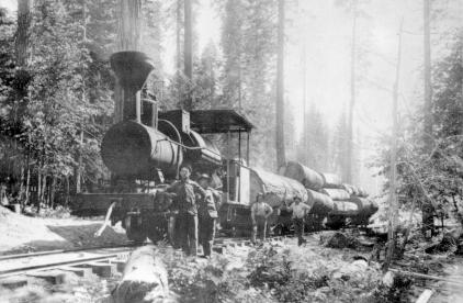
Lumber

|archive-url=https://web.archive.org/web/20240128004932/https://www.fs.usda.gov/Internet/FSE_DOCUMENTS/stelprdb5304587.pdf |url-status=dead |archive-date=January 28, 2024 |title=A Sawmill History of the Sierra National Forest 1852-1940 |author=Ben Hurt |publisher=Sierra National Forest |access-date=January 21, 2024}} In 1854, Charles Converse and Bill Chitister relocated the mill to Crane Valley, now Bass Lake.
In 1872, the California Lumber Company established a steam mill near Nelder Grove and constructed a 65 mi log flume to transport lumber to Madera. The company was reorganized in 1874 and operated for several decades.
Logging operations in the county declined during the Great Depression. Activity resumed in 1941 with the opening of a new sawmill in North Fork, which used trucks and modern equipment to reach deeper areas of the Sierra National Forest. The industry contracted again in the early 1990s due to federal regulations that reduced timber harvests. The North Fork mill closed in February 1994.
The North Fork Loggers Jamboree is held annually to commemorate the county’s logging history.
21st century
Employment
Madera County's employment sectors are a blend of traditional industries like farming and manufacturing, coupled hospitality and service-oriented fields. Based on the average employment percentages from 2015 to 2022, the employment sectors in Madera County are ranked as follows:
| Sector | Employment Share |
|---|---|
| Government | 12.71% |
| Farm | 12.08% |
| Health & Education | 11.08% |
| Wholesale & Retail Trade | 5.45% |
| Leisure | 4.26% |
| Professional Services | 3.63% |
| Manufacturing | 3.31% |
| Construction | 2.14% |
| Transportation and Utilities | 1.44% |
| Financial Activities | 0.71% |
| Information | 0.30% |
The sectors that saw the largest decrease in the period were information (-25%), financial activities (-12.50%) and manufacturing (-5.71%). Looking towards the future, Government, Health and Education and Professional Sectors are forecast to be the fastest growing employment sectors.
Agriculture
Agriculture is a major sector of Madera County’s economy. In 2022, the county’s gross crop value was reported at $1.9 billion.{{cite web |title=County Agriculture Stats |url=https://maderafb.com/county-agriculture-stats/
Madera County ranked first in California for fig production, and fourth statewide in almonds, pistachios, and grapes (primarily raisin varieties).{{cite web |title=County Agriculture Stats |url=https://maderafb.com/county-agriculture-stats/
| Commodity | 2022 Rank | 2022 Dollar Value | 2021 Rank |
|---|---|---|---|
| Almonds, Nuts & Hulls | 1 | $570,739,000 | 1 |
| Milk | 2 | $454,727,000 | 2 |
| Grapes | 3 | $233,893,000 | 3 |
| Pistachios | 4 | $227,873,000 | 4 |
| Pollination | 5 | $66,880,000 | 5 |
| Cattle & Calves | 6 | $62,317,000 | 6 |
| Mandarins & Tangerines | 7 | $45,036,000 | 7 |
| Corn Silage | 8 | $37,293,000 | 9 |
| Replacement Heifers | 9 | $34,255,000 | 8 |
| Alfalfa, Hay & Silage* | 10 | $26,845,000 | ** |
In the 1990s Mixtec farmworkers were a large presence in the southern part of the state, and were beginning to filter northwards here along with other Mexican indigenous agricultural laborers to work in the county's farms.
Education
Madera County is mostly covered by the State Center Community College District centered on Fresno City College in Fresno. Other districts with territory within Madera County also include the West Hills Community College District and the Merced Community College District.
School districts include:
Unified:
- Chawanakee Unified School District
- Firebaugh-Las Deltas Unified School District
- Golden Valley Unified School District
- Madera Unified School District
- Yosemite Unified School District - Includes some sections zoned for K-12 and some for grades 9–12 only
Secondary:
- Chowchilla Union High School District
Elementary:
- Alview-Dairyland Union Elementary School District
- Bass Lake Joint Union Elementary School District
- Chowchilla Elementary School District
- Raymond-Knowles Union Elementary School District
Government, policing, and politics
Government
The government of Madera County is mandated by the California Constitution to have a five-member Board of Supervisors elected to staggered four-year terms. The Board of Supervisors: District 1, Jordan Wamhoff; District 2, David Rogers; District 3, Robert Poythress; District 4, Leticia Gonzalez; District 5, Robert Macaulay; and County Administrator, Jay Varney; and staff provide for voter registration and elections, law enforcement, jails, vital records, property records, tax collection, public health, roads, and social services for the entire county. It is the local government for all unincorporated areas. Other elected offices include the Sheriff, Tyson Pogue; District Attorney, Sally Orme Moreno; Assessor, Brian Glover (acting); Auditor-Controller, David Richstone; Treasurer-Tax Collector, Tracy Kennedy; and Clerk/Registrar of Voters-Recorder, Rebecca Martinez.
Policing
Madera County Sheriff's Office
The Sheriff's Office and staff provide court protection, jail administration, and coroner service for all of Madera County with its total population of approximately 156,000 residents. The Sheriff provides police patrol and detective services to the unincorporated areas of the county, which contain approximately 70,000 residents, or 45% of Madera County's total population. The Sheriff's main station and offices are in the City of Madera. There are two Sheriff's substations: Oakhurst, population 3,000, and The Madera Ranchos, population 12,000, both on Highway 41 to Yosemite National Park in the Sierras.
Municipal police departments
The municipal police departments within Madera County are Madera, the county seat, population 62,000, and Chowchilla, population 19,600.
Correctional Facilities
Madera County has three correctional facilities. The first is the Madera County Jail, managed by the elected Sheriff. The second, Valley State Prison, is a state-run prison located in Chowchilla. The third, the Central California Women's Facility, is also in Chowchilla, across from Valley State Prison. Inmates are counted in the county's census population.
Politics
Voter registration
| Population and registered voters | Total population | Registered votersPercentage of registered voters with respect to total population. Percentages of party members with respect to registered voters follow. | Democratic | Republican | Democratic–Republican spread | Independent | Green | Libertarian | Peace and Freedom | Americans Elect | Other | No party preference |
|---|---|---|---|---|---|---|---|---|---|---|---|---|
| 149,611 | ||||||||||||
| 53,782 | 35.9% | |||||||||||
| 18,212 | 33.9% | |||||||||||
| 23,858 | 44.4% | |||||||||||
| -5,646 | -10.5% | |||||||||||
| 1,615 | 3.0% | |||||||||||
| 208 | 0.4% | |||||||||||
| 264 | 0.5% | |||||||||||
| 131 | 0.2% | |||||||||||
| 0 | 0.0% | |||||||||||
| 191 | 0.4% | |||||||||||
| 9,303 | 17.3% |
Cities by population and voter registration
| Cities by population and voter registration | City | Population | Registered voters | |||||
|---|---|---|---|---|---|---|---|---|
| Democratic | Republican | D–R spread | Other | No party preference | ||||
| Chowchilla | 18,465 | 22.5% | 30.8% | 45.1% | -14.3% | 9.0% | 18.8% | |
| Madera | 60,221 | 26.8% | 44.9% | 33.1% | +11.8% | 6.2% | 18.4% |
Overview
Madera is a strongly Republican county in presidential and congressional elections. The last Democrat to win a majority in the county was Jimmy Carter in 1976.
Madera is split between the 5th and 13th congressional districts,{{Cite web | access-date = September 24, 2014 | archive-url = https://web.archive.org/web/20130930184128/http://wedrawthelines.ca.gov/downloads/meeting_handouts_072011/handouts_20110729_q2_cd_finaldraft_splits.zip | archive-date = September 30, 2013 | url-status = dead
With respect to the California State Assembly, the county is split between , and .
In the California State Senate, Madera is split between , and .
On November 4, 2008, Madera County voted 73.4% for Proposition 8, which amended the California Constitution to define marriage as a union between one man and one woman.
The county is one of three counties in California to establish a separate department to deal with corrections, pursuant to California Government Code §23013, the Madera County Department of Corrections, along with Napa County and Santa Clara County. The officers receive their powers under 831 and 831.5 of the California Penal Code.
Crime
The following table includes the number of incidents reported and the rate per 1,000 persons for each type of offense.
| Population and crime rates | Population | Violent crime | Homicide | Forcible rape | Robbery | Aggravated assault | Property crime | Burglary | Larceny-theft | Motor vehicle theft | Arson |
|---|---|---|---|---|---|---|---|---|---|---|---|
| 149,611 | |||||||||||
| 685 | 4.58 | ||||||||||
| 3 | 0.02 | ||||||||||
| 36 | 0.24 | ||||||||||
| 162 | 1.08 | ||||||||||
| 484 | 3.24 | ||||||||||
| 2,144 | 14.33 | ||||||||||
| 1,166 | 7.79 | ||||||||||
| 1,484 | 9.92 | ||||||||||
| 520 | 3.48 | ||||||||||
| 18 | 0.12 |
Cities by population and crime rates
| Cities by population and crime rates | City | Population | Violent crimes | Violent crime rate | ||
|---|---|---|---|---|---|---|
| per 1,000 persons | Property crimes | Property crime rate | ||||
| per 1,000 persons | ||||||
| Chowchilla | 19,221 | 115 | 5.98 | 446 | 23.20 | |
| Madera | 62,796 | 466 | 7.42 | 1,621 | 25.81 |
Attractions
- Bass Lake
- The Balls
- Chukchansi Gold Resort & Casino
- Corlieu Falls
- Ducey's Bass Lake Lodge
- The Forks Resort
- Fresno Dome
- Hensley Lake
- Mammoth Pool Reservoir
- Madera AVA
- Nelder Grove
- The Pines Resort
- Mount Ritter
- Shuteye Peak
- Sierra Vista Scenic Byway
- Willow Creek
- Yosemite National Park
Transportation
Major highways
- [[File:California 41.svg|25px|link= |alt=]] State Route 41
- [[File:California 49.svg|25px|link= |alt=]] State Route 49
- [[File:California 99.svg|25px|link= |alt=]] State Route 99
- [[File:California 145.svg|25px|link= |alt=]] State Route 145
- [[File:California 152.svg|25px|link= |alt=]] State Route 152
- [[File:California 233.svg|25px|link= |alt=]] State Route 233
Areas Inaccessible by Road

A gap of less than 10 mi separates the end of Minaret Road, extending northeast from North Fork, from the terminus of Red’s Meadow Road in the Eastern Sierra. In the 20th century, proposals were advanced to link the San Joaquin Valley and the Eastern Sierra by highway or tunnel across Minaret Summit. To preserve the option for such a project, an area southwest of the summit was excluded from the Wilderness Act of 1964.
In the 1970s, Governor Ronald Reagan opposed the highway proposal after visiting the region. The area was later designated as wilderness under the California Wilderness Act of 1984.{{cite news |last=Skelton |first=George |date=1997-07-28 |title=The Man in the White Hat Who Saved the Sierra |url=https://www.latimes.com/archives/la-xpm-1997-jul-28-mn-17071-story.html
Public transportation
- Madera County Connection provides service between the cities of Madera and Chowchilla. Routes also run to eastern Madera County. A connection to Fresno can be made at Valley Children's Hospital near the county line.
- The cities of Madera and Chowchilla also have their own local, intracity transit services named Madera Metro and Chowchilla Area Transit, respectively.
- Greyhound buses and Amtrak trains stop in Madera
Airports
- Madera Municipal Airport and Chowchilla Airport are general aviation airports.
Communities

Cities
- Chowchilla
- Madera (county seat)
Census-designated places
- Ahwahnee
- Bass Lake
- Bonadelle Ranchos
- Coarsegold
- Fairmead
- La Vina
- Madera Acres
- Madera Ranchos
- Nipinnawasee
- North Fork
- Oakhurst
- Parksdale
- Parkwood
- Rolling Hills
- Yosemite Lakes
Unincorporated communities
- Knowles
- O'Neals
- Raymond
- Ripperdan
- Sugar Pine
- Sumner Hill
Population ranking
The population ranking of the following table is based on the 2010 census of Madera County.
† county seat
| Rank | City/Town/etc. | Municipal type | Population (2010 Census) |
|---|---|---|---|
| 1 | † Madera | City | 61,416 |
| 2 | Chowchilla | City | 18,720 |
| 3 | Madera Acres | CDP | 9,163 |
| 4 | Bonadelle Ranchos-Madera Ranchos | CDP | 8,569 |
| 5 | Yosemite Lakes | CDP | 4,952 |
| 6 | Oakhurst | CDP | 2,829 |
| 7 | Parksdale | CDP | 2,621 |
| 8 | Parkwood | CDP | 2,268 |
| 9 | Ahwahnee | CDP | 2,246 |
| 10 | Coarsegold | CDP | 1,840 |
| 11 | Fairmead | CDP | 1,447 |
| 12 | Rolling Hills | CDP | 742 |
| 13 | Bass Lake | CDP | 527 |
| 14 | Nipinnawasee | CDP | 475 |
| 15 | La Vina | CDP | 279 |
| 16 | Picayune Rancheria (Chukchansi Indians) | AIAN | 69 |
| 17 | Northfork Rancheria (Mono Indians) | AIAN | 60 |
Notes
References
References
- "Total Gross Domestic Product for Madera, CA (MSA)". [[Federal Reserve Bank of St. Louis]].
- "Board of Supervisors | Madera County".
- "California Geography". NETSTATE.
- "Find a County". National Association of Counties.
- "Madera County, California".
- Madera County, [http://www.madera-county.com/history/index.html County History] {{webarchive. link. (January 30, 2009 . Accessed 2009.10.09.)
- {{California's Geographic Names. 798
- Madera County GenWeb, [http://cagenweb.com/madera/MadHistory.html Madera County History]. Accessed 2017.09.01.
- "Memorial for law agents," [http://www.maderatribune.com The Madera Tribune], May 13, 2014, Pages A1 and A3
- Barnes, Dwight H.. (2001). "Miners, Lumberjacks and Cowboys: A History of Eastern Madera County". Sierra Historic Sites Association.
- Johnston, Hank. (1968). "Thunder in the Mountains: The Life and Times of Madera Sugar Pine". Stauffer Publishing.
- (August 22, 2012). "2010 Census Gazetteer Files". United States Census Bureau.
- "Annual Estimates of the Resident Population for Counties: April 1, 2020 to July 1, 2024". United States Census Bureau.
- "Census of Population and Housing from 1790-2000". [[US Census Bureau]].
- "Historical Census Browser". University of Virginia Library.
- (March 27, 1995). "Population of Counties by Decennial Census: 1900 to 1990". United States Census Bureau.
- (April 2, 2001). "Census 2000 PHC-T-4. Ranking Tables for Counties: 1990 and 2000". United States Census Bureau.
- (2021). "2020 Decennial Census Demographic Profile (DP1)".
- (2021). "2020 Decennial Census Redistricting Data (Public Law 94-171)".
- (2023). "2020 Decennial Census Demographic and Housing Characteristics (DHC)".
- "California: 1980, General Social and Economic Characteristics, Part 1 - Table 59: Persons by Race, Hispanic Origin, and Sex".
- "California: 1990, Part 1 - Table 5: Race and Hispanic Origin".
- "P004: Hispanic or Latino, and Not Hispanic or Latino by Race – 2000: DEC Summary File 1 – Madera County, California".
- "P2: Hispanic or Latino, and Not Hispanic or Latino by Race – 2010: DEC Redistricting Data (PL 94-171) – Madera County, California".
- "P2: Hispanic or Latino, and Not Hispanic or Latino by Race – 2020: DEC Redistricting Data (PL 94-171) – Madera County, California".
- included in the Asian category in the 1980 Census
- included in the Asian category in the 1990 Census
- not an option in the 1980 Census
- not an option in the 1990 Census
- "Ahwahnee CDP, California - 2020 Decennial Census". United States Census Bureau.
- "Bass Lake CDP, California - 2020 Decennial Census". United States Census Bureau.
- "Chowchilla City, California - 2020 Decennial Census". United States Census Bureau.
- "Coarsegold CDP, California - 2020 Decennial Census". United States Census Bureau.
- "Fairmead CDP, California - 2020 Decennial Census". United States Census Bureau.
- "La Vina CDP, California - 2020 Decennial Census". United States Census Bureau.
- "Madera City, California - 2020 Decennial Census". United States Census Bureau.
- "Madera Acres CDP, California - 2020 Decennial Census". United States Census Bureau.
- "2019 American Community Survey 5-Year Estimates". United States Census Bureau.
- "Oakhurst CDP, California - 2020 Decennial Census". United States Census Bureau.
- "Parksdale CDP, California - 2020 Decennial Census". United States Census Bureau.
- "Yosemite Lakes CDP, California - 2020 Decennial Census". United States Census Bureau.
- (2006). "As We Were Told: An Oral and Written History". Coarsegold Historical Society.
- "Madera County Economic Forecast 2021: Employment Sectors 2015-2021 History, 2022-2050 Forecast".
- "2022 Crop & Livestock Report". Madera County Department of Agriculture.
- "2020 CENSUS - SCHOOL DISTRICT REFERENCE MAP: Madera County, CA". [[U.S. Census Bureau]].
- "Valley State Prison (VSP)". California Department of Corrections and Rehabilitation.
- U.S. Census Bureau. American Community Survey, 2011 American Community Survey 5-Year Estimates, Table B02001. [https://www.census.gov U.S. Census website]. Retrieved October 26, 2013.
- California Secretary of State. [http://www.sos.ca.gov/elections/ror/ror-pages/ror-odd-year-2013/political-sub.pdf February 10, 2013 - Report of Registration] {{webarchive. link. (July 27, 2013 . Retrieved October 31, 2013.)
- Leip, David. "Dave Leip's Atlas of U.S. Presidential Elections".
- {{Cite GovTrack. CA. 4
- "Final Maps {{!}} California Citizens Redistricting Commission".
- Bowen, Debra. (2008). "Statement of Vote November 4th, 2008, General Election". California Secretary of State.
- "California Penal Code - PEN". FindLaw.
- Office of the Attorney General, Department of Justice, State of California. [http://stats.doj.ca.gov/cjsc_stats/prof09/00/11.pdf Table 11: Crimes – 2009] {{webarchive. link. (December 2, 2013 . Retrieved November 14, 2013.)
- Only larceny-theft cases involving property over $400 in value are reported as property crimes.
- United States Department of Justice, Federal Bureau of Investigation. [https://www.fbi.gov/about-us/cjis/ucr/crime-in-the-u.s/2012/crime-in-the-u.s.-2012/tables/8tabledatadecpdf/table-8-state-cuts/table_8_offenses_known_to_law_enforcement_by_california_by_city_2012.xls Crime in the United States, 2012, Table 8 (California)]. Retrieved November 14, 2013.
- [https://www.census.gov/programs-surveys/decennial-census/decade.2010.html 2010 Census]
- [https://www.census.gov/2010census/popmap/ipmtext.php?fl=2775 2010 Census Interactive Population Search]
- [https://www.census.gov/2010census/popmap/ipmtext.php?fl=2495 2010 Census Interactive Population Search]
This article was imported from Wikipedia and is available under the Creative Commons Attribution-ShareAlike 4.0 License. Content has been adapted to SurfDoc format. Original contributors can be found on the article history page.
Ask Mako anything about Madera County, California — get instant answers, deeper analysis, and related topics.
Research with MakoFree with your Surf account
Create a free account to save articles, ask Mako questions, and organize your research.
Sign up freeThis content may have been generated or modified by AI. CloudSurf Software LLC is not responsible for the accuracy, completeness, or reliability of AI-generated content. Always verify important information from primary sources.
Report