From Surf Wiki (app.surf) — the open knowledge base
M7 motorway (Hungary)
Road in Hungary
Road in Hungary
| Field | Value | |||||
|---|---|---|---|---|---|---|
| country | HUN | |||||
| type | M | |||||
| route | 7 | |||||
| map | M7 Autópálya Hungary.png | |||||
| map_notes | [[File:000080 Navy Blue Square.svg | 10px | alt=Map key - blue]] in use [[File:Grey.PNG | 10px | alt=Map key - grey]] other highways | |
| e-road | ||||||
| length_km | 233 | |||||
| established | 1965 | |||||
| history | Completed: 2008 | |||||
| terminus_a | Budapest | |||||
| junction | {{plainlist | 1= | ||||
| *{{jct | country | HUN | M | 1}} in Budaörs | ||
| *{{jct | country | HUN | M | 0}} in Érd | ||
| *{{jct | country | HUN | MR | 81}} in Székesfehérvár-ipari zóna | ||
| *{{jct | country | HUN | MR | 8 | MR | 63}} in Székesfehérvár-dél |
| *{{jct | country | HUN | M | 8}} near Balatonvilágos (planned) | ||
| *{{jct | country | HUN | MR | 71}} in Balatonvilágos | ||
| *{{jct | country | HUN | MR | 65}} in Siófok | ||
| *{{jct | country | HUN | MR | 67}} near Balatonlelle | ||
| *{{jct | country | HUN | MR | 68}} near Balatonkeresztúr | ||
| *{{jct | country | HUN | M | 76}} near Hollád (planned) | ||
| *{{jct | country | HUN | MR | 61}} in Nagykanizsa-kelet | ||
| *{{jct | country | HUN | MR | 74}} in Nagykanizsa-Centrum | ||
| *{{jct | country | HUN | M | 70}} near Letenye | ||
| terminus_b | Letenye | |||||
| border with | ||||||
| counties | Pest, Fejér, Veszprém, Somogy, Zala | |||||
| cities | Budapest, Érd, Székesfehérvár, Siófok, Nagykanizsa |
|e-road =
- in Budaörs
- in Érd
- in Székesfehérvár-ipari zóna
- in Székesfehérvár-dél
- near Balatonvilágos (planned)
- in Balatonvilágos
- in Siófok
- near Balatonlelle
- near Balatonkeresztúr
- near Hollád (planned)
- in Nagykanizsa-kelet
- in Nagykanizsa-Centrum
- near Letenye border with


The M7 motorway () is a Hungarian motorway which runs from Budapest towards the Croatian border at Letenye, reaching Székesfehérvár, then Siófok, a town on Lake Balaton, and the city of Nagykanizsa in the southwest of the country. M7 is the first highway of the country, its first section was opened in 1965.
The motorway connects with the Croatian motorway A4 at Goričan and forms part of the Pan-European corridor Vb, connecting Budapest with Zagreb, the capital of Croatia, and Rijeka, the largest Croatian seaport. Since the completion of the M7 it is possible to travel on motorway from Budapest to the Adriatic Sea, a popular tourist destination for Hungarians.
The last portion of the motorway to the Croatian border, including the Zrinski Bridge on the river Mura, was completed on 22 October 2008. The road's first sections were built in the 1960s and 1970s. The completion of the last sections was undertaken since 2001.
Openings timeline
- Budapest – Budaörs (7 km): 1964 - half profile; (this section was extended 2x3 lane in 1978-79)
- Budaörs – Martonvásár (18 km): 1966 - half profile; (this section was extended in 1972; 2x3 lane in 2001)
- Martonvásár – Velence (15 km): 1967 - half profile; (this section was extended in 1973; 2x3 lane in 2001)
- Martonvásár – Székesfehérvár (12 km): 1968 - half profile; (this section was extended in 1973; 2x3 lane in 2001)
- Székesfehérvár – Balatonaliga (33 km): 1970 - half profile; (this section was extended in 1975)
- Balatonaliga – Zamárdi (22 km): 1971 - half profile; (this section was extended in 2001)
- Zamárdi – Balatonszárszó with Kőröshegy Viaduct (14,2 km): 2007.08.08.
- Balatonszárszó – Ordacsehi (20 km): 2005.06.
- Ordacsehi – Balatonkeresztúr (25,7 km): 2006.03.27.
- Balatonkeresztúr – Zalakomár (21 km): 2008.06.26.
- Zalakomár – Nagykanizsa (15 km): 2008.08.19.
- Nagykanizsa – Sormás (11,3 km): 2007.08.24.
- Sormás (Eszteregnye) – Becsehely (4,5 km): 2006.12.11.
- Becsehely – Letenye (6,5 km): 2004.09.18.
- Letenye (CRO border) with Zrínyi Bridge (800 m): 2008.10.22.
Junctions, exits and rest area
Distance from Zero Kilometre Stone (Adam Clark Square) in Budapest in kilometres.
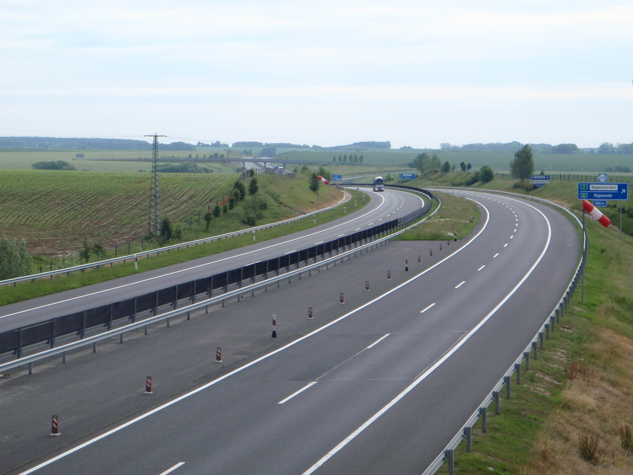
- [[File:Hungary road sign E-016.svg|25px]] The route is full length motorway. The maximum speed limit is 130 km/h, with [[File:2 active lanes and 1 emergency.svg|80px]] (2x2 lane road with stop lane).
| km | Destinations | Route | Notes | ||||||
|---|---|---|---|---|---|---|---|---|---|
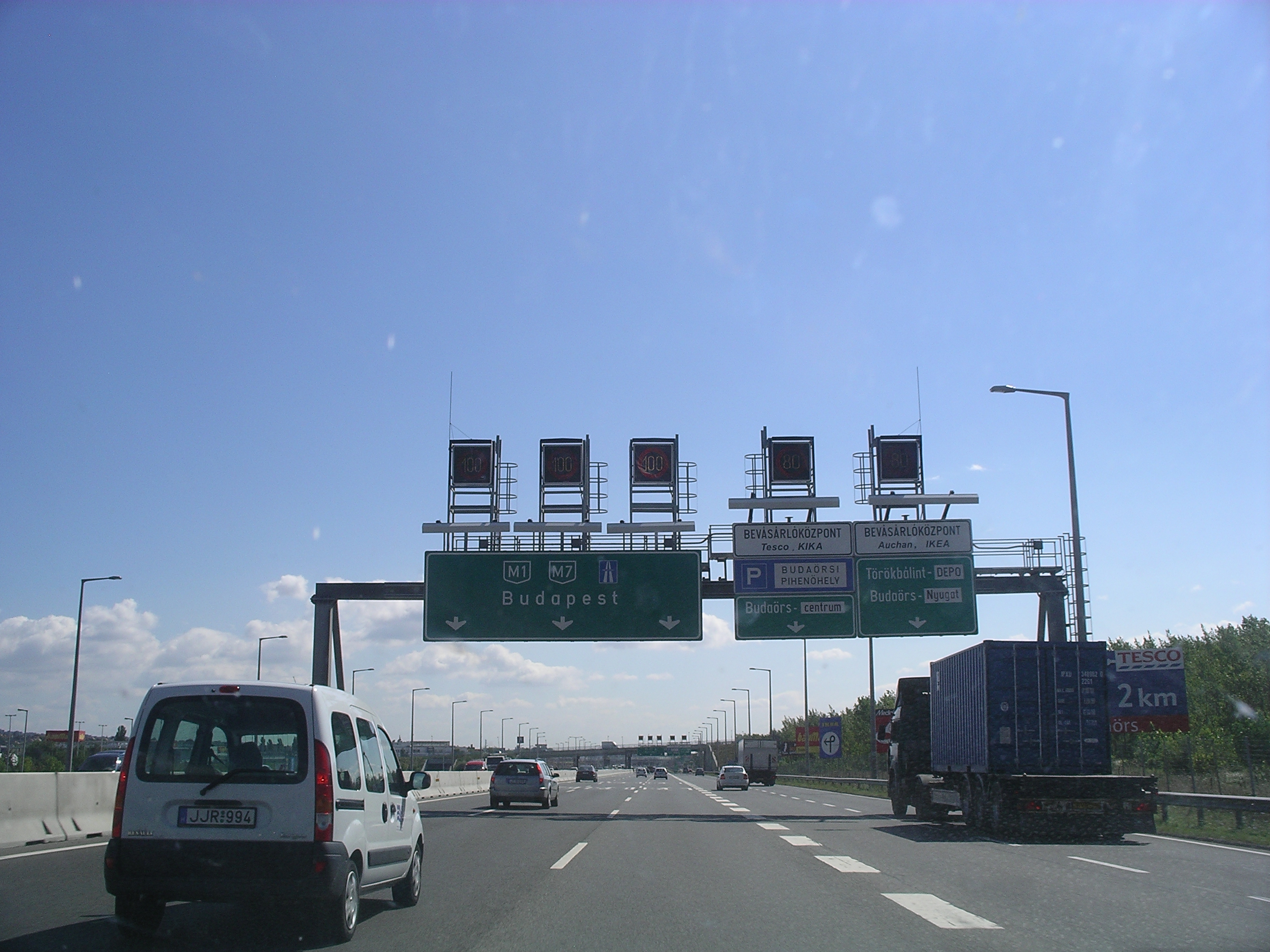
| 6 | [[File:AB-AS-blau.svg | 21px | Exit]] | Budapest, Budaörsi út | |||||
| 7 | [[File:AB-AS-blau.svg | 21px | Exit]] | Budaörs | |||||
| 9 | [[File:AB-AS-blau.svg | 21px | Exit]] | [[File:Pfeil oben.svg | 8px]] Budaörs | ||||
| 10 | [[File:AB-AS-blau.svg | 21px | Exit]] | Budaörs-kelet | |||||
| [[File:Zeichen 314 - Parkplatz, StVO 2013.svg | 18px | Rest area]] Budaörs rest area | |||||||
| 11 | [[File:AB-AS-blau.svg | 21px | Exit]] | Budaörs-nuygat | |||||
| 12 | [[File:AB-Kreuz-blau.svg | 21px | Interchange]] | M7-M1 intersection | |||||
| 14 | [[File:AB-AS-blau.svg | 21px | Exit]] | Törökbálint | |||||
| 16 | [[File:AB-Kreuz-blau.svg | 21px | Interchange]] | Érd-észak | |||||
| (Budapest bypass) | |||||||||
| 18 | [[File:AB-AS-blau.svg | 21px | Exit]] | Érd | |||||
| 19 | [[File:Zeichen 314 - Parkplatz, StVO 2013.svg | 21px | Rest area]] | [[File:Pfeil oben.svg | 8px]] Érd rest area | Parking only on the side leading to Budapest [[File:Hungary road sign F-006.svg | 18px]] [[File:Hungary road sign F-005.svg | 18px]] | |
| 23 | [[File:AB-AS-blau.svg | 21px | Exit]] | Tárnok | |||||
| 26 | [[File:Zeichen 314 - Parkplatz, StVO 2013.svg | 21px | Rest area]] | Tárnok rest area | [[File:Hungary road sign F-016.svg | 18px]] Lukoil / Lukoil + [[File:Hungary road sign F-007.svg | 18px]] [[File:Hungary road sign F-003.svg | 18px]] [[File:Hungary road sign F-014.svg | 18px]] |
| [[File:BSicon STR+GRZq.svg | 18px]] Border of Pest and Fejér Counties | ||||||||
| 30 | [[File:AB-AS-blau.svg | 21px | Exit]] | Martonvásár, Gyúró | |||||
| 33 | [[File:Zeichen 314 - Parkplatz, StVO 2013.svg | 21px | Rest area]] | Váli-völgy rest area | |||||
| [[File:AB-AS-blau.svg | 18px | Exit]] Baracska, Vál | |||||||
| 42 | [[File:AB-AS-blau.svg | 21px | Exit]] | Kápolnásnyék, Vereb, Pázmánd | |||||
| 45 | [[File:Zeichen 314 - Parkplatz, StVO 2013.svg | 21px | Rest area]] | Velencei rest area | |||||
| [[File:AB-AS-blau.svg | 18px | Exit]] Velence, Nadap, Tata | |||||||
| 50 | [[File:AB-AS-blau.svg | 21px | Exit]] | Pákozd, Sukoró | |||||
| [[File:Zeichen 314 - Parkplatz, StVO 2013.svg | 18px | Rest area]] Pákozd rest area | |||||||
| 57 | [[File:AB-AS-blau.svg | 21px | Exit]] | Székesfehérvár-kelet, Agárd | |||||
| 60 | [[File:AB-AS-blau.svg | 21px | Exit]] | Székesfehérvár-centrum, Dunaújváros | |||||
| [[File:Zeichen 314 - Parkplatz, StVO 2013.svg | 18px | Rest area]] Fehérvár rest area | |||||||
| 64 | [[File:AB-AS-blau.svg | 21px | Exit]] | Székesfehérvár-dél, Sárbogárd | |||||
| (Székesfehérvár bypass) | |||||||||
| 70 | [[File:AB-AS-blau.svg | 21px | Exit]] | Szabadbattyán, Tác-Gorsium | |||||
| [[File:Zeichen 314 - Parkplatz, StVO 2013.svg | 18px | Rest area]] Gorsium rest area | |||||||
| 80 | [[File:AB-AS-blau.svg | 21px | Exit]] | Lepsény, Polgárdi | |||||
| 83 | [[File:Zeichen 314 - Parkplatz, StVO 2013.svg | 21px | Rest area]] | Lepsény rest area | [[File:Hungary road sign F-016.svg | 18px]] MOL / MOL + [[File:Hungary road sign F-006.svg | 18px]] [[File:Hungary road sign F-014.svg | 18px]] | |
| [[File:BSicon STR+GRZq.svg | 18px]] Border of Fejér and Veszprém Counties | ||||||||
| 90 | [[File:AB-Kreuz-blau.svg | 21px | Interchange]] | M7-M8(710) interchange | |||||
| [[File:AB-AS-blau.svg | 21px | Exit]] | Balatonfüred, Enying | ||||||
| [[File:BSicon STR+GRZq.svg | 18px]] Border of Veszprém and Somogy Counties | ||||||||
| 95 | [[File:Zeichen 314 - Parkplatz, StVO 2013.svg | 21px | Rest area]] | Sóstó rest area | [[File:Hungary road sign F-016.svg | 18px]] MOL / MOL + [[File:Hungary road sign F-007.svg | 18px]] [[File:Hungary road sign F-014.svg | 18px]] | |
| 98 | [[File:AB-AS-blau.svg | 21px | Exit]] | Siófok-kelet | |||||
| 101 | [[File:Zeichen 314 - Parkplatz, StVO 2013.svg | 21px | Rest area]] | Szabadi rest area | [[File:Hungary road sign F-007.svg | 18px]] [[File:Hungary road sign F-014.svg | 18px]] [[File:Hungary road sign F-006.svg | 18px]] | |
| [[File:AB-Fluss.svg | 21px | Bridge]] | Sió (Bridge - 71.6 m) | ||||||
| 105 | [[File:AB-AS-blau.svg | 21px | Exit]] | Siófok-Centrum, Szekszárd | |||||
| 109 | [[File:Zeichen 314 - Parkplatz, StVO 2013.svg | 21px | Rest area]] | Töreki rest area | [[File:Hungary road sign F-014.svg | 18px]] | |||
| 112 | [[File:AB-AS-blau.svg | 21px | Exit]] | Siófok-nyugat, Zamárdi-felső, Szántód | |||||
| 115 | [[File:AB-AS-blau.svg | 21px | Exit]] | Balatonendréd, Zamárdi-alsó | |||||
| 121 | [[File:AB-AS-blau.svg | 21px | Exit]] | Balatonföldvár, Bálványos | |||||
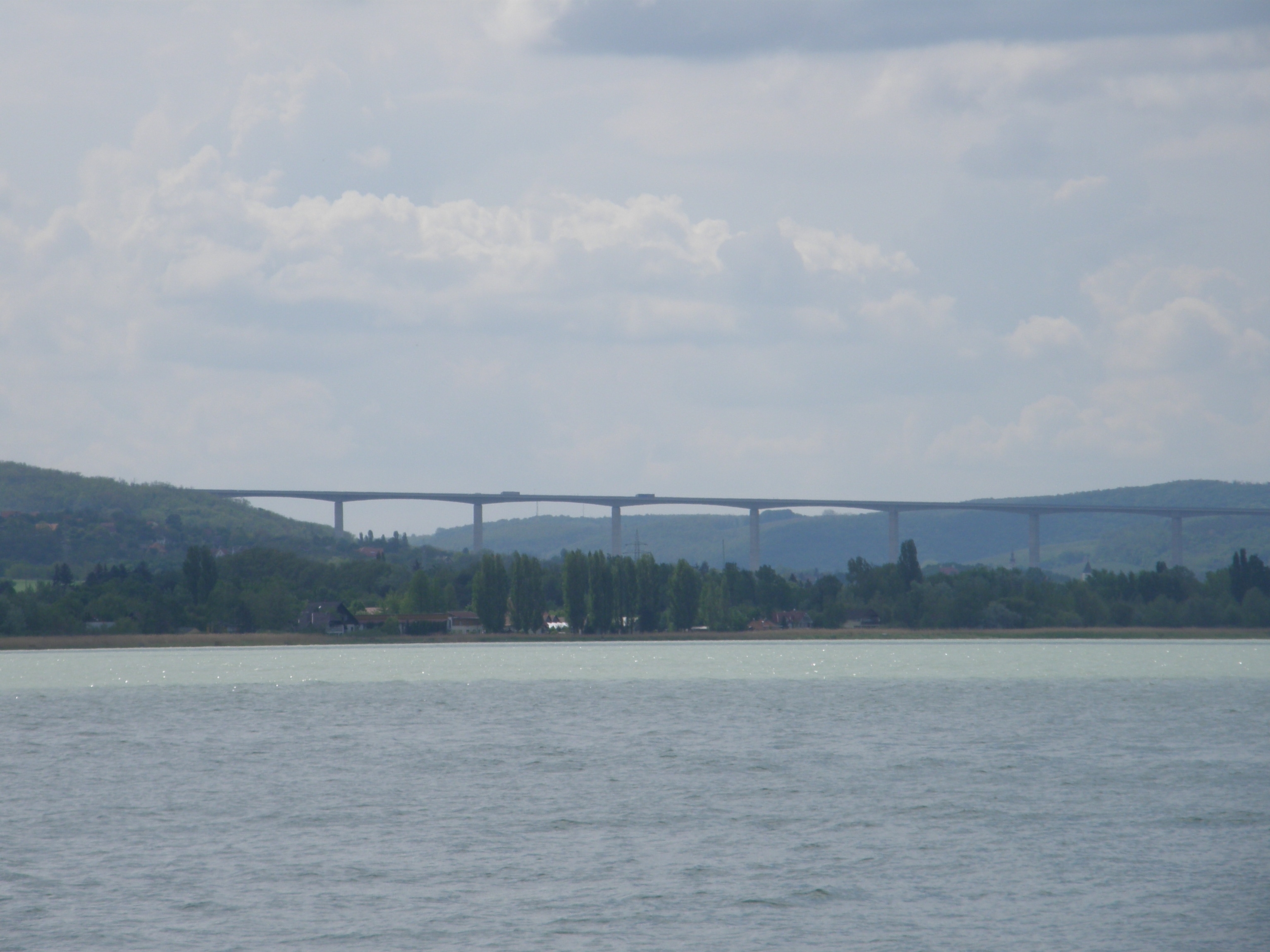
| 121-22 | [[File:AB-Brücke.svg | 21px | Viaduct]] | Kőröshegy Viaduct (1872 m) | Longest Bridge in Hungary | ||||
| 126 | [[File:AB-AS-blau.svg | 21px | Exit]] | Balatonszárszó | |||||
| 130 | [[File:AB-AS-blau.svg | 21px | Exit]] | Balatonőszöd, Szólád | |||||
| 135 | [[File:AB-AS-blau.svg | 21px | Exit]] | Balatonszemes, Balatonlelle | |||||
| 138 | [[File:Zeichen 314 - Parkplatz, StVO 2013.svg | 21px | Rest area]] | Balatonlelle rest area | [[File:Hungary road sign F-017.svg | 18px]] MOL / MOL + [[File:Hungary road sign F-014.svg | 18px]] [[File:Hungary road sign F-006.svg | 18px]] [[File:Hungary road sign F-021.svg | 18px]] |
| 143 | [[File:AB-AS-blau.svg | 21px | Exit]] | Balatonboglár, Lengyeltóti | |||||
| 145 | [[File:AB-AS-blau.svg | 21px | Exit]] | Ordacsehi | |||||
| 150 | [[File:AB-AS-blau.svg | 21px | Exit]] | Fonyód | |||||
| 156 | [[File:Zeichen 314 - Parkplatz, StVO 2013.svg | 21px | Rest area]] | Táska rest area | [[File:Hungary road sign F-014.svg | 18px]] | |||
| 160 | [[File:AB-AS-blau.svg | 21px | Exit]] | Balatonfenyves, Táska | |||||
| 168 | [[File:Zeichen 314 - Parkplatz, StVO 2013.svg | 21px | Rest area]] | Keresztúr rest area | [[File:Hungary road sign F-016.svg | 18px]] Shell / Shell + [[File:Hungary road sign F-014.svg | 18px]] [[File:Hungary road sign F-006.svg | 18px]] [[File:Hungary road sign F-021.svg | 18px]] |
| 170 | [[File:AB-AS-blau.svg | 21px | Exit]] | Balatonkeresztúr, Balatonszentgyörgy | |||||
| 175 | [[File:AB-AS-blau.svg | 21px | Exit]] | Hollád | |||||
| 177 | [[File:Zeichen 314 - Parkplatz, StVO 2013.svg | 21px | Rest area]] | Szegerdő rest area | [[File:Hungary road sign F-014.svg | 18px]] | |||
| 183 | [[File:AB-AS-blau.svg | 21px | Exit]] | Sávoly, Balatonring | |||||
| [[File:BSicon STR+GRZq.svg | 18px]] Border of Somogy and Zala Counties | ||||||||
| 191 | [[File:AB-AS-blau.svg | 21px | Exit]] | Zalakomár, Zalakaros | |||||
| 194 | [[File:Zeichen 314 - Parkplatz, StVO 2013.svg | 21px | Rest area]] | Zalakomár rest area | [[File:Hungary road sign F-016.svg | 18px]] INA / INA + [[File:Hungary road sign F-014.svg | 18px]] [[File:Hungary road sign F-003.svg | 18px]] | |
| 206 | [[File:AB-AS-blau.svg | 21px | Exit]] | Nagykanizsa-kelet, Kaposvár | |||||
| 211 | [[File:AB-AS-blau.svg | 21px | Exit]] | Nagykanizsa-Centrum, Gyékényes, Zalaegerszeg | |||||
| 215 | [[File:Zeichen 314 - Parkplatz, StVO 2013.svg | 21px | Rest area]] | Sormás rest area | [[File:Hungary road sign F-014.svg | 18px]] | |||
| 219 | [[File:AB-AS-blau.svg | 21px | Exit]] | Sormás, Eszteregnye | |||||
| 224 | [[File:AB-AS-blau.svg | 21px | Exit]] | Becsehely | |||||
| 232 | [[File:AB-Kreuz-blau.svg | 21px | Interchange]] | Letenye | |||||
| M7-M70 interchange | |||||||||
| 233 | [[File:Hungary road sign C-039.svg | 21px | Border control]] | Letenye (H) – Goričan (HR) border crossing | |||||
| [[File:AB-Fluss.svg | 21px | Bridge]] | Mura (Zrínyi Bridge - 216 m) | ||||||
| [[File:Motorway-A4-Hex-Green.svg | 30px]] A4 motorway [[File:E65-HR.svg | 30px | link=European route E65]] [[File:E71-HR.svg | 30px | link=European route E71]] → to Zagreb, Croatia Croatia |
- Planned section
Maintenance
The operation and maintenance of the road by Hungarian Public Road Nonprofit Pte Ltd Co. This activity is provided by these highway engineers.
- near Martonvásár, kilometre trench 30
- near Balatonvilágos, kilometre trench 90
- near Fonyód, kilometre trench 150
- near Eszteregnye, kilometre trench 219
Payment
From 1 February 2015, the motorway can be used instead of the national sticker with the following county stickers:
| Type of vignette | Available section |
|---|---|
| Pest County | between Egér Street junction and Martonvásár (7 km – 30 km) |
| Fejér County | between Pusztazámor and Balatonvilágos (23 km – 90 km) |
| Veszprém County | between Polgárdi and Siófok east (80 km – 98 km) |
| Somogy County | between Balatonvilágos and Zalakomár (90 km – 191 km) |
| Zala County | between Sávoly and Letenye [state border] (183 km – 234 km) |
Toll-free section
- From Border of Budapest to Egér Street section (5 km – 7 km) can be used free of charge.
Significant artifacts
From Budapest to the Croatian border, the M7 motorway features the following bridges, tunnels or covered cuts:
; Bridge
- Zrinski Bridge (Zrínyi Miklós híd; 216 m) over Mur river ; Viaduct
- Köröshegy Viaduct (Kőröshegyi völgyhíd; 1872 m) – Longest bridge in Hungary
European Routes
| [[File:E65-HUN.svg | 40px | link=European route E65]] | 22 km | [[File:74 (Hu) Otszogletu zold tabla.svg | 25px]] Nagykanizsa-centrum [[File:AB-AS-blau.svg]] (211) – CRO [[File:Motorway-A4-Hex-Green.svg | 28px]] Autocesta A4 |
|---|
This article was imported from Wikipedia and is available under the Creative Commons Attribution-ShareAlike 4.0 License. Content has been adapted to SurfDoc format. Original contributors can be found on the article history page.
Ask Mako anything about M7 motorway (Hungary) — get instant answers, deeper analysis, and related topics.
Research with MakoFree with your Surf account
Create a free account to save articles, ask Mako questions, and organize your research.
Sign up freeThis content may have been generated or modified by AI. CloudSurf Software LLC is not responsible for the accuracy, completeness, or reliability of AI-generated content. Always verify important information from primary sources.
Report