From Surf Wiki (app.surf) — the open knowledge base
M3 motorway (Hungary)
Road in Hungary
Road in Hungary
| Field | Value | ||||
|---|---|---|---|---|---|
| country | HUN | ||||
| type | M | ||||
| route | 3 | ||||
| map | M3 Autópálya Hungary.png | ||||
| map_notes | [[File:000080 Navy Blue Square.svg | 10px | alt=Map key - blue]] in use[[File:Grey.PNG | 10px | alt=Map key - grey]] planned |
| e-road | |||||
| length_km | 281 | ||||
| length_notes | 307 km planned | ||||
| established | 1978 | ||||
| terminus_a | Budapest | ||||
| junction | {{plainlist | 1= | |||
| *{{jct | country | HUN | Mb | 0}} near Fót | |
| *{{jct | country | HUN | M | 31}} in Gödöllő | |
| *{{jct | country | HUN | MR | 21}}, in Hatvan | |
| *{{jct | country | HUN | Mb | 25}}, near Füzesabony | |
| *{{jct | country | HUN | MR | 331}} near Mezőkövesd | |
| *{{jct | country | HUN | M | 30}} near Emőd | |
| *{{jct | country | HUN | MR | 35}} near Polgár | |
| *{{jct | country | HUN | M | 35}} near Görbeháza | |
| *{{jct | country | HUN | MR | 338}}, , near Nyíregyháza | |
| *{{Jct | country | HUN | M | 49}}, near Őr | |
| *{{jct | country | HUN | MR | 41}} near Vásárosnamény | |
| terminus_b | Barabás | ||||
| border with | |||||
| counties | Pest, Heves, Borsod-Abaúj-Zemplén, Hajdú-Bihar, Szabolcs-Szatmár-Bereg | ||||
| cities | Budapest, Hatvan, Gyöngyös, Füzesabony, Polgár, Nyíregyháza |
|e-road =
- near Fót
- in Gödöllő
- , in Hatvan
- , near Füzesabony
- near Mezőkövesd
- near Emőd
- near Polgár
- near Görbeháza
- , , near Nyíregyháza
- , near Őr
- near Vásárosnamény border with


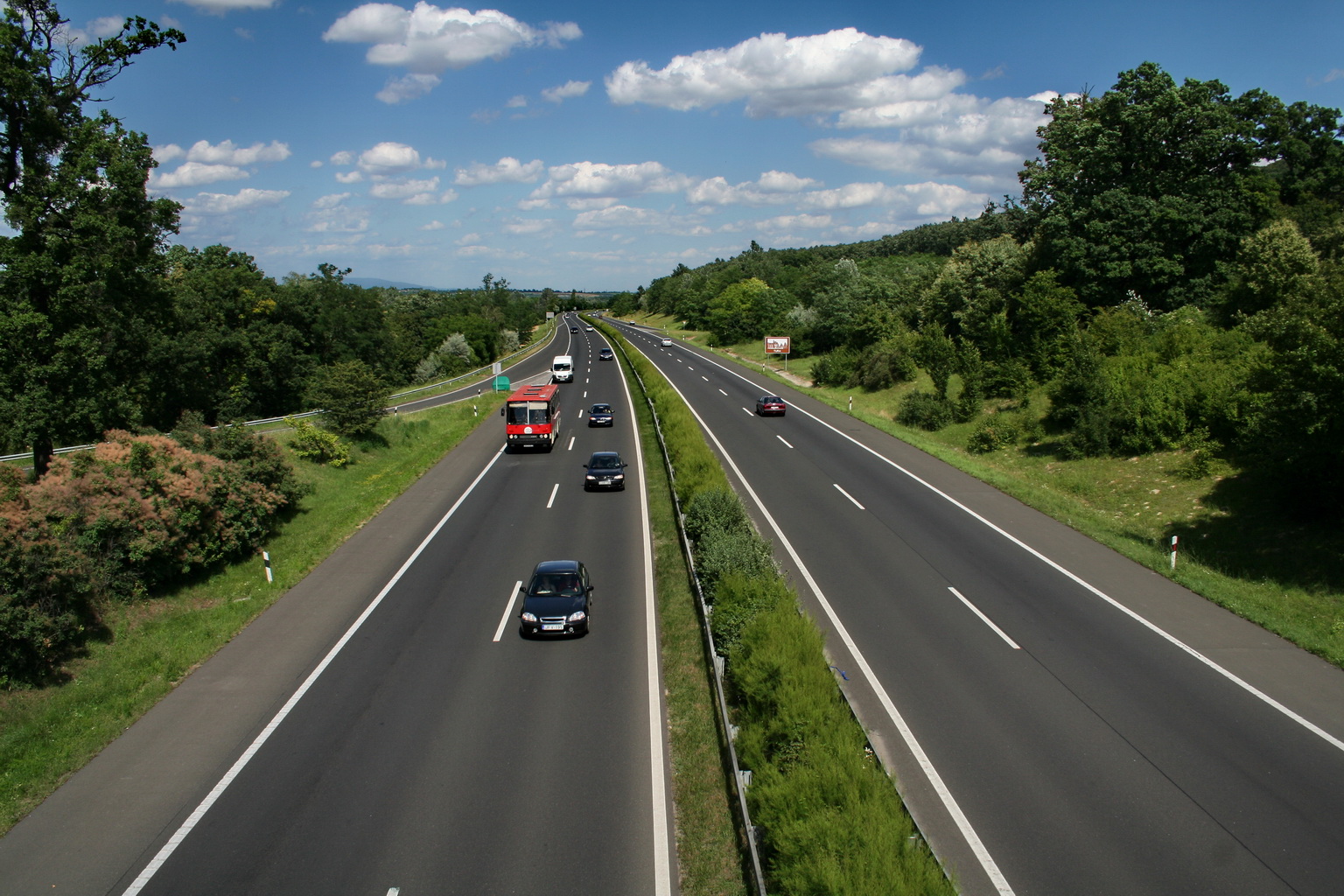
The M3 motorway () is a Hungarian motorway connecting Budapest to Nyíregyháza. It will eventually connect Budapest to the Ukrainian border. Two other motorways branch off it, the M30 (connecting the M3 to Miskolc) and the M35 (connecting the M3 to Debrecen). The M3 follows route 3, and, later, route 4. The section of the motorway between Görbeháza and Nyíregyháza was opened to traffic in August 2007. The section of the motorway between Highway 49 and Vásárosnamény was opened to the public in 2014. The total length of the motorway now is 281 km.
Openings timeline
- Budapest – Gödöllő (14 km): 1978.10.16.
- Gödöllő – Hatvan (29 km): 1980.10.31.
- Hatvan – Gyöngyös-west (15 km): 1983
- Gyöngyös-west – Füzesabony (44 km): 1998.09.01.
- Füzesabony – Polgár (61 km): 2002
- Polgár – Görbeháza; M35 (11 km): 2004.10.
- Görbeháza; M35 – Nyíregyháza (41 km): 2007.08.31.
- Nyíregyháza bypass (8 km): 2006.08.05.
- Nagykálló – Őr (33,8 km): 2013.01.16.
- Őr – Vásárosnamény (11,9 km): 2014.10.10.
List of junctions, exits and rest area
Distance from Zero Kilometre Stone (Adam Clark Square) in Budapest in kilometres.
- [[File:Hungary road sign E-016.svg|25px]] The route is full length motorway. The maximum speed limit is 130 km/h, with [[File:2 active lanes and 1 emergency.svg|80px]] (2x2 lane road with stop lane).
| km | Destinations | Route | Notes | ||||||
|---|---|---|---|---|---|---|---|---|---|
| 10 | [[File:AB-AS-blau.svg | 21px | Exit]] | Budapest | |||||
| 11 | [[File:AB-AS-blau.svg | 21px | Exit]] | Újpalota, Újpest | |||||
| 12 | [[File:Zeichen 314 - Parkplatz, StVO 2013.svg | 21px | Rest area]] | Szilas pihenőhely | Rest area: [[File:Hungary road sign F-016.svg | 18px]] Shell / Shell + [[File:Hungary road sign F-006.svg | 18px]] [[File:Hungary road sign F-021.svg | 18px]] [[File:Hungary road sign F-002.svg | 18px]] |
| [[File:AB-AS-blau.svg | 21px | Exit]] | Dunakeszi, Vác | ||||||
| 13 | [[File:AB-Kreuz-blau.svg | 21px | Interchange]] | M3-M0 interchange | |||||
| (Budapest bypass) | |||||||||
| 18 | [[File:Zeichen 314 - Parkplatz, StVO 2013.svg | 21px | Rest area]] | Ring pihenőhely | Temporary rest area, toward to Hungaroring circuit: [[File:Hungary road sign F-014.svg | 18px]] | |||
| 19 | [[File:AB-AS-blau.svg | 21px | Exit]] | Mogyoród-nyugat, Fót, Hungaroring | |||||
| 23 | [[File:AB-AS-blau.svg | 21px | Exit]] | Mogyoród-kelet, Hungaroring, Szada | |||||
| 25 | [[File:Zeichen 314 - Parkplatz, StVO 2013.svg | 21px | Rest area]] | Jakabpusztai pihenőhely | Rest area: [[File:Hungary road sign F-016.svg | 18px]] Lukoil / Lukoil + [[File:Hungary road sign F-003.svg | 18px]] [[File:Hungary road sign F-014.svg | 18px]] [[File:Hungary road sign F-006.svg | 18px]] |
| 27 | [[File:AB-Kreuz-blau.svg | 21px | Interchange]] | M3-M31 interchange | |||||
| [[File:AB-AS-blau.svg | 21px | Exit]] | Vác, Gödöllő | ||||||
| 32 | [[File:Zeichen 314 - Parkplatz, StVO 2013.svg | 21px | Rest area]] | [[File:Pfeil unten.svg | 8px]] Babati pihenő | Rest area, towards only Nyíregyháza: [[File:Hungary road sign F-006.svg | 18px]] [[File:Hungary road sign F-014.svg | 18px]] [[File:Hungary road sign F-005.svg | 18px]] |
| 36 | [[File:Zeichen 314 - Parkplatz, StVO 2013.svg | 21px | Rest area]] | Kisbagi pihenőhely | Rest area: [[File:Hungary road sign F-006.svg | 18px]] [[File:Hungary road sign F-014.svg | 18px]] | ||
| 39 | [[File:AB-AS-blau.svg | 21px | Exit]] | Bag, Aszód, Tura | |||||
| 43 | [[File:Zeichen 314 - Parkplatz, StVO 2013.svg | 21px | Rest area]] | Galga pihenőhely | Rest area: [[File:Hungary road sign F-006.svg | 18px]] [[File:Hungary road sign F-014.svg | 18px]] | ||
| [[File:BSicon STR+GRZq.svg | 18px]] Border of Pest and Heves Counties | ||||||||
| 51 | [[File:Zeichen 314 - Parkplatz, StVO 2013.svg | 21px | Rest area]] | Kerekharaszti pihenőhely | Rest area: [[File:Hungary road sign F-016.svg | 18px]] MOL / MOL + [[File:Hungary road sign F-006.svg | 18px]] [[File:Hungary road sign F-014.svg | 18px]] | |
| [[File:AB-AS-blau.svg | 21px | Exit]] | Kerekharaszt | ||||||
| 55 | [[File:AB-AS-blau.svg | 21px | Exit]] | Hatvan-nyugat, Salgótarján, Galyatető | |||||
| 59 | [[File:AB-AS-blau.svg | 21px | Exit]] | Hatvan-kelet, Szolnok | |||||
| 60 | [[File:Zeichen 314 - Parkplatz, StVO 2013.svg | 21px | Rest area]] | Horti pihenőhely | Rest area: [[File:Hungary road sign F-006.svg | 18px]] [[File:Hungary road sign F-014.svg | 18px]] [[File:Hungary road sign F-005.svg | 18px]] | |
| 66 | [[File:Zeichen 314 - Parkplatz, StVO 2013.svg | 21px | Rest area]] | Ecsédi pihenőhely | Rest area: [[File:Hungary road sign F-007.svg | 18px]] [[File:Hungary road sign F-014.svg | 18px]] | ||
| 70 km | [[File:AB-AS-blau.svg | 21px | Exit]] | Gyöngyös-nyugat, Hort | |||||
| 75 | [[File:Zeichen 314 - Parkplatz, StVO 2013.svg | 21px | Rest area]] | Halászaranyosi pihenőhely | Rest area: [[File:Hungary road sign F-014.svg | 18px]] [[File:Hungary road sign F-021.svg | 18px]] | ||
| 78 | [[File:AB-AS-blau.svg | 21px | Exit]] | Gyöngyös-kelet, Mátrafüred, Adács | |||||
| 82 | [[File:Zeichen 314 - Parkplatz, StVO 2013.svg | 21px | Rest area]] | Borsókúti pihenőhely | Rest area: [[File:Hungary road sign F-016.svg | 18px]] OMV / OMV + [[File:Hungary road sign F-007.svg | 18px]] [[File:Hungary road sign F-014.svg | 18px]] [[File:Hungary road sign F-021.svg | 18px]] |
| 87 | [[File:Zeichen 314 - Parkplatz, StVO 2013.svg | 21px | Rest area]] | Nagyfügedi pihenőhely | Rest area: [[File:Hungary road sign F-014.svg | 18px]] [[File:Hungary road sign F-021.svg | 18px]] | ||
| 90 | [[File:AB-AS-blau.svg | 21px | Exit]] | Nagyfüged, Heves, Ludas | |||||
| 92 | [[File:Zeichen 314 - Parkplatz, StVO 2013.svg | 21px | Rest area]] | Kisasszonytéri pihenőhely | Rest area: [[File:Hungary road sign F-014.svg | 18px]] [[File:Hungary road sign F-021.svg | 18px]] | ||
| 103 | [[File:AB-AS-blau.svg | 21px | Exit]] | Kál, Erdőtelek | |||||
| 104 | [[File:AB-Brücke.svg | 21px | Bridge]] | Bridge over Railway Line 102 (Kál-Kápolna-Kisújszállás) | |||||
| 106 | [[File:Zeichen 314 - Parkplatz, StVO 2013.svg | 21px | Rest area]] | Rekettyés pihenőhely | Rest area: [[File:Hungary road sign F-016.svg | 18px]] MOL / MOL + [[File:Hungary road sign F-007.svg | 18px]] [[File:Hungary road sign F-014.svg | 18px]] | |
| 108 | [[File:AB-Kreuz-blau.svg | 21px | Interchange]] | M3-M25 interchange | |||||
| 114 | [[File:AB-AS-blau.svg | 21px | Exit]] | Füzesabony, Eger, Jászberény | |||||
| 122 | [[File:Zeichen 314 - Parkplatz, StVO 2013.svg | 21px | Rest area]] | Mezőszemerei pihenőhely | Rest area: [[File:Hungary road sign F-014.svg | 18px]] | |||
| [[File:BSicon STR+GRZq.svg | 18px]] Border of Heves and Borsod-Abaúj-Zemplén Counties | ||||||||
| 128 | [[File:AB-AS-blau.svg | 21px | Exit]] | Mezőkövesd, Borsodivánka | |||||
| 139 | [[File:AB-AS-blau.svg | 21px | Exit]] | Mezőnagymihály, Mezőkeresztes | |||||
| 142 | [[File:Zeichen 314 - Parkplatz, StVO 2013.svg | 21px | Rest area]] | Geleji pihenőhely | Rest area: [[File:Hungary road sign F-016.svg | 18px]] Shell / Shell + [[File:Hungary road sign F-007.svg | 18px]] [[File:Hungary road sign F-014.svg | 18px]] | |
| 151 | [[File:AB-Kreuz-blau.svg | 21px | Interchange]] | M3-M30 interchange | |||||
| 153 | [[File:Zeichen 314 - Parkplatz, StVO 2013.svg | 21px | Rest area]] | Igrici pihenőhely | Rest area: [[File:Hungary road sign F-014.svg | 18px]] | |||
| 156 | [[File:AB-AS-blau.svg | 21px | Exit]] | Mezőcsát, Hejőpapi | |||||
| 164 | [[File:AB-AS-blau.svg | 21px | Exit]] | Hejőkürt, Tiszaújváros | |||||
| 169 | [[File:AB-Fluss.svg | 21px | Bridge]] | Tisza (Bridge - 405.5 m) | |||||
| [[File:BSicon STR+GRZq.svg | 18px]] Border of Borsod-Abaúj-Zemplén and Hajdú-Bihar Counties | ||||||||
| 171 | [[File:Zeichen 314 - Parkplatz, StVO 2013.svg | 21px | Rest area]] | Polgári pihenőhely | Rest area: [[File:Hungary road sign F-014.svg | 18px]] | |||
| 175 | [[File:AB-AS-blau.svg | 21px | Exit]] | Nyékládháza, Polgár | |||||
| [[File:BABKirche.svg | 21px | Arcehopark]] | M3 Arcehopark | Archeological and landscape historical skansen | |||||
| 179 | [[File:AB-Fluss.svg | 21px | Bridge]] | Western Main Channel (Bridge - 93 m) | |||||
| 184 | [[File:Zeichen 314 - Parkplatz, StVO 2013.svg | 21px | Rest area]] | Görbeháza pihenőhely | Rest area: [[File:Hungary road sign F-017.svg | 18px]] MOL / MOL + [[File:Hungary road sign F-007.svg | 18px]] [[File:Hungary road sign F-014.svg | 18px]] | |
| 187 | [[File:AB-Kreuz-blau.svg | 21px | Interchange]] | Görbeháza | |||||
| M3-M35 interchange | |||||||||
| 194 | [[File:Zeichen 314 - Parkplatz, StVO 2013.svg | 21px | Rest area]] | Rétaljai pihenőhely () | Rest area: [[File:Hungary road sign F-014.svg | 18px]]. The western terminus of European routes E579 | |||
| 200 | [[File:AB-Fluss.svg | 21px | Bridge]] | Eastern Main Channel (Bridge) | |||||
| 203 | [[File:AB-AS-blau.svg | 21px | Exit]] | Hajdúnánás, Tiszavasvári | |||||
| 206 | [[File:Zeichen 314 - Parkplatz, StVO 2013.svg | 21px | Rest area]] | Hajdúnánási pihenőhely | Rest area: [[File:Hungary road sign F-014.svg | 18px]] | |||
| [[File:BSicon STR+GRZq.svg | 18px]] Border of Hajdú-Bihar and Szabolcs-Szatmár-Bereg Counties | ||||||||
| 215 | [[File:Zeichen 314 - Parkplatz, StVO 2013.svg | 21px | Rest area]] | Kálmánházi pihenőhely | Rest area: [[File:Hungary road sign F-016.svg | 18px]] Mobil Petrol / Mobil Petrol + [[File:Hungary road sign F-007.svg | 18px]] [[File:Hungary road sign F-014.svg | 18px]] [[File:Hungary road sign F-021.svg | 18px]] |
| 221 | [[File:AB-AS-blau.svg | 21px | Exit]] | Nyíregyháza-nyugat, Kálmánháza | |||||
| 227 | [[File:AB-AS-blau.svg | 21px | Exit]] | Nyíregyháza-dél, Debrecen | |||||
| 229 | [[File:Zeichen 314 - Parkplatz, StVO 2013.svg | 21px | Rest area]] | Nyíregyházi pihenőhely | Rest area: [[File:Hungary road sign F-014.svg | 18px]] | |||
| 234 | [[File:AB-AS-blau.svg | 21px | Exit]] | Nyíregyháza-kelet, Nagykálló | |||||
| [[File:AB-AS-blau.svg | 21px | Exit]] | Nyíregyháza-észak, Záhony | ||||||
| Eastern bypass of Nyíregyháza, and terminus of European routes E573 | |||||||||
| 244 | [[File:Zeichen 314 - Parkplatz, StVO 2013.svg | 21px | Rest area]] | Mohos pihenőhely | Rest area: [[File:Hungary road sign F-016.svg | 18px]] ? + [[File:Hungary road sign F-007.svg | 18px]] [[File:Hungary road sign F-014.svg | 18px]] | |
| 254 | [[File:AB-AS-blau.svg | 21px | Exit]] | Ófehértó | |||||
| 263 | [[File:Zeichen 314 - Parkplatz, StVO 2013.svg | 21px | Rest area]] | Kántorjánosi pihenőhely | Rest area: [[File:Hungary road sign F-014.svg | 18px]] | |||
| 267 | [[File:AB-Kreuz-blau.svg | 21px | Interchange]] | Vaja, Mátészalka | |||||
| M3-M49 interchange | |||||||||
| 280 | [[File:Hungary road sign D-017.svg | 21px | Roundabout]] | Vásárosnamény | |||||
| [[File:AB-AS-blau.svg | 21px | Exit]] | Vásárosnamény-észak, Ilk | ||||||
| 286 | [[File:AB-Kreuz-blau.svg | 21px | Interchange]] | M3-M34 interchange | |||||
| 288 | [[File:AB-AS-blau.svg | 21px | Exit]] | Kisvarsány, Nagyvarsány | |||||
| 289 | [[File:AB-Fluss.svg | 21px | Bridge]] | Tisza (Bridge - 210 m) | |||||
| 292 | [[File:AB-AS-blau.svg | 21px | Exit]] | Tiszaszalka, Gergelyiugurnya | |||||
| [[File:Zeichen 314 - Parkplatz, StVO 2013.svg | 21px | Rest area]] | Vámosatyai pihenőhely | Rest area: | |||||
| 301 | [[File:AB-AS-blau.svg | 21px | Exit]] | Gelénes, Barabás | |||||
| 307 | [[File:Hungary road sign C-037.svg | 21px | Border control]] | Beregdaróc (H) – Luzhanka (UA) border crossing | |||||
| [[File:M24-CIS.svg | 35px]] M24 highway → to Mukachevo, Ukraine Ukraine |
- Under construction, Planned section
Maintenance
The operation and maintenance of the road by Hungarian Public Road Nonprofit Pte Ltd Co. This activity is provided by these highway engineers.
- near Gödöllő, kilometre trench 23
- near Kál, kilometre trench 103
- near Emőd, kilometre trench 151
- near Hajdúnánás, kilometre trench 204
- near Újfehértó, kilometre trench 254
Payment
Hungarian system has 2 main type in terms of salary:
1, time-based fee vignettes (E-matrica); with a validity of either 10 days (3500 HUF), 1 month (4780 HUF) or 1 year (42980 HUF).
2, county vignettes (Megyei matrica); the highway can be used instead of the national sticker with the following county stickers:
:{| class="wikitable" |- !Type of vignette !! Available section |- |Pest County
| between Szentmihályi Street junction and Hatvan west (11 km – 55 km) |
|---|
| Heves County |
| between Bag and Mezőkövesd (39 km – 128 km) |
| - |
| Borsod-Abaúj-Zemplén County |
| between Füzesabony and Polgár (114 km – 175 km) |
| - |
| Hajdú-Bihar County |
| between Hejőkürt and Nyíregyháza west (164 km – 221 km) |
| - |
| Szabolcs-Szatmár-Bereg County |
| between Hajdúnánás and Vásárosnamény (203 km – 280 km) |
| } |
Significant artifacts
From Budapest to the Ukrainian border, the M3 motorway features the following bridges, tunnels or covered cuts:
; Bridge
- Tisza Bridge of Polgár (Polgári Tisza-híd; 405.5 m) over Tisza river ; Landscape history memorial park
- M3 Arcehopark – Open-air museum near this motorway ; Outlet center
- M3 Outlet Center
European Route(s)
| [[File:E573-HUN.svg | 40px | link=European route E573]] | 7 km | [[File:4 (Hu) Otszogletu zold tabla.svg | 25px]] Nyíregyháza-south [[File:AB-AS-blau.svg]] (227) – [[File:403 (Hu) Otszogletu zold tabla.svg | 25px]] Nyíregyháza-north [[File:AB-AS-blau.svg]] (234) |
|---|
References
References
This article was imported from Wikipedia and is available under the Creative Commons Attribution-ShareAlike 4.0 License. Content has been adapted to SurfDoc format. Original contributors can be found on the article history page.
Ask Mako anything about M3 motorway (Hungary) — get instant answers, deeper analysis, and related topics.
Research with MakoFree with your Surf account
Create a free account to save articles, ask Mako questions, and organize your research.
Sign up freeThis content may have been generated or modified by AI. CloudSurf Software LLC is not responsible for the accuracy, completeness, or reliability of AI-generated content. Always verify important information from primary sources.
Report