From Surf Wiki (app.surf) — the open knowledge base
M1 motorway
First inter-urban motorway in the UK
.svg)
First inter-urban motorway in the UK
| Field | Value | ||
|---|---|---|---|
| country | ENG | ||
| type | M | ||
| route | 1 | ||
| alternate_name | London–Yorkshire motorway | ||
| map | |||
| map_custom | yes | ||
| map_notes | M1 highlighted in blue | ||
| photo | Motorway M1 Yorkshire 2007-08-13.jpg | ||
| photo_notes | Looking north towards junction 37 on one of the few stretches that remain three-lane, 2007 | ||
| length_mi | 193.5 | ||
| length_ref | |||
| established | 1959 | ||
| history | Opened: 1959 | ||
| Completed: 1999 | |||
| direction_a | South | ||
| direction_b | North | ||
| terminus_a | Staples Corner, London (A406) | ||
| terminus_b | Hook Moor, West Yorkshire (A1(M)) | ||
| counties | Greater London, Hertfordshire, Bedfordshire, Buckinghamshire, Northamptonshire, Leicestershire, Nottinghamshire, Derbyshire, Yorkshire (South & West) | ||
| destinations | London | ||
| Brent Cross | |||
| Watford | |||
| St Albans | |||
| Hemel Hempstead | |||
| Luton | |||
| Milton Keynes | |||
| Northampton | |||
| Rugby | |||
| Leicester | |||
| Loughborough | |||
| Nottingham | |||
| Derby | |||
| Mansfield | |||
| Chesterfield | |||
| Sheffield | |||
| Rotherham | |||
| Barnsley | |||
| Wakefield | |||
| Leeds | |||
| e-road | |||
| maint | National Highways | ||
| junction | [[File:Junction 1.svg | 1000x20px]] [[File:UK road A406.svg | 1000x20px]] |
| J1 -North Circular Road | |||
| [[File:Junction 2.svg | 1000x20px]] [[File:UK road A1.svg | 1000x20px]] | |
| J2 -A1 road | |||
| [[File:Junction 6a.svg | 1000x20px]] [[File:UK-Motorway-M25.svg | 1000x20px]] | |
| J6a → M25 motorway | |||
| [[File:Junction 11a.svg | 1000x20px]] [[File:UK road A5.svg | 1000x20px]] | |
| J11a - A5 road | |||
| [[File:Junction 17.svg | 1000x20px]] [[File:UK-Motorway-M45.svg | 1000x20px]] | |
| J17 → M45 motorway | |||
| [[File:Junction 19.svg | 1000x20px]] [[File:UK-Motorway-M6.svg | 1000x20px]] | |
| J19 → M6 motorway | |||
| [[File:Junction 21.svg | 1000x20px]] [[File:UK-Motorway-M69.svg | 1000x20px]] | |
| J21 → M69 motorway | |||
| [[File:UK road A42.svg | 1000x20px]] | ||
| J23a -A42 road | |||
| [[File:UK road A50.svg | 1000x20px]] | ||
| J24a -A50 road | |||
| [[File:Junction 25.png | 1000x20px]] [[File:UK road A52.svg | 1000x20px]] | |
| J25 -A52 road | |||
| [[File:Junction 28.png | 1000x20px]] [[File:UK road A38.svg | 1000x20px]] | |
| J28 - A38 road | |||
| [[File:Junction 31.png | 1000x20px]] [[File:UK road A57.svg | 1000x20px]] | |
| J31 - A57 road | |||
| [[File:Junction 32.svg | 1000x20px]] [[File:UK-Motorway-M18.svg | 1000x20px]] | |
| J32 → M18 motorway | |||
| [[File:Junction 33.png | 1000x20px]] [[File:UK road A630.svg | 1000x20px]] | |
| J33 -A630 road | |||
| [[File:Junction 35.svg | 1000x20px]] [[File:UK road A629.svg | 1000x20px]] | |
| J35 -A629 road | |||
| [[File:Junction 37.png | 1000x20px]] [[File:UK road A628.svg | 1000x20px]] | |
| J37 -A628 road | |||
| [[File:Junction 42.svg | 1000x20px]] [[File:UK-Motorway-M62.svg | 1000x20px]] | |
| J42 → M62 motorway | |||
| [[File:Junction 43.svg | 1000x20px]] [[File:UK-Motorway-M621.svg | 1000x20px]] | |
| J43 → M621 motorway | |||
| previous_type | M | ||
| next_type | M | ||
| previous_route | 1 | ||
| next_route | 2 | ||
| next_dab | Great Britain |
the M1 motorway in England
Completed: 1999
Brent Cross Watford St Albans Hemel Hempstead Luton Milton Keynes Northampton Rugby Leicester Loughborough Nottingham Derby Mansfield Chesterfield Sheffield Rotherham Barnsley Wakefield Leeds | e-road = J1 -North Circular Road J2 -A1 road J6a → M25 motorway J11a - A5 road J17 → M45 motorway J19 → M6 motorway J21 → M69 motorway J23a -A42 road J24a -A50 road J25 -A52 road J28 - A38 road J31 - A57 road J32 → M18 motorway J33 -A630 road J35 -A629 road J37 -A628 road J42 → M62 motorway J43 → M621 motorway
The M1 motorway connects London to Leeds, where it joins the A1(M) near Aberford, to connect to Newcastle. It was the first inter-urban motorway to be completed in the UK; the first motorway in the country was the Preston Bypass, which later became part of the M6.
The motorway is 193 mi long and was constructed in four phases. Most of the motorway was opened between 1959 and 1968. The southern end was extended in 1977 and the northern end was extended in 1999.
It is also the second longest motorway in the country with the M6 motorway being the longest at 232 miles (373 km).
History
There had been plans before the Second World War for a motorway network in the United Kingdom. Lord Montagu of Beaulieu formed a company to build a 'motorway-like road' from London to Birmingham in 1923, but it was a further 26 years before the Special Roads Act 1949 was passed, which allowed for the construction of roads limited to specific vehicle classifications, and in the 1950s, the country's first motorways were given the government go-ahead.
The first section of motorway was the Preston Bypass in Lancashire, now part of the M6 motorway, which opened in 1958. The M1 was Britain's first full-length motorway and opened in 1959. The early M1 had no speed limits, crash barriers, or lighting, and had soft shoulders rather than hard. As there was then little traffic, London musicians such as the Rolling Stones were known to speed up to take advantage of the Watford Gap Motorway Services Area, open 24 hours at a time when pubs closed at 11 p.m.
First section, 1959

The first section of the motorway, between junction 5 (Watford) and junction 18 (Crick/Rugby), opened on 2 November 1959, together with the motorway's two spurs, the M10 (from junction 7 to south of St Albans originally connecting to the A1) and the M45 (from junction 17 to the A45 and Coventry). Parts of the Hertfordshire section were built using steam rollers.{{cite web |url-status = dead |archive-url = https://web.archive.org/web/20110722134904/http://www.therobeytrust.co.uk/Stocklist%20tri-tandem%20roller.htm |archive-date = 22 July 2011
The M1 was officially inaugurated from Slip End (close to Luton), celebrated by a large concrete slab on the bridge next to the village, with inscription "London-Yorkshire Motorway – This slab was sealed by the Harold Watkinson M.P. – Minister of Transport – Inauguration Day – 24th March 1958". It was relocated, during widening works in 2007–08, to the eastern side of junction 10.

This section of the M1 broadly follows the route of the A5 north-west. It started at the Watford Bypass (A41), which runs south-east to meet the A1 at Apex corner, and ended on the A5 at Crick. The M10 spur motorway connected the M1 to the North Orbital Road (A405/A414, a precursor of the M25) where it also met the A5 (now renumbered here as the A5183) and, 2 mi to the east via the A414, the A6, which subsequently became part of the M25.
A £1.5million contract was given in May 1958 for the most southerly section, from Aldenham to Beechtrees (the M10 junction), for two lanes of reinforced concrete, to open in November 1959. There was immense flooding on this section in July 1958.
Although the whole of the first section opened in 1959, it was built in two parts, with the northern part (junctions 10 to 18) being built by John Laing and the southern part (the St Albans Bypass) being built by Tarmac Construction.
The headquarters of the Laing project was on Wolverton Road in Newport Pagnell. The motorway was opened by Ernest Marples at the Pepperstock junction (junction 10), previously a motorway spur, now the A1081. The two motorway projects, the St Albans Bypass and the Pepperstock-Crick section met at Luton.
On the opening of the M1, the first person to reach the Birmingham end of the new section of motorway was anaesthetist Eric Plumpton (Dr Frederic Salkeld Plumpton, 19332016) in his Triumph TR2, travelling 23 mi from Upper Heyford, Northamptonshire in 14minutes at an average speed of 98.5 mph, at about 10.10am. The northern end of the M1 and M45 opened at 9.56am.
Charnwood Forest protest
In 1956 it was announced that the proposed route, from Misterton with Walcote to Markfield, would go right through the middle of the much-loved beauty spots of Charnwood Forest in the Borough of Charnwood. 32,000 signatures of the 'Save Charnwood' petition were sent to parliament on 19 March 1958.

The proposed unpopular route, in Charnwood, was opposed by the Leicestershire Ramblers Association, but not by Leicestershire County Council. This proposed route would never have got through a public enquiry. An alternative route was go to through the Soar Valley.

The altered route, to mostly avoid Charnwood Forest, was published on Wednesday 17 September 1958. The controversial £12m motorway section opened on Friday 22 January 1965 at the Leicester Forest East services, with the Bishop of Leicester in attendance.
Rugby to Leeds, 1965 to 1968
The continuation of the motorway from junction 18 towards Yorkshire was carried out as a series of extensions between 1965 and 1968. Diverging from the A5, the motorway takes a more northerly route through the East Midlands, via Leicester, Loughborough, Nottingham to Sheffield, where the M18 splits from the M1 at junction 32 to head to Doncaster.
In February 1964, at Lockington, Leicestershire, a 150 lb German bomb was found in the construction.
Originally, the M1 was planned to end at Doncaster but it was decided to make what was going to be the "Leeds and Sheffield Spur" into the primary route, with the 11 mi section to the A1(M) south of Doncaster given the separate motorway number M18.
From junction 32, the motorway passes Sheffield, Rotherham, Barnsley and Wakefield, reaching the original end of the motorway at (the original) junction 44 to the east of Leeds. There were plans to route the M1 from just south of junction 42, where it interchanges with the M62, round the west of Leeds to the A1 at Dishforth. The chosen route passes to the east of Leeds. With the M62 and M621, the M1 forms a ring of motorways around the south of Leeds.
Leeds South Eastern Urban Motorway, 1972
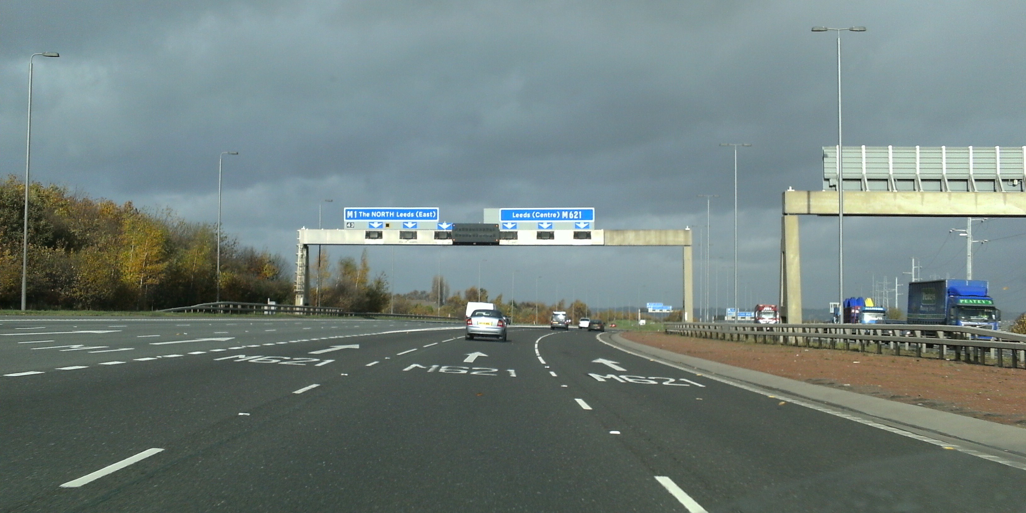
In 1972, an extension of the M1 was opened into central Leeds as the Leeds South Eastern Motorway, where it met the Leeds South Western Motorway (M621) coming north-east from the M62 at junction 3.
Lighting
In July 1972, the then UK Minister for Transport Industries, John Peyton, announced that 86 mi of UK motorway particularly prone to fog would benefit from lighting in a project that "should be" completed by 1973. Sections to be illuminated included the M1 between junctions 3 and 14, and between junctions 16 and 24.
Safety barriers
An increasing official interest in secondary safety was evident in an announcement in March 1973 that work would begin shortly on erecting "tensioned safety barriers" along the central reservation of a 34 mi section of the M1 between Kegworth (J24) and Barlborough (J30).
Leeds to Hook Moor, 1999
Between 1996 and 1999, the M1 section north of the M62 underwent a major reconstruction and extension to take the M1 on a new route to the A1(M) at Aberford. The new road involved the construction of a series of new junctions, bridges and viaducts to the east of Leeds. When the new section of M1 was completed and opened on 4 February 1999, the Leeds South Eastern Motorway section of the M1 was re-designated as the M621, and the junctions were given new numbers: M621 junctions 4 to 7.
London extensions, 1966, 1967 and 1977


The M1 was extended south towards London from its original starting point at junction 5, in three stages. The first stage, opened in 1966, took the motorway south-east, parallel to the A41, to meet the A5 at junction 4 south of Elstree. The second phase continued east to Scratchwood (London Gateway Services, which occupies the location of the missing junction 3, from where an unbuilt spur would have connected to the A1 at Stirling Corner to the north-east). The M1 then runs south alongside the Midland Main Line towards Hendon, where it meets the A1 again at junction 2 via a tightly curved flyover section. These flyovers connecting from the A1 were originally both for northbound traffic: the left one as the on-ramp to the M1, the right one going over the A1/A41 junction beneath to rejoin the A1 northbound.
Junction 2 is about 2.5 mi south of the original junction 3. Before the completion of junction 2, southbound traffic left the motorway via a slip road which passed around the back of the now disused Homebase and under the A41/A1 Mill Hill Bypass, and looped round to join it at Fiveways Interchange. This slip road is still visible to southbound traffic approximately 650 yd before junction 2, and was maintained until the early 2000s, even though not accessible to traffic. The northbound slip road from the A1 is now partially used as the entrance way to a retail park and was once carried by bridge, but no longer reaches the northbound carriageway, because it is cut off by the motorway continuing south.
The final section of the M1 was opened to junction 1 at Staples Corner in 1977. There the motorway meets the North Circular Road (A406) at a grade separated junction and roundabout. Unrealised plans from the 1960s would have seen the motorway continue through the junction on an elevated roadway to end at West Hampstead, where it would have met the North Cross Route, the northern section of the London Motorway Box, a proposed ring of urban motorway around the central area. The layout of the Staples Corner junction was originally built in accordance with those plans, although most of the London Ringways Plan had been cancelled by 1973. Around the same time, the section between the then-M10 and junction 5 was widened from the original two lanes to three.
On its completion, the M1 acted as a fast link road between London and Birmingham via the M6. It also provided a link to London Luton Airport for those regions, and its proximity to the site of the new town of Milton Keynes (designated in 1967) meant that it was soon providing a vital transport link to another major area.
Recent developments
In 2006, plans were published for the widening of 91 mi from Leicester through to Leeds (junctions 21–42) to four lanes each way.
Escalating costs across the whole of the Highways Agency programme, including the M1 project, on which costs had risen to £5.1billion, as well as increasing opposition to major road expansion, as well as criticisms by the Transport Select Committee and the National Audit Office, led to wide-ranging re-assessments of the Agency's project costs. Widening was scaled back to the junctions 6A to 10 scheme that was already in progress, and from Nottingham and Mansfield (junctions 25–28), and hard shoulder running was to be used for other sections.
Many later developments, including smart motorway schemes, have been made to the M1, and these are detailed below. Recent concerns about accidents and deaths on the former hard shoulder have led to a halt and review into extending all lane running which reported in July 2021.
Developments
A5-M1 Link (Dunstable Northern Bypass)
The A5-M1 Link (Dunstable Northern Bypass) is a two-lane dual carriageway running east from the A5 north of Dunstable joining the M1 at a new junction 11a south of Chalton. Here, it is intended to join with a proposed Luton Northern Bypass to form a northern bypass for the wider conurbation. The A5-M1 Link aims to alleviate traffic congestion in Houghton Regis and Dunstable, reduce journey times for long-distance traffic travelling through Dunstable and improve the regional economy. The Highways Agency detrunked the A5 through Dunstable when the A5-M1 Link opened to the public in May 2017. As part of the Dunstable Town Centre Masterplan, Central Bedfordshire Council built the 2.9 km Woodside Link to connect the new junction 11a to the industrial areas of Dunstable and Houghton Regis. Most of the road opened to traffic in autumn 2016 with the remaining section connecting to junction 11a.
M1/M69 junction
There is a proposal to widen the M1 to dual four-lane or dual five-lane between junctions 21 and 21a and construct a new link road between the M1 and the M69. During this work the Leicester Forest East services would be closed, and possibly relocated. Consultation took place in 2007. , work on this scheme has still not begun.
M1 junction 19 improvement
Following the report of a public inquiry in March 2013, the Secretary of State for Transport announced on 18 July 2013 that work to update the Catthorpe Interchange at junction 19, between the M1 motorway, M6 motorway and A14 road, close to Catthorpe, would go ahead. Work on the £191million three-layer interchange started in January 2014. The scheme was fully opened to traffic in December 2016.
A421 dualling from Milton Keynes to M1 junction 13
In conjunction with the M1 widening schemes and dualling of the A421 between M1 junction 13 and the A1 near St Neots, proposals were made to widen the A421 between the M1 junction 13 in Bedfordshire and the Kingston roundabout in Milton Keynes. |archive-url=http://webarchive.nationalarchives.gov.uk/20100702205428/http://www.southeast-ra.gov.uk/documents/factsheet/03.pdf |url-status=dead |archive-date=2 July 2010 |access-date=22 July 2009 }} Exhibitions were held in June 2005 which rejected proposals to re-route the road in favour of widening the current road. In 2005, the project was given an estimated total cost of £33million.
Funding of £23.5million was confirmed by the government for these works, as part of the South East Midlands Local Enterprise Partnership "Local Growth Deal". As part of the government's pinch point reduction programme, work commenced in 2014 on the A421 in Milton Keynes to improve the Kingston roundabout, and dual the section from it to (near) the Bedfordshire border, with the construction of two new roundabouts on the route. The road corridor includes a separate cycleway.
The upgrade work for this final phase of the plan, the section running from junction 13 to Eagle Farm roundabout, started in September 2018 and was completed in December 2020.
Smart Motorways
M1 widening and variable speed limits, junctions 6A to 10 (M25 to Luton South)
Work began on the 10 mi section between the M25 and Luton (J6A-J10) in 2006 and opened in 2009, which included the construction of new parallel collector-distributor lanes between junctions 7 and 8.
The M10 spur was built as a motorway because it inevitably led to the M1, but as non-motorway traffic could now travel between the A414 at Hemel Hempstead and Park Street Roundabout without having to access the M1, the M10 was downgraded to an A road, and designated as part of the A414 to allow for this. The work also included widening or replacement of 11 underbridges on one or both carriageways, and replacing seven overbridges at a total cost of £294million. A variable mandatory speed limit system was installed, making this the first smart motorway scheme on the M1.
M1 dynamic hard shoulder running, junctions 10 to 13 (Luton South to Milton Keynes South)
Work to introduce dynamic hard shoulder running on approximately 15 mi of motorway between Luton and Milton Keynes (J10-J13) was completed in December 2012, at a total cost of £327million. This made the hard shoulder available to be opened as a traffic lane where additional capacity was necessary. Modifications were made to junctions 11 and 12, to allow for four lanes running through each junction, and the A421 from junction 13 to the Bedford southern bypass was also upgraded to two lanes each way during this period. The scheme will likely be converted to all lane running at some point in the 2020 decade, alongside all other dynamic hard shoulder running schemes. This was because a Government review into smart motorways found dynamic hard shoulder running was too confusing for drivers, leading to plans to convert all dynamic hard shoulders into permanent running lanes.
M1 widening and variable speed limits, junctions 25–28 (Nottingham to Mansfield)
Work to widen the 15 mi section from Nottingham to Mansfield (J25-J28) to four lanes each way began in October 2007 and was completed in May 2010, at a cost of £340million. A 50mph limit, enforced by average speed cameras, was imposed for the period of construction, but it proved to be so effective that a permanent variable mandatory speed limit system was installed. In 2023, following a previous debate on the issue, local MPs Mark Fletcher and Lee Anderson called on the government to upgrade junction 28, describing it as a "pinch point" disadvantaging local residents and businesses.
M1 widening and variable speed limits, junctions 13–16 (Milton Keynes South to Northampton West)
National Highways converted the existing 23 mi section of the M1 between Milton Keynes and Northampton (J13-J16) into an all-lane-running (ALR) smart motorway consisting of four lanes running in both directions without a hard shoulder, with the project's cost being £373million. Construction began in January 2018, with the scheme opening in stages until 9 March 2023, when the project was fully complete.
Other proposals
The speed limit between M1 junctions 33 to 34, near Rotherham, has been reduced to 60mph, to reduce levels of nitrogen dioxide. The plans were to be implemented before October 2020, and the speed limit reduction is still in place.
Incidents and accidents
- On 12 October 1970, a woman, Barbara Mayo, was abducted and murdered whilst hitchhiking up the motorway from London to Yorkshire. She was found dead in Ault Hucknall near the motorway in Derbyshire. The murder has never been solved.
- On 16 March 1972, 200 vehicles crashed in thick fog resulting in the deaths of nine people on the M1 near Ridgmont, north of Luton.
- On 8 January 1989, British Midland Flight 92, a Boeing 737-400 aircraft crashed onto the embankment of the M1 whilst attempting an emergency landing at East Midlands Airport in Leicestershire. There were no ground casualties nor vehicular damage on the motorway as a result of the crash, however 47 passengers on board the aircraft were killed and a further 74 passengers and crew members were seriously injured.
- On 11 June 2003, three military armoured vehicles were thrown across the carriageway near junction 19 near Lutterworth when the transporter carrying them jacknifed; five people were killed.
- An 18 mi stretch of the motorway was closed entirely on the morning of 11 December 2005, following a major explosion and fire at the Buncefield Oil Depot which is less than half a mile (800m) from junction 8 of the M1.
- Part of the motorway close to Tinsley Viaduct was closed to allow safe demolition of the Tinsley cooling towers in the early hours of 24 August 2008. The M1 remained closed for much of the day until the stability of the viaduct was confirmed.
- On 15 April 2011, a 7 mi stretch of the road was closed between junctions 1 and 4 due to a fire at a scrapyard underneath the motorway. The road was fully re-opened early on 21 April 2011 with a 50 mph speed limit in force whilst repair work continued to an elevated section.
- On 26 August 2017, two lorries and a minibus crashed between junctions 14 and 15, near Newport Pagnell, shutting down the motorway for most of the day. Eight people were killed and three severely injured. The drivers of the lorries were charged with dangerous driving, with one also charged with drunk driving. The incident represented the largest loss of life as the result of a motorway accident since a crash on the M40 in 1993.
Junctions
| County | Location | mile | km | Jct | Destinations (SB) | Destinations (NB) | Notes |
|---|---|---|---|---|---|---|---|
| Greater London | London Borough of Barnet | 7.0 | 11.3 | 1 | Southern terminus | ||
| 9.1 | |||||||
| 9.2 | 14.6 | ||||||
| 14.8 | 2 | No access | Southbound exit and northbound entrance | ||||
| 12.0 | 19.3 | London Gateway services | |||||
| 13.2 | |||||||
| 13.5 | 21.3 | ||||||
| 21.8 | 4 | No access | Southbound exit and northbound entrance | ||||
| Hertfordshire | Bushey–Radlett boundary | 17.1 | |||||
| 17.5 | 27.5 | ||||||
| 28.1 | 5 | ||||||
| Watford–Bricket Wood boundary | 19.7 | ||||||
| 20.0 | 31.7 | ||||||
| 32.2 | 6 | ||||||
| St Stephen | 20.4 | ||||||
| 20.8 | 32.9 | ||||||
| 33.5 | 6A | ||||||
| No access | Southbound exit and northbound entrance | ||||||
| St Michael | 22.5 | ||||||
| 22.7 | 36.2 | ||||||
| 36.6 | 7 | No access | Southbound exit and northbound entrance | ||||
| 23.5 | |||||||
| 23.8 | 37.8 | ||||||
| 38.3 | 8 | ||||||
| Redbourn–Flamstead–Harpenden boundary | 27.9 | ||||||
| 28.3 | 44.9 | ||||||
| 45.6 | 9 | ||||||
| Bedfordshire | Slip End–Luton boundary | 30.3 | |||||
| 30.6 | 48.8 | ||||||
| 49.2 | 10 | ||||||
| Luton | 33.7 | ||||||
| 34.0 | 54.3 | ||||||
| 54.7 | 11 | ||||||
| Chalton | 11A | ||||||
| Toddington | Toddington services | ||||||
| 38.5 | |||||||
| 38.9 | 62.0 | ||||||
| 62.6 | 12 | ||||||
| Husborne Crawley–Brogborough boundary | 45.2 | ||||||
| 45.4 | 72.7 | ||||||
| 73.1 | 13 | ||||||
| Buckinghamshire | Broughton–Moulsoe boundary | 49.7 | |||||
| 50.2 | 80.0 | ||||||
| 80.8 | 14 | ||||||
| Newport Pagnell | 53.7 | 86.5 | Newport Pagnell services | ||||
| Northamptonshire | Grange Park | 61.8 | |||||
| 62.3 | 99.4 | ||||||
| 100.2 | 15 | ||||||
| Rothersthorpe | 64.3 | ||||||
| 64.9 | 103.5 | ||||||
| 104.5 | 15A | Northampton services | Northampton services | ||||
| Upper Heyford | 67.9 | ||||||
| 68.3 | 109.2 | ||||||
| 109.9 | 16 | ||||||
| Watford | 75.1 | 120.8 | Watford Gap services | ||||
| Watford–Crick boundary | 76.6 | ||||||
| 76.9 | 123.3 | ||||||
| 123.8 | 17 | No access | Northbound exit and southbound entrance | ||||
| Crick | 78.5 | ||||||
| 78.9 | 126.3 | ||||||
| 126.9 | 18 | ||||||
| Leicestershire | Swinford | ||||||
| (Catthorpe Interchange) | 82.3 | ||||||
| 82.7 | 132.4 | ||||||
| 133.1 | 19 | No access to M6 from southbound exit or to A14 from northbound exit | |||||
| Lutterworth–Misterton with Walcote boundary | 85.5 | ||||||
| 86.1 | 137.6 | ||||||
| 138.5 | 20 | ||||||
| Enderby–Lubbesthorpe–Braunstone Town boundary | 96.1 | ||||||
| 96.6 | 154.6 | ||||||
| 155.4 | 21 | ||||||
| Leicester Forest East | 97.7 | 157.2 | Leicester Forest East services | ||||
| Kirby Muxloe | 99.3 | ||||||
| 99.5 | 159.8 | ||||||
| 160.1 | 21A | No access | Northbound exit and southbound entrance | ||||
| Markfield | 104.3 | ||||||
| 104.7 | 167.8 | ||||||
| 168.5 | 22 | ||||||
| Shepshed | 108.8 | ||||||
| 109.2 | 175.1 | ||||||
| 175.8 | 23 | ||||||
| Long Whatton and Diseworth | 113.4 | ||||||
| 113.6 | 182.5 | ||||||
| 182.8 | 23A | Donington Park services | No access to A42 from northbound exit and to A453 from southbound exit | ||||
| Lockington-Hemington | 114.9 | ||||||
| 115.4 | 184.9 | ||||||
| 185.7 | 24 | Donington Park services | |||||
| 115.8 | |||||||
| 116.2 | 186.3 | ||||||
| 187.0 | 24A | No access | No exit from northbound traffic (use Junction 24) | ||||
| Derbyshire | Sandiacre | 120.0 | |||||
| 120.5 | 193.2 | ||||||
| 193.9 | 25 | ||||||
| Nottinghamshire | Trowell | 124.1 | 199.8 | Trowell services | |||
| Nuthall | 126.0 | ||||||
| 126.6 | 202.8 | ||||||
| 203.7 | 26 | ||||||
| Felley–Annesley boundary | 131.5 | ||||||
| 132.0 | 211.7 | ||||||
| 212.4 | 27 | ||||||
| Derbyshire | Pinxton–South Normanton boundary | 135.0 | |||||
| 135.5 | 217.2 | ||||||
| 218.0 | 28 | ||||||
| Tibshelf | 138.3 | 222.5 | Tibshelf services | ||||
| Heath | 141.7 | ||||||
| 142.3 | 228.1 | ||||||
| 229.0 | 29 | ||||||
| Duckmanton | 29A | ||||||
| Barlborough | 148.4 | ||||||
| 148.8 | 238.9 | ||||||
| 239.5 | 30 | ||||||
| South Yorkshire | Woodall | 151.3 | 243.5 | Woodall services | |||
| Aston–Todwick boundary | 153.8 | ||||||
| 154.2 | 247.5 | ||||||
| 248.2 | 31 | ||||||
| Thurcroft–Morthen boundary | 156.3 | ||||||
| 156.6 | 251.6 | ||||||
| 252.1 | 32 | ||||||
| Treeton– Brinsworth boundary | 158.8 | ||||||
| 159.2 | 255.6 | ||||||
| 256.2 | 33 | ||||||
| Sheffield | 161.5 | ||||||
| 161.7 | 259.9 | ||||||
| 260.3 | 34 | ||||||
| Sheffield–Thorpe Hesley boundary | 164.9 | ||||||
| 165.4 | 265.4 | ||||||
| 266.2 | 35 | ||||||
| Sheffield–Tankersley boundary | 166.7 | ||||||
| 166.9 | 268.2 | ||||||
| 268.6 | 35A | No access | Northbound exit and southbound entrance | ||||
| Tankersley–Hoyland–Birdwell boundary | 168.0 | ||||||
| 168.5 | 270.3 | ||||||
| 271.2 | 36 | ||||||
| Dodworth–Barnsley boundary | 172.1 | ||||||
| 172.6 | 276.9 | ||||||
| 277.8 | 37 | ||||||
| Haigh | 176.4 | ||||||
| 176.9 | 283.9 | ||||||
| 284.7 | 38 | ||||||
| West Yorkshire | West Bretton–Woolley boundary | 178.5 | 287.2 | Woolley Edge services | |||
| Calder Grove–Durkar boundary | 179.9 | ||||||
| 180.4 | 289.5 | ||||||
| 290.4 | 39 | ||||||
| Ossett–Wakefield boundary | 182.6 | ||||||
| 183.0 | 293.8 | ||||||
| 294.5 | 40 | ||||||
| East Ardsley | 185.1 | ||||||
| 185.6 | 297.9 | ||||||
| 298.7 | 41 | ||||||
| Lofthouse–Robin Hood–Leeds boundary | 186.5 | ||||||
| 187.0 | 300.1 | ||||||
| 301.0 | 42 | ||||||
| Rothwell–Leeds boundary | 188.4 | ||||||
| 189.0 | 303.2 | ||||||
| 304.1 | 43 | No access | Northbound exit and southbound entrance | ||||
| 189.4 | |||||||
| 189.9 | 304.8 | ||||||
| 305.6 | 44 | ||||||
| Leeds | 190.8 | ||||||
| 191.2 | 307.1 | ||||||
| 307.7 | 45 | Skelton Lake services | |||||
| Leeds–Garforth boundary | 193.7 | ||||||
| 194.0 | 311.7 | ||||||
| 312.2 | 46 | ||||||
| Garforth | 196.6 | ||||||
| 197.0 | 316.4 | ||||||
| 317.1 | 47 | ||||||
| Micklefield–Lotherton cum Aberford boundary | 197.7 | 318.1 | - | Northern terminus | |||
| Notes | |||||||
| 1.000 mi = 1.609 km; 1.000 km = 0.621 mi |
References
References
- "Driving directions to M1". Google Maps.
- "Motorway archive". Institute of Highways and Transportation.
- "Key facts about England's motorways and trunk roads". Highways Agency.
- (2004). "The motorway achievement volume 1". Thomas Telford.
- Topham, Gwyn. (3 November 2023). "Watford Gap: M1 services that hosted Stones and Beatles faces demolition". The Guardian.
- "The Slab".
- ''Luton News and Bedfordshire Chronicle'' Thursday 22 May 1958, page 3
- ''Luton News and Bedfordshire Chronicle'' Thursday 3 July 1958, page 1
- "list of material held by Northamptonshire CC". Motorway archive.
- ''Wolverton Express'' Friday 20 November 1959, page 1
- ''Coventry Evening Telegraph'' Monday 2 November 1959, page 1
- [https://rcoa.ac.uk/obituary-dr-frederic-salkeld-plumpton Eric Plumpton, first driver to reach the M1 north end]
- ''Coventry Evening Telegraph'' Monday 2 November 1959, page 1
- ''Rugby Advertiser'' Tuesday 3 November 1959, page 3
- ''Times'' Thursday 6 March 1958, page 6
- ''Nottingham Evening Post'' Tuesday 14 December 1965, page 8
- ''Daily Express'' Monday 17 February 1964, page 1
- (13 July 1972). "News: Motorway lighting". [[Autocar (magazine).
- "HA press release M1 J10-13 lighting". Nds.coi.gov.uk.
- (31 March 1973). "Motorweek: More M1 barriers". [[The Motor.
- "A1(M) Bramham to Wetherby – One Year After Study". Highways Agency.
- (30 October 2006). "Protesters unfurl anti-M1 banners". BBC News.
- (31 July 2007). "Campaigners outraged at escalating costs of road widening".
- Jowit, Juliette. (6 May 2007). "M1 widening to cost £21m per mile". [[The Observer]].
- "Smart motorway evidence stocktake and action plan".
- "A5-M1 Link (Dunstable Northern Bypass)".
- "Dunstable Town Centre Masterplan".
- "Woodside Link road".
- "M1/M69 Public Consultation Information – The new solution". Highways Agency.
- "M1/M69 Public Consultation Information – what happens now". Highways Agency.
- "M1 Junctions 21 to 31 Improvements". Highways Agency.
- "M69 (M1 J21) Whetstone Interchange".
- "M1 Jct 19".
- (18 July 2013). "Press release:Go ahead for two new road schemes in the Midlands". Department for Transport.
- "Catthorpe: £191{{nbsp}}million M1/M6/A14 junction improvement work to begin".
- "M1 Junction 19 Improvement Scheme". Highways Agency.
- (7 July 2014). "£23.5million project unveiled to upgrade A421 to dual carriageway". Milton Keynes Citizen.
- Logan MacLeod. (14 December 2020). "Multi-million pound project improving road link between Bedford and Milton Keynes complete". [[Milton Keynes Citizen]].
- "M1 Jct 6a to 10 Widening". Highways Agency.
- "9 Mar 2009 : Column 10W—continued". Hansard.
- "M1 Junctions 10–13 Improvements". Highways Agency.
- "M1 Jct 10 to 13 Improvements". Highways Agency.
- "A421 Bedford to M1 Junction 13". Highways Agency.
- "Action plan announced to boost smart motorway safety".
- "M1 widening J25-28: work to reduce congestion and improve safety starts in earnest". Highways Agency.
- "£340m M1 contract to MVM consortium".
- (3 January 2010). "M1 works speed cameras will stay". BBC News.
- [https://www.chad.co.uk/news/transport/mps-to-gather-in-westminster-to-call-for-improvements-to-m1-junction-near-mansfield-4142811 MPs to gather in Westminster to call for improvements to M1 junction near Mansfield] ''Chad'', 16 May 2023. Retrieved 27 December 2023
- [https://www.bbc.co.uk/news/uk-england-derbyshire-67661397 M1: New plans for junction 28 upgrade to be sent to government] ''[[BBC News]]'', 11 December 2023. Retrieved 27 December 2023
- (9 January 2023). "M1 junction 13 to junction 16: smart motorway". National Highways.
- (12 September 2020). "Motorways to trial 60mph limits to cut pollution". BBC News.
- Paton, Graeme. (12 September 2020). "Motorway speed limit of 60mph to cut pollution". [[The Times]].
- (January 1991). "Crimewatch UK January 1991". BBC.
- (13 July 2003). "Road death toll mounts".
- Ranter, Harro. "ASN Aircraft accident Boeing 737-4Y0 G-OBME Kegworth". [[Flight Safety Foundation]].
- "Five killed in M1 crash". BBC News.
- (24 August 2008). "Blast demolishes landmark towers". BBC News.
- (26 April 2011). "M1 is fully reopened after Mill Hill scrapyard fire". BBC News.
- (26 August 2017). "Eight dead in M1 horror crash after two lorries collide with minibus 'carrying children'". Metro.
- (28 August 2017). "Eight Indians die in worst UK road crash in 24 years". Times of India.
This article was imported from Wikipedia and is available under the Creative Commons Attribution-ShareAlike 4.0 License. Content has been adapted to SurfDoc format. Original contributors can be found on the article history page.
Ask Mako anything about M1 motorway — get instant answers, deeper analysis, and related topics.
Research with MakoFree with your Surf account
Create a free account to save articles, ask Mako questions, and organize your research.
Sign up freeThis content may have been generated or modified by AI. CloudSurf Software LLC is not responsible for the accuracy, completeness, or reliability of AI-generated content. Always verify important information from primary sources.
Report