From Surf Wiki (app.surf) — the open knowledge base
Louth County Council
Local authority of County Louth, Ireland

Local authority of County Louth, Ireland
| Field | Value | ||
|---|---|---|---|
| name | Louth County Council | ||
| native_name | Comhairle Contae Lú | ||
| jurisdiction | County Louth | ||
| coa_pic | Louth Coat of Arms.png | ||
| coa_res | 200px | ||
| house_type | County council | ||
| motto | |||
| "Lugh equally skilled in many arts" | |||
| foundation | 1 April 1899 | ||
| leader1_type | Cathaoirleach | ||
| leader1 | Seán Kelly | ||
| party1 | FF | ||
| members | 29 | ||
| structure1 | Louth County Council composition.svg | ||
| structure1_res | 260px | ||
| :{{Party index link | Sinn Féin | border | darkgray}} (7) |
| :{{Party index link | Fianna Fáil | border | darkgray}} (6) |
| :{{Party index link | Fine Gael | border | darkgray}} (6) |
| :{{Party index link | Labour Party (Ireland) | border | darkgray}} (2) |
| :{{Party index link | Green Party (Ireland) | border | darkgray}} (1) |
| :{{Party index link | Independent politician (Ireland) | border | darkgray}} (7) |
| last_election1 | 7 June 2024 | ||
| meeting_place | County Hall, Dundalk | ||
| website |
"Lugh equally skilled in many arts" : (7) : (6) : (6) : (2) : (1) : (7)
Louth County Council () is the local authority of County Louth, Ireland. As a county council, it is governed by the Local Government Act 2001. The council is responsible for housing and community, roads and transportation, urban planning and development, amenity and culture, and environment. The council has 29 elected members. Elections are held every five years and are by single transferable vote. The head of the council has the title of Cathaoirleach (chairperson). The current Cathaoirleach is Kevin Callan. The county administration is headed by a chief executive, David Conway. The county town is Dundalk.
History
Louth County Council was established on 1 April 1899 under the Local Government (Ireland) Act 1898 for the administrative county of County Louth, succeeding the judicial county of Louth and the judicial county of the town of Drogheda.
Originally meetings of Louth County Council took place in Dundalk Courthouse. A home for the county officials was subsequently established at County Buildings in Crowe Street and both the county council and its officials moved to County Hall in 2000. Up until then administration services in Dundalk were separated into two different buildings, the former Louth Infirmary at The Crescent and in Crowe Street. This rationalisation streamlined services in one building.
Both the crests of Dundalk and County Louth reference the legend of Táin Bó Cúailnge. Louth traces its name from the Celtic god Lú. According to one interpretation of The Táin, Lú's son is the warrior Cú Chulainn, who it is claimed was born in near Dundalk, hence the fates of Dundalk and Louth are always linked together.
Regional Assembly
Louth County Council has two representatives on the Eastern and Midland Regional Assembly who are part of the Eastern Strategic Planning Area Committee.
Elections
The Local Government (Ireland) Act 1919 introduced the electoral system of proportional representation by means of the single transferable vote (PR-STV) for the 1920 Irish local elections. This electoral system has been retained. The 29 members of Louth County Council are elected for a five-year term of office from multi-member local electoral areas (LEAs).
Local electoral areas and municipal districts
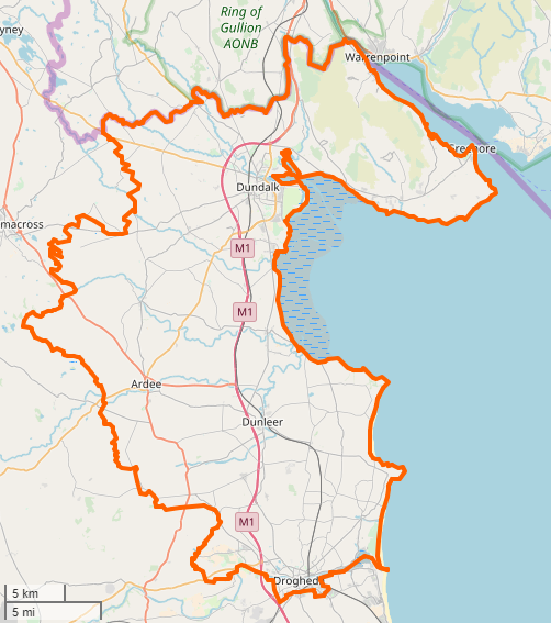
County Louth is divided into borough and municipal districts and LEAs, defined by electoral divisions. The municipal district which contains the administrative area of the former borough of Drogheda is referred to as a Borough District.
Councillors have regular monthly meetings both as a whole council and within their municipal district. Each municipal district elects its own chair, titled a Cathaoirleach.
| Municipal District | LEA | Definition | Seats |
|---|---|---|---|
| Ardee | Ardee Rural, Ardee Urban, Castlebellingham, Clonkeen, Collon, Darver, Dromin, Drumcar, Dunleer, Dysart, Killanny, Louth, Mansfieldstown, Mullary, Stabannan and Tallanstown | 6 | |
| Borough District of Drogheda | Drogheda Rural | Clogher, Monasterboice, St. Peter's and Termonfeckin | 4 |
| Drogheda Urban | Fair Gate, St Lawrence Gate, St. Mary's (part) and West Gate | 6 | |
| Dundalk | Dundalk—Carlingford | Ballymascanlan, Carlingford, Drummullagh, Dundalk No. 1 Urban, Dundalk No. 2 Urban, Faughart, Greenore, Jenkinstown, Rathcor, Ravensdale; those parts of the electoral divisions of Castletown, Dundalk Rural, Dundalk No. 3 Urban and Dundalk No. 4 Urban not contained in the local electoral area of Dundalk South | 6 |
| Dundalk South | Barronstown, Castlering, Creggan Upper, Dromiskin, Haggardstown; those parts of the electoral divisions of Castletown and Dundalk Rural south of the R178 (Carrickmacross Road); and those parts of the electoral divisions of Dundalk No. 3 Urban and Dundalk No. 4 Urban south of a line drawn as follows: Commencing at the boundary between the electoral divisions of Dundalk No. 1 Urban and Dundalk No. 3 Urban at the Carrickmacross Road Bridge and St. Dominick's Place and then proceeding in an easterly direction to the junction of St. Dominick's Place with the roundabout at the Crescent; then proceeding in a clockwise direction around and excluding the said roundabout to its junction with Anne Street; then proceeding in a north-easterly direction along Anne Street to its junction with Park Street; then proceeding in a north easterly direction along Park Street to its junction with Francis Street; then proceeding in a north-easterly direction along Francis Street and Roden Place following the boundary between the electoral divisions of Dundalk No. 1 Urban and Dundalk No. 4 Urban; then proceeding in an easterly direction along Jocelyn Street, Seatown Place and along the road connecting Seatown Place to Barrack Street to reach the junction of said road with the Dundalk Inner Relief Road; then proceeding in a north-westerly projection along the Dundalk Inner Relief Road to its junction with the road at St. Helena; then proceeding along the north-easterly projection of the said road at St. Helena to Dundalk Harbour | 7 |
Councillors
The following were elected at the 2024 Louth County Council election.
2024 seats summary
| Party | Seats |
|---|---|
| 7 | |
| 6 | |
| 6 | |
| 2 | |
| 1 | |
| 7 |
Councillors by electoral area
This list reflects the order in which councillors were elected on 7 June 2024.
;Notes
Co-options
Chief executive
Each council has a chief executive, previously known as city or county manager, who is the manager of the local authority.
| Year | Title | Name | Next position |
|---|---|---|---|
| 2024–present | Chief Executive | David Conway | |
| 2014–2024 | Chief executive | Joan Martin | |
| 2013–2014 | County Manager | Philomena Poole | County manager for Dún Laoghaire–Rathdown County Council |
| 2012–2013 | Acting County Manager | Joan Martin | |
| 2007–2012 | County Manager | Conn Murray | City and County Manager for Limerick Council |
Each Chief Executive has a Management Team made up of appointed Directors of Service who head specified Directorates. Under a provision of the Local Government Act the elected members must vote confidence in a new chief executive and also have the power to remove one from office. The Cathaoirleach chairs each monthly meeting as well as meetings of the Corporate Policy Group (CPG) some weeks in advance of the agenda being agreed. Members of the CPG Team include the elected chairpersons of each Strategic Policy Committee (SPC), the Directors of Service and the Meetings Administrator. There are five SPC chairpersons in Louth County Council and Directors of Service serve on each with an agreed workplan. There is also an Audit Committee on which two members are elected to serve together with three appointed members, one of whom will be the independent chairperson. The Audit Committee must always remain independent from the council though publishes minutes and an agreed workplan. The LCDC, made up of four elected members, the Chief Executive of the day, several Directors of Service, several staff members and appointed members from various sectoral interests is similar to a SPC in nature, in actual statute, but does not publish or agree its workplan with the elected members or be scrutinised by the Audit Committee despite having a considerable financial budget.
Cathaoirleach of the council
Every year, the local authority elects a chair called the Cathaoirleach (chairperson) for a term of one year and a deputy chair called the Leas-Cathaoirleach from among its members. The members elected for each municipal district elect a Cathaoirleach and a Leas-Chathaoirleach for their grouping. The Cathaoirleach chairs the meetings of the local authority or municipal district. Mayor and Deputy Mayor are titles used in municipal districts which were formerly borough councils. Based on population the Dundalk Municipal District is the largest in the state, comprising 13 elected members, but is not designated as a borough district. Following the 2014 legislation it was an option for Dundalk to be also recognised as a borough district on the equivalent standing as her sister town of Drogheda on the legislation drawn up by then Minister for Local Government John Paul Phelan. Despite requests this was not taken up.
| Year | Name | Party |
|---|---|---|
| 2023–2024 | Paula Butterly | |
| 2022–2023 | Conor Keelan | |
| 2021–2022 | Pio Smith | |
| 2020–2021 | Dolores Minogue | |
| 2018–2020 | Liam Reilly | |
| 2017–2018 | Colm Markey | |
| 2016–2017 | Paul Bell | |
| 2015–2016 | Peter Savage (7th) | |
| 2014–2015 | Oliver Tully (2nd) | |
| 2013–2014 | Declan Breathnach (2nd) | |
| 2012–2013 | Finnan McCoy | |
| 2011–2012 | Oliver Tully (1st) | |
| 2010–2011 | Peter Savage (6th) | |
| 2009–2010 | Jim D'Arcy | |
| 2008–2009 | Declan Breathnach (1st) | |
| 2007–2008 | Jimmy Mulroy | |
| 2006–2007 | Jim Lennon | |
| 2005–2006 | Peter Savage (5th) | |
| 2004–2005 | Terry Brennan | |
| 2003–2004 | Nicholas McCabe (8th) | |
| 2002–2003 | Jacqui McConville | |
| 2001–2002 | Tommy Reilly (2nd) | |
| 2000–2001 | Nicholas McCabe (7th) | |
| 1999–2000 | Peter Savage (4th) | |
| 1998–1999 | Miċéal O'Donnell (2nd) | |
| 1997–1998 | Martin Bellew | |
| 1996–1997 | Tommy Reilly (1st) | |
| 1995–1996 | W. Frank Godfrey | |
| 1994–1995 | Nicholas McCabe (6th) | |
| 1993–1994 | Jim Cousins | |
| 1992–1993 | Peter Savage (3rd) | |
| 1991–1992 | John McConville (2nd) | |
| 1990–1991 | Miċéal O'Donnell (1st) | |
| 1989–1990 | Nicholas McCabe (5th) | |
| 1988–1989 | Peter Savage (2nd) | |
| 1986–1988 | John McConville (1st) | |
| 1985–1986 | Peter Savage (1st) | |
| 1983–1985 | Nicholas McCabe (4th) | |
| 1982–1983 | Patrick Buckley | |
| 1981–1982 | Nicholas McCabe (3rd) | |
| 1980–1981 | Tommy Elmore | |
| 1979–1980 | Nicholas McCabe (2nd) | |
| 1976–1979 | Peter J. Moore | |
| 1975–1976 | Patrick J. O'Hare (2nd) | |
| 1974–1975 | Nicholas McCabe (1st) | |
| 1973–1974 | Patrick J. O'Hare (1st) | |
| 1967–1973 | Paddy Donegan | |
| 1960–1967 | Bernard Rafferty | |
| 1958–1960 | William Woods (2nd) | |
| 1957–1958 | Laurence Walsh | |
| 1955–1957 | William Woods (1st) | |
| 1925–1955 | James McGee | |
| 1920–1925 | James Murphy | |
| 1918–1920 | Patrick McGee | |
| 1913–1918 | William Doran | |
| 1899–1913 | Peter Hughes |
Population by local electoral area
The table below sets out the population of the county broken down by Local Electoral Area, total 2022 population of 139,703.
| LEA | Population (2016) | Population (2022) | Seats | Population per seat |
|---|---|---|---|---|
| Drogheda Rural | 17,876 | 19,845 | 4 | 4,961 |
| Drogheda Urban | 27,656 | 28,537 | 6 | 4,756 |
| Dundalk South | 30,207 | 38,195 | 7 | 5,457 |
| Dundalk Carlingford | 25,599 | 26,092 | 6 | 4,349 |
| Ardee | 29,026 | 27,034 | 6 | 4,506 |
The table below sets out the electorate population of the county broken down by Local Electoral Area.
| LEA | Electorate (2022) | Seats | Electorate per seat |
|---|---|---|---|
| Drogheda Rural | 14,133 | 4 | 3,533 |
| Drogheda Urban | 19,729 | 6 | 3,288 |
| Dundalk South | 25,691 | 7 | 3,670 |
| Dundalk Carlingford | 20,039 | 6 | 3,339 |
| Ardee | 19,928 | 6 | 3,321 |
Population by municipal district
The table below sets out the population of the county broken down by Municipal District, total 2022 population of 139,703. File:Dundalk Municipal.District.png|Dundalk Municipal District File:Drogheda Municipal District.png|Drogheda Municipal District File:Ardee Municipal.District.png|Ardee Municipal District
| District | Population (2011) | Population (2016) | Population (2022) | Seats | Population per seat |
|---|---|---|---|---|---|
| Dundalk | 53,082 | 55,806 | 64,287 | 13 | 4,945 |
| Drogheda | 41,925 | 44,052 | 48,382 | 10 | 4,838 |
| Ardee | 27,890 | 29,026 | 27,034 | 6 | 4,506 |
Population by electoral division
The table below sets out the population of the county broken down by electoral division.
| Electoral Division | Population (2006) | Population (2011) | Population (2016) |
|---|---|---|---|
| Louth | 111,267 | 122,897 | 128,375 |
| Dundalk (Town + Rural) | 51,758 | 56,761 | 59,557 |
| Dundalk Town | 29,037 | 31,149 | 32,288 |
| 004 Dundalk Urban No. 1 | 2,190 | 2,148 | 2,169 |
| 005 Dundalk Urban No. 2 | 1,211 | 1,169 | 1,140 |
| 006 Dundalk Urban No. 3 | 1,400 | 1,449 | 1,710 |
| 007 Dundalk Urban No. 4 | 6,183 | 6,039 | 5,970 |
| 023 Castletown (Part Urban) | 2,518 | 2,637 | 2,685 |
| 027 Dundalk Rural (Part Urban) | 15,440 | 17,620 | 18,514 |
| 030 Haggardstown (Part Urban) | 95 | 87 | 100 |
| Dundalk rural area | 22,721 | 25,612 | 27,269 |
| 019 Ballymascanlan | 2,016 | 2,213 | 2,206 |
| 020 Barronstown | 647 | 744 | 746 |
| 021 Carlingford | 1,384 | 1,801 | 2,201 |
| 022 Castlering | 935 | 1,012 | 1,034 |
| 023 Castletown (Part Rural) | 1,421 | 1,573 | 1,622 |
| 024 Creggan Upper | 684 | 787 | 852 |
| 025 Darver | 562 | 568 | 678 |
| 026 Drummullagh | 1,120 | 1,257 | 1,350 |
| 027 Dundalk Rural (Part Rural) | 535 | 540 | 686 |
| 028 Faughart | 905 | 991 | 958 |
| 029 Greenore | 979 | 1,169 | 1,201 |
| 030 Haggardstown (Part Rural) | 5,769 | 6,303 | 6,819 |
| 031 Jenkinstown | 948 | 1,173 | 1,277 |
| 032 Killanny | 683 | 799 | 825 |
| 033 Louth | 1,308 | 1,505 | 1,575 |
| 034 Mansfieldstown | 640 | 807 | 855 |
| 035 Rathcor | 1,203 | 1,352 | 1,374 |
| 036 Ravensdale | 982 | 1,018 | 1,010 |
| Drogheda Borough | 28,973 | 28,576 | 29,471 |
| 001 Fair Gate | 9,783 | 9,806 | 10,317 |
| 002 St. Laurence Gate | 3,801 | 4,004 | 4,075 |
| 003 West Gate | 5,899 | 6,042 | 6,284 |
| 041 St. Peter's (Part Urban) | 3,460 | 2,161 | 2,099 |
| 047 St. Mary's (Part Urban) | 6,030 | 6,563 | 6,696 |
| Ardee No. 1 rural area | 17,976 | 20,262 | 20,924 |
| 008 Ardee Rural | 2,626 | 2,875 | 2,952 |
| 009 Ardee Urban | 4,301 | 4,554 | 4,917 |
| 010 Castlebellingham | 1,371 | 1,617 | 1,688 |
| 011 Clonkeen | 545 | 648 | 675 |
| 012 Collon | 1,380 | 1,770 | 1,859 |
| 013 Dromin | 535 | 610 | 629 |
| 014 Dromiskin | 1,935 | 2,187 | 2,226 |
| 015 Drumcar | 1,385 | 1,526 | 1,451 |
| 016 Dunleer | 2,340 | 2,796 | 2,868 |
| 017 Stabannan | 590 | 620 | 619 |
| 018 Tallanstown | 968 | 1,059 | 1,040 |
| Louth rural area | 12,560 | 17,298 | 18,423 |
| 037 Clogher | 2,494 | 3,031 | 3,237 |
| 038 Dysart | 777 | 918 | 925 |
| 039 Monasterboice | 1,164 | 1,342 | 1,365 |
| 040 Mullary | 1,528 | 1,723 | 1,754 |
| 041 St. Peter's (Part Rural) | 4,022 | 6,990 | 7,605 |
| 042 Termonfeckin | 2,575 | 3,294 | 3,537 |
References
References
- "Services". Louth County Council.
- "Local Government (Ireland) Act 1898 (c. 37)". [[The National Archives (United Kingdom).
- (12 August 1898). "[[Local Government (Ireland) Act 1898]]".
- (12 August 1898). "Local Government (Ireland) Act 1898".
- (1900). "27th Report of the Local Government Board for Ireland (Cmd. 9480)". [[Local Government Board for Ireland]].
- "Louth County Committee of Agriculture (and Technical Instruction) Archives, 1901 - 1985". Louth County Council.
- (8 October 2003). "Details of Local Authorities in Ireland".
- Rudd, J.. (1990). "Studying Your Local Area: A Guide to Information Sources". Combat Poverty Agency.
- "Louth County Hall Millennium Centre". Planning Architecture Design Database Ireland.
- {{Cite ISB. (2014). (16 December 2014)
- "Information Note for Data Users: Revision to the Irish NUTS2 and NUTS3 regions".
- "EMRA Members".
- (1921). "Annual report of the Local Government Board for Ireland for year 1921". [[Local Government Board for Ireland]].
- "Local Government (Ireland) Act 1919 (c. 19)". [[The National Archives (United Kingdom).
- {{cite ISB. (2018). (19 December 2018)
- {{cite ISB. (2019). (17 January 2019)
- {{cite ISB. (2014). (27 January 2014)
- "Cathaoirligh of Dundalk Urban District Council/Municipal District of Dundalk - Louth County Council".
- "Louth County Council – Elected Candidates". [[RTÉ News]].
- (18 December 2024). "New faces on Louth County Council as Rachel Kerley and Debbie McCole co-opted".
- "Chief Executive of the council".
- Savage, John. (15 July 2024). "Tributes paid to retiring Louth Chief Executive Joan Martin".
- (8 July 2024). "Recruitment process for CEO, Louth County Council underway". Drogheda Independent.
- (2024-11-18). "David Conway appointed new Chief Executive of LCC".
- (10 January 2015). "Joan first CEO of Louth Council". Dundalk Leader.
- (19 February 2014). "Poole set to leave Louth council after six months".
- "Murray named as new 'super manager' for new Limerick local authority". Limerick Leader.
- "Cathaoirleach of the council".
- "Cathaoirleach of Council - Louth County Council".
- "Louth County Council Population CSO Ireland".
- "Drogheda Rural 2022 Population CSO Ireland".
- "Drogheda Urban 2022 Population CSO Ireland".
- "Census 2016 Sapmap Area: Local Electoral Area Dundalk South".
- "Dundalk South 2022 Population CSO Ireland".
- "Census 2016 Sapmap Area: Local Electoral Area Dundalk Carlingford".
- "Dundalk North 2022 Population CSO Ireland".
- "Census 2016 Sapmap Area: Local Electoral Area Ardee".
- "Ardee 2022 Population CSO Ireland".
- "Drogheda Rural 2024 Local Elections Electorate {{!}} RTÉ".
- "Drogheda Urban 2024 Local Elections Electorate {{!}} RTÉ".
- "Dundalk South 2024 Local Elections Electorate {{!}} RTÉ".
- "Dundalk Carlingford 2024 Local Elections Electorate {{!}} RTÉ".
- "Ardee 2024 Local Elections Electorate {{!}} RTÉ".
- "LOuth County Council Population {{!}} CSO Ireland".
- "Census 2016 Sapmap Area: Municipal District Dundalk".
- "Census 2016 Sapmap Area: Municipal District Drogheda".
- "Census 2016 Sapmap Area: Municipal District Ardee".
- "Census of population by electoral division 2016". CSO.
This article was imported from Wikipedia and is available under the Creative Commons Attribution-ShareAlike 4.0 License. Content has been adapted to SurfDoc format. Original contributors can be found on the article history page.
Ask Mako anything about Louth County Council — get instant answers, deeper analysis, and related topics.
Research with MakoFree with your Surf account
Create a free account to save articles, ask Mako questions, and organize your research.
Sign up freeThis content may have been generated or modified by AI. CloudSurf Software LLC is not responsible for the accuracy, completeness, or reliability of AI-generated content. Always verify important information from primary sources.
Report