From Surf Wiki (app.surf) — the open knowledge base
Loch Lomond and The Trossachs National Park
National park in Scotland

National park in Scotland
| Field | Value |
|---|---|
| name | Loch Lomond and The Trossachs National Park |
| iucn_category | V |
| photo | Loch Katrine.jpg |
| photo_caption | Looking eastwards along Loch Katrine |
| location | United Kingdom (Scotland) |
| map_image | Loch Lomond and The Trossachs National Park UK relief location map.png |
| coordinates | |
| area_km2 | 1865 |
| area_ref | |
| established | 2002 |
| governing_body | National park authority |
| website | Official Website |
Loch Lomond and The Trossachs National Park () is a national park in Scotland centred on Loch Lomond and the hills and glens of the Trossachs, along with several other ranges of hills. It was the first of the two national parks established by the Scottish Parliament in 2002, the second being the Cairngorms National Park. The park extends to cover much of the western part of the southern highlands, lying to the north of the Glasgow conurbation, and contains many mountains and lochs. It is the fourth-largest national park in the British Isles, with a total area of 1,865 km2 and a boundary of some 350 km in length. It features 21 Munros (including Ben Lomond, Ben Lui, Beinn Challuim, Ben More and two peaks called Ben Vorlich) and 20 Corbetts.
The park straddles the Highland Boundary Fault, which divides it into two distinct regions - lowland and highland - that differ in underlying geology, soil types and topography. The change in rock type can most clearly be seen at Loch Lomond itself, as the fault runs across the islands of Inchmurrin, Creinch, Torrinch and Inchcailloch and over the ridge of Conic Hill. To the south lie green fields and cultivated land; to the north, mountains.
The Loch Lomond and The Trossachs National Park lies close to Scotland's heavily populated Central Belt, and the area has long been popular with visitors. Principal attractions are viewing scenery and wildlife, walking, climbing, water sports, and other outdoor activities. In 2017, there were 2.9 million visits to the park, of which 2.1 million were day visits and 783,000 were made by visitors staying overnight within the park.
Geography
The national park extends to cover much of the western part of the southern highlands, lying to the north of the Glasgow conurbation. The park authority defines the park as being split into four sections: Breadalbane, Loch Lomond, The Trossachs, and Cowal.
The park is centred on Loch Lomond, the largest lake in Great Britain by surface area, with a surface area of 27.5 mi2. The loch contains many islands, including Inchmurrin, the largest fresh-water island in the British Isles. It is a popular leisure destination, and is surrounded by hills, including Ben Lomond on the eastern shore, which is 973.7 m in height, and the most southerly of the Scottish Munro peaks. A 2005 poll of Radio Times readers voted Loch Lomond as the sixth greatest natural wonder in Britain.
The Trossachs are an area of wooded hills, glens and lochs that lie to the east of Loch Lomond. The name was originally applied only to a small woodland glen that lies at the centre of the area, but is now generally applied to the wider region. They have long been visited by tourists due to the relative proximity of major population centres such as Glasgow and Stirling, and the area remains popular with walkers, cyclists and tourists. The wooded hills and lochs of the area may be considered to represent a microcosm of a typical highland landscape, and the woodlands are an important habitat for many species.
Much of the Trossachs area is protected by various different conservation designations, including the "Great Trossachs Forest" national nature reserve.
Breadalbane refers to the northern part of the park, including the villages of Crianlarich and Tyndrum. The area consists of the steep hills and mountains of the southern highlands, and includes Ben More, the highest mountain in the national park.
The westernmost part of the park comprises the eastern side of the Cowal peninsula, which is separated from the rest of the park by Loch Long. The Arrochar Alps, a popular location for hillwalking and climbing, lie at the northern edge of Cowal, overlooking Loch Lomond.
Several major transport routes pass through the park, including the A82 road between Glasgow and Fort William, which follows the western shore of Loch Lomond, continuing north via Strath Fillan to bypass the village of Crianlarich and pass through Tyndrum. The A85 road from Edinburgh passes to the east of the Trossachs and through the Breadalbane area of the park, meeting the A82 at Crianlarich. The only railway in the national park is the West Highland Line, which follows the eastern shore of Loch Long as far as Arrochar, and thence runs close to the A82 as far as Tyndrum.
Formation of the national park
Many countries have established national parks on the basis of setting aside areas of wilderness; Scotland however, lacks any such areas, as thousands of years of human activity have altered the landscape. Human settlement and activity, including agriculture, historical deforestation, overgrazing by sheep and deer, and extensive 20th century afforestation with introduced tree species (particularly conifers) have resulted in landscapes which are best described as semi-natural.
Despite the lack of true "wilderness" the idea that areas of Scotland having wild or remote character should be designated to protect the environment and encourage public access grew in popularity throughout the nineteenth and early twentieth centuries. Following the Second World War, a committee was established to consider the issue of national parks in Scotland. The report, published in 1945, proposed national parks in five areas, one of which was Loch Lomond and The Trossachs. The government designated these five areas as "National Park Direction Areas", giving powers for planning decisions taken by local authorities to be reviewed by central government, however the areas were not given full national park status. In 1981 the direction areas were replaced by national scenic areas, of which there are now 40. In 1990 the Countryside Commission for Scotland (CCS) produced a report into protection of the landscape of Scotland, which recommended that four areas were under such pressure that they ought to be designated as national parks, each with an independent planning board, in order to retain their heritage value. The four areas identified were similar to those proposed in 1945, and thus again included Loch Lomond and The Trossachs.
Despite this long history of recommendations that national parks be established in Scotland, no action was taken until the establishment of the Scottish Parliament in 1999. The Loch Lomond and The Trossachs National Park was designated as such under the National Parks (Scotland) Act 2000, which was one of the first pieces of legislation to be passed by the Parliament. The park was formally established on 1 July 2002.
Wildlife and conservation

Over 200 species of birds and over 25% of all the species of plants known to occur in Britain have been recorded in the national park. The park is home to many of the species most associated with the Scottish highlands, including capercaillie, red deer, red squirrel, Scottish wildcat, golden eagle, peregrine falcon, black grouse, buzzard and osprey. Beavers are also now present in the park, with signs of beaver activity being observed on Loch Achray in the Trossachs during a survey undertaken over the winter of 2017–18; the beavers are assumed to have spread there from the existing population on the River Tay. A colony of wallabies has lived on Inchconnachan, an island in Loch Lomond, since 1940.
Many different habitats are present in the park, including large areas of woodland, which covers approximately 30% of the park. Around 22.5% is covered commercial conifer plantations, whilst native woodlands cover 7.5%. Native woodland in the park includes area of Atlantic oakwoods, Caledonian pinewoods, and areas of wet woodland. Higher up there are important upland habitats such as heathland, blanket bog and willow scrub. The park has 22 large lochs and 50 rivers and larger burns, along with numerous smaller lochs, lochans and burns. These waters support fish species such as salmon, trout, Arctic charr, powan and river, brook and sea lampreys.
The park also includes 39 mi of coastline around three sea lochs: Loch Long, Loch Goil and the Holy Loch. This coastline consists of many rocky shores, cliffs, and areas of salt marsh and mudflats. The coastal habitat is rich in marine invertebrates, and supports a range of waders and seabirds. Marine wildlife such as harbour seals and porpoises can be found further offshore.
Conservation designations
The national park is classified as a Category v protected area by the International Union for Conservation of Nature. In total 67 sites within the park hold some form of conservation designation for their natural heritage value, including 8 Special Areas of Conservation (SAC) and 2 Special Protection Areas (SPA). Two of Scotland's national scenic areas - Loch Lomond NSA and the Trossachs NSA - are wholly within the national park, and the westernmost part of the River Earn (Comrie to St Fillans) NSA also lies within the park's boundaries. Additionally, there are two forest parks (Queen Elizabeth Forest Park and Argyll Forest Park) and two national nature reserves (NNR) (Loch Lomond National Nature Reserve and The Great Trossachs Forest National Nature Reserve) within the National Park.
Recreation and tourism

The area has long been popular with tourists, with the Trossachs being one of the first parts of Scotland to become a recognised tourist destination due to its position on the southern edge of the Scottish Highlands and to the quality of the scenery, which may be considered to represent a microcosm of a typical Highland landscape. Loch Lomond was also a popular destination for early travellers, such that when James Boswell and Samuel Johnson visited on the return from their tour of the Western Isles in 1773, the area was already firmly enough established as a destination for Boswell to note that it would be unnecessary to attempt any description.
In 2017 there were 2.9 million visits to the park, of which 2.1 million were day visits and 783,000 were made by visitors staying overnight within the park. Beauty spots include the Falls of Dochart, the viewpoint at the Rest and be thankful, and Inchcailloch island in Loch Lomond. There is a national park visitor centre in Balloch at the southern end of Loch Lomond, called Loch Lomond Shores, which includes a visitor information centre at the most popular gateway to the park, as well as an aquarium, shops and restaurants.
Loch Lomond is one of Scotland's premier boating and watersports venues, with visitors enjoying activities including kayaking, Canadian canoeing, paddle boarding, wake boarding, water skiing and wake surfing. Cruises on the loch can be taken from Tarbet, Inversnaid, Luss and Rowardennan, and on Loch Katrine in the Trossachs visitors can travel on the historic steamship SS Sir Walter Scott (launched in 1899).
The park is popular with walkers, with routes ranging from easy family strolls through to hillwalking on the park's highest summits. Popular summits include Ben Lomond in Dunbartonshire and The Cobbler in the Arrochar Alps. The West Highland Way, Scotland's first officially designated long-distance footpath, passes through the park, following the eastern shore of Loch Lomond and passing close to Crianlarich. In addition to the West Highland Way five more of Scotland's Great Trails pass through sections of the park, including the Loch Lomond and Cowal Way, the Three Lochs Way and the Great Trossachs Path.
As with all land and inland water in Scotland there is a right of responsible access to the land, lochs and rivers of the park for those wishing to participate in recreational pursuits such as walking, camping, swimming and canoeing. In 2017 the national park authority introduced byelaws restricting the right to camp along much of the shoreline of Loch Lomond, due to issues such as litter and anti-social behaviour that were blamed on some irresponsible campers. The byelaws were opposed by groups such as Mountaineering Scotland and Ramblers Scotland, who argued that they would criminalise camping even where it was carried out responsibly, and that the national park authority already had sufficient powers to address irresponsible behaviour using existing laws. The restrictions have since been extended to cover a number of other parts of the park, including land around most of the major lochs. In these areas camping is now restricted to designated sites, and campers are required to purchase a permit to camp within these areas between March and October.
Administration

The national park is administered by a national park authority, which is an executive non-departmental public body of the Scottish Government. Under the National Parks (Scotland) Act 2000, national parks in Scotland have four aims:
- To conserve and enhance the natural and cultural heritage of the area
- To promote sustainable use of the natural resources of the area
- To promote understanding and enjoyment (including enjoyment in the form of recreation) of the special qualities of the area by the public
- To promote sustainable economic and social development of the area's communities
The aims are slightly broader than the duties and purposes set out for English and Welsh national parks under the National Parks and Access to the Countryside Act 1949 and amending legislation. The general purpose of the national park authority, as defined in the National Parks (Scotland) Act 2000, is to ensure that these aims are "collectively achieved ...in a coordinated way". Although the four aims have equal status, in accordance with the Sandford Principle, the first aim (conservation and enhancement of the natural and cultural heritage) is to be given greater weight when it appears to the park authority that there is irreconcilable conflict with the other aims.
The Loch Lomond and The Trossachs National Park Authority is a full planning authority, exercising powers that would otherwise be exercised by local authorities, and also takes responsibility for managing access to the countryside that elsewhere falls to local authorities. Aside from the planning and access function, the national parks authority has considerable flexibility as to how the four aims are achieved. It can, for example, acquire land, make byelaws and management agreements, provide grants, offer advice, and undertake or commission research. The authority is headquartered in Balloch, at the southern end of Loch Lomond.
The national park authority is run by a board, consisting of 17 members. Five members are elected by the community and twelve are appointed by the Scottish Government, of whom six are nominated by the Local Authorities. The board meets in public at least three times a year.
Towns and villages within the park
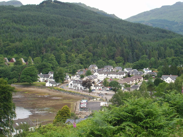
As of the 2011 census the population of the national park was 15,168.
| Council area | Towns and villages |
|---|---|
| Stirling | Aberfoyle, Balmaha, Brig o' Turk, Callander, Crianlarich, Croftamie, Drymen, Inversnaid, Killin, Lochearnhead, Port of Menteith, Tyndrum, Strathyre, Balquhidder, Kilmahog, Gartmore, Inchmahome (Island of Lake of Menteith) |
| West Dunbartonshire | Balloch, Croftamie, Gartocharn |
| Perth and Kinross | St Fillans |
| Argyll and Bute | Ardentinny, Ardlui, Arrochar, Blairmore, Carrick Castle (village), Glenbranter, Kilmun, Lochgoilhead, Luss, Tarbet, Succoth, Strone, Whistlefield. |
Munros within the Park
.jpg)
There are 21 Munros (mountains over 914.4 m) in the National Park, of which 16 are within the Breadalbane section of the park. Ben Lomond is one of the most frequently climbed mountains in Scotland. A list of Munros within the park and the closest village is given below:
- Ben More (1173.9 m), Crianlarich
- Stob Binnein (1164.8 m), Crianlarich
- Ben Lui (1131.4 m), Tyndrum
- Cruach Ardrain (1045.9 m), Crianlarich
- Ben Oss (1029.8 m), Tyndrum
- Ben Challum (1024.9 m), Tyndrum
- Beinn Ime (1012.2 m), Arrochar
- An Caisteal (995.9 m), Crianlarich
- Ben Vorlich (985.3 m), Lochearnhead
- Beinn Dubhchraig (978.6 m), Tyndrum
- Ben Lomond (973.7 m), Balmaha
- Stuc a' Chroin (973 m), Lochearnhead
- Meall Glas (959.3 m), Crianlarich
- Beinn Tulaichean (945.8 m), Crianlarich
- Ben Vorlich (942.8 m), Ardlui
- Beinn a' Chroin (941.4 m), Crianlarich
- Beinn Chabhair (932.2 m), Ardlui
- Beinn Narnain (926.8 m), Arrochar
- Sgiath Chuil (920.1 m), Crianlarich
- Beinn a' Chleibh (916.3 m), Tyndrum
- Ben Vane (915.76 m), Ardlui
References
Citations
Bibliography
References
- "Key Facts". Loch Lomond and The Trossachs National Park Authority.
- (8 July 2002). "National park 'goes live'". BBC News.
- Wild Park 2020. p. 55.
- Tom Weir. (1980). "The Scottish Lochs". Constable and Company.
- "Archived copy".
- "Explore by map". Loch Lomond and The Trossachs National Park Authority.
- (1994). "The Guinness Book of Records 1995". Guinness World Records Limited.
- Worsley, Harry. (1988). "Loch Lomond: The Loch, the Lairds and the Legends". Lindsay Publications.
- "Loch Lomond". Loch Lomond and The Trossachs National Park Authority.
- [[Ordnance Survey]] 1:50000 ''Landranger Map''. Sheet 56. Loch Lomond and Inverary.
- [https://news.bbc.co.uk/2/hi/uk_news/wales/mid_/4735935.stm "Caves win 'natural wonder' vote"] BBC.co.uk Retrieved 10 December 2006.
- D. Bennet (ed.) The Southern Highlands. Scottish Mountaineering Club District Guides - Scottish Mountaineering Trust. 2nd edition (August 1986). pp. 47-49.
- (2006). "Strath Gartney, Achray and Loch Ard Forest: Special qualities of the Trossachs". Loch Lomond and The Trossachs National Park Authority.
- (2006). "Sitelink - Map Search". Scottish Natural Heritage.
- SNH Commissioned Report 376: The Special Landscape Qualities of the Loch Lomond and The Trossachs National Park. p. 26.
- "Breadalbane {{!}} Highlands, Loch Tay, Perthshire {{!}} Britannica".
- "Breadalbane from The Gazetteer for Scotland".
- "Argyll Forest Park". Forestry Commission Scotland.
- "Arrochar Alps and Crianlarich". WalkHighlands.
- "Wildness in Scotland's Countryside". Scottish Natural Heritage.
- "History Leading to the Cairngorms National Park". Cairngorms National Park Authority.
- "Brief History of National Parks Proposals". SNH.
- "National Scenic Areas". Scottish Natural Heritage.
- (March 2013). "Unfinished Business a national parks strategy for scotland". Scottish Campaign for National Parks.
- "Wildlife & Nature in and around the Loch Lomond and Trossachs National Park". Visit Loch Lomond.
- (2018). "SNH Research Report 1013 - Survey of the Tayside area beaver population 2017-2018". Scottish Natural Heritage.
- "About Loch Lomond". Visitscotland.
- (October 2019). "Trees and Woodland Strategy". Loch Lomond and The Trossachs National Park Authority.
- Wild Park 2020. p. 24.
- Wild Park 2020. p. 31.
- Wild Park 2020. p. 35.
- Wild Park 2020. p. 44.
- "Loch Lomond and The Trossachs in United Kingdom of Great Britain and Northern Ireland". Protected Planet.
- "Where are we now?". Loch Lomond and The Trossachs National Park Authority.
- Wild Park 2020. p. 162.
- (2010). "SNH Commissioned Report 376: The Special Landscape Qualities of the Loch Lomond and The Trossachs National Park". nature.scot.
- S. Johnson & J. Boswell (ed. R. Black). ''To the Hebrides: "Journey to the Western Isles of Scotland" and "Journal of a Tour to the Hebrides"'', p. 423. Published by Birlinn, 2007.
- Global Tourism Solutions (UK) Ltd. (11 Jan 2019). "Tourism Economic Impact 2017". Loch Lomond & The Trossachs National Park Authority.
- "Loch Lomond Shores". Undiscovered Scotland.
- (March 2013). "Loch Lomond Byelaws 2013". Loch Lomond and The Trossachs National Park Authority.
- (2017). "Cruise Loch Lomond". Cruise Loch Lomond.
- "Loch Katrine - Loch Cruises". Steamship Sir Walter Scott Ltd..
- "Loch Lomond and The Trossachs". WalkHighlands.
- "West Highland Way". Scotland's Great Trails.
- "Long distance walking routes". Loch Lomond and The Trossachs National Park Authority.
- "Scotland's Great Trails: the official guide". Scotland's Great Trails.
- (2005). "Scottish Outdoor Access Code". Scottish Natural Heritage.
- (28 February 2017). "Loch Lomond camping byelaws come into force". Mountaineering Scotland.
- "Camping in the National Park". Loch Lomond and The Trossachs National Park.
- "Camping and Motorhome Byelaw Q&As". Loch Lomond and The Trossachs National Park.
- "Executive non-departmental public bodies". Scottish Government.
- (2017). "National Park". Scottish Natural Heritage.
- (August 2015). "Future National Parks in Scotland: Possible Governance Models". Scottish Campaign for National Parks.
- (October 2017). "A National Park in Galloway? A Discussion Paper". Galloway National Park Association.
- "Our Board & Committees". Loch Lomond and The Trossachs National Park Authority.
- "Ben Lomond".
- "Munros by most climbed".
This article was imported from Wikipedia and is available under the Creative Commons Attribution-ShareAlike 4.0 License. Content has been adapted to SurfDoc format. Original contributors can be found on the article history page.
Ask Mako anything about Loch Lomond and The Trossachs National Park — get instant answers, deeper analysis, and related topics.
Research with MakoFree with your Surf account
Create a free account to save articles, ask Mako questions, and organize your research.
Sign up freeThis content may have been generated or modified by AI. CloudSurf Software LLC is not responsible for the accuracy, completeness, or reliability of AI-generated content. Always verify important information from primary sources.
Report