From Surf Wiki (app.surf) — the open knowledge base
Llanfair-ar-y-bryn
Community and parish in Carmarthenshire, Wales
Community and parish in Carmarthenshire, Wales
| Field | Value | |
|---|---|---|
| type | Community | |
| country | Wales | |
| coordinates | ||
| unitary_wales | Carmarthenshire | |
| module | [[File:Wales Carmarthenshire Community Llanfair-ar-y-Bryn map.svg | 240px]] |
| Map of the community |
Map of the community
Llanfair-y-bryn is a community and Church in Wales parish in Carmarthenshire, Wales. Covering an area of some 95 km², it lies along and to the northwest and southeast of the A483 Swansea to Chester road immediately north of the town of Llandovery. The population of the community at the 2011 census was 624. The term also referred to a church located outside the parish.
Description
Two particularities of Llanfair-ar-y-bryn (meaning: "St Mary's on the hill") are that
- the community and parish contain no settlement of that name: in 1801 it comprised the hamlets of Rhandir Abbot, Rhandir Canol, Rhandir Isaf, and Rhandir Uchaf; today the principal settlements are Cynghordy and Rhandir-mwyn
- the parish church was, until 1883, located one mile outside the parish itself, in Llandingad (Llandovery); in 1883 a new church (also called St Mary's) was opened at a more central location in Cynghordy.
The area is served by trains operated between Swansea and Shrewsbury via Llandrindod Wells by Transport for Wales, which manages Cynghordy railway station, a request stop on the Heart of Wales Line from Llanelli to Craven Arms.
The community is bordered by the communities of: Myddfai; Llandovery; and Cilycwm, all being in Carmarthenshire; by Llanddewi Brefi in Ceredigion; and by: Llanwrtyd Wells; Llangamarch; Maescar; and Llywel, all in Powys.
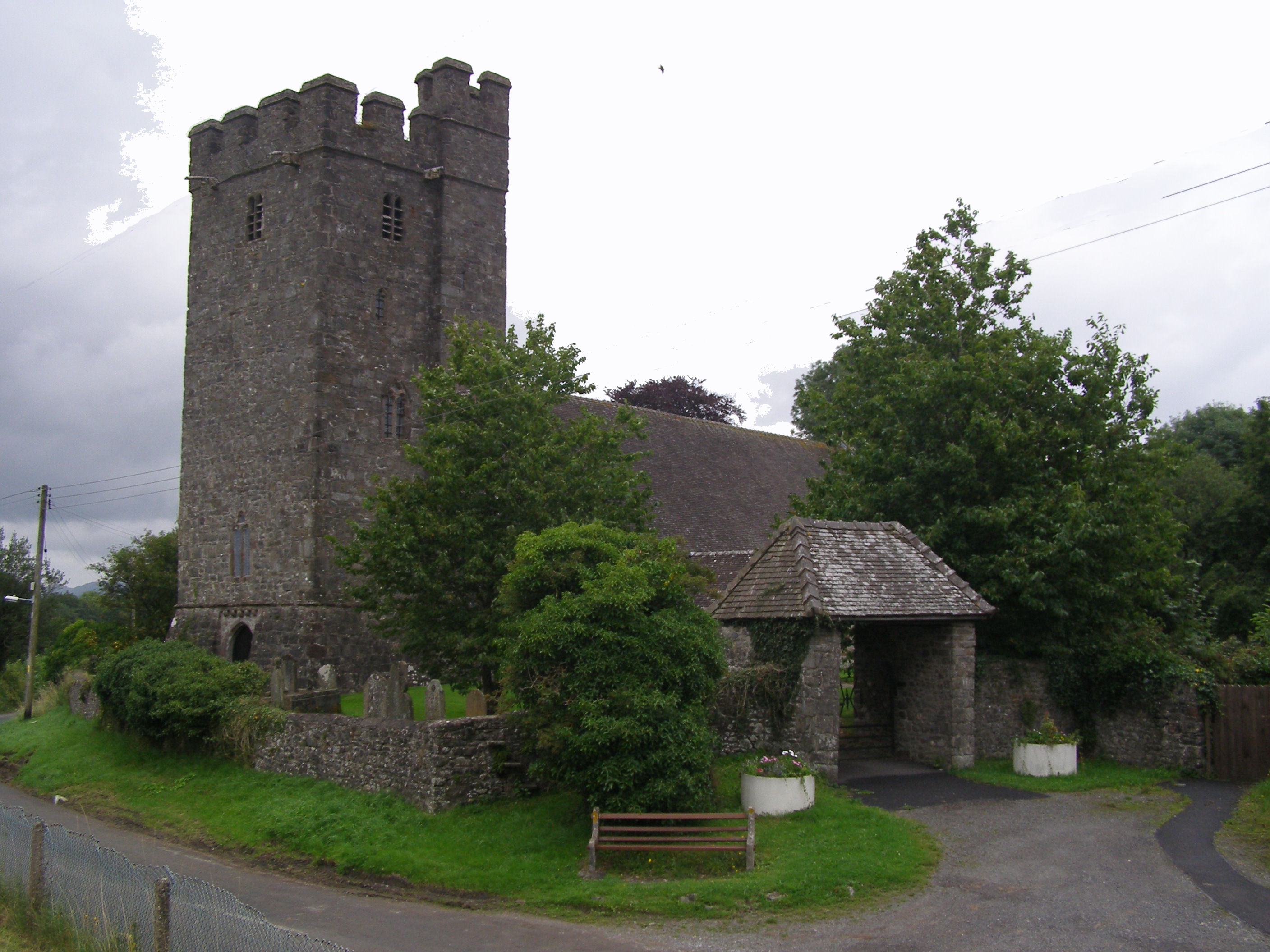
The old parish church, Llanfair-ar-y-bryn
The original Church of St Mary stands a mile outside the parish on the northeastern edge of Llandovery, on the site of the Roman auxiliary fort of Alabum.
William Williams Pantycelyn (1717–1791), generally acknowledged as one of Wales's greatest hymn writers, is buried in the churchyard there, having been a resident of the parish for much of his life.
References
References
- [https://www.google.co.uk/maps?q=llanfair+ar+y+bryn+google+map&oe=utf-8&client=firefox&hnear=Llanfair-ar-y-Bryn,+Carmarthenshire,+United+Kingdom&gl=uk&t=m&z=11 Google map of Llanfair-ar-y-bryn]
- "Community population 2011".
- [https://books.google.com/books?id=ATITAAAAQAAJ&dq=Rhandir+Abbot&pg=PT311 Nicholas Carlisle: A Topographical Dictionary of the Dominion of Wales]
- {{Coflein
This article was imported from Wikipedia and is available under the Creative Commons Attribution-ShareAlike 4.0 License. Content has been adapted to SurfDoc format. Original contributors can be found on the article history page.
Ask Mako anything about Llanfair-ar-y-bryn — get instant answers, deeper analysis, and related topics.
Research with MakoFree with your Surf account
Create a free account to save articles, ask Mako questions, and organize your research.
Sign up freeThis content may have been generated or modified by AI. CloudSurf Software LLC is not responsible for the accuracy, completeness, or reliability of AI-generated content. Always verify important information from primary sources.
Report