From Surf Wiki (app.surf) — the open knowledge base
Lithia Springs, Georgia
| Field | Value |
|---|---|
| official_name | Lithia Springs, Georgia |
| native_name | |
| settlement_type | Unincorporated community |
| Census-designated place | |
| image_skyline | Veterans Memorial Highway, Lithia Springs GA.jpg |
| image_caption | Veterans Memorial Highway |
| (Georgia State Route 8) | |
| image_map | Douglas_County_Georgia_Incorporated_and_Unincorporated_areas_Lithia_Springs_Highlighted.svg |
| mapsize | 250px |
| map_caption | Location in Douglas County and the state of Georgia |
| pushpin_map | |
| pushpin_label_position | |
| subdivision_type | Country |
| subdivision_name | United States |
| subdivision_type1 | State |
| subdivision_name1 | Georgia |
| subdivision_type2 | County |
| subdivision_name2 | Douglas |
| leader_title1 | |
| established_title | |
| established_title2 | |
| established_title3 | |
| population_as_of | 2020 |
| population_total | 16644 |
| population_density_km2 | 478.09 |
| population_density_sq_mi | 1238.21 |
| timezone | Eastern (EST) |
| utc_offset | -5 |
| timezone_DST | EDT |
| utc_offset_DST | -4 |
| coordinates | |
| elevation_footnotes | tags-- |
| elevation_m | 318 |
| elevation_ft | 1043 |
| postal_code_type | ZIP Code |
| postal_code | 30122 |
| area_codes | 770/678/470 |
| blank_name | FIPS code |
| blank_info | 13-46832 |
| blank1_name | GNIS feature ID |
| blank1_info | 0356358 |
| unit_pref | Imperial |
| area_footnotes | |
| area_total_km2 | 34.95 |
| area_total_sq_mi | 13.49 |
| area_land_km2 | 34.81 |
| area_water_km2 | 0.13 |
| area_land_sq_mi | 13.44 |
| area_water_sq_mi | 0.05 |
Census-designated place (Georgia State Route 8)
Lithia Springs () is an unincorporated community and census-designated place, formerly incorporated as a city, located in northeastern Douglas County, Georgia, United States. As of the 2020 census, the community had a population of 16,644. The area is named for its historic lithia mineral water springs.
Incorporated in 1882, Lithia Springs was dissolved the first time in 1933. Lithia Springs became incorporated again in 1994, to be Douglas County's second completely internal municipality, but disincorporated again in 2000.
In 2000, the citizens voted (80% yea, 20% nay) on December 20 to dissolve the city charter and de-incorporate the city, transferring all assets to the county. The referendum that ended the town was part of the settlement in a lawsuit brought by city residents charging the city should be dissolved because it did not deliver enough services to justify its existence under state law. During its incorporation until 2000, the former city had five mayors.
Lithia Springs is assigned the United States Postal Service ZIP code of 30122.
History
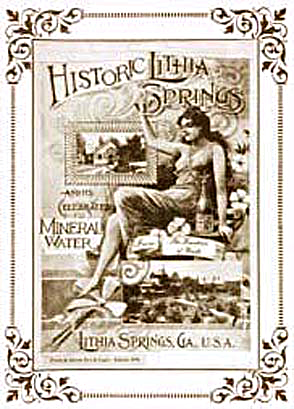
The history of the community began with Lithia Springs, a natural lithia water spring. So popular were the curative waters that flowed from Lithia Springs that people came for miles to drink it. The neighboring city of Austell was also founded due to the spring's popularity.
In 1887 Judge Bowden bought the springs with a group of investors and started bottling and selling Bowden lithia spring water. That same year the Sweet Water Hotel, a 300-room luxury health resort, opened in Lithia Springs. The hotel and its famous lithia spring water were so popular that Mark Twain, members of the Vanderbilt family, and Presidents Cleveland, Taft, McKinley and Theodore Roosevelt all enjoyed the many amenities of the resort, which included the world-famous Lithia Vapor Baths.
In 1888, the Piedmont Chautauqua Institute opened in Lithia Springs. Henry W. Grady, editor of the Atlanta Constitution, was the founder and gave the institute the motto "Enlightenment of the People". In 1888, over 30,000 tourists, sightseers, and health-seekers visited Lithia Springs.
The only remnants of this time that have survived are the natural springs and its historic lithia water under the name brand Lithia, which is still bottled and sold in restaurants and health food stores.
Geography
Lithia Springs is located in the northeastern corner of Douglas County, bordered to the north and east by the Cobb County line and to the south by East County Line Road, Cedar Terrace Road, and Factory Shoals Road. Sweetwater Creek, a tributary of the Chattahoochee River, flows through the eastern part of the community, and Sweetwater Creek State Park is along its southern edge.
Some of the incorporated limits of Douglasville occupy some of the territory around Lithia Springs, along Interstate 20, Blair Bridge Road, Lee Road and Thornton Road.
According to the U.S. Census Bureau, the Lithia Springs CDP has a total area of 35.4 sqkm, of which 35.2 sqkm is land and 0.13 sqkm, or 0.37%, is water.
Demographics
1850-1870 1870-1880 1890-1910 1920-1930 1940 1950 1960 1970 1980 1990 2000 2010 2020
Lithia Springs was first listed as a census designated place in the 1980 U.S. census. After incorporation in 1994, it was delineated as a city with 2,072 people in the 2000 U.S. census. After the city was dissolved, it was redesignated as a CDP in the 2010 U.S. census.
| Race / Ethnicity (NH = Non-Hispanic) | title=P004 Hispanic or Latino, and Not Hispanic or Latino by Race – 2000: DEC Summary File 1 – Lithia Springs town, Georgia | url=https://data.census.gov/table/DECENNIALSF12000.P004?g=160XX00US1346832 | website=United States Census Bureau}} | title=P2 Hispanic or Latino, and Not Hispanic or Latino by Race – 2010: DEC Redistricting Data (PL 94-171) - Lithia Springs CDP, Georgia | url=https://data.census.gov/cedsci/table?q=p2&g=160XX00US1346832&tid=DECENNIALPL2010.P2 | website=United States Census Bureau}} | % 2000 | % 2010 |
|---|---|---|---|---|---|---|---|---|
| White alone (NH) | 1,800 | 6,063 | 4,668 | 86.87% | ||||
| Black or African American alone (NH) | 199 | 6,122 | 7,978 | 9.60% | ||||
| Native American or Alaska Native alone (NH) | 9 | 41 | 29 | 0.43% | ||||
| Asian alone (NH) | 6 | 217 | 216 | 0.29% | ||||
| Pacific Islander alone (NH) | 1 | 37 | 24 | 0.05% | ||||
| Some Other Race alone (NH) | 0 | 30 | 95 | 0.00% | ||||
| Mixed Race or Multi-Racial (NH) | 25 | 257 | 570 | 1.21% | ||||
| Hispanic or Latino (any race) | 32 | 2,724 | 3,064 | 1.54% | ||||
| Total | 2,072 | 15,491 | 16,644 | 100.00% |
As of the 2020 United States census, there were 16,644 people, 6,435 households, and 4,159 families residing in the CDP.
Parks

Sweetwater Creek State Park is Lithia Springs' main recreational area. The park is home to the George Sparks Reservoir, owned and maintained by the City of East Point. It is home to hiking trails, picnic pavilions, playgrounds and the ruins of the Manchester Mill, a mill destroyed by Sherman's Atlanta Campaign in 1864.
Several movies have filmed scenes in this park, including Avengers: Infinity War, The Hunger Games, The Hunger Games: Catching Fire, The Hunger Games: Mockingjay Part 1 and No Good Deed.
In 2005, the remnants of Hurricane Dennis damaged the bridge over the reservoir, the main road into and out of the park. The bridge was rebuilt and the road was reopened in 2006. The park is located off Mount Vernon Road in Lithia Springs.
Woodrow Wilson Park/Lithia Springs Girls Ball Field is a small park surrounded by homes and apartments. The park is situated next to Sweetwater Creek. When heavy rains occurred in the area, the park was prone to flooding. It was flooded during the 2009 Southeastern United States floods. It is was scheduled to be rebuilt in 2011, and operates today. The park is located off Mount Vernon Road near Skyview Drive.
Schools
Douglas County School System is the sole school district in the county.
Lithia Springs is home to six schools operated by the school district:
- Annette Winn Elementary off US. Hwy 78
- Lithia Springs Elementary off Junior High Dr.
- Sweetwater Elementary off E. County Line Rd.
- Turner Middle School next to Lithia Elementary
- Chestnut Log Middle School off Hwy. 92
- Lithia Springs Comprehensive High School across the street from Sweetwater Elementary
Library
Lithia Springs has one library, Betty C. Hagler Public Library, also known as Lithia Springs Public Library.
Economy
There are multiple datacenters in Lithia Springs.
Notable people
- Ruth Blair - first woman state historian of Georgia; grew up here
- Sawyer Gipson-Long - professional baseball player
- Walton Goggins - moved to Lithia Springs at a young age and grew up in the area
- Lil Nas X - rapper; born in Lithia Springs
- Elana Meyers - Olympian; attended Lithia Springs High School
- Calvin Pace - NFL player; attended Lithia Springs High School 1994–1998
References
References
- "U.S. Census website". [[United States Census Bureau]].
- (2007-10-25). "US Board on Geographic Names". [[United States Geological Survey]].
- "2020 U.S. Gazetteer Files". United States Census Bureau.
- Davis, Fannie Mae (1987). ''From Indian Trail to Interstate 20'', Douglas County History.
- Bowden, Lithia Springs Co. (1891). ''The American Carlsbad and its Famous Medicinal Waters'', Bowden Lithia Spring Company.
- (April 2020}}{{cbignore). "Geographic Identifiers: 2010 Demographic Profile Data (G001): Lithia Springs CDP, Georgia". U.S. Census Bureau, American Factfinder.
- "Decennial Census of Population and Housing by Decade". [[United States Census Bureau]].
- (1870). "1870 Census of Population - Georgia - Population of Civil Divisions less than Counties". [[United States Census Bureau]].
- (1880). "1880 Census of Population - Georgia - Population of Civil Divisions less than Counties". [[United States Census Bureau]].
- (1910). "1910 Census of Population - Georgia". [[United States Census Bureau]].
- (1930). "1930 Census of Population - Georgia". [[United States Census Bureau]].
- (1940). "1940 Census of Population - Georgia". [[United States Census Bureau]].
- (1950). "1950 Census of Population - Georgia". [[United States Census Bureau]].
- (1960). "1960 Census of Population - Population of County Subdivisions - Georgia". [[United States Census Bureau]].
- (1970). "1970 Census of Population - Population of County Subdivisions - Georgia". [[United States Census Bureau]].
- (1980). "1980 Census of Population - Number of Inhabitants - Georgia". [[United States Census Bureau]].
- (1990). "1990 Census of Population - Summary Social, Economic, and Housing Characteristics - Georgia". [[United States Census Bureau]].
- (2000). "2000 Census of Population - General Population Characteristics - Georgia". [[United States Census Bureau]].
- (2010). "2010 Census of Population - General Population Characteristics - Georgia". [[United States Census Bureau]].
- "P004 Hispanic or Latino, and Not Hispanic or Latino by Race – 2000: DEC Summary File 1 – Lithia Springs town, Georgia".
- "P2 Hispanic or Latino, and Not Hispanic or Latino by Race – 2010: DEC Redistricting Data (PL 94-171) - Lithia Springs CDP, Georgia".
- "P2 Hispanic or Latino, and Not Hispanic or Latino by Race – 2020: DEC Redistricting Data (PL 94-171) - Lithia Springs CDP, Georgia".
- (January 1, 2011). "Douglas County, Georgia 2012 Operating Budget".
- "2020 CENSUS - SCHOOL DISTRICT REFERENCE MAP: Douglas County, GA". [[U.S. Census Bureau]].
- "Integrated permitting, three fiber routes among keys to Douglas County data center success".
- Trace, Ciaran B.. (2015). "Atlanta between the Wars: The Creation of the Georgia Department of Archives and History, 1918-1936". Information & Culture.
This article was imported from Wikipedia and is available under the Creative Commons Attribution-ShareAlike 4.0 License. Content has been adapted to SurfDoc format. Original contributors can be found on the article history page.
Ask Mako anything about Lithia Springs, Georgia — get instant answers, deeper analysis, and related topics.
Research with MakoFree with your Surf account
Create a free account to save articles, ask Mako questions, and organize your research.
Sign up freeThis content may have been generated or modified by AI. CloudSurf Software LLC is not responsible for the accuracy, completeness, or reliability of AI-generated content. Always verify important information from primary sources.
Report