From Surf Wiki (app.surf) — the open knowledge base
List of Ramsar Sites
List of wetlands protected under the Ramsar Convention

List of wetlands protected under the Ramsar Convention
Ramsar sites are protected under by the Ramsar Convention, an international treaty for the conservation and sustainable use of wetlands, recognizing the fundamental ecological functions of wetlands and their economic, cultural, scientific, and recreational value. The convention establishes that "wetlands should be selected for the list on account of their international significance in terms of ecology, botany, zoology, limnology or hydrology." Over the years, the Conference of the Contracting Parties has adopted more specific criteria interpreting the convention text.
The Ramsar List organizes the Ramsar sites according to the contracting party that designated each to the list. Contracting parties are grouped into six "regions": Africa, Asia, Europe, Latin America and the Caribbean, North America, and Oceania. , 172 states have designated 2,520 sites to the list, covering 253,075,668 ha. The complete list of the wetlands is accessible on the Ramsar Sites Information Service website.
Africa
Algeria
| Name | Area (ha) | Area (acre) |
|---|---|---|
| Aulnaie de Aïn Khiar | 180 ha | |
| Chott Aïn El Beïda | 6853 ha | |
| Chott de Zehrez Chergui | 50985 ha | |
| Chott de Zehrez Gharbi | 52200 ha | |
| Chott Ech Chergui | 855500 ha | |
| Chott El Beïdha-Hammam Essoukhna | 12223 ha | |
| Chott El Hodna | 362000 ha | |
| Chott Melghir | 551500 ha | |
| Chott Merrouane et Oued Khrouf | 337700 ha | |
| Chott Oum El Raneb | 7155 ha | |
| Chott Sidi Slimane | 616 ha | |
| Chott Tinsilt | 2154 ha | |
| Complexe de zones humides de la plaine de Guerbes-Sanhadja | 42100 ha | |
| Dayet El Ferd | 3323 ha | |
| Garaet Annk Djemel et El Merhsel | 18140 ha | |
| Garaet El Taref | 33460 ha | |
| Garaet Guellif | 24000 ha | |
| Garaet Timerganine | 1460 ha | |
| Grotte karstique de Ghar Boumâaza | 20000 ha | |
| Gueltates Afilal | 20900 ha | |
| Ile de Rachgoun | 66 ha | |
| La Réserve Naturelle du Lac des Oiseaux | 120 ha | |
| La Vallée d'Iherir | 6500 ha | |
| Lac de Fetzara | 20680 ha | |
| Lac de Télamine | 2399 ha | |
| Lac du barrage de Boughezoul | 9058 ha | |
| Le Cirque de Aïn Ouarka | 2350 ha | |
| Les Gueltates d'Issakarassene | 35100 ha | |
| Les Salines d'Arzew | 5778 ha | |
| Marais de Bourdim | 11 ha | |
| Marais de la Macta | 44500 ha | |
| Marais de la Mekhada | 8900 ha | |
| Oasis de Moghrar et de Tiout | 195500 ha | |
| Oasis de Ouled Saïd | 25400 ha | |
| Oasis de Tamantit et Sid Ahmed Timmi | 95700 ha | |
| Oglat Ed Daïra | 23430 ha | |
| Oum Lâagareb | 729 ha | |
| Réserve Intégrale du Lac El Mellah | 2257 ha | |
| Réserve Intégrale du Lac Oubeïra | 3160 ha | |
| Réserve Intégrale du Lac Tonga | 2700 ha | |
| Réserve Naturelle du Lac de Béni-Bélaïd | 600 ha | |
| Réserve Naturelle du Lac de Réghaïa | 842 ha | |
| Sebkha d'Oran | 56870 ha | |
| Sebkhet Bazer | 4379 ha | |
| Sebkhet El Hamiet | 2509 ha | |
| Sebkhet El Melah | 18947 ha | |
| Site classé Sebkhet Ezzmoul | 6765 ha | |
| Site Ramsar du Lac Boulhilet | 856 ha | |
| Tourbière du Lac Noir | 5 ha | |
| Vallée de l'oued Soummam | 12453 ha |
Angola
| Name | Area (ha) | Area (acre) |
|---|---|---|
| Lisima Lya Mwono | 5,367,000 ha |
Benin
| Name | Area (ha) | Area (acre) |
|---|---|---|
| Basse Vallée de l'Ouémé, Porto-Novo Lagoon, Lake Nokoué | 652760 ha | |
| Basse Vallée du Couffo, Lagune Côtiere, Chenal Aho, Lac Ahémé | 524289 ha | |
| Site Ramsar du Complexe W | 895480 ha | |
| Zone Humide de la Rivière Pendjari | 144774 ha |
Botswana
| Name | Area (ha) | Area (acre) |
|---|---|---|
| Okavango Delta System | 5537400 ha |
Burkina Faso
| Name | Area (ha) | Area (acre) |
|---|---|---|
| Barrage de Bagre | 36793 ha | |
| Barrage de la Kompienga | 16916 ha | |
| Barrage de la Tapoa | 3419 ha | |
| Barrage de Samandéni | 68202 ha | |
| Barrage de Tougouri | 1221 ha | |
| Barrage de Yalgo | 4522 ha | |
| Bassin du Nakanbé-Mané | 19477 ha | |
| Complexe du Parc Urbain Bãngr – Weoogo et du lac des trois barrages | 945 ha | |
| Complexe d'Aires Protégées Pô-Nazinga-Sissili | 301,972.6 ha | |
| Cône d'épandage de Banh | 10003 ha | |
| Corridor forestier de la Boucle du Mouhoun | 134553 ha | |
| Forêt Galerie de Léra | 451 ha | |
| La Forêt Classée et Réserve Partielle de Faune Comoé-Léraba | 124500 ha | |
| La Mare aux Hippopotames | 19200 ha | |
| La Mare d'Oursi | 45000 ha | |
| La Vallée du Sourou | 20926 ha | |
| Lac Bam | 2693 ha | |
| Lac de Tingrela | 494 ha | |
| Lac Dem | 1354 ha | |
| Lac Higa | 1514 ha | |
| Mare de Darkoye | 1716 ha | |
| Mare de Yomboli | 834.5 ha | |
| Parc National d'Arly | 219485 ha | |
| Parc National du W | 235000 ha | |
| Zone de confluence Mouhoun-Sourou | 23300 ha |
Burundi
| Name | Area (ha) | Area (acre) |
|---|---|---|
| Parc National de la Rusizi | 10673 ha | |
| Parc National de la Ruvubu | 50800 ha | |
| Paysage Aquatique Protégé du Nord | 16242 ha | |
| Réserve Naturelle de la Malagarazi | 800 ha |
Cameroon
| Name | Area (ha) | Area (acre) |
|---|---|---|
| Barombi Mbo Crater Lake | 415 ha | |
| Estuaire du Rio del Rey | 165000 ha | |
| Partie Camerounaise du Fleuve Ntem | 39848 ha | |
| Partie Camerounaise du fleuve Sangha | 6200 ha | |
| Partie Camerounaise du Lac Tchad | 12500 ha | |
| Waza Logone Floodplain | 600000 ha | |
| Zone Humide d'Ebogo | 3097 ha |
Cape Verde
| Name | Area (ha) | Area (acre) |
|---|---|---|
| Curral Velho | 600 ha | |
| Lagoa de Pedra Badejo | 200 ha | |
| Lagoa de Rabil | 300 ha | |
| Salinas of the English Port | 535 ha |
Central African Republic
| Name | Area (ha) | Area (acre) |
|---|---|---|
| Les Rivières de Mbaéré-Bodingué | 101300 ha | |
| Riviere Sangha située en République Centrafricaine | 275000 ha |
Chad
| Name | Area (ha) | Area (acre) |
|---|---|---|
| Lake Fitri | 195000 ha | |
| Partie tchadienne du lac Tchad | 1648168 ha | |
| Plaine de Massenya | 2526000 ha | |
| Plaines d'inondation des Bahr Aouk et Salamat | 4922000 ha | |
| Plaines d'inondation du Logone et les dépressions Toupouri | 2978900 ha | |
| Réserve de faune de Binder-Léré | 135000 ha |
Comoros
| Name | Area (ha) | Area (acre) |
|---|---|---|
| Lake Dziani Boundouni | 30 ha | |
| Le Karthala | 13000 ha | |
| Le Mont Ntringui | 3000 ha |
Congo (Republic of the Congo)
| Name | Area (ha) | Area (acre) |
|---|---|---|
| Bas-Kouilou-Yombo | 55124 ha | |
| Cayo-Loufoualeba | 15366 ha | |
| Conkouati-Douli | 504950 ha | |
| Grands affluents | 5908074 ha | |
| La Réserve Communautaire du Lac Télé/Likouala-aux-Herbes | 438960 ha | |
| Leketi-Mbama | 774965 ha | |
| Les Rapides du Congo-Djoué | 2500 ha | |
| Libenga | 59409 ha | |
| Loubetsi-Nyanga | 251151.08 ha | |
| Sangha-Nouabalé-Ndoki | 1525000 ha | |
| Site Ramsar Ntokou-Pikounda | 427200 ha | |
| Site Ramsar Odzala Kokoua | 1300000 ha | |
| Site Ramsar Vallée du Niari | 1581000 ha | |
| Tchicapika-Owando | 970165.83 ha |
Democratic Republic of the Congo
| Name | Area (ha) | Area (acre) |
|---|---|---|
| Bassin de la Lufira | 4470993 ha | |
| Ngiri-Tumba-Maindombe | 6569624 ha | |
| Mangroves National Park | 66000 ha | |
| Virunga National Park | 8,00000 ha |
Djibouti
| Name | Area (ha) | Area (acre) |
|---|---|---|
| Haramous-Loyada | 3000 ha |
Egypt
| Name | Area (ha) | Area (acre) |
|---|---|---|
| Lake Bardawil | 59500 ha | |
| Lake Burullus | 46200 ha | |
| Lake Qarun Protected Area | 134042 ha | |
| Wadi El Rayan Protected Area | 175790 ha |
Equatorial Guinea
| Name | Area (ha) | Area (acre) |
|---|---|---|
| Annobón | 23000 ha | |
| Muni Estuary Natural Reserve | 80000 ha | |
| Ntem River and Campo River | 33000 ha |
Eswatini
| Name | Area (ha) | Area (acre) |
|---|---|---|
| Hawane Dam and Nature Reserve | 232 ha | |
| Sand River Dam | 764 ha | |
| Van Eck Dam | 187 ha |
Gabon
| Name | Area (ha) | Area (acre) |
|---|---|---|
| Bas Ogooue | 862700 ha | |
| Chutes et Rapides sur Ivindo | 132500 ha | |
| Parc National Akanda | 54000 ha | |
| Parc National Pongara | 92969 ha | |
| Petit Loango | 480000 ha | |
| Rapides de Mboungou Badouma et de Doume | 59500 ha | |
| Setté Cama | 220000 ha | |
| Site Ramsar des Monts Birougou | 536800 ha | |
| Wongha-Wonghé | 380000 ha |
Gambia
| Name | Area (ha) | Area (acre) |
|---|---|---|
| Baobolon Wetland Reserve | 20000 ha | |
| Niumi National Park | 4940 ha | |
| Tanbi Wetland Complex | 6304 ha |
Ghana
| Name | Area (ha) | Area (acre) |
|---|---|---|
| Densu Delta | 5892.99 ha | |
| Keta Lagoon Complex | 101022.69 ha | |
| Muni-Pomadze Ramsar Site | 9461.12 ha | |
| Owabi | 7260 ha | |
| Sakumo Ramsar Site | 1364.35 ha | |
| Songor Lagoon | 51133.33 ha |
Guinea
| Name | Area (ha) | Area (acre) |
|---|---|---|
| Bafing-Falémé | 517300 ha | |
| Bafing-Source | 317200 ha | |
| Gambie-Koulountou | 281400 ha | |
| Gambie-Oundou-Liti | 527400 ha | |
| Ile Alcatraz | 1 ha | |
| Ile Blanche | 10 ha | |
| Îles Tristão | 85000 ha | |
| Konkouré | 90000 ha | |
| Niger Source | 180400 ha | |
| Niger-Mafou | 1015450 ha | |
| Niger-Niandan-Milo | 1046400 ha | |
| Niger-Tinkisso | 400600 ha | |
| Rio Kapatchez | 20000 ha | |
| Rio Pongo | 30000 ha | |
| Sankarani-Fié | 1015200 ha | |
| Tinkisso | 896000 ha |
Guinea-Bissau
| Name | Area (ha) |
|---|---|
| Archipel Bolama-Bijagós | 1046950 |
| Lagoa de Cufada | 39098 |
| Lagune de Wendu Tcham | 14970.18 |
| Parc Naturel des Mangroves du Fleuve Cacheu (PNTC) | 88615 |
Ivory Coast
| Name | Area (ha) | Area (acre) |
|---|---|---|
| Complexe Sassandra-Dagbego | 10551 ha | |
| Fresco | 15507 ha | |
| Grand Bassam | 40210 ha | |
| Iles Ehotilé-Essouman | 27274 ha | |
| N'Ganda N'Ganda | 14402 ha | |
| Parc national d'Azagny | 19400 ha |
Kenya

| Name | Area (ha) | Area (acre) |
|---|---|---|
| Lake Baringo | 31469 ha | |
| Lake Bogoria | 10700 ha | |
| Lake Elmenteita | 10880 ha | |
| Lake Naivasha | 30000 ha | |
| Lake Nakuru | 18800 ha | |
| Tana River Delta Ramsar Site | 163600 ha |
Lesotho
| Name | Area (ha) | Area (acre) |
|---|---|---|
| Lets'eng-la-Letsie | 434 ha |
Liberia
| Name | Area (ha) | Area (acre) |
|---|---|---|
| Gbedin Wetlands | 25 ha | |
| Kpatawee Wetlands | 835 ha | |
| Lake Piso | 76091 ha | |
| Marshall Wetlands | 12168 ha | |
| Mesurado Wetlands | 6760 ha |
Libya
| Name | Area (ha) | Area (acre) |
|---|---|---|
| Ain Elshakika | 33 ha | |
| Ain Elzarga | 50 ha |
Madagascar
| Name | Area (ha) | Area (acre) |
|---|---|---|
| Barrière de Corail Nosy Ve Androka | 91445 ha | |
| Complexe des lacs Ambondro et Sirave (CLAS) | 14481.5 ha | |
| Complexe des lacs de Manambolomaty | 7491 ha | |
| Complexe des Zones Humides de Bemanevika | 10000 ha | |
| Iles Barren | 463200 ha | |
| Lac Kinkony | 13800 ha | |
| Lac Sofia | 1650 ha | |
| Le Lac Alaotra : Les Zones Humides et Bassins Versants | 722500 ha | |
| Mangroves de la Baie d'Ambaro | 54000 ha | |
| Mangroves de Tsiribihina | 47218 ha | |
| Marais de Torotorofotsy avec leurs bassins versants | 9993 ha | |
| Parc de Tsarasaotra | 5 ha | |
| Parc national Tsimanampesotse | 203740 ha | |
| Rivière Nosivolo et affluents | 358511 ha | |
| Site Bioculturel d'Antrema | 20620 ha | |
| Zone Humide de Mandrozo | 15145 ha | |
| Zones Humides Ankarafantsika (CLSA) | 33145 ha | |
| Zones humides d'Ambondrobe | 13000 ha | |
| Zones humides de Bedo | 1962 ha | |
| Zones humides de l'Onilahy | 42950 ha | |
| Zones Humides de Sahamalaza | 24049 ha |
Malawi
| Name | Area (ha) | Area (acre) |
|---|---|---|
| Elephant Marsh | 61556 ha | |
| Lake Chilwa | 224800 ha |
Mali
| Name | Area (ha) | Area (acre) |
|---|---|---|
| Delta Intérieur du Niger | 4119500 ha | |
| Lac Magui | 24740 ha | |
| Lac Wegnia | 3900 ha | |
| Plaine Inondable du Sourou | 56500 ha |
Mauritania
| Name | Area (ha) | Area (acre) |
|---|---|---|
| Chat Tboul | 15500 ha | |
| Lac Gabou et le réseau hydrographique du Plateau du Tagant | 9500 ha | |
| Parc National du Banc d'Arguin | 1200000 ha | |
| Parc National du Diawling | 15600 ha |
Mauritius
| Name | Area (ha) | Area (acre) |
|---|---|---|
| Blue Bay Marine Park | 353 ha | |
| Pointe d'Esny Wetland | 22 ha | |
| Rivulet Terre Rouge Estuary Bird Sanctuary | 26 ha |
Morocco
| Name | Area (ha) | Area (acre) |
|---|---|---|
| Aguelmams Sidi Ali - Tifounassine | 600 ha | |
| Archipel et dunes d'Essawira | 4000 ha | |
| Assif Mgoun | 1400 ha | |
| Assifs Ahançal-Melloul | 1385 ha | |
| Assifs Réghaya-Aït Mizane | 830 ha | |
| Baie d'Ad-Dakhla | 40000 ha | |
| Baie de Khnifiss | 20000 ha | |
| Barrage Al Massira | 14000 ha | |
| Barrage Mohammed V | 5000 ha | |
| Cap des Trois Fourches | 5000 ha | |
| Cap Ghir-Imsouane | 6800 ha | |
| Complexe de Sidi Moussa-Walidia | 10000 ha | |
| Complexe du bas Loukkos | 3600 ha | |
| Complexe du bas Tahaddart | 11000 ha | |
| Côte Aftissate-Boujdour | 11700 ha | |
| Côte des Bokkoyas | 5530 ha | |
| Embouchure de la Moulouya | 3000 ha | |
| Embouchure de l'oued Dr'a | 10000 ha | |
| Embouchures des oueds Chbeyka-Al Wa'er | 8000 ha | |
| Haut Oued Lakhdar | 2200 ha | |
| Lac d'Afennourir | 800 ha | |
| Lacs d'Imouzzer du Kandar | 512 ha | |
| Lacs Isly-Tislite | 800 ha | |
| Lagune et barrage de Smir | 837 ha | |
| Littoral de Jebel Moussa | 500 ha | |
| Marais et côte du Plateau de Rmel | 1300 ha | |
| Merja de Fouwarate | 502 ha | |
| Merja Sidi Boughaba | 650 ha | |
| Merja Zerga | 7300 ha | |
| Moyenne Dr'a | 45000 ha | |
| Oasis du Tafilalet | 65000 ha | |
| Oued Assaquia Al Hamra à La'youne | 9500 ha | |
| Oued Tizguite | 606 ha | |
| Sebkha Bou Areg | 14000 ha | |
| Sebkha Zima | 760 ha | |
| Sebkhat Imlili | 1774 ha | |
| Zones humides de l'oued El Maleh | 1200 ha | |
| Zones humides de Souss-Massa | 1000 ha |
Mozambique
| Name | Area (ha) | Area (acre) |
|---|---|---|
| Lake Niassa and its Coastal Zone | 1363700 ha | |
| Zambezi Delta | 3171172 ha |
Namibia
| Name | Area (ha) | Area (acre) |
|---|---|---|
| Bwabwata-Okavango Ramsar Site | 46964 ha | |
| Etosha Pan, Lake Oponono and Cuvelai drainage | 600000 ha | |
| Orange River Mouth | 500 ha | |
| Sandwich Harbour | 16500 ha | |
| Walvis Bay | 12600 ha |
Niger
| Name | Area (ha) | Area (acre) |
|---|---|---|
| Complexe Kokorou-Namga | 66829 ha | |
| Dallol Bosso | 376162 ha | |
| Dallol Maouri | 318966 ha | |
| Gueltas et Oasis de l'Aïr | 2413237 ha | |
| La Mare de Dan Doutchi | 25366 ha | |
| La Mare de Lassouri | 26737 ha | |
| La Mare de Tabalak | 7713 ha | |
| Lac de Guidimouni | 338.4 ha | |
| Lac de Madarounfa | 524.3 ha | |
| Lac Tchad | 340423 ha | |
| Oasis du Kawar | 368536 ha | |
| Parc National du W | 235000 ha | |
| Zone humide du moyen Niger | 88050 ha | |
| Zone Humide du Moyen Niger II | 65850 ha |
Nigeria
| Name | Area (ha) | Area (acre) |
|---|---|---|
| Ado-Awaye (Iyake) Suspended Lake Wetland | 165.3 ha | |
| Apoi Creek Forests | 29213 ha | |
| Arinta Waterfall | 181.4 ha | |
| Baturiya Wetland | 101095 ha | |
| Dagona Sanctuary Lake | 344 ha | |
| Ebute Oni coastal wetland | 102.6 ha | |
| Foge Islands | 4229 ha | |
| International Institute of Tropical Agriculture (IITA) | 53 ha | |
| Lake Chad Wetlands in Nigeria | 607354 ha | |
| Lower Kaduna-Middle Niger Floodplain | 229054 ha | |
| Maladumba Lake | 1860 ha | |
| Nguru Lake (and Marma Channel) complex | 58100 ha | |
| Oguta Lake | 572 ha | |
| Osun-Oshogbo Sacred Grove | 53.9 ha | |
| Pandam and Wase Lakes | 19742 ha | |
| Upper Orashi Forest | 25165 ha | |
| Yemoji Lake Ijebu Ode | 184.1 ha |
Rwanda
| Name | Area (ha) | Area (acre) |
|---|---|---|
| Rugezi-Bulera-Ruhondo | 6,736 ha |
São Tomé and Príncipe
| Name | Area (ha) | Area (acre) |
|---|---|---|
| Ilots Tinhosas | 23 ha |
Senegal
| Name | Area (ha) | Area (acre) |
|---|---|---|
| Kalissaye | 30014 ha | |
| Parc National de la Langue de Barbarie | 2000 ha | |
| Parc National des Oiseaux du Djoudj | 16000 ha | |
| Parc national du Delta du Saloum | 73000 ha | |
| Réserve Naturelle Communautaire de Palmarin | 10430 ha | |
| Réserve Naturelle Communautaire de Tocc Tocc | 273 ha | |
| Réserve Naturelle d'Intérêt Communautaire de la Somone | 700 ha | |
| Réserve Spéciale de Faune de Gueumbeul | 720 ha | |
| Réserve Spéciale de Faune de Ndiaël | 10000 ha |
Seychelles
| Name | Area (ha) | Area (acre) |
|---|---|---|
| Aldabra Atoll | 43900 ha | |
| Mare Aux Cochons High altitude freshwater wetlands | 1 ha | |
| Port Launay Coastal Wetlands | 124 ha |
Sierra Leone
| Name | Area (ha) | Area (acre) |
|---|---|---|
| Sierra Leone River Estuary | 295000 ha |
South Africa
Main article: List of Ramsar sites in South Africa
| Name | Area (ha) | Area (acre) |
|---|---|---|
| Barberspan | 3118 ha | |
| Berg Estuary Ramsar Site | 1162.8 ha | |
| Blesbokspruit | 1858 ha | |
| Bot - Kleinmond Estuarine System | 1350 ha | |
| Dassen Island Nature Reserve | 737 ha | |
| De Berg Nature Reserve | 1,265.4 ha | |
| De Hoop Vlei | 750 ha | |
| De Mond | 918 ha | |
| Dyer Island Provincial Nature Reserve and Geyser Island Provincial Nature Reserve | 288 ha | |
| False Bay Nature Reserve | 1542 ha | |
| Ingula Nature Reserve | 8084 ha | |
| Kgaswane Mountain Reserve | 4952.4 ha | |
| Kosi Bay | 10982 ha | |
| Lake Sibaya | 7750 ha | |
| Langebaan | 6000 ha | |
| Makuleke Wetlands | 7757 ha | |
| Middelpunt Nature Reserve | 510.3 ha | |
| Mkambati Nature Reserve | 7,720 ha | |
| Natal Drakensberg Park | 242813 ha | |
| Ndumo Game Reserve | 10117 ha | |
| Ntsikeni Nature Reserve | 9200 ha | |
| Nylsvley Nature Reserve | 3970 ha | |
| Orange River Mouth | 2000 ha | |
| Prince Edward Islands | 37500 ha | |
| Seekoeivlei Nature Reserve | 4754 ha | |
| St Lucia System | 155500 ha | |
| Turtle Beaches/Coral Reefs of Tongaland | 39500 ha | |
| uMgeni Vlei Nature Reserve | 958 ha | |
| Verloren Valei Nature Reserve | 5891 ha | |
| Verlorenvlei | 1500 ha | |
| Wilderness Lakes | 1300 ha |
South Sudan
| Name | Area (ha) | Area (acre) |
|---|---|---|
| Sudd | 5700000 ha |
Sudan
| Name | Area (ha) | Area (acre) |
|---|---|---|
| Dinder National Park | 1084600 ha | |
| Dongonab Bay-Marsa Waiai | 280000 ha | |
| Khor Abu Habil Inner Delta | 946409 ha | |
| Suakin-Gulf of Agig | 1125000 ha |
Togo
| Name | Area (ha) | Area (acre) |
|---|---|---|
| Bassin versant Oti-Mandouri | 425000 ha | |
| Parc national de la Keran | 163400 ha | |
| Reserve de faune de Togodo | 31000 ha | |
| Zones Humides du Littoral du Togo | 591000 ha |
Tunisia
| Name | Area (ha) | Area (acre) |
|---|---|---|
| Ain Dahab | 560 ha | |
| Bahiret el Bibane | 39266 ha | |
| Barrage de Sidi El Barrak | 2734 ha | |
| Barrage de Sidi Saad | 8650 ha | |
| Barrage Lebna | 1147 ha | |
| Barrage Merguellil | 714 ha | |
| Barrage Mlaabi | 98 ha | |
| Barrage Oued El Hajar | 254 ha | |
| Barrage Oued Ermal | 620 ha | |
| Barrage Sidi Abdelmoneem | 31 ha | |
| Chott El Jerid | 586187 ha | |
| Chott Elguetar | 7400 ha | |
| Complexe des zones humides de Barrage Ghdir El Goulla et Barrage El Mornaguia | 273 ha | |
| Complexe des zones humides de Sebkhet Oum Ez-Zessar et Sebkhet El Grine | 9195 ha | |
| Complexe des zones humides des Chott el Guetayate et Sebkhet Dhreia et Oueds Akarit, Rekhama et Meleh | 4845 ha | |
| Complexe Lac de Tunis | 2243 ha | |
| Djerba Bin El Ouedian | 12082 ha | |
| Djerba Guellala | 2285 ha | |
| Djerba Ras Rmel | 1856 ha | |
| Garâa Sejenane | 4322 ha | |
| Garaet Sidi Mansour | 2426 ha | |
| Golfe de Boughrara | 12880 ha | |
| Ichkeul | 12600 ha | |
| Iles Kerkennah ou L'archipel de Kerkennah | 15000 ha | |
| Iles Kneiss avec leurs zones intertidales | 22027 ha | |
| Lac et tourbière de Mejen Ech Chitan | 7 ha | |
| Lagune de Ghar el Melh et Delta de la Mejerda | 10168 ha | |
| Lagunes du Cap Bon oriental | 504 ha | |
| Les Gorges de Thelja | 675 ha | |
| Les Tourbières de Dar Fatma | 13 ha | |
| Marais d'eau douce Garaet Douza | 1400 ha | |
| Oued Dekouk | 5750 ha | |
| Réserve naturelle de Saddine | 2610 ha | |
| Salines de Monastir | 1000 ha | |
| Salines de Thyna | 3343 ha | |
| Sebkhet Halk Elmanzel et Oued Essed | 1450 ha | |
| Sebkhet Kelbia | 8732 ha | |
| Sebkhet Noual | 17060 ha | |
| Sebkhet Sejoumi | 2979 ha | |
| Sebkhet Sidi Elhani | 36000 ha | |
| Sebkhet Soliman | 880 ha | |
| Zones humides oasiennes de Kebili | 2419 ha |
Uganda
| Name | Area (ha) | Area (acre) |
|---|---|---|
| Lake Bisina Wetland System | 54229 ha | |
| Lake George | 15000 ha | |
| Lake Mburo-Nakivali Wetland System | 26834 ha | |
| Lake Nabugabo wetland system | 22000 ha | |
| Lake Nakuwa Wetland System | 91150 ha | |
| Lake Opeta Wetland System | 68912 ha | |
| Lutembe Bay Wetland System | 98 ha | |
| Mabamba Bay Wetland System | 2424 ha | |
| Murchison Falls-Albert Delta Wetland System | 17293 ha | |
| Nabajjuzi Wetland system | 1753 ha | |
| Rwenzori Mountains Ramsar Site | 99500 ha | |
| Sango Bay-Musambwa Island-Kagera Wetland System (SAMUKA) | 55110 ha |
Tanzania
| Name | Area (ha) | Area (acre) |
|---|---|---|
| Kilombero Valley Floodplain | 796735 ha | |
| Lake Natron Basin | 224781 ha | |
| Malagarasi-Muyovozi Wetlands | 3250000 ha | |
| Rufiji-Mafia-Kilwa Marine Ramsar Site | 596908 ha |
Zambia
| Name | Area (ha) | Area (acre) |
|---|---|---|
| Bangweulu Swamps | 1100000 ha | |
| Busanga Swamps | 200000 ha | |
| Kafue Flats | 600500 ha | |
| Luangwa Flood Plains | 250000 ha | |
| Lukanga Swamps | 260000 ha | |
| Mweru wa Ntipa | 490000 ha | |
| Tanganyika | 230000 ha | |
| Zambezi Floodplains | 900000 ha |
Zimbabwe
| Name | Area (ha) | Area (acre) |
|---|---|---|
| Chinhoyi Caves Recreational Park | 33.35 ha | |
| Cleveland Dam | 1050 ha | |
| Driefontein Grasslands | 201194 ha | |
| Lake Chivero and Manyame | 29260 ha | |
| Mana Pools | 0 ha | |
| Monavale Wetland | 507 ha | |
| Victoria Falls National Park | 1750 ha |
Asia
Bahrain
| Name | Area (ha) | Area (acre) |
|---|---|---|
| Hawar Islands | 5200 ha | |
| Tubli Bay | 1610 ha |
Bangladesh
| Name | Area (ha) | Area (acre) |
|---|---|---|
| Sundarbans Reserved Forest | 601700 ha | |
| Tanguar Haor | 9500 ha |
Bhutan
| Name | Area (ha) | Area (acre) |
|---|---|---|
| Bumdeling | 142 ha | |
| Gangtey-Phobji | 970 ha | |
| Khotokha | 114 ha |
Cambodia
| Name | Area (ha) | Area (acre) |
|---|---|---|
| Boeng Chhmar and Associated River System and Floodplain | 28000 ha | |
| Koh Kapik and Associated Islets | 12000 ha | |
| Middle Stretches of Mekong River North of Stoeng Treng | 14600 ha | |
| Prek Toal Ramsar Site | 21342 ha | |
| Stung Sen Wildlife Sanctuary | 9293 ha |
China
| Name | Area (ha) | Area (acre) |
|---|---|---|
| Anhui Shengjin Lake National Nature Reserve | 33340 ha | |
| Beijing Yeya Lake Wetlands | 4,007.8 ha | |
| Bitahai Wetland | 1985 ha | |
| Chongming Dongtan Nature Reserve, Shanghai | 32600 ha | |
| Dafeng National Nature Reserve | 78000 ha | |
| Dalai Lake National Nature Reserve, Inner Mongolia | 740000 ha | |
| Dalian National Spotted Seal Nature Reserve | 11700 ha | |
| Dashanbao | 5958 ha | |
| Dong dongting hu | 190000 ha | |
| Dongfanghong Wetland National Nature Reserve | 31538 ha | |
| Dongzhaigang | 5400 ha | |
| Eerduosi National Nature Reserve | 7680 ha | |
| Eling Lake | 65907 ha | |
| Fujian Minjiang River Estuary Wetlands | 2,100 ha | |
| Fujian Zhangjiangkou National Mangrove Nature Reserve | 2358 ha | |
| Gansu Dunhuang Xihu Wetlands | 192,287 ha | |
| Gansu Gahai Wetlands Nature Reserve | 247431 ha | |
| Gansu Yanchiwan Wetlands | 29876.2 ha | |
| Gansu Yellow River Shouqu Wetlands | 132067 ha | |
| Guangdong Guangzhou Haizhu Wetlands | 751.4 ha | |
| Guangdong Haifeng Wetlands | 11591 ha | |
| Guangdong Nanpeng Archipelago Wetlands | 35679 ha | |
| Guangdong Shenzhen Futian Mangrove Wetlands | 367.6 ha | |
| Guangxi Beihai Jinhaiwan Mangrove Wetlands | 1,357.8 ha | |
| Guangxi Beilun Estuary National Nature Reserve | 3000 ha | |
| Guangxi Guilin Huixian Karst Wetlands | 586.8 ha | |
| Hangzhou Xixi Wetlands | 325 ha | |
| Heilongjiang Grand Khingan Jiuqushibawan Wetlands | 4,929 ha | |
| Heilongjiang Grand Khingan Shuangheyuan Wetlands | 8,712 ha | |
| Heilongjiang Hadong Yanjiang Wetlands | 9973.6 ha | |
| Heilongjiang Nanweng River National Nature Reserve | 229523 ha | |
| Heilongjiang Qixing River National Nature Reserve | 20000 ha | |
| Heilongjiang Youhao Wetlands | 60687 ha | |
| Heilongjiang Zhenbaodao Wetland National Nature Reserve | 44364 ha | |
| Henan Minquan Yellow River Gudao Wetlands | 2303.5 ha | |
| Honghe National Nature Reserve | 21836 ha | |
| Hubei Chen Lake Wetland Nature Reserve | 11579 ha | |
| Hubei Dajiu Lake Wetland | 9320 ha | |
| Hubei Gong'an Chong Lake Wetlands | 1,259.7 ha | |
| Hubei Honghu Wetlands | 43450 ha | |
| Hubei Wang Lake | 20495 ha | |
| Hubei Xiantao Sha Lake Wetlands | 2,167.4 ha | |
| Huidong Harbor Sea Turtle National Nature Reserve | 400 ha | |
| Hunan Chongling Wetlands | 2,401.7 ha | |
| Hunan Maoli Lake Wetlands | 4,776 ha | |
| Inner Mongolia Bila River Wetlands | 56604 ha | |
| Inner Mongolia Grand Khingan Hanma Wetlands | 107348 ha | |
| Jiangsu Huai'an Baima Lake Wetlands | 2,796.1 ha | |
| Jiangxi Poyang Lake Nanji Wetlands | 33300 ha | |
| Jilin Hani Wetlands | 3571.5 ha | |
| Jilin Momoge National Nature Reserve | 144000 ha | |
| Lashihai Wetland | 3560 ha | |
| Mai Po Marshes and Inner Deep Bay | 1540 ha | |
| Maidika | 43496 ha | |
| Mapangyong Cuo | 73782 ha | |
| Nan Dongting Wetland and Waterfowl Nature Reserve | 168000 ha | |
| Napahai Wetland | 2083 ha | |
| Niaodao | 53600 ha | |
| Poyanghu | 22400 ha | |
| Qinghai Longbaotan Wetlands | 9,529 ha | |
| San Jiang National Nature Reserve | 164400 ha | |
| Shandong Jining Nansi Lake | 50761.6 ha | |
| Shandong Yellow River Delta Wetland | 95950 ha | |
| Shanghai Yangtze Estuarine Wetland Nature Reserve for Chinese Sturgeon | 3760 ha | |
| Shankou Mangrove Nature Reserve | 4000 ha | |
| Shuangtai Estuary | 128000 ha | |
| Sichuan Changshahongma Wetlands | 669800 ha | |
| Sichuan Ruoergai Wetland National Nature Reserve | 166570 ha | |
| Sichuan Seda Nilaba Wetlands | 60,760 ha | |
| Tianjin Beidagang Wetlands | 1130 ha | |
| Tibet Selincuo Wetlands | 1893630 ha | |
| Tibet Trari Nam Co Wetlands | 142982 ha | |
| Xi dongting lake nature reserve | 35000 ha | |
| Xianghai | 105467 ha | |
| Xingkai Lake National Nature Reserve | 222488 ha | |
| Yancheng National Nature Reserve | 453000 ha | |
| Yunnan Huize Nianhu Wetlands | 453000 ha | |
| Zhaling Lake | 64920 ha | |
| Zhalong | 210000 ha | |
| Zhangye Heihe Wetland National Nature Reserve | 41164.56 ha | |
| Zhanjiang Mangrove National Nature Reserve | 20279 ha | |
| Zhejiang Pingyang Nanji Islands Wetlands | 19,892.9 ha |
India
Main article: List of Ramsar sites in India
| Name | Area (ha) | Area (acre) |
|---|---|---|
| Aghanashini Estuary | 4,801 ha | |
| Ankasamudra Bird Conservation Reserve | 98.8 ha | |
| Ansupa Lake | 231 ha | |
| Asan Conservation Reserve | 444.4 ha | |
| Ashtamudi Wetland | ||
| A chain of brackish Kerala backwaters lagoons and lakes lying parallel to the Arabian Sea Malabar Coast of Kerala | 61400 ha | |
| Bakhira Wildlife Sanctuary | 2894 ha | |
| Beas Conservation Reserve | 6428.9 ha | |
| Bhindawas Wildlife Sanctuary | 412 ha | |
| Bhitarkanika Mangroves | ||
| India's second largest mangrove are home of olive ridley turtle in India's Odisha state in the Brahmani river and Baitarani river delta | 65000 ha | |
| Bhoj Wetland | ||
| Consists of the two lakes, Bhojtal and Lower Lake, located in Bhopal in Madhya Pradesh state, | 3201 ha | |
| Chandra Taal | ||
| Situated in the Spiti valley of the Lahul and Spiti district of Himachal Pradesh | 49 ha | |
| Chilika Lake | ||
| Spread over the Puri district, Khurda district and Ganjam districts of Odisha at the mouth of the Daya River, flows into the Bay of Bengal | 116500 ha | |
| Chitrangudi Bird Sanctuary | 260.5 ha | |
| Deepor Beel | ||
| Assam | 4000 ha | |
| East Calcutta Wetlands | 12500 ha | |
| Gogabil Lake | 86.6 ha | |
| Gokul Jalashay | 448.0 ha | |
| Gulf of Mannar Marine Biosphere Reserve | 52,671.9 ha | |
| Haiderpur Wetland | 6908 ha | |
| Harike Wetland | 4100 ha | |
| Hirakud Reservoir | 65400 ha | |
| Hokera Wetland | ||
| Located at the northwest Himalayan biogeopgraphic province of Kashmir, near the snow-draped Pir Panjal. | 1375 ha | |
| Hygam Wetland Conservation Reserve | 801.8 ha | |
| Kabartal Wetland | 2620 ha | |
| Kanjirankulam Bird Sanctuary | 96.9 ha | |
| Kanjli Wetland | 183 ha | |
| Karaivetti Bird Sanctuary | 453.7 ha | |
| Karikili Bird Sanctuary | 58.4 ha | |
| Kazhuveli Bird Sanctuary | 5,151.6 ha | |
| Keoladeo National Park | 2873 ha | |
| Keshopur-Miani Community Reserve | 343.9 ha | |
| Khachoedpalri wetland | 172 ha | |
| Khichan wetland | 54.2 ha | |
| Khijadia Wildlife Sanctuary | 511.7 ha | |
| Kolleru Lake | 90100 ha | |
| Koonthankulam Bird Sanctuary | 72 ha | |
| Kopra Jalashay | 210 ha | |
| Loktak Lake | 26600 ha | |
| Lonar Lake | 427 ha | |
| Longwood Shola Reserve Forest | 116 ha | |
| Magadi Kere Conservation Reserve | 54.4 ha | |
| Menar Wetland Complex | 463.4 ha | |
| Nagi Bird Sanctuary | 205.8 ha | |
| Nakti Bird Sanctuary | 332.6 ha | |
| Nal Sarovar Bird Sanctuary | 12000 ha | |
| Nanda Lake | 42 ha | |
| Nandur Madhameshwar | 1437 ha | |
| Nangal Wildlife Sanctuary | 116 ha | |
| Nanjarayan Bird Sanctuary | 125.9 ha | |
| Nawabganj Bird Sanctuary | 224.6 ha | |
| Pala Wetland | 1850 ha | |
| Pallikaranai Marsh Reserve Forest | 1,247.5 ha | |
| Parvati Arga Bird Sanctuary | 722 ha | |
| Pichavaram Mangrove | 1,478.6 ha | |
| Point Calimere Wildlife and Bird Sanctuary | 38500 ha | |
| Pong Dam Lake | 15662 ha | |
| Ranganathittu Bird Sanctuary | 517.7 ha | |
| Renuka Lake | 20 ha | |
| Ropar Wetland | 1365 ha | |
| Rudrasagar Lake | 240 ha | |
| Sakhya Sagar | 248 ha | |
| Sakkarakottai Bird Sanctuary | 230.5 ha | |
| Saman Bird Sanctuary | 526.3 ha | |
| Samaspur Bird Sanctuary | 799.4 ha | |
| Sambhar Lake | 24000 ha | |
| Sandi Bird Sanctuary | 308.5 ha | |
| Sarsai Nawar Jheel | 161.3 ha | |
| Sasthamkotta Lake | 373 ha | |
| Satkosia Gorge | 98196.7 ha | |
| Shallbugh Wetland Conservation Reserve | 1675 ha | |
| Siliserh Lake | 316 ha | |
| Sirpur Wetland | 161 ha | |
| Suchindram Theroor Wetland Complex | 94.2 ha | |
| Sultanpur National Park | 142.5 ha | |
| Sundarban Wetland | 423,000 ha | |
| Sur Sarovar | 431 ha | |
| Surinsar-Mansar Lakes | 350 ha | |
| Tampara Lake | 300 ha | |
| Tawa Reservoir | 20,050 ha | |
| Thane Creek | 6521.1 ha | |
| Therthangal Bird Sanctuary | 29.3 ha | |
| Thol Lake Wildlife Sanctuary | 699 ha | |
| Tso Kar Wetland Complex | 9,577 ha | |
| Tsomoriri | 12000 ha | |
| Udaipur Jheel | 319.0 ha | |
| Udhayamarthandapuram Bird Sanctuary | 43.8 ha | |
| Udhwa Lake Bird Sanctuary | 935.5 ha | |
| Upper Ganga River | 26590 ha | |
| Vaduvur Bird Sanctuary | 112.6 ha | |
| Vedanthangal Bird Sanctuary | 40.3 ha | |
| Vellode Bird Sanctuary | 77.2 ha | |
| Vembanad-Kol Wetland | 151250 ha | |
| Vembannur Wetland Complex | 19.7 ha | |
| Wadhvana Wetland | 630 ha | |
| Wular Lake | 18900 ha | |
| Yashwant Sagar | 822.9 ha |
Indonesia
| Name | Area (ha) | Area (acre) |
|---|---|---|
| Berbak | 162700 ha | |
| Danau Sentarum | 80000 ha | |
| Menipo Nature Recreational Park | 2,449.5 ha | |
| Pulau Rambut Wildlife Reserve | 90 ha | |
| Rawa Aopa Watumohai National Park | 105194 ha | |
| Sembilang National Park | 202896 ha | |
| Tanjung Puting National Park | 408286 ha | |
| Wasur National Park | 413810 ha |
Iran
| Name | Area (ha) | Area (acre) |
|---|---|---|
| Alagol, Ulmagol and Ajigol Lakes | 1400 ha | |
| Amirkelayeh Lake | 1230 ha | |
| Anzali Wetland Complex | 15000 ha | |
| Barm Alvan | 20 ha | |
| Bujagh National Park | 3177 ha | |
| Choghakhor Wetland | 1687 ha | |
| Deltas of Rud-e-Gaz and Rud-e-Hara | 15000 ha | |
| Deltas of Rud-e-Shur, Rud-e-Shirin and Rud-e-Minab | 45000 ha | |
| Fereydoon Kenar, Ezbaran & Sorkh Ruds Ab-Bandans | 5427 ha | |
| Gandoman | 1,070 ha | |
| Gavkhouni Lake and marshes of the lower Zaindeh Rud | 43000 ha | |
| Gomishan Lagoon | 17700 ha | |
| Govater Bay and Hur-e-Bahu | 75000 ha | |
| Hamun-e-Puzak, south end | 10000 ha | |
| Hamun-e-Saberi & Hamun-e-Helmand | 50000 ha | |
| Kanibarazan Wetland | 927 ha | |
| Khuran Straits | 100000 ha | |
| Lake Gori | 120 ha | |
| Lake Kobi | 1200 ha | |
| Lake Parishan and Dasht-e-Arjan | 6200 ha | |
| Lake Urmia or Orumiyeh | 483000 ha | |
| Miankaleh Peninsula, Gorgan Bay and Lapoo-Zaghmarz Ab-bandan | 100000 ha | |
| Neiriz Lakes & Kamjan Marshes | 108000 ha | |
| Shadegan Marshes & mudflats of Khor-al Amaya & Khor Musa | 400000 ha | |
| Sheedvar Island | 870 ha | |
| Shurgol, Yadegarlu & Dorgeh Sangi Lakes | 2500 ha |
Iraq
| Name | Area (ha) | Area (acre) |
|---|---|---|
| Central Marshes | 219700 ha | |
| Hammar Marsh | 180000 ha | |
| Hawizeh Marsh | 137700 ha | |
| Sawa Lake | 500 ha |
Israel
| Name | Area (ha) | Area (acre) |
|---|---|---|
| En Afeq Nature Reserve | 66 ha | |
| Hula Nature Reserve | 300 ha |
Japan
Main article: List of Ramsar sites in Japan
| Name | Area (ha) | Area (acre) |
|---|---|---|
| Akan-ko | 1318 ha | |
| Akiyoshidai Groundwater System | 563 ha | |
| Akkeshi-ko and Bekambeushi-shitsugen | 5277 ha | |
| Arao-higata | 754 ha | |
| Biwa-ko | 65984 ha | |
| Fujimae-higata | 323 ha | |
| Furen-ko and Shunkuni-tai | 6139 ha | |
| Higashiyoka-higata | 218 ha | |
| Hinuma | 935 ha | |
| Hizen Kashima-higata | 57 ha | |
| Hotokenuma | 222 ha | |
| Hyo-ko | 24 ha | |
| Imuta-ike | 60 ha | |
| Izu-numa and Uchi-numa | 559 ha | |
| Izumi Wintering Habitat of Cranes | 478 ha | |
| Kabukuri-numa and the surrounding rice paddies | 423 ha | |
| Kasai Marine Park | 366.9 ha | |
| Katano-kamoike | 10 ha | |
| Kejo-numa | 34 ha | |
| Keramashoto Coral Reef | 8290 ha | |
| Kiritappu-shitsugen | 2504 ha | |
| Kuju Bogatsuru and Tadewara-shitsugen | 91 ha | |
| Kushimoto Coral Communities | 574 ha | |
| Kushiro-shitsugen | 7863 ha | |
| Kutcharo-ko | 1607 ha | |
| Lake Inawashiro | 10,960.0 ha | |
| Lower Maruyama River and the surrounding rice paddies | 1094 ha | |
| Manko | 58 ha | |
| Mikata-goko | 1110 ha | |
| Miyajima | 142 ha | |
| Miyajima-numa | 41 ha | |
| Nagura Ampuru | 157 ha | |
| Nakaikemi-shicchi | 87 ha | |
| Nakaumi | 8043 ha | |
| Notsuke-hanto and Notsuke-wan | 6053 ha | |
| Oku-Nikko-shitsugen | 260 ha | |
| Onuma | 1236 ha | |
| Oyama Kami-ike and Shimo-ike | 39 ha | |
| Oze | 8711 ha | |
| Sakata | 76 ha | |
| Sarobetsu-genya | 2560 ha | |
| Shinji-ko | 7652 ha | |
| Shizugawa-wan | 5793 ha | |
| Streams in Kume-jima | 255 ha | |
| Tateyama Midagahara and Dainichidaira | 574 ha | |
| Tofutsu-ko | 900 ha | |
| Tokai Hilly Land Spring-fed Mires | 23 ha | |
| Uryunuma-shitsugen | 624 ha | |
| Utonai-ko | 510 ha | |
| Watarase-yusuichi | 2861 ha | |
| Yakushima Nagata-hama | 10 ha | |
| Yatsu-higata | 40 ha | |
| Yonahawan | 704 ha | |
| Yoshigadaira Wetlands | 887 ha |
Jordan
| Name | Area (ha) | Area (acre) |
|---|---|---|
| Azraq Oasis | 7372 ha | |
| Fifa Nature Reserve | 6100 ha |
Kazakhstan
| Name | Area (ha) | Area (acre) |
|---|---|---|
| Alakol-Sasykkol Lakes System | 914663 ha | |
| Ili River Delta and South Lake Balkhash | 976630 ha | |
| Koibagar-Tyuntyugur Lake System | 58000 ha | |
| Kulykol-Taldykol Lake System | 8300 ha | |
| Lakes of the lower Turgay and Irgiz | 348000 ha | |
| Lesser Aral Sea and Delta of the Syrdarya River | 330000 ha | |
| Naurzum Lake System | 139714 ha | |
| Tengiz-Korgalzhyn Lake System | 353341 ha | |
| Ural River Delta and adjacent Caspian Sea coast | 111500 ha | |
| Zharsor-Urkash Lake System | 41250 ha |
Kuwait
| Name | Area (ha) | Area (acre) |
|---|---|---|
| Mubarak Al-Kabeer Reserve | 50948 ha |
Kyrgyzstan
| Name | Area (ha) | Area (acre) |
|---|---|---|
| Chatyr Kul | 16100 ha | |
| Son-Kol Lake | 36869 ha | |
| The Issyk-kul State Nature Reserve with the Issyk-kul Lake | 626439 ha |
Laos
| Name | Area (ha) | Area (acre) |
|---|---|---|
| Beung Kiat Ngong Wetlands | 2360 ha | |
| Xe Champhone Wetlands | 12400 ha |
Lebanon
| Name | Area (ha) | Area (acre) |
|---|---|---|
| Aammiq Wetland | 280 ha | |
| Deir el Nouriyeh cliffs of Ras Chekaa | 0 ha | |
| Palm Islands Nature Reserve | 415 ha | |
| Tyre Beach | 380 ha |
Malaysia
| Name | Area (ha) | Area (acre) |
|---|---|---|
| Kuching Wetlands National Park | 6610 ha | |
| Lower Kinabatangan-Segama Wetlands | 78803 ha | |
| Pulau Kukup | 647 ha | |
| Sungai Pulai | 9126 ha | |
| Tanjung Piai | 526 ha | |
| Tasek Bera | 38446 ha | |
| Kota Kinabalu Wetland Centre | 24 ha |
Mongolia
Main article: Ramsar sites in Mongolia
| Name | Area (ha) | Area (acre) |
|---|---|---|
| Ayrag Nuur | 45000 ha | |
| Har Us Nuur National Park | 321360 ha | |
| Lake Achit and its surrounding wetlands | 73730 ha | |
| Lake Buir and its surrounding wetlands | 104000 ha | |
| Lake Ganga and its surrounding wetlands | 3280 ha | |
| Lake Uvs and its surrounding wetlands | 585000 ha | |
| Lakes in the Khurkh-Khuiten river valley | 42940 ha | |
| Mongol Daguur | 210000 ha | |
| Ogii Nuur | 2510 ha | |
| Terhiyn Tsagaan Nuur | 6110 ha | |
| Valley of the Lakes | 45600 ha |
Myanmar
| Name | Area (ha) | Area (acre) |
|---|---|---|
| Gulf of Mottama | 161030 ha | |
| Indawgyi Wildlife Sanctuary | 47884.38 ha | |
| Inlay Lake Ramsar Site | 5,797.6 ha | |
| Meinmahla Kyun Wildlife Sanctuary | 50000 ha | |
| Moeyungyi Wetland Wildlife Sanctuary | 10359 ha | |
| Nanthar Island and Mayyu Estuary | 3608 ha | |
| Pyu Lake | 234 ha |
Nepal
| Name | Area (ha) | Area (acre) |
|---|---|---|
| Beeshazar and Associated Lakes | 3200 ha | |
| Ghodaghodi Lake Area | 2563 ha | |
| Gokyo and associated lakes | 7770 ha | |
| Gosaikunda and Associated Lakes | 1030 ha | |
| Jagadishpur Reservoir | 225 ha | |
| Koshi Tappu | 17500 ha | |
| Lake Cluster of Pokhara Valley | 26106 ha | |
| Mai Pokhari | 90 ha | |
| Phoksundo Lake | 494 ha | |
| Rara Lake | 1583 ha |
North Korea
| Name | Area (ha) | Area (acre) |
|---|---|---|
| Mundok Migratory Bird Reserve | 3715 ha | |
| Rason Migratory Bird Reserve | 3526 ha |
Oman
| Name | Area (ha) | Area (acre) |
|---|---|---|
| Al Ansab Wetland | 54 ha | |
| Qurm Nature Reserve | 106.83 ha | |
| Wetlands Reserve in Al Wusta Governorate | 213,714.9 ha |
Pakistan
Main article: List of Ramsar wetland sites in Pakistan
| Name | Area (ha) | Area (acre) |
|---|---|---|
| Astola Island | 5000 ha | |
| Chashma Barrage | 34099 ha | |
| Deh Akro-II Desert Wetland Complex | 20500 ha | |
| Drigh Lake | 164 ha | |
| Haleji Lake | 1704 ha | |
| Hub Dam | 27000 ha | |
| Indus Delta | 472800 ha | |
| Indus Dolphin Reserve | 125000 ha | |
| Jiwani Coastal Wetland | 4600 ha | |
| Jubho Lagoon | 706 ha | |
| Kinjhar Lake | 13468 ha | |
| Miani Hor | 55000 ha | |
| Nurri Lagoon | 2540 ha | |
| Ormara Turtle Beaches | 2400 ha | |
| Runn of Kutch | 566375 ha | |
| Tanda Dam | 405 ha | |
| Taunsa Barrage | 6576 ha | |
| Thanedar Wala | 4047 ha | |
| Uchhali Complex | 1243 ha |
Philippines
Main article: List of Ramsar sites in the Philippines
| Name | Area (ha) | Area (acre) |
|---|---|---|
| Agusan Marsh Wildlife Sanctuary | 14836 ha | |
| Del Carmen Mangrove Reserve (DCMR) in Siargao Island Protected Landscape and Seascape (SIPLAS) | 8,654.4 ha | |
| Las Piñas–Parañaque Critical Habitat and Ecotourism Area | 175 ha | |
| Naujan Lake National Park | 14568 ha | |
| Olango Island Wildlife Sanctuary | 5800 ha | |
| Puerto Princesa Subterranean River National Park | 22202 ha | |
| Sasmuan Pampanga Coastal Wetlands | 3667.3 ha | |
| Sibugay Wetland Nature Reserve | 175,551.1 ha | |
| Tubbataha Reefs Natural Park | 96828 ha | |
| Negros Occidental Coastal Wetlands Conservation Area | 89607.8 ha |
Saudi Arabia
| Name | Area (ha) | Area (acre) |
|---|---|---|
| Farasan Islands Biosphere Reserve | 10,609.0 ha |
South Korea
| Name | Area (ha) | Area (acre) |
|---|---|---|
| 1100 Altitude Wetland | 13 ha | |
| Daebudo Tidal Flat | 453 ha | |
| Dongbaekdongsan | 59 ha | |
| Dongcheon Estuary | 540 ha | |
| Du-ung Wetland Ramsar Site | 6 ha | |
| Ganghwa Maehwamarum Habitat | 1 ha | |
| Gochang and Buan Tidal Flats | 4550 ha | |
| Han River-Bamseom Islets | 27 ha | |
| Hanbando Wetland Ramsar Site | 191.5 ha | |
| Jangdo Wetland | 9 ha | |
| Janghang Wetland | 595.8 ha | |
| Jeungdo Tidal Flat | 3130 ha | |
| Moojechineup | 4 ha | |
| Muan Tidal Flat | 3589 ha | |
| Muljangori-oreum wetland | 63 ha | |
| Mulyeongari-oreum Ramsar Site | 31 ha | |
| Mungyeong Doline Wetland | 49.4 ha | |
| Odaesan National Park Wetlands | 2 ha | |
| Pyeongdume Wetland | 2.3 ha | |
| Seocheon Tidal Flat | 1530 ha | |
| Songdo Tidal Flat | 611 ha | |
| Sumeunmulbaengdui Ramsar Site | 117.5 ha | |
| Suncheon Bay | 3550 ha | |
| The High Moor, Yongneup of Mt. Daeam | 106 ha | |
| Ungok Wetland | 180 ha | |
| Upo Wetland | 854 ha |
Sri Lanka
| Name | Area (ha) | Area (acre) |
|---|---|---|
| Annaiwilundawa Tanks Sanctuary | 1397 ha | |
| Bundala | 6210 ha | |
| Kumana Wetland Cluster | 19011 ha | |
| Maduganga | 915 ha | |
| Vankalai Sanctuary | 4839 ha | |
| Wilpattu Ramsar Wetland Cluster | 165800 ha |
Syria
| Name | Area (ha) | Area (acre) |
|---|---|---|
| Sabkhat al-Jabbul Nature Reserve | 10000 ha |
Tajikistan
| Name | Area (ha) | Area (acre) |
|---|---|---|
| Karakul Lake | 36400 ha | |
| Kayrakum Reservoir | 52000 ha | |
| Lower part of Panj River | 0 ha | |
| Shorkul and Rangkul Lakes | 2400 ha | |
| Zorkul Lake | 3800 ha |
Thailand
Main article: List of Ramsar wetlands of Thailand
| Name | Area (ha) | Area (acre) |
|---|---|---|
| Bung Khong Long Non-Hunting Area | 2214 ha | |
| Don Hoi Lot | 87500 ha | |
| Had Chao Mai Marine National Park - Ta Libong Island Non-Hunting Area - Trang River Estuaries | 66313 ha | |
| Kaper Estuary - Laemson Marine National Park - Kraburi Estuary | 122046 ha | |
| Khao Sam Roi Yot Wetland | 6892 ha | |
| Ko Kra Archipelago | 374 ha | |
| Ko Ra-Ko Phra Thong Archipelago | 19648 ha | |
| Krabi Estuary | 21299 ha | |
| Kuan Ki Sian of the Thale Noi Non-hunting Area Wetlands | 494 ha | |
| Kut Ting Marshland | 2200 ha | |
| Lower Songkhram River | 5504.5 ha | |
| Mu Koh Ang Thong Marine National Park | 10200 ha | |
| Nong Bong Kai Non-Hunting Area | 434 ha | |
| Phang Nga Bay Marine National Park | 40000 ha | |
| Princess Sirindhorn Wildlife Sanctuary | 20100 ha | |
| Royal Thai Army Nature Education Center (Bang Pu) | 1,480.3 ha |
Turkmenistan
| Name | Area (ha) | Area (acre) |
|---|---|---|
| Turkmenbashy Bay | 267124 ha |
United Arab Emirates
| Name | Area (ha) | Area (acre) |
|---|---|---|
| Al Wathba Wetland Reserve | 500 ha | |
| Al-Zora Protected Area | 195 ha | |
| Bul Syayeef | 14505 ha | |
| Hatta Mountain Reserve | 2100 ha | |
| Jabal Ali Wetland Sanctuary | 2002 ha | |
| Mangrove and Alhafeya Protected Area in Khor Kalba | 1494 ha | |
| Ras Al Khor Wildlife Sanctuary | 620 ha | |
| Sir Bu Nair Island Protected Area | 4964 ha | |
| Wadi Wurayah National Park | 12700 ha | |
| Wasit Nature Reserve | 86 ha |
Uzbekistan
| Name | Area (ha) | Area (acre) |
|---|---|---|
| Aydar-Arnasay Lakes system | 527100 ha | |
| Lake Dengizkul | 31300 ha | |
| Sudochye lake system | 84,000 ha | |
| Tudakul and Kuymazar Water Reservoirs | 32000 ha |
Vietnam
| Name | Area (ha) | Area (acre) |
|---|---|---|
| Ba Be National Park | 10048 ha | |
| Bau Sau Wetlands and Seasonal Floodplain | 13759 ha | |
| Con Dao National Park | 19991 ha | |
| Lang Sen Wetland Reserve | 4802 ha | |
| Mui Ca Mau National Park | 41862 ha | |
| Tram Chim National Park | 7313 ha | |
| U Minh Thuong National Park | 8038 ha | |
| Van Long Wetland Nature Reserve | 2736 ha | |
| Xuan Thuy Natural Wetland Reserve | 12000 ha |
Yemen
| Name | Area (ha) | Area (acre) |
|---|---|---|
| Detwah Lagoon | 580 ha |
Europe
Albania
| Name | Area (ha) | Area (acre) |
|---|---|---|
| Albanian Prespa Lakes | 15119 ha | |
| Butrint | 13500 ha | |
| Karavasta Lagoon | 20000 ha | |
| Lake Shkodra and River Buna | 49562 ha |
Andorra
| Name | Area (ha) | Area (acre) |
|---|---|---|
| Parc naturel de la vallée de Sorteny | 1080 ha | |
| Parque Natural Comunal de los Valles del Comapedrosa | 1543 ha | |
| Vall de Madriu-Perafita-Claror | 4247 ha |
Armenia
| Name | Area (ha) | Area (acre) |
|---|---|---|
| Khor Virap Marsh | 50 ha | |
| Lake Arpi | 3230 ha | |
| Lake Sevan | 490231 ha |
Austria
| Name | Area (ha) | Area (acre) |
|---|---|---|
| Autertal - St. Lorenzener Hochmoor | 48 ha | |
| Bayerische Wildalm and Wildalmfilz | 133 ha | |
| Donau-March-Thaya-Auen | 36090 ha | |
| Güssing Fishponds | 148 ha | |
| Hörfeld-Moor | 137 ha | |
| Lafnitztal | 2180 ha | |
| Lendspitz - Maiernigg | 77.6 ha | |
| Mires of Pass Thurn | 190 ha | |
| Mires of the Sauerfelder Wald | 119 ha | |
| Mires of the Schwarzenberg | 267 ha | |
| Mires of the Überling | 265 ha | |
| Moor- und Seenlandschaft Keutschach-Schiefling | 543 ha | |
| Moore am Nassköhr | 211 ha | |
| Nationalpark Kalkalpen | 18532 ha | |
| Neusiedlersee, Seewinkel & Hanság | 44229 ha | |
| Peatlands in Styrian Salzkammergut | 152.2 ha | |
| Pürgschachen Moor | 62 ha | |
| Rheindelta | 2065 ha | |
| Rotmoos im Fuschertal | 58 ha | |
| Sablatnigmoor | 96 ha | |
| Stauseen am Unteren Inn | 870 ha | |
| Untere Lobau | 915 ha | |
| Upper Drava River | 1029 ha | |
| Waldviertel ponds, peat bogs & floodplains | 13000 ha | |
| Wilder Kaiser | 3781 ha |
Azerbaijan
| Name | Area (ha) | Area (acre) |
|---|---|---|
| Agh-Ghol | 500 ha | |
| Ghizil-Agaj | 99060 ha |
Belarus
| Name | Area (ha) | Area (acre) |
|---|---|---|
| Berezinsky Biosphere Reserve | 85149 ha | |
| Dikoe Fen Mire | 23145 ha | |
| Dnieper River Floodplain | 29352.94 ha | |
| Drozbitka-Svina | 6727.2 ha | |
| Duleby Islands-Zaozerye | 30772 ha | |
| Golubickaya Puscha | 18240 ha | |
| Iput River Floodplain | 3501.8 ha | |
| Kotra | 10584 ha | |
| Kozyansky | 26060 ha | |
| Mid-Pripyat State Landscape Zakaznik | 90447 ha | |
| Morochno | 5845 ha | |
| Olmany Mires Zakaznik | 94219 ha | |
| Osveiski | 22600 ha | |
| Podvelikiy Moh | 10647 ha | |
| Polesye Valley of River Bug | 23159 ha | |
| Pripyatsky National Park | 88553 ha | |
| Prostyr | 9500 ha | |
| 9068 ha | ||
| Sporovsky Biological Reserve | 19384 ha | |
| Stary Zhaden | 17048 ha | |
| Svislochsko-Berezinskiy | 18341 ha | |
| Vigonoshchanskoe | 54182 ha | |
| Vileity | 8452 ha | |
| Vydritsa | 21292 ha | |
| Yelnia | 23200 ha | |
| Zvanets | 15873 ha |
Belgium
| Name | Area (ha) | Area (acre) |
|---|---|---|
| De Ijzerbroeken te Diksmuide en Lo-Reninge | 2360 ha | |
| Grotte des Emotions | 3 ha | |
| Kalmthoutse Heide | 2200 ha | |
| Les Hautes Fagnes | 9974 ha | |
| Marais d'Harchies | 557.06 ha | |
| Schorren van de Beneden Schelde | 420 ha | |
| Vallée de la Haute-Sûre | 29000 ha | |
| Vlaamse Banken | 1900 ha | |
| Zwin | 530 ha |
Bosnia and Herzegovina
| Name | Area (ha) | Area (acre) |
|---|---|---|
| Bardaca Wetland | 3500 ha | |
| Hutovo Blato | 7411 ha | |
| Livanjsko Polje | 45868 ha |
Bulgaria
| Name | Area (ha) | Area (acre) |
|---|---|---|
| Atanasovo Lake | 1404 ha | |
| Belene Islands Complex | 18330 ha | |
| Dragoman Marsh Karst Complex | 14967 ha | |
| Durankulak Lake | 350 ha | |
| Ibisha Island | 3365 ha | |
| Lake Shabla | 404 ha | |
| Poda | 307 ha | |
| Pomorie Wetland Complex | 922 ha | |
| Ropotamo Complex | 5500 ha | |
| Srébarna | 1463.75 ha | |
| Vaya Lake | 2900 ha |
Croatia
| Name | Area (ha) | Area (acre) |
|---|---|---|
| Crna Mlaka Fishponds | 756 ha | |
| Lonjsko Polje Nature Park | 51218 ha | |
| Nature Park Kopacki rit | 23126.3 ha | |
| Neretva River Delta | 12742 ha | |
| Vransko Lake | 5748 ha |
Cyprus
| Name | Area (ha) | Area (acre) |
|---|---|---|
| Larnaca Salt Lake | 1107 ha | |
| Limassol Salt Lake |
Czech Republic
| Name | Area (ha) | Area (acre) |
|---|---|---|
| Jizera Headwaters | 2303 ha | |
| Krkonošská rašeliniště | 230 ha | |
| Krušnohorská rašeliniště | 11224 ha | |
| Lednické rybníky | 650 ha | |
| Liběchovka and Pšovka Brooks | 350 ha | |
| Litovelské Pomoraví | 5122 ha | |
| Mokřady dolního Podyjí | 11525 ha | |
| Novozámecký a Brehyňský rybník | 923 ha | |
| Poodří | 5450 ha | |
| Pramenné vývěry a rašeliniště Slavkovského lesa | 3223 ha | |
| Punkva subterranean stream | 1571 ha | |
| Šumavská rašeliniště | 6371 ha | |
| Třeboňská rašeliniště | 1100 ha | |
| Třeboňské rybníky | 10165 ha |
Denmark
| Name | Area (ha) | Area (acre) |
|---|---|---|
| Aqajarua | 22350 ha | |
| Eqalummiut Nunaat and Nassuttuup Nunaa | 579530 ha | |
| Ertholmene | 1266 ha | |
| Filso | 4270 ha | |
| Heden | 252390 ha | |
| Hirsholmene | 3714 ha | |
| Hochstetter Forland | 184820 ha | |
| Horsens Fjord & Endelave | 42737 ha | |
| Ikkattoq and adjacent archipelago | 44880 ha | |
| Karrebæk, Dybso and Avno Fjords | 18860 ha | |
| Kilen | 51280 ha | |
| Kitsissunnguit | 6910 ha | |
| Kitsissut Avalliit | 4470 ha | |
| Kuannersuit Kuussuat | 5190 ha | |
| Læso | 66548 ha | |
| Lille Vildmose | 7393 ha | |
| Lillebælt | 35189 ha | |
| Maribo Lakes | 3823 ha | |
| Mykines | 2300 ha | |
| Nærå Coast and Æbelo area | 13161 ha | |
| Nakskov Fjord and Inner Fjord | 8552 ha | |
| Naternaq | 184010 ha | |
| Nissum Bredning with Harboore and Agger Tange | 12786 ha | |
| Nissum Fjord | 10952 ha | |
| Nólsoy | 2197 ha | |
| Nordre Ronner | 2993 ha | |
| Ørsted Dal, Pingel Dal and Enhjørningen Dal | 218000 ha | |
| Præsto Fjord, Jungshoved Nor, Ulvshale and Nyord | 24778 ha | |
| Qínnquata Marraa and Kuussuaq | 6480 ha | |
| Randers and Mariager Fjords and the adjacent sea | 39190 ha | |
| Ringkobing Fjord | 27652 ha | |
| Sejro Bugt, Nekselo Bugt & Saltbæk Vig | 44111 ha | |
| Skuvoy | 1790 ha | |
| South Funen Archipelago | 38329 ha | |
| Stadil and Veststadil Fjords | 6932 ha | |
| Stavns Fjord and adjacent waters | 15533 ha | |
| Ulvedybet and Nibe Bredning | 18575 ha | |
| Vadehavet | 151080 ha | |
| Vejlerne and Logstor Bredning | 43534 ha | |
| Waters between Lolland and Falster including Rodsand, Guldborg sound, and Boto Nor | 34812 ha | |
| Waters north of Anholt | 11616 ha | |
| Waters South of Zealand, Skælskor Fjord, Glæno and adjacent wetlands | 18577 ha | |
| Waters southeast of Fejø and Femo Islands | 41826 ha |
Estonia
Main article: List of Ramsar sites in Estonia
| Name | Area (ha) | Area (acre) |
|---|---|---|
| Agusalu | 11000 ha | |
| Alam-Pedja | 34220 ha | |
| Emajoe Suursoo Mire and Piirissaar Island | 32600 ha | |
| Endla | 10110 ha | |
| Haapsalu-Noarootsi Wetland Complex | 27450 ha | |
| Hiiumaa islets and Käina Bay | 17700 ha | |
| Laidevahe Nature Reserve | 2424 ha | |
| Leidissoo Nature Reserve | 8178 ha | |
| Lihula | 6620 ha | |
| Luitemaa | 11240 ha | |
| Matsalu Nature Reserve | 48610 ha | |
| Muraka | 13980 ha | |
| Nigula Nature Reserve | 6398 ha | |
| Puhto-Laelatu-Nehatu Wetland Complex | 4640 ha | |
| Sookuninga Nature Reserve | 5869 ha | |
| Soomaa | 39639 ha | |
| Vilsandi National Park | 24100 ha |
Finland
| Name | Area (ha) | Area (acre) |
|---|---|---|
| Aspskär Islands | 728 ha | |
| Bird Wetlands of Haapavesi | 3616 ha | |
| Bird Wetlands of Hailuoto Island | 6512 ha | |
| Bird Wetlands of Hanko and Tammisaari | 55196 ha | |
| Bird Wetlands of Lapväärtti | 1224 ha | |
| Bird Wetlands of Siikajoki | 2691 ha | |
| Bird Wetlands of Vanajavesi Area | 702 ha | |
| Bird-lakes of Rääkkylä and Kitee | 1227 ha | |
| Bird-Lakes of Rantasalmi | 1109 ha | |
| Björkör and Lågskär Archipelago | 6309 ha | |
| Kainuunkylä Islands | 1005 ha | |
| Kauhaneva–Pohjankangas National Park | 6849 ha | |
| Kirkon-Vilkkiläntura Bay | 194 ha | |
| Koitelainen Mires | 48938 ha | |
| Krunnit Islands | 4435 ha | |
| Lake Kirkkojärvi and Lupinlahti Bay | 649 ha | |
| Lake Kirkkojärvi Area | 305 ha | |
| Lake Kutajärvi Area | 1051 ha | |
| Lake Läppträsket | 199 ha | |
| Lake Sysmäjärvi | 734 ha | |
| Lakes Aittojärvi and Kongasjärvi | 703 ha | |
| Lakes Heinä-Suvanto and Hetejärvi | 1224 ha | |
| Lätäseno-Hietajoki Mires | 43367 ha | |
| Lemmenjoki National Park | 285990 ha | |
| Levaneva Mires | 3343 ha | |
| Liminganlahti Bay Area | 12275 ha | |
| Martimoaapa - Lumiaapa - Penikat Mires | 14086 ha | |
| Olvassuo Mires | 27073 ha | |
| Oulanka National Park | 29390 ha | |
| Patvinsuo National Park | 12727 ha | |
| Pernajanlahti Bay | 1143 ha | |
| Pilvineva Mires | 3667 ha | |
| Porvoonjoki Estuary - Stensböle | 958 ha | |
| Quark Archipelago | 63699 ha | |
| Riisitunturi National Park | 12461 ha | |
| River Luiro Mires | 12345 ha | |
| Salamajärvi National Park | 9261 ha | |
| Sammuttijänkä - Vaijoenjänkä Mires | 51749 ha | |
| Signilskär-Märket Archipelago | 22566 ha | |
| Siikalahti Bay Area | 682 ha | |
| Söderskär and Långören Archipelago | 18219 ha | |
| Sotkavuoma Mires | 2602 ha | |
| Suurenaukeansuo - Isosuo Mires and Lake Pohjalampi | 1640 ha | |
| Teuravuoma - Kivijärvenvuoma Mires | 5788 ha | |
| Torronsuo National Park | 3093 ha | |
| Valkmusa National Park | 1710 ha | |
| Vanhankaupunginlahti, Laajalahti | 508 ha | |
| Vassorfjärden Bay | 1537 ha | |
| Veneneva-Pelso Mires | 12039 ha |
France
| Name | Area (ha) | Area (acre) |
|---|---|---|
| Baie d'Audierne | 2396 ha | |
| Baie de Somme | 17320 ha | |
| Baie du Mont Saint-Michel | 62000 ha | |
| Basse-Mana | 59000 ha | |
| Basses Vallees Angevines | 6450 ha | |
| Bassin d'Arcachon - Secteur du delta de l'Eyre | 5175 ha | |
| Camargue | 85000 ha | |
| Estuaire du fleuve Sinnamary | 28400 ha | |
| Étang de Biguglia | 1790 ha | |
| Étang de Palo | 212 ha | |
| Étang de Saint-Paul | 485 ha | |
| Étang de Salses-Leucate | 7637 ha | |
| Étang des Salines | 207 ha | |
| Étang d'Urbino | 790 ha | |
| Étangs de la Champagne humide | 255800 ha | |
| Étangs de la Petite Woëvre | 5300 ha | |
| Étangs du Lindre, forêt du Romersberg et zones voisines | 5308 ha | |
| Étangs palavasiens | 5797 ha | |
| Golfe du Morbihan | 23000 ha | |
| Grand Cul-de-Sac Marin de la Guadeloupe | 29500 ha | |
| Grande Briere | 19000 ha | |
| Ile d'Europa | 205800 ha | |
| Impluvium d'Evian | 3275 ha | |
| La Brenne | 140000 ha | |
| La Dombes | 47,659 ha | |
| La Petite Camargue | 37000 ha | |
| La Vasière des Badamiers | 115 ha | |
| Lac de Grand-Lieu | 6300 ha | |
| Lac du Bourget - Marais de Chautagne | 5500 ha | |
| Le Pinail | 923 ha | |
| Lagon de Moorea | 5000 ha | |
| Le Marais audomarois | 3726 ha | |
| Les étangs de Villepey | 255 ha | |
| Les étangs littoraux de la Narbonnaise | 12334 ha | |
| Les Lacs du Grand Sud Neo-Caledonien | 43970 ha | |
| Marais Breton, Baie de Bourgneuf, Ile de Noirmoutier et Forêt de Monts | 55826 ha | |
| Marais d'Orx et zones humides associées | 962 ha | |
| Marais de Kaw | 137000 ha | |
| Marais de Sacy | 1073 ha | |
| Marais du Cotentin et du Bessin, Baie des Veys | 32500 ha | |
| Marais du Fier d'Ars | 4452 ha | |
| Marais et tourbières des montagnes du Bugey | 1,049.9 ha | |
| Marais et tourbières des vallées de la Somme et de l'Avre | 13100 ha | |
| Marais Poitevin | 69,034 ha | |
| Marais salants de Guérande et du Més | 5200 ha | |
| Marais Vernier et Vallée de la Risle maritime | 9564.46 ha | |
| Mares temporaires de Tre Padule de Suartone | 218 ha | |
| Réserve Naturelle Nationale des Terres Australes Francaises | 2270000 ha | |
| Rhin Supérieur / Oberrhein | 22413 ha | |
| Rives du Lac Léman | 1915 ha | |
| Salins d'Hyères | 900 ha | |
| Tourbière de Moltifao | 33 ha | |
| Tourbières et lacs de la Montagne jurassienne | 12156 ha | |
| Vallées de la Scarpe et de l'Escaut | 27622 ha | |
| Zones humides et marines de Saint-Martin | 2997 ha |
Georgia
| Name | Area (ha) | Area (acre) |
|---|---|---|
| Bugdasheni Lake | 119.3 ha | |
| Ispani Mire | 770 ha | |
| Madatapa Lake | 1398 ha | |
| Wetlands of Central Kolkheti | 33710 ha |
Germany
| Name | Area (ha) | Area (acre) |
|---|---|---|
| Aland-Elbe-Niederung und Elbaue Jerichow | 8605 ha | |
| Ammersee | 6517 ha | |
| Bayerische Wildalm | 7 ha | |
| Lake Constance: Wollmatinger Ried - Giehrenmoos & Mindelsee | 1286 ha | |
| Chiemsee | 8660 ha | |
| Diepholzer Moorniederung | 15060 ha | |
| Donauauen & Donaumoos | 8000 ha | |
| Dümmer | 3600 ha | |
| Elbauen, Schnackenburg-Lauenburg | 7560 ha | |
| Galenbecker See | 1015 ha | |
| Hamburgisches Wattenmeer | 11700 ha | |
| Helmestausee Berga-Kelbra | 1453 ha | |
| Ismaninger Speichersee & Fischteichen | 955 ha | |
| Krakower Obersee | 870 ha | |
| Lech-Donau-Winkel | 4014 ha | |
| Mühlenberger Loch | 675 ha | |
| Niederelbe, Barnkrug-Otterndorf | 11760 ha | |
| Niederung der Unteren Havel/Gülper See/Schollener See | 8920 ha | |
| Oberrhein / Rhin Supérieur | 25117 ha | |
| Ostseeboddengewässer Westrügen-Hiddensee-Zingst | 25800 ha | |
| Ostufer Müritz | 4830 ha | |
| Peitzer Teichgebiet | 1060 ha | |
| Rheinauen zwischen Eltville und Bingen | 566 ha | |
| Rieselfelder Münster | 233 ha | |
| Rosenheim Basin Bogs | 1039.2 ha | |
| Schleswig-Holstein Wadden Sea and adjacent areas | 454988 ha | |
| Starnberger See | 5720 ha | |
| Steinhuder Meer | 5730 ha | |
| Unterer Inn, Haiming-Neuhaus | 1955 ha | |
| Unterer Niederrhein | 25000 ha | |
| Unteres Odertal, Schwedt | 5400 ha | |
| Wattenmeer, Elbe-Weser-Dreieck | 38460 ha | |
| Wattenmeer, Jadebusen & westliche Wesermündung | 49490 ha | |
| Wattenmeer, Ostfriesisches Wattenmeer & Dollart | 121620 ha | |
| Weserstaustufe Schlüsselburg | 1600 ha |
Greece
| Name | Area (ha) | Area (acre) |
|---|---|---|
| Amvrakikos Gulf | 23649 ha | |
| Artificial Lake Kerkini | 10996 ha | |
| Axios, Loudias, Aliakmon Delta | 11808 ha | |
| Evros Delta | 9267 ha | |
| Kotychi lagoons | 6302 ha | |
| Lake Mikri Prespa | 5078 ha | |
| Lake Vistonis, Porto Lagos, Lake Ismaris & adjoining lagoons | 24396 ha | |
| Lakes Volvi & Koronia | 16388 ha | |
| Messolonghi lagoons | 33687 ha | |
| Nestos delta & adjoining lagoons | 21930 ha |
Hungary
| Name | Area (ha) | Area (acre) |
|---|---|---|
| Baradla Cave System and related wetlands | 2056 ha | |
| Béda-Karapancsa | 8668.9 ha | |
| Biharugra Fishponds | 2791 ha | |
| Bodrogzug | 4220 ha | |
| Borsodi-Mezöség | 18470.9 ha | |
| Csongrád-Bokrosi Sóstó sodic-alkaline pans | 865 ha | |
| Fishponds and Marshlands south of Lake Balaton | 9483 ha | |
| Gemenc | 19770 ha | |
| Hortobágy | 32037 ha | |
| Ipoly Valley | 2303.7 ha | |
| Kis-Balaton | 14659 ha | |
| Lake Balaton | 59800 ha | |
| Lake Fehér at Kardoskút | 492 ha | |
| Lake Fertö | 8432 ha | |
| Lake Kolon at Izsák | 3059 ha | |
| Lakes by Tata | 1897 ha | |
| Mártély | 2324 ha | |
| Montág-puszta | 2203 ha | |
| Nyirkai-Hany | 419 ha | |
| Ócsai Turjános | 1145.8 ha | |
| Pacsmag Fishponds Nature Conservation Area | 439.4 ha | |
| Pusztaszer | 5000 ha | |
| Rába valley | 9552.3 ha | |
| Rétszilas Fishponds Nature Conservation Area | 1494 ha | |
| Szaporca | 289.5 ha | |
| Upper Kiskunság Alkaline Lakes | 7393.8 ha | |
| Upper Kiskunság alkaline steppes | 13177 ha | |
| Upper Tisza (Felsö-Tisza) | 26871 ha | |
| Velence and Dinnyés Nature Conservation Area | 1354.5 ha |
Iceland
| Name | Area (ha) | Area (acre) |
|---|---|---|
| Andakíll Protected Habitat Area | 3086 ha | |
| Grunnafjörður | 1470 ha | |
| Guðlaugstungur Nature Reserve | 40160 ha | |
| Mývatn-Laxá region | 20000 ha | |
| Snæfell and Eyjabakkar Area | 26450 ha | |
| Þjórsárver | 37500 ha |
Ireland
Main article: List of Ramsar sites in the Republic of Ireland
| Name | Area (ha) | Area (acre) |
|---|---|---|
| Baldoyle Bay | 203 ha | |
| Ballyallia Lough | 308 ha | |
| Ballycotton Bay | 92 ha | |
| Ballymacoda | 375 ha | |
| Bannow Bay | 958 ha | |
| Blacksod Bay and Broadhaven | 683 ha | |
| Blackwater Estuary | 468 ha | |
| Castlemaine Harbour | 2973 ha | |
| Clara Bog | 460 ha | |
| Coole Lough & Garryland Wood | 364 ha | |
| Cork Harbour | 1436 ha | |
| Cummeen Strand | 1491 ha | |
| Dundalk Bay | 4768 ha | |
| Dungarvan Harbour | 1041 ha | |
| Easky Bog | 607 ha | |
| The Gearagh | 307 ha | |
| Inner Galway Bay | 11905 ha | |
| Killala Bay/Moy Estuary | 1061 ha | |
| Knockmoyle/Sheskin | 1198 ha | |
| Lough Barra Bog | 176 ha | |
| Lough Corrib | 17728 ha | |
| Lough Derravaragh | 1120 ha | |
| Lough Ennell | 1404 ha | |
| Lough Gara | 1742 ha | |
| Lough Glen | 81 ha | |
| Lough Iron | 182 ha | |
| Lough Oughter | 1464 ha | |
| Lough Owel | 1032 ha | |
| Meenachullion Bog | 194 ha | |
| Mongan Bog | 127 ha | |
| North Bull Island | 1436 ha | |
| Owenboy | 397 ha | |
| Owenduff catchment | 1382 ha | |
| Pettigo Plateau | 900 ha | |
| Pollardstown Fen | 130 ha | |
| Raheenmore Bog | 162 ha | |
| Raven, The | 589 ha | |
| Rogerstown Estuary | 195 ha | |
| Sandymount Strand/Tolka Estuary | 654 ha | |
| Slieve Bloom Mountains | 2230 ha | |
| The Broadmeadow Estuary | 546 ha | |
| Tralee Bay | 861 ha | |
| Tramore Backstrand | 367 ha | |
| Trawbreaga Bay | 1003 ha | |
| Wexford Wildfowl Reserve | 194 ha |
Italy
Main article: List of Ramsar sites in Italy

| Name | Area (ha) | Area (acre) |
|---|---|---|
| Bacino dell'Angitola | 875 ha | |
| Biviere di Gela | 256 ha | |
| Busatello marsh | 443 ha | |
| Ex Lago e Padule di Bientina | 1,784.0 ha | |
| Foce dell'Isonzo – Isola della Cona | 2,340.0 ha | |
| Isola Boscone | 201 ha | |
| Lago dei Monaci | 94 ha | |
| Lago di Barrea | 303 ha | |
| Lago di Burano | 410 ha | |
| Lago di Caprolace | 229 ha | |
| Lago di Fogliano | 395 ha | |
| Lago di Nazzano | 265 ha | |
| Lago di Sabaudia | 1474 ha | |
| Lago di San Giuliano | 2118 ha | |
| Lago di Sibolla | 128.0 ha | |
| Lago di Tovel | 37 ha | |
| Laguna di Marano: Foci dello Stella | 1400 ha | |
| Laguna di Orbetello | 887 ha | |
| Laguna di Venezia: Valle Averto | 500 ha | |
| Lagustelli di Percile | 256 ha | |
| Le Cesine | 620 ha | |
| Massaciuccoli lake and marsh | 11135 ha | |
| Oasi del Sele-Serre Persano | 174 ha | |
| Oasi di Castelvolturno o Variconi | 195 ha | |
| Ortazzo e Ortazzino | 440 ha | |
| Padule di Fucecchio | 2,500 ha | |
| Padule di Scarlino | 206 ha | |
| Padule Orti-Bottagone | 151.0 ha | |
| Palude Brabbia | 459 ha | |
| Palude del Brusà Le Vallette | 171 ha | |
| Palude della Diaccia Botrona | 2500 ha | |
| Palude di Bolgheri | 518 ha | |
| Palude di Colfiorito | 157 ha | |
| Palude di Ostiglia | 123 ha | |
| Pantano di Pignola | 172 ha | |
| Piallassa della Baiona e Risega | 1630 ha | |
| Pian di Spagna - Lago di Mezzola | 1740 ha | |
| Posada River Mouth | 736 ha | |
| Punte Alberete | 480 ha | |
| Sacca di Bellocchio | 223 ha | |
| Saline di Cervia | 785 ha | |
| Saline di Margherita di Savoia | 3871 ha | |
| Stagno di Cábras | 3575 ha | |
| Stagno di Cagliari | 3466 ha | |
| Stagno di Corru S'Ittiri, Stagni di San Giovanni e Marceddì | 2610 ha | |
| Stagno di Mistras | 680 ha | |
| Stagno di Molentargius | 1401 ha | |
| Stagno di Pauli Maiori | 287 ha | |
| Stagno di Sale Porcus | 330 ha | |
| Stagno di S'Ena Arrubia | 223 ha | |
| Torbiere d'Iseo | 325 ha | |
| Torre Guaceto | 940 ha | |
| Trapani and Paceco salt ponds | 971 ha | |
| Trappola Marshland - Ombrone River Mouth | 536 ha | |
| Valle Bertuzzi | 3100 ha | |
| Valle Campotto e Bassarone | 1363 ha | |
| Valle Cavanata | 243 ha | |
| Valle di Gorino | 1330 ha | |
| Valle Santa [it] | 261 ha | |
| Valli del Mincio | 1082 ha | |
| Valli residue del comprensorio di Comacchio | 13500 ha | |
| Vendicari | 1450 ha | |
| Vincheto di Cellarda | 99 ha |
Latvia
| Name | Area (ha) | Area (acre) |
|---|---|---|
| Lake Engure | 19700 ha | |
| Lake Kanieris | 1995 ha | |
| Lubana wetland complex | 48020 ha | |
| Northern Bogs | 5318 ha | |
| Pape Wetland Complex | 51725 ha | |
| Teiči and Pelecare bogs | 23560 ha |
Liechtenstein
| Name | Area (ha) | Area (acre) |
|---|---|---|
| Ruggeller Riet | 101 ha |
Lithuania
| Name | Area (ha) | Area (acre) |
|---|---|---|
| Adutiskis-Svyla-Birveta wetland complex | 6881 ha | |
| Cepkeliai | 11227 ha | |
| Girutiskis bog | 1402 ha | |
| Kamanos | 6401 ha | |
| Nemunas Delta | 28952 ha | |
| Viesvilé | 3218 ha | |
| Zuvintas | 7500 ha |
Luxembourg
| Name | Area (ha) | Area (acre) |
|---|---|---|
| Haff Réimech | 313 ha | |
| Vallée de la Haute-Sûre | 16900 ha |
Malta
| Name | Area (ha) | Area (acre) |
|---|---|---|
| Għadira | 11 ha | |
| Is-Simar | 5 ha |
Moldova
| Name | Area (ha) | Area (acre) |
|---|---|---|
| Lower Dniester | 60000 ha | |
| Lower Prut Lakes | 19152 ha | |
| Unguri-Holosnita | 15553 ha |
Monaco
| Name | Area (ha) | Area (acre) |
|---|---|---|
| Réserve sous-marine du Larvotto | 23 ha |
Montenegro
| Name | Area (ha) | Area (acre) |
|---|---|---|
| Skadarsko Jezero | 20000 ha | |
| Tivat Saline | 150 ha | |
| Ulcinj Salina | 1477 ha |
Netherlands

| Name | Area (ha) | Area (acre) |
|---|---|---|
| Alde Feanen | 2124 ha | |
| Bargerveen | 2082 ha | |
| Biesbosch | 9640 ha | |
| Broekvelden/Vettenbroek | 700 ha | |
| Deelen | 514 ha | |
| Deurnsche Peel & Mariapeel | 2734 ha | |
| Duinen Ameland | 2054.5 ha | |
| Duinen en Lage Land Texel | 4088.8 ha | |
| Duinen Schiermonnikoog | 833.1 ha | |
| Duinen Terschelling | 4040.3 ha | |
| Duinen Vlieland | 1484.1 ha | |
| East Point | 7,597 ha | |
| Engbertsdijksvenen | 998 ha | |
| Grevelingen | 13753 ha | |
| Groote Peel | 1348 ha | |
| Haringvliet | 10880 ha | |
| Het Pekelmeer | 400 ha | |
| Het Spaans Lagoen | 259 ha | |
| Hollands Diep | 4139 ha | |
| IJsselmeer | 113341 ha | |
| Ketelmeer en Vossemeer | 3900 ha | |
| Klein Bonaire | 1295 ha | |
| Klein Curaçao | 248.5 ha | |
| Krammer-Volkerak | 6159 ha | |
| Lac Baai | 1550 ha | |
| Lauwersmeer | 5754 ha | |
| Leekstermeergebied | 1543 ha | |
| Malpais/Sint Michiel | 1100 ha | |
| Markermeer & IJmeer | 68,463.4 ha | |
| Markiezaat | 1831.9 ha | |
| Muizenberg | 65 ha | |
| Mullet Pond | 26.4 ha | |
| Naardermeer | 1151 ha | |
| North Sea Coastal Area | 144474.8 ha | |
| Northwest Curaçao | 2441 ha | |
| Oostelijke Vechtplassen | 4500 ha | |
| Oosterschelde | 36978 ha | |
| Oostvaardersplassen | 5477 ha | |
| Oudegaasterbrekken, Fluessen en omgeving | 3053.9 ha | |
| Pekelmeer | 1612 ha | |
| Rif Sint Marie | 668 ha | |
| Rottige Meenthe en Brandemeer | 1369 ha | |
| Sneekermeergebied | 2300 ha | |
| South Coast | 3,975 ha | |
| Veerse Meer | 2539 ha | |
| Veluwerandmeren | 6123.5 ha | |
| Voordelta | 92271 ha | |
| Voornes Duin | 1432 ha | |
| Wadden Sea | 271023.3 ha | |
| Washington Slagbaai | 5853 ha | |
| Weerribben | 3329 ha | |
| West Point | 2,185 ha | |
| Western Wetlands | 392 ha | |
| Westerschelde & Saeftinghe | 43647 ha | |
| Wieden | 9400 ha | |
| Zoommeer | 1175 ha | |
| Zuidlaardermeergebied | 2100 ha | |
| Zwanenwater en Pettemerduinen | 770.3 ha | |
| Zwarte Meer | 2162 ha |
North Macedonia
| Name | Area (ha) | Area (acre) |
|---|---|---|
| Dojran Lake | 2696 ha | |
| Lake Ohrid | 25205 ha | |
| Lake Prespa | 18920 ha |
Norway
| Name | Area (ha) | Area (acre) |
|---|---|---|
| Åkersvika | 428.1 ha | |
| Anda | 52.5 ha | |
| Atnsjømyrene | 533 ha | |
| Balsfjord Wetland System | 1795 ha | |
| Bear Island | 298171 ha | |
| Bliksvær | 4316 ha | |
| Dokkadelta | 375 ha | |
| Dunoyane | 1191 ha | |
| Evenes wetland system | 434 ha | |
| Fiskumvannet Nature Reserve | 119 ha | |
| Fokstumyra | 1799 ha | |
| Forlandsoyane | 540 ha | |
| Froan Nature Reserve and Landscape Protection Area | 49097 ha | |
| Gåsøyane | 236 ha | |
| Giske Wetlands System | 553.3 ha | |
| Glomådeltaet | 594 ha | |
| Grunnfjorden | 1472 ha | |
| Haroya Wetlands System | 190 ha | |
| Havmyran | 3872 ha | |
| Hedmarksvidda Wetland System | 4742 ha | |
| Hopen | 318567 ha | |
| Horsvaer | 17036 ha | |
| Horta | 3158 ha | |
| Hynna | 6442 ha | |
| Ilene and Presterodkilen Wetland System | 216 ha | |
| Innherred Freshwater System | 182 ha | |
| Isoyane | 230 ha | |
| Jaeren wetland system | 3085 ha | |
| Karlsoyvaer | 4936 ha | |
| Kongsfjorden | 710 ha | |
| Kurefjorden | 392 ha | |
| Kvisleflået | 5682 ha | |
| Laukvikoyene | 1084 ha | |
| Lista Wetlands System | 1173 ha | |
| Lovund-Lundeura | 153 ha | |
| Målselvutløpet | 1287.5 ha | |
| Mastadfjellet | 802 ha | |
| Mellandsvågen | 96 ha | |
| Mosvasstangen Landscape Protection Area | 1440.9 ha | |
| Nordenskiöldkysten | 42992 ha | |
| Nordre Oyeren | 6440.7 ha | |
| Nordre Tyrifjord Wetlands System | 322 ha | |
| Ora | 1676 ha | |
| Orland Wetland System | 3168 ha | |
| Ovre Forra | 10254 ha | |
| Pasvik Nature Reserve | 1910 ha | |
| Reisautløpet | 600 ha | |
| Risøysundet | 504 ha | |
| Røstøyan | 6986.4 ha | |
| Rott-Håstein-Kjør | 10721.8 ha | |
| Runde | 351 ha | |
| Sandblåst-/Gaustadvågen Nature Reserve | 245.3 ha | |
| Sklinna | 589 ha | |
| Skogvoll | 5544 ha | |
| Slettnes | 1230 ha | |
| Sørkapp | 55203 ha | |
| Stabbursneset | 1568 ha | |
| Tanamunningen | 3409 ha | |
| Tautra & Svaet | 1635 ha | |
| Trondheim Fjord wetland system | 1846 ha | |
| Tufsingdeltaet | 895 ha | |
| Ulendeltaet | 269.9 ha | |
| West-Vikna Archipelago | 13592 ha |
Poland
Main article: Ramsar sites of Poland
| Name | Area (ha) | Area (acre) |
|---|---|---|
| Biebrzański National Park | 59233 ha | |
| Czerwone bog woodland - nature reserve | 114.7 ha | |
| Druzno Lake Nature Reserve | 3068 ha | |
| Glacial lakes in the Tatra National Park | 571.1 ha | |
| Karaś Lake Nature Reserve | 815 ha | |
| Lake of Seven Islands Nature Reserve | 1618 ha | |
| Luknajno Lake Nature Reserve | 1189 ha | |
| Milicz Fishponds Nature Reserve | 5324 ha | |
| Narew River National Park | 7350 ha | |
| Peat bogs in the Tatra National Park | 741 ha | |
| Peatland of the Izera River Valley | 529.4 ha | |
| Poleski National Park | 9762 ha | |
| Przemków Fish Ponds | 4605.4 ha | |
| Słowiński National Park | 32744 ha | |
| Subalpine peatbogs in Karkonosze Mountains | 40 ha | |
| Swidwie Lake Nature Reserve | 891 ha | |
| Vistula River Mouth | 1748.1 ha | |
| Warta River Mouth National Park | 7956 ha | |
| Wigry National Park | 15085 ha |
Portugal
| Name | Area (ha) | Area (acre) |
|---|---|---|
| Bertiandos and S. Pedro of Arcos Lagoons | 346 ha | |
| Caldeira da Graciosa | 120 ha | |
| Caldeira do Faial | 312 ha | |
| Caldeirão do Corvo | 316 ha | |
| Complexo Vulcânico das Furnas | 2855 ha | |
| Complexo Vulcânico das Sete Cidades | 2171 ha | |
| Complexo Vulcânico do Fogo | 2182 ha | |
| Estrela Mountain upper Plateau and upper Zêzere River | 5075 ha | |
| Estuário do Sado | 25588 ha | |
| Estuário do Tejo | 14563 ha | |
| 'Fajãs' of Caldeira and Cubres Lagoons | 87 ha | |
| Ilhéus das Formigas e Recife Dollabarat | 7 ha | |
| Lagoa da Albufeira | 1995 ha | |
| Lagoa de St. André et Lagoa de Sancha | 2638 ha | |
| Mira Minde Polje and related Springs | 662 ha | |
| Mondego Estuary | 1518 ha | |
| Óbidos Lagoon | 1,040.0 ha | |
| Pateira de Fermentelos Lake and Águeda and Cértima Valleys | 1559 ha | |
| Paúl de Arzila | 585 ha | |
| Paúl de Madriz | 226 ha | |
| Paúl de Tornada | 50 ha | |
| Paúl do Boquilobo | 529 ha | |
| Paúl do Taipal | 233 ha | |
| Planalto Central da Terceira | 1283 ha | |
| Planalto Central das Flores | 2572 ha | |
| Planalto Central de São Jorge | 231 ha | |
| Planalto Central do Pico | 748 ha | |
| Praia da Vitória Marsh | 16 ha | |
| Ria de Alvor | 1454 ha | |
| Ria Formosa | 16000 ha | |
| Sapais de Castro Marim | 2235 ha | |
| Vascão River | 44331 ha |
Romania

| Name | Area (ha) | Area (acre) |
|---|---|---|
| Bistreț | 27482 ha | |
| Blahnița | 45286 ha | |
| Borcea Arm | 21529 ha | |
| Calafat-Ciuperceni-Danube | 29206 ha | |
| Canaralele de la Harsova | 7406 ha | |
| Comana Natural Park | 24963 ha | |
| Danube Delta | 647000 ha | |
| Danube Islands Bugeac-Iotormac | 82832 ha | |
| Dumbrăvița Fishpond Complex | 2282 ha | |
| Iron Gates Natural Park | 115666 ha | |
| Jijia-Iasi Wetlands | 19,432.5 ha | |
| Jiu-Danube Confluence | 19800 ha | |
| Lake Calarasi | 5001 ha | |
| Lake Techirghiol | 1462 ha | |
| Mures Floodplain | 17166 ha | |
| Old Danube-Macin Arm | 26792 ha | |
| Olt-Danube Confluence | 46623 ha | |
| Poiana Stampei Peat Bog | 640 ha | |
| Small Island of Braila | 17586 ha | |
| Suhaia | 19594 ha |
Serbia
| Name | Area (ha) | Area (acre) |
|---|---|---|
| Djerdap | 66,525.2 ha | |
| Gornje Podunavlje | 22480 ha | |
| Koviljsko-Petrovaradinski Rit | 8292 ha | |
| Labudovo okno | 3733 ha | |
| Ludasko Lake | 593 ha | |
| Obedska Bara | 17501 ha | |
| Pestersko polje | 3455 ha | |
| Slano Kopovo | 976 ha | |
| Stari Begej - Carska Bara Special Nature Reserve | 1767 ha | |
| Vlasina | 3209 ha | |
| Zasavica | 1913 ha |
Slovakia

| Name | Area (ha) | Area (acre) |
|---|---|---|
| Caves of the Demanova Valley | 1448 ha | |
| Domica | 622 ha | |
| Dunajské luhy | 14488 ha | |
| Latorica | 4405 ha | |
| Moravské luhy | 5380 ha | |
| Orava River and its Tributaries | 865 ha | |
| Parížske močiare | 184 ha | |
| Poiplie | 411 ha | |
| Rudava River Valley | 560 ha | |
| Senné fishponds | 425 ha | |
| Súr | 1137 ha | |
| Tisa River | 735 ha | |
| Turiec wetlands | 750 ha | |
| Wetlands of Orava Basin | 9287 ha |
Slovenia
| Name | Area (ha) | Area (acre) |
|---|---|---|
| Cerkniško jezero z okolico | 7250 ha | |
| Sečoveljske soline | 650 ha | |
| Škocjanske jame | 305 ha |
Spain

Main article: List of Ramsar sites in Spain
| Name | Area (ha) | Area (acre) |
|---|---|---|
| Aiguamolls de l'Empordà | 4784 ha | |
| Albufera de Adra | 75 ha | |
| Albufera de Valencia | 21000 ha | |
| Bahía de Cádiz | 10000 ha | |
| Colas del Embalse de Ullibarri | 397 ha | |
| Complejo de Corrubedo | 550 ha | |
| Complejo intermareal Umia-Grove | 2561 ha | |
| Complejo lagunar de La Albuera | 1878 ha | |
| Delta del Ebro | 7736 ha | |
| Doñana | 111646 ha | |
| Embalse de las Cañas | 101 ha | |
| Embalse de Orellana | 5500 ha | |
| Embalses de Cordobilla y Malpasillo | 1972 ha | |
| Humedales de la Sierra de Urbión | 86 ha | |
| Humedales del Macizo de Peñalara | 487 ha | |
| Humedales y Turberas de Padul | 327 ha | |
| Lago de Banyoles | 1033 ha | |
| Lago de Caicedo-Yuso y Salinas de Añana | 26 ha | |
| Laguna de Chiprana | 162 ha | |
| Laguna de El Hito | 573 ha | |
| Laguna de Fuente de Piedra | 1364 ha | |
| Laguna de Gallocanta | 6720 ha | |
| Laguna de la Nava de Fuentes | 326 ha | |
| Laguna de la Vega | 34 ha | |
| Laguna de Manjavacas | 231 ha | |
| Laguna de Pitillas | 216 ha | |
| Laguna del Prado | 52 ha | |
| Laguna y arenal de Valdoviño | 485 ha | |
| Lagunas de Alcázar de San Juan | 240 ha | |
| Lagunas de Cádiz | 158 ha | |
| Lagunas de Campotejar | 61 ha | |
| Lagunas de la Mata y Torrevieja | 3693 ha | |
| Lagunas de Laguardia | 45 ha | |
| Lagunas de las Moreras | 73 ha | |
| Lagunas de Puebla de Beleña | 191 ha | |
| Lagunas de Ruidera | 6639 ha | |
| Lagunas de Villafáfila | 2714 ha | |
| Lagunas del sur de Córdoba | 86 ha | |
| Las Tablas de Daimiel | 1928 ha | |
| Mar Menor | 14933 ha | |
| Marjal de Almenara | 1473.9 ha | |
| Marismas de Santoña | 6907 ha | |
| Marismas del Odiel | 7185 ha | |
| Marjal de Pego-Oliva | 1290 ha | |
| Pantano de El Hondo | 2387 ha | |
| Paraje Natural Brazo del Este | 1362 ha | |
| Paraje Natural Laguna Grande | 200 ha | |
| Paraje Natural Lagunas de Palos y las Madres | 635 ha | |
| Paraje Natural Punta Entinas-Sabinar | 1948 ha | |
| Parque Nacional de Aigüestortes i Estany de Sant Maurici | 39979 ha | |
| Parque Nacional Marítimo-Terrestre de las Islas Atlánticas de Galicia | 8542.6 ha | |
| Prat de Cabanes - Torreblanca | 812 ha | |
| Reserva Natural Complejo Endorreico de Chiclana | 793 ha | |
| Reserva Natural Complejo Endorreico de Espera | 514 ha | |
| Reserva Natural Complejo Endorreico de Puerto Real | 863 ha | |
| Reserva Natural Complejo Endorreico Lebrija-Las Cabezas | 897 ha | |
| Reserva Natural Laguna de los Jarales | 147 ha | |
| Reserva Natural Laguna de Tíscar | 185 ha | |
| Reserva Natural Laguna del Chinche | 221 ha | |
| Reserva Natural Laguna del Conde o El Salobral | 345 ha | |
| Reserva Natural Laguna Honda | 368 ha | |
| Reserva Natural Lagunas de Archidona | 204 ha | |
| Reserva Natural Lagunas de Campillos | 1342 ha | |
| Ria de Mundaka-Guernika | 945 ha | |
| Ría de Villaviciosa | 1263 ha | |
| Ría del Eo | 1740 ha | |
| Rias de Ortigueira y Ladrido | 2920 ha | |
| Saladar de Jandía | 127 ha | |
| Saladas de Sástago-Bujaraloz | 8145 ha | |
| S'Albufera de Mallorca | 1700 ha | |
| Salburua | 174 ha | |
| Salinas de Ibiza y Formentera | 1640 ha | |
| Salinas de Santa Pola | 2496 ha | |
| Salinas del Cabo de Gata | 300 ha | |
| Tremedales de Orihuela | 1845 ha | |
| Txingudi | 128 ha |
Sweden
| Name | Area (ha) | Area (acre) |
|---|---|---|
| Aloppkölen-Köpmankölen | 20079 ha | |
| Asköviken-Sörfjärden | 12251 ha | |
| Blaikfjället | 43487 ha | |
| Blekinge archipelago | 12958 ha | |
| Dalälven-Färnebofjärden | 16866 ha | |
| Dättern | 3990 ha | |
| Dumme mosse | 3098 ha | |
| Emån | 1527 ha | |
| Falsterbo – (Bay of) Foteviken | 7851.4 ha | |
| Fylleån | 805.6 ha | |
| Gammelstadsviken | 440 ha | |
| Getapulien-Grönbo | 3229 ha | |
| Getterön | 449.9 ha | |
| Gotland, east coast | 4963.8 ha | |
| Gullhög-Tönningfloarna | 1881 ha | |
| Gustavsmurarna-Tröskens rikkärr | 660.2 ha | |
| Helgeån | 8042 ha | |
| Hjälstaviken | 808 ha | |
| Hornborgasjön | 6197 ha | |
| Hovran area | 4858 ha | |
| Kallgate-Hejnum | 1647 ha | |
| Kilsviken | 9046 ha | |
| Klingavälsån-Krankesjön | 3989 ha | |
| Komosse | 4288 ha | |
| Koppången | 4936 ha | |
| Kvismaren | 837 ha | |
| Laidaure | 4316 ha | |
| Lake Ånnsjön | 11031 ha | |
| Lake Åsnen | 17866 ha | |
| Lake Östen | 1486 ha | |
| Lake Persöfjärden | 3452 ha | |
| Lundåkra Bay | 2148 ha | |
| Mannavuoma | 704 ha | |
| Mellanljusnan | 1711.4 ha | |
| Mellerstön | 290 ha | |
| Mörrumsån-Pukavik Bay | 2557 ha | |
| Mossaträsk-Stormyran | 914 ha | |
| Nittälven | 1940 ha | |
| Nordre älv estuary | 7226 ha | |
| Öland, eastern coastal areas | 10718 ha | |
| Oldflån-Flån | 10590 ha | |
| Oset-Rynningeviken | 646 ha | |
| Ottenby | 1856 ha | |
| Päivävuoma | 2759 ha | |
| Pirttimysvuoma | 2586 ha | |
| Rappomyran | 3031 ha | |
| Sikåsvågarna | 2305 ha | |
| Sjaunja | 181333 ha | |
| Skälderviken | 1463 ha | |
| Södra Bråviken | 3610 ha | |
| Stigfjorden | 7326 ha | |
| Store Mosse and Kävsjön | 7797 ha | |
| Storkölen | 6992 ha | |
| Sulsjön-Sulån | 350 ha | |
| Svartån | 1977 ha | |
| Svenska Högarna-Nassa | 15210 ha | |
| Tåkern | 5421 ha | |
| Tärnasjön | 23236 ha | |
| Tavvavuoma | 28920 ha | |
| Tjålmejaure-Laisdalen Valley | 21602 ha | |
| Tönnersjöheden-Årshultsmyren | 12388 ha | |
| Träslövsläge-Morups Tånge | 1975.5 ha | |
| Tysjöarna | 424 ha | |
| Umeälv delta | 1889 ha | |
| Vasikkavuoma | 200 ha | |
| Västra Roxen | 4108 ha | |
| Vattenån | 3621 ha | |
| Vindelälven | 66395 ha |
Switzerland
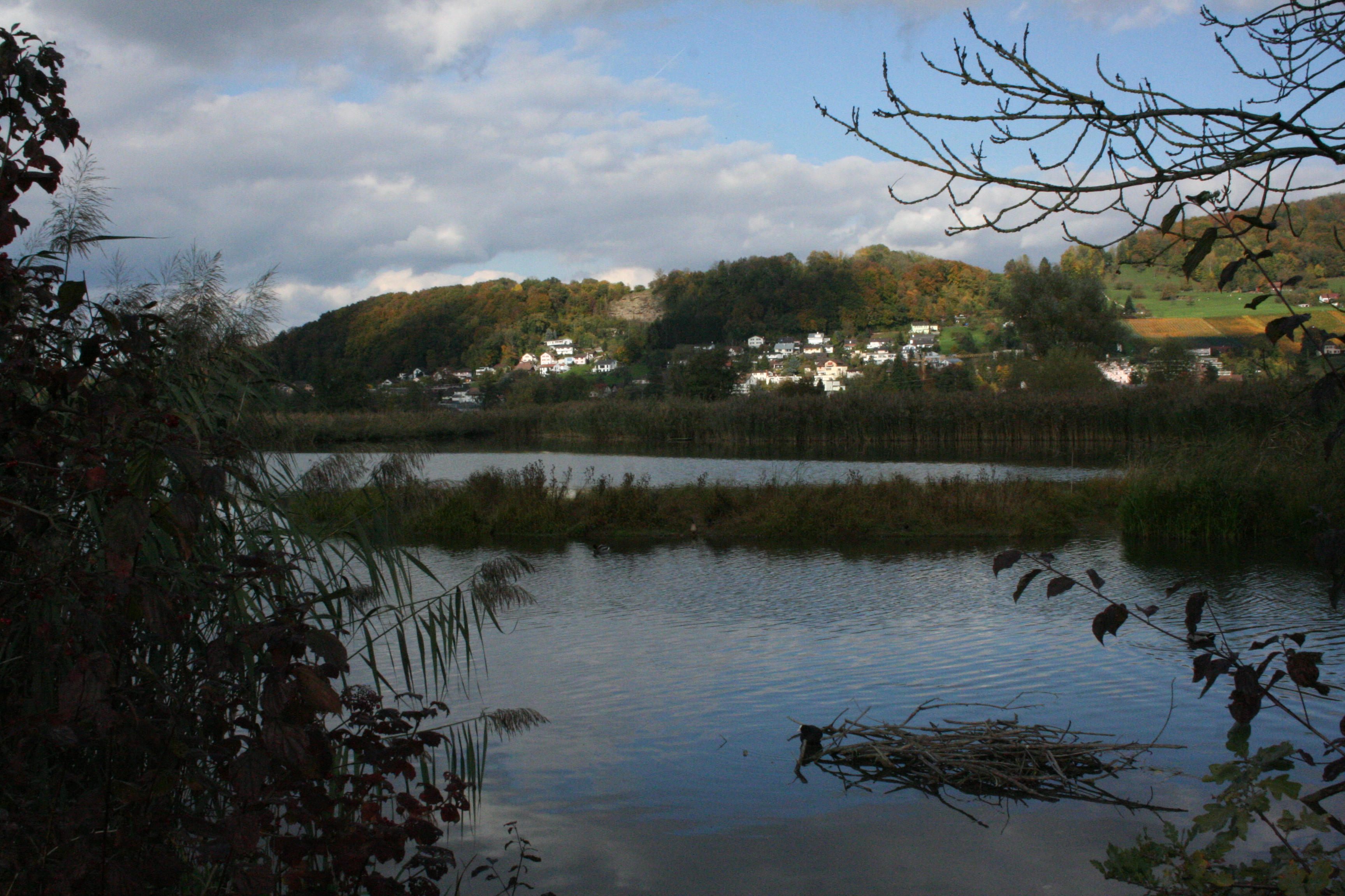
| Name | Area (ha) | Area (acre) |
|---|---|---|
| Bolle di Magadino | 663 ha | |
| Fanel et Chablais de Cudrefin | 1155 ha | |
| Kaltbrunner Riet | 157 ha | |
| Klingnauer Stausee | 364 ha | |
| Laubersmad-Salwidili | 1376 ha | |
| Le Rhône genevois-Vallons de l'Allondon et de La Laire | 1929.4 ha | |
| Les Grangettes | 6342.2 ha | |
| Niederried Stausee | 297 ha | |
| Rhonegletschervorfeld | 317 ha | |
| Rive sud du lac de Neuchâtel | 1705.9 ha | |
| Vadret da Roseg | 383 ha |
Turkey
| Name | Area (ha) | Area (acre) |
|---|---|---|
| Akyatan Lagoon | 14700 ha | |
| Gediz Delta | 14900 ha | |
| Göksu Delta | 15000 ha | |
| Kızılırmak Delta | 21700 ha | |
| Kizören Obrouk | 127 ha | |
| Lake Burdur | 24800 ha | |
| Lake Kuş | 20400 ha | |
| Lake Kuyucuk | 416 ha | |
| Lake Seyfe | 10700 ha | |
| Lake Uluabat | 19900 ha | |
| Meke Maar | 202 ha | |
| Nemrut Caldera | 4589 ha | |
| Sultan Reedy National Park | 17200 ha | |
| Yumurtalik Lagoons | 19853 ha |
Ukraine
Main article: Ramsar sites in Ukraine
| Name | Area (ha) | Area (acre) |
|---|---|---|
| Archipelago Velyki and Mali Kuchugury | 7740 ha | |
| Aquatic-cliff complex of Cape Kazantyp | 251 ha | |
| Aquatic-cliff complex of Karadag | 224 ha | |
| Aquatic-coastal complex of Cape Opuk | 775 ha | |
| Atak – Borzhavske | 283.4 ha | |
| Bakotska Bay | 1590 ha | |
| Berda River Mouth & Berdianska Spit & Berdianska Bay | 1800 ha | |
| Big Chapelsk Depression | 2359 ha | |
| Bilosaraiska Bay and Bilosaraiska Spit | 2000 ha | |
| Black Bog | 15 ha | |
| Burshtyn Water Reservoir | 1260 ha | |
| Byle Lake and Koza Berezyna Mire | 8036.5 ha | |
| Central Syvash | 80000 ha | |
| Cheremske Bog | 2975.7 ha | |
| Desna River Floodplains | 4270 ha | |
| Dniester-Turunchuk Crossrivers Area | 76000 ha | |
| Dnipro River Delta | 26000 ha | |
| Dnipro-Oril Floodplains | 2560 ha | |
| Dnister River Valley | 820 ha | |
| Eastern Syvash | 165000 ha | |
| Karkinitska and Dzharylgatska Bays | 87000 ha | |
| Kartal Lake | 500 ha | |
| Kryva Bay and Kryva Spit | 1400 ha | |
| Kugurlui Lake | 6500 ha | |
| Kyliiske Mouth | 32800 ha | |
| Lake Synevyr | 29 ha | |
| Liadova-Murafa | 5394.3 ha | |
| Lower Smotrych River | 1480 ha | |
| Molochnyi Liman | 22400 ha | |
| Nadsiannia Raised Bog | 37 ha | |
| Narcissi Valley | 256 ha | |
| Northern Part of the Dniester Liman | 20000 ha | |
| Obytochna Spit and Obytochna Bay | 2000 ha | |
| Ozirnyi-Brebeneskul | 1656.9 ha | |
| Perebrody Peatlands | 12718 ha | |
| Pohorilets River Headwaters | 1624.6 ha | |
| Polissia Mires | 2145 ha | |
| Prut River Headwaters | 4935.4 ha | |
| Prypiat River Floodplains | 12000 ha | |
| Romania-Friendship Cave | 0.1 ha | |
| Sasyk Lake | 21000 ha | |
| Shagany-Alibei-Burnas Lakes System | 19000 ha | |
| Shatsk Lakes | 32850 ha | |
| Sim Maiakiv Floodplain | 2140 ha | |
| Somyne Swamps | 10852 ha | |
| Stokhid River Floodplains | 10000 ha | |
| Syra Pogonia Bog | 10000 ha | |
| Tendrivska Bay | 38000 ha | |
| Tyligulskyi Liman | 26000 ha | |
| Yagorlytska Bay | 34000 ha |
United Kingdom
Main article: List of Ramsar sites in England, List of Ramsar sites in Northern Ireland, List of Ramsar sites in Scotland, List of Ramsar sites in Wales, List of Ramsar sites in British Overseas Territories
| Name | Area (ha) | Area (acre) |
|---|---|---|
| Abberton Reservoir | 726 ha | |
| Akrotiri | 2171 ha | |
| Alde-Ore Estuary | 2547 ha | |
| Alderney West Coast and the Burhou Islands | 15629 ha | |
| Arun Valley | 529 ha | |
| Avon Valley | 1385 ha | |
| Ballaugh Curragh | 193 ha | |
| Ballynahone Bog | 243 ha | |
| Belfast Lough | 432 ha | |
| Benfleet and Southend Marshes | 2251 ha | |
| Bertha's Beach | 4000 ha | |
| Black Bog | 183 ha | |
| Blackwater Estuary | 4395 ha | |
| Booby Pond and Rookery | 82 ha | |
| Breydon Water | 1203 ha | |
| Bridgend Flats, Islay | 331 ha | |
| Broadland | 4623 ha | |
| Burry Inlet | 6672 ha | |
| Cairngorm Lochs | 173 ha | |
| Caithness & Sutherland Peatlands | 143503 ha | |
| Caithness Lochs | 1379 ha | |
| Cameron Reservoir | 69 ha | |
| Carlingford Lough | 831 ha | |
| Castle Loch, Lochmaben | 108 ha | |
| Chesil Beach & The Fleet | 748 ha | |
| Chichester and Langstone Harbours | 5810 ha | |
| Chippenham Fen | 112 ha | |
| Claish Moss | 568 ha | |
| Coll | 2209 ha | |
| Colne Estuary | 2701 ha | |
| Cors Caron | 874 ha | |
| Cors Fochno & Dyfi | 2508 ha | |
| Corsydd Mon a Llyn | 626 ha | |
| Cromarty Firth | 3747 ha | |
| Crouch & Roach Estuaries | 1736 ha | |
| Crymlyn Bog | 268 ha | |
| Cuilcagh Mountain | 2744 ha | |
| Deben Estuary | 979 ha | |
| Dengie | 3127 ha | |
| Dersingham Bog | 158 ha | |
| Diego Garcia | 35424 ha | |
| Din Moss - Hoselaw Loch | 51 ha | |
| Dornoch Firth and Loch Fleet | 7837 ha | |
| Dorset Heathlands | 6730 ha | |
| Duddon Estuary | 6806 ha | |
| East Sanday Coast | 1515 ha | |
| Eilean Na Muice Duibhe | 576 ha | |
| Esthwaite Water | 137 ha | |
| Exe Estuary | 2346 ha | |
| Fairy Water Bogs | 224 ha | |
| Fala Flow | 318 ha | |
| Fardrum and Roosky Turloughs | 43 ha | |
| Firth of Forth | 6314 ha | |
| Firth of Tay and Eden Estuary | 6918 ha | |
| Foulness | 10933 ha | |
| Garron Plateau | 4650 ha | |
| Garry Bog | 155 ha | |
| Gibraltar Point | 414 ha | |
| Gladhouse Reservoir | 186 ha | |
| Gough Island | 229811 ha | |
| Greenlaw Moor | 248 ha | |
| Gruinart Flats, Islay | 3261 ha | |
| Hamford Water | 2187 ha | |
| Herm, Jethou and The Humps | 1802.9 ha | |
| Holburn Lake and Moss | 28 ha | |
| Humber Estuary | 37988 ha | |
| Hungry Bay Mangrove Swamp | 2 ha | |
| Inaccessible Island | 126524 ha | |
| Inner Clyde Estuary | 1825 ha | |
| Inner Moray Firth | 2339 ha | |
| Irthinghead Mires | 792 ha | |
| Isles of Scilly | 402 ha | |
| Kintyre Goose Roosts | 312 ha | |
| Larne Lough | 396 ha | |
| Lee Valley | 448 ha | |
| Leighton Moss | 129 ha | |
| Les Écréhous & Les Dirouilles, Jersey | 5459 ha | |
| Les Minquiers, Jersey | 9575 ha | |
| Les Pierres de Lecq | 512 ha | |
| Lewis Peatlands | 58984 ha | |
| Lihou Island and l'Erée Headland, Guernsey | 427 ha | |
| Lindisfarne | 3679 ha | |
| Llyn Idwal | 14 ha | |
| Llyn Tegid | 482 ha | |
| Loch an Duin | 2621 ha | |
| Loch Eye | 205 ha | |
| Loch Ken & River Dee Marshes | 769 ha | |
| Loch Leven | 1612 ha | |
| Loch Lomond | 237 ha | |
| Loch Maree | 3174 ha | |
| Loch of Inch & Torrs Warren | 2111 ha | |
| Loch of Kinnordy | 85 ha | |
| Loch of Lintrathen | 217 ha | |
| Loch of Skene | 121 ha | |
| Loch of Strathbeg | 616 ha | |
| Loch Ruthven | 201 ha | |
| Loch Spynie | 94 ha | |
| Lough Foyle | 2204 ha | |
| Lough Neagh & Lough Beg | 50166 ha | |
| Lover's Lake Nature Reserve | 2 ha | |
| Lower Derwent Valley | 915 ha | |
| Magheraveely Marl Loughs | 59 ha | |
| Malham Tarn | 286 ha | |
| Martin Mere | 120 ha | |
| Medway Estuary & Marshes | 4697 ha | |
| Mersey Estuary | 5033 ha | |
| Midland Meres & Mosses | 511 ha | |
| Midland Meres and Mosses Phase 2 | 1588 ha | |
| Minsmere - Walberswick | 2019 ha | |
| Montrose Basin | 985 ha | |
| Moray and Nairn Coast | 2412 ha | |
| Morecambe Bay | 37405 ha | |
| Muir of Dinnet | 158 ha | |
| Nene Washes | 1517 ha | |
| North Norfolk Coast | 7887 ha | |
| North Uist Machair and Islands | 4705 ha | |
| North, Middle & East Caicos Islands | 58617 ha | |
| Northumbria Coast | 1108 ha | |
| Ouse Washes | 2469 ha | |
| Paget Marsh | 11 ha | |
| Pagham Harbour | 637 ha | |
| Pembroke Marsh East | 8 ha | |
| Pettigoe Plateau | 1264 ha | |
| Pevensey Levels | 3578 ha | |
| Poole Harbour | 2439 ha | |
| Portsmouth Harbour | 1249 ha | |
| Rannoch Moor | 1519 ha | |
| Redgrave and South Lopham Fens | 127 ha | |
| Ribble and Alt Estuaries | 13464 ha | |
| Rinns of Islay | 3571 ha | |
| River Spey - Insh Marshes | 1159 ha | |
| Ronas Hill - North Roe & Tingon | 5470 ha | |
| Rostherne Mere | 80 ha | |
| Roydon Common | 194 ha | |
| Rutland Water | 1360 ha | |
| Sea Lion Island | 1000 ha | |
| Severn Estuary | 24701 ha | |
| Silver Flowe | 620 ha | |
| Sleibhtean agus Cladach Thiriodh | 1939 ha | |
| Slieve Beagh | 1885 ha | |
| Solent and Southampton Water | 5415 ha | |
| Sombrero Island Nature Reserve Marine Park | 1050.7 ha | |
| Somerset Levels and Moors | 6388 ha | |
| Somerset Long Bay Pond | 1 ha | |
| South East Coast of Jersey, Channel Islands | 3210 ha | |
| South Tayside Goose Roosts | 331 ha | |
| South Uist Machair & Lochs | 5019 ha | |
| South West London Waterbodies | 828 ha | |
| Spittal Pond | 10 ha | |
| Stodmarsh | 481 ha | |
| Stour & Orwell Estuaries | 3324 ha | |
| Strangford Loch | 15581 ha | |
| Teesmouth & Cleveland Coast | 1247 ha | |
| Thames Estuary and Marshes | 5589 ha | |
| Thanet Coast & Sandwich Bay | 2169 ha | |
| The Dee Estuary | 14302 ha | |
| The Mersey Narrows and North Wirral Foreshore | 2078 ha | |
| The New Forest | 28003 ha | |
| The Swale | 6515 ha | |
| The Wash | 62212 ha | |
| Thursley & Ockley Bog | 265 ha | |
| Turmennan Lough | 15 ha | |
| Upper Lough Erne | 5818 ha | |
| Upper Nene Valley Gravel Pits | 1358 ha | |
| Upper Solway Flats & Marshes | 43637 ha | |
| Walmore Common | 53 ha | |
| Warwick Pond | 2 ha | |
| Western Salt Ponds of Anegada | 1071 ha | |
| Westwater | 50 ha | |
| Wicken Fen | 254 ha | |
| Woodwalton Fen | 208 ha | |
| Ythan Estuary & Meikle Loch | 314 ha |
Latin America and the Caribbean
Antigua and Barbuda
| Name | Area (ha) | Area (acre) |
|---|---|---|
| Codrington Lagoon | 3600 ha |
Argentina
| Name | Area (ha) | Area (acre) | Province | Site# | Designated | |
|---|---|---|---|---|---|---|
| Bahía de Samborombón | 243965 ha | Buenos Aires | 885 | 1997-01-24 | ||
| Bañados del Río Dulce y Laguna de Mar Chiquita | 996000 ha | Córdoba | 1176 | 2002-05-28 | ||
| Delta del Paraná | 243126 ha | Santa Fe | ||||
| Entre Ríos | 2255 | 2015-10-03 | ||||
| Glaciar Vinciguerra y Turberas Asociadas | 2760 ha | Tierra del Fuego | 1886 | 2009-09-15 | ||
| Humedal Laguna Melincué | 92000 ha | Santa Fe | 1785 | 2008-07-24 | ||
| Humedales Chaco | 508000 ha | Chaco | 1366 | 2004-02-02 | ||
| Humedales de Península Valdés | 42695 ha | Chubut | 2070 | 2012-07-20 | ||
| Jaaukanigás | 492000 ha | Santa Fe | 1112 | 2001-10-10 | ||
| Laguna Blanca | 11250 ha | Neuquén | 556 | 1992-05-04 | ||
| Laguna de Llancanelo | 91,365 ha | Mendoza | 759 | 1995-11-08 | ||
| Laguna de los Pozuelos | 16224 ha | Jujuy | 555 | 1992-05-04 | ||
| Lagunas altoandinas y puneñas de Catamarca | 1228175 ha | Catamarca | 1865 | 2009-02-02 | ||
| Lagunas de Guanacache, Desaguadero y del Bebedero | 962370 ha | Mendoza | ||||
| San Juan | ||||||
| San Luis | 1012 | 1999-12-14 | ||||
| Lagunas de Vilama | 157000 ha | Jujuy | 1040 | 2000-09-20 | ||
| Lagunas y Esteros del Iberá | 24550 ha | Corrientes | 1162 | 2002-01-18 | ||
| Palmar Yatay | 21450 ha | Entre Ríos | 1969 | 2011-05-05 | ||
| Parque Nacional Ciervo de los Pantanos | 5561.31 ha | Buenos Aires | 1750 | 2008-03-22 | ||
| Parque Provincial El Tromen | 30000 ha | Neuquén | 1626 | 2006-02-02 | ||
| Península Mitre | 369,417 ha | 2557 | 20-08-2024 | |||
| Reserva Costa Atlantica de Tierra del Fuego | 28600 ha | Tierra del Fuego | 745 | 1995-09-13 | ||
| Reserva Ecológica Costanera Sur | 353 ha | Buenos Aires | 1459 | 2005-03-22 | ||
| Reserva Natural Villavicencio | 62244 ha | Mendoza | 2330 | 2017-12-27 | ||
| Reserva Provincial Laguna Brava | 405000 ha | La Rioja | 1238 | 2003-02-02 | ||
| Rio Pilcomayo | 51889 ha | Formosa | 557 | 1992-05-04 |
Bahamas
| Name | Area (ha) | Area (acre) |
|---|---|---|
| Inagua National Park | 32600 ha |
Barbados
| Name | Area (ha) | Area (acre) |
|---|---|---|
| Graeme Hall Swamp | 33 ha |
Belize
| Name | Area (ha) | Area (acre) |
|---|---|---|
| Crooked Tree Wildlife Sanctuary | 6637 ha | |
| Sarstoon Temash National Park | 16955 ha |
Bolivia
| Name | Area (ha) | Area (acre) |
|---|---|---|
| Bañados del Izozog y el río Parapetí | 615882 ha | |
| Cuenca de Tajzara | 5500 ha | |
| Lago Titicaca | 800000 ha | |
| Lagos Poopó y Uru Uru | 967607 ha | |
| Laguna Concepción | 31124 ha | |
| Los Lípez | 1427717 ha | |
| Palmar de las Islas y las Salinas de San José | 856754 ha | |
| Pantanal Boliviano | 3189888 ha | |
| Río Blanco | 2404915 ha | |
| Río Matos | 1729788 ha | |
| Río Yata | 2813229 ha |
Brazil
| Name | Area (ha) | Area (acre) |
|---|---|---|
| Abrolhos Marine National Park | 91300 ha | |
| Amazon Estuary and its Mangroves | 3850253 ha | |
| Anavilhanas National Park | 350469.8 ha | |
| Atol das Rocas Biological Reserve | 35186.4 ha | |
| Baixada Maranhense Environmental Protection Area | 1775035 ha | |
| Cabo Orange National Park | 202307 ha | |
| Environmental Protection Area of Cananéia-Iguape-Peruíbe | 657328 ha | |
| Fernando de Noronha Archipelago | 10929.2 ha | |
| Guaporé Biological Reserve | 600000 ha | |
| Guaraqueçaba Ecological Station | 4370 ha | |
| Guaratuba | 38329.3 ha | |
| Ilha do Bananal | 562312 ha | |
| Ilha Grande National Park | 76033.1 ha | |
| Lagoa do Peixe | 34400 ha | |
| Lund Warming | 23865.4 ha | |
| Mamirauá | 1124000 ha | |
| Pantanal Matogrossense | 135000 ha | |
| Parque Estadual Marinho do Parcel Manoel Luís including the Baixios do Mestre Álvaro and Tarol | 34555 ha | |
| Reentrancias Maranhenses | 2680911 ha | |
| Reserva Particular del Patrimonio Natural Fazenda Rio Negro | 7000 ha | |
| Reserva Particular do Patrimonio Natural SESC Pantanal | 87871 ha | |
| Rio Doce State Park | 35973 ha | |
| Rio Juruá | 2136489 ha | |
| Rio Negro | 12001614.4 ha | |
| Taiamã Ecological Station | 11555 ha | |
| Taim Ecological Station | 10938.6 ha | |
| Viruá National Park | 216427 ha |
Chile
| Name | Area (ha) | Area (acre) |
|---|---|---|
| Bahía Lomas | 58945 ha | |
| Carlos Anwandter Sanctuary | 4877 ha | |
| Humedal del río Limarí, desde Salala hasta su desembocadura | 527 ha | |
| Humedal el Yali | 520 ha | |
| Humedales Costeros de la Bahía Tongoy | 259 ha | |
| Humedales de Monkul | 1380 ha | |
| Laguna del Negro Francisco y Laguna Santa Rosa | 62460 ha | |
| Las Salinas de Huentelauquén (LSH) | 2772 ha | |
| Parque Andino Juncal | 13795 ha | |
| Salar de Aguas Calientes IV | 15529 ha | |
| Salar de Pujsa | 17397 ha | |
| Salar de Surire | 15858 ha | |
| Salar de Tara | 96439 ha | |
| Salar del Huasco | 6000 ha | |
| Santuario de la Naturaleza Laguna Conchalí | 34 ha | |
| Sistema Hidrológico de Soncor del Salar de Atacama | 67133 ha |
Colombia
| Name | Area (ha) | Area (acre) |
|---|---|---|
| Complejo Cenagoso de Ayapel | 54376.8 ha | |
| Complejo de Humedales de la Estrella Fluvial Inírida (EFI) | 250158.91 ha | |
| Complejo de Humedales del Alto Rio Cauca Asociado a la Laguna de Sonso | 5525 ha | |
| Complejo de humedales Lagos de Tarapoto | 45464 ha | |
| Complejo de Humedales Laguna del Otún | 6579 ha | |
| Complejo de Humedales Urbanos del Distrito Capital de Bogotá | 667.4 ha | |
| Delta del Río Baudó | 8888 ha | |
| Laguna de la Cocha | 39000 ha | |
| Sistema Delta Estuarino del Río Magdalena, Ciénaga Grande de Santa Marta | 400000 ha | |
| Sistema Lacustre de Chingaza | 4058 ha |
Costa Rica

| Name | Area (ha) | Area (acre) |
|---|---|---|
| Caño Negro | 9969 ha | |
| Cuenca Embalse Arenal | 67295 ha | |
| Gandoca-Manzanillo | 9445 ha | |
| Humedal Caribe Noreste | 75310 ha | |
| Humedal Maquenque | 59692 ha | |
| Isla del Coco | 99623 ha | |
| Laguna Respringue | 75 ha | |
| Manglar de Potrero Grande | 139 ha | |
| Palo Verde | 24519 ha | |
| Tamarindo | 500 ha | |
| Térraba-Sierpe | 30654 ha | |
| Turberas de Talamanca (Distributed across Chirripó National Park, Tapantí National Park, Los Quetzales National Park, Los Santos Forest Reserve, Vueltas Hill Biological Reserve, Macho River Forest Reserve) | 192520 ha |
Cuba
| Name | Area (ha) | Area (acre) |
|---|---|---|
| Buenavista | 313500 ha | |
| Ciénaga de Lanier y Sur de la Isla de la Juventud | 126200 ha | |
| Ciénaga de Zapata | 452000 ha | |
| Gran Humedal del Norte de Ciego de Ávila | 226875 ha | |
| Humedal Delta del Cauto | 47835 ha | |
| Humedal Río Máximo-Cagüey | 22000 ha |
Dominican Republic
| Name | Area (ha) | Area (acre) |
|---|---|---|
| Humedales de Jaragua | 32978.63 ha | |
| Lago Enriquillo | 20000 ha | |
| Los Humedales de Montecristi y la Línea Noroeste | 84322.2 ha | |
| Parque Nacional Manglares del Bajo Yuna | 77518.6 ha | |
| Refugio de Vida Silvestre Laguna Cabral o Rincón | 4600 ha | |
| Refugio de Vida Silvestre Laguna Redonda y Limón | 5754 ha |
Ecuador
| Name | Area (ha) | Area (acre) |
|---|---|---|
| Abras de Mantequilla | 22500 ha | |
| Complejo de Humedales Cuyabeno Lagartococha Yasuní | 773668.5 ha | |
| Complejo de Humedales Ñucanchi Turupamba | 12290 ha | |
| Complejo LLanganti | 30355 ha | |
| Humedales del Sur de Isabela | 872 ha | |
| Isla Santay | 4705 ha | |
| La Segua | 1835 ha | |
| La Tembladera | 1471 ha | |
| Laguna de Cube | 113 ha | |
| Manglares Churute | 35042 ha | |
| Manglares del Estuario Interior del Golfo de Guayaquil | 15337 ha | |
| Parque Nacional Cajas | 29477 ha | |
| Refugio de Vida Silvestre Isla Santa Clara | 45 ha | |
| Reserva Biológica Limoncocha | 4613 ha | |
| Reserva Ecológica de Manglares Cayapas-Mataje | 44847 ha | |
| Reserva Ecológica El Ángel | 17003 ha | |
| Sistema Lacustre Lagunas del Compadre | 23952 ha | |
| Sistema Lacustre Yacuri | 27762 ha | |
| Zona Marina Parque Nacional Machalilla | 14430 ha |
El Salvador
| Name | Area (ha) | Area (acre) |
|---|---|---|
| Area Natural Protegida Laguna del Jocotal | 4479 ha | |
| Complejo Bahía de Jiquilisco | 63500 ha | |
| Complejo Barra de Santiago | 11519 ha | |
| Complejo Güija | 10180 ha | |
| Complejo Jaltepeque | 49454 ha | |
| Complejo Los Cobanos | 21312 ha | |
| Embalse Cerrón Grande | 60698 ha | |
| Laguna de Olomega | 7557 ha |
Grenada
| Name | Area (ha) | Area (acre) |
|---|---|---|
| Levera Wetland | 518 ha |
Guatemala
Main article: List of Ramsar sites in Guatemala
| Name | Area (ha) | Area (acre) |
|---|---|---|
| Eco-región Lachuá | 53523 ha | |
| Manchón-Guamuchal | 13500 ha | |
| Parque Nacional Laguna del Tigre | 335080 ha | |
| Parque Nacional Yaxhá-Nakum-Naranjo | 37160 ha | |
| Punta de Manabique | 132900 ha | |
| Refugio de Vida Silvestre Bocas del Polochic | 21227 ha | |
| Reserva de Usos Múltiples Río Sarstún | 35202 ha |
Honduras
Main article: List of Ramsar sites in Honduras
| Name | Area (ha) | Area (acre) |
|---|---|---|
| Barras de Cuero y Salado | 13225 ha | |
| Laguna de Bacalar | 7394 ha | |
| Parque Nacional Jeanette Kawas | 79382.16 ha | |
| Refugio de Vida Silvestre Punta Izopo | 11200 ha | |
| Sistema de Humedal Laguna de Alvarado | 13846 ha | |
| Sistema de Humedales Cuyamel-Omoa | 30029 ha | |
| Sistema de Humedales de la Isla de Guanaja | 13148 ha | |
| Sistema de Humedales de la Isla de Utila | 16225 ha | |
| Sistema de Humedales de la Zona Sur de Honduras | 75031.13 ha | |
| Sistema de Humedales de Santa Elena | 1,543 ha | |
| Sistema de Humedales Laguna de Zambuco | 649 ha | |
| Subcuenca del Lago de Yojoa | 44253.94 ha |
Jamaica
| Name | Area (ha) | Area (acre) |
|---|---|---|
| Black River Lower Morass | 85664 ha | |
| Mason River Protected Area | 82 ha | |
| Palisadoes - Port Royal | 7523 ha | |
| Portland Bight Wetlands and Cays | 24542 ha |
Nicaragua
| Name | Area (ha) | Area (acre) |
|---|---|---|
| Cayos Miskitos y Franja Costera Immediata | 85000 ha | |
| Deltas del Estero Real y Llanos de Apacunca | 81700 ha | |
| Lago de Apanás-Asturias | 5415 ha | |
| Los Guatuzos | 43750 ha | |
| Refugio de Vida Silvestre Río San Juan | 43000 ha | |
| Sistema de Humedales de la Bahía de Bluefields | 86501 ha | |
| Sistema de Humedales de San Miguelito | 43475 ha | |
| Sistema Lacustre Playitas-Moyúa-Tecomapa | 1161 ha | |
| Sistema Lagunar de Tisma | 16850 ha |
Panama
| Name | Area (ha) | Area (acre) |
|---|---|---|
| Bahía de Panamá | 85664 ha | |
| Complejo de Humedales de Matusagaratí | 64,750.2 ha | |
| Golfo de Montijo | 80765 ha | |
| Humedal de Importancia Internacional Damani-Guariviara | 24089 ha | |
| Punta Patiño | 13805 ha | |
| San San - Pond Sak | 16414 ha |
Paraguay
| Name | Area (ha) | Area (acre) |
|---|---|---|
| Estero Milagro | 25000 ha | |
| Lago Ypoá | 100000 ha | |
| Laguna Chaco Lodge | 2500 ha | |
| Laguna Teniente Rojas Silva | 8470 ha | |
| Río Negro | 370000 ha | |
| Tifunque | 280000 ha |
Peru

| Name | Area (ha) | Area (acre) |
|---|---|---|
| Bofedales y Laguna de Salinas | 17657 ha | |
| Complejo de humedales del Abanico del río Pastaza | 3827329 ha | |
| Estuario de Virrilá | 5,643.8 ha | |
| Humedal Lucre - Huacarpay | 1979 ha | |
| Lake Titicaca | 460000 ha | |
| Laguna del Indio - Dique de los Españoles | 502 ha | |
| Lagunas Las Arreviatadas | 1250 ha | |
| Manglares de San Pedro de Vice | 3399 ha | |
| Paracas National Reserve | 335000 ha | |
| Junín National Reserve | 53000 ha | |
| Reserva Nacional Pacaya-Samiria | 2080000 ha | |
| Lagunas de Mejía National Sanctuary | 691 ha | |
| Manglares de Tumbes National Sanctuary | 2972 ha | |
| Zona Reservada Los Pantanos de Villa | 263 ha |
Saint Lucia
| Name | Area (ha) | Area (acre) |
|---|---|---|
| Mankòtè Mangrove | 60 ha | |
| Savannes Bay | 25 ha |
Suriname
| Name | Area (ha) | Area (acre) |
|---|---|---|
| Coppenamemonding | 12000 ha |
Trinidad and Tobago
| Name | Area (ha) | Area (acre) |
|---|---|---|
| Buccoo Reef / Bon Accord Lagoon Complex | 1287 ha | |
| Caroni Swamp | 8398 ha | |
| Nariva Swamp | 6234 ha |
Uruguay
| Name | Area (ha) | Area (acre) |
|---|---|---|
| Bañados del Este y Franja Costera | 407408 ha | |
| Esteros de Farrapos e Islas del Río Uruguay | 17495 ha | |
| Laguna de Rocha | 10933 ha |
Venezuela
| Name | Area (ha) | Area (acre) |
|---|---|---|
| Archipielago Los Roques | 213220 ha | |
| Ciénaga de Los Olivitos | 26000 ha | |
| Cuare | 9968 ha | |
| Laguna de la Restinga | 5248 ha | |
| Laguna de Tacarigua | 9200 ha |
North America
Canada
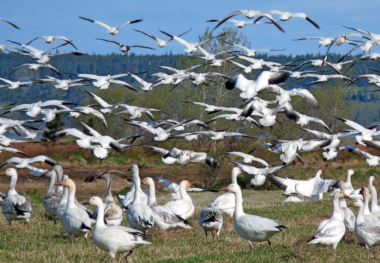
| Name | Area (ha) | Area (acre) |
|---|---|---|
| Baie de l'Isle-Verte | 2215 ha | |
| Beaverhill Lake | 18050 ha | |
| Cap Tourmente | 2398 ha | |
| Chignecto | 1020 ha | |
| Columbia Wetlands | 15070 ha | |
| Creston Valley | 6970 ha | |
| Delta Marsh | 23000 ha | |
| Dewey Soper Migratory Bird Sanctuary | 815900 ha | |
| Fraser River Delta | 20682 ha | |
| Grand Codroy Estuary | 925 ha | |
| Hay-Zama Lakes | 50000 ha | |
| Lac Saint Pierre | 11952 ha | |
| Lac Saint-François | 2310 ha | |
| Last Mountain Lake | 15602 ha | |
| Long Point | 13730 ha | |
| Malpeque Bay | 24440 ha | |
| Mary's Point | 1200 ha | |
| Matchedash Bay | 1840 ha | |
| McConnell River | 32800 ha | |
| Mer Bleue Conservation Area | 3447 ha | |
| Minesing Swamp | 6000 ha | |
| Musquodoboit Harbour | 1925 ha | |
| Oak Hammock Marsh | 3600 ha | |
| Old Crow Flats | 617000 ha | |
| Peace-Athabasca Delta | 321300 ha | |
| Point Pelee | 1564 ha | |
| Polar Bear Pass | 262400 ha | |
| Polar Bear Provincial Park | 2408700 ha | |
| Queen Maud Gulf | 6278200 ha | |
| Quill Lakes | 63500 ha | |
| Rasmussen Lowlands | 300000 ha | |
| Shepody Bay | 12200 ha | |
| Southern Bight-Minas Basin | 26800 ha | |
| Southern James Bay | 25290 ha | |
| St. Clair | 244 ha | |
| Tabusintac Lagoon and River Estuary | 4997 ha | |
| Whooping Crane Summer Range | 1689500 ha |
Mexico
Main article: List of Ramsar sites in Mexico
| Name | Area (ha) | Area (acre) |
|---|---|---|
| Agua Dulce | 39 ha | |
| Anillo de Cenotes | 891 ha | |
| Área de Protección de Flora y Fauna Cuatrociénegas | 84347 ha | |
| Área de Protección de Flora y Fauna Laguna de Términos | 705016 ha | |
| Área de Protección de Flora y Fauna Yum Balam | 154052 ha | |
| Área Natural Protegida Estatal Presa de Silva y Zonas Aledañas | 3934 ha | |
| Áreas de Protección de Flora y Fauna de Nahá y Metzabok | 7216 ha | |
| Arroyos y Manantiales de Tanchachín | 1174 ha | |
| Bahía de San Quintín | 5438 ha | |
| Bala'an K'aax | 131610 ha | |
| Balandra | 449 ha | |
| Baño de San Ignacio | 4225 ha | |
| Canal del Infiernillo y esteros del territorio Comcaac | 29700 ha | |
| Cascadas de Texolo y su entorno | 500 ha | |
| Ciénaga de Tamasopo | 1364 ha | |
| Ciénegas de Lerma | 3023 ha | |
| Complejo Lagunar Bahía Guásimas - Estero Lobos | 135198 ha | |
| Corredor Costero La Asamblea-San Francisquito | 44304 ha | |
| Cuencas y corales de la zona costera de Huatulco | 44400 ha | |
| Dzilam | 61707 ha | |
| Ecosistema Ajos-Bavispe, zona de influencia Cuenca Río San Pedro | 182623 ha | |
| Ecosistema Arroyo Verde APFF Sierra de Álamos Río Cuchujaqui | 174 ha | |
| El Jagüey, Buenavista de Peñuelas | 35 ha | |
| Ensenada de Pabellones | 40639 ha | |
| Estero de Punta Banda | 2393 ha | |
| Estero El Chorro | 267 ha | |
| Estero El Soldado | 350 ha | |
| Estero La Manzanilla | 264 ha | |
| Estero Majahuas | 786 ha | |
| Humedal de Importancia Especialmente para la Conservación de Aves Acuáticas Reserva Ría Lagartos | 60348 ha | |
| Humedal La Sierra de Guadalupe | 348087 ha | |
| Humedal Los Comondú | 460959 ha | |
| Humedales de Bahía Adair | 42430 ha | |
| Humedales de Bahía San Jorge | 12198 ha | |
| Humedales de Guachochi | 57.52 ha | |
| Humedales de la Laguna La Cruz | 6665 ha | |
| Humedales de la Laguna La Popotera | 1975 ha | |
| Humedales de Montaña La Kisst | 36 ha | |
| Humedales de Montaña María Eugenia | 86 ha | |
| Humedales de Yavaros-Moroncarit | 13627 ha | |
| Humedales del Delta del Río Colorado | 250000 ha | |
| Humedales del Lago de Pátzcuaro | 707 ha | |
| Humedales La Libertad | 5432 ha | |
| Humedales Mogote - Ensenada La Paz | 9184 ha | |
| Isla Rasa | 66 ha | |
| Isla San Pedro Mártir | 30165 ha | |
| Islas Marietas | 1357 ha | |
| La Alberca de los Espinos | 33 ha | |
| La Mancha y El Llano | 1414 ha | |
| La Mintzita | 57 ha | |
| La Tovara | 5733 ha | |
| Lago de Chapala | 114659 ha | |
| Lago de San Juan de los Ahorcados | 1099 ha | |
| Lago de Texcoco | 10077.4 ha | |
| Laguna Barra de Navidad | 794 ha | |
| Laguna Chalacatepec | 1093 ha | |
| Laguna Costera El Caimán | 1125 ha | |
| Laguna de Atotonilco | 2850 ha | |
| Laguna de Babícora | 26045 ha | |
| Laguna de Chichankanab | 1999 ha | |
| Laguna de Cuyutlán vasos III y IV | 4051 ha | |
| Laguna de Hueyapan | 276 ha | |
| Laguna de Metztitlán | 2937 ha | |
| Laguna de Santiaguillo | 24016 ha | |
| Laguna de Sayula | 16800 ha | |
| Laguna de Tamiahua | 88000 ha | |
| Laguna de Tecocomulco | 1769 ha | |
| Laguna de Yuriria | 15020 ha | |
| Laguna de Zacapu | 40 ha | |
| Laguna de Zapotlán | 1496 ha | |
| Laguna Hanson, Parque Nacional Constitución de 1857 | 510 ha | |
| Laguna Huizache Caimanero | 48283 ha | |
| Laguna La Juanota | 232 ha | |
| Laguna Madre | 307894 ha | |
| Laguna Ojo de Liebre | 36600 ha | |
| Laguna Playa Colorada-Santa María La Reforma | 53140 ha | |
| Laguna San Ignacio | 17500 ha | |
| Laguna Xola-Paramán | 775 ha | |
| Lagunas de Chacahua | 17424 ha | |
| Lagunas de Santa María-Topolobampo-Ohuira | 22500 ha | |
| Manantiales Geotermales de Julimes | 368 ha | |
| Manglares de Nichupté | 4257 ha | |
| Manglares y humedales de la Laguna de Sontecomapan | 8921 ha | |
| Manglares y humedales de Tuxpan | 6870 ha | |
| Manglares y Humedales del Norte de Isla Cozumel | 32786 ha | |
| Marismas Nacionales | 200000 ha | |
| Oasis de la Sierra El Pilar | 180803 ha | |
| Oasis Sierra de La Giganta | 41181 ha | |
| Otoch Ma'ax Yetel Kooh | 5367 ha | |
| Parque Estatal Cañón de Fernández | 17002 ha | |
| Parque Estatal Lagunas de Yalahau | 5683 ha | |
| Parque Nacional Arrecife Alacranes | 334113 ha | |
| Parque Nacional Arrecife de Puerto Morelos | 9066 ha | |
| Parque Nacional Arrecife de Cozumel | 11987 ha | |
| Parque Nacional Arrecifes de Xcalak | 17949 ha | |
| Parque Nacional Bahía de Loreto | 206581 ha | |
| Parque Nacional Cabo Pulmo | 7100 ha | |
| Parque Nacional Cañón del Sumidero | 21789 ha | |
| Parque Nacional Isla Contoy | 5126 ha | |
| Parque Nacional Isla Isabel | 94 ha | |
| Parque Nacional Lagunas de Montebello | 6022 ha | |
| Parque Nacional Sistema Arrecifal Veracruzano | 52238 ha | |
| Playa Barra de la Cruz | 18 ha | |
| Playa de Colola | 287 ha | |
| Playa de Maruata | 80 ha | |
| Playa Tortuguera Cahuitán | 65 ha | |
| Playa Tortuguera Chenkán | 121 ha | |
| Playa Tortuguera El Verde Camacho | 6454 ha | |
| Playa Tortuguera Rancho Nuevo | 30 ha | |
| Playa Tortuguera Tierra Colorada | 54 ha | |
| Playa Tortuguera X'cacel-X'cacelito | 362 ha | |
| Playón Mexiquillo | 67 ha | |
| Presa de Atlangatepec | 1200 ha | |
| Presa Jalpan | 68 ha | |
| Presa La Vega | 1950 ha | |
| Presa Manuel Ávila Camacho | 23612 ha | |
| Reserva de la Biosfera Archipiélago de Revillagigedo | 636685 ha | |
| Reserva de la Biosfera Banco Chinchorro | 144360 ha | |
| Reserva de la Biosfera Chamela-Cuixmala | 13142 ha | |
| Reserva de la Biosfera La Encrucijada | 144868 ha | |
| Reserva de la Biosfera Los Petenes | 282857 ha | |
| Reserva de la Biosfera Pantanos de Centla | 302706 ha | |
| Reserva de la Biosfera Ría Celestún | 81482 ha | |
| Reserva Estatal Ciénagas y Manglares de la Costa Norte de Yucatán | 54776.7 ha | |
| Reserva Estatal El Palmar | 50177 ha | |
| Rio Sabinas | 603123 ha | |
| Río San Pedro-Meoqui | 374 ha | |
| Santuario Playa Boca de Apiza - El Chupadero - El Tecuanillo | 40 ha | |
| Sian Ka'an | 652193 ha | |
| Sistema de Humedales Remanentes del Delta del Río Colorado | 127614 ha | |
| Sistema de Lagunas Interdunarias de la Ciudad de Veracruz | 141 ha | |
| Sistema de Represas y Corredores biológicos de la Cuenca Hidrográfica del Río Necaxa | 1541 ha | |
| Sistema Estuarino Boca del Cielo | 8931 ha | |
| Sistema Estuarino Puerto Arista | 62138 ha | |
| Sistema Lacustre Ejidos de Xochimilco y San Gregorio Atlapulco | 2657 ha | |
| Sistema Lagunar Agiabampo - Bacorehuis - Río Fuerte Antiguo | 90804 ha | |
| Sistema Lagunar Alvarado | 267010 ha | |
| Sistema Lagunar Ceuta | 1497 ha | |
| Sistema Lagunar Estuarino Agua Dulce - El Ermitaño | 1281 ha | |
| Sistema Lagunar San Ignacio - Navachiste - Macapule | 79873 ha | |
| Sistema Ripario de la Cuenca y Estero de San José del Cabo | 124219 ha | |
| Zona Sujeta a Conservación Ecológica Cabildo - Amatal | 2832 ha | |
| Zona Sujeta a Conservación Ecológica El Gancho - Murillo | 4643 ha | |
| Zona Sujeta a Conservación Ecológica Sistema Lagunar Catazajá | 41059 ha |
United States
Main article: List of Ramsar sites in the United States
| Name | Area (ha) | Area (acre) |
|---|---|---|
| Ash Meadows National Wildlife Refuge | 9509 ha | |
| Bolinas Lagoon | 445 ha | |
| Cache River - Cypress Creek Wetlands | 24281 ha | |
| Cache-Lower White Rivers | 99166 ha | |
| Caddo Lake | 7977 ha | |
| Catahoula Lake | 12150 ha | |
| Chesapeake Bay Estuarine Complex | 45000 ha | |
| Cheyenne Bottoms | 10978 ha | |
| Chiwaukee Illinois Beach Lake Plain | 1584 ha | |
| Congaree National Park | 10539 ha | |
| Connecticut River Estuary and Tidal Wetlands Complex | 6484 ha | |
| Corkscrew Swamp Sanctuary | 5261 ha | |
| Delaware Bay Estuary | 51252 ha | |
| Door Peninsula Coastal Wetlands | 4630.77 ha | |
| Edwin B Forsythe NWR | 18800 ha | |
| Elkhorn Slough | 724 ha | |
| Everglades National Park | 610497 ha | |
| Francis Beidler Forest | 6438 ha | |
| Grasslands Wildlife Management Area | 65000 ha | |
| Horicon Marsh | 13355 ha | |
| Humbug Marsh | 188 ha | |
| Izembek Lagoon National Wildlife Refuge | 168433 ha | |
| Kakagon and Bad River Sloughs | 4355 ha | |
| Kawainui and Hamakua Marsh Complex | 414 ha | |
| Laguna de Santa Rosa Wetland Complex | 1576 ha | |
| Lower Wisconsin Riverway | 17700 ha | |
| Missisquoi Delta and Bay Wetlands | 3102 ha | |
| Niagara River Corridor | 5247.7 ha | |
| Okefenokee National Wildlife Refuge | 162635 ha | |
| Palmyra Atoll National Wildlife Refuge | 204127 ha | |
| Pelican Island National Wildlife Refuge | 2203 ha | |
| Quivira National Wildlife Refuge | 8958 ha | |
| Roswell Artesian Wetlands | 917 ha | |
| San Francisco Bay Estuary | 158711 ha | |
| Sand Lake National Wildlife Refuge | 8700 ha | |
| Sue and Wes Dixon Waterfowl Refuge at Hennepin & Hopper Lakes | 1117 ha | |
| The Emiquon Complex | 5729 ha | |
| Tijuana River National Estuarine Research Reserve | 1021 ha | |
| Tomales Bay | 2850 ha | |
| Upper Mississippi River Floodplain Wetland | 122357 ha | |
| Wilma H. Schiermeier Olentangy River Wetland Research Park | 21 ha |
Oceania
Australia
Main article: Ramsar sites in Australia
| Name | Area (ha) | Area (acre) |
|---|---|---|
| Apsley Marshes | 865 ha | |
| Ashmore Reef Commonwealth Marine Reserve | 58300 ha | |
| Banrock Station Wetland Complex | 1375 ha | |
| Barmah Forest | 28515 ha | |
| Becher Point Wetlands | 677 ha | |
| Blue Lake | 338 ha | |
| Bool and Hacks Lagoons | 3200 ha | |
| Bowling Green Bay | 35500 ha | |
| Cape Barren Island, east coast lagoons | 4473 ha | |
| Caryapundy Swamp | 70,176.2 ha | |
| Cobourg Peninsula | 220700 ha | |
| Coongie Lakes | 2178952 ha | |
| Coral Sea Reserves | 1728920 ha | |
| Corner Inlet | 67186 ha | |
| Currawinya Lakes | 151300 ha | |
| Edithvale-Seaford Wetlands | 261 ha | |
| Eighty-mile Beach | 125000 ha | |
| Elizabeth and Middleton Reefs Marine National Nature Reserve | 187726 ha | |
| Fivebough and Tuckerbil Swamps | 689 ha | |
| Forrestdale and Thomsons Lakes | 754 ha | |
| Ginini Flats Subalpine Bog Complex | 125 ha | |
| Gippsland Lakes | 60015 ha | |
| Glenelg Estuary and Discovery Bay Ramsar Site | 22289 ha | |
| Great Sandy Strait | 93160 ha | |
| Gunbower Forest | 19931 ha | |
| Gwydir Wetlands: Gingham and Lower Gwydir Watercourses | 823 ha | |
| Hattah-Kulkyne Lakes | 955 ha | |
| Hosnie's Spring | 202 ha | |
| Hunter Estuary Wetlands | 3388 ha | |
| Interlaken Lakeside Reserve | 520 ha | |
| Jocks Lagoon | 19 ha | |
| Kakadu National Park | 1979766 ha | |
| Kerang Wetlands | 9419 ha | |
| Lake Albacutya | 5731 ha | |
| Lake Gore | 4017 ha | |
| Lake Pinaroo | 719 ha | |
| Lake Warden system | 2300 ha | |
| Lakes Argyle and Kununurra | 150000 ha | |
| Lavinia | 7020 ha | |
| Little Llangothlin Nature Reserve | 258 ha | |
| Little Waterhouse Lake | 56 ha | |
| Logan Lagoon | 2320 ha | |
| Lower Ringarooma River | 4160 ha | |
| Macquarie Marshes | 19850 ha | |
| Moreton Bay | 113314 ha | |
| Moulting Lagoon | 4507 ha | |
| Muir-Byenup System | 10631 ha | |
| Myall Lakes | 44612 ha | |
| Narran Lake Nature Reserve | 5531 ha | |
| NSW Central Murray State Forests | 83992 ha | |
| Ord River Floodplain | 141453 ha | |
| Paroo River Wetlands | 138304 ha | |
| Peel-Yalgorup system | 26530 ha | |
| Piccaninnie Ponds Karst Wetlands | 862 ha | |
| Pittwater-Orielton Lagoon | 3175 ha | |
| Port Phillip Bay & Bellarine Peninsula | 22897 ha | |
| Pulu Keeling National Park | 2603 ha | |
| Riverland | 30640 ha | |
| Roebuck Bay | 55000 ha | |
| Shoalwater and Corio Bays | 239100 ha | |
| The Coorong and Lakes Alexandrina and Albert | 142530 ha | |
| The Dales, Christmas Island | 580 ha | |
| Toolibin Lake | 497 ha | |
| Towra Point | 604 ha | |
| Vasse-Wonnerup system | 1115 ha | |
| Western District Lakes | 32898 ha | |
| Western Port | 59297 ha |
Fiji
| Name | Area (ha) | Area (acre) |
|---|---|---|
| Qoliqoli Cokovata | 134900 ha | |
| Upper Navua Conservation Area | 615 ha |
Kiribati
| Name | Area (ha) | Area (acre) |
|---|---|---|
| Nooto-North Tarawa | 1033 ha |
Marshall Islands
| Name | Area (ha) | Area (acre) |
|---|---|---|
| Jaluit Atoll Conservation Area | 69000 ha | |
| Namdrik Atoll | 1119 ha |
New Zealand
| Name | Area (ha) | Area (acre) |
|---|---|---|
| Awarua Wetland | 20000 ha | |
| Farewell Spit | 11388 ha | |
| Firth of Thames | 7800 ha | |
| Kopuatai Peat Dome | 10201 ha | |
| Manawatu river mouth and estuary | 200 ha | |
| Wairarapa Moana Wetland | 10547 ha | |
| Whangamarino | 5923 ha |
Palau
| Name | Area (ha) | Area (acre) |
|---|---|---|
| Lake Ngardok Nature Reserve | 500 ha |
Papua New Guinea
| Name | Area (ha) | Area (acre) |
|---|---|---|
| Lake Kutubu | 4924 ha | |
| Tonda Wildlife Management Area | 590000 ha |
Samoa
| Name | Area (ha) | Area (acre) |
|---|---|---|
| Lake Lanoto'o | 470 ha | |
| O Le Pupū Puē National Park | 5019 ha | |
| Vaipu Swamp Conservation Area | 278.3 ha |
Vanuatu
| Name | Area (ha) | Area (acre) |
|---|---|---|
| Lake Letes | 8,248.1 ha |
References
References
This article was imported from Wikipedia and is available under the Creative Commons Attribution-ShareAlike 4.0 License. Content has been adapted to SurfDoc format. Original contributors can be found on the article history page.
Ask Mako anything about List of Ramsar Sites — get instant answers, deeper analysis, and related topics.
Research with MakoFree with your Surf account
Create a free account to save articles, ask Mako questions, and organize your research.
Sign up freeThis content may have been generated or modified by AI. CloudSurf Software LLC is not responsible for the accuracy, completeness, or reliability of AI-generated content. Always verify important information from primary sources.
Report