From Surf Wiki (app.surf) — the open knowledge base
List of municipalities in British Columbia
None

None


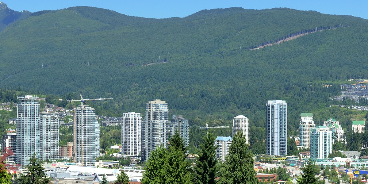

British Columbia is the third-most populous province in Canada, with 5,000,879 residents as of 2021, and is the second-largest in land area, at 920687 km2. British Columbia's 161 municipalities cover only of the province's land mass yet are home to of its population. A municipality is a local government incorporated by the province allowing a community to govern itself and to provide and regulate local services. These services typically include, but are not limited to, the provision of drinking water, sewers, roads, fire protection, street lights, garbage/recycling collection, land use planning, building inspection, and parks.
Within their limited jurisdictions, municipalities are autonomous, responsible and accountable to their citizens and to the province. Their powers and responsibilities are regulated through the Local Government Act, the Community Charter, and, in the case of Vancouver, the Vancouver Charter. They have the power of a natural person, the power to expropriate, and the power to establish and enforce bylaws. They are able to raise funds through property taxes and user fees, and borrow a limited amount through the Municipal Finance Authority of British Columbia to pay for capital costs.
Municipalities are governed by a mayor and council who are democratically elected every 4 years on the third Saturday in October. The most recent election took place on October 15, 2022; the next election will take place on October 17, 2026. Each municipality is a member of a regional district to which their councils elect representatives. The board of directors of the regional district is used as a forum to discuss regional issues.
To become a municipality, a community, with the assistance of the provincial Ministry of Community, Sport and Cultural Development, defines its borders and holds a referendum on the issue. If successful the Cabinet of British Columbia issues a letters patent incorporating the community. Part 2 of the Local Government Act sets out a classification scheme that gives each new municipality a designation. If the population is fewer than 2,500 people the new municipality is designated a village, if between 2,500 and 5,000 a town, and if greater than 5,000 a city. If the new municipality has an area greater than 800 ha and an average population density of fewer than 5 persons per hectare then is it designated a district municipality. The municipality must request change in designation but is not compelled to do so, despite population growth or loss – Greenwood has retained its city status, for example, rather than relinquishing it as other boomtowns of its era have done. There is no longer any legal difference between the designations.
Cities
Main article: List of cities in British Columbia
A city is a classification of municipalities used in British Columbia. British Columbia's lieutenant governor may incorporate a community as a city by letters patent, on the recommendation of the Minister of Housing and Municipal Affairs, if its population is greater than 5,000 and the outcome of a vote involving affected residents was that greater than 50 percent voted in favour of the proposed incorporation.
British Columbia has 53 cities, which had a cumulative population of 3,630,140 in the 2021 census. British Columbia's largest and smallest cities are Vancouver and Greenwood with populations of 662,248 and 702 respectively. The fastest-growing city in British Columbia is Langford, which grew 31.8 percent between 2016 and 2021, while the fastest-shrinking is Merritt, which shrunk by 1.2 percent. The largest city by land area is Abbotsford, which spans 375.33 km2, while the smallest is Duncan, at 2.06 km2. The first community to incorporate as a city was New Westminster on July 16, 1860, while the most recent community to incorporate as a city was Mission on March 29, 2021. Victoria is the capital city of British Columbia.
District municipalities
Main article: List of district municipalities in British Columbia
A district municipality is a classification of municipalities used in British Columbia. British Columbia's lieutenant governor may incorporate a community as a district municipality by letters patent, under the recommendation of the Minister of Housing and Municipal Affairs, if the area is greater than 800 ha and has a population density of fewer than 5 people per hectare, and the outcome of a vote involving affected residents was that greater than 50 percent voted in favour of the proposed incorporation.
British Columbia has 49 district municipalities that had a cumulative population of 669,454 in the 2021 Census. British Columbia's largest and smallest district municipalities are Langley and Wells with populations of 132,603 and 218 respectively. The fastest-growing district municipality in British Columbia is Stewart, which grew 28.9 percent between 2016 and 2021, while the fastest-shrinking is the Northern Rockies Regional Municipality, which declined by 18.8 percent.
Of British Columbia's current 49 district municipalities, the first to incorporate as a district municipality was North Cowichan on June 18, 1873, while the most recent community to incorporate as a district municipality was the Northern Rockies Regional Municipality (NRRM) on February 6, 2009. Although portrayed as a regional municipality in its official name, the NRRM is actually classified as a district municipality.
Indian government districts
The lone Indian government district designation was created by the federal shíshálh Nation Self-Government Act and provincial Sechelt Indian Government District Enabling Act and granted to the shíshálh Nation Government District (formerly known as the Sechelt Indian Government District), which governs the shíshálh Nation lands consisting of 33 former Indian reserves.
Island municipalities
If the community wishing to incorporate is located within a trust area under the Island Trust Act, it must incorporate as an island municipality. A single island municipality designation has been granted to Bowen Island.
Mountain resort municipalities
A mountain resort municipality designation is granted by the Minister of Housing and Municipal Affairs through the Local Government Act if there exists alpine ski lift operations, year-round recreational facilities, and commercial overnight accommodations. British Columbia's lone mountain resort municipality is Sun Peaks.
Resort municipalities
A single resort municipality designation has been granted to Whistler by the Resort Municipality of Whistler Act.
Towns
Main article: List of towns in British Columbia
A town is a classification of municipalities used in British Columbia. British Columbia's lieutenant governor may incorporate a community as a town by letters patent, under the recommendation of the Minister of Communities, Sport and Cultural Development, if its population is greater than 2,500 but not greater than 5,000 and the outcome of a vote involving affected residents was that greater than 50 percent voted in favour of the proposed incorporation.
British Columbia has 14 towns that had a cumulative population of 95,922 in the 2021 census. British Columbia's largest and smallest towns are Comox and Port McNeill with populations of 14,806 and 2,356 respectively. View Royal and Smithers are the fastest-growing and fastest-shrinking towns in the province, growing by 11.2 percent and shrinking by 0.4 percent respectively between 2016 and 2021. Of British Columbia's current 14 towns, the first to incorporate as a town was Ladysmith on June 3, 1904, while the most recent community to incorporate as a town was View Royal on December 5, 1988.
Villages

Main article: List of villages in British Columbia
A village is a classification of municipalities used in British Columbia. British Columbia's lieutenant governor may incorporate a community as a village by letters patent, on the recommendation of the Minister of Communities, Sport and Cultural Development, if its population is not greater than 2,500 and the outcome of a vote involving affected residents was that greater than 50 percent voted in favour of the proposed incorporation.
British Columbia has 42 villages that had a cumulative population of 48,511 in the 2021 census. British Columbia's largest and smallest villages are Cumberland and Zeballos with populations of 4,447 and 126 respectively. Radium Hot Springs and Silverton are the fastest-growing and fastest-shrinking villages in the province, growing by 72.6 percent and shrinking by 23.6 percent respectively between 2016 and 2021. Of British Columbia's current 42 villages, the first to incorporate as a village was Kaslo on August 14, 1893, while the most recent community to incorporate as a village was Queen Charlotte (now known as Daajing Giids) on December 5, 2005.
List of municipalities
| Name | Status | Regional district | Incorporation date | 2021 Canadian census | Population (2021) | Population (2016) | Change | Land area (km2) | Population density (/km2) | Abbotsford | Armstrong | Burnaby | Campbell River | Castlegar | Chilliwack | Colwood | Coquitlam | Courtenay | Cranbrook | Dawson Creek | Delta | Duncan | Enderby | Fernie | Fort St. John | Grand Forks | Greenwood | Kamloops | Kelowna | Kimberley | Langford | Langley | Maple Ridge | Merritt | Mission | Nanaimo | Nelson | New Westminster | North Vancouver | Parksville | Penticton | Pitt Meadows | Port Alberni | Port Coquitlam | Port Moody | Powell River | Prince George | Prince Rupert | Quesnel | Revelstoke | Richmond | Rossland | Salmon Arm | Surrey | Terrace | Trail | Vancouver | Vernon | Victoria | West Kelowna | White Rock | Williams Lake | 100 Mile House | Barriere | Central Saanich | Chetwynd | Clearwater | Coldstream | Elkford | Esquimalt | Fort St. James | Highlands | Hope | Houston | Hudson's Hope | Invermere | Kent | Kitimat | Lake Country | Langley | Lantzville | Lillooet | Logan Lake | Mackenzie | Metchosin | New Hazelton | North Cowichan | North Saanich | North Vancouver | Northern Rockies | Oak Bay | Peachland | Port Edward | Port Hardy | Saanich | Sechelt | Sicamous | Sooke | Spallumcheen | Sparwood | Squamish | Stewart | Summerland | Taylor | Tofino | Tumbler Ridge | Ucluelet | Vanderhoof | Wells | West Vancouver | shíshálh Nation | Bowen Island | Sun Peaks Mountain | Whistler | Comox | Creston | Gibsons | Golden | Ladysmith | Lake Cowichan | Oliver | Osoyoos | Port McNeill | Princeton | Qualicum Beach | Sidney | Smithers | View Royal | Alert Bay | Anmore | Ashcroft | Belcarra | Burns Lake | Cache Creek | Canal Flats | Chase | Clinton | Cumberland | Daajing Giids | Fraser Lake | Fruitvale | Gold River | Granisle | Harrison Hot Springs | Hazelton | Kaslo | Keremeos | Lions Bay | Lumby | Lytton | Masset | McBride | Midway | Montrose | Nakusp | New Denver | Pemberton | Port Alice | Port Clements | Pouce Coupe | Radium Hot Springs | Salmo | Sayward | Silverton | Slocan | Tahsis | Telkwa | Valemount | Warfield | Zeballos | Sub-total cities | Sub-total district municipalities | Sub-total Indian government districts | Sub-total island municipalities | Sub-total mountain resort municipalities | Sub-total resort municipalities | Sub-total towns | Sub-total villages | Total municipalities | British Columbia |
|---|---|---|---|---|---|---|---|---|---|---|---|---|---|---|---|---|---|---|---|---|---|---|---|---|---|---|---|---|---|---|---|---|---|---|---|---|---|---|---|---|---|---|---|---|---|---|---|---|---|---|---|---|---|---|---|---|---|---|---|---|---|---|---|---|---|---|---|---|---|---|---|---|---|---|---|---|---|---|---|---|---|---|---|---|---|---|---|---|---|---|---|---|---|---|---|---|---|---|---|---|---|---|---|---|---|---|---|---|---|---|---|---|---|---|---|---|---|---|---|---|---|---|---|---|---|---|---|---|---|---|---|---|---|---|---|---|---|---|---|---|---|---|---|---|---|---|---|---|---|---|---|---|---|---|---|---|---|---|---|---|---|---|---|---|---|---|---|---|---|---|---|---|---|---|---|---|---|---|---|---|
| City | Fraser Valley | December 12, 1995 | 375.33 | |||||||||||||||||||||||||||||||||||||||||||||||||||||||||||||||||||||||||||||||||||||||||||||||||||||||||||||||||||||||||||||||||||||||||||||||||||||||||||||||||||||||||||||||||
| City | North Okanagan | March 31, 1913 | 5.22 | |||||||||||||||||||||||||||||||||||||||||||||||||||||||||||||||||||||||||||||||||||||||||||||||||||||||||||||||||||||||||||||||||||||||||||||||||||||||||||||||||||||||||||||||||
| City | Metro Vancouver | September 22, 1892 | 90.57 | |||||||||||||||||||||||||||||||||||||||||||||||||||||||||||||||||||||||||||||||||||||||||||||||||||||||||||||||||||||||||||||||||||||||||||||||||||||||||||||||||||||||||||||||||
| City | Strathcona | June 24, 1947 | 144.38 | |||||||||||||||||||||||||||||||||||||||||||||||||||||||||||||||||||||||||||||||||||||||||||||||||||||||||||||||||||||||||||||||||||||||||||||||||||||||||||||||||||||||||||||||||
| City | Central Kootenay | January 1, 1974 | 19.87 | |||||||||||||||||||||||||||||||||||||||||||||||||||||||||||||||||||||||||||||||||||||||||||||||||||||||||||||||||||||||||||||||||||||||||||||||||||||||||||||||||||||||||||||||||
| City | Fraser Valley | April 26, 1873 | 261.34 | |||||||||||||||||||||||||||||||||||||||||||||||||||||||||||||||||||||||||||||||||||||||||||||||||||||||||||||||||||||||||||||||||||||||||||||||||||||||||||||||||||||||||||||||||
| City | Capital | June 24, 1985 | 17.66 | |||||||||||||||||||||||||||||||||||||||||||||||||||||||||||||||||||||||||||||||||||||||||||||||||||||||||||||||||||||||||||||||||||||||||||||||||||||||||||||||||||||||||||||||||
| City | Metro Vancouver | July 25, 1891 | 122.15 | |||||||||||||||||||||||||||||||||||||||||||||||||||||||||||||||||||||||||||||||||||||||||||||||||||||||||||||||||||||||||||||||||||||||||||||||||||||||||||||||||||||||||||||||||
| City | Comox Valley | January 1, 1915 | 32.42 | |||||||||||||||||||||||||||||||||||||||||||||||||||||||||||||||||||||||||||||||||||||||||||||||||||||||||||||||||||||||||||||||||||||||||||||||||||||||||||||||||||||||||||||||||
| City | East Kootenay | November 1, 1905 | 31.97 | |||||||||||||||||||||||||||||||||||||||||||||||||||||||||||||||||||||||||||||||||||||||||||||||||||||||||||||||||||||||||||||||||||||||||||||||||||||||||||||||||||||||||||||||||
| City | Peace River | May 26, 1936 | 26.72 | |||||||||||||||||||||||||||||||||||||||||||||||||||||||||||||||||||||||||||||||||||||||||||||||||||||||||||||||||||||||||||||||||||||||||||||||||||||||||||||||||||||||||||||||||
| City | Metro Vancouver | November 10, 1879 | 179.66 | |||||||||||||||||||||||||||||||||||||||||||||||||||||||||||||||||||||||||||||||||||||||||||||||||||||||||||||||||||||||||||||||||||||||||||||||||||||||||||||||||||||||||||||||||
| City | Cowichan Valley | March 4, 1912 | 2.06 | |||||||||||||||||||||||||||||||||||||||||||||||||||||||||||||||||||||||||||||||||||||||||||||||||||||||||||||||||||||||||||||||||||||||||||||||||||||||||||||||||||||||||||||||||
| City | North Okanagan | March 1, 1905 | 4.26 | |||||||||||||||||||||||||||||||||||||||||||||||||||||||||||||||||||||||||||||||||||||||||||||||||||||||||||||||||||||||||||||||||||||||||||||||||||||||||||||||||||||||||||||||||
| City | East Kootenay | July 28, 1904 | 15.11 | |||||||||||||||||||||||||||||||||||||||||||||||||||||||||||||||||||||||||||||||||||||||||||||||||||||||||||||||||||||||||||||||||||||||||||||||||||||||||||||||||||||||||||||||||
| City | Peace River | December 31, 1947 | 32.67 | |||||||||||||||||||||||||||||||||||||||||||||||||||||||||||||||||||||||||||||||||||||||||||||||||||||||||||||||||||||||||||||||||||||||||||||||||||||||||||||||||||||||||||||||||
| City | Kootenay Boundary | April 15, 1897 | 10.37 | |||||||||||||||||||||||||||||||||||||||||||||||||||||||||||||||||||||||||||||||||||||||||||||||||||||||||||||||||||||||||||||||||||||||||||||||||||||||||||||||||||||||||||||||||
| City | Kootenay Boundary | July 12, 1897 | 2.42 | |||||||||||||||||||||||||||||||||||||||||||||||||||||||||||||||||||||||||||||||||||||||||||||||||||||||||||||||||||||||||||||||||||||||||||||||||||||||||||||||||||||||||||||||||
| City | Thompson-Nicola | October 17, 1967 | 297.93 | |||||||||||||||||||||||||||||||||||||||||||||||||||||||||||||||||||||||||||||||||||||||||||||||||||||||||||||||||||||||||||||||||||||||||||||||||||||||||||||||||||||||||||||||||
| City | Central Okanagan | May 4, 1905 | 211.85 | |||||||||||||||||||||||||||||||||||||||||||||||||||||||||||||||||||||||||||||||||||||||||||||||||||||||||||||||||||||||||||||||||||||||||||||||||||||||||||||||||||||||||||||||||
| City | East Kootenay | March 29, 1944 | 60.51 | |||||||||||||||||||||||||||||||||||||||||||||||||||||||||||||||||||||||||||||||||||||||||||||||||||||||||||||||||||||||||||||||||||||||||||||||||||||||||||||||||||||||||||||||||
| City | Capital | December 8, 1992 | 41.43 | |||||||||||||||||||||||||||||||||||||||||||||||||||||||||||||||||||||||||||||||||||||||||||||||||||||||||||||||||||||||||||||||||||||||||||||||||||||||||||||||||||||||||||||||||
| City | Metro Vancouver | March 15, 1955 | 10.18 | |||||||||||||||||||||||||||||||||||||||||||||||||||||||||||||||||||||||||||||||||||||||||||||||||||||||||||||||||||||||||||||||||||||||||||||||||||||||||||||||||||||||||||||||||
| City | Metro Vancouver | September 12, 2014 | 267.82 | |||||||||||||||||||||||||||||||||||||||||||||||||||||||||||||||||||||||||||||||||||||||||||||||||||||||||||||||||||||||||||||||||||||||||||||||||||||||||||||||||||||||||||||||||
| City | Thompson-Nicola | April 1, 1911 | 26.04 | |||||||||||||||||||||||||||||||||||||||||||||||||||||||||||||||||||||||||||||||||||||||||||||||||||||||||||||||||||||||||||||||||||||||||||||||||||||||||||||||||||||||||||||||||
| City | Fraser Valley | March 29, 2021 | 226.98 | |||||||||||||||||||||||||||||||||||||||||||||||||||||||||||||||||||||||||||||||||||||||||||||||||||||||||||||||||||||||||||||||||||||||||||||||||||||||||||||||||||||||||||||||||
| City | Nanaimo | December 24, 1874 | 90.45 | |||||||||||||||||||||||||||||||||||||||||||||||||||||||||||||||||||||||||||||||||||||||||||||||||||||||||||||||||||||||||||||||||||||||||||||||||||||||||||||||||||||||||||||||||
| City | Central Kootenay | March 18, 1897 | 11.93 | |||||||||||||||||||||||||||||||||||||||||||||||||||||||||||||||||||||||||||||||||||||||||||||||||||||||||||||||||||||||||||||||||||||||||||||||||||||||||||||||||||||||||||||||||
| City | Metro Vancouver | July 16, 1860 | 15.62 | |||||||||||||||||||||||||||||||||||||||||||||||||||||||||||||||||||||||||||||||||||||||||||||||||||||||||||||||||||||||||||||||||||||||||||||||||||||||||||||||||||||||||||||||||
| City | Metro Vancouver | August 10, 1891 | 11.83 | |||||||||||||||||||||||||||||||||||||||||||||||||||||||||||||||||||||||||||||||||||||||||||||||||||||||||||||||||||||||||||||||||||||||||||||||||||||||||||||||||||||||||||||||||
| City | Nanaimo | June 19, 1945 | 14.52 | |||||||||||||||||||||||||||||||||||||||||||||||||||||||||||||||||||||||||||||||||||||||||||||||||||||||||||||||||||||||||||||||||||||||||||||||||||||||||||||||||||||||||||||||||
| City | Okanagan-Similkameen | January 1, 1909 | 43.03 | |||||||||||||||||||||||||||||||||||||||||||||||||||||||||||||||||||||||||||||||||||||||||||||||||||||||||||||||||||||||||||||||||||||||||||||||||||||||||||||||||||||||||||||||||
| City | Metro Vancouver | April 25, 1914 | 86.34 | |||||||||||||||||||||||||||||||||||||||||||||||||||||||||||||||||||||||||||||||||||||||||||||||||||||||||||||||||||||||||||||||||||||||||||||||||||||||||||||||||||||||||||||||||
| City | Alberni-Clayoquot | October 28, 1967 | 19.66 | |||||||||||||||||||||||||||||||||||||||||||||||||||||||||||||||||||||||||||||||||||||||||||||||||||||||||||||||||||||||||||||||||||||||||||||||||||||||||||||||||||||||||||||||||
| City | Metro Vancouver | March 7, 1913 | 29.16 | |||||||||||||||||||||||||||||||||||||||||||||||||||||||||||||||||||||||||||||||||||||||||||||||||||||||||||||||||||||||||||||||||||||||||||||||||||||||||||||||||||||||||||||||||
| City | Metro Vancouver | March 11, 1913 | 25.85 | |||||||||||||||||||||||||||||||||||||||||||||||||||||||||||||||||||||||||||||||||||||||||||||||||||||||||||||||||||||||||||||||||||||||||||||||||||||||||||||||||||||||||||||||||
| City | qathet | October 15, 1955 | 28.91 | |||||||||||||||||||||||||||||||||||||||||||||||||||||||||||||||||||||||||||||||||||||||||||||||||||||||||||||||||||||||||||||||||||||||||||||||||||||||||||||||||||||||||||||||||
| City | Fraser-Fort George | March 6, 1915 | 316.74 | |||||||||||||||||||||||||||||||||||||||||||||||||||||||||||||||||||||||||||||||||||||||||||||||||||||||||||||||||||||||||||||||||||||||||||||||||||||||||||||||||||||||||||||||||
| City | North Coast | March 10, 1910 | 66.00 | |||||||||||||||||||||||||||||||||||||||||||||||||||||||||||||||||||||||||||||||||||||||||||||||||||||||||||||||||||||||||||||||||||||||||||||||||||||||||||||||||||||||||||||||||
| City | Cariboo | March 21, 1928 | 35.35 | |||||||||||||||||||||||||||||||||||||||||||||||||||||||||||||||||||||||||||||||||||||||||||||||||||||||||||||||||||||||||||||||||||||||||||||||||||||||||||||||||||||||||||||||||
| City | Columbia Shuswap | March 1, 1899 | 41.28 | |||||||||||||||||||||||||||||||||||||||||||||||||||||||||||||||||||||||||||||||||||||||||||||||||||||||||||||||||||||||||||||||||||||||||||||||||||||||||||||||||||||||||||||||||
| City | Metro Vancouver | November 10, 1879 | 128.87 | |||||||||||||||||||||||||||||||||||||||||||||||||||||||||||||||||||||||||||||||||||||||||||||||||||||||||||||||||||||||||||||||||||||||||||||||||||||||||||||||||||||||||||||||||
| City | Kootenay Boundary | March 18, 1897 | 59.72 | |||||||||||||||||||||||||||||||||||||||||||||||||||||||||||||||||||||||||||||||||||||||||||||||||||||||||||||||||||||||||||||||||||||||||||||||||||||||||||||||||||||||||||||||||
| City | Columbia Shuswap | May 15, 1905 | 155.19 | |||||||||||||||||||||||||||||||||||||||||||||||||||||||||||||||||||||||||||||||||||||||||||||||||||||||||||||||||||||||||||||||||||||||||||||||||||||||||||||||||||||||||||||||||
| City | Metro Vancouver | November 10, 1879 | 316.11 | |||||||||||||||||||||||||||||||||||||||||||||||||||||||||||||||||||||||||||||||||||||||||||||||||||||||||||||||||||||||||||||||||||||||||||||||||||||||||||||||||||||||||||||||||
| City | Kitimat-Stikine | December 31, 1927 | 57.33 | |||||||||||||||||||||||||||||||||||||||||||||||||||||||||||||||||||||||||||||||||||||||||||||||||||||||||||||||||||||||||||||||||||||||||||||||||||||||||||||||||||||||||||||||||
| City | Kootenay Boundary | June 14, 1901 | 34.90 | |||||||||||||||||||||||||||||||||||||||||||||||||||||||||||||||||||||||||||||||||||||||||||||||||||||||||||||||||||||||||||||||||||||||||||||||||||||||||||||||||||||||||||||||||
| City | Metro Vancouver | April 6, 1886 | 115.18 | |||||||||||||||||||||||||||||||||||||||||||||||||||||||||||||||||||||||||||||||||||||||||||||||||||||||||||||||||||||||||||||||||||||||||||||||||||||||||||||||||||||||||||||||||
| City | North Okanagan | December 30, 1892 | 96.43 | |||||||||||||||||||||||||||||||||||||||||||||||||||||||||||||||||||||||||||||||||||||||||||||||||||||||||||||||||||||||||||||||||||||||||||||||||||||||||||||||||||||||||||||||||
| City | Capital | August 2, 1862 | 19.45 | |||||||||||||||||||||||||||||||||||||||||||||||||||||||||||||||||||||||||||||||||||||||||||||||||||||||||||||||||||||||||||||||||||||||||||||||||||||||||||||||||||||||||||||||||
| City | Central Okanagan | June 26, 2015 | 122.09 | |||||||||||||||||||||||||||||||||||||||||||||||||||||||||||||||||||||||||||||||||||||||||||||||||||||||||||||||||||||||||||||||||||||||||||||||||||||||||||||||||||||||||||||||||
| City | Metro Vancouver | April 15, 1957 | 5.17 | |||||||||||||||||||||||||||||||||||||||||||||||||||||||||||||||||||||||||||||||||||||||||||||||||||||||||||||||||||||||||||||||||||||||||||||||||||||||||||||||||||||||||||||||||
| City | Cariboo | March 15, 1929 | 33.12 | |||||||||||||||||||||||||||||||||||||||||||||||||||||||||||||||||||||||||||||||||||||||||||||||||||||||||||||||||||||||||||||||||||||||||||||||||||||||||||||||||||||||||||||||||
| District municipality | Cariboo | July 27, 1965 | 53.01 | |||||||||||||||||||||||||||||||||||||||||||||||||||||||||||||||||||||||||||||||||||||||||||||||||||||||||||||||||||||||||||||||||||||||||||||||||||||||||||||||||||||||||||||||||
| District municipality | Thompson-Nicola | December 4, 2007 | 10.73 | |||||||||||||||||||||||||||||||||||||||||||||||||||||||||||||||||||||||||||||||||||||||||||||||||||||||||||||||||||||||||||||||||||||||||||||||||||||||||||||||||||||||||||||||||
| District municipality | Capital | December 12, 1950 | 41.20 | |||||||||||||||||||||||||||||||||||||||||||||||||||||||||||||||||||||||||||||||||||||||||||||||||||||||||||||||||||||||||||||||||||||||||||||||||||||||||||||||||||||||||||||||||
| District municipality | Peace River | September 25, 1962 | 63.55 | |||||||||||||||||||||||||||||||||||||||||||||||||||||||||||||||||||||||||||||||||||||||||||||||||||||||||||||||||||||||||||||||||||||||||||||||||||||||||||||||||||||||||||||||||
| District municipality | Thompson-Nicola | December 3, 2007 | 55.65 | |||||||||||||||||||||||||||||||||||||||||||||||||||||||||||||||||||||||||||||||||||||||||||||||||||||||||||||||||||||||||||||||||||||||||||||||||||||||||||||||||||||||||||||||||
| District municipality | North Okanagan | December 21, 1906 | 66.57 | |||||||||||||||||||||||||||||||||||||||||||||||||||||||||||||||||||||||||||||||||||||||||||||||||||||||||||||||||||||||||||||||||||||||||||||||||||||||||||||||||||||||||||||||||
| District municipality | East Kootenay | July 16, 1971 | 108.12 | |||||||||||||||||||||||||||||||||||||||||||||||||||||||||||||||||||||||||||||||||||||||||||||||||||||||||||||||||||||||||||||||||||||||||||||||||||||||||||||||||||||||||||||||||
| District municipality | Capital | September 1, 1912 | 7.08 | |||||||||||||||||||||||||||||||||||||||||||||||||||||||||||||||||||||||||||||||||||||||||||||||||||||||||||||||||||||||||||||||||||||||||||||||||||||||||||||||||||||||||||||||||
| District municipality | Bulkley-Nechako | December 19, 1952 | 23.45 | |||||||||||||||||||||||||||||||||||||||||||||||||||||||||||||||||||||||||||||||||||||||||||||||||||||||||||||||||||||||||||||||||||||||||||||||||||||||||||||||||||||||||||||||||
| District municipality | Capital | December 7, 1993 | 38.01 | |||||||||||||||||||||||||||||||||||||||||||||||||||||||||||||||||||||||||||||||||||||||||||||||||||||||||||||||||||||||||||||||||||||||||||||||||||||||||||||||||||||||||||||||||
| District municipality | Fraser Valley | April 6, 1929 | 40.87 | |||||||||||||||||||||||||||||||||||||||||||||||||||||||||||||||||||||||||||||||||||||||||||||||||||||||||||||||||||||||||||||||||||||||||||||||||||||||||||||||||||||||||||||||||
| District municipality | Bulkley-Nechako | March 4, 1957 | 72.88 | |||||||||||||||||||||||||||||||||||||||||||||||||||||||||||||||||||||||||||||||||||||||||||||||||||||||||||||||||||||||||||||||||||||||||||||||||||||||||||||||||||||||||||||||||
| District municipality | Peace River | November 16, 1965 | 826.70 | |||||||||||||||||||||||||||||||||||||||||||||||||||||||||||||||||||||||||||||||||||||||||||||||||||||||||||||||||||||||||||||||||||||||||||||||||||||||||||||||||||||||||||||||||
| District municipality | East Kootenay | May 22, 1951 | 10.75 | |||||||||||||||||||||||||||||||||||||||||||||||||||||||||||||||||||||||||||||||||||||||||||||||||||||||||||||||||||||||||||||||||||||||||||||||||||||||||||||||||||||||||||||||||
| District municipality | Fraser Valley | January 1, 1895 | 168.59 | |||||||||||||||||||||||||||||||||||||||||||||||||||||||||||||||||||||||||||||||||||||||||||||||||||||||||||||||||||||||||||||||||||||||||||||||||||||||||||||||||||||||||||||||||
| District municipality | Kitimat-Stikine | March 31, 1953 | 239.28 | |||||||||||||||||||||||||||||||||||||||||||||||||||||||||||||||||||||||||||||||||||||||||||||||||||||||||||||||||||||||||||||||||||||||||||||||||||||||||||||||||||||||||||||||||
| District municipality | Central Okanagan | May 2, 1995 | 122.16 | |||||||||||||||||||||||||||||||||||||||||||||||||||||||||||||||||||||||||||||||||||||||||||||||||||||||||||||||||||||||||||||||||||||||||||||||||||||||||||||||||||||||||||||||||
| District municipality | Metro Vancouver | April 26, 1873 | 307.22 | |||||||||||||||||||||||||||||||||||||||||||||||||||||||||||||||||||||||||||||||||||||||||||||||||||||||||||||||||||||||||||||||||||||||||||||||||||||||||||||||||||||||||||||||||
| District municipality | Nanaimo | June 25, 2003 | 27.68 | |||||||||||||||||||||||||||||||||||||||||||||||||||||||||||||||||||||||||||||||||||||||||||||||||||||||||||||||||||||||||||||||||||||||||||||||||||||||||||||||||||||||||||||||||
| District municipality | Squamish-Lillooet | December 31, 1946 | 27.63 | |||||||||||||||||||||||||||||||||||||||||||||||||||||||||||||||||||||||||||||||||||||||||||||||||||||||||||||||||||||||||||||||||||||||||||||||||||||||||||||||||||||||||||||||||
| District municipality | Thompson-Nicola | November 10, 1970 | 324.28 | |||||||||||||||||||||||||||||||||||||||||||||||||||||||||||||||||||||||||||||||||||||||||||||||||||||||||||||||||||||||||||||||||||||||||||||||||||||||||||||||||||||||||||||||||
| District municipality | Fraser-Fort George | May 19, 1966 | 154.19 | |||||||||||||||||||||||||||||||||||||||||||||||||||||||||||||||||||||||||||||||||||||||||||||||||||||||||||||||||||||||||||||||||||||||||||||||||||||||||||||||||||||||||||||||||
| District municipality | Capital | December 3, 1984 | 69.57 | |||||||||||||||||||||||||||||||||||||||||||||||||||||||||||||||||||||||||||||||||||||||||||||||||||||||||||||||||||||||||||||||||||||||||||||||||||||||||||||||||||||||||||||||||
| District municipality | Kitimat-Stikine | December 15, 1980 | 24.34 | |||||||||||||||||||||||||||||||||||||||||||||||||||||||||||||||||||||||||||||||||||||||||||||||||||||||||||||||||||||||||||||||||||||||||||||||||||||||||||||||||||||||||||||||||
| District municipality | Cowichan Valley | June 18, 1873 | 195.41 | |||||||||||||||||||||||||||||||||||||||||||||||||||||||||||||||||||||||||||||||||||||||||||||||||||||||||||||||||||||||||||||||||||||||||||||||||||||||||||||||||||||||||||||||||
| District municipality | Capital | August 19, 1965 | 37.16 | |||||||||||||||||||||||||||||||||||||||||||||||||||||||||||||||||||||||||||||||||||||||||||||||||||||||||||||||||||||||||||||||||||||||||||||||||||||||||||||||||||||||||||||||||
| District municipality | Metro Vancouver | May 13, 1907 | 160.66 | |||||||||||||||||||||||||||||||||||||||||||||||||||||||||||||||||||||||||||||||||||||||||||||||||||||||||||||||||||||||||||||||||||||||||||||||||||||||||||||||||||||||||||||||||
| District municipality | Northern Rockies | February 6, 2009 | 84,759.31 | |||||||||||||||||||||||||||||||||||||||||||||||||||||||||||||||||||||||||||||||||||||||||||||||||||||||||||||||||||||||||||||||||||||||||||||||||||||||||||||||||||||||||||||||||
| District municipality | Capital | July 2, 1906 | 10.52 | |||||||||||||||||||||||||||||||||||||||||||||||||||||||||||||||||||||||||||||||||||||||||||||||||||||||||||||||||||||||||||||||||||||||||||||||||||||||||||||||||||||||||||||||||
| District municipality | Central Okanagan | January 1, 1909 | 16.10 | |||||||||||||||||||||||||||||||||||||||||||||||||||||||||||||||||||||||||||||||||||||||||||||||||||||||||||||||||||||||||||||||||||||||||||||||||||||||||||||||||||||||||||||||||
| District municipality | North Coast | June 29, 1966 | 167.16 | |||||||||||||||||||||||||||||||||||||||||||||||||||||||||||||||||||||||||||||||||||||||||||||||||||||||||||||||||||||||||||||||||||||||||||||||||||||||||||||||||||||||||||||||||
| District municipality | Mount Waddington | May 5, 1966 | 38.55 | |||||||||||||||||||||||||||||||||||||||||||||||||||||||||||||||||||||||||||||||||||||||||||||||||||||||||||||||||||||||||||||||||||||||||||||||||||||||||||||||||||||||||||||||||
| District municipality | Capital | March 1, 1906 | 103.59 | |||||||||||||||||||||||||||||||||||||||||||||||||||||||||||||||||||||||||||||||||||||||||||||||||||||||||||||||||||||||||||||||||||||||||||||||||||||||||||||||||||||||||||||||||
| District municipality | Sunshine Coast | February 15, 1956 | 39.02 | |||||||||||||||||||||||||||||||||||||||||||||||||||||||||||||||||||||||||||||||||||||||||||||||||||||||||||||||||||||||||||||||||||||||||||||||||||||||||||||||||||||||||||||||||
| District municipality | Columbia Shuswap | December 4, 1989 | 12.80 | |||||||||||||||||||||||||||||||||||||||||||||||||||||||||||||||||||||||||||||||||||||||||||||||||||||||||||||||||||||||||||||||||||||||||||||||||||||||||||||||||||||||||||||||||
| District municipality | Capital | December 7, 1999 | 56.60 | |||||||||||||||||||||||||||||||||||||||||||||||||||||||||||||||||||||||||||||||||||||||||||||||||||||||||||||||||||||||||||||||||||||||||||||||||||||||||||||||||||||||||||||||||
| District municipality | North Okanagan | July 21, 1892 | 254.92 | |||||||||||||||||||||||||||||||||||||||||||||||||||||||||||||||||||||||||||||||||||||||||||||||||||||||||||||||||||||||||||||||||||||||||||||||||||||||||||||||||||||||||||||||||
| District municipality | East Kootenay | October 6, 1964 | 191.30 | |||||||||||||||||||||||||||||||||||||||||||||||||||||||||||||||||||||||||||||||||||||||||||||||||||||||||||||||||||||||||||||||||||||||||||||||||||||||||||||||||||||||||||||||||
| District municipality | Squamish-Lillooet | May 18, 1948 | 104.71 | |||||||||||||||||||||||||||||||||||||||||||||||||||||||||||||||||||||||||||||||||||||||||||||||||||||||||||||||||||||||||||||||||||||||||||||||||||||||||||||||||||||||||||||||||
| District municipality | Kitimat-Stikine | May 16, 1930 | 551.57 | |||||||||||||||||||||||||||||||||||||||||||||||||||||||||||||||||||||||||||||||||||||||||||||||||||||||||||||||||||||||||||||||||||||||||||||||||||||||||||||||||||||||||||||||||
| District municipality | Okanagan-Similkameen | December 21, 1906 | 74.04 | |||||||||||||||||||||||||||||||||||||||||||||||||||||||||||||||||||||||||||||||||||||||||||||||||||||||||||||||||||||||||||||||||||||||||||||||||||||||||||||||||||||||||||||||||
| District municipality | Peace River | August 23, 1958 | 16.92 | |||||||||||||||||||||||||||||||||||||||||||||||||||||||||||||||||||||||||||||||||||||||||||||||||||||||||||||||||||||||||||||||||||||||||||||||||||||||||||||||||||||||||||||||||
| District municipality | Alberni-Clayoquot | February 5, 1932 | 10.56 | |||||||||||||||||||||||||||||||||||||||||||||||||||||||||||||||||||||||||||||||||||||||||||||||||||||||||||||||||||||||||||||||||||||||||||||||||||||||||||||||||||||||||||||||||
| District municipality | Peace River | April 9, 1981 | 1,557.41 | |||||||||||||||||||||||||||||||||||||||||||||||||||||||||||||||||||||||||||||||||||||||||||||||||||||||||||||||||||||||||||||||||||||||||||||||||||||||||||||||||||||||||||||||||
| District municipality | Alberni-Clayoquot | February 26, 1952 | 6.48 | |||||||||||||||||||||||||||||||||||||||||||||||||||||||||||||||||||||||||||||||||||||||||||||||||||||||||||||||||||||||||||||||||||||||||||||||||||||||||||||||||||||||||||||||||
| District municipality | Bulkley-Nechako | January 22, 1926 | 53.93 | |||||||||||||||||||||||||||||||||||||||||||||||||||||||||||||||||||||||||||||||||||||||||||||||||||||||||||||||||||||||||||||||||||||||||||||||||||||||||||||||||||||||||||||||||
| District municipality | Cariboo | June 29, 1998 | 158.09 | |||||||||||||||||||||||||||||||||||||||||||||||||||||||||||||||||||||||||||||||||||||||||||||||||||||||||||||||||||||||||||||||||||||||||||||||||||||||||||||||||||||||||||||||||
| District municipality | Metro Vancouver | March 15, 1912 | 87.18 | |||||||||||||||||||||||||||||||||||||||||||||||||||||||||||||||||||||||||||||||||||||||||||||||||||||||||||||||||||||||||||||||||||||||||||||||||||||||||||||||||||||||||||||||||
| First Nations government district | qathet and Sunshine Coast | March 17, 1988 | ||||||||||||||||||||||||||||||||||||||||||||||||||||||||||||||||||||||||||||||||||||||||||||||||||||||||||||||||||||||||||||||||||||||||||||||||||||||||||||||||||||||||||||||||||
| Island municipality | Metro Vancouver | December 4, 1999 | 50.12 | |||||||||||||||||||||||||||||||||||||||||||||||||||||||||||||||||||||||||||||||||||||||||||||||||||||||||||||||||||||||||||||||||||||||||||||||||||||||||||||||||||||||||||||||||
| Mountain resort municipality | Thompson-Nicola | June 3, 2010 | 40.85 | |||||||||||||||||||||||||||||||||||||||||||||||||||||||||||||||||||||||||||||||||||||||||||||||||||||||||||||||||||||||||||||||||||||||||||||||||||||||||||||||||||||||||||||||||
| Resort municipality | Squamish-Lillooet | September 6, 1975 | 240.00 | |||||||||||||||||||||||||||||||||||||||||||||||||||||||||||||||||||||||||||||||||||||||||||||||||||||||||||||||||||||||||||||||||||||||||||||||||||||||||||||||||||||||||||||||||
| Town | Comox Valley | January 14, 1946 | 16.87 | |||||||||||||||||||||||||||||||||||||||||||||||||||||||||||||||||||||||||||||||||||||||||||||||||||||||||||||||||||||||||||||||||||||||||||||||||||||||||||||||||||||||||||||||||
| Town | Central Kootenay | May 14, 1924 | 8.41 | |||||||||||||||||||||||||||||||||||||||||||||||||||||||||||||||||||||||||||||||||||||||||||||||||||||||||||||||||||||||||||||||||||||||||||||||||||||||||||||||||||||||||||||||||
| Town | Sunshine Coast | March 4, 1929 | 4.31 | |||||||||||||||||||||||||||||||||||||||||||||||||||||||||||||||||||||||||||||||||||||||||||||||||||||||||||||||||||||||||||||||||||||||||||||||||||||||||||||||||||||||||||||||||
| Town | Columbia Shuswap | June 26, 1957 | 11.33 | |||||||||||||||||||||||||||||||||||||||||||||||||||||||||||||||||||||||||||||||||||||||||||||||||||||||||||||||||||||||||||||||||||||||||||||||||||||||||||||||||||||||||||||||||
| Town | Cowichan Valley | June 3, 1904 | 12.04 | |||||||||||||||||||||||||||||||||||||||||||||||||||||||||||||||||||||||||||||||||||||||||||||||||||||||||||||||||||||||||||||||||||||||||||||||||||||||||||||||||||||||||||||||||
| Town | Cowichan Valley | August 19, 1944 | 8.24 | |||||||||||||||||||||||||||||||||||||||||||||||||||||||||||||||||||||||||||||||||||||||||||||||||||||||||||||||||||||||||||||||||||||||||||||||||||||||||||||||||||||||||||||||||
| Town | Okanagan-Similkameen | December 31, 1945 | 5.49 | |||||||||||||||||||||||||||||||||||||||||||||||||||||||||||||||||||||||||||||||||||||||||||||||||||||||||||||||||||||||||||||||||||||||||||||||||||||||||||||||||||||||||||||||||
| Town | Okanagan-Similkameen | January 14, 1946 | 8.41 | |||||||||||||||||||||||||||||||||||||||||||||||||||||||||||||||||||||||||||||||||||||||||||||||||||||||||||||||||||||||||||||||||||||||||||||||||||||||||||||||||||||||||||||||||
| Town | Mount Waddington | February 18, 1966 | 13.77 | |||||||||||||||||||||||||||||||||||||||||||||||||||||||||||||||||||||||||||||||||||||||||||||||||||||||||||||||||||||||||||||||||||||||||||||||||||||||||||||||||||||||||||||||||
| Town | Okanagan-Similkameen | September 11, 1951 | 59.28 | |||||||||||||||||||||||||||||||||||||||||||||||||||||||||||||||||||||||||||||||||||||||||||||||||||||||||||||||||||||||||||||||||||||||||||||||||||||||||||||||||||||||||||||||||
| Town | Nanaimo | May 5, 1942 | 17.98 | |||||||||||||||||||||||||||||||||||||||||||||||||||||||||||||||||||||||||||||||||||||||||||||||||||||||||||||||||||||||||||||||||||||||||||||||||||||||||||||||||||||||||||||||||
| Town | Capital | September 30, 1952 | 5.11 | |||||||||||||||||||||||||||||||||||||||||||||||||||||||||||||||||||||||||||||||||||||||||||||||||||||||||||||||||||||||||||||||||||||||||||||||||||||||||||||||||||||||||||||||||
| Town | Bulkley-Nechako | October 6, 1921 | 15.26 | |||||||||||||||||||||||||||||||||||||||||||||||||||||||||||||||||||||||||||||||||||||||||||||||||||||||||||||||||||||||||||||||||||||||||||||||||||||||||||||||||||||||||||||||||
| Town | Capital | December 5, 1988 | 14.33 | |||||||||||||||||||||||||||||||||||||||||||||||||||||||||||||||||||||||||||||||||||||||||||||||||||||||||||||||||||||||||||||||||||||||||||||||||||||||||||||||||||||||||||||||||
| Village | Mount Waddington | January 14, 1946 | 1.69 | |||||||||||||||||||||||||||||||||||||||||||||||||||||||||||||||||||||||||||||||||||||||||||||||||||||||||||||||||||||||||||||||||||||||||||||||||||||||||||||||||||||||||||||||||
| Village | Metro Vancouver | December 7, 1987 | 27.53 | |||||||||||||||||||||||||||||||||||||||||||||||||||||||||||||||||||||||||||||||||||||||||||||||||||||||||||||||||||||||||||||||||||||||||||||||||||||||||||||||||||||||||||||||||
| Village | Thompson-Nicola | June 27, 1952 | 50.86 | |||||||||||||||||||||||||||||||||||||||||||||||||||||||||||||||||||||||||||||||||||||||||||||||||||||||||||||||||||||||||||||||||||||||||||||||||||||||||||||||||||||||||||||||||
| Village | Metro Vancouver | August 22, 1979 | 5.50 | |||||||||||||||||||||||||||||||||||||||||||||||||||||||||||||||||||||||||||||||||||||||||||||||||||||||||||||||||||||||||||||||||||||||||||||||||||||||||||||||||||||||||||||||||
| Village | Bulkley-Nechako | December 6, 1923 | 6.54 | |||||||||||||||||||||||||||||||||||||||||||||||||||||||||||||||||||||||||||||||||||||||||||||||||||||||||||||||||||||||||||||||||||||||||||||||||||||||||||||||||||||||||||||||||
| Village | Thompson-Nicola | November 28, 1967 | 10.40 | |||||||||||||||||||||||||||||||||||||||||||||||||||||||||||||||||||||||||||||||||||||||||||||||||||||||||||||||||||||||||||||||||||||||||||||||||||||||||||||||||||||||||||||||||
| Village | East Kootenay | June 29, 2004 | 11.07 | |||||||||||||||||||||||||||||||||||||||||||||||||||||||||||||||||||||||||||||||||||||||||||||||||||||||||||||||||||||||||||||||||||||||||||||||||||||||||||||||||||||||||||||||||
| Village | Thompson-Nicola | April 22, 1969 | 3.75 | |||||||||||||||||||||||||||||||||||||||||||||||||||||||||||||||||||||||||||||||||||||||||||||||||||||||||||||||||||||||||||||||||||||||||||||||||||||||||||||||||||||||||||||||||
| Village | Thompson-Nicola | July 16, 1963 | 8.14 | |||||||||||||||||||||||||||||||||||||||||||||||||||||||||||||||||||||||||||||||||||||||||||||||||||||||||||||||||||||||||||||||||||||||||||||||||||||||||||||||||||||||||||||||||
| Village | Comox Valley | January 1, 1898 | 29.04 | |||||||||||||||||||||||||||||||||||||||||||||||||||||||||||||||||||||||||||||||||||||||||||||||||||||||||||||||||||||||||||||||||||||||||||||||||||||||||||||||||||||||||||||||||
| Village | North Coast | December 5, 2005 | 35.58 | |||||||||||||||||||||||||||||||||||||||||||||||||||||||||||||||||||||||||||||||||||||||||||||||||||||||||||||||||||||||||||||||||||||||||||||||||||||||||||||||||||||||||||||||||
| Village | Bulkley-Nechako | September 27, 1966 | 4.06 | |||||||||||||||||||||||||||||||||||||||||||||||||||||||||||||||||||||||||||||||||||||||||||||||||||||||||||||||||||||||||||||||||||||||||||||||||||||||||||||||||||||||||||||||||
| Village | Kootenay Boundary | November 4, 1952 | 2.70 | |||||||||||||||||||||||||||||||||||||||||||||||||||||||||||||||||||||||||||||||||||||||||||||||||||||||||||||||||||||||||||||||||||||||||||||||||||||||||||||||||||||||||||||||||
| Village | Strathcona | August 26, 1965 | 10.92 | |||||||||||||||||||||||||||||||||||||||||||||||||||||||||||||||||||||||||||||||||||||||||||||||||||||||||||||||||||||||||||||||||||||||||||||||||||||||||||||||||||||||||||||||||
| Village | Bulkley-Nechako | June 29, 1971 | 39.85 | |||||||||||||||||||||||||||||||||||||||||||||||||||||||||||||||||||||||||||||||||||||||||||||||||||||||||||||||||||||||||||||||||||||||||||||||||||||||||||||||||||||||||||||||||
| Village | Fraser Valley | May 27, 1949 | 5.49 | |||||||||||||||||||||||||||||||||||||||||||||||||||||||||||||||||||||||||||||||||||||||||||||||||||||||||||||||||||||||||||||||||||||||||||||||||||||||||||||||||||||||||||||||||
| Village | Kitimat-Stikine | February 15, 1956 | 2.89 | |||||||||||||||||||||||||||||||||||||||||||||||||||||||||||||||||||||||||||||||||||||||||||||||||||||||||||||||||||||||||||||||||||||||||||||||||||||||||||||||||||||||||||||||||
| Village | Central Kootenay | August 14, 1893 | 3.01 | |||||||||||||||||||||||||||||||||||||||||||||||||||||||||||||||||||||||||||||||||||||||||||||||||||||||||||||||||||||||||||||||||||||||||||||||||||||||||||||||||||||||||||||||||
| Village | Okanagan-Similkameen | October 30, 1956 | 2.09 | |||||||||||||||||||||||||||||||||||||||||||||||||||||||||||||||||||||||||||||||||||||||||||||||||||||||||||||||||||||||||||||||||||||||||||||||||||||||||||||||||||||||||||||||||
| Village | Metro Vancouver | December 17, 1970 | 2.53 | |||||||||||||||||||||||||||||||||||||||||||||||||||||||||||||||||||||||||||||||||||||||||||||||||||||||||||||||||||||||||||||||||||||||||||||||||||||||||||||||||||||||||||||||||
| Village | North Okanagan | December 20, 1955 | 5.93 | |||||||||||||||||||||||||||||||||||||||||||||||||||||||||||||||||||||||||||||||||||||||||||||||||||||||||||||||||||||||||||||||||||||||||||||||||||||||||||||||||||||||||||||||||
| Village | Thompson-Nicola | May 3, 1945 | 6.73 | |||||||||||||||||||||||||||||||||||||||||||||||||||||||||||||||||||||||||||||||||||||||||||||||||||||||||||||||||||||||||||||||||||||||||||||||||||||||||||||||||||||||||||||||||
| Village | North Coast | May 11, 1961 | 20.69 | |||||||||||||||||||||||||||||||||||||||||||||||||||||||||||||||||||||||||||||||||||||||||||||||||||||||||||||||||||||||||||||||||||||||||||||||||||||||||||||||||||||||||||||||||
| Village | Fraser-Fort George | April 7, 1932 | 4.62 | |||||||||||||||||||||||||||||||||||||||||||||||||||||||||||||||||||||||||||||||||||||||||||||||||||||||||||||||||||||||||||||||||||||||||||||||||||||||||||||||||||||||||||||||||
| Village | Kootenay Boundary | May 25, 1967 | 12.23 | |||||||||||||||||||||||||||||||||||||||||||||||||||||||||||||||||||||||||||||||||||||||||||||||||||||||||||||||||||||||||||||||||||||||||||||||||||||||||||||||||||||||||||||||||
| Village | Kootenay Boundary | June 22, 1956 | 1.46 | |||||||||||||||||||||||||||||||||||||||||||||||||||||||||||||||||||||||||||||||||||||||||||||||||||||||||||||||||||||||||||||||||||||||||||||||||||||||||||||||||||||||||||||||||
| Village | Central Kootenay | November 24, 1964 | 8.04 | |||||||||||||||||||||||||||||||||||||||||||||||||||||||||||||||||||||||||||||||||||||||||||||||||||||||||||||||||||||||||||||||||||||||||||||||||||||||||||||||||||||||||||||||||
| Village | Central Kootenay | January 12, 1929 | 0.87 | |||||||||||||||||||||||||||||||||||||||||||||||||||||||||||||||||||||||||||||||||||||||||||||||||||||||||||||||||||||||||||||||||||||||||||||||||||||||||||||||||||||||||||||||||
| Village | Squamish-Lillooet | July 20, 1956 | 61.36 | |||||||||||||||||||||||||||||||||||||||||||||||||||||||||||||||||||||||||||||||||||||||||||||||||||||||||||||||||||||||||||||||||||||||||||||||||||||||||||||||||||||||||||||||||
| Village | Mount Waddington | June 16, 1965 | 7.03 | |||||||||||||||||||||||||||||||||||||||||||||||||||||||||||||||||||||||||||||||||||||||||||||||||||||||||||||||||||||||||||||||||||||||||||||||||||||||||||||||||||||||||||||||||
| Village | North Coast | December 31, 1975 | 13.07 | |||||||||||||||||||||||||||||||||||||||||||||||||||||||||||||||||||||||||||||||||||||||||||||||||||||||||||||||||||||||||||||||||||||||||||||||||||||||||||||||||||||||||||||||||
| Village | Peace River | January 6, 1932 | 2.06 | |||||||||||||||||||||||||||||||||||||||||||||||||||||||||||||||||||||||||||||||||||||||||||||||||||||||||||||||||||||||||||||||||||||||||||||||||||||||||||||||||||||||||||||||||
| Village | East Kootenay | December 10, 1990 | 6.34 | |||||||||||||||||||||||||||||||||||||||||||||||||||||||||||||||||||||||||||||||||||||||||||||||||||||||||||||||||||||||||||||||||||||||||||||||||||||||||||||||||||||||||||||||||
| Village | Central Kootenay | October 30, 1946 | 2.44 | |||||||||||||||||||||||||||||||||||||||||||||||||||||||||||||||||||||||||||||||||||||||||||||||||||||||||||||||||||||||||||||||||||||||||||||||||||||||||||||||||||||||||||||||||
| Village | Strathcona | June 27, 1968 | 4.44 | |||||||||||||||||||||||||||||||||||||||||||||||||||||||||||||||||||||||||||||||||||||||||||||||||||||||||||||||||||||||||||||||||||||||||||||||||||||||||||||||||||||||||||||||||
| Village | Central Kootenay | May 6, 1930 | 0.35 | |||||||||||||||||||||||||||||||||||||||||||||||||||||||||||||||||||||||||||||||||||||||||||||||||||||||||||||||||||||||||||||||||||||||||||||||||||||||||||||||||||||||||||||||||
| Village | Central Kootenay | June 1, 1901 | 0.78 | |||||||||||||||||||||||||||||||||||||||||||||||||||||||||||||||||||||||||||||||||||||||||||||||||||||||||||||||||||||||||||||||||||||||||||||||||||||||||||||||||||||||||||||||||
| Village | Strathcona | June 17, 1970 | 5.26 | |||||||||||||||||||||||||||||||||||||||||||||||||||||||||||||||||||||||||||||||||||||||||||||||||||||||||||||||||||||||||||||||||||||||||||||||||||||||||||||||||||||||||||||||||
| Village | Bulkley-Nechako | July 18, 1952 | 7.04 | |||||||||||||||||||||||||||||||||||||||||||||||||||||||||||||||||||||||||||||||||||||||||||||||||||||||||||||||||||||||||||||||||||||||||||||||||||||||||||||||||||||||||||||||||
| Village | Fraser-Fort George | December 13, 1962 | 5.16 | |||||||||||||||||||||||||||||||||||||||||||||||||||||||||||||||||||||||||||||||||||||||||||||||||||||||||||||||||||||||||||||||||||||||||||||||||||||||||||||||||||||||||||||||||
| Village | Kootenay Boundary | December 8, 1952 | 1.89 | |||||||||||||||||||||||||||||||||||||||||||||||||||||||||||||||||||||||||||||||||||||||||||||||||||||||||||||||||||||||||||||||||||||||||||||||||||||||||||||||||||||||||||||||||
| Village | Strathcona | June 27, 1952 | 1.55 | |||||||||||||||||||||||||||||||||||||||||||||||||||||||||||||||||||||||||||||||||||||||||||||||||||||||||||||||||||||||||||||||||||||||||||||||||||||||||||||||||||||||||||||||||
| 4,497.15 | **** | |||||||||||||||||||||||||||||||||||||||||||||||||||||||||||||||||||||||||||||||||||||||||||||||||||||||||||||||||||||||||||||||||||||||||||||||||||||||||||||||||||||||||||||||||||
| 91,547.50 | **** | |||||||||||||||||||||||||||||||||||||||||||||||||||||||||||||||||||||||||||||||||||||||||||||||||||||||||||||||||||||||||||||||||||||||||||||||||||||||||||||||||||||||||||||||||||
| 11.03 | **** | |||||||||||||||||||||||||||||||||||||||||||||||||||||||||||||||||||||||||||||||||||||||||||||||||||||||||||||||||||||||||||||||||||||||||||||||||||||||||||||||||||||||||||||||||||
| 50.12 | **** | |||||||||||||||||||||||||||||||||||||||||||||||||||||||||||||||||||||||||||||||||||||||||||||||||||||||||||||||||||||||||||||||||||||||||||||||||||||||||||||||||||||||||||||||||||
| 40.85 | **** | |||||||||||||||||||||||||||||||||||||||||||||||||||||||||||||||||||||||||||||||||||||||||||||||||||||||||||||||||||||||||||||||||||||||||||||||||||||||||||||||||||||||||||||||||||
| 240.00 | **** | |||||||||||||||||||||||||||||||||||||||||||||||||||||||||||||||||||||||||||||||||||||||||||||||||||||||||||||||||||||||||||||||||||||||||||||||||||||||||||||||||||||||||||||||||||
| 200.83 | **** | |||||||||||||||||||||||||||||||||||||||||||||||||||||||||||||||||||||||||||||||||||||||||||||||||||||||||||||||||||||||||||||||||||||||||||||||||||||||||||||||||||||||||||||||||||
| 442.98 | **** | |||||||||||||||||||||||||||||||||||||||||||||||||||||||||||||||||||||||||||||||||||||||||||||||||||||||||||||||||||||||||||||||||||||||||||||||||||||||||||||||||||||||||||||||||||
| 97,030.46 | **** | |||||||||||||||||||||||||||||||||||||||||||||||||||||||||||||||||||||||||||||||||||||||||||||||||||||||||||||||||||||||||||||||||||||||||||||||||||||||||||||||||||||||||||||||||||
| 920,686.55 | **** |
Former municipalities
Communities in British Columbia that once held their own municipal status include Aennofield, Alberni, Brocklehurst, Chapman Camp, Columbia, Cranberry Lake, Dewdney, Dufferin, Fort Nelson, Fraser Mills, Glenmore, Guisachan, Kinnaird, Marysville, Matsqui, Mission City, Natal, Nicomen Island, North Kamloops, Phoenix, Point Grey, Sandon, South Fort George, South Vancouver, Sumas, Tadanac, Valleyview and Westview. The majority of these former municipalities ceased to exist as a result of amalgamation with or annexation by another municipality. Others, such as Phoenix and Sandon, were dissolved from their municipal status as a result of population decline, while Dewdney dissolved due to financial reasons. The Jumbo Glacier Mountain Resort Municipality was dissolved in 2021.
Notes
References
References
- (February 1, 2005). "Land and freshwater area, by province and territory". Statistics Canada.
- (March 14, 2022). "Population and dwelling counts, for Canada, provinces and territories, 2021 and 2016 censuses – 100% data". [[Statistics Canada]].
- (1996). "''Local Government Act''". British Columbia Queens Printer.
- (December 15, 2014). "Municipal Election Schedule in Canada". Intergovernmental Committee on Urban and Regional Research.
- Union of British Columbia Municipalities. "Local Government in British Columbia: A Community Effort".
- (November 12, 2012). "Local Government Act: Part 2 — Incorporation of Municipalities". Government of British Columbia Queen's Printer.
- (September 9, 2014). "Order of the Lieutenant Governor in Council: Order in Council No. 513". Province of British Columbia.
- (June 26, 2015). "Order in Council No. 357". Province of British Columbia.
- (March 29, 2021). "Order in Council 0187-2021".
- (September 5, 2024). "Victoria".
- "British Columbia Regional Districts, Municipalities, Corporate Name, Date of Incorporation and Postal Address". British Columbia Ministry of Communities, Sport and Cultural Development.
- "Statistics Relating to Regional and Municipal Governments in BC 2011". Ministry of Community, Sport and Cultural Development.
- "shíshálh Nation Self-Government Act". Minister of Justice.
- "Sechelt Indian Government District Enabling Act". Ministry of Community, Sport and Cultural Development.
- "Island Trust Act". Ministry of Community, Sport and Cultural Development.
- "Resort Municipality of Whistler Act". Ministry of Community, Sport and Cultural Development.
- (February 9, 2022). "Population and dwelling counts: Canada, provinces and territories, and census subdivisions (municipalities), British Columbia". [[Statistics Canada]].
- (January 29, 2009). "Order of the Lieutenant Governor in Council (Order in Council No. 033)". Province of British Columbia.
- "Resume of Orders in Council: Volume 37, Number 8 (Order in Council 158)". British Columbia Queen's Printer.
- (July 13, 2022). "Ancestral Haida name restored to Haida Gwaii village". Government of British Columbia.
- Boivin, John. (August 25, 2023). "Census recount bumps up Silverton's official population to 181".
- "Municipal Census Populations (1921–2011)". BC Stats.
- "Name Details: Brocklehurst (Community)". GeoBC.
- "Name Details: Grand Forks (City)". GeoBC.
- (March 14, 2014). "Profiles of Historic Sites: Dewdney Community". Mission District Historical Society, Heritage Places Branch.
- (December 6, 2013). "Profiles of Historic Sites: Nicomen Island Community". Mission District Historical Society, Heritage Places Branch.
- "Name Details: Phoenix (Abandoned Locality)". GeoBC.
- "From Boom to Bust in 20 Years: Sandon's History as an Incorporated City". Sandon Museum.
- (December 13, 2021). "Province of British Columbia Order of the Lieutenant Governor in Council No. 699/2021". Province of British Columbia.
This article was imported from Wikipedia and is available under the Creative Commons Attribution-ShareAlike 4.0 License. Content has been adapted to SurfDoc format. Original contributors can be found on the article history page.
Ask Mako anything about List of municipalities in British Columbia — get instant answers, deeper analysis, and related topics.
Research with MakoFree with your Surf account
Create a free account to save articles, ask Mako questions, and organize your research.
Sign up freeThis content may have been generated or modified by AI. CloudSurf Software LLC is not responsible for the accuracy, completeness, or reliability of AI-generated content. Always verify important information from primary sources.
Report