From Surf Wiki (app.surf) — the open knowledge base
Linchmere
Village and parish in West Sussex, England
Village and parish in West Sussex, England
| Field | Value |
|---|---|
| official_name | Linchmere |
| country | England |
| civil_parish | Linchmere |
| region | South East England |
| area_footnotes | |
| area_total_km2 | 9.03 |
| population | 2,392. |
| population_ref | 2011 Census |
| population_density | 246 /km2 |
| os_grid_reference | SU869308 |
| coordinates | |
| post_town | HASLEMERE |
| postcode_area | GU |
| postcode_district | GU27 |
| dial_code | 01428 |
| constituency_westminster | Chichester |
| london_distance | 41 mi NE |
| shire_district | Chichester |
| shire_county | West Sussex |
Linchmere, also spelled Lynchmere, is a village and a civil parish, the northernmost parish in the Chichester district of West Sussex, England. It is between Haslemere and Liphook, south of the B2131 road. As well as Linchmere village, the parish contains the settlements of Hammer and Camelsdale.
Linchmere parish is bordered to the north by Haslemere in Surrey with a tributary of the River Wey as boundary, to the east by Fernhurst parish, to the south by Linch civil parish with the Shulbrede stream as boundary, and to the west by the civil parish of Bramshott in Hampshire.
In the 2001 census there were 836 households in the civil parish, with a total population of 2,225. The population in the 2011 Census had increased to 2,392.
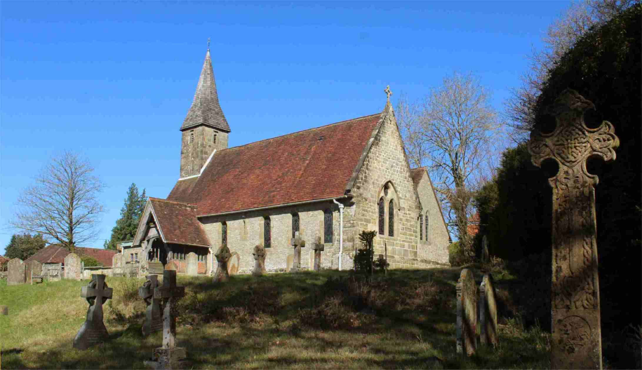
Village Church
St Peter's church is on the south side of Linchmere village, on a high point overlooking valleys to the South and West.

The BBC correspondent famous for his work in the 1939-45 war Richard Dimbleby is buried in St Peter's churchyard.
Inside the church on the North wall is an 8 ft long stone tablet with 7 human faces, representing the seven biblical Deadly Sins. A brass plaque says that it dates from about 1300AD and was originally in a church in the South of France, being presented to Lynchmere church in the year 1906.
Village History
The name Linchmere was, in ancient times, spelled Wlenchemere.
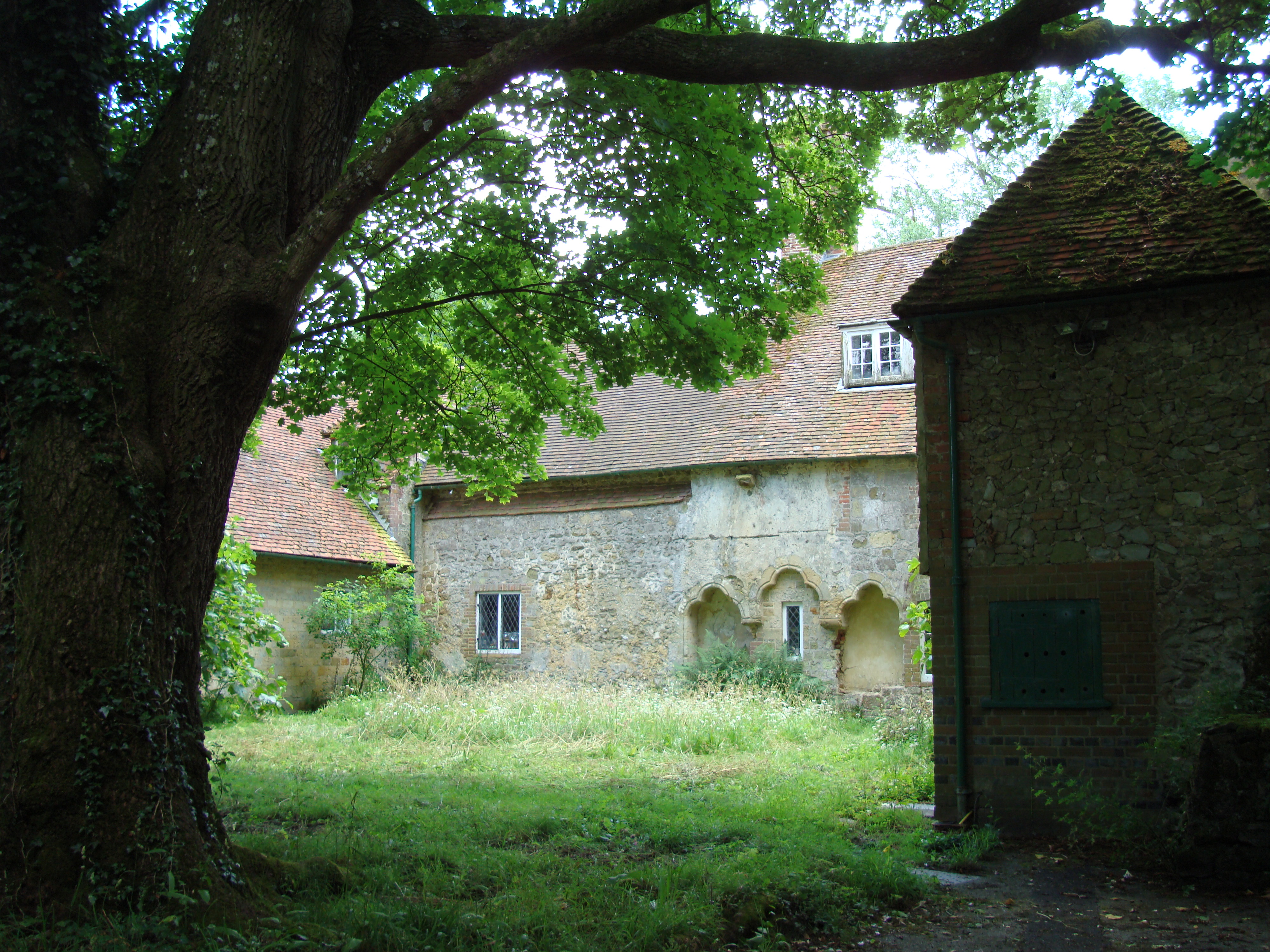
South of the village is the remains of an Augustinian priory founded in 1200 was first known as Woolynchmere Priory and later as Shulbrede Priory. It is located 1.4 km south of Linchmere village centre), and is associated with a nearly manor house and the peerage of Baron Ponsonby of Shulbrede.
The settlement at Hammer took its name from an iron mill which was active there from before 1573 until at least 1730. There were also other iron works in the district including one partly in what is now Fernhurst parish, in Furnace Wood near Lower Lodge Farm, apparently started a little before 1620. The associated water supply is still named Furnace Pond and is just 2.8 km south of Linchmere village centre.{{cite web |url=http://www.fernhurstfurnace.co.uk/?page_id=23
References
- Ordnance Survey Explorer (scale 1:25,000) map 133 Haslemere & Petersfield
References
- "2001 Census: West Sussex – Population by Parish". [[West Sussex County Council]].
- "Civil Parish population 2011". [[Office for National Statistics]].
This article was imported from Wikipedia and is available under the Creative Commons Attribution-ShareAlike 4.0 License. Content has been adapted to SurfDoc format. Original contributors can be found on the article history page.
Ask Mako anything about Linchmere — get instant answers, deeper analysis, and related topics.
Research with MakoFree with your Surf account
Create a free account to save articles, ask Mako questions, and organize your research.
Sign up freeThis content may have been generated or modified by AI. CloudSurf Software LLC is not responsible for the accuracy, completeness, or reliability of AI-generated content. Always verify important information from primary sources.
Report