From Surf Wiki (app.surf) — the open knowledge base
Limmat
River in Switzerland

River in Switzerland
| Field | Value |
|---|---|
| name | Limmat |
| image | Limmat River.jpg |
| image_caption | The Limmat in Zurich, looking downstream to Rathausbrücke from Quaibrücke at Lake Zurich, Stadthausquai to the left and Limmatquai to right. |
| subdivision_type1 | Country |
| subdivision_name1 | Switzerland |
| subdivision_type2 | Cantons |
| subdivision_name2 | Zurich, Aargau |
| subdivision_type3 | Settlements |
| subdivision_name3 | Zurich (ZH), Schlieren (ZH), Dietikon (ZH), Oetwil a.d.L. (ZH), Wettingen (AG), Baden (AG), Ennetbaden (AG), Nussbaumen (AG), Turgi (AG), Untersiggenthal (AG) |
| source1_location | Lake Zurich, Zurich |
| source1_coordinates | |
| source1_elevation | 406 m |
| mouth_location | Aare, Gebenstorf |
| mouth_coordinates | |
| mouth_elevation | 328 m |
| discharge1_location | Baden |
| discharge1_min | 69.2 m3/s (MNQ 1951-2013), |
| 24.6 m3/s (NNQ, 2003) | |
| discharge1_avg | 101.0 m3/s (MQ 1951-2013) |
| discharge1_max | 141 m3/s (MHQ 1951-2013), |
| 657 m3/s (HHQ, 1999) | |
| progression | |
| map | Karte Limmat.png |
| length | 36.3 km, 140 km (Lake Zurich and Linth included) |
| basin_size | 2416 km2 (Lake Zurich and Linth included) |
| tributaries_left | Sihl, Schäflibach, Reppisch, Dorfbach Spreitenbach |
| tributaries_right | Länggenbach, Furtbach, Lugibach, Gottesgraben |
| waterbodies | Lake Zurich, Stausee Wettingen |
24.6 m3/s (NNQ, 2003) 657 m3/s (HHQ, 1999)
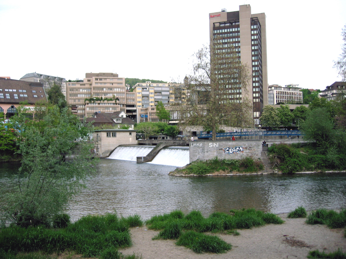


The Limmat is a river in Switzerland. The river commences at the outfall of Lake Zurich, in the southern part of the city of Zurich. From Zurich it flows in a northwesterly direction, continuing a further 35 km until it reaches the river Aare. The confluence is located north of the small town of Brugg and shortly after the mouth of the Reuss.
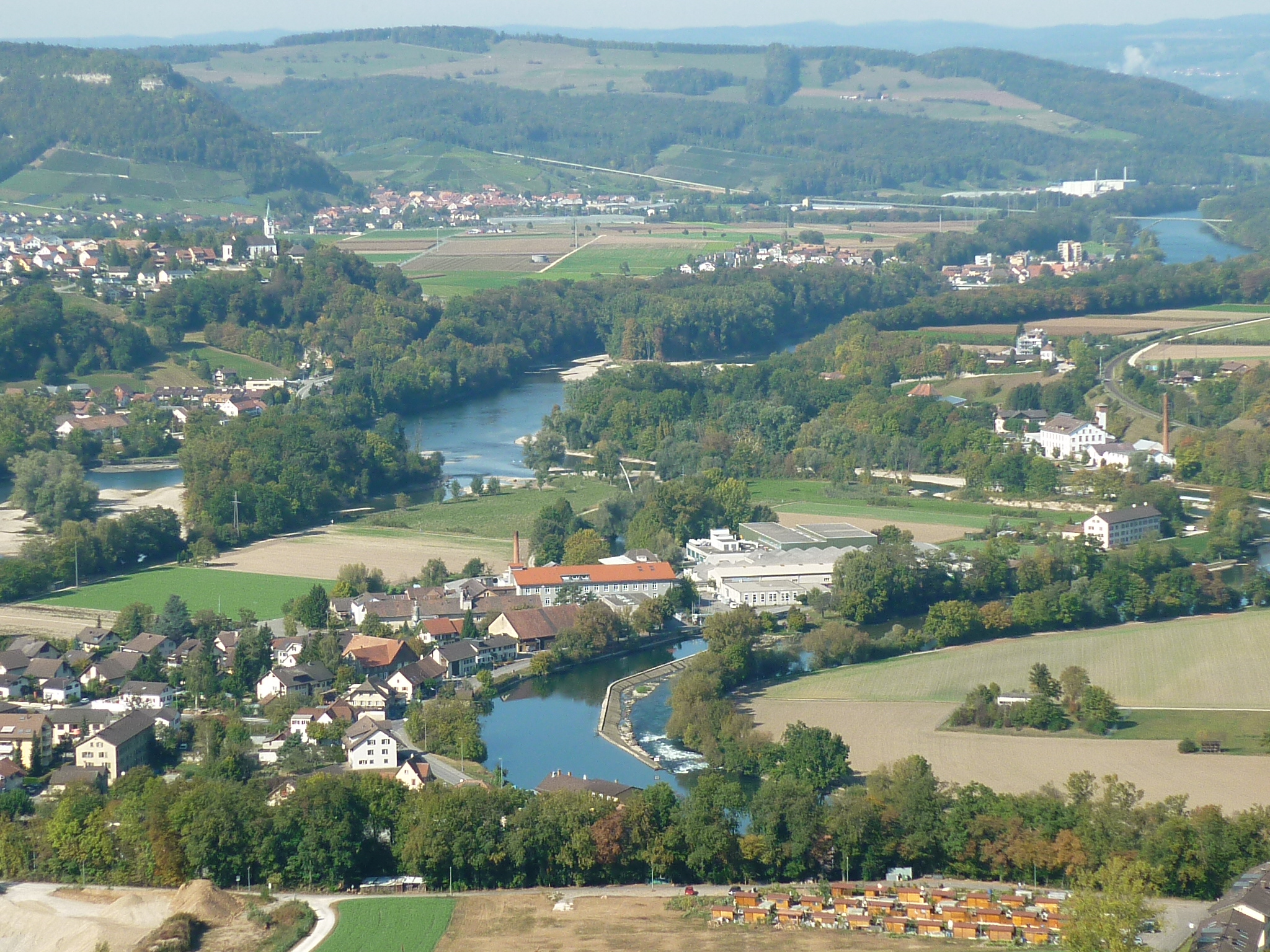
The main towns along the Limmat Valley downstream of Zurich are Dietikon, Wettingen, and Baden. Its main tributaries are the Linth, Wägitaler Aa and Jona, all via Lake Zurich, the Sihl in Zurich, and the Reppisch in Dietikon.
The hydronym is first attested in the 8th century, as Lindimacus. It is of Gaulish origin, from *lindo- "lake" (Welsh llyn) and *magos "plain" (Welsh maes), and was thus presumably in origin the name of the plain formed by the Linth.
Power generation
Like many Swiss rivers, the Limmat is intensively used for production of hydroelectric power: along its course of 35 km, its fall is used by no less than ten hydroelectric power stations. These include:
| Station | Capacity (MW) | Location | Geographic coordinates | ||||||
|---|---|---|---|---|---|---|---|---|---|
| url=http://www.regionalwerke.ch/index.php?id=57 | title=Limmat Power Generation | publisher=Regional Werke AG Baden | access-date=2013-04-25 | url-status=dead | archive-url=https://web.archive.org/web/20130521094819/http://www.regionalwerke.ch/index.php?id=57 | archive-date=2013-05-21}} | 3.9 | Baden | |
| Dietikon Power Station | 2.6 | Dietikon | |||||||
| Höngg Power Station | 1 | Zurich | |||||||
| Kappelerhof Power Station | 6.8 | Baden | |||||||
| Letten Power Station | 4 | Zurich | |||||||
| Schiffmühle Power Station | 2.6 | Untersiggenthal | |||||||
| Turgi Power Station | 1 | Turgi | |||||||
| Wettingen Power Station | 26 | Wettingen |
Towns near the river
- In the canton of Zurich:
- Zurich
- Oberengstringen
- Unterengstringen
- Schlieren
- Dietikon
- Geroldswil
- Oetwil an der Limmat
- In the canton of Aargau
- Spreitenbach
- Würenlos
- Neuenhof
- Wettingen
- Baden
- Ennetbaden
- Nussbaumen AG
- Untersiggenthal
- Turgi
Cultural heritage
Located on the swamp land between Limmat and Lake Zurich around Sechseläutenplatz on small islands and peninsulas in Zurich, prehistoric pile dwellings around Lake Zurich were set on piles to protect against occasional flooding by the Linth and Jona. Zürich–Enge Alpenquai is located on Lake Zurich lakeshore in Enge, a locality of the municipality of Zurich. It was neighbored by the settlements at Kleiner Hafner and Grosser Hafner on a then peninsula respectively island in the effluence of the Limmat, within an area of about 0.2 km2 in the city of Zurich. As well as being part of the 56 Swiss sites of the UNESCO World Heritage Site Prehistoric pile dwellings around the Alps, the settlement is also listed in the Swiss inventory of cultural property of national and regional significance as a Class object.
References
References
- (1935). "Die vorrömische Schweiz im Lichte geschichtlicher Zeugnisse und sprachlicher Tatsachen". Leemann.
- "Limmat Power Generation". Regional Werke AG Baden.
- "Flusskraftwerk Dietikon". Elektrizitätswerke des Kantons Zürich.
- "Kraftwerk Höngg". City of Zürich.
- "Kraftwerk Letten". City of Zürich.
- "Kraftwerk Wettingen". City of Zürich.
- "Limmat". [[Historical Dictionary of Switzerland]].
- "Funicular Boat Lifts of Switzerland". funimag.com.
- "Clubportrait Schiffe".
- "Limmat river cruises". Zürichsee-Schifffahrtsgesellschaft.
- (2009). "A-Objekte KGS-Inventar". Schweizerische Eidgenossenschaft, Amt für Bevölkerungsschutz.
- "Prehistoric Pile Dwellings in Switzerland". Swiss Coordination Group UNESCO Palafittes (palafittes.org).
- "World Heritage". palafittes.org.
This article was imported from Wikipedia and is available under the Creative Commons Attribution-ShareAlike 4.0 License. Content has been adapted to SurfDoc format. Original contributors can be found on the article history page.
Ask Mako anything about Limmat — get instant answers, deeper analysis, and related topics.
Research with MakoFree with your Surf account
Create a free account to save articles, ask Mako questions, and organize your research.
Sign up freeThis content may have been generated or modified by AI. CloudSurf Software LLC is not responsible for the accuracy, completeness, or reliability of AI-generated content. Always verify important information from primary sources.
Report