From Surf Wiki (app.surf) — the open knowledge base
Lexington County, South Carolina
County in South Carolina, United States

County in South Carolina, United States
| Field | Value |
|---|---|
| county | Lexington County |
| state | South Carolina |
| motto | "Grow with us" |
| seal | Lexington County Seal.png |
| founded | 1785 |
| named for | Battle of Lexington and Concord |
| seat wl | Lexington |
| largest city wl | Lexington |
| city type | community |
| area_total_sq_mi | 757.62 |
| area_land_sq_mi | 699.00 |
| area_water_sq_mi | 58.62 |
| area percentage | 7.74 |
| population_as_of | 2020 |
| population_total | 293991 |
| pop_est_as_of | 2024 |
| population_est | 313774 |
| population_density_sq_mi | auto |
| coordinates | |
| time zone | Eastern |
| web | www.lex-co.sc.gov |
| district | 2nd |
| ex image | Lexington County Courthouse, Lexington, South Carolina.JPG |
| ex image cap | Lexington County Courthouse |
| flag | Lexington_County_Flag.gif |
Lexington County is a county located in the U.S. state of South Carolina. As of the 2020 census, the population was 293,991. Its county seat and largest community is Lexington. The county was chartered in 1785 and was named in commemoration of Lexington, Massachusetts, the site of the Battle of Lexington in the American Revolutionary War. Lexington County is the sixth-most populous county in South Carolina by population and is part of the Columbia, SC Metropolitan Statistical Area. It is located in the Midlands region of South Carolina.
History
Lexington County was charted in 1785 and was named after the Battles of Lexington and Concord, fought at the outset of the American Revolutionary War.
Geography
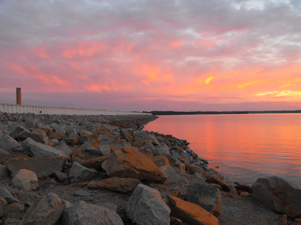
According to the U.S. Census Bureau, the county has a total area of 757.62 sqmi, of which 699.00 sqmi is land and 58.62 sqmi (7.74%) is water. The largest body of water is Lake Murray, while other waterways include the Broad River, the Saluda River and the Congaree River. Lexington County has urban, suburban, and rural landscapes. Much of the county's urbanization is in its eastern and northeastern areas. The elevation in the county is 392 ft.
Climate
Lexington County averages 47 in of rain per year; the U.S. average is 38 in. The average snowfall is 1 in; the U.S. average is 28 in. The average number of days with any measurable precipitation is 103.
On average, there are 218 sunny days per year in Lexington County. The July high is around 92.3 °F and the January low is 33.2 °F. The comfort index rates the county a 7.3 out of 10, where higher is more comfortable. The U.S. average on the comfort index is a 7 out of 10.
State and local protected areas
- Congaree Creek Heritage Preserve
- Lake Murray Dam North Recreational Area
- Peachtree Rock Heritage Preserve
- Saluda Shoals Park
- Shealy's Pond Heritage Preserve
Major water bodies
- Congaree River
- Lake Murray
- North Fork Edisto River
- Red Bank Creek
- Saluda River
Adjacent counties
- Richland County – east
- Orangeburg County – southeast
- Calhoun County – southeast
- Aiken County – southwest
- Saluda County – west
- Newberry County – northwest
Demographics
|align-fn=center 1790–1960 1900–1990 1990–2000 2010 2020
2020 census
| Race | Num. | Perc. |
|---|---|---|
| White (non-Hispanic) | 208,854 | 71.04% |
| Black or African American (non-Hispanic) | 42,382 | 14.42% |
| Native American | 894 | 0.3% |
| Asian | 6,644 | 2.26% |
| Pacific Islander | 185 | 0.06% |
| Other/Mixed | 13,235 | 4.5% |
| Hispanic or Latino | 21,797 | 7.41% |
As of the 2020 census, there were 293,991 people, 118,193 households, and 81,118 families residing in the county. The median age was 39.8 years, 23.3% of residents were under the age of 18, and 17.3% were 65 years of age or older. For every 100 females there were 94.2 males, and for every 100 females age 18 and over there were 91.3 males in the county.
The racial makeup of the county was 72.3% White, 14.6% Black or African American, 0.5% American Indian and Alaska Native, 2.3% Asian, 0.1% Native Hawaiian and Pacific Islander, 3.6% from some other race, and 6.6% from two or more races. Hispanic or Latino residents of any race comprised 7.4% of the population.
74.8% of residents lived in urban areas, while 25.2% lived in rural areas.
There were 116,720 households in the county, of which 31.5% had children under the age of 18 living with them and 27.1% had a female householder with no spouse or partner present. About 26.3% of all households were made up of individuals and 10.7% had someone living alone who was 65 years of age or older.
There were 127,887 housing units, of which 8.7% were vacant. Among occupied housing units, 75.8% were owner-occupied and 24.2% were renter-occupied. The homeowner vacancy rate was 1.5% and the rental vacancy rate was 8.8%.
2010 census
At the 2010 census, there were 262,391 people, 102,733 households, and 70,952 families living in the county.{{cite web |access-date=March 11, 2016 |archive-url=https://archive.today/20200213014208/http://factfinder.census.gov/bkmk/table/1.0/en/DEC/10_DP/DPDP1/0500000US45063 |archive-date=February 13, 2020 |url-status=dead |access-date=March 11, 2016 |archive-url=https://archive.today/20200213234158/http://factfinder.census.gov/bkmk/table/1.0/en/DEC/10_SF1/GCTPH1.CY07/0500000US45063 |archive-date=February 13, 2020 |url-status=dead |access-date=March 11, 2016 |archive-url=https://archive.today/20200213035001/http://factfinder.census.gov/bkmk/table/1.0/en/ACS/10_5YR/DP02/0500000US45063 |archive-date=February 13, 2020 |url-status=dead
Of the 102,733 households, 34.5% had children under the age of 18 living with them, 51.4% were married couples living together, 13.0% had a female householder with no husband present, 30.9% were non-families, and 24.9% of all households were made up of individuals. The average household size was 2.53 and the average family size was 3.01. The median age was 37.9 years.
The median income for a household in the county was $52,205 and the median income for a family was $64,630. Males had a median income of $44,270 versus $34,977 for females. The per capita income for the county was $26,393. About 8.5% of families and 11.1% of the population were below the poverty line, including 15.7% of those under age 18 and 8.4% of those age 65 or over.{{cite web |access-date=March 11, 2016 |archive-url=https://archive.today/20200213020625/http://factfinder.census.gov/bkmk/table/1.0/en/ACS/10_5YR/DP03/0500000US45063 |archive-date=February 13, 2020 |url-status=dead
2000 census
At the 2000 census, there were 216,014 people, 83,240 households, and 59,849 families living in the county. The population density was 309 /mi2. There were 90,978 housing units at an average density of 130 /mi2. The racial makeup of the county was 84.18% White, 12.63% Black or African American, 0.34% Native American, 1.05% Asian, 0.04% Pacific Islander, 0.79% from other races, and 0.98% from two or more races. 1.92% of the population were Hispanic or Latino of any race.
There were 83,240 households, out of which 35.50% had children under the age of 18 living with them, 56.60% were married couples living together, 11.60% had a female householder with no husband present, and 28.10% were non-families. 22.50% of all households were made up of individuals, and 6.90% had someone living alone who was 65 years of age or older. The average household size was 2.56 and the average family size was 3.01.
In the county, 26.10% of the population was under the age of 18, 8.30% was from 18 to 24, 31.60% from 25 to 44, 23.80% from 45 to 64, and 10.20% was 65 years of age or older. The median age was 36 years. For every 100 females, there were 94.50 males. For every 100 females age 18 and over, there were 91.30 males.
The median income for a household in the county was $44,659, and the median income for a family was $52,637. Males had a median income of $36,435 versus $26,387 for females. The per capita income for the county was $21,063. About 6.40% of families and 9.00% of the population were below the poverty line, including 11.10% of those under age 18 and 9.30% of those age 65 or over.
Law and government
Politics
Lexington County was one of the first areas of South Carolina to support the Republican Party. The last official Democratic candidate to carry the county at a presidential level was Franklin D. Roosevelt in 1944, and the official Democratic candidate last won 40 percent of the county's vote in 1952. It supported splinter Dixiecrat candidates in 1948 and 1956.
In the 2020 U.S. presidential election, Lexington County voted 64.2% in favor of Republican Donald Trump and 34.1% in favor of Democrat Joe Biden with 72.6% of the eligible electorate voting. This was the strongest performance by a Democratic candidate for president since 1976.
The county's Republican bent is not limited to national politics; its voters frequently reject Democrats at the state level as well. The county has supported the Republican candidate for governor in every election since 1982 when Richard Riley carried every county in the state. The last Democratic senatorial nominee to manage even 30 percent of the county's vote was Inez Tenenbaum in 2004, and no Democrat has carried the county since Ernest "Fritz" Hollings did so in 1980. In 1986, it was the only county in the state to support Hollings' Republican opponent, future Governor Henry McMaster. It was one of the first areas where Republicans broke the long Democratic monopoly on state and local offices. For much of his tenure, longtime state senator Nikki Setzler was the only elected Democrat above the county level. He was succeeded in 2024 by fellow Democrat Russell Ott.
On November 4, 2014, Lexington County residents voted against a proposed sales tax increase. The money generated from this tax would have mostly been used to improve traffic conditions upon roadways. That same day, residents voted to repeal a ban on alcohol sales on Sundays within the county.
Law enforcement
In 2015, long-time county sheriff James Metts pled guilty to charges of conspiring to harbor and conceal illegal aliens. Metts accepted bribes to keep undocumented immigrants out of federal databases. Metts had been sheriff since 1972.
Economy
In 2022, the GDP was $16.7 billion (about $53,814 per capita), and the real GDP was $13.8 billion (about $44,563 per capita) in chained 2017 dollars.
The Saxe Gotha Industrial Park near Cayce houses multiple distribution sites for major national companies, including Amazon, Chick-fil-A, The Home Depot and Nephron Pharmaceuticals. Near Lexington is the Michelin tire-production plant. Other manufacturers include Shaw Industries, Southeastern Freight Lines, and Flex, at which president Biden spoke in July 2023.
| Industry | Employment Counts | Employment Percentage (%) | Average Annual Wage ($) |
|---|---|---|---|
| Accommodation and Food Services | 12,892 | 9.9 | 20,436 |
| Administrative and Support and Waste Management and Remediation Services | 7,696 | 5.9 | 39,000 |
| Agriculture, Forestry, Fishing and Hunting | 608 | 0.5 | 55,432 |
| Arts, Entertainment, and Recreation | 956 | 0.7 | 23,140 |
| Construction | 7,402 | 5.7 | 62,244 |
| Educational Services | 10,238 | 7.9 | 50,596 |
| Finance and Insurance | 3,276 | 2.5 | 73,736 |
| Health Care and Social Assistance | 19,302 | 14.9 | 56,992 |
| Information | 2,252 | 1.7 | 62,972 |
| Management of Companies and Enterprises | 1,388 | 1.1 | 77,272 |
| Manufacturing | 12,343 | 9.5 | 69,108 |
| Mining, Quarrying, and Oil and Gas Extraction | 143 | 0.1 | 73,164 |
| Other Services (except Public Administration) | 4,281 | 3.3 | 48,048 |
| Professional, Scientific, and Technical Services | 4,951 | 3.8 | 71,032 |
| Public Administration | 5,240 | 4.0 | 56,004 |
| Real Estate and Rental and Leasing | 1,625 | 1.3 | 54,860 |
| Retail Trade | 18,087 | 13.9 | 34,996 |
| Transportation and Warehousing | 9,682 | 7.5 | 46,904 |
| Utilities | 1,410 | 1.1 | 92,144 |
| Wholesale Trade | 6,158 | 4.7 | 83,252 |
| Total | 129,930 | 100.0% | 51,735 |
Top Employers

| Rank | Employer | Employees |
|---|---|---|
| 1 | Lexington Medical Center | 7,893 |
| 2 | Lexington School District 1 | 3,674 |
| 3 | Amazon | 3,050 |
| 4 | Wal-Mart | 2,603 |
| 5 | State government | 2,308 |
| 6 | Michelin | 2,240 |
| 7 | County of Lexington | 1,855 |
| 8 | Dominion Energy | 1,486 |
| 9 | Lexington School District 2 | 1,274 |
| 10 | Lexington School District Five | 1,136 |
Transportation
Interstates
- Interstate 20 travels from west to east and connects Columbia to Atlanta and Augusta in the west and Florence in the east. It serves the nearby towns and suburbs of Pelion, Lexington, West Columbia, Sandhill, Pontiac, and Elgin. Interstate 20 is also used by travelers heading to Myrtle Beach, although the interstate's eastern terminus is in Florence.
- Interstate 26 travels from northwest to southeast and connects the Columbia area to the other two major population centers of South Carolina: the Greenville-Spartanburg area in the northwestern part of the state and North Charleston – Charleston area in the southeastern part of the state.
- Interstate 77 begins in Lexington county and ends in Cleveland, Ohio and is frequently used by travelers on the east coast heading to or from Florida.
U.S. Routes
State Routes
Columbia Metropolitan Airport
.jpg)
Main article: Columbia Metropolitan Airport
The Columbia Metropolitan Airport serves as the main airport system for the greater Columbia area. In 2018, the airport served 1,197,603 passengers with 12,324 flights. Additionally, the airport is also the regional hub for UPS Airlines, transporting 136.7 million pounds of freight/mail in 2018. The airport was named Lexington County Airport, and during World War II, trained pilots for North American B-25 Mitchell crews.
Public Transportation

Main article: The Comet (transit)
Public transportation in Lexington County is provided by the COMET, or officially the Central Midlands Regional Transit Authority (CMRTA). The bus system is the main public transit system for the greater Columbia area. In Lexington County, the bus system runs in the areas of West Columbia, Cayce, Irmo, Springdale, Seven Oaks, and Harbison. Additionally, COMET offers Dial-a-ride transit (DART), which provides personalized service passengers with disabilities.
Education
There are five school districts covering portions of the county.
| Public school district name | Enrollment | Teachers | Schools | Colleges | Enrollment | Campuses | Public libraries | Visitors (counted once) | Branches | |||||||
|---|---|---|---|---|---|---|---|---|---|---|---|---|---|---|---|---|
| Lexington County School District One | 27,072 | 1,959 | 31 | |||||||||||||
| Lexington County School District Two{{cite web | date=2021 | title=District of Lexington School District Two | access-date=September 28, 2022 | publisher=South Carolina Department of Education}} | 8,582 | 636 | 13 | |||||||||
| Lexington County School District Three{{cite web | date=2021 | title=District of Lexington County School District Three | access-date=September 28, 2022 | publisher=South Carolina Department of Education}} | 2,020 | 160 | 4 | |||||||||
| Lexington County School District Four | 3,245 | 224 | 6 | |||||||||||||
| Lexington & Richland County School District Five{{cite web | date=2021 | title=District of School District Five Of Lexington & Richland Count | access-date=September 28, 2022 | publisher=South Carolina Department of Education}} | 16,780 | 1,332 | 22 | |||||||||
| Midlands Technical College | url=https://lex-co.sc.gov/sites/default/files/Documents/Lexington%20County/Departments/Financial/CAFR18%20FINAL%20Eletronic%20Copy.pdf | archive-url=https://ghostarchive.org/archive/20221009/https://lex-co.sc.gov/sites/default/files/Documents/Lexington%20County/Departments/Financial/CAFR18%20FINAL%20Eletronic%20Copy.pdf | archive-date=October 9, 2022 | url-status=live | title=Comprehensive Annual Financial Report | date=2018 | publisher=Lexington County Government | access-date=June 24, 2020}} | 3 | |||||||
| Lexington County Public Library | 160,336 | 10 |
Attractions

- Lake Murray
- Riverbanks Zoo
- Riverbanks Botanical Garden
- Riverbanks Waterfall Junction and waterpark
- Lexington County Museum
- Lake Murray Dam
- Lexington County Baseball Stadium
- Cayce-West Columbia Riverwalk
- Fourteen-mile Creek Trail
- Columbiana Centre
Communities
_from_the_banks_of_the_Congaree_River.jpg)


Cities
- Cayce (partly in Richland County)
- Columbia (mostly in Richland County)
- West Columbia
Towns
- Batesburg-Leesville
- Chapin
- Gaston
- Gilbert
- Irmo (partly in Richland County)
- Lexington (county seat and largest community)
- Pelion
- Pine Ridge
- South Congaree
- Springdale
- Summit
- Swansea
Census-designated places
- Edmund
- Fairview Crossroads
- Oak Grove
- Red Bank
- Seven Oaks
- White Knoll
Ghost town
- Granby
Population ranking
The population ranking of the following table is based on the 2020 census of Lexington County.
† = county seat
| Rank | Name | Type | Population |
|---|---|---|---|
| (2020 census) | |||
| 1 | Columbia | City | 136,632 |
| 2 | † Lexington | Town | 23,568 |
| 3 | West Columbia | City | 17,416 |
| 4 | Seven Oaks | CDP | 14,652 |
| 5 | Cayce | City | 13,781 |
| 6 | Oak Grove | CDP | 12,899 |
| 7 | Irmo | Town | 11,569 |
| 8 | Red Bank | CDP | 10,924 |
| 9 | White Knoll | CDP | 7,858 |
| 10 | Batesburg-Leesville | Town | 5,270 |
| 11 | Springdale | Town | 2,744 |
| 12 | South Congaree | Town | 2,377 |
| 13 | Pine Ridge | Town | 2,167 |
| 14 | Chapin | Town | 1,809 |
| 15 | Gaston | Town | 1,608 |
| 16 | Edmund | CDP | 969 |
| 17 | Swansea | Town | 722 |
| 18 | Pelion | Town | 631 |
| 19 | Gilbert | Town | 571 |
| 20 | Fairview Crossroads | CDP | 540 |
| 21 | Summit | Town | 423 |
Notable person
- Floyd Spence, former representative for South Carolina's 2nd congressional district
Notes
References
References
- "Find a County". National Association of Counties.
- (2009). "South Carolina: Individual County Chronologies". The Newberry Library.
- Barefoot, Daniel W.. (1999). "Touring South Carolina's Revolutionary War Sites". John F. Blair, Publisher.
- (August 23, 2022). "2020 County Gazetteer Files – South Carolina". United States Census Bureau.
- "Climate in Lexington County, South Carolina".
- "SCDNR Public Lands".
- "Saluda Shoals Park".
- "County Population Totals and Components of Change: 2020-2024". United States Census Bureau.
- "U.S. Decennial Census". United States Census Bureau.
- "Historical Census Browser". University of Virginia Library.
- (March 27, 1995). "Population of Counties by Decennial Census: 1900 to 1990". United States Census Bureau.
- (April 2, 2001). "Census 2000 PHC-T-4. Ranking Tables for Counties: 1990 and 2000". United States Census Bureau.
- "State & County QuickFacts". United States Census Bureau.
- "QuickFacts: Lexington County, South Carolina". United States Census Bureau.
- "Explore Census Data".
- (2021). "2020 Decennial Census Demographic Profile (DP1)".
- (2021). "2020 Decennial Census Redistricting Data (Public Law 94-171)".
- (2023). "2020 Decennial Census Demographic and Housing Characteristics (DHC)".
- "U.S. Census website". [[United States Census Bureau]].
- (November 7, 2020). "South Carolina Election Results". New York Times.
- (November 7, 2020). "2020 Statewide General Election".
- Leip, David. "Dave Leip's Atlas of U.S. Presidential Elections".
- Dave Leip's U.S. Election Atlas; [https://uselectionatlas.org/RESULTS/state.php?year=1982&fips=45&f=1&off=5&elect=0 1982 Gubernatorial General Election Results – South Carolina]
- Dave Leip's U.S. Election Atlas; [https://uselectionatlas.org/RESULTS/state.php?year=1986&fips=45&f=1&off=3&elect=0 1986 Senatorial General Election Results – South Carolina]
- "Lexington County Voters Reject Penny Tax".
- (November 4, 2014). "Lexington County, Cayce voters repeal Sunday alcohol sales ban".
- "Former Lexington County Sheriff James R. Metts Pleads Guilty to Conspiring to Harbor and Conceal Illegal Aliens — FBI".
- (April 27, 2015). "Former Lexington County Sheriff James R. Metts Sentenced".
- "The Sheriff Who Sold Amnesty".
- "South Carolina's Longest-Serving Sheriff James Metts Indicted".
- U.S. Bureau of Economic Analysis. (2001-01-01). "Gross Domestic Product: All Industries in Lexington County, SC".
- U.S. Bureau of Economic Analysis. (2001-01-01). "Real Gross Domestic Product: All Industries in Lexington County, SC".
- "Saxe Gotha Industrial Park". Lexington County.
- "Chick-fil-A Supply establishing distribution center in Lexington County". Governor's Office of South Carolina.
- "TOP EMPLOYERS". Lexington County.
- "Live Updates: Joe Biden in SC: President lands in Columbia ahead of Investing in America stop". Greenville News.
- (April 19, 2024). "Lexington County". S.C. Department of Employment & Workforce - Business Intelligence Department.
- (n.d.). "Annual Comprehensive Financial Report, 2020-2021". Lexington County (S.C.).
- {{FAA-airport
- (n.d.). "The Comet Tracker". The Central Midlands Transit Authority.
- "2020 CENSUS - SCHOOL DISTRICT REFERENCE MAP: Lexington County, SC". [[U.S. Census Bureau]].
- (2021). "District of Lexington County School District One". South Carolina Department of Education.
- (2021). "District of Lexington School District Four". South Carolina Department of Education.
- (2018). "Comprehensive Annual Financial Report". Lexington County Government.
- "City and Town Population Totals: 2020-2022". [[United States Census Bureau]], Population Division.
This article was imported from Wikipedia and is available under the Creative Commons Attribution-ShareAlike 4.0 License. Content has been adapted to SurfDoc format. Original contributors can be found on the article history page.
Ask Mako anything about Lexington County, South Carolina — get instant answers, deeper analysis, and related topics.
Research with MakoFree with your Surf account
Create a free account to save articles, ask Mako questions, and organize your research.
Sign up freeThis content may have been generated or modified by AI. CloudSurf Software LLC is not responsible for the accuracy, completeness, or reliability of AI-generated content. Always verify important information from primary sources.
Report