From Surf Wiki (app.surf) — the open knowledge base
Lee County, Arkansas
County in Arkansas, United States
County in Arkansas, United States
| Field | Value |
|---|---|
| county | Lee County |
| state | Arkansas |
| type | County |
| ex image | Lee County Courthouse 001.jpg |
| ex image cap | Main façade of the Lee County Courthouse, 2014 |
| named for | General Robert E. Lee |
| founded | |
| seat wl | Marianna |
| largest city wl | Marianna |
| area_total_sq_mi | 620 |
| area_land_sq_mi | 603 |
| area_water_sq_mi | 17 |
| area percentage | 2.7% |
| population_as_of | 2020 |
| population_total | 8600 |
| pop_est_as_of | 2024 |
| population_est | 8104 |
| density_sq_mi | auto |
| district | 1st |
| time zone | Central |
| web | leecounty.arkansas.gov |
Lee County is a county located in the U.S. state of Arkansas. With its eastern border formed by the Mississippi River, it is considered to be part of the Arkansas Delta. As of the 2020 census, the population was 8,600. The county seat is Marianna.
The county was established by the state legislature on April 17, 1873, during the Reconstruction era. It was named for General Robert E. Lee, who served as General in Chief of the Armies of the Confederate States during the American Civil War.
History
The area of the Delta was developed largely for cotton as a commodity crop before the Civil War, based on the labor of enslaved African Americans. It continued as an important crop into the 20th century, when it was worked by African-American sharecroppers and tenant farmers. In the post-Reconstruction era, whites struggled to re-establish white supremacy, by violence and intimidation of black Republican Party voters in this area and throughout the South. At the turn of the century, the state legislature passed measures that effectively disenfranchised most blacks for decades. The Equal Justice Initiative reported in 2015 that the county had 15 lynchings of African Americans from 1877 to 1950, most in the decades near the turn of the 20th century. This was the third-highest of any county in the state. To escape the violence and oppression, thousands of African Americans left the state in the Great Migration to northern and western cities, especially after 1940. Mechanization of farming and industrial-scale agriculture have decreased the need for workers. The rural county has continued to lose population because of the lack of work opportunities. There has been a decrease in population every decade since 1940.
Geography
According to the U.S. Census Bureau, the county has a total area of 620 sqmi, of which 603 sqmi is land and 17 sqmi (2.7%) is water.
Major highways
- [[Image:US 79.svg|20px]] U.S. Highway 79
- [[Image:Arkansas 1.svg|20px]] Highway 1
- [[Image:Arkansas 78.svg|20px]] Highway 78
- [[Image:Arkansas 121.svg|25px]] Highway 121
- [[Image:Arkansas 131.svg|25px]] Highway 131
- [[Image:Arkansas 261.svg|25px]] Highway 261
Adjacent counties
- St. Francis County (north)
- Crittenden County (northeast)
- Tunica County, Mississippi (east)
- Phillips County (south)
- Monroe County (west)
National protected area
- St. Francis National Forest (part)
Demographics
| align-fn = center 1790–1960 1900–1990 1990–2000 2010
2020 census
As of the 2020 census, the county had a population of 8,600. The median age was 42.6 years. 18.3% of residents were under the age of 18 and 19.6% of residents were 65 years of age or older. For every 100 females there were 127.0 males, and for every 100 females age 18 and over there were 135.7 males age 18 and over.
The racial makeup of the county was 40.3% White, 54.2% Black or African American, 0.5% American Indian and Alaska Native, 0.2% Asian,
There were 3,103 households in the county, of which 27.4% had children under the age of 18 living in them. Of all households, 33.4% were married-couple households, 21.5% were households with a male householder and no spouse or partner present, and 40.5% were households with a female householder and no spouse or partner present. About 35.8% of all households were made up of individuals and 17.2% had someone living alone who was 65 years of age or older.
There were 3,695 housing units, of which 16.0% were vacant. Among occupied housing units, 57.3% were owner-occupied and 42.7% were renter-occupied. The homeowner vacancy rate was 1.3% and the rental vacancy rate was 8.4%.
2010 census
As of the 2010 United States census, there were 10,424 people living in the county. 55.3% were Black or African American, 42.0% White, 0.5% Native American, 1.6% were Hispanic or Latino (of any race), 0.4% Asian, 0.7% of some other race and 1.2% of two or more races.
2000 census
As of the 2000 United States census, there were 12,580 people, 4,182 households, and 2,960 families living in the county. The population density was 21 /mi2. There were 4,768 housing units at an average density of 8 /mi2. The racial makeup of the county was 57.24% Black or African American, 41.41% White, 2.19% Hispanic or Latino of any race, 0.27% Asian, 0.16% Native American, 0.52% from other races, and 0.40% from two or more races.
There were 4,182 households, out of which 31.20% had children under the age of 18 living with them, 43.20% were married couples living together, 23.10% had a female householder with no husband present, and 29.20% were non-families. 27.20% of all households were made up of individuals, and 13.80% had someone living alone who was 65 years of age or older. The average household size was 2.59 and the average family size was 3.14.
In the county, the population was spread out, with 26.00% under the age of 18, 10.20% from 18 to 24, 28.70% from 25 to 44, 21.10% from 45 to 64, and 14.00% who were 65 years of age or older. The median age was 35 years. For every 100 females there were 111.40 males. For every 100 females age 18 and over, there were 118.40 males.
The median income for a household in the county was $20,510, and the median income for a family was $25,846. Males had a median income of $26,900 versus $19,505 for females. The per capita income for the county was $10,983. About 24.70% of families and 29.90% of the population were below the poverty line, including 38.80% of those under age 18 and 27.60% of those age 65 or over.
Government and infrastructure
Government
The county government is a constitutional body granted specific powers by the Constitution of Arkansas and the Arkansas Code. The quorum court is the legislative branch of the county government and controls all spending and revenue collection. Representatives are called justices of the peace and are elected from county districts every even-numbered year. The number of districts in a county vary from nine to fifteen, and district boundaries are drawn by the county election commission. The Lee County Quorum Court has nine members. Presiding over quorum court meetings is the county judge, who serves as the chief executive officer of the county. The county judge is elected at-large and does not vote in quorum court business, although capable of vetoing quorum court decisions.
| Position | Officeholder | Party |
|---|---|---|
| County Judge | Terry Sandefer | Democratic |
| County Clerk | Pam Webb | Democratic |
| Circuit Clerk | Millie A. Hill | Democratic |
| Sheriff/Collector | Corey Demond Wilson | Democratic |
| Treasurer | Mark Smith | Democratic |
| Assessor | Becky Hogan | Democratic |
| Coroner | Robert Kennedy | Democratic |
The composition of the Quorum Court following the 2024 elections is 7 Democrats and 2 Republicans. Justices of the Peace (members) of the Quorum Court following the elections are:
- District 1: Rusty Crump (D)
- District 2: Junious Pruett (R)
- District 3: Lydia Lewis (D)
- District 4: Jed S. Anderson (D)
- District 5: Ronni Schwantz (R)
- District 6: Tracia Tinzie (D)
- District 7: West Higginbothom (D)
- District 8: Bill Gerrard (D)
- District 9: Jesse C. Garrett (D)
Additionally, the townships of Lee County are entitled to elect their own respective constables, as set forth by the Constitution of Arkansas. Constables are largely of historical significance as they were used to keep the peace in rural areas when travel was more difficult. The township constables as of the 2024 elections are:
- District 1: James Stacks (D)
- District 2: Payton Stegall (R)
- District 3: Carl E. Bledsoe Sr. (D)
- District 5: Thomas Webb III (D)
- District 6: Mike Middleton (D)
- District 7: Adrian D. Smith (D)
- District 8: Timothy Turley (D)
Infrastructure
The East Arkansas Regional Unit of the Arkansas Department of Correction is in Lee County.
The Lee County Courthouse in located in the town of Marianna, which is the county seat.
Politics
Since World War II, Lee County has voted for the Democratic presidential candidate in all but two elections: 1948, when it voted for third-party Strom Thurmond rather than for Harry Truman, and in 1972, when formerly Democratic voters crossed party lines and voted for Republican Richard Nixon. The former comes with the caveat that Black people could not vote in the South in 1948, and the latter was the last year that white conservatives dominated county politics. Following passage and enforcement of the Voting Rights Act of 1965, newly registered African Americans began to support Democratic Party candidates. They have largely maintained this affiliation. Most whites have shifted into the Republican Party since the 1970s, and major population loss combined with the state's hard right turn has made the county tightly close in recent elections. Despite being a Democratic stronghold, in 2020 Donald Trump became the first Republican since 1972 (and only the second overall) to come within 5% of winning the county.
Communities
Towns
- Marianna (county seat)
- Aubrey
- Haynes
- LaGrange
- Moro
- Rondo
Unincorporated communities
- Kokomo, Arkansas
- Brickeys, Arkansas
- Midway, Arkansas
- Monroe, Arkansas
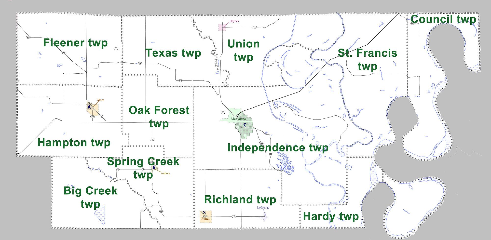
Townships
|access-date = August 9, 2011 |url-status = dead |archive-url = https://web.archive.org/web/20121019125206/http://www2.census.gov/geo/pvs/bas/bas11/st05_ar/cou/c05077_lee/BAS11C20507700000_000.pdf |archive-date = October 19, 2012
- Big Creek
- Council
- Fleener
- Hampton (Moro)
- Hardy
- Independence (Marianna)
- Oak Forest
- Richland (LaGrange, Rondo)
- St. Francis
- Spring Creek (Aubrey)
- Texas
- Union (Haynes)
Education
There is one school district in the county, Lee County School District. Its boundaries are that of the county. The sole high school in the county is Lee High School.
References
References
- "Census - Geography Profile: Lee County, Arkansas". [[United States Census Bureau]].
- "Find a County". National Association of Counties.
- Gannett, Henry. (1905). "The Origin of Certain Place Names in the United States". [[United States Government Publishing Office.
- [https://eji.org/sites/default/files/lynching-in-america-third-edition-supplement-by-county.pdf ''Lynching in America''/ Supplement: Lynchings by County: Arkansas - Lee County]{{Dead link. (February 2020)
- (August 22, 2012). "2010 Census Gazetteer Files". United States Census Bureau.
- "Annual Estimates of the Resident Population for Counties: April 1, 2020 to July 1, 2023". United States Census Bureau.
- "U.S. Decennial Census". United States Census Bureau.
- "Historical Census Browser". University of Virginia Library.
- (March 27, 1995). "Population of Counties by Decennial Census: 1900 to 1990". United States Census Bureau.
- (April 2, 2001). "Census 2000 PHC-T-4. Ranking Tables for Counties: 1990 and 2000". United States Census Bureau.
- "State & County QuickFacts". United States Census Bureau.
- (2021). "2020 Decennial Census Demographic Profile (DP1)".
- (2021). "2020 Decennial Census Redistricting Data (Public Law 94-171)".
- (2023). "2020 Decennial Census Demographic and Housing Characteristics (DHC)".
- "U.S. Census website". [[United States Census Bureau]].
- "Quorum Courts".
- "Office of County Judge".
- "Lee {{!}} Association of Arkansas Counties".
- "2022 General Election".
- "Election Night Reporting".
- "Election Night Reporting".
- "Lee County, Arkansas, elections, 2024".
- "Election Night Reporting".
- "What is a Constable?".
- "Facilities: East Arkansas Regional Unit". [[Arkansas Department of Correction]].
- "Lee County Arkansas Courthouse". County Criminal Records.
- "Lee County". Local.Arkansas.gov: County and Municipal Information & Services.
- "Dave Leip's Atlas of U.S. Presidential Elections".
- "Arkansas: 2010 Census Block Maps - County Subdivision". [[United States Census Bureau]].
- Geography Division. (December 17, 2020). "2020 CENSUS - SCHOOL DISTRICT REFERENCE MAP: Lee County, AR". [[U.S. Census Bureau]].
This article was imported from Wikipedia and is available under the Creative Commons Attribution-ShareAlike 4.0 License. Content has been adapted to SurfDoc format. Original contributors can be found on the article history page.
Ask Mako anything about Lee County, Arkansas — get instant answers, deeper analysis, and related topics.
Research with MakoFree with your Surf account
Create a free account to save articles, ask Mako questions, and organize your research.
Sign up freeThis content may have been generated or modified by AI. CloudSurf Software LLC is not responsible for the accuracy, completeness, or reliability of AI-generated content. Always verify important information from primary sources.
Report