From Surf Wiki (app.surf) — the open knowledge base
Lebanon, Missouri
City in and county seat of Laclede County, Missouri, United States
City in and county seat of Laclede County, Missouri, United States
| Field | Value |
|---|---|
| name | Lebanon, Missouri |
| settlement_type | City |
| official_name | City of Lebanon |
| image_skyline | Pencil Drawing of Train Depot in Lebanon Missouri by A.B. Greene.jpg |
| image_caption | Lebanon Train Depot in 1873 |
| motto | "Friendly People. Friendly Place." |
| mapframe | yes |
| mapframe-zoom | 10 |
| mapframe-point | none |
| mapsize | 250px |
| map_caption | Location of Lebanon, Missouri |
| coordinates | |
| subdivision_type | Country |
| subdivision_name | United States |
| subdivision_type1 | State |
| subdivision_type2 | County |
| subdivision_name1 | Missouri |
| subdivision_name2 | Laclede |
| established_title | Incorporated |
| established_date | 1877 |
| government_type | Mayor-Council-City Administrator |
| leader_title | Mayor |
| leader_name | Jared Carr |
| unit_pref | Imperial |
| area_footnotes | |
| area_total_km2 | 38.13 |
| area_total_sq_mi | 14.72 |
| area_land_km2 | 37.92 |
| area_land_sq_mi | 14.64 |
| area_water_km2 | 0.21 |
| area_water_sq_mi | 0.08 |
| elevation_footnotes | |
| elevation_ft | 1280 |
| population_total | 15013 |
| population_as_of | 2020 |
| population_density_km2 | 395.86 |
| population_density_sq_mi | 1025.27 |
| postal_code_type | ZIP code |
| postal_code | 65536 |
| area_code | 417 |
| website | |
| timezone | Central (CST) |
| utc_offset | -6 |
| timezone_DST | CDT |
| utc_offset_DST | -5 |
| blank_name | FIPS code |
| blank_info | 29-41168 |
| blank1_name | GNIS feature ID |
| blank1_info | 2395664 |
| mapframe-zoom = 10 | mapframe-point = none
Lebanon is a city in and the county seat of Laclede County, Missouri, United States. The population was estimated at 15,013 at the time of the 2020 census. It is the county seat of Laclede County. The Lebanon Micropolitan Statistical Area consists of Laclede County. The original name of Lebanon, Missouri was Wyota, named after the original Native Americans that settled in the area. Later, Reverend Benjamin Hooker changed the name to his hometown in Lebanon, Tennessee.
History
Lebanon was founded in 1849. The community was named after Lebanon, Tennessee, the former home of many of the first settlers.
Lebanon had many motels for travelers along Route 66.
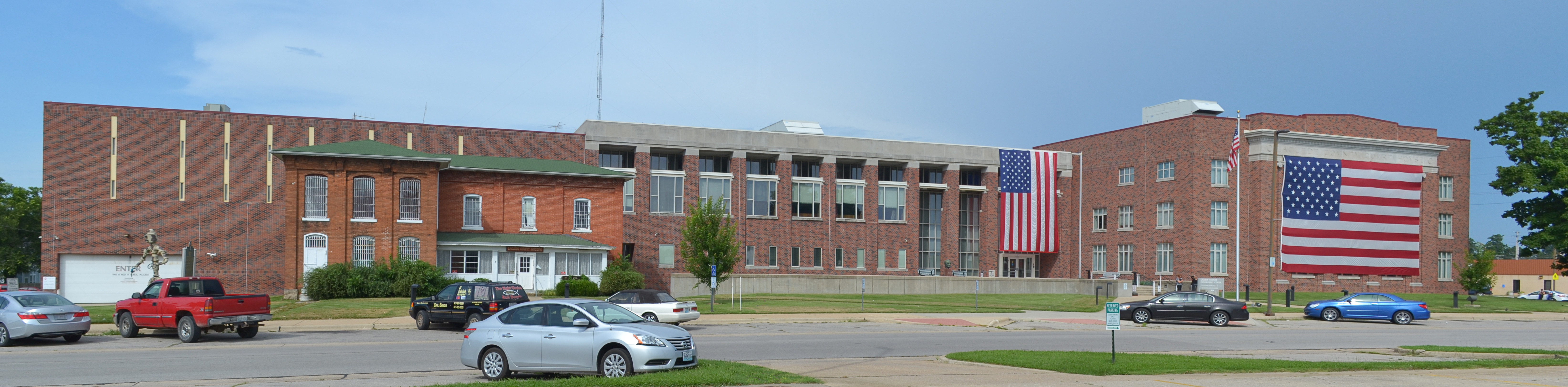
The Ralph E. Burley House, Joe Knight Building, Laclede County Jail, Ploger-Moneymaker Place, and Wallace House are listed on the National Register of Historic Places.
Demographics
2020 census
The 2020 United States census counted 15,013 people, 6,053 households, and 3,784 families in Lebanon. The population density was 1,025.5 /mi2. There were 6,729 housing units at an average density of 459.6 /mi2. The racial makeup was 89.38% (13,418) white, 1.36% (204) black or African-American, 0.58% (87) Native American, 0.82% (123) Asian, 0.05% (8) Pacific Islander, 1.16% (174) from other races, and 6.65% (999) from two or more races. Hispanic or Latino of any race was 4.7% (696) of the population.
Of the 6,053 households, 36.8% had children under the age of 18; 42.8% were married couples living together; 34.1% had a female householder with no husband present. Of all households, 31.3% consisted of individuals and 13.4% had someone living alone who was 65 years of age or older. The average household size was 2.4 and the average family size was 3.0.
26.5% of the population was under the age of 18, 7.9% from 18 to 24, 26.6% from 25 to 44, 22.6% from 45 to 64, and 14.6% who were 65 years of age or older. The median age was 34.9 years. For every 100 females, the population had 89.5 males. For every 100 females ages 18 and older, there were 82.0 males.
The 2016-2020 5-year American Community Survey estimates show that the median household income was $41,160 (with a margin of error of +/- $4,834) and the median family income was $55,330 (+/- $5,167). Males had a median income of $35,720 (+/- $3,968) versus $22,032 (+/- $3,611) for females. The median income for those above 16 years old was $30,181 (+/- $3,901). Approximately, 16.2% of families and 21.0% of the population were below the poverty line, including 22.0% of those under the age of 18 and 18.5% of those ages 65 or over.
2010 census
As of the census of 2010, there were 14,474 people, 5,980 households, and 3,745 families living in the city. The population density was 989.3 PD/sqmi. There were 6,728 housing units at an average density of 459.9 /mi2. The racial makeup of the city was 94.1% White, 1.3% African American, 0.6% Native American, 0.7% Asian, 0.1% Pacific Islander, 0.7% from other races, and 2.4% from two or more races. Hispanic or Latino of any race were 2.6% of the population.
There were 5,980 households, of which 34.0% had children under the age of 18 living with them, 43.6% were married couples living together, 13.7% had a female householder with no husband present, 5.3% had a male householder with no wife present, and 37.4% were non-families. 31.8% of all households were made up of individuals, and 14.3% had someone living alone who was 65 years of age or older. The average household size was 2.36 and the average family size was 2.94.
The median age in the city was 35.4 years. 25.9% of residents were under the age of 18; 9.7% were between the ages of 18 and 24; 25.9% were from 25 to 44; 22.5% were from 45 to 64; and 15.8% were 65 years of age or older. The gender makeup of the city was 47.5% male and 52.5% female.
2000 census
As of the census of 2000, there were 12,155 people, 5,132 households, and 3,181 families living in the city. The population density was 891.9 PD/sqmi. There were 5,745 housing units at an average density of 421.6 /mi2. The racial makeup of the city was 95.99% White, 0.90% African American, 0.54% Native American, 0.50% Asian, 0.03% Pacific Islander, 0.42% from other races, and 1.61% from two or more races. Hispanic or Latino of any race were 1.65% of the population.
There were 5,132 households, out of which 30.6% had children under the age of 18 living with them, 45.8% were married couples living together, 12.3% had a female householder with no husband present, and 38.0% were non-families. 33.4% of all households were made up of individuals, and 16.6% had someone living alone who was 65 years of age or older. The average household size was 2.30 and the average family size was 2.91.
In the city, the population was spread out, with 25.2% under the age of 18, 10.1% from 18 to 24, 27.4% from 25 to 44, 19.5% from 45 to 64, and 17.9% who were 65 years of age or older. The median age was 36 years. For every 100 females, there were 88.2 males. For every 100 females age 18 and over, there were 82.9 males.
The median income for a household in the city was $27,668, and the median income for a family was $36,509. Males had a median income of $27,657 versus $17,509 for females. The per capita income for the city was $16,636. About 12.3% of families and 15.2% of the population were below the poverty line, including 17.4% of those under age 18 and 18.0% of those age 65 or over.
Geography
According to the United States Census Bureau, the city has a total area of 14.72 sqmi, of which 14.63 sqmi is land and 0.09 sqmi is water. Lebanon is along I-44, and Routes 5, 32, and 64 as well as the historic Route 66.
Climate
| Jan record high F = 79 | Feb record high F = 83 | Mar record high F = 90 | Apr record high F = 93 | May record high F = 101 | Jun record high F = 105 | Jul record high F = 113 | Aug record high F = 110 | Sep record high F = 106 | Oct record high F = 95 | Nov record high F = 86 | Dec record high F = 80 | year record high F = 113
|Jan avg record high F = 65.7 |Feb avg record high F = 71.2 |Mar avg record high F = 78.9 |Apr avg record high F = 93.7 |May avg record high F = 88.0 |Jun avg record high F = 91.9 |Jul avg record high F = 96.8 |Aug avg record high F = 97.6 |Sep avg record high F = 91.6 |Oct avg record high F = 84.6 |Nov avg record high F = 74.8 |Dec avg record high F = 66.7 |year avg record high F = 99.0
|Jan avg record low F = 2.6 |Feb avg record low F = 7.1 |Mar avg record low F = 15.7 |Apr avg record low F = 28.6 |May avg record low F = 37.9 |Jun avg record low F = 49.9 |Jul avg record low F = 56.4 |Aug avg record low F = 53.7 |Sep avg record low F = 41.0 |Oct avg record low F = 28.1 |Nov avg record low F = 17.8 |Dec avg record low F = 7.8 |year avg record low F = -1.2
| Jan record low F = −21 | Feb record low F = −28 | Mar record low F = −10 | Apr record low F = 9 | May record low F = 26 | Jun record low F = 36 | Jul record low F = 43 | Aug record low F = 38 | Sep record low F = 28 | Oct record low F = 15 | Nov record low F = 1 | Dec record low F = −19 | year record low F = −28 | access-date = August 2, 2021 | archive-date = August 3, 2021 | archive-url = https://web.archive.org/web/20210803031847/https://w2.weather.gov/climate/xmacis.php?wfo=sgf | url-status = dead | access-date = August 2, 2021}}
Education
Public education in Lebanon is administered by Lebanon R-III School District, which operates Lebanon High School.
The Lebanon Senior High School Girls Wrestling Team is notable for winning the inaugural MSHSAA State Girls Wrestling Championship in 2019, the first 1st place title in the school's history.
Lebanon has a public library, the Lebanon–Laclede County Library.
Notable people
- Richard P. Bland — congressman from the state of Missouri
- Jim Bohannon — radio news and talk show host
- Ernest R. Breech — business executive
- Justin Britt — lineman for Houston Texans
- Cynthia Coffman — 38th Attorney General of Colorado
- Phil M. Donnelly — 41st and 43rd governor of Missouri
- Michael S. Hopkins — NASA astronaut and Air Force colonel
- Jeff Knight — member of the Missouri House of Representatives
- Antoine Predock — architect and designer
- Jerry Schoonmaker — baseball player for the Washington Senators
- William Tecumseh Vernon — educator, minister and bishop
- Betty Wagoner — professional baseball player for the South Bend Blue Sox
- Lanford Wilson — playwright and winner of the Pulitzer Prize for drama
- Harold Bell Wright — author
- David Gregory Kays — federal judge
- Dean Whipple — federal judge
References
References
- "ArcGIS REST Services Directory". United States Census Bureau.
- "U.S. Census website". [[United States Census Bureau]].
- {{GNIS. 2395664
- "Find a County". National Association of Counties.
- "Explore Census Data".
- "Post Offices". Jim Forte Postal History.
- "Laclede County Place Names, 1928–1945 (archived)". The State Historical Society of Missouri.
- Eaton, David Wolfe. (1916). "How Missouri Counties, Towns and Streams Were Named". The State Historical Society of Missouri.
- {{NRISref
- "Census of Population and Housing". Census.gov.
- "Explore Census Data".
- "Explore Census Data".
- "U.S. Census website". [[United States Census Bureau]].
- "US Gazetteer files 2010". [[United States Census Bureau]].
- "Lebanon R-Iii School District". Great Schools.
- "Lebanon girls wrestling claims third team state title in four years".
- "Missouri Public Libraries". PublicLibraries.com.
- "Astronaut Bio". NASA JSC.
This article was imported from Wikipedia and is available under the Creative Commons Attribution-ShareAlike 4.0 License. Content has been adapted to SurfDoc format. Original contributors can be found on the article history page.
Ask Mako anything about Lebanon, Missouri — get instant answers, deeper analysis, and related topics.
Research with MakoFree with your Surf account
Create a free account to save articles, ask Mako questions, and organize your research.
Sign up freeThis content may have been generated or modified by AI. CloudSurf Software LLC is not responsible for the accuracy, completeness, or reliability of AI-generated content. Always verify important information from primary sources.
Report