From Surf Wiki (app.surf) — the open knowledge base
Leat
Artificial watercourse or aqueduct dug into the ground

Artificial watercourse or aqueduct dug into the ground
Water supply
Leats are used to increase the yield of a reservoir by trapping streams in nearby catchments by means of a contour leat. This captures part or all of the stream flow and transports it along the contour to the reservoir. Such leats are common around reservoirs in the uplands of Wales.
Mining

Leats were built to work lead, tin and silver ores in mining areas of Wales, Cornwall, Devon, the Pennines and the Leadhills/Wanlockhead area of Southern Scotland from the 17th century onwards. They were used to supply water for hushing mineral deposits, washing ore and powering mills.
Use in Roman times
Leats were also used extensively by the Romans, and can still be seen at many sites, such as the Dolaucothi Gold Mines. They used the aqueducts to prospect for ores by sluicing away the overburden of soil to reveal the bedrock in a method known as hushing. They could then attack the ore veins by fire-setting, quench with water from a tank above the workings, and remove the debris with waves of water, a method still used in hydraulic mining. The water supply could then be used for washing the ore after crushing by simple machines also driven by water.
The Romans also used them for supplying water to the bath-houses or thermae and to drive vertical water-wheels.
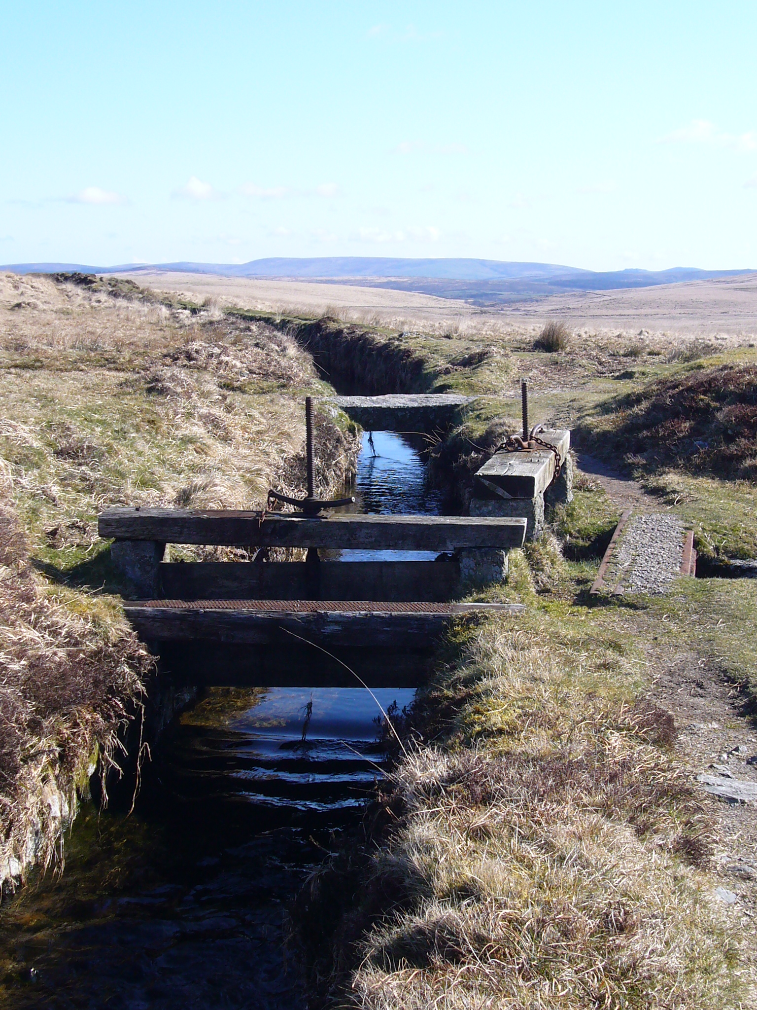
Dartmoor
There are many leats on Dartmoor, mostly constructed to provide power for mining activities, although some were also sources of drinking water. The courses of many Dartmoor leats may still be followed. Many such leats on the moor are marked on the 1:50000 and 1:25000 Ordnance Survey maps, such as that serving the now-defunct Vitifer mine near the Warren House Inn. Notable leats include:
- Drake's Leat, constructed in 1591 under the management of Sir Francis Drake, as an agent of the Corporation of Plymouth, to carry water from Dartmoor to Plymouth.
- Devonport Leat constructed in the late 18th century to carry water to the expanding naval dockyard at Devonport (now a part of Plymouth).
References
References
- Knight, Charles. (1861). "Cyclopaedia: Of Geography, Biography, Natural History, Arts and Sciences". Bradbury and Evans.
- [http://www.legendarydartmoor.co.uk/leats_moor.htm Tim Sandles, 21 March 2016: Leats] {{Webarchive. link. (5 April 2018 at legendarydartmoor.co.uk, accessed 5 April 2018)
- Robins, J. (1984) ''Follow the leat with John Robins: a series of walks along Dartmoor leats and a description of the mines some of them served'', John Robins, {{ISBN. 0-9508030-0-6
- Hawkings, D.J. (1987) ''Water from the moor'', Devon, {{ISBN. 0-86114-788-X Provides a full history of the leats which supplied Plymouth, England.
This article was imported from Wikipedia and is available under the Creative Commons Attribution-ShareAlike 4.0 License. Content has been adapted to SurfDoc format. Original contributors can be found on the article history page.
Ask Mako anything about Leat — get instant answers, deeper analysis, and related topics.
Research with MakoFree with your Surf account
Create a free account to save articles, ask Mako questions, and organize your research.
Sign up freeThis content may have been generated or modified by AI. CloudSurf Software LLC is not responsible for the accuracy, completeness, or reliability of AI-generated content. Always verify important information from primary sources.
Report