From Surf Wiki (app.surf) — the open knowledge base
Latakia Governorate
| Field | Value |
|---|---|
| name | Latakia Governorate |
| native_name | مُحافظة اللاذقية |
| settlement_type | Governorate |
| image_seal | Seal of Latakia Governorate.jpg |
| seal_size | 150px |
| image_map | Latakia in Syria 2016.svg |
| map_caption | Map of Syria with Latakia highlighted |
| mapframe | yes |
| mapframe-zoom | 7 |
| mapframe-wikidata | yes |
| coordinates | |
| coor_pinpoint | Latakia |
| subdivision_type | Country |
| subdivision_name | Syria |
| parts_type | Manatiq (Districts) |
| parts_style | para |
| p1 | 4 |
| established_title | |
| seat_type | Capital |
| seat | Latakia |
| unit_pref | Metric |
| area_total_km2 | 2297 |
| leader_title | Governor |
| leader_name | Muhammad Othman |
| area_note | Estimates range between 2,297 km2 and 2,437 km2 |
| population_total | 1,008,000 |
| population_as_of | 2011 |
| population_density_km2 | auto |
| timezone | AST |
| utc_offset | +3 |
| iso_code | SY-LA |
| website |
| mapframe-zoom = 7 | mapframe-wikidata = yes
Latakia Governorate ( ar), officially known as Lattakia Governorate, and also transliterated as Ladhakia, is one of the fourteen governorates of Syria. It is situated in northwestern Syria, bordering Turkey's Hatay Province to the north, Idlib and Hama Governorate to the east, Tartus Governorate to the south, and the Mediterranean Sea to the west. Its reported area varies in different sources from 2297 km2 to 2437 km2. The governorate has a population of 1,008,000 (2011 estimate).
History
The governorate was historically part of the Alawite State, which existed from 1920 to 1936.
Tartus Governorate was formerly included as part of Latakia, before being split off circa 1972.
The region has been relatively peaceful during the Syrian civil war, being a generally pro-Assad region that had largely remained under government control. The Free Syrian Army attacked Al-Haffah in 2012, and unsuccessfully attempted to wrest control of the province in 2014, 2015 and 2016. In 2016 the Islamic State conducted a bomb attack on Jableh, resulting in many deaths.
On 8 March 2025, the UK-based SOHR reported that Syrian security forces and pro-government fighters had committed a massacre of more than 750 Alawite civilians during clashes in western Syria.
Archaeological sites
- Citadel of Salah Ed-Din - Ayyubid castle
- Paltus - Phoenician city
- Ugarit - Bronze Age site
Geography

The Latakia Governorate comprises about half of Syria's Mediterranean coastline. The western part of the governorate consists mainly of coastal plains, with the inland eastern parts being mountainous, with the Syrian Coastal Mountain Range (Nusayriyah Mountains) running north to south. Its highest peak, Nabi Yunis, is 1,562 meters (5,125 ft) tall with the average elevation only about 1,200 meters. The western areas of the governorate catch moisture-laden winds from the Mediterranean Sea and are thus more fertile and more heavily populated than the eastern slopes.
The Orontes River flows north alongside the range on its eastern verge in the Al-Ghab Plain, a 64 km longitudinal trench, and then around the northern edge of the range to flow into the Mediterranean. Another important river is Nahr al-Kabir al-Shamali, a river running from the Turkish border and to the southwest to flow in the Mediterranean, with the 16 Tishreen dam, one of the most important in the region, being constructed for power generation, storage of rain and river water, and the creation of Mashqita Lake.
Cities
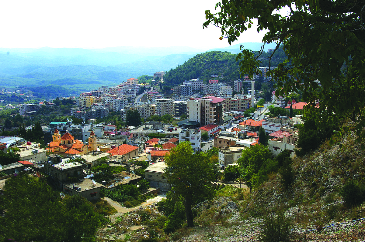
Latakia is the regional capital; other major settlements include Al-Haffah, Ibn Hani, Jableh, Kessab, Manjila, Qaranjah, Qardaha and Salma.
The following cities are the administrative centres of the districts in Latakia Governorate (Population based on 2004 official census):
| City | Population |
|---|---|
| Latakia | 383,786 |
| Jableh | 80,000 |
| Qardaha | 8,671 |
| Al-Haffah | 4,298 |
Districts
The governorate is divided into four districts (manatiq). The districts are further divided into 22 sub-districts (nawahi):
- Latakia District (7 sub-districts)
- Latakia Subdistrict
- Al-Bahluliyah Subdistrict
- Rabia Subdistrict
- Ayn al-Baydah Subdistrict
- Qastal Ma'af Subdistrict
- Kessab Subdistrict
- Hanadi Subdistrict
- Al-Haffah District (5 sub-districts)
- Al-Haffah Subdistrict
- Slinfah Subdistrict
- Ayn al-Tineh Subdistrict
- Kinsabba Subdistrict
- Muzayraa Subdistrict
- Jableh District (6 sub-districts)
- Jableh Subdistrict
- Ayn al-Sharqiyah Subdistrict
- Al-Qutailibiyah Subdistrict
- Ayn Shiqaq Subdistrict
- Daliyah Subdistrict
- Beit Yashout Subdistrict
- Qardaha District (4 sub-districts)
- Qardaha Subdistrict
- Harf al-Musaytirah Subdistrict
- Al-Fakhurah Subdistrict
- Jawbat Burghal Subdistrict
Climate
|Jan record high C = 24.4 |Feb record high C = 26.3 |Mar record high C = 32.6 |Apr record high C = 35.6 |May record high C = 38.8 |Jun record high C = 38.4 |Jul record high C = 36.2 |Aug record high C = 38.4 |Sep record high C = 38.2 |Oct record high C = 39.0 |Nov record high C = 32.6 |Dec record high C = 28.0 |year record high C = 39.0 |Jan record low C = -1.6 |Feb record low C = -0.5 |Mar record low C = -0.6 |Apr record low C = 3.9 |May record low C = 10.6 |Jun record low C = 11.7 |Jul record low C = 17.8 |Aug record low C = 17.2 |Sep record low C = 12.4 |Oct record low C = 8.9 |Nov record low C = 0.0 |Dec record low C = 0.0 |year record low C = -1.6 | archive-url = https://web.archive.org/web/20171010134227/ftp://ftp.atdd.noaa.gov/pub/GCOS/WMO-Normals/TABLES/REG_VI/SY/40022.TXT | archive-date = 2017-10-10 | url-status = dead | access-date = 26 April 2017}} | access-date = 26 April 2017}} Meteo Climat (record highs and lows) | access-date = 26 April 2017}}
Economy

The governorate is located on the Mediterranean Sea, which gave it great economic importance, with the capital of the governorate, Latakia serving as Syria's main port. Its port was established on 12 February 1950.
Its imported cargo includes clothing, construction materials, vehicles, furniture, minerals, tobacco, cotton, and food supplies such as lintels, onions, wheat, barley, dates, grains and figs; in 2008, the port handled about 8 million tons of cargo.
The governorate is also a popular domestic tourist destination, with the Cote d'Azur B=beach of Latakia being Syria's premier coastal resort, offering water skiing, jet skiing, and windsurfing. The city contains eight hotels, two of which have five-star ratings; both the Cote d'Azur de Cham Hotel and Lé Meridien Lattiquie Hotel are located 6 km north of the city, at Cote d'Azur. The latter hotel has 274 rooms and is the only international hotel in the city. Latakia is also host to numerous designer-label stores, notably on 8 Azar Street, and the heart of the city's shopping area is the series of blocks enclosed by 8 Azar Street, Yarmouk Street, and Saad Zaghloul Street in the city centre. Cinemas in Latakia include Ugarit Cinema, al-Kindi, and a smaller theater off al-Moutanabbi Street.
Demographics
As per the 2004 Syrian census the population was 879,550. A 2011 UNOCHA estimate put the population at 1,008,000, though this has likely changed since the start of the war.
At the end of 2021, Latakia’s population reached 1,634,000, accounting for 6% of Syria’s total population. The majority at 68% are Alawite Muslims, followed by 17% Sunni Muslims, 15% Christians, 0.2% Twelver Shia Muslims and 0.2% Ismaili Muslims.
Languages
The primary languages of the province are Arabic, Armenian and Turkish (Syrian Turkmen dialects). Arabic is spoken in all district centres of the governorate and most, if not all towns and villages surrounding them, with the North Levantine dialect mostly used. An exception is Kessab, a historically Armenian-populated town where Armenian is the primary language in it and the surrounding villages such as Sev Aghpyur, Esguran and Duzaghaj, and the Turkmen Mountain where Turcoman is spoken primarily, though many Turkmen have fled the area since the start of the civil war.
Gallery
File:Latakia_Governorate_map.png|Map of Latakia governorate File:Beit Yashot02.jpg|Mountains near Beit Yashout File:Ugarit 02.jpg|Ruins of Ugarit File:Holy Mother of God Armenian Apostolic Church, Kessab, Syria.jpg|Armenian church in Kessab File:Mushayrafet al-Samouk.JPG|Countryside near Mushayrafet al-Samouk File:Cote d'Azure - Latakia, Syria.jpg|Sunbathers on the Latakian Cote d'Azur
References
References
- https://levant24.com/news/2025/03/latakia-governor-addresses-reconstruction-security-and-civil-peace-efforts/
- (2025-11-02). "Ukraine supplies 23,500 tons of wheat to Syria via Lattakia port - Syrian Arab News Agency (SANA)".
- (2025-10-27). "Authorities in Lattakia arrest Military Prosecutor Linked to deposed Regime - Syrian Arab News Agency (SANA)".
- "Syria: Governorates, Major Cities & Localities - Population Statistics, Maps, Charts, Weather and Web Information".
- "Syria Provinces". www.statoids.com.
- Longrigg, Stephen Hemsley. "Syria and Lebanon Under French Mandate." London: Oxford University Press, 1958.
- "Assad's forces deploy in Latakia to repel rebel offensive". Al Arabiya.
- Leith Fadel. "Syrian Army Advances North Towards the Turkish Border in Latakia: 3 Villages Captuted". Al-Masdar News.
- "Foreign jihadists advertise role in Latakia fighting". The Long War Journal.
- Philip Issa. (24 May 2016). "Suicide bombing killed 43 at Syrian hospital: WHO". Global News.
- (8 March 2025). "'They left nobody': More than 1,000 people killed in some of Syria's deadliest violence". Sky News.
- Federal Research Division, Library of Congress (2005) [http://memory.loc.gov/frd/cs/profiles/Syria.pdf "Country Profile: Syria"] page 5
- "Syria - History, People, & Maps".
- "المراقبة والإدارة البیئیة لنھر الكبیر الشمالي".
- [http://www.cbssyr.org/new%20web%20site/General_census/census_2004/NH/TAB06-1-2004.htm Latakia city population] {{webarchive. link. (17 March 2013)
- "حول مرفأ اللاذقية - مرفأ اللاذقية".
- Mannheim, Ivan. (2001). "Syria & Lebanon Handbook: The Travel Guide". Footprint Travel Guides.
- (June 2014). "Syrian Arab Republic - Governorates profile". UNOCHA.
- Hussain Ibrahim Qutrib. (2016). ""Useful Syria" and Demographic Changes in Syria". King Faisal Center for Research and Islamic Studies.
- Mannheim, Ivan. (2001). "Syria and Lebanon Handbook: The Travel Guide". Footprint Travel Guides.
- "The regime forces the last remaining Turkmen Families to leave to Turkey". Enab Baladi.
This article was imported from Wikipedia and is available under the Creative Commons Attribution-ShareAlike 4.0 License. Content has been adapted to SurfDoc format. Original contributors can be found on the article history page.
Ask Mako anything about Latakia Governorate — get instant answers, deeper analysis, and related topics.
Research with MakoFree with your Surf account
Create a free account to save articles, ask Mako questions, and organize your research.
Sign up freeThis content may have been generated or modified by AI. CloudSurf Software LLC is not responsible for the accuracy, completeness, or reliability of AI-generated content. Always verify important information from primary sources.
Report