From Surf Wiki (app.surf) — the open knowledge base
Larksville, Pennsylvania
Borough in Pennsylvania, US

Borough in Pennsylvania, US
| Field | Value |
|---|---|
| official_name | Larksville, Pennsylvania |
| settlement_type | Borough |
| motto | |
| image_skyline | Larksville, PA municipal building (2), Sept. 2023.jpg |
| image_caption | Larksville Borough Municipal Building |
| image_shield | Patch of Larksville, Pennsylvania.png |
| pushpin_map | Pennsylvania#USA |
| pushpin_label | Larksville |
| pushpin_label_position | left |
| pushpin_mapsize | |
| subdivision_type | Country |
| subdivision_name | United States |
| subdivision_type1 | State |
| subdivision_name1 | Pennsylvania |
| subdivision_type2 | County |
| subdivision_name2 | Luzerne |
| government_type | Borough Council |
| leader_title | Mayor |
| established_title | Settled |
| established_title1 | Incorporated |
| established_date1 | 1909 |
| unit_pref | Imperial |
| area_footnotes | |
| area_total_km2 | 12.54 |
| area_land_km2 | 12.15 |
| area_water_km2 | 0.39 |
| area_total_sq_mi | 4.84 |
| area_land_sq_mi | 4.69 |
| area_water_sq_mi | 0.15 |
| population_as_of | 2020 |
| population_footnotes | |
| population_total | 4225 |
| population_density_km2 | 347.79 |
| population_density_sq_mi | 900.85 |
| timezone | Eastern (EST) |
| utc_offset | -5 |
| timezone_DST | EDT |
| utc_offset_DST | -4 |
| coordinates | |
| postal_code_type | Zip code |
| area_code | 570 |
| website | |
| blank_name | FIPS code |
| blank_info | 42-41608 |
| image_map | File:Luzerne County Pennsylvania Incorporated and Unincorporated areas Larksville Highlighted.svg |
| map_caption | Location of Larksville in Luzerne County, Pennsylvania. |
Larksville is a borough in Luzerne County, Pennsylvania, United States. It is 2 mi west of Wilkes Barre on the Susquehanna River (along U.S. Route 11). The population was 4,216 as of the 2020 census.
History
Larksville was formed from a section of Plymouth Township; it was incorporated as a borough on November 10, 1909. Once known as Blindtown, the community's name was changed to Larksville in honor of Peggy Lark, a former resident.
The borough gained prominence in the late 19th and early 20th centuries as an active anthracite coal mining community, drawing a large portion of its labor force from European immigrants. Larksville was a thriving mining town. Houses were clustered around the collieries. The collieries in the borough were Boston, Loree, Lance, Woodward, and Number 4. At its peak, in 1920, Larksville's population was well over 9,000 people. However, the mining industry in the region collapsed after the 1959 Knox Mine Disaster. The population began to dwindle after its demise. Today, the population is just over 4,000.
Geography
Larksville is located at (41.258525, -75.927176).
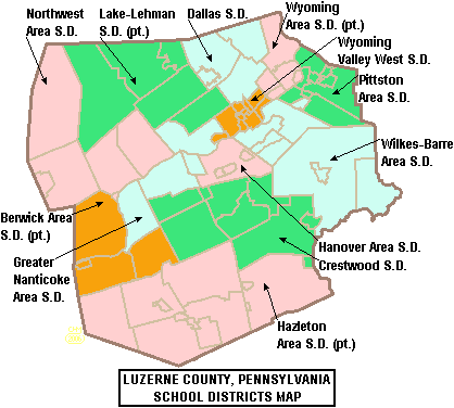
According to the United States Census Bureau, the borough has a total area of 12.6 km2, of which 12.2 km2 is land and 0.4 km2, or 3.24%, is water. The Susquehanna River makes up Larksville's southeastern border. U.S. Route 11 travels through the southern portion of the borough. Most of the homes and businesses are located in central and southern Larksville. The northern portion of the borough mostly consists of hills, forests, and a few houses. Larksville is part of the Wyoming Valley West School District.
Demographics
As of the census of 2000, there were 4,694 people, 1,808 households, and 1,323 families residing in the borough. The population density was 986.0 PD/sqmi. There were 1,939 housing units at an average density of 407.3 /sqmi. The racial makeup of the borough was 98.93% White, 0.28% African American, 0.04% Native American, 0.28% Asian, 0.13% from other races, and 0.34% from two or more races. Hispanic or Latino of any race were 0.70% of the population.
There were 1,808 households, out of which 32.1% had children under the age of 18 living with them, 56.3% were married couples living together, 12.6% had a female householder with no husband present, and 26.8% were non-families. 22.6% of all households were made up of individuals, and 11.7% had someone living alone who was 65 years of age or older. The average household size was 2.59 and the average family size was 3.05.
In the borough the population was spread out, with 23.4% under the age of 18, 7.2% from 18 to 24, 27.2% from 25 to 44, 26.7% from 45 to 64, and 15.5% who were 65 years of age or older. The median age was 40 years. For every 100 females, there were 94.4 males. For every 100 females age 18 and over, there were 91.9 males.
The median income for a household in the borough was $35,467, and the median income for a family was $41,211. Males had a median income of $33,993 versus $21,998 for females. The per capita income for the borough was $16,196. About 10.2% of families and 13.6% of the population were below the poverty line, including 19.1% of those under age 18 and 9.5% of those age 65 or over.
Education
It is in the Wyoming Valley West School District.
Notable people
- April Fronzoni, a field hockey striker from the United States
- Bryan Kocis, founder of Cobra Video
- Frank O'Connell, Pennsylvania State Representative and State Senator
- John Siegal, an American football player
- Joe Skladany, an American football player
- Leo Skladany, an American football player
References
References
- "ArcGIS REST Services Directory". United States Census Bureau.
- "City and Town Population Totals: 2020—2021". US Census Bureau.
- (2011-02-12). "US Gazetteer files: 2010, 2000, and 1990". [[United States Census Bureau]].
- "Census of Population and Housing". U.S. Census Bureau.
- "U.S. Census website". [[United States Census Bureau]].
- "Incorporated Places and Minor Civil Divisions Datasets: Subcounty Resident Population Estimates: April 1, 2010 to July 1, 2012". U.S. Census Bureau.
- "Census Population API". United States Census Bureau.
- "2020 CENSUS - SCHOOL DISTRICT REFERENCE MAP: Luzerne County, PA". [[U.S. Census Bureau]].
This article was imported from Wikipedia and is available under the Creative Commons Attribution-ShareAlike 4.0 License. Content has been adapted to SurfDoc format. Original contributors can be found on the article history page.
Ask Mako anything about Larksville, Pennsylvania — get instant answers, deeper analysis, and related topics.
Research with MakoFree with your Surf account
Create a free account to save articles, ask Mako questions, and organize your research.
Sign up freeThis content may have been generated or modified by AI. CloudSurf Software LLC is not responsible for the accuracy, completeness, or reliability of AI-generated content. Always verify important information from primary sources.
Report