From Surf Wiki (app.surf) — the open knowledge base
Langenbruck

| Field | Value | ||
|---|---|---|---|
| subject_name | Langenbruck | ||
| image_photo | 2004-Langenbruck.jpg | ||
| municipality_type | municipality | ||
| imagepath_coa | Wappen Langenbruck.png | pixel_coa= | |
| canton | Basel-Landschaft | ||
| iso-code-region | CH-BL | ||
| district | Waldenburg | ||
| coordinates | |||
| postal_code | 4438 | ||
| municipality_code | 2888 | ||
| area | 15.69 | ||
| elevation | 734 | elevation_description= | |
| population | populationof = | popofyear = | |
| website | www.langenbruck.ch | ||
| mayor | mayor_asof= | mayor_party= | |
| mayor_title | list_of_mayors = | ||
| neighboring_municipalities | Bennwil, Egerkingen (SO), Eptingen, Hägendorf (SO), Holderbank (SO), Mümliswil-Ramiswil (SO), Oberdorf, Waldenburg |
| iso-code-region = CH-BL
Langenbruck is a municipality in the district of Waldenburg in the canton of Basel-Landschaft in Switzerland.
History
Langenbruck is first mentioned in 1145 as Langebruccho.
Geography
Langenbruck has an area, , of 15.69 km2. Of this area, 8.01 km2 or 51.1% is used for agricultural purposes, while 6.93 km2 or 44.2% is forested. Of the rest of the land, 0.74 km2 or 4.7% is settled (buildings or roads), 0.04 km2 or 0.3% is either rivers or lakes.
Of the built up area, housing and buildings made up 2.2% and transportation infrastructure made up 2.1%. Out of the forested land, 41.8% of the total land area is heavily forested and 2.4% is covered with orchards or small clusters of trees. Of the agricultural land, 0.9% is used for growing crops and 32.4% is pastures and 17.1% is used for alpine pastures. All the water in the municipality is flowing water.
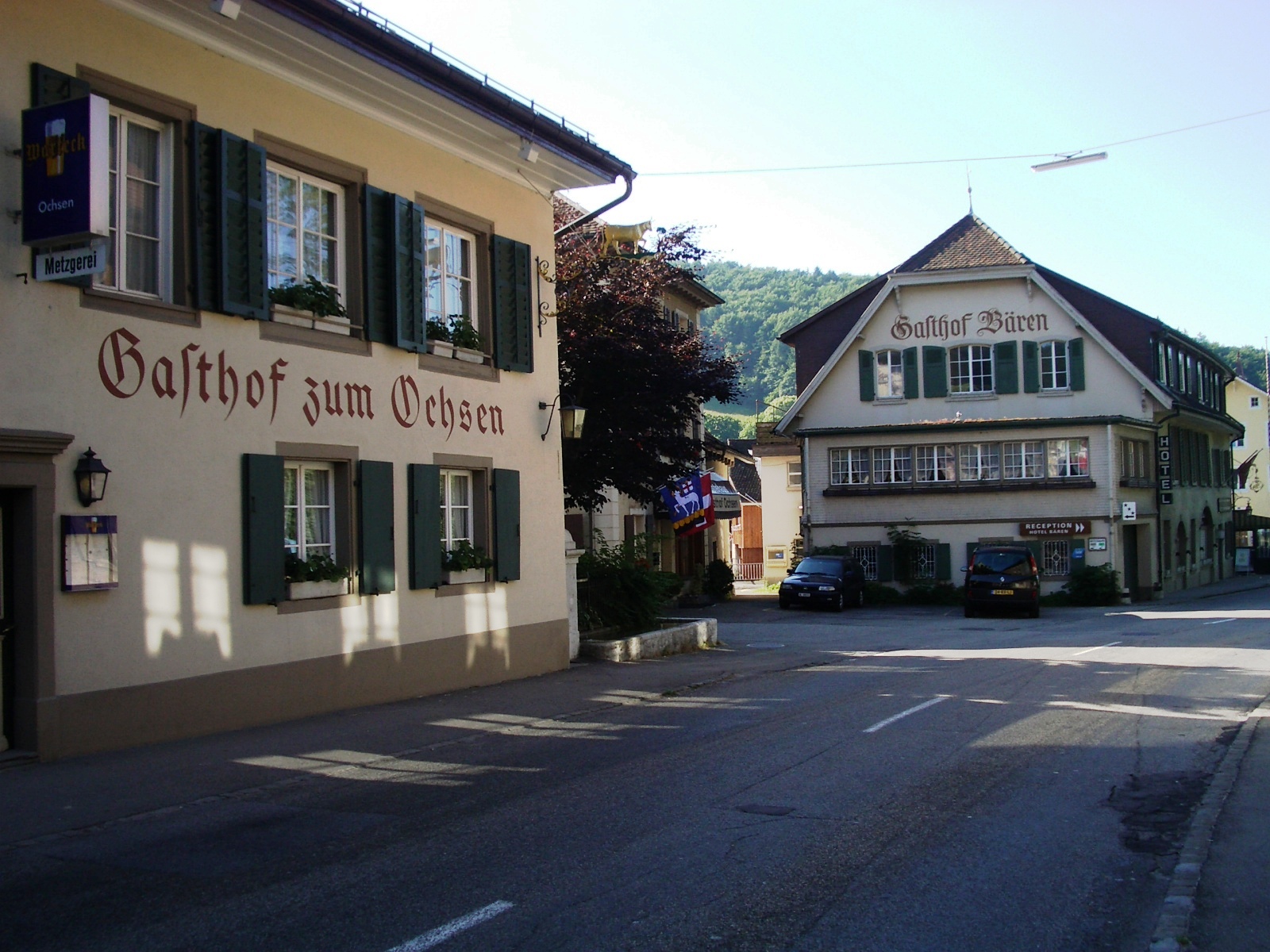
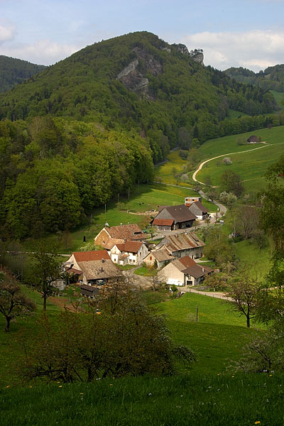
The municipality is located in the Waldenburg district, on the south side of the Oberen Hauenstein. It consists of the linear village of Langenbruck, the hamlet of Bärenwil and numerous individual farm houses.
Coat of arms
The blazon of the municipal coat of arms is Gules, over a base Sable, on a Bridge Or a Paschal Lamb passant holding a banner Argent, a cross Gules.
Demographics
Langenbruck has a population () of . , 14.8% of the population are resident foreign nationals. Over the last 10 years (1997–2007) the population has changed at a rate of 1.6%.
Most of the population () speaks German (843 or 90.7%), with Serbo-Croatian being second most common (16 or 1.7%) and Italian language being third (15 or 1.6%). There are 8 people who speak French and 1 person who speaks Romansh.
, the gender distribution of the population was 51.4% male and 48.6% female. The population was made up of 832 Swiss citizens (83.5% of the population), and 165 non-Swiss residents (16.5%) Of the population in the municipality 283 or about 30.5% were born in Langenbruck and lived there in 2000. There were 139 or 15.0% who were born in the same canton, while 305 or 32.8% were born somewhere else in Switzerland, and 168 or 18.1% were born outside of Switzerland.
In there were 8 live births to Swiss citizens and 2 births to non-Swiss citizens, and in same time span there were 13 deaths of Swiss citizens. Ignoring immigration and emigration, the population of Swiss citizens decreased by 5 while the foreign population increased by 2. There was 1 Swiss man who emigrated from Switzerland. At the same time, there were 9 non-Swiss men and 3 non-Swiss women who immigrated from another country to Switzerland. The total Swiss population change in 2008 (from all sources, including moves across municipal borders) was a decrease of 6 and the non-Swiss population increased by 10 people. This represents a population growth rate of 0.4%.
The age distribution, , in Langenbruck is; 52 children or 5.2% of the population are between 0 and 6 years old and 160 teenagers or 16.0% are between 7 and 19. Of the adult population, 117 people or 11.7% of the population are between 20 and 29 years old. 122 people or 12.2% are between 30 and 39, 169 people or 17.0% are between 40 and 49, and 241 people or 24.2% are between 50 and 64. The senior population distribution is 105 people or 10.5% of the population are between 65 and 79 years old and there are 31 people or 3.1% who are over 80.
, there were 427 people who were single and never married in the municipality. There were 407 married individuals, 62 widows or widowers and 33 individuals who are divorced.
, there were 362 private households in the municipality, and an average of 2.4 persons per household. There were 122 households that consist of only one person and 34 households with five or more people. Out of a total of 377 households that answered this question, 32.4% were households made up of just one person and 3 were adults who lived with their parents. Of the rest of the households, there are 95 married couples without children, 112 married couples with children There were 24 single parents with a child or children. There were 6 households that were made up unrelated people and 15 households that were made some sort of institution or another collective housing.
there were 159 single family homes (or 52.6% of the total) out of a total of 302 inhabited buildings. There were 56 multi-family buildings (18.5%), along with 63 multi-purpose buildings that were mostly used for housing (20.9%) and 24 other use buildings (commercial or industrial) that also had some housing (7.9%). Of the single family homes 54 were built before 1919, while 13 were built between 1990 and 2000.
there were 466 apartments in the municipality. The most common apartment size was 4 rooms of which there were 123. There were 11 single room apartments and 146 apartments with five or more rooms. Of these apartments, a total of 339 apartments (72.7% of the total) were permanently occupied, while 95 apartments (20.4%) were seasonally occupied and 32 apartments (6.9%) were empty. The vacancy rate for the municipality, , was 0.21%.
The historical population is given in the following chart: Colors= id:lightgrey value:gray(0.9) id:darkgrey value:gray(0.8) ImageSize = width:1080 height:210 PlotArea = height:150 left:100 bottom:50 right:100 AlignBars = justify DateFormat = x.y Period = from:0 till:1000 TimeAxis = orientation:vertical AlignBars = justify ScaleMajor = gridcolor:darkgrey increment:200 start:0 ScaleMinor = gridcolor:lightgrey increment:40 start:0 PlotData= color:yellowgreen width:40 mark:(line,white) align:center bar:1585 from:start till:260 text:"260" bar:1763 from:start till:397 text:"397" bar:1850 from:start till:927 text:"927" bar:1860 from:start till:991 text:"991" bar:1870 from:start till:900 text:"900" bar:1880 from:start till:875 text:"875" bar:1888 from:start till:826 text:"826" bar:1900 from:start till:827 text:"827" bar:1910 from:start till:773 text:"773" bar:1920 from:start till:865 text:"865" bar:1930 from:start till:837 text:"837" bar:1941 from:start till:849 text:"849" bar:1950 from:start till:979 text:"979" bar:1960 from:start till:915 text:"915" bar:1970 from:start till:873 text:"873" bar:1980 from:start till:788 text:"788" bar:1990 from:start till:915 text:"915" bar:2000 from:start till:929 text:"929"
Heritage sites of national significance
The medieval mine at Dürsteltal is listed as a Swiss heritage site of national significance. The entire Schöntal area is part of the Inventory of Swiss Heritage Sites.
Politics
In the 2007 federal election the most popular party was the SVP which received 36.54% of the vote. The next three most popular parties were the SP (22.97%), the Green Party (15.33%) and the FDP (14.2%). In the federal election, a total of 378 votes were cast, and the voter turnout was 54.5%.
Economy
, Langenbruck had an unemployment rate of 3.6%. , there were 76 people employed in the primary economic sector and about 27 businesses involved in this sector. 66 people were employed in the secondary sector and there were 8 businesses in this sector. 171 people were employed in the tertiary sector, with 35 businesses in this sector. There were 484 residents of the municipality who were employed in some capacity, of which females made up 43.6% of the workforce.
the total number of full-time equivalent jobs was 240. The number of jobs in the primary sector was 51, all of which were in agriculture. The number of jobs in the secondary sector was 62 of which 36 or (58.1%) were in manufacturing and 25 (40.3%) were in construction. The number of jobs in the tertiary sector was 127. In the tertiary sector; 10 or 7.9% were in wholesale or retail sales or the repair of motor vehicles, 16 or 12.6% were in the movement and storage of goods, 15 or 11.8% were in a hotel or restaurant, 20 or 15.7% were technical professionals or scientists, 11 or 8.7% were in education and 37 or 29.1% were in health care.
, there were 78 workers who commuted into the municipality and 283 workers who commuted away. The municipality is a net exporter of workers, with about 3.6 workers leaving the municipality for every one entering. Of the working population, 15.9% used public transportation to get to work, and 47.5% used a private car.
Religion

At the , 461 or 49.6% belonged to the Swiss Reformed Church, while 176 or 18.9% were Roman Catholic. Of the rest of the population, there were 25 members of an Orthodox church (or about 2.69% of the population), there were 6 individuals (or about 0.65% of the population) who belonged to the Christian Catholic Church, and there were 35 individuals (or about 3.77% of the population) who belonged to another Christian church. There were 58 (or about 6.24% of the population) who were Islamic. There were 4 individuals who were Hindu and 3 individuals who belonged to another church. 140 (or about 15.07% of the population) belonged to no church, are agnostic or atheist, and 21 individuals (or about 2.26% of the population) did not answer the question.
Weather
Langenbruck has an average of 144.5 days of rain or snow per year and on average receives 1252 mm of precipitation. The wettest month is June during which time Langenbruck receives an average of 135 mm of rain or snow. During this month there is precipitation for an average of 13.3 days. The month with the most days of precipitation is May, with an average of 14.1, but with only 122 mm of rain or snow. The driest month of the year is October with an average of 87 mm of precipitation over 9.2 days.
Education
In Langenbruck about 348 or (37.5%) of the population have completed non-mandatory upper secondary education, and 110 or (11.8%) have completed additional higher education (either university or a Fachhochschule). Of the 110 who completed tertiary schooling, 54.5% were Swiss men, 30.0% were Swiss women, 9.1% were non-Swiss men and 6.4% were non-Swiss women.
, there were 11 students in Langenbruck who came from another municipality, while 96 residents attended schools outside the municipality.
Notable people
- Oskar Bider, Swiss aviation pioneer
References
References
- [http://www.bfs.admin.ch/bfs/portal/de/index/themen/02/03/blank/data/gemeindedaten.html Swiss Federal Statistical Office-Land Use Statistics] 2009 data {{in lang. de accessed 25 March 2010
- [http://www.crwflags.com/fotw/flags/ch-bl079.html Flags of the World.com] accessed 11-March-2011
- [http://www.bfs.admin.ch/bfs/portal/de/index/infothek/onlinedb/superweb/login.html Swiss Federal Statistical Office - Superweb database - Gemeinde Statistics 1981-2008] {{webarchive. link. (2010-06-28 {{in lang). de accessed 19 June 2010
- [http://www.bfs.admin.ch/bfs/portal/en/index/regionen/02/key.html Swiss Federal Statistical Office] {{webarchive. link. (2016-01-05 accessed 11-March-2011)
- de accessed 16 February 2011
- link. (2013-08-09 {{in lang). de accessed 2 February 2011
- link. (2015-01-21 {{in lang). de accessed 28 January 2011
- {{as of. link. (2010-11-07 , ''Mieter- und Genossenschafterwohnungen1 nach Zimmerzahl und Mietpreis 2000'' {{in lang). de accessed 20 February 2011
- {{HDS. 1252. Langenbruck
- link. (2014-09-30 {{in lang). de accessed 29 January 2011
- (2009). "Kantonsliste A-Objekte:Basel-Landschaft". Federal Office of Civil Protection.
- [http://www.bfs.admin.ch/bfs/portal/de/index/themen/17/02/blank/data/04/03.html Swiss Federal Statistical Office, ''Nationalratswahlen 2007: Stärke der Parteien und Wahlbeteiligung, nach Gemeinden/Bezirk/Canton''] {{webarchive. link. (2015-05-14 {{in lang). de accessed 28 May 2010
- link. (2014-12-25 {{in lang). de accessed 28 January 2011
- [http://www.media-stat.admin.ch/stat/pendler/pop.php Swiss Federal Statistical Office - Statweb] {{webarchive. link. (2012-08-04 {{in lang). de accessed 24 June 2010
- "Temperature and Precipitation Average Values-Table, 1961-1990". Federal Office of Meteorology and Climatology - MeteoSwiss.
This article was imported from Wikipedia and is available under the Creative Commons Attribution-ShareAlike 4.0 License. Content has been adapted to SurfDoc format. Original contributors can be found on the article history page.
Ask Mako anything about Langenbruck — get instant answers, deeper analysis, and related topics.
Research with MakoFree with your Surf account
Create a free account to save articles, ask Mako questions, and organize your research.
Sign up freeThis content may have been generated or modified by AI. CloudSurf Software LLC is not responsible for the accuracy, completeness, or reliability of AI-generated content. Always verify important information from primary sources.
Report