From Surf Wiki (app.surf) — the open knowledge base
Lamphey
Village, parish and community in Pembrokeshire, Wales
Village, parish and community in Pembrokeshire, Wales
| Field | Value | |
|---|---|---|
| country | Wales | |
| static_image_name | Bishop's Palace, Lamphey - geograph.org.uk - 14003.jpg | |
| static_image_caption | Part of the Bishop's Palace | |
| coordinates | ||
| official_name | Lamphey | |
| welsh_name | Llandyfái | |
| population | 843 | |
| population_ref | (2011) | |
| unitary_wales | Pembrokeshire | |
| constituency_westminster | Mid and South Pembrokeshire | |
| constituency_welsh_assembly | Carmarthen West and South Pembrokeshire | |
| post_town | Pembroke | |
| postcode_district | SA71 5 | |
| postcode_area | SA | |
| dial_code | 01646 | |
| os_grid_reference | SN018004 | |
| module | [[File:2024 Wales Pembrokeshire Community Lamphey map.svg | 240px]] |
| Map of the community |
Map of the community Lamphey ( ) is both a village, a parish and a community near the south coast of Pembrokeshire, Wales, approximately 2 mi east of the town of Pembroke, and 2 mi north of the seaside village of Freshwater East. The 2011 census reported a population of 843.
Freshwater East is in the community as is the village of Hodgeston.
The village includes the ruins of the fourteenth-century Lamphey Bishop's Palace; a palace of the Bishop of St David's.
Church of St Tyfai and St Faith
The parish church, dedicated to St Tyfai (or Tyfie) and St Faith, is medieval in origin but was largely rebuilt in 1869–1871 by the architect Ewan Christian. The fine tower is thirteenth or fourteenth century. In the chancel a piscina and two lancet windows date from the thirteenth century, but have been repositioned. The font is Norman.
Notable landmarks
Several Georgian-era buildings remain, including the guesthouse, Lower Lamphey Park on the Ridgeway. The village has two hotels/restaurants, The Dial public house, a primary school, a service station with a shop, a hairdressers, and a local bakery which has served the community for generations. There are playing fields. The village hall, with a capacity of 120 people, was completed in 2007.
Bishop Vaughan was responsible for adding the first-floor chapel on the north side of Lamphey Hall in the early 16th century. In 1542, Lamphey Manor was "surrendered to Henry VIII in exchange for the rich rectory of Carew".
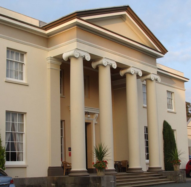
The grade II listed Lamphey Court, a Georgian mansion, was built in 1823 to the west of the ruins of the Bishop's Palace. It was the seat of the Mathias family until it was sold in 1978 by Wing Commander Lewis Mathias, the High Sheriff of Pembrokeshire.
Governance
Lamphey, together with Cosheston, forms an electoral ward. The total ward population taken at the 2011 Census was 1,671.
Railway
Lamphey railway station on the Pembroke Dock branch of the West Wales Line is operated by Transport for Wales Rail, who also manage the station. Trains stop here on request every two hours in each direction, westwards to and eastwards to , , and .
River
The Pembroke River rises at nearby Hodgeston Hill to flow through Lamphey to Pembroke Castle.
References
References
- "Community population 2011".
- "Church of St Tyfie and St Faith, Lamphey".
- {{Coflein
- (1 May 2009). "The Rough Guide to Wales". Rough Guides Limited.
- "The Dial Inn". Thedialinn.co.uk.
- "Lamphey Village Hall, Lamphey, Nr.Pembroke". Pembrokeshirehalls.org.uk.
- Emery, Anthony. (1996). "Greater Medieval Houses of England and Wales, 1300-1500: Volume 2, East Anglia, Central England and Wales". Cambridge University Press.
- "Three Pembrokeshire villages".
- "Ward population 2011".
- "Lamphey". The Train Line.
This article was imported from Wikipedia and is available under the Creative Commons Attribution-ShareAlike 4.0 License. Content has been adapted to SurfDoc format. Original contributors can be found on the article history page.
Ask Mako anything about Lamphey — get instant answers, deeper analysis, and related topics.
Research with MakoFree with your Surf account
Create a free account to save articles, ask Mako questions, and organize your research.
Sign up freeThis content may have been generated or modified by AI. CloudSurf Software LLC is not responsible for the accuracy, completeness, or reliability of AI-generated content. Always verify important information from primary sources.
Report