From Surf Wiki (app.surf) — the open knowledge base
Lake Sevan
Lake in Armenia
Lake in Armenia
| Field | Value |
|---|---|
| name | Lake Sevan |
| image | File:Lake Sevan from space.jpg |
| caption | NASA photo from space |
| location | Gegharkunik Province, Armenia |
| coords | |
| inflow | 28 rivers and streams |
| outflow | evaporation: 85–90%, Hrazdan River: 10–15% |
| basin_countries | Armenia |
| agency | Ministry of Environment |
| length | 74 km |
| width | 32 km |
| area | 1242 km2 |
| depth | 26.8 m |
| max-depth | 79.4 m |
| volume | 33.2 km3 |
| salinity | 0.7% |
| elevation | 1900.44 m (2012) |
| islands | formerly 1 (now a peninsula) |
| sections | 2 (Major Sevan, Minor Sevan) |
| cities | Gavar, Sevan, Martuni, Vardenis |
| pushpin_map | Armenia#Gegharkunik#Caucasus mountains#Europe#Asia |
| pushpin_map_alt | Lake Sevan is located in central eastern Armenia. |
| mapframe | yes |
| mapframe-zoom | 8 |
| mapframe-wikidata | yes |
| mapframe-point | none |
| embed | yes |
| designation1 | National Park |
| designation1_offname | Sevan National Park |
| designation1_date | 14 March 1978 |
| designation2 | Ramsar |
| designation2_offname | Lake Sevan |
| designation2_date | 6 July 1993 |
| designation2_number | 620 |
| max-depth = 79.4 m | mapframe-zoom = 8 | mapframe-wikidata = yes | mapframe-point = none

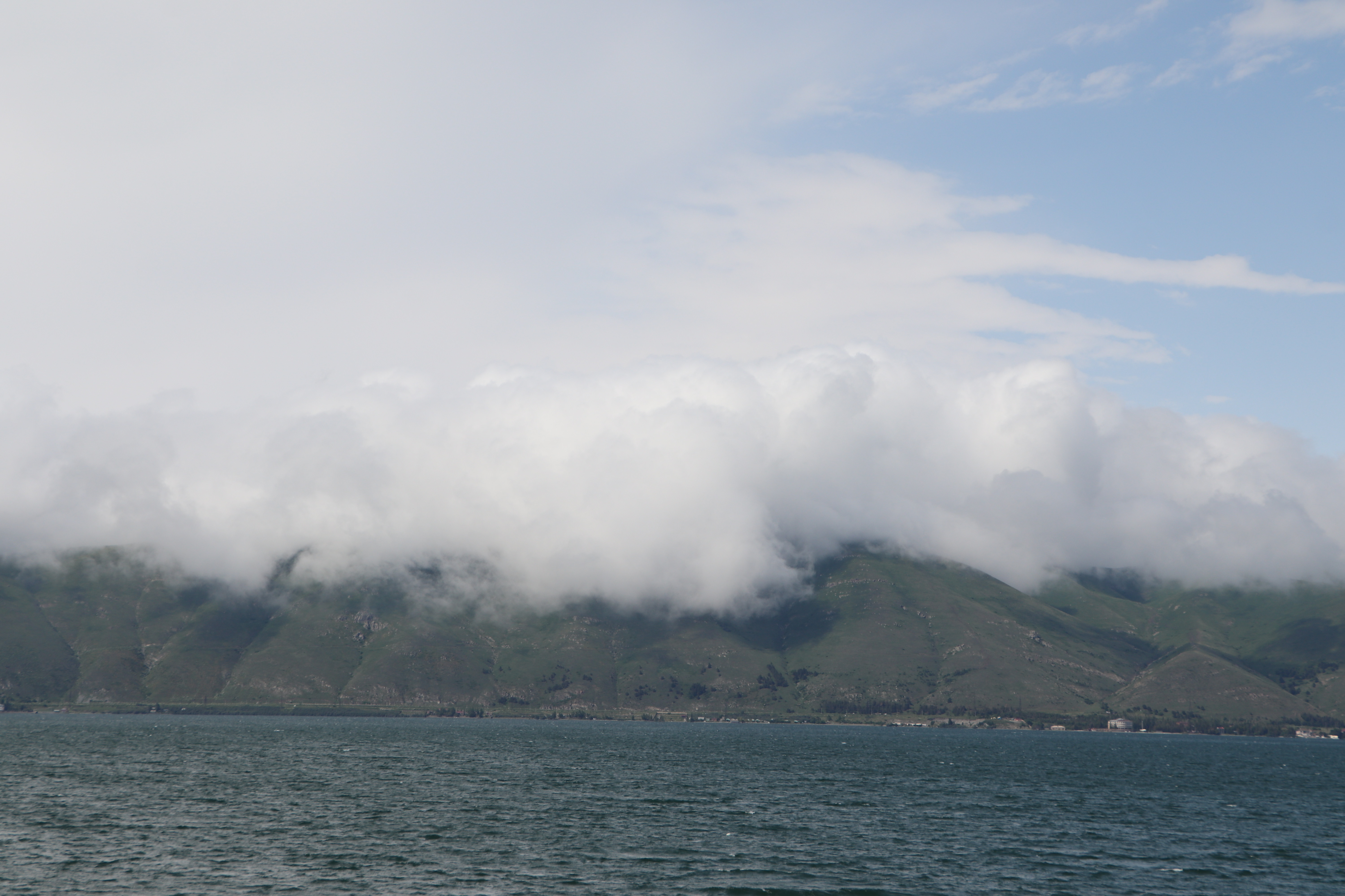
Lake Sevan () is the largest body of water in both Armenia and the Caucasus region. It is one of the largest freshwater high-altitude (alpine) lakes in Eurasia. The lake is situated in Gegharkunik Province, at an altitude of 1900 m above sea level. The total surface area of its basin is about 5000 km2, which makes up of Armenia's territory. The lake itself is 1242 km2, and the volume is 32.8 km3. It is fed by 28 rivers and streams. Only 10% of the incoming water is drained by the Hrazdan River, while the remaining 90% evaporates.
Sevan has significant economic, cultural, and recreational value. Its sole major island (now a peninsula) is home to a medieval monastery. The lake provides some 90% of the fish and 80% of the crayfish catch of Armenia.
Sevan was heavily exploited for irrigation of the Ararat plain and hydroelectric power generation during the Soviet period. Consequently, its water level decreased by around 20 m and its volume reduced by more than 40%. Later, two tunnels were built to divert water from highland rivers, which halted its decline and its level began rising. Before human intervention dramatically changed the lake's ecosystem, the lake was at an altitude of 1916 m above sea level, 95 m deep, covered an area of 1416 km2 (5% of Armenia's entire area), and had a volume of 58.5 km3.
Etymology
In the Middle Ages, Sevan was solely the name of the island (now peninsula) and the monastery built on it. In the 19th and early 20th centuries, Russian and European sources sometimes referred to the lake as Sevanga or Sevang, Per folk etymology, Sevan is either a combination of sev ("black") and vank’ ("monastery"), sev ("black") + Van (i.e., Lake Van), or originates from the phrase sa ē vank'ə ("this is the monastery").
The scholarly explanation, first suggested by in 1896, is that Sevan originated from the Urartian word suinia, usually translated as "lake". It is attested on an 8th-century BC cuneiform inscription by the Urartian king Rusa I, found in Odzaberd, on the southern shore of the lake.
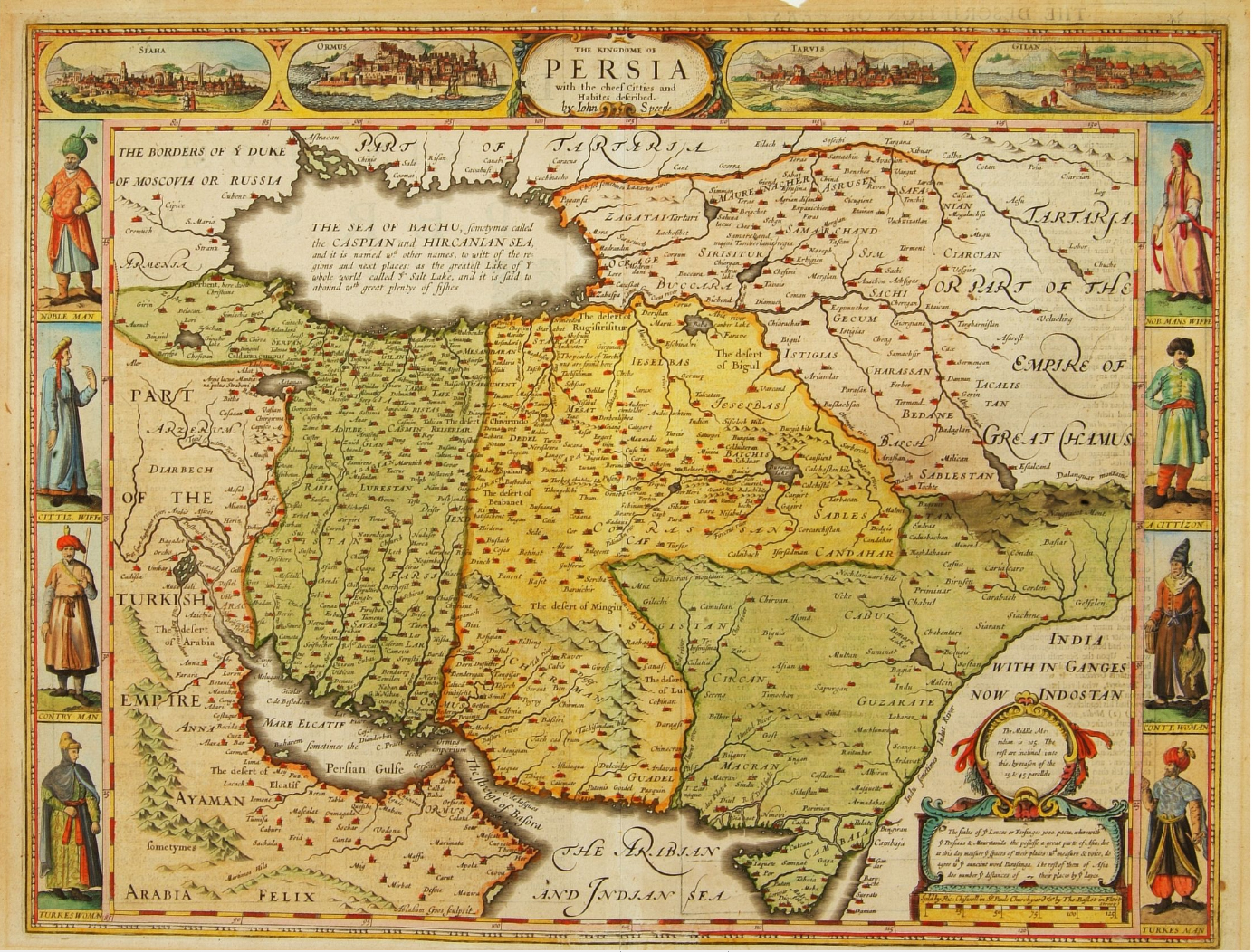
The historical Armenian name of the lake, attested in early medieval texts, is Sea of Gegham (classical Armenian: ծով Գեղամայ, tsov Geghamay). The historic Georgian name of the lake is Gelakuni (გელაქუნი), which is essentially the Georgian transcription of Armenian Gegharkuni. In classical antiquity, the lake was known as Lychnitis (). John Chardin, who visited the lake in 1673, called it the "Lake of Erivan" and wrote that it was called Deria-Shirin ("sweet lake") by Persians and Kiagar-couni-sou by Armenians.
The Turkic name Gokcha or Gökche, which means "blue lake" was also used in Russian and British sources from the 17th to early 20th centuries.
Significance
Cultural
Along with Lake Van and Lake Urmia, Sevan is considered one of the three great "seas" of historic Armenia. It is the only one within the boundaries of present-day Republic of Armenia, while the other two are located in Turkey and Iran, respectively. Lake Sevan is considered the "jewel" of Armenia and is "recognized as a national treasure" in the country. The 2001 Law on Lake Sevan defines the lake as "a strategic ecosystem valuable for its environmental, economical, social, scientific, cultural, aesthetic, medical, climatic, recreational, and spiritual value."
Chardin in 1673 noted the "extraordinary sweetness of the water", the "small Island in the middle of it; where stands a Monastery built about 600 years ago, of which the Prior is an Archbishop", and "nine sorts of fish which are there taken; the fairest trouts and carps which are eaten at Erivan being caught in this Lake".
Naturalist and traveler Friedrich Parrot, best known for ascending Mount Ararat in 1829 for the first time in history, wrote:
Economic
It is important for the Armenian economy: being the main source of irrigation water, Sevan provides low-cost electricity, fish, recreation, and tourism.
Origin
Sevan originated during the early Quaternary when tectonic formation created a Palaeo-Sevan, ten times larger than the present lake. The current lake was formed some 25 to 30 thousand years ago.
Human intervention
Exploitation and reduction
Background
Sevan was recognized as being a major potential water resource in the 19th century. Its high altitude location relative to the fertile Ararat plain and limited energy resources attracted engineers to explore ways of usage of the lake's water. In his 1910 booklet, Armenian engineer Sukias Manasserian proposed using Sevan's water for irrigation and hydroelectric power generation. He proposed draining the lake by 50 m. Major Sevan would completely dry out, while Minor Sevan would have a surface area of 240 km2.
Implementation
Manasserian's proposal was adopted by the Soviet authorities in the 1930s when, under Joseph Stalin, the country was undergoing rapid industrialization. Works on the project started in 1933. The riverbed of Hrazdan was deepened through excavation. A tunnel was bored around 40 m under the lake's surface. The tunnel was completed in 1949 and thereafter the Sevan's level began to drop significantly, at a rate over 1 m per year. The water was used for irrigation and the Sevan–Hrazdan Cascade of six hydroelectric power stations on Hrazdan River.
| Indices | 1936 | 2000 | Decrease |
|---|---|---|---|
| Height above sea level, m | 1915.97 | 1896.65 | -19.32 |
| Lake surface, km2 | 1416.2 | 1238.8 | 12.5% |
| Mean depth, m | 41.3 | 26.8 | 35% |
| Maximum depth, m | 98.7 | 79.7 | 19% |
| Water amount, km3 | 58.48 | 33.20 | 43.2% |
Effects
During the second half of the 20th century, the ecological condition of Lake Sevan underwent tangible changes and vast degradation due to reduced water level, increased eutrophication, and detrimental impact of human activity on the biological diversity of the lake. According to Babayan et al. the lake level dropped by 19.88 m by 2002, while the volume decreased by 43.8% (from 58.5 to). Due to the water level decrease, the quality of the water deteriorated, natural habitats were destroyed that meant loss of biodiversity. Vardanian wrote that drop of the lake level and the economic development in the basin brought about the change in hydro-chemical regime of the lake. The quality of the water deteriorated, water turbidity increased. The inner circulation of the water constituents as well as the circulation of the biological substances altered.
Reversal and recovery

Arpa–Sevan tunnel
By the time of the Khrushchev Thaw, "it had become evident that the ecological and economic consequences of extensive exploitation of the water of Lake Sevan were too undesirable to continue in the same way." Soviet Armenian leaders soon agreed that "the best way to solve the issue would be to construct a canal to divert water from Armenia's Arpa River into the lake." To support this project, Yerevan needed assistance from the all-union budget. On Victory Day (9 May) 1961, Armenian officials, led by First Secretary Yakov Zarobyan, together with Marshal Ivan Bagramyan, met with Nikita Khrushchev at the lake to discuss the Arpa-Sevan proposal. Guided by advice from Khrushchev's close ally Anastas Mikoyan, the Armenian leadership managed to persuade Khrushchev to support the project, "estimated to be 480 million rubles (in old price values)."
The plan for the Arpa-Sevan tunnel was approved on 12 August 1961 by the Council of Ministers of the Soviet Union. It envisioned diverting water from a reservoir of the Arpa River near Kechut through a 49 km long tunnel to the lake near Artsvanist. Armenian authorities "moved to begin the implementation of the project" on 29 August 1961. The tunnel was eventually completed in 1981 and continues to bring up to 200 e6m3 of water to Sevan per year. However, it is estimated that due to climate change, the outflow of the Arpa river will decrease by 22% by 2030.
Vorotan–Arpa tunnel
Since the water level in the lake did not rise as fast and as much, on 20 April 1981 the Council of Ministers of the Soviet Union made a decision for the construction of the Vorotan–Arpa tunnel. This 21.6 km long tunnel was begun from the Spandarian Reservoir on the Vorotan River further south from Kechut. Due to the Nagorno-Karabakh conflict and the 1988 earthquake in northwestern Armenia construction was halted. The tunnel was inaugurated on 26 April 2004. The Vorotan–Arpa tunnel brings an additional 165 e6m3 to the lake annually.
Increase in water level
After the construction of the two tunnels the water level began rising significantly since the mid-2000s. In 2007 it was reported that the water level had risen by 2.44 m in the previous six years. It reached 1900.04 m in October 2010. The government committee on Sevan forecasts that the level will reach 1903.5 m by 2029.
Water level stood at 1900.44 m in November 2019.
Population
.svg)
The Gegharkunik Province, which roughly corresponds to the lake's basin, had a de facto population of 211,828 according to the 2011 Armenian census. The largest settlements in the province are: Gavar (20,765), Sevan (19,229), Martuni (12,894), Vardenis (12,685), Vardenik (9,880), Yeranos (6,119), Chambarak (5,660), Lchashen (5,054), Tsovagyugh (4,189).
Tourism


Beaches
Lake Sevan has the only beaches in Armenia. They are a popular destination for the Armenians. Sevan's beaches provide a unique experience within the landlocked country for Armenians. The beaches adjacent to hotels are usually privatized. Numerous beaches are located along the entire lake shore. The most popular of them is a 2.5 km stretch on the northern shore, extending northwest from the peninsula. Resorts include Harsnaqar Hotel, Best Western Bohemian Resort, and numerous smaller facilities. Activities include swimming, sunbathing, jet skiing, windsurfing, and sailing. The area also includes numerous campgrounds and picnic areas for daytime use. A less-developed beach destination stretches along the eastern shore from Tsovagyugh to Shorzha, with numerous small cabins at Shorzha. The Avan Marak Tsapatagh Hotel, a Tufenkian Heritage Hotel, is a luxury resort on the undeveloped southeastern shore of the lake near Tsapatagh.
The Armenian government pledged to "reduce the growing commercialization of rest at Lake Sevan that makes it unaffordable for most citizens struggling to find other beach options during hot Armenian summers." In 2011 the government established public beaches in the Sevan National Park's recreational zone. The first two public beaches were opened in July. Some 100,000 people visited the public beaches in summer of 2011. The beaches have free parking space, children's and sports playgrounds, toilets, medical aid stations, and rescue services. They are also equipped with beach couches. By 2014, the number of public beaches reached 11. Some 200,000 people took holiday there in 2014.
Tufenkian Avan Marak Tsapatagh hotel.jpg|Tufenkian Avan Marak Tsapatagh Hotel (Tsapatagh) Lake Sevan beach at Best Western Bohemian Resort.JPG|Best Western Bohemian Resort Sevan beach.jpg|The beach of Sevan town Sevan Northern Beach-1.JPG Sevan town water park2.jpg|The Harsnaqar Hotel Complex Lake Sevan from Harsnakar.jpg|View from the northeastern shore near the city of Sevan
Sites of interest
The most famous cultural monument is the Sevanavank monastery located on the peninsula, which was until the mid-20th century an island. Another prominent monastery at the western shore is Hayravank, and further south, in the village of Noratus, is a field of khachkars; a cemetery with about 900 khachkars of different styles. Additional khachkars are found at Nerkin Getashen on the south coast.
In 2017, a Wikipedia globe was submerged in the lake to create an artificial reef.
Island
Main article: Sevan Island
Sevan Island2.jpg|Sevan Island Sevanavanq 01.jpg|Sevan Island Sevan Island1.jpg|Sevan Island Sevan peninsula.jpg|Sevan peninsula (formerly an island) in Lake Sevan
Sevan peninsula, Armenia, panoramic view (June 2015).jpg|Sevan peninsula in 2015
Fauna
Fish
Sevan trout (Salmo ischchan) is an endemic species of the lake, but it is endangered as some competitors were introduced into the lake, including common whitefish (Coregonus lavaretus) from Lake Ladoga, goldfish (Carrasius auratus), and crayfish (Astacus leptodactylus). If the Sevan trout is likely to become extinct in its "home" lake, it seems that it will survive in Issyk-Kul Lake (Kyrgyzstan), where it was introduced in the 1970s.
Due to anthropogenic impact, changes have occurred in all the biological components of the lake, including bacteria, benthos, and of course fish. Thus, the benthic mass increased tenfold in 1940, due to oligochaetes and chrinomices. Today, the former prevail and multiply the oxygen-rich residue at the bottom of the lake.
The bojak and winter bakhtak species of the Sevan-endemic trout have already disappeared. The summer bakhtak occurs rarely; the gegharkuni is still capable of reproducing naturally. In 1980s, the quantity of Sevan koghak significantly decreased. Numerous reasons for this have been identified:
- The level of the water was lowered, the paths of rivers changed, and the trout (gegharkuni and Aestivalis species) lost their natural spawning places. Changes in the areas near the shore (mossing, disappearance of macrophyte plants) also had a negative impact on the trout lays. The trout spawn only in certain areas, with oxygen-rich underground water at the depth of 25 -.
- Deoxidization of the bottom is extremely detrimental for salmon, which are used to more than 4 mg/L of O2.
- In the last 10 years, poaching rapidly increased, which significantly reduced the number of fish in the lake.
Birds

The bird fauna of the lake and its vicinity makes over 200 species, out of which 95 species are breeding. The lake is an important breeding ground for the Armenian gull (Larus armenicus) with about 4,000–5,000 pairs. During migration the Lake is visited by wide variety of birds including raptors, such as Montagu's harrier (Circus pygargus) and steppe eagle (Aquila nipalensis), waterbirds such as red-crested pochard (Netta rufina) and ferruginous duck (Aythya nyroca), while during the wintering period the lake hosts another set of species such as Bewick's swan (Cygnus columbianus) and great black-headed gull (Larus ichthyaetus). Sometimes the lake is visited by lesser white-fronted goose (Anser erythropus), a very rare migrant in Armenia.
Culture
There are a lot of historical monuments located on the coast of Sevan, ranging from prehistoric petroglyphs to various monasteries. The monasteries include Sevanavank, Vanevan, Kotavank and others. There are also many historical castles and fortresses on the coast, including Berdkunk Fortress, Odzaberd, and others.
Gallery
Klasztor Sewanawank - wycieczka WikiCamp 2017.jpg Vanevan Monastery Front.JPG Kotavank November.JPG Berdkunq fortress and Lake Sevan.jpg Overlooking Teyseba.JPG
Pollution
The rivers feeding Lake Sevan flow through densely populated settlements which produce agricultural, domestic, and industrial waste. It significantly changes the lake's ecosystem. According to a 2017 study the lake's water contains concentration of metals such as aluminium, nickel, arsenic, cobalt, and lead.
According to Armenian environmental organization EcoLur, the lake is in a critical condition because of the presence of vanadium. Environmental Impact Monitoring Center, an agency of the Armenian Ministry of Nature Protection, reported in 2012 that the average annual concentration of vanadium (64 μg/L) in the samples taken from Lake Sevan exceeded the maximum permissible concentration (MPC) by 6.4 times, while selenium (26 μg/L) exceeded MPC 2.6 times, copper (21 μg/L) 2.1 times, magnesium (60 μg/L) 1.2 times. A 2016 study found that mining and metallurgical industrial activities—namely the Sotk gold mine on the southeastern shore of the lake—caused significant heavy metal, especially vanadium, pollution of the Sotk and Masrik rivers in the Lake Sevan catchment basin. According to the researchers it "may have posed health risks to aquatic life as well as to humans (at least in the case of river water used for drinking purposes)."
References
;Notes
;Citations
Bibliography
References
- (2008). "The Lakes Handbook: Limnology and Limnetic Ecology". John Wiley & Sons.
- (2 March 2013). "Water level of Armenia's Lake Sevan rises faster than specified law – official". news.am.
- "Lake Sevan".
- (1908). "Սևանայ վանքի պատմութիւնը". [[Azgagrakan Handes]].
- {{Cite EB1911
- (1873). "Geografičesko-statističeskij slovarʹ Rossijskoj Imperii: Pavasterort – Sjatra-Kasy, Volume 4". Bezobrazov i komp..
- (1869). "Природа и люди на Кавказѣ и за Кавказом". V. Demakov Typography.
- (1896). "The Ascent of Mount Ararat". [[Scribner's Magazine]].
- (1850). "The expedition for the survey of the rivers Euphrates and Tigris". Longman, Brown, Green, and Longmans.
- (1984). "Каспийская экспедиция К.М. Бэра, 1853–1857 гг: дневники и материалы [Caspiran Encyclopedia of K. M. Baer, 1853–1857: Diary and Materials]". [[Nauka (publisher).
- René Grousset. ''The Empire of the Steppes: A History of Central Asia'', Rutgers University Press, 1970, p. 348, {{ISBN. 0-8135-1304-9
- (1911). "По Закавказью. археологические наблюдения и исследования 1893, 1894 и 1896 гг. [Through the Transcaucasia: archeological observations and studies in 1893, 1894, and 1896]". Mamontov Typography.
- ''Клинообразные надписи Закавказья'', исследование М. В. Никольского, 1896, p. [http://elib.shpl.ru/ru/nodes/24479-vyp-5-klinoobraznye-nadpisi-zakavkazya-issledovanie-m-v-nikolskogo-1896#mode/inspect/page/189/zoom/4 127]
- Pospelov, Evgeniy. (1998). "Географические названия мира [Geograficheskie Nazvaniia Mira] (Geographic names of the world)". Russkie Slovari.
- (1969). ["Армения—открытый музей"](https://books.google.com/books?id=EF1KAAAAIAAJ&q=слово+"Севан"+(от+"Сиунна"+—+страна). [[:ru:Искусство (издательство).
- (1984). "Словарь народных географических терминов". Mysl.
- "Geographic characteristic of the Republic of Armenia". National Statistical Service of Republic of Armenia.
- Avakian, Arra S.. (1998). "Armenia: A Journey Through History". Electric Press.
- (1980). "Moses Khorenats'i History of the Armenians". Harvard University Press.
- "Gruusia / Georgian". [[Institute of the Estonian Language]].
- "გელაქუნი [gelakuni]". [[National Parliamentary Library of Georgia]].
- (1963). "Studies in Christian Caucasian history". Georgetown University Press.
- Smith, William. (1854). "Dictionary of Greek and Roman Geography". Walton and Maberly.
- "The Travels of Sir John Chardin into Persia and the East Indies". London, 1686, pp247-248
- (2013). "A History Of Persia". Taylor & Francis.
- (1986). "Arrān".
- (1999). "The Aqquyunlu: Clan, Confederation, Empire". University of Utah Press.
- (1953). "Caucasian Battlefields: A History of the Wars on the Turco-Caucasian Border 1828–1921". Cambridge University Press.
- (1980). "Armenia, cradle of civilization". Allen & Unwin.
- (1927). "Explorations in Hittite Asia Minor A Preliminary Report". University of Chicago Press.
- (1998). "Armeno-Turcica Selected Studies". Indiana University, Research Institute for Inner Asian Studies.
- John Speede. (1631). "The Kingdom of Persia with the cheef Citties and Habites described". G. Humble.
- Bryce, James. (1878). "Transcaucasia and Ararat: Being Notes of a Vacation Tour in Autumn of 1876". Macmillan and Co..
- (1858). "The history of British India: (In 10 vol.)". Madden.
- (1869). "Travels in the Central Caucasus and Bashan: Including Visits to Ararat and Tabreez and Ascents of Kazbek and Elbruz". Longmans, Green, & Company.
- (2007). "Ancient civilizations: the illustrated guide to belief, mythology, and art". Barnes & Noble.
- J. R. Russell. Zoroastrianism in Armenia. — Harvard University Press, 1987. — P. 1—2.
- Encyclopaedia of Islam. — Leiden: BRILL, 1986. — Vol. I. — P. 634.
- Robert H. Hewsen. The Geography of Armenia // The Armenian People From Ancient to Modern Times: The Dynastic Periods: From Antiquity to the Fourteenth Century / Edited by Richard G. Hovannisian. — St. Martin's Press, 1997. — Vol. I. — P. 8—10.
- Papajian, Sarkis. (1974). "A brief history of Armenia". [[Armenian Evangelical Union of North America]].
- (1995). "Armenian infotext". Bookshelf Publishers.
- (1999). "Armenia: At the Crossroads". Routledge.
- (27 December 2013). "Lake Concerns: Group warns that "Armenia's Jewel" could be endangered by carelessness". [[ArmeniaNow]].
- (2000). "Crossing Borders--confronting History: Intercultural Adjustment in a Post-Cold War World". University Press of America.
- (15 March 2001). "Հայաստանի Հանրապետության օրենքը Սևանա լճի մասին [Republic of Armenia Law on Lake Sevan]".
- "The Travels of Sir John Chardin into Persia and the East Indies". London, 1686, pp247-248.
- Parrot, Friedrich. (2016). "Journey to Ararat". [[Gomidas Institute]].
- "1961-1981 the Complex of Hydraulic Works for Transfer of the Arpa and Yeghegis | Arpa Sevan".
- "1968-1980 Construction of Tunnel No.2 and of Arpa-Sevan Conduit | Arpa Sevan".
- (2015-11-01). "Climate change impact on water resources and crop production in Armenia". Agricultural Water Management.
- "1995-2003 "Complex of Hydraulic Structures for Diversion of the Vorotan River Runoff to the Basin of the Arpa River" | Arpa Sevan".
- link. Azg]]. (27 April 2004)
- (29 June 2007). "Sevan Rising: Lake Sevan's recovery quicker than expected". [[ArmeniaNow]].
- (6 October 2010). "Սեւանա լճի մակարդակը այս տարի բարձրացել է 56 սանտիմետրով". [[Radio Free Europe/Radio Liberty]].
- "Water report from 2019 Nov 20".
- "ՀՀ Գեղարքունիքի մարզի առկա և մշտական բնակչությունն ըստ վարչատարածքային միավորների և սեռի".
- Bonner, Raymond. (9 August 1993). "Yerevan Journal; Landlocked and Alone, Armenia Fears the Winter". [[The New York Times]].
- Holding, Deirdre. (2014). "Armenia: with Nagorno Karabagh". [[Bradt Travel Guides]].
- (8 July 2011). "'Public' Beaches Available at Armenia's Lake". [[Radio Free Europe/Radio Liberty]].
- (30 September 2011). "Available 'Blue Pearl': Public beaches proved popular with Lake Sevan holidaymakers". [[ArmeniaNow]].
- (5 July 2015). "The holiday season opened along with the public beaches of Sevan Lake".
- "CEE/Newsletter/October 2017/Full – Meta".
- Aghababyan K., Khanamirian G. 2017. Baseline study of the Birds at Lake Sevan for further monitoring. Lake Sevan National Park.
- (August 2017). "Assessment of mutagenicity of water from Lake Sevan, Armenia with application of Tradescantia (clone 02).". [[Mutation Research (journal).
- "Sevan Lake (2012)". Ecolur Network.
- (2016). "Environmental Risk Assessment of Heavy Metal Pollution in Armenian River Ecosystems: Case Study of Lake Sevan and Debed River Catchment Basins". Polish Journal of Environmental Studies.
- (27 April 2004). "Ավարտվեց "Որոտան-Արփա" թունելի շինարարությունը [Construction of "Vorotan-Arpa" tunnel completed]". [[Azg (daily).
- Massalski, Władysław. (1892). "Brockhaus and Efron Encyclopedic Dictionary Volume X".
This article was imported from Wikipedia and is available under the Creative Commons Attribution-ShareAlike 4.0 License. Content has been adapted to SurfDoc format. Original contributors can be found on the article history page.
Ask Mako anything about Lake Sevan — get instant answers, deeper analysis, and related topics.
Research with MakoFree with your Surf account
Create a free account to save articles, ask Mako questions, and organize your research.
Sign up freeThis content may have been generated or modified by AI. CloudSurf Software LLC is not responsible for the accuracy, completeness, or reliability of AI-generated content. Always verify important information from primary sources.
Report