From Surf Wiki (app.surf) — the open knowledge base
Laguna Niguel, California
City in California, United States

City in California, United States
| Field | Value | |
|---|---|---|
| name | Laguna Niguel, California | |
| settlement_type | City | |
| image_skyline | Rows of tract homes in Laguna Niguel.jpg | |
| image_caption | Suburban homes in Laguna Niguel, 2004 | |
| image_flag | Flag of Laguna Niguel, California.gif | |
| image_seal | Seal of Laguna Niguel, California.png | |
| image_map | File:Orange County California Incorporated and Unincorporated areas Laguna Niguel Highlighted 0639248.svg | |
| map_caption | Location of Laguna Niguel in Orange County, California | |
| pushpin_map | California#USA | |
| pushpin_map_caption | Location in the United States | |
| pushpin_label | Laguna Niguel | |
| pushpin_label_position | top | |
| coordinates | ||
| subdivision_type | Country | |
| subdivision_name | United States | |
| subdivision_type1 | State | |
| subdivision_name1 | California | |
| subdivision_type2 | County | |
| subdivision_name2 | Orange | |
| established_title | Incorporated | |
| established_date | December 1, 1989{{Cite web | |
| url | http://www.calafco.org/docs/Cities_by_incorp_date.doc | |
| title | California Cities by Incorporation Date | |
| format | Word | |
| publisher | California Association of Local Agency Formation Commissions | |
| access-date | August 25, 2014 | url-status=dead |
| archive-url | https://web.archive.org/web/20141103002921/http://www.calafco.org/docs/Cities_by_incorp_date.doc | |
| archive-date | November 3, 2014 }} | |
| government_type | Council-Manager | |
| leader_title | Mayor | |
| leader_name | Ray Gennaway | |
| leader_title1 | Mayor Pro Tem | |
| leader_name1 | Gene Johns | |
| leader_title2 | City Council | |
| leader_name2 | Kelly Jennings | |
| Stephanie Oddo | ||
| Stephanie Winstead | ||
| leader_title3 | City Manager | |
| leader_name3 | Tamara Letourneau | |
| leader_title4 | Deputy City Manager | |
| leader_name4 | Justin Martin | |
| unit_pref | Imperial | |
| area_footnotes | ||
| area_total_sq_mi | 14.79 | |
| area_total_km2 | 38.30 | |
| area_land_sq_mi | 14.74 | |
| area_land_km2 | 38.17 | |
| area_water_sq_mi | 0.05 | |
| area_water_km2 | 0.13 | |
| area_water_percent | 0.35 | |
| elevation_footnotes | ||
| elevation_ft | 400 | |
| elevation_m | 122 | |
| population_as_of | 2020 | |
| population_footnotes | ||
| population_total | 64355 | |
| population_density_sq_mi | auto | |
| population_density_km2 | auto | |
| timezone | Pacific | |
| utc_offset | -8 | |
| timezone_DST | PDT | |
| utc_offset_DST | -7 | |
| postal_code_type | ZIP codes | |
| postal_code | 92607, 92677 | |
| area_code_type | Area code | |
| area_code | 949 | |
| blank_name | FIPS code | |
| blank_info | ||
| blank1_name | GNIS feature IDs | |
| blank1_info | , | |
| website |
|access-date=August 25, 2014 |url-status=dead |archive-url=https://web.archive.org/web/20141103002921/http://www.calafco.org/docs/Cities_by_incorp_date.doc |archive-date=November 3, 2014 }} Stephanie Oddo Stephanie Winstead
Laguna Niguel ( ) is a city in Orange County, California, United States. The name Laguna Niguel is derived from the words "Laguna" (Spanish for "lagoon") and "Niguili" (the name of a Native American village once located near Aliso Creek). It also appeared in Spanish records as Nigüili, Nigüel, or Neuil from Juaneño (Acjachemem) nawil. As of the 2020 census, the population was 64,355. Laguna Niguel is located in the San Joaquin Hills in the southeastern corner of Orange County, close to the Pacific Ocean, and borders the cities of Aliso Viejo, Dana Point, Laguna Beach, Laguna Hills, Mission Viejo, and San Juan Capistrano.
Laguna Niguel has its origins in the Rancho Niguel Mexican land grant, which was acquired in 1959 by the Laguna Niguel Corporation to develop one of California's first master-planned communities. As a predominantly residential city, Laguna Niguel serves as a bedroom community for the job centers of northern and central Orange County. Laguna Niguel has a median household income 31 percent above the Orange County average and nearly double the U.S. average. It is known for its mild coastal climate, low crime rate, and its numerous parks and public trails.
History
Early inhabitants and settlers
The first recorded inhabitants of the Laguna Niguel area were the Acjachemem Native Americans, who may have had a village called "Niguili" near the confluence of Aliso Creek and Sulphur Creek. Aliso Creek marked the boundary between the Acjachemem and Tongva people. In the 1700s, during the Spanish colonization of the Americas, Spanish missionaries established the nearby Mission San Juan Capistrano to convert the Acjachemem to Christianity. The Mission lands, which included the present-day boundaries of Laguna Niguel, were divided into private land grants in 1821 upon Mexico's independence from Spain.
In 1842, the 13316 acre Rancho Niguel was granted to Juan Avila; he retained ownership of the land through the Mexican–American War (when California became part of the United States) until 1865, when a severe drought forced him into bankruptcy. In 1895 Lewis Moulton and Jean Pierre Daguerre bought the Rancho Niguel and other portions of the surrounding area from farmers who were struggling due to persistent drought conditions. The Moulton Company was established to oversee 19000 acre of local land which was used, mainly for orchards and sheep ranching, well into the mid-20th century. In 1951 the land was divided between the Moulton and Daguerre families, the latter inheriting 8056 acre in the future location of Laguna Niguel. In 1954 the Daguerres sold 7200 acre to the Shumaker Group and
856 acre of oceanfront to George Capron, a former Major League Baseball player who established the Capron Ranch.
Laguna Niguel Corporation
The completion of Interstate 5 in 1959 enabled easy access to job centers in Los Angeles County, creating a boom in the Orange County housing market. In 1959, Cabot, Cabot & Forbes and Paine Webber partnered to form the Laguna Niguel Corporation, which purchased the Daguerre land to develop one of California's first master planned communities. Cabot Road and Forbes Road were named in legacy after the company. The initial 7100 acre town plan was created by Viennese architect Victor Gruen and expanded beginning in 1971 by AVCO Community Developers after they acquired the Laguna Niguel Corporation. The name of the city was created from "Laguna", a reference to the tidal lagoon that once formed at the mouth of Aliso Creek, and the name of the Acjachemem village Niguili that once occupied the area. As the city would be developed in stages, ranchers and farmers signed annual leases with the Laguna Niguel Corporation to use the land until the planned communities were built.
In contrast to a traditional bedroom community, Laguna Niguel was designed so that "families should have most of their economic needs and their social and cultural interests met by facilities within the community". The plan was also notable for its emphasis on parks and open space – comprising nearly a third of the land to be developed. The Laguna Niguel Corporation went public in April 1959 and raised an initial $8.2 million from investors. In 1962 the first tracts of Monarch Bay and Niguel Terrace were completed, consisting of 565 homes. In 1960, the Moulton Niguel Water District (which today serves all of Laguna Niguel) was established by a conglomerate of ranchers, to import water from the Colorado River Aqueduct as the area lacked a sufficient natural water supply. In 1964, Crown Valley Parkway was completed from I-5 to the Pacific Coast Highway, facilitating transport through the growing city. By 1965 the population of Laguna Niguel reached 1,000.
The Laguna Niguel Homeowner's Association was formed in 1966 as an advisory to the Orange County Board of Supervisors (which governed the unincorporated community). In 1973 Laguna Niguel Regional Park opened to the public. The Chet Holifield Federal Building (a local landmark popularly known as the "Ziggurat"), designed by William L. Pereira, was constructed for Rockwell International in 1971 and was meant to bring 7,000 jobs to the area. It was traded to the US General Services Administration in exchange for industrial facilities elsewhere.
Incorporation and conflict with Dana Point
In 1965 the Laguna Niguel Corporation had purchased George Capron's oceanfront property and began to develop the Niguel Shores neighborhood, known in its early days as the "Coastal Strip" and today as Monarch Beach. By the 1970s, unincorporated Dana Point began expressing interest in including the Niguel Shores in a new city. In 1977 Dana Point briefly proposed incorporation with Laguna Niguel as a single city. Both cities submitted incorporation requests in December 1986, when a controversy immediately erupted over the coastal Monarch Beach community. Although Monarch Beach had been developed by the Laguna Niguel Corporation, its residents voted 61 percent in favor of joining with Dana Point. Laguna Niguel filed a lawsuit, which was ultimately turned down by a judge. Laguna Niguel was formally incorporated on December 1, 1989, without the coastal strip, as Orange County's 29th city.
Incorporated city
The population increased quickly during the last few decades of the 20th century, from 12,237 in 1980 to 61,891 in 2000. Growth since 2000 has been slower, with an estimate of 65,806 in 2015, due to the fact that the city has been fully built out. In 1992, Alicia Parkway was completed to I-5, providing a shorter route for northbound commuters; in 1996 the 73 San Joaquin Hills toll road opened, linking Laguna Niguel to the Interstate 405 in Costa Mesa. The Laguna Niguel City Hall, which had been planned as early as 1989, finally opened on October 15, 2011.
In 1994 local residents first noticed damage to retaining walls and roads near an artificial slope on Via Estoril in the Niguel Summit community, and geologists warned that the area could be subject to a landslide. After heavy rains caused by the 1997–98 Super El Niño, the hill collapsed on March 19, 1998, destroying 5 or 6 homes at the top and five condominium units at the bottom. There were no deaths as the area had been evacuated only a few hours prior to the collapse. An investigation revealed that the company responsible for development, J.M. Peters Inc., had improperly packed and graded the 275,000 tons of fill supporting the Niguel Summit homes. In addition, the project had been plagued by instability throughout its construction, and halted repeatedly "after complaints of mudslides, slope washouts, erosion and dust." The Los Angeles Times reported that "according to county records, the developers were warned that building on "ancient landslides" could be unsafe, but they were able to continue construction after producing their own geological report that persuaded county officials to let the project go forward." However the most recent disaster to the Niguel Summit Subdivision has been the coastal fire in 2022 which flattened 20 homes and damaged many more. This fire started after problems and circuit activity was reported on a Southern California Edison short distance electricity tower in Laguna Beach.
Geography

According to the United States Census Bureau, the city has a total area of 14.8 sqmi. 14.7 sqmi of it is land and 0.05 sqmi of it (0.35%) is water.
Laguna Niguel consists of mostly hilly terrain, being located within the San Joaquin Hills. The average elevation is 400 ft; elevations range from near sea level to 936 ft at the summit of Niguel Hill, in the southwest corner of the city.{{cite map|publisher=ACME Mapper|title=USGS Topo Maps for United States
The main watercourses in Laguna Niguel are Salt Creek, which flows through the southern part of the city, and Sulphur Creek, which drains much of the northern half. Sulphur Creek is a tributary of Aliso Creek, which flows through the wide and deep Aliso Canyon before reaching the Pacific Ocean. Laguna Niguel Lake, formed by damming Sulphur Creek, is the largest body of water in the city. Although Laguna Niguel is located very close to the Pacific, it does not border it, the result of a controversy over the coastline with Dana Point in 1989 (see #History).
Climate
|Laguna Niguel, California |44|68|2.9 |45|68|3.4 |47|69|2.0 |50|72|0.9 |54|73|0.3 |58|75|0.1 |61|79|0.1 |60|80|0.0 |59|80|0.3 |54|77|0.7 |48|72|1.1 |43|67|2.4
Like much of coastal Southern California, Laguna Niguel has pleasant weather year-round. On average, August is the hottest month and December the coolest. The highest recorded temperature was 108 F, which occurred in 1963, and the lowest temperature was 21 F, which was recorded in 1949. Precipitation is sparse in Laguna Niguel, as only five months out of the year receive rainfall greater than one inch, with an annual average of 14.2 in. The highest monthly rainfall on average occurs in February and is 3.4 in.

Neighborhoods
Neighborhoods include Bear Brand Ranch, San Marin, El Niguel Heights and Golf Course, Ocean Ranch, Laguna Crest, Laguna Sur. Coronado Pointe, South Peak, Crest de Ville, Niguel Coast, Palmilla, Beacon Hill, Monarch Point, and the Highlands, which offer city, canyon, and ocean views. Other neighborhoods include Rancho Niguel, Marina Hills, Concord Hill, Niguel West, Niguel Summit, Kite Hill, Rolling Hills, and San Joaquin Hills.
Roads
.svg)

In addition to the highways listed above, Alicia Parkway and Crown Valley Parkway are major north-south thoroughfares and the Street of the Golden Lantern/Moulton Parkway is a major east-west thoroughfare. Minor thoroughfares include Camino del Avion, Marina Hills Drive, Aliso Creek Road, Niguel Road, Cabot Road, La Paz Road, and Pacific Park Drive (Oso Parkway at the Laguna Hills-Laguna Niguel border).
Demographics
|align-fn=center 1860–1870 1880–1890 1900 1910 1920 1930 1940 1950 1960 1970 1980 1990 2000 2010 2020
Laguna Niguel was first listed as a city in the 1970 U.S. census. Prior to that, the area was part of unincorporated San Juan Township.
| Race / Ethnicity (NH = Non-Hispanic) | Pop 1980 | Pop 1990 | title=P004: Hispanic or Latino, and Not Hispanic or Latino by Race – 2000: DEC Summary File 1 – Laguna Niguel city, California | url=https://data.census.gov/table?g=160XX00US0639248&tid=DECENNIALSF12000.P004 | website=United States Census Bureau | access-date= }} | title=P2: Hispanic or Latino, and Not Hispanic or Latino by Race – 2010: DEC Redistricting Data (PL 94-171) – Laguna Niguel city, California | url=https://data.census.gov/cedsci/table?q=p2&g=160XX00US0639248&tid=DECENNIALPL2010.P2 | website=United States Census Bureau | access-date= }} | % 1980 | % 1990 | % 2000 | % 2010 |
|---|---|---|---|---|---|---|---|---|---|---|---|---|---|---|
| White alone (NH) | 11,452 | 36,886 | 47,916 | 45,682 | 42,824 | 93.59% | 83.08% | 77.42% | ||||||
| Black or African American alone (NH) | 25 | 564 | 723 | 693 | 766 | 0.20% | 1.27% | 1.17% | ||||||
| Native American or Alaska Native alone (NH) | 26 | 102 | 110 | 115 | 115 | 0.21% | 0.23% | 0.18% | ||||||
| Asian alone (NH) | 223 | 3,360 | 4,764 | 5,390 | 6,306 | 1.82% | 7.57% | 7.70% | ||||||
| Native Hawaiian or Pacific Islander alone (NH) | 62 | 79 | 67 | 0.10% | 0.13% | 0.10% | ||||||||
| Other race alone (NH) | 6 | 37 | 133 | 118 | 344 | 0.05% | 0.08% | 0.21% | ||||||
| Mixed race or Multiracial (NH) | x | x | 1,758 | 2,141 | 3,423 | x | x | 2.84% | ||||||
| Hispanic or Latino (any race) | 505 | 3,451 | 6,425 | 8,761 | 10,510 | 4.13% | 7.77% | 10.38% | ||||||
| Total | 12,237 | 44,400 | 61,891 | 62,979 | 64,355 | 100.00% | 100.00% | 100.00% |
2020
The 2020 United States census reported that Laguna Niguel had a population of 64,355. The population density was 4,367.2 PD/sqmi. The racial makeup of Laguna Niguel was 69.7% White, 1.3% African American, 0.5% Native American, 9.9% Asian, 0.1% Pacific Islander, 6.0% from other races, and 12.6% from two or more races. Hispanic or Latino of any race were 16.3% of the population.
The census reported that 99.6% of the population lived in households, 0.4% lived in non-institutionalized group quarters, and 0.1% were institutionalized.
There were 25,425 households, out of which 27.0% included children under the age of 18, 55.7% were married-couple households, 5.2% were cohabiting couple households, 24.9% had a female householder with no partner present, and 14.1% had a male householder with no partner present. 22.9% of households were one person, and 10.5% were one person aged 65 or older. The average household size was 2.52.
The age distribution was 18.2% under the age of 18, 8.0% aged 18 to 24, 21.5% aged 25 to 44, 31.1% aged 45 to 64, and 21.1% who were 65years of age or older. The median age was 47.0years. For every 100 females, there were 94.0 males.
There were 27,281 housing units at an average density of 1,851.3 /mi2, of which 25,425 (93.2%) were occupied. Of these, 67.1% were owner-occupied, and 32.9% were occupied by renters.
In 2023, the US Census Bureau estimated that the median household income was $140,605, and the per capita income was $77,246. About 3.5% of families and 5.9% of the population were below the poverty line.
2010
The 2010 United States census reported that Laguna Niguel had a population of 62,979. The population density was 4,231.1 PD/sqmi. The racial makeup of Laguna Niguel was 50,625 (80.4%) White (72.5% Non-Hispanic White), 777 (1.2%) African American, 219 (0.3%) Native American, 5,459 (8.7%) Asian, 87 (0.1%) Pacific Islander, 3,019 (4.8%) from other races, and 2,793 (4.4%) from two or more races. Hispanic or Latino of any race were 8,761 persons (13.9%).
The Census reported that 62,731 people (99.6% of the population) lived in households, 248 (0.4%) lived in non-institutionalized group quarters, and 0 (0%) were institutionalized.
There were 24,232 households, out of which 8,085 (33.4%) had children under the age of 18 living in them, 14,077 (58.1%) were opposite-sex married couples living together, 2,271 (9.4%) had a female householder with no husband present, 886 (3.7%) had a male householder with no wife present. There were 994 (4.1%) unmarried opposite-sex partnerships, and 237 (1.0%) same-sex married couples or partnerships; 5,390 households (22.2%) were made up of individuals, and 1,790 (7.4%) had someone living alone who was 65 years of age or older. The average household size was 2.59. There were 17,234 families (71.1% of all households); the average family size was 3.06.
The population was spread out, with 14,216 people (22.6%) under the age of 18, 4,722 people (7.5%) aged 18 to 24, 14,667 people (23.3%) aged 25 to 44, 21,177 people (33.6%) aged 45 to 64, and 8,197 people (13.0%) who were 65 years of age or older. The median age was 42.8 years. For every 100 females, there were 94.0 males. For every 100 females age 18 and over, there were 91.2 males.
There were 25,312 housing units at an average density of 1,700.5 /sqmi, of which 17,453 (72.0%) were owner-occupied, and 6,779 (28.0%) were occupied by renters. The homeowner vacancy rate was 0.9%; the rental vacancy rate was 5.4%. 45,029 people (71.5% of the population) lived in owner-occupied housing units and 17,702 people (28.1%) lived in rental housing units.
During 2009–2013, Laguna Niguel had a median household income of $99,771, with 6.3% of the population living below the federal poverty line.
Government and politics
| Year | Democratic | Republican | Third Parties |
|---|---|---|---|
| 2020 | 51.41% 20,469 | 46.71% 18,596 | 1.88% 749 |
| 2016 | 46.11% 14,954 | 47.83% 15,511 | 6.06% 1,967 |
| 2012 | 40.39% 12,832 | 57.67% 18,321 | 1.94% 615 |
| 2008 | 46.13% 15,076 | 52.03% 17,002 | 1.84% 602 |
| 2004 | 37.83% 11,701 | 61.23% 18,937 | 0.94% 290 |
| 2000 | 36.54% 10,232 | 60.06% 16,820 | 3.40% 951 |
| 1996 | 33.45% 8,220 | 56.91% 13,984 | 9.64% 2,368 |
| 1992 | 28.91% 7,416 | 45.01% 11,547 | 26.08% 6,689 |
The City Council consists of five members, elected from the city at-large, who serve staggered four-year terms. Annually, the City Council appoints a Mayor and a Mayor Pro Tempore from its own membership to serve a one-year term. The City Council currently consists of:
- Ray Gennawey (Mayor)
- Gene Johns (Mayor Pro Tempore)
- Kelly Jennings (Council Member)
- Stephanie Winstead (Council Member)
- Stephanie Oddo (Council Member)
The City Hall is located at 30111 Crown Valley Parkway.
County, state and federal

In the Orange County Board of Supervisors Laguna Niguel is part of the 5th District and represented by Supervisor Katrina Foley.
In the California State Legislature, Laguna Niguel is in , and in .
In the United States House of Representatives, Laguna Niguel is in .
According to the Orange County Registrar of Voters, as of May 15, 2025, Laguna Niguel has 46,125 registered voters. Of those, 16,071 (39.72%) are registered Republicans, 11,615 (28.71%) are registered Democrats, and 10,843 (26.80%) have no political party preference/are independents.
Laguna Niguel is historically a Republican stronghold in presidential elections. In 2020, however, Joe Biden became the first Democratic presidential nominee to win the city since its incorporation.
Crime
The Uniform Crime Report (UCR), collected annually by the FBI, compiles police statistics from local and state law enforcement agencies across the nation. The UCR records Part I and Part II crimes. Part I crimes become known to law enforcement and are considered the most serious crimes including homicide, rape, robbery, aggravated assault, burglary, larceny, motor vehicle theft, and arson. Part II crimes only include arrest data. The 2023 UCR Data for Laguna Niguel is listed below:
| Aggravated Assault | Homicide | Rape | Robbery | Burglary | Larceny Theft | Motor Vehicle Theft | Arson |
|---|---|---|---|---|---|---|---|
| Laguna Niguel | 40 | 0 | 1 | 25 | 82 | 462 | 81 |
Economy
As a bedroom community, most residents commute outside of Laguna Niguel to central and north Orange County cities, such as Irvine and Newport Beach. Most jobs within Laguna Niguel are in the service industry. According to the city's 2022 Annual Comprehensive Financial Report,{{cite web|url=https://www.cityoflagunaniguel.org/DocumentCenter/View/24023/FY-2021-2022-ACFR

| # | Employer | # of employees |
|---|---|---|
| 1 | United States Government | 2,000 |
| 2 | Costco | 595 |
| 3 | Capistrano Unified School District | 337 |
| 4 | Walmart | 301 |
| 5 | Lifetime Fitness | 282 |
| 6 | Whole Foods Market | 256 |
| 7 | Mercedes-Benz of Laguna Niguel | 210 |
| 8 | The Home Depot | 186 |
| 9 | Albertsons | 154 |
| 10 | Vons | 141 |
Education
The city is served by the Capistrano Unified School District.
Elementary schools
- Moulton Elementary School
- Marian Bergeson Elementary
- Crown Valley Elementary School
- Hidden Hills Elementary School
- Laguna Niguel Elementary School
- John S. Malcom Elementary School
- George White Elementary School
- Orange County Academy of Sciences and Arts (K-8)
Middle schools
- Niguel Hills Middle School
- Aliso Viejo Middle School (in Aliso Viejo)
- Orange County Academy of Sciences and Arts (K-8)
High schools
- Aliso Niguel High School (in Aliso Viejo)
- Dana Hills High School (in Dana Point)
Colleges
- Saddleback College (in Mission Viejo – Served by the South Orange County Community College District)
- Chapman University (in Orange)
- Soka University of America (in Aliso Viejo)
- University of California, Irvine (in Irvine)
- California State University, Fullerton (in Irvine)
- California State University, Fullerton (in Fullerton)
- Southern California Institute of Technology, SCIT (in Anaheim)
- Pepperdine University (in Irvine)
Private schools
- St. Anne School
Infrastructure
Emergency services
Laguna Niguel is protected by Orange County Fire Authority with ambulance services provided by Care Ambulance Service. Police services are provided by Orange County Sheriff. Although there are no hospitals in Laguna Niguel proper, nearby hospitals include Mission Hospital, Saddleback Memorial Hospital and South Coast Medical Center.
Utilities
Electricity in Laguna Niguel is provided by Southern California Edison and San Diego Gas & Electric. Water is provided by the Moulton Niguel Water District, which is supplied by the Metropolitan Water District of Southern California's Colorado River Aqueduct and the State Water Project. Gas is supplied by San Diego Gas & Electric and The Gas Company. Waste management is provided by CR&R (Solag Disposal).
Transportation
.jpg)
Roads
Laguna Niguel is served by Interstate 5 on the northeastern border, and the State Route 73 toll road which runs along the northern border. The Pacific Coast Highway (PCH) is located just outside the southern boundary of the city. Within the city, neighborhoods are connected by a network of four- to six-lane arterial roadways with timed intersections. The main thoroughfare is Crown Valley Parkway, which bisects Laguna Niguel roughly from southwest to northeast, linking the PCH in Dana Point to I-5 in Mission Viejo. The other main roads are Alicia Parkway, Niguel Road, La Paz Road, and Moulton Parkway/Golden Lantern (north-south), and Aliso Creek Road, Marina Hills Drive, and Camino del Avion (east-west). Due to the hilly local geography, Laguna Niguel's streets are not arranged in a grid pattern.
Buses
The Orange County Transportation Authority (OCTA) operates the 85, 87, 90, 91, 187 and 490 bus routes in Laguna Niguel. The 490 bus line provides connecting service to the Metrolink train station.
Rail
The Laguna Niguel/Mission Viejo station near I-5 is served by the Orange County Line and Inland Empire–Orange County Line of Metrolink commuter rail, providing service to points in Los Angeles, Riverside, San Bernardino and San Diego Counties. The Amtrak Pacific Surfliner served Laguna Niguel from 2007 to 2012, but has since ceased to stop here. Amtrak continues to serve the nearby Irvine and San Juan Capistrano stations.
Bicycling
Most major arterial roads in Laguna Niguel are marked with bike lanes. There are about 60 mi of such lanes in the city. There are also several dedicated bikeways which link Laguna Niguel's extensive public park system (see #Parks and open space).
Parks and open space
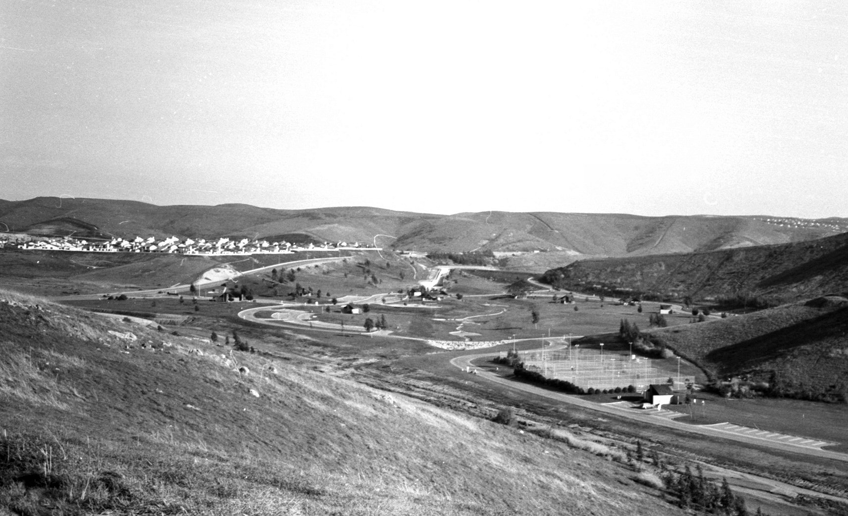
Laguna Niguel is known throughout Orange County for its extensive park and trail system. Over one-third of Laguna Niguel is public open space, a legacy of the original 1959 Gruen plan, and is divided between 31 city parks and 4 county parks. Laguna Niguel's major roads are designated as "scenic highways" within landscape corridors, which includes parks, decorative medians, and grade-separated recreational paths. The 227 acre Laguna Niguel Regional Park is centrally located and includes an extensive trail network, ball courts and Laguna Niguel Lake, a popular fishing and boating venue. Crown Valley Park, visited by about 240,000 people per year, has the city's main public sports facilities. Aliso and Wood Canyons Wilderness Park, which borders Laguna Niguel on the west, consists of over 4000 acre of canyons, grasslands and riparian forests along Aliso Creek. Aliso and Wood Canyons is part of the larger South Coast Wilderness, 22000 acre of preserved open space in the San Joaquin Hills that also includes the larger Laguna Coast Wilderness Park and Crystal Cove State Park outside the city limits. The interconnected city and regional park systems provide a significant refuge for wildlife in an area of Orange County otherwise filled with suburban sprawl.
There are about 80 mi of non-motorized trails in Laguna Niguel for hiking, biking and horseback riding. Major hiking trails include the Aliso Summit trail, which hugs the rim of Aliso Canyon on the western edge of Laguna Niguel, and the Colinas Bluff Trail on the eastern border, overlooking San Juan Capistrano. The Laguna Ridge Trail passes through Badlands County Park, which exposes the namesake geological formations, and approaches the summit of Niguel Hill, the highest point in the city. The paved Salt Creek Trail, a popular Class I bikeway, follows Salt Creek and Niguel Road from Dana Point to Laguna Niguel Regional Park. The Aliso Creek and Oso Creek trails are mostly outside Laguna Niguel, but link the city via greenbelts to other parts of south Orange County. The Aliso Creek Trail is also known as the "Forest to the Sea Trail", as it is planned to connect the Santa Ana Mountains in the Cleveland National Forest to the Pacific Ocean at Laguna Beach.
Notable people
- Josh Allen, quarterback for the Buffalo Bills
- Erik Apple, mixed martial arts fighter
- Gavyn Bailey, singer-songwriter
- Patricia Bates, member of the California State Senate
- Julie Doyle, soccer player
- Daniel L. Fapp, cinematographer
- McKayla Maroney, 2012 Summer Olympics medalist
- Cady McClain, actress, singer and author
- Frank Rosenthal, professional gambler, former casino boss, and reputed Chicago Outfit associate
- Mimi Walters, member of the U.S. House of Representatives
- Rachel Wood, soccer player
Sister cities
- Iraq Al-Qa'im, Iraq, since January 2008
References
References
- "Mayor & City Council". City of Laguna Niguel.
- "2020 U.S. Gazetteer Files". United States Census Bureau.
- {{Cite GNIS. 1660875. Laguna Niguel
- "Laguna Niguel (city) QuickFacts". [[United States Census Bureau]].
- ''2011 Business and Community Directory'', Laguna Niguel Chamber of Commerce, p. 7.
- Bright, William. (1998). "1500 California Place Names: Their Origin and Meaning, A Revised version of1000 California Place Namesby Erwin G. Gudde, Third edition". University of California Press.
- "QuickFacts Orange County, California". United States Census Bureau.
- "US Household Income". Department of Numbers.
- Chianis, Alexia. (November 18, 2013). "The 50 Safest Cities in California". SafeWise.
- "History and Statistics". City of Laguna Niguel.
- "Niguel Shores – A History". Niguel Shores Community Association.
- Hammer, Alexander R.. (October 14, 1969). "AVCO UNIT TO GET SHARE OF LAGUNA; $19-Million Transaction Set by the Two Concerns". The New York Times.
- "Facts, Figures and MNWD's History". Moulton Niguel Water District.
- Yee, Christopher. (February 11, 2015). "Laguna Niguel: Looking back at our heritage". Orange County Register.
- Lemas, Matt. (August 22, 2015). "The Ziggurat: How a white elephant became a county landmark". Orange County Register.
- "Chet Holifield Federal Building, Laguna Niguel, CA". U.S. General Services Administration.
- Pike, Elizabeth. (June 1988). "Annexation". Orange Coast Magazine.
- Olvera, Carlos N.. (January 4, 2014). "It's History: A Rough Road to Cityhood". Dana Point Times.
- Walker, Doris I.. "Laguna Niguel". Included in: Orange County Historical Commission. (2004). ''A Hundred Years of Yesterdays: A Centennial History of the People of Orange County and Their Communities''. pp. 169–172.
- (March 20, 1998). "Laguna Niguel Slide Destroys 7 Dwellings". Los Angeles Times.
- Ourlian, Robert. (April 12, 1998). "Niguel Summit Project Troubled From Start". Los Angeles Times.
- Garvey, Megan. (September 12, 1998). "Niguel Summit Landslide Case Settled". Los Angeles Times.
- Fry, Hannah. (May 12, 2022). "Laguna Niguel residents return to ruins: '30 years' worth of memories' consumed by fire".
- (October 25, 2011). ["County of Orange, California City Boundaries"](http://ocpublicworks.com/civicax/filebank/blobdload.aspx?BlobID=8438}}{{Dead link). Orange County Department of Public Works.
- "Average Weather for Laguna Niguel, CA – Temperature and Precipitation". Weather.com.
- "Decennial Census by Decade".
- "1870 Census of Population – Population of Civil Divisions less than Counties – California – Almeda County to Sutter County".
- "1870 Census of Population – Population of Civil Divisions less than Counties – California – Tehama County to Yuba County".
- "1890 Census of Population – Population of California by Minor Civil Divisions".
- "1900 Census of Population – Population of California by Counties and Minor Civil Divisions".
- "1910 Census of Population – Supplement for California".
- "1920 Census of Population – Number of Inhabitants – California".
- "1930 Census of Population – Number and Distribution of Inhabitants – California".
- "1940 Census of Population – Number of Inhabitants – California".
- "1950 Census of Population – Number of Inhabitants – California".
- "1960 Census of Population – General population Characteristics – California".
- "1970 Census of Population – Number of Inhabitants – California".
- "1980 Census of Population – Number of Inhabitants – California".
- "1990 Census of Population – Population and Housing Unit Counts – California".
- "2000 Census of Population – Population and Housing Unit Counts – California".
- "2010 Census of Population – Population and Housing Unit Counts – California".
- "California 1980 Census".
- "California 1990 Census".
- "P004: Hispanic or Latino, and Not Hispanic or Latino by Race – 2000: DEC Summary File 1 – Laguna Niguel city, California".
- "P2: Hispanic or Latino, and Not Hispanic or Latino by Race – 2010: DEC Redistricting Data (PL 94-171) – Laguna Niguel city, California".
- "P2: Hispanic or Latino, and Not Hispanic or Latino by Race – 2020: DEC Redistricting Data (PL 94-171) – Laguna Niguel city, California".
- "Laguna Niguel city, California; DP1: Profile of General Population and Housing Characteristics – 2020 Census of Population and Housing".
- "Laguna Niguel city, California; P16: Household Type – 2020 Census of Population and Housing".
- "Laguna Niguel city, California; DP03: Selected Economic Characteristics – 2023 ACS 5-Year Estimates Comparison Profiles".
- "2010 Census Interactive Population Search: CA – Laguna Niguel city". U.S. Census Bureau.
- (2020). "Precinct results".
- (November 8, 2016). "Certified statement of the votecast at the Presidential Election".
- (November 6, 2012). "Certified statement of the votecast at the General Election".
- "Orange County Statement of Votes".
- (November 29, 2004). "Orange County Statement of Votes".
- (November 7, 2000). "Orange County Statement of Votes, General Election".
- California. Secretary of State. (March 30, 1968). "Statement of vote". Sacramento, Calif. : The Secretary.
- California. Secretary of State. (March 30, 1968). "Statement of vote". Sacramento, Calif. : The Secretary.
- "Mayor & City Council {{!}} the City of Laguna Niguel Website!".
- "City Hall". City of Laguna Niguel.
- "Final Maps {{!}} California Citizens Redistricting Commission".
- {{Cite GovTrack. CA. 49
- "Experience".
- "CA Secretary of State – Report of Registration – February 10, 2019".
- "Offense Definitions".
- "National Data".
- "St. Anne School". St. Anne School.
- "Fire and Emergency Medical Services". City of Laguna Niguel.
- "Police Services". City of Laguna Niguel.
- "Local Hospitals". City of Laguna Niguel.
- "Utility Companies". City of Laguna Niguel.
- "OC Bus System Map". Orange County Transportation Authority.
- "Laguna Niguel/Mission Viejo Station". Metrolink.
- "Laguna Niguel-Mission Viejo". TrainWeb.
- "Orange County Bikeways Map". Orange County Transportation Authority.
- (August 4, 1992). "Open Space/Parks/Conservation". City of Laguna Niguel.
- "City of Laguna Niguel Parks & Recreational Facilities Map". City of Laguna Niguel.
- "Laguna Niguel Regional Park". OC Parks.
- "Crown Valley Community Park". City of Laguna Niguel.
- "Aliso and Wood Canyons Wilderness Park". OC Parks.
- "Laguna Coast Wilderness Park". OC Parks.
- "Trails-Hiking and Biking". City of Laguna Niguel.
- "Aliso Summit Trail". City of Laguna Niguel.
- "Colinas Bluff Trail". City of Laguna Niguel.
- "Laguna Ridge Trail". City of Laguna Niguel.
- "Julie Doyle".
- "Sister City Directory – SOCAL Sister Cities".
- (October 2, 2014). "Laguna Niguel may sever sister city ties to town run by Islamic State".
This article was imported from Wikipedia and is available under the Creative Commons Attribution-ShareAlike 4.0 License. Content has been adapted to SurfDoc format. Original contributors can be found on the article history page.
Ask Mako anything about Laguna Niguel, California — get instant answers, deeper analysis, and related topics.
Research with MakoFree with your Surf account
Create a free account to save articles, ask Mako questions, and organize your research.
Sign up freeThis content may have been generated or modified by AI. CloudSurf Software LLC is not responsible for the accuracy, completeness, or reliability of AI-generated content. Always verify important information from primary sources.
Report