From Surf Wiki (app.surf) — the open knowledge base
Krishna district
District in Andhra Pradesh, India

District in Andhra Pradesh, India
| Field | Value | |
|---|---|---|
| name | Krishna district | |
| settlement_type | District of Andhra Pradesh | |
| total_type | Total | |
| image_skyline | {{multiple image | |
| border | infobox | |
| total_width | 300 | |
| perrow | 1/2/2/2/1 | |
| image1 | Ghantasala stupa.jpg | |
| caption1 | Ghantasala stupa | |
| image2 | Vijayawada Airport 3 (November 2018).jpg | |
| caption2 | Vijayawada Airport | |
| image3 | Machilipatnam beach at dusk11 09.jpg | |
| caption3 | Machilipatnam beach | |
| mapframe | yes | |
| mapframe-zoom | 8 | |
| mapframe-wikidata | yes | |
| coor_pinpoint | Machilipatnam | |
| subdivision_type | Country | |
| subdivision_name | India | |
| subdivision_type1 | State | |
| subdivision_name1 | Emblem of Andhra Pradesh.svg Andhra Pradesh | |
| subdivision_type2 | Region | |
| subdivision_name2 | Coastal Andhra | |
| parts_type | Administrative divisions | |
| parts | {{bulleted list | |
| established_title | Established | |
| seat_type | Headquarters | |
| seat | Machilipatnam | |
| area_total_km2 | 3773 | |
| area_footnotes | ||
| population_as_of | 2011 | |
| population_total | 17,35,079 | |
| population_footnotes | ||
| population_density_km2 | auto | |
| demographics_type1 | Demographics | |
| demographics1_title1 | Literacy | |
| demographics1_info1 | 73.74% | |
| demographics1_title2 | Sex ratio | |
| demographics1_info2 | 996 | |
| leader_title | District collector and magistrate | |
| leader_name | D. K. Balaji IAS | |
| leader_title1 | Superintendent of Police | |
| leader_name1 | Adnan Nayoom Azmi IPS | |
| leader_title2 | Lok Sabha constituencies | |
| leader_name2 | 01 constituency | |
| leader_title3 | Assembly constituencies | |
| leader_name3 | 07 constituencies | |
| registration_plate | AP-16 (former) | |
| AP–39, AP–40 (from 30 January 2019) | ||
| blank_name_sec1 | Major highways | |
| blank_info_sec1 | NH-65, NH-216 | |
| coordinates | ||
| website |
| mapframe-zoom = 8 | mapframe-wikidata = yes |03 revenue divisions |26 mandals AP–39, AP–40 (from 30 January 2019) Krishna district is a district in the Coastal Andhra region in Indian state of Andhra Pradesh, with Machilipatnam as its administrative headquarters. It is surrounded on the East by Bay of Bengal, West by Guntur, Bapatla and North by Eluru and NTR districts and South again by Bay of Bengal.
Etymology
Krishna District with its district headquarters at Machilipatnam is the coastal district of Andhra Pradesh. It was formerly called as Machilipatnam District. Later it was renamed as Krishna District after the holy river Krishna, by adding certain Taluks of the abolished Guntur district in 1859. Again in 1925, Krishna District was further divided into Krishna and West Godavari Districts. There are no changes in its jurisdiction except some minor changes (in Divi Taluk and Munagala Paragana). Further Again in 2022 Krishna District was divided into Krishna and NTR Districts. It was named after the Krishna River (also known as Krishnaveni in literature) the third longest river in India. The river flows through the district before it empties itself into Bay of Bengal, near Hamsaladevi village.
History
The history of this region dates back to the 2nd century BCE. The area was ruled by the Satavahanas (230 BCAD 227); Pallavas (AD 340AD 500), Chalukyas (AD 6151070 AD) and later by Cholas, Kakatiyas, Musunuri Nayaks, Reddy dynasty and Gajapati kings of Odisha.
Satavahana period (230 BCAD 227): The Satavahanas ruled this region with headquarters at Srikakulam, at present a village in Ghantasala mandal of the district. Prominent rulers during this period were Srimukha (founder), Gotamiputra Satakarni and Yajnasri Satakarni (last Satavahana king). The Satavahanas imparted more stability and security to the life of the people of the region for more than four centuries.
Pallava Kingdom (AD 340AD 500), spread over from Krishna river to Tungabhadra, including Amaravati in the East, Bellary in the West and Kancheepuram in the South with capital cities at Venginagar near Eluru and Pithapuram, both in Vengidesa. Bruhitpalayanas, the contemporaries of Pallavas ruled the district with Koduru as their capital. Vishnukundinas (AD 6th century) rulers created cave temples at Mogalrajapuram (now in Vijayawada) and Undavalli.
Eastern chalukyas (AD 615AD 1070), the entire Andhra country was under the control of a single ruler under their reign. The Eastern Chalukyas were credited with the excavations of the cave temple at Undavalli, rock cut shrines, and Shiva temples.
Cholas ruled this region with their capital located at Rajamahendri. It was during Rajaraja Narendra's reign that Nannayya Bhattu translated the Mahabharata into Telugu. Kakatiyas ruled this region up to the early 14th century with Orugallu as their capital. They are followed by Musunuri Nayaks who rebelled against Delhi sultanate and won. Musunuri Nayaks constructed various forts in South India including Hampi and ruled many states of India independently. Reddy dynasty a subordinate of Musunuri Kapaya Naidu established himself in the hill fort of Kondaveedu. The Kondaveedu Reddis were great patrons of Telugu literature. The poet Srinadha and his brother-in-law Bammera Pothana flourished at his court.
Gajapathis of Odisha: Kapileswarapuram named in honour of Kapileswara Gajapathi now in Pamidimukkala mandal exists to this day. He was succeeded by Vidyadhara Gajapathi who built Vidyadharapuram (now in Vijayawada) and constructed a reservoir at Kondapalli. Krishnadevaraya of Vijayanagara empire conquered this region in the early 16th century. Then this region became part of the Kingdom of Golconda in 1550 which was founded by Sultan Quli Qutub Shah as part of the Qutb Shahis in 1512. Abu-l-Hussain Shah known as Tanisha was the last ruler of Qutab Shahi dynasty.
Medieval period
Aurangazeb ruled this region as part of the province of Golconda. Asaf Jah who was appointed as subedar or viceroy of the Deccan in AD 1713 with the title of Nizam-ul-Mulk. The province of Golconda comprised five Nawabs’ charges viz. Arcot, Cuddapah, Kurnool, Rajahmundry and Chicacole (Srikakulam). This region was part of the Nawab of Rajahmundry.
The British: In the year 1611 the English founded their settlement at Masulipatnam which remained their headquarters until they finally moved to Madras in 1641. The Dutch and French also had settlements at Masulipatnam. Upon the death of the old Nizam-ul-Mulk in June 1748, his heirs strove for the succession with the support of the English and the French. When Nizam Ali Khan was proclaimed ruler of Golconda in 1761, the British secured at first the divisions of Masulipatnam, Nizampatnam and part of Kondaveedu and later the entire Circars. At first the district was administered by a chief and council at Masulipatnam but in 1794 Collectors, directly responsible to the Board of Revenue, were appointed at Masulipatnam.
The Krishna District was formed from the district of Rajahmundry in 1859, when it also included Guntur and West Godavari districts of united Andhra Pradesh. Guntur district was created from Krishna district in 1904. Similarly West Godavari district was created from Krishna district in 1925.
After 1947
Krishna District had 10 Talukas in 1971. In 1978 they were increased to 21 Talukas. In 1985, Mandal system was created and 50 mandals were formed in the district. In 2022 Krishna district was divided into Krishna and NTR districts.
Historical demographics
census of India, the district had a population of 4,517,398 with a density of 518 persons per km2. The total population constitute, 2,267,375 males and 2,250,023 females –a ratio of 992 females per 1000 males. The total urban population is (40.81%). There are literates with a literacy rate of 73.74%.
Geography
Krishna district is surrounded on the east by Bay of Bengal, west by Guntur and Bapatla districts and north by Eluru and NTR districts and south by Bay of Bengal. The Krishna district occupies an area of 3775 km2. It has a total coastline of 88 km.
Flora and fauna
The forest occupies only 9 percent of the total undivided district area. However, it contains Reserved Forest areas in Nandigama, Vijayawada, Tiruvuru, Nuzvid, Gannavaram, Machilipatnam and Divi Seema Talukas. A type of light wood known as ‘Ponuku’ (Gyrocapus Jacquini) is found in the Kondapalli hills. The wood is used for the manufacture of the well known Kondpalli toys. The most noticeable trees are pterocarpus, Terminalia, Anogeissus and Logustroeinai and Casuarina.
Panthers, dholes, jungle cats, foxes, bears and other carnivorous mammalian fauna are found here. Deer, spotted deer sambar, blackbuck and other herbivorous animals are found in the inland forests. The district has a large number of Murrah buffaloes and cows.
Climate
The climatic conditions of the district consist of extremely hot summers and moderately hot winters and may be classified as tropical. The period starting from April to June is the hottest. The annual rainfall in the region is about 1047.68 mm and 66% of it is contributed to by the Southwest monsoon.
Black Cotton (57.6 percent), Sand clay loams (22.3 percent), Red loams (19.4 percent), and sandy soils account for balance 0.7% in the district.
Demographics
After reorganization the district had a population of 17,35,079, of which 482,513 (27.81%) live in urban areas. Krishna district has a sex ratio of 996 females per 1000 males and a literacy rate of 73.75%. Scheduled Castes and Scheduled Tribes make up 346,989 (20.00%) and 37,716 (2.17%) of the population respectively.
Based on the 2011 census, 93.30% of the population spoke Telugu and 5.97% Urdu as their first language.
Administrative divisions
Politics
The parliamentary constituency is Machilipatnam Lok Sabha constituency
It comprises the following legislative assembly segments:
| Constituency number | Name | Reserved for | |
|---|---|---|---|
| (SC/ST/None) | Parliament | ||
| 71 | Gannavaram | None | Machilipatnam |
| 72 | Gudivada | None | |
| 74 | Pedana | None | |
| 75 | Machilipatnam | Nona | |
| 76 | Avanigadda | None | |
| 77 | Pamarru | SC | |
| 78 | Penamaluru | None |
The district is divided into 3 revenue divisions: Gudivada, Machilipatnam and Vuyyuru, which are further subdivided into a total of 26 mandals, each headed by a sub-collector.
Mandals
The list of 26 mandals in Krishna district, divided into 3 revenue divisions, is given below.
- Gudivada revenue division
- Bapulapadu
- Gannavaram
- Gudivada
- Gudlavalleru
- Nandivada
- Pedaparupudi
- Unguturu
- Machilipatnam revenue division
- Avanigadda
- Bantumilli
- Challapalli
- Ghantasala
- Guduru
- Koduru
- Kruthivennu
- Machilipatnam North
- Machilipatnam South
- Mopidevi
- Nagayalanka
- Pedana
- Vuyyuru revenue division
- Kankipadu
- Movva
- Pamarru
- Pamidimukkala
- Penamaluru
- Thotlavalluru
- Vuyyuru
Cities and Towns
There are one municipal corporation and four municipalities in the district.
| Ciy/Town | Civil status | Revenue Division | Population |
|---|---|---|---|
| Machilipatnam | Municipal Corporation | Machilipatnam | 169,892 |
| Gudivada | Municipality Grade – Special | Gudivada | 118,167 |
| Tadigadapa | Municipality Grade – Special | Vuyyuru | 126,190 |
| Vuyyuru | Nagar Panchayat | Vuyyuru | 49,521 |
| Pedana | Municipality Grade – 3 | Machilipatnam | 30,721 |
Source:
Villages
- Gudapadu
- Gurazada
- Kallamvaripalem
- Majeru
- Pedayerukapadu
- Vadali
- Zamidintakurru
Economy
Agriculture is the main stay of economy. Paddy is the main food crop cultivated. Based on 2019–20 data, the gross cropped area of the district was 3.76 Lakh Hectares of which gross irrigated area was 2.42 lakh Hectares. Other products produced include sugarcane, mango, tomato, milk, meat and fisheries.
Transport
Road
NH 65 from Pune to Machilipatnam, NH 165 from Pamarru to Palakollu, NH 216 from Ongole to Kathipudi pass through the district.
Rail
There exists 97 km of rail network in the district. Gudivada Junction railway station and Machilipatnam railway station are prominent railway stations in the district. Nearest major railway station is Vijayawada Junction railway station at a distance of 80Km from Machilipatnam by train.
Water
The Machilipatnam Port is currently under construction. The Port will have an initial cargo capacity of 35 million tonnes (35 MMTPA), through four berths-three general cargo berths and one coal terminal. The Port is scheduled to be completed in two years. In the future, the capacity of the four-berth deep water port will be increased to 116 million tonnes (116 MMTPA) as the cargo traffic increases gradually.
Air
Krishna district is served by Vijayawada International airport located in Gannavaram at a distance of 67.9 km from Machilipatnam.
Education
Dr.Gururaju Government Homoeo Medical college and Regional Research Institute for Homoeopathy are located in Gudivada. Krishna University is located in Machilipatnam.
Culture

The culture of Krishna district is mostly traditional in rural places and moderately modern in Gudivada and Machilipatnam. It is also famous as the birthplace for Indian classical dance named Kuchipudi. The dialect of Telugu spoken in Krishna is widely considered to be the standard form of Telugu.
Sports
Kabbadi is the most popular sport, followed by cricket, volleyball, badminton, basketball and tennis.
NTR Stadium is the main sports venue in Gudivada. It is used for several sports, like athletics, volleyball, cricket practice, kho kho, kabaddi, badminton, tennis and basketball. It is also the stadium for Krishna District Cricket Association.
Tourism
There are several places of tourist interest in the district. Some of them are given below.
- Kolleru lake (Kaikaluru Mandal): largest freshwater lake
- Manginapudi beach: Natural beach
- Movva: Sri Movva Venugopala Swamy temple. Kshetrayya is said to have composed his famous lyrics here.
- Kuchipudi:the birth place of Siddhendra Yogi, the originator of the Kuchpudi dance
- Ghantasala: once upon a time, a port and a halting place for Buddhist pilgrims and merchants travelling from Kalinga to Ceylone. Hindu and Buddhist Sculptures can be seen here
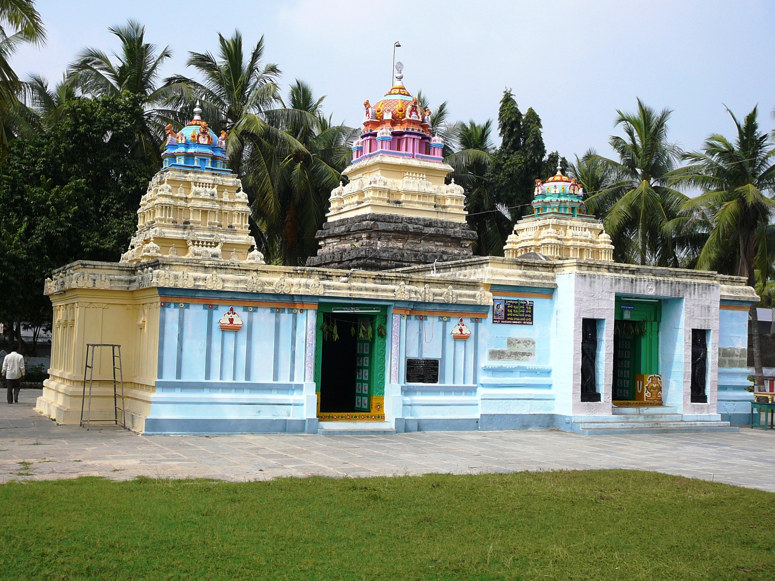
- Srikakulam (Ghantasala Mandal): the historical capital of Andhra Empire of Goutamiputra Satakarni (AD 102–123). This is famous for the temple of Andhra Mahavishnu
- Hamsaladeevi(Koduru Mandal): river Krishna drains into the Bay of Bengal at this place
- Gudivada: famous for Jain temple of Parswandha Swamy
Notable people
- Kakarla Subba Rao was born in Pedamuttevi of Movva mandal and became the first director of Nizam's Institute of Medical Sciences, Hyderabad
- Tripuraneni Ramaswamy born in Angaluru of Gudlavalleru mandal was a poet and social reformer
- Kasinadhuni Nageswara Rao was born in Pesaramilli village of Gudlavalleu mandal, was the founder of (Andhra Patrika, first telugu newspaper and also company which manufactures ayurvedic pain balm called Amrutanjan.
- Pingali Venkayya was born in Bhatlapenumarru,near Machilipatnam, was a freedom fighter and was known as designer of Indian National Flag.
- Cottari Kanakaiya Nayudu was born in Machilipatnam. He served as the first-ever captain of the Indian national cricket team.
- N. T. Rama Rao popularly referred to by his initials NTR, was an Indian actor, filmmaker and a Chief Minister of Andhra Pradesh. He was born in Nimmakuru of Gudivada mandal.
- Narla Venkateswara Rao was a Telugu language writer, journalist and politician from Andhra Pradesh in India. He was Rajya Sabha member twice from 3 April 1958 to 2 April 1970, and wrote a satakam in Telugu along with several other books.
- Narla Tata Rao was a prominent person in the power sector of India and a former chairman of the Andhra Pradesh State Electricity Board. He was born in Kavutaram
- Patcha Ramachandra Rao was a distinguished metallurgist and administrator. He was born in Kavutaram in Krishna District
- Kaikala Satyanarayana was an Indian actor, producer, director, and politician who predominantly worked in Telugu cinema. He was born in Kavutaram village in Krishna district.
References
Books
References
- "District Census Hand Book – Krishna". [[Registrar General and Census Commissioner of India]].
- "Krishna District, Government of Andhra Pradesh {{!}} India {{!}} India".
- (31 January 2019). "New 'AP 39' code to register vehicles in Andhra Pradesh launched". The New Indian Express.
- "NEW_District Profile {{!}} Krishna District, Government of Andhra Pradesh {{!}} India".
- "Krishna District, Government of Andhra Pradesh | India".
- "History". Krishna district website.
- {{EB1911
- "Rank of Districts in Andhra Pradesh according to Composite Index".
- "District Census Handbook – Guntur". The Registrar General & Census Commissioner.
- (5 April 2022). "Andhra Pradesh's 13 New Districts: Here's All About Them – From Planning to Formation {{!}} Explained".
- "District Census Hand Book – Krishna". [[Registrar General and Census Commissioner of India]].
- "Decadal Variation In Population 1901–2011".
- "Flora and Fauna of Krishna district". AP forest department.
- (2011). "Population by Religion – Andhra Pradesh". [[Registrar General and Census Commissioner of India]].
- "Table C-16 Population by Mother Tongue: Andhra Pradesh". [[Registrar General and Census Commissioner of India]].
- "Delimitation of Parliamentary and Assembly Constituencies Order, 2008". The Election Commission of India.
- "District profile". Krishna District Official Website.
- "Krishna district profile – AP Government – 4 April 2022".
- (6 January 2021). "Andhra government notifies five new nagar panchayats, rejigs 13 civic bodies".
- "Wayback Machine".
- "District Census Handbook - Krishna".
- "RAJIV YUVASHAKTHI SELF EMPLOYMENT SCHEME - ABSTRACT OF PHYSICAL ACHIEVEMENT". [[Government of Andhra Pradesh]].
- "Vadali Pin Code on NativePlanet".
- (22 May 2023). "Andhra CM Jagan Reddy launches construction work of Rs 5,156 crore Machilipatnam port".
- (22 May 2023). "Andhra CM Jagan Reddy Launches Construction Work of Rs 5,156 Crore Machilipatnam Port".
- "NTR Amaravati International Airport {{!}} Airports Authority of India".
- "How to reach".
- "District profile". National Informatics Centre.
- (2 June 2007). "NTR Stadium all set to become more sporty". The Hindu.
This article was imported from Wikipedia and is available under the Creative Commons Attribution-ShareAlike 4.0 License. Content has been adapted to SurfDoc format. Original contributors can be found on the article history page.
Ask Mako anything about Krishna district — get instant answers, deeper analysis, and related topics.
Research with MakoFree with your Surf account
Create a free account to save articles, ask Mako questions, and organize your research.
Sign up freeThis content may have been generated or modified by AI. CloudSurf Software LLC is not responsible for the accuracy, completeness, or reliability of AI-generated content. Always verify important information from primary sources.
Report