From Surf Wiki (app.surf) — the open knowledge base
Klamath Falls, Oregon

| Field | Value |
|---|---|
| name | Klamath Falls, Oregon |
| settlement_type | City |
| nickname | Oregon's City of Sunshine |
| motto | "Working For You" |
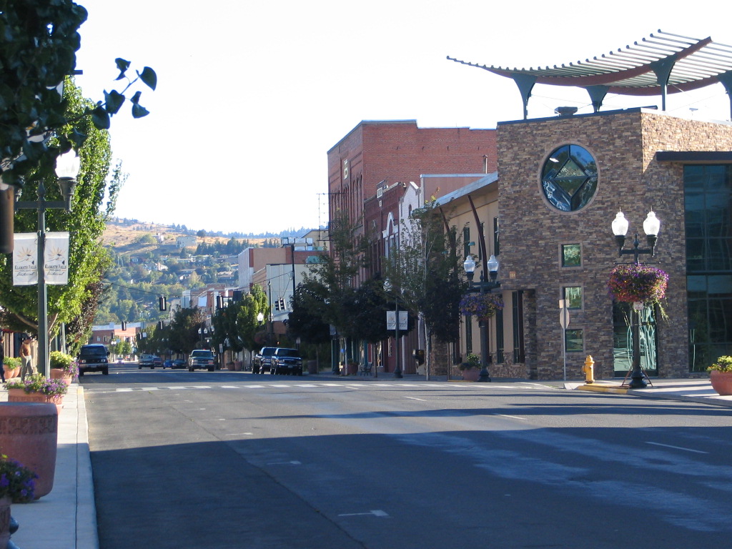
| image_skyline | Klamath Falls (2022).jpg |
| image_map | Klamath_County_Oregon_Incorporated_and_Unincorporated_areas_Klamath_Falls_Highlighted.svg |
| map_caption | Location in Oregon |
| pushpin_label | Klamath Falls |
| pushpin_label_position | top |
| pushpin_map | Oregon#USA |
| pushpin_map_caption | Location in the United States |
| subdivision_type | Country |
| subdivision_name | United States |
| subdivision_type1 | State |
| subdivision_name1 | Oregon |
| subdivision_type2 | County |
| subdivision_name2 | Klamath |
| leader_title | Mayor |
| established_title | Incorporated |
| established_date | 1905 |
| unit_pref | Imperial |
| area_footnotes | |
| area_total_km2 | 54.27 |
| area_total_sq_mi | 20.96 |
| area_land_sq_mi | 20.08 |
| area_land_km2 | 52.01 |
| area_water_sq_mi | 0.88 |
| area_water_km2 | 2.27 |
| population_as_of | 2020 |
| population_footnotes | |
| population_total | 21813 |
| population_density_km2 | 419.43 |
| population_density_sq_mi | 1086.30 |
| timezone | Pacific |
| utc_offset | −8 |
| timezone_DST | Pacific |
| utc_offset_DST | −7 |
| coordinates | |
| elevation_footnotes | |
| elevation_ft | 4095 |
| postal_code_type | ZIP codes |
| postal_code | 97601, 97603 |
| area_code | 541 |
| blank_name | FIPS code |
| blank_info | 41-39700 |
| blank1_name | GNIS feature ID |
| blank1_info | 2411554 |
| website | City Website |
|
Klamath Falls ( ) is a city in and the county seat of Klamath County, Oregon, United States. The city was originally called Linkville when George Nurse founded the town in 1867. It was named after the Link River, on whose falls the city was sited. The name was changed to Klamath Falls in 1893. The population was 21,813 at the 2020 census. With its suburb Altamont, a census-designated place, the combined population of the towns is 42,046 residents. The city is on the southeastern shore of the Upper Klamath Lake, at the foothills of the Cascade Range, and is home to the Oregon Institute of Technology.
Logging was the first major industry of Klamath Falls.
History
Etymology
At its founding in 1867, Klamath Falls was named Linkville. The name was changed to Klamath Falls in 1892–93. The name Klamath () may be a variation of the descriptive native for "people" (in Chinookan) used by the Indigenous peoples of the Northwest Plateau to refer to the region.
History
The Klamath and Modoc peoples were the first known inhabitants of the area. The Modocs' homeland is about 20 mi south of Klamath Falls, but when they were forced onto a reservation with their adversaries, the Klamath, a rebellion ensued and they hid out in nearby lava beds. This led to the Modoc War of 1872–1873, which was a hugely expensive campaign for the US Cavalry, costing an estimated $500,000, the equivalent of over $8 million in 2000. 17 Indigenous people and 83 Americans were killed.
The Applegate Trail, which passes through the lower Klamath area, was blazed in 1846 from west to east in an attempt to provide a safer route for emigrants on the Oregon Trail. The first non-Indigenous settler is considered to have been Wallace Baldwin, a 19-year-old civilian who drove fifty head of horses in the valley in 1852. In 1867, George Nurse, named the small settlement "Linkville", because of Link River north of Lake Ewauna.
The Klamath Reclamation Project began in 1906 to drain marshland and move water to allow for agriculture. With the building of the main "A" Canal, water was first made available on May 22, 1907. Veterans of World War I and World War II were given homesteading opportunities on the reclaimed land.
During World War II, a Japanese-American internment camp, the Tule Lake War Relocation Center, was located in nearby Newell, California, and a satellite of the Camp White, Oregon, POW camp was located just on the Oregon–California border near the town of Tulelake, California. In May 1945, about 30 mi east of Klamath Falls, (near Bly, Oregon) a Japanese Fu-Go balloon bomb killed a woman and five children on a church outing. This is said to be the only Japanese-inflicted casualty on the US mainland during the war.
Timber harvesting through the use of railroad was extensive in Klamath County for the first few decades of the 20th century. With the arrival of the Southern Pacific Transportation Company in 1909, Klamath Falls grew quickly from a few hundred to several thousand. Dozens of lumber mills cut fir and pine lumber, and the industry flourished until the late 1980s when the northern spotted owl and other endangered species were driving forces in changing western forest policy.
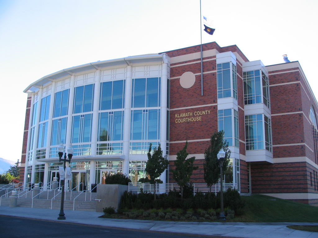
On September 20, 1993, a series of earthquakes struck near Klamath Falls. Many downtown buildings, including the county courthouse and the former Sacred Heart Academy and Convent, were damaged or destroyed; further, two people were killed.
Water rights controversy
The city made national headlines in 2001 when a court decision was made to shut off Klamath Project irrigation water on April 6, 2001 because of Endangered Species Act requirements. The Lost River sucker and shortnose sucker were listed on the Federal Endangered Species List in 1988, and when drought struck in 2001, a panel of scientists stated that further diversion of water for agriculture would be detrimental to these species, which reside in the Upper Klamath Lake, as well as to the protected Coho salmon which spawn in the Klamath River. Many protests by farmers and citizens culminated in a "Bucket Brigade" on Main Street May 7, 2001, in Klamath Falls. The event was attended by 18,000 farmers, ranchers, citizens, and politicians. Two giant bucket monuments have since been constructed and erected in town to commemorate the event. Such universal criticism resulted in a new plan implemented in early 2002 to resume irrigation to farmers.
Low river flows in the Klamath and Trinity rivers and high temperatures led to a mass die-off of at least 33,000 salmon in 2002. Dwindling salmon numbers have practically shut down the fishing industry in the region and caused over $60m in disaster aid being given to fishermen to offset losses. 90% of Trinity River water is diverted for California agriculture. As much as 90% of the Trinity's water, which would otherwise flow into the Klamath and out to sea, instead rushes south toward California's thirsty center.
According to a National Academy of Sciences report of October 22, 2003, limiting irrigation water did little if anything to help endangered fish and may have hurt the populations. A contrary report has criticized the National Academy of Sciences report. The Chiloquin Dam has been removed to help improve sucker spawning habitat.
In 2021 tensions between locals and the Federal Government led two local farmers to purchase land at the headgates in Klamath Falls, OR. These farmers have ties to the Ammon Bundy People's Rights organization and are preparing for a potential standoff situation with the government.
Geothermal heating
Klamath Falls is located in a known geothermal resource area. Geothermal power has been used directly for geothermal heating in the area since the early 1900s. A downtown district heating system was constructed in 1981 and extended in 1982. There was public opposition to the scheme. Many homes were heated by private geothermal wells, and owners were concerned that the city system could lower the water level and/or reduce water temperatures. System operation was delayed until 1984 following an aquifer study. Full operational testing showed no negative impact on the private wells. The system was shut down again in 1986 after multiple distribution piping failures were discovered. By 1991, the distribution piping had been reconstructed, and the system was again operating. The system has been expanded since then, and according to the Oregon Institute of Technology, the operation is "at or near operational break-even". The system is used to provide direct heat for homes, city schools, greenhouses, government and commercial buildings, geothermally heated snowmelt systems for sidewalks and roads, and process heat for the wastewater treatment plant.
Air quality
According to the Oregon Department of Environmental Quality in 2012, significant efforts are being made to improve the air quality in the Klamath Basin.
Geography
According to the United States Census Bureau, the city has a total area of 20.66 sqmi, of which 19.81 sqmi is land and 0.85 sqmi is water. The elevation is 4094 ft.
Klamath Falls has a high desert landscape. The older part of the city is located above natural geothermal springs. These have been used for the heating of homes and streets, primarily in the downtown area.
Climate
Klamath Falls is known as "Oregon's City of Sunshine" because the area enjoys 300 days of sun per year. The Klamath Falls area is a high desert and features a climate with cold, snowy winters along with hot summer afternoons and cool summer nights. Under the Köppen climate classification the city's climate type is Csb, often described as warm summer Mediterranean. Using the 0 C isotherm preferred by some climatologists, Klamath Falls is a Dsb climate, often described as warm summer humid continental.
Typical of its region, Klamath Falls has a dry season in summertime, with the greatest precipitation occurring in wintertime, a substantial proportion falling as snow. Although it is not arid or semi-arid, total precipitation is still low, at 13.41 in per year, due to Klamath Falls being in the rain shadow of the Cascade Mountains to the west. The wettest "rain year" has been from July 1955 to June 1956 with 21.78 in and the driest from July 1954 to June 1955 with 6.09 in. Annual snowfall averages around 36.5 in, with the most on record being 100.6 in between July 1955 and June 1956; in contrast, only a trace of snow fell between July 1991 and June 1992. The maximum snow depth has been 36 in on January 3, 1901.
The all-time record high is 105 F, set on July 27, 1911, and the all-time record low is -24 F, set on January 15, 1888. The freeze-free season averages around 120 days, with the first freeze in a typical year being on September 21, and the last freeze being on June 1. On average 18.2 days per year reach 90 F or higher, and 1.9 nights per year reach temperatures of 0 F or lower.
| Jan record high F = 78 | Feb record high F = 69 | Mar record high F = 77 | Apr record high F = 87 | May record high F = 98 | Jun record high F = 103 | Jul record high F = 103 | Aug record high F = 104 | Sep record high F = 103 | Oct record high F = 92 | Nov record high F = 74 | Dec record high F = 63 | Jan avg record high F = 53.1 | Feb avg record high F = 58.4 | Mar avg record high F = 67.8 | Apr avg record high F = 75.6 | May avg record high F = 83.4 | Jun avg record high F = 90.7 | Jul avg record high F = 96.3 | Aug avg record high F = 95.1 | Sep avg record high F = 89.5 | Oct avg record high F = 78.8 | Nov avg record high F = 65.1 | Dec avg record high F = 51.9 | year avg record high F = 97.6 | Jan avg record low F = 5.7 | Feb avg record low F = 10.8 | Mar avg record low F = 16.1 | Apr avg record low F = 19.5 | May avg record low F = 24.8 | Jun avg record low F = 30.9 | Jul avg record low F = 39.1 | Aug avg record low F = 38.4 | Sep avg record low F = 29.3 | Oct avg record low F = 19.8 | Nov avg record low F = 11.1 | Dec avg record low F = 6.2 | year avg record low F = -1.0 | Jan record low F = -25 | Feb record low F = -14 | Mar record low F = -5 | Apr record low F = 10 | May record low F = 17 | Jun record low F = 23 | Jul record low F = 22 | Aug record low F = 28 | Sep record low F = 20 | Oct record low F = 8 | Nov record low F = -7 | Dec record low F = -20 |access-date = May 5, 2023 |access-date = May 5, 2023 |access-date = May 5, 2023
Demographics
U.S. Decennial Census 2018 Estimate
| align-fn = center
2020 census
As of the 2020 census, Klamath Falls had a population of 21,813. The median age was 36.1 years. 21.3% of residents were under the age of 18 and 17.5% of residents were 65 years of age or older. For every 100 females there were 98.3 males, and for every 100 females age 18 and over there were 97.7 males age 18 and over.
95.7% of residents lived in urban areas, while 4.3% lived in rural areas.
There were 9,089 households in Klamath Falls, of which 27.1% had children under the age of 18 living in them. Of all households, 34.9% were married-couple households, 23.8% were households with a male householder and no spouse or partner present, and 30.9% were households with a female householder and no spouse or partner present. About 35.1% of all households were made up of individuals and 14.9% had someone living alone who was 65 years of age or older.
There were 9,979 housing units, of which 8.9% were vacant. Among occupied housing units, 47.3% were owner-occupied and 52.7% were renter-occupied. The homeowner vacancy rate was 2.2% and the rental vacancy rate was 7.4%.
| Race | Number | Percent |
|---|---|---|
| White | 16,666 | 76.4% |
| Black or African American | 275 | 1.3% |
| American Indian and Alaska Native | 939 | 4.3% |
| Asian | 391 | 1.8% |
| Native Hawaiian and Other Pacific Islander | 42 | 0.2% |
| Some other race | 1,137 | 5.2% |
| Two or more races | 2,363 | 10.8% |
| Hispanic or Latino (of any race) | 3,054 | 14.0% |
2010 census
_(klaDA0034b).jpg)
As of the census of 2010, there were 20,840 people, 8,542 households and 4,876 families residing in the city. The immediate neighboring Census Designated Place of Altamont, Oregon had a population of 19,257. The population density was 1052.0 PD/sqmi. There were 9,595 housing units at an average density of 484.4 /sqmi. The racial makeup of the city was 83.4% White, 1.0% African American, 4.3% Native American, 1.6% Asian, 0.1% Pacific Islander, 4.5% from other races, and 5.0% from two or more races. Hispanic or Latino of any race were 11.8% of the population.
There were 8,542 households, of which 30.4% had children under the age of 18 living with them, 38.5% were married couples living together, 13.0% had a female householder with no husband present, 5.6% had a male householder with no wife present, and 42.9% were non-families. 32.9% of all households were made up of individuals, and 11.3% had someone living alone who was 65 years of age or older. The average household size was 2.35 and the average family size was 2.98.
The median age in the city was 33.6 years. 23.6% of residents were under the age of 18; 14.6% were between the ages of 18 and 24; 25.2% were from 25 to 44; 24.1% were from 45 to 64; and 12.3% were 65 years of age or older. The gender makeup of the city was 49.3% male and 50.7% female.

2000 census
As of the census of 2000, there were 19,462 people, 7,916 households, and 4,670 families residing in the city. The population density was 1089.5 /sqmi. There were 8,722 housing units at an average density of 488.3 /sqmi.
The racial makeup of the city was:
- 85.12% White
- 1.02% African American
- 4.44% Native American
- 1.32% Asian
- 0.13% Pacific Islander
- 4.15% from other races
- 3.83% from two or more races
9.32% of the population are Hispanic or Latino of any race.
There were 7,916 households, out of which:
- 30.0% had children under the age of 18 living with them
- 42.2% were married couples living together
- 11.7% had a female householder with no husband present
- 41.0% were non-families
- 32.4% of all households were made up of individuals
- 11.9% had someone living alone who was 65 years of age or older
The average household size was 2.36 and the average family size was 2.99.
The age distribution was:
- 25.5% under the age of 18
- 13.1% from 18 to 24
- 27.2% from 25 to 44
- 21.5% from 45 to 64
- 12.8% who were 65 years of age or older
The median age was 33 years. For every 100 females, there were 101.9 males. For every 100 females age 18 and over, there were 100.1 males.
The median income for a household in the city was $28,498, and the median income for a family was $37,021. Males had a median income of $31,567 versus $22,313 for females. The per capita income for the city was $16,710. About 21.9% of the population and 16.2% of families were below the poverty line, including 26.8% of those under age 18 and 9.5% of those 65 or over.
Parks and recreation

Moore Park features a multi-use trail network.
OC&E Woods Line State Trail is a rail trail in the city and the longest state park in Oregon.
Veterans Memorial Park is located downtown along Lake Ewauna.
Klamath Falls is located on the Pacific Flyway, and waterfowl, raptors, and American white pelican have been seen.
Government
Klamath Falls is a home rule municipality under the Oregon Constitution, and has been governed by a council–manager form of government since its citizens voted to adopt the current charter in 1972. The city council, which is nonpartisan, has five members, each elected from one of the five wards. They serve four-year terms, which are staggered so that either two or three seats are up for election every two years. The mayor, who is nonpartisan and serves a term of four years, presides over all city council meetings. This official appoints committees, can veto any ordinance not passed with the affirmative vote of at least four council members, and casts tie-breaking votes. The city manager, however, is the administrative head of the city. This official is appointed by the council and serves an indefinite term at the council's pleasure. The municipal judge and the city attorney are appointed on the same basis. Todd Kellstrom was mayor from 1992 to 2016. Carol Westfall is the current mayor, having beaten Kellstrom in the 2016 election. Jonathan Teichert is the current city manager.
For the purpose of representation in the state legislature, Klamath Falls is located in the 28th Senate district, represented by Republican Dennis Linthicum, and in the 56th House district, represented by Republican E. Werner Reschke. Federally, Klamath Falls is located in Oregon's 2nd congressional district, which has a Cook Partisan Voting Index of R+10 and is represented by Republican Cliff Bentz.
Education

Colleges and universities
- College of Cosmetology
- Klamath Community College
- Oregon Institute of Technology
Public schools
Klamath Falls and the surrounding area are served by Klamath County School District and the Klamath Falls City School District.
Media
Radio stations
FM stations
- 88.5 FM - KLMF JPR classics & news service
- 88.9 FM - KJKF Contemporary Christian Music K-LOVE
- 89.5 FM - KTEC College Freeform Oregon Institute of Technology
- 89.9 FM - K210BY Christian
- 90.5 FM - K213AI Jefferson Public Radio news & information service
- 90.9 FM - KSKF Jefferson Public Radio rhythm & news service
- 91.5 FM - K218EX Spanish Christian
- 91.9 FM - K220BJ Jefferson Public Radio news & information service
- 92.5 FM - KLAD-FM Country
- 92.9 FM - K225CW News/Talk
- 93.3 FM - K227CU Rock
- 94.9 FM - KAGO-FM Rock
- 96.5 FM - KFLS-FM Country Tulelake
- 97.1 FM - K246BB Christian Keno
- 97.5 FM - KYSF Christian Worship Music Air 1 Bonanza
- 98.5 FM - KHIC Top 40 Keno
- 99.5 FM - KFXX-FM Classic Hits
- 99.9 FM - K260AK Christian
- 100.7 FM - KLKF Contemporary Christian Music K-LOVE Malin
- 101.3 FM - K267CF Christian
- 102.5 FM - K273DF News/Talk
- 104.3 FM - K282CB Sports
- 104.7 FM - KFEG Classic Rock
- 105.5 FM - KKKJ Top 40 Merrill
- 106.5 FM - K293CQ Regional Mexican Altamont
- 106.9 FM - KKRB Adult Contemporary
AM stations
Television stations
- Channel 2 KOTI - NBC
- Channel 15 K15KE-D KTVL - CBS
- Channel 22 KFTS - PBS
- Channel 30 K31NH KBLN-TV - 3ABN
- Channel 31 KDKF - ABC
- Channel 48 K26NB-D KFBI-LD MNT
Newspapers
- Herald and News
- Klamath Republican (defunct)
Infrastructure
Transportation

Amtrak, the national passenger rail system, serves Klamath Falls station, located on a route originally built by the Southern Pacific Railroad – operating its Coast Starlight daily in both directions between Seattle, Washington and Los Angeles, California.
Fixed-route public transit service is operated by Basin Transit Service, a special service district with an elected board. Oregon POINT connects Klamath Falls with Medford and Brookings, Oregon. Sage Stage provides weekly service to Alturas, California.
The Klamath Falls airport is the location of the Kingsley Field Air National Guard Base; the airport and base are 6 mi south of downtown. The nearest commercial airport is Rogue Valley International-Medford Airport, which is 78 miles (126 km) away.
Military airbase
Kingsley Field Air National Guard Base, also known as Crater Lake–Klamath Regional Airport, was established in 1928. It is home to the 270th Air Traffic Control Squadron, 173rd Fighter Wing of the Oregon Air National Guard, stationed at Kingsley Field airbase. The squadron currently flies F-15 C/D variants. It has the second-largest runway in Oregon (10,301 by wide) and was listed as a backup landing strip for the Space Shuttle. It is normal to hear the aircraft throughout Klamath Falls during daylight hours.
Notable people
·Only people who already have a Wikipedia article may appear here. This establishes notability. ·The biographical article must mention how they are associated with Klamath Falls, whether born, raised, or residing. ·The fact of their association should have a reliable source cited, unless it is well-known. ·alphabetical by last name please ·All others will be deleted without further explanation
- Sharron Angle (born 1949), Nevada politician
- Brenda Bakke (born 1963), actress
- Dennis Bennett (1939–2012), Major League Baseball player
- Harry D. Boivin (1904–1999), speaker of the Oregon House of Representatives
- Ernest C. Brace (1931–2014), pilot
- Jeff Bronkey (born 1965), Major League Baseball player
- Seth Brown (born 1992), Major League Baseball player for the Oakland Athletics
- Don Pedro Colley (1938–2017), actor
- Ian Dobson (born 1982), Team Run Eugene coach, and retired Olympic 5k runner
- Christine Drazan (born 1972), minority leader of the Oregon House of Representatives
- Chris Eyre (born 1968), Sundance Film Festival award winner
- Helen J. Frye (1930–2011), Federal District Court judge
- Chad Gray (born 1971), musician
- Rosie Hamlin (1945–2017), singer-songwriter
- Ralph Hill (1908–1994), Olympic 5000 meters silver medalist
- James Ivory (born 1928), Oscar-winning director, screenwriter and producer
- Charles S. Moore (1857–1915), Oregon politician
- Dan O'Brien (born 1966), Olympic gold medalist in Decathlon
- Charles O. Porter (1919–2006), Oregon politician
- Marty Ravellette (1939–2007), armless hero who lived in Klamath Falls in the 1960s
- Janice Romary (1927–2007), U.S. women's Olympic foilist
- Laurenne Ross (born 1988), World Cup alpine ski racer
- Kim Walker-Smith (born 1981), neopentecostal worship leader and recording artist
- Paul Zahniser (1896–1964), Major League Baseball player
Sister city
Klamath Falls has one sister city, as designated by Sister Cities International:
- New Zealand Rotorua, New Zealand
References
References
- "ArcGIS REST Services Directory". United States Census Bureau.
- "U.S. Census website". United States Census Bureau.
- {{GNIS. 2411554
- "History of Klamath Falls".
- Bauer, Laurence James. (2007). "The Linguistics Student's Handbook". [[Edinburgh University Press]].
- "The North American Indian - The Klamath". [[World Wisdom]].
- Quinn, Arthur. (1998). "Hell With the Fire Out: A History of the Modoc War". [[Faber and Faber]].
- "California and the Indian Wars: The Modoc War, 1872–1873". [[California State Military Museum]].
- "The Applegate Trail". Southern Oregon Historical Society and the Josephine County Historical Society.
- (December 18, 1946). "Putting Nature to Work {{!}} Living in and Reclaiming the Basin". Oregon History Society.
- Stephen Most. (2003). "Klamath Homestead Drawing". Oregon History Society.
- Bowden, Jack. (December 15, 2003). "Railroad Logging in the Klamath Country". Oso Publishing.
- "Search Results for: Oregon". Cascadia Region Earthquake Workgroup (CREW).
- "A History of the Klamath Bucket Brigade". Klamath Bucket Brigade.
- Michael Milstein. (October 27, 2002). "Tapping the Trinity {{!}} The Salmon Coalition". PelicanNetwork.net.
- (June 27, 2007). "Leaving No Tracks {{!}} Angler: The Cheney Vice Presidency". [[The Washington Post]].
- (October 22, 2003). "Broader Approach Needed for Protection And Recovery of Fish in Klamath River Basin". [[National Academies of Sciences, Engineering, and Medicine]].
- (October 13, 2020). "Ammon's Army: Inside the Far-Right People's Rights Network ⋆ Institute for Research and Education on Human Rights".
- "Farmers with ties to Ammon Bundy buy land, make camp by shut Klamath irrigation canal".
- "Geothermal in Oregon". Geo-Heat Center, [[Oregon Institute of Technology, Klamath Falls]].
- Rachel Sakata. (September 26, 2012). "Klamath Falls PM2.5 Attainment Plan". [[Oregon Department of Environmental Quality]] (DEQ).
- "Area - Land & Water". United States Census Bureau.
- Jeff Barnard. (March 22, 2010). "US town uses geothermal energy to stay warm". [[Associated Press]].
- National Weather Service Corporate Image Web Team. "National Weather Service – NWS Medford".
- "Klamath Falls 2 SSW, Oregon". [[Western Regional Climate Center]].
- "Klamath Falls 2 SSW, Oregon". Western Regional Climate Center.
- "Klamath Falls 2 SSW, Oregon". Western Regional Climate Center.
- "Klamath Falls 2 SSW, Oregon". Western Regional Climate Center.
- Moffat, Riley Moore. (1996). "Population History of Western U.S. Cities and Towns, 1850-1990". [[Rowman & Littlefield.
- "Census of Population and Housing". United States Census Bureau.
- (August 2023). "Population Estimates". United States Census Bureau.
- "Census Population API". United States Census Bureau.
- (2021). "2020 Decennial Census Demographic Profile (DP1)".
- (2023). "2020 Decennial Census Demographic and Housing Characteristics (DHC)".
- (2021). "2020 Decennial Census Redistricting Data (Public Law 94-171)".
- "Land Area and Persons Per Square Mile". United States Census Bureau.
- (April 22, 2012). "Moore Mountain Area Trails".
- Legislative Assembly. (1957). "Problems of the Urban Fringe, Volume 1". Bureau of Municipal Research and Service, [[University of Oregon]].
- "The Revised Charter of 1972".
- "City of Klamath Falls Mayor".
- "I want to / Find / Mayor & Council".
- "Introducing The Cook Political Report Partisan Voting Index (PVI) for the 111th Congress". [[The Cook Political Report]].
- "Routes & Schedules".
- "Service between Alturas, Tulelake & Klamath Falls, OR".
- (June 7, 1928). "James Ivory Biography". [[Fandango Media]].
- "Sister City".
This article was imported from Wikipedia and is available under the Creative Commons Attribution-ShareAlike 4.0 License. Content has been adapted to SurfDoc format. Original contributors can be found on the article history page.
Ask Mako anything about Klamath Falls, Oregon — get instant answers, deeper analysis, and related topics.
Research with MakoFree with your Surf account
Create a free account to save articles, ask Mako questions, and organize your research.
Sign up freeThis content may have been generated or modified by AI. CloudSurf Software LLC is not responsible for the accuracy, completeness, or reliability of AI-generated content. Always verify important information from primary sources.
Report