From Surf Wiki (app.surf) — the open knowledge base
Kirana Hills Site
Pakistan Ministry of Defense range in Punjab
Pakistan Ministry of Defense range in Punjab
| Field | Value |
|---|---|
| name | Kirana Hills |
| native_name | Kirana PAF |
| partof | PAF Base Mushaf |
| location | Sargodha District in Punjab, Pakistan |
| nearest_town | Sargodha, Punjab |
| country | Pakistan |
| image | Tilla Chenab.JPG |
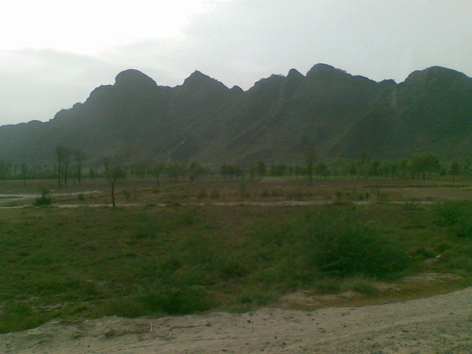
| caption | The summit of Kirana Hills. |
| image2 | |
| coordinates | |
| type | Radar and Weapons Complex |
| pushpin_map | Pakistan |
| pushpin_mapsize | 300 |
| code | |
| site_area | 100 sqmi |
| height | 1050 ft |
| length | 12 mi |
| ownership | Ministry of Defense |
| operator | National Defence Complex |
| (Main contractor) | |
| controlledby | |
| open_to_public | Yes |
| site_other_label | Defining authority |
| site_other | Geological Survey of Pakistan (GSP) |
| built | |
| builder | Pakistan Army Corps of Engineers |
| dates | 1981–95 |
| status | Active |
| fate | |
| current_commander | |
| past_commanders | |
| garrison | No. 4091 Squadron |
| occupants | |
| subcritical_tests | 24 under Kirana-I |
| other_tests_label | |
| remediation | 1995 |
| footnotes |
(Main contractor) The Kirana Hills Site is an extensive rocky mountain range and a reservation of the Ministry of Defense (MoD) and nuclear arsenal storage location of Pakistan army, located in the Sargodha District in Punjab, Pakistan.
Known locally as "Black Mountains" due to its brownish landscape, it is expanded between the township of Rabwah and the metropolitan city of Sargodha.
The highest peak of the Kirana Hills is measured at 1050 ft with average peaks at highest peak is about 600 ft.
Overview
Etymology
The Kirana Hills is a series of bedrock hills that were named after a small village that once resided before the villagers moved to the township of Rabwah (now Chanab Nagar) and the planned city of Sargodha.
Topography and geology
The Kirana Hills is an extensive rocky mountain range located in the Sargodha District, and about 80 mi in distance from the Salt Range. In 1913, British geologists conducted extensive investigations on the rock formations in the Kirana Hills, which are different from the rest of its parent mountains ranges; the rocks are noticeably black in formation.
The highest peak at the Kirana Hills is measured exactly at 1050 ft by the British surveyors from the level of the plain in 1913. The average height in the Kirana Hills are recorded at 600 ft by the Geological Survey of Pakistan (GSP) in their studies of hydrology reports in 1967. The Kirana Hills are expanded and scattered over an area of about 100 sqmi and about 12 mi in length.
According to the Pakistani scientific investigations, the rocks are mainly hardened shales and slates with minor amount of quartzites which contained with layers of hematite, thin bands of rhyolites, tuff and diabase.
In 1970s, the Geological Survey of Pakistan conducted a survey to find uranium ores and began the mining of uranium after its geologists confirmed the deposits of uranium ores at the Kirana Hills.
Climate and wildlife
The landform of the Kirana Hills is known to be a steppe with heavy grassland besides the Rocky Mountains. The Pakistan Meteorological Department reported its weather conditions to be extreme with the highest have been recorded to 50 C in the summer while the minimum temperature recorded is as low as freezing point 0 C in the winter.
Its environs are heavily infested with wild boars.
Venue
Radar and weapons complex
In 1970, the Ministry of Defense (MoD) acquired the Kirana Hills as a defense site for the Pakistan Air Force. The Pakistan Air Force established a radar station with the commissioning of the No. 4091 Squadron at the Kirana Hills, which is still in commission at the Kirana Hills. The Kirana Hills forms a larger part of the Mushaf Air Force Base in Sargodha, which falls into its area of command.
In 1978–79, the Pakistan Army Corps of Engineers acquired the range for the possible test sites and began its boring operations for the tunnels measuring 100 to in length, as a potential for nuclear test sites.{{Cite web | access-date =30 July 2011 | archive-date =13 May 2013 | archive-url =https://web.archive.org/web/20130513034301/http://observerindia.com/cms/sites/orfonline/modules/analysis/AnalysisDetail.html?cmaid=2237&mmacmaid=182 | url-status =dead
According to Pakistani admissions, there have been forty-six short tunnels that were bored, with Special Development Works (SDW) constructing the two horizontal and three vertical underground line of sight sites to withheld 24-40 ktTNT of energy blast from the nuclear weapons. At one of its tunnels the Chinese M-11 missiles were once housed before the United States Intelligence found out, and moved the missiles for further testings at an unknown locations by the Air Force.
Subcritical testing activities
The Kirana-I was the codename for the 24 subcritical physical experiments on nuclear weapon designs that took place under the leadership of the Pakistan Air Force with the Pakistan's national defense laboratories between 1983–95.
The first subcritical experiment on physics package was carried out on 11 March 1983 but the subcritical experiments are not true full-scale nuclear weapon testing.
The Pakistan Institution of Nuclear Science & Technology (Pinstech), Metallurgical Laboratories (ML), and the Khan Research Laboratories (KRL) conducted various investigations and studies on dynamical properties of materials, radiation effects, and secondary weapon assessments for the nuclear explosive devices at the Kirana base to validate the viability of the nuclear weapons before conducting nuclear testing.
The subcritical physics experiments proved crucial in understanding and preparing the physical package to evolved into a weapon pits to be delivered by the Pakistan Air Force's combat aircraft stationed at the Sargodha Air Force Base.
Boring and tunnel operations were carried out at night to avoid the American detection from its satellites fixated on the region. The army engineers also worked on relocating the wildlife, specifically the wild boars, to stay out of the weapon-testing tunnels before the diagnosticians housed the tunnels. The tunnels at the Kirana Hills are composed of multiple cables, line-of-sight screen boxes, oscillators, computers, and other diagnostics equipments were installed by the national laboratories' diagnostics teams.
First diagnostics test on a working nuclear weapon device was reportedly designed in vintage style, which had the push-button to create an electronic circuit. The push-button mechanism, however, was replaced with laser activation system after the error was discovered during the trigger testing.{{Cite encyclopedia | access-date =27 June 2015 }} The HMX and PBX explosives were prepared for number of subcritical experiments by the weapon-testing laboratories. This first subcritical physics experiment was carried out on 11 March 1983.
Merger with PAF Base Mushaf
Main article: PAF Base Mushaf
In 1995, the Pakistan Air Force took over the host responsibilities for the nation's military nuclear weapons program. With the Clinton administration continuously monitoring the region, the Ministry of Defense (MoD) moved the subcritical experiments to unknown location in Kala Chitta Range, which is in Khyber-Pakhtunkhwa. The Pakistani government released a tender for the remediation works at the Kirana Hills opened the parts of the site for public tourism in 1995.
The Pakistan Air Force Radar Station for monitoring the airspace of Pakistan is still active with its unit Sq-No. 4091.
In spite of its clean-up, the Kirana Base is still in commissioned as a principle nuclear installation site for the Pakistan Air Force, according to the Indian intelligence analysts.
Sources
References
Bibliography
References
- (22 November 2017). "Pakistan is protecting its nuclear missiles by building underground fortresses".
- {{harvnb. Mahajan. 2009
- {{harvnb. Ali. 2002
- {{harvnb. Smith. 2007
- {{harvnb. DoE&ES. 2012
- "Kirana Hills". Wikimaps.
- {{harvnb. DoE&ES. 2012
- (26 March 2021). "Ethnobiology of Mountain Communities in Asia". Springer Nature.
- (1918). "A Bibliography of Indian Geology". Office of the Geological Survey of India.
- "District of Sargodha".
- (1 May 2009). "Petrography and age of the rocks of Bulland Hill, Kirana Hills, Sarghoda District, West Pakistan". Geological Magazine.
- (2004). "Defence Journal". Ikram ul-Majeed Sehgal.
- {{harvnb. Verma. 2001
- {{harvnb. Futter. 2015
- {{harvnb. Khan. 2012
- {{harvnb. Khan. 2012
- (2008). "The gas centrifuge and nuclear weapons proliferation". Physics Today.
- (December 1979). "Radioactive survey of Kirana hills using solid state nuclear track detectors". Nuclear Tracks.
- {{harvnb. Khan. 2012
- (June 2000). "When Mountains Move". Defence Journal.
- "Pakistan Became a Nuclear State in 1983-Dr. Samar", The Nation, (Islamabad) May 2, 2003 accessed on August 6, 2009
- "Facebook-- An Air Force Radar over a kirana Hills in Sargodha.".
This article was imported from Wikipedia and is available under the Creative Commons Attribution-ShareAlike 4.0 License. Content has been adapted to SurfDoc format. Original contributors can be found on the article history page.
Ask Mako anything about Kirana Hills Site — get instant answers, deeper analysis, and related topics.
Research with MakoFree with your Surf account
Create a free account to save articles, ask Mako questions, and organize your research.
Sign up freeThis content may have been generated or modified by AI. CloudSurf Software LLC is not responsible for the accuracy, completeness, or reliability of AI-generated content. Always verify important information from primary sources.
Report