From Surf Wiki (app.surf) — the open knowledge base
Kingston, Tennessee
| Field | Value |
|---|---|
| name | Kingston, Tennessee |
| settlement_type | City |
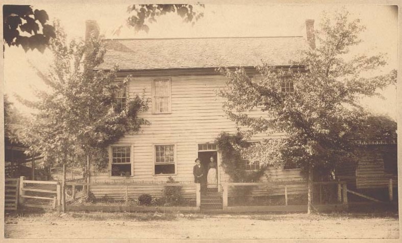
| image_skyline | Kingston-from-4th-tn1.jpg |
| imagesize | 250px |
| image_caption | Kingston |
| image_flag | Flag of Kingston, Tennessee.png |
| image_blank_emblem | Logo of Kingston, Tennessee.png |
| blank_emblem_type | Logo |
| image_map | File:Roane County Tennessee Incorporated and Unincorporated areas Kingston Highlighted 4739620.svg |
| mapsize | 250px |
| map_caption | Location of Kingston in Roane County, Tennessee. |
| subdivision_type | Country |
| subdivision_name | United States |
| subdivision_type1 | State |
| subdivision_name1 | Tennessee |
| subdivision_type2 | County |
| subdivision_name2 | Roane |
| established_title | Settled |
| established_date | 1792 |
| established_title2 | Incorporated |
| established_date2 | 1799 |
| named_for | Maj. Robert King, officer at Fort Southwest Point |
| unit_pref | Imperial |
| area_footnotes | |
| area_total_km2 | 21.18 |
| area_land_km2 | 18.88 |
| area_water_km2 | 2.30 |
| area_total_sq_mi | 8.18 |
| area_land_sq_mi | 7.29 |
| area_water_sq_mi | 0.89 |
| population_as_of | 2020 |
| population_footnotes | |
| population_total | 5953 |
| population_density_km2 | 315.31 |
| population_density_sq_mi | 816.60 |
| timezone | Eastern (EST) |
| utc_offset | -5 |
| timezone_DST | EDT |
| utc_offset_DST | -4 |
| elevation_footnotes | |
| elevation_ft | 764 |
| coordinates | |
| postal_code_type | ZIP code |
| postal_code | 37763 |
| area_code | 865 |
| blank_name | FIPS code |
| blank_info | 47-39620 |
| blank1_name | Feature ID = 1290257 |
| website |
Kingston is a city in and the county seat of Roane County, Tennessee, United States. This city is thirty-six miles southwest of Knoxville. It had a population of 5,934 at the 2010 United States census, and is included in the Harriman, Tennessee Micropolitan Statistical Area. Kingston is adjacent to Watts Bar Lake.
History
Kingston has its roots in Fort Southwest Point, which was built just south of present-day Kingston in 1792. At the time, Southwest Point was on the fringe of the legal settlement area for Euro-Americans. A Cherokee village, headed by Chief Tollunteeskee, was situated just across the river, at what is now Rockwood. In 1805, Colonel Return J. Meigs, who operated out of Southwest Point, was appointed Cherokee Agent, effectively moving the agency from the Tellico Blockhouse to Southwest Point. The city of Kingston was established on October 23, 1799, as part of an effort to partition Knox County (the initial effort to form a separate county failed, but succeeded two years later). Kingston was named after Major Robert King, an officer at Fort Southwest Point in the 1790s.
On September 21, 1807, Kingston was Tennessee's state capital for one day. The Tennessee General Assembly convened in Kingston that day due to an agreement with the Cherokee, who had been told that if the Cherokee Nation ceded the land that is now Roane County, Kingston would become the capital of Tennessee. After adjourning that day, the Assembly resumed meeting in Knoxville.
At the outset of the Civil War in 1861, Kingston was selected as the site of the third session of the East Tennessee Convention, which attempted to form a new, Union-aligned state in East Tennessee. Due to the Confederate occupation of the region, however, this third session, which was scheduled for August 1861, never took place. In October 1861, William B. Carter and several co-conspirators planned the East Tennessee bridge burnings from a command post in Kingston. On November 24, 1863, Confederate Cavalry under Joseph Wheeler numbering about 500–1,000 men tried to take Kingston from the Union in the Battle of Kingston, but they were unsuccessful.
In 1955, the Tennessee Valley Authority completed work on the Kingston Fossil Plant, which at the time was the world's largest coal-burning power plant. The plant, which consumes roughly 14000 ST of coal daily, can produce up to 1,456 megawatts of electricity. The plant's 1,000-foot (305 m) smokestacks are a familiar sight to those driving on the Roane County stretch of Interstate 40. On December 22, 2008, a 40 acre impoundment containing fly ash slurry from the power plant broke, spilling more than 1 e9USgal of waste into the surrounding area.
Geography

The town is situated at the confluence of the Clinch, Emory, and Tennessee rivers. These confluences are now part of Watts Bar Lake, a reservoir created by the impoundment of the Tennessee by Watts Bar Dam several miles to the southwest.
Kingston is located near the junction of U.S. Route 70, which connects Kingston with Knoxville to the east and Nashville to the west, and State Route 58, which connects Kingston with Oak Ridge to the northeast and Chattanooga to the south. Interstate 40 passes through Kingston, running roughly parallel to U.S. 70.
According to the United States Census Bureau, the city has a total area of 20.3 sqkm, of which 18.4 sqkm is land and 1.9 sqkm, or 9.56%, is water.
Climate
|Jan record high F = 74 |Feb record high F = 81 |Mar record high F = 86 |Apr record high F = 89 |May record high F = 94 |Jun record high F = 104 |Jul record high F = 106 |Aug record high F = 102 |Sep record high F = 99 |Oct record high F = 95 |Nov record high F = 84 |Dec record high F = 75
|Jan avg record high F = 65.6 |Feb avg record high F = 70.4 |Mar avg record high F = 79.1 |Apr avg record high F = 85.1 |May avg record high F = 89.1 |Jun avg record high F = 94.4 |Jul avg record high F = 95.4 |Aug avg record high F = 94.5 |Sep avg record high F = 92.0 |Oct avg record high F = 85.1 |Nov avg record high F = 74.1 |Dec avg record high F = 67.5 |year avg record high F = 96.9
|Jan avg record low F = 11.9 |Feb avg record low F = 17.4 |Mar avg record low F = 22.6 |Apr avg record low F = 31.9 |May avg record low F = 40.2 |Jun avg record low F = 54.6 |Jul avg record low F = 59.7 |Aug avg record low F = 59.5 |Sep avg record low F = 49.8 |Oct avg record low F = 33.9 |Nov avg record low F = 23.7 |Dec avg record low F = 19.5 |year avg record low F = 10.4
|Jan record low F = 0 |Feb record low F = 3 |Mar record low F = 15 |Apr record low F = 25 |May record low F = 32 |Jun record low F = 47 |Jul record low F = 54 |Aug record low F = 53 |Sep record low F = 40 |Oct record low F = 29 |Nov record low F = 16 |Dec record low F = 3
|access-date = May 22, 2023 |access-date = May 22, 2023
Demographics
2020 census
| Race | Number | Percentage | White (non-Hispanic) | Black or African American (non-Hispanic) | Native American | Asian | Pacific Islander | Other/Mixed | Hispanic or Latino |
|---|---|---|---|---|---|---|---|---|---|
| 5,309 | 89.18% | ||||||||
| 203 | 3.41% | ||||||||
| 9 | 0.15% | ||||||||
| 56 | 0.94% | ||||||||
| 2 | 0.03% | ||||||||
| 242 | 4.07% | ||||||||
| 132 | 2.22% |
As of the 2020 United States census, there were 5,953 people, 2,225 households, and 1,335 families residing in the city.
2000 census
As of the census of 2000, there were 5,264 people, 2,263 households, and 1,532 families residing in the city. The population density was 803.7 PD/sqmi. There were 2,478 housing units at an average density of 378.4 /sqmi. The racial makeup of the city was 93.75% White, 3.55% African American, 0.23% Native American, 0.49% Asian, 0.06% Pacific Islander, 0.23% from other races, and 1.69% from two or more races. Hispanic or Latino of any race were 0.97% of the population.

There were 2,263 households, out of which 26.0% had children under the age of 18 living with them, 54.3% were married couples living together, 10.8% had a female householder with no husband present, and 32.3% were non-families. 29.6% of all households were made up of individuals, and 14.8% had someone living alone who was 65 years of age or older. The average household size was 2.25 and the average family size was 2.77.
In the city, the population was spread out, with 20.5% under the age of 18, 8.2% from 18 to 24, 26.0% from 25 to 44, 24.8% from 45 to 64, and 20.4% who were 65 years of age or older. The median age was 42 years. For every 100 females there were 88.8 males. For every 100 females age 18 and over, there were 87.0 males.
The median income for a household in the city was $34,071, and the median income for a family was $44,979. Males had a median income of $40,186 versus $22,971 for females. The per capita income for the city was $20,301. About 6.0% of families and 10.0% of the population were below the poverty line, including 16.6% of those under age 18 and 8.9% of those age 65 or over.
Newspapers
Roane County News
Notable people
- Robert K. Byrd (1823–1885), Union Army colonel and state senator
- George Lewis Gillespie, Jr. (1841–1913), U.S. Army general and Medal of Honor recipient
- Jennie Jackson (1852–1910), one of the original Fisk Jubilee Singers
- Martin W. Littleton (1872–1934), U.S. congressman and attorney, known for defending Harry Thaw at his murder trial
- Sam Rayburn (1882–1961), U.S. congressman and Speaker of the House
- Bowden Wyatt (1917–1969), University of Tennessee football coach
- Wil Crowe Professional baseball player for the Pittsburgh Pirates
References
References
- ''[http://www.state.tn.us/sos/bluebook/05-06/48-data.pdf Tennessee Blue Book]'', 2005-2006, pp. 618-625.
- "ArcGIS REST Services Directory". United States Census Bureau.
- "U.S. Census website". [[United States Census Bureau]].
- {{GNIS. 1290257
- "Find a County". National Association of Counties.
- "Geographic Identifiers: 2010 Demographic Profile Data (G001): Kingston city, Tennessee". U.S. Census Bureau, American Factfinder.
- Snyder Roberts, "[http://www.roanetn.com/rnhist.htm Thumbnail Sketch of Early Roane County History] {{webarchive. link. (2008-05-09 ," 1969. Transcribed for web content by Pat Roberts McDonald, 2007. Retrieved: January 2, 2008.)
- Samuel Cole Williams, ''Early Travels in the Tennessee Country, 1540–1800'' (Johnson City, Tenn.: The Watauga Press, 1928), 500.
- Roane County Heritage Commission, "[http://www.roanealliance.org/community/community_history.html History of Roane County] {{webarchive. link. (2005-12-15 ," 1997. Retrieved: January 2, 2008.)
- Oliver Perry Temple, "[https://books.google.com/books?id=g8xYAAAAMAAJ&dq=east+tennessee+civil+war+%22knoxville-greeneville+convention%22&pg=PA340 The Knoxville-Greeneville Convention of 1861]," ''East Tennessee and the Civil War'' (R. Clarke Company, 1899), p. 351.
- David Madden, "Unionist Resistance to Confederate Occupation: The Bridge Burners of East Tennessee," East Tennessee Historical Society ''Publications'', Vols. 52-53 (1980–1981), pp. 22-40.
- "The Civil War In Roane County".
- "[http://www.tva.gov/sites/kingston.htm TVA: Kingston Fossil Plant]." Retrieved: January 2, 2008.
- ''Harriman, TN'' and ''Bacon Gap, TN,'' 7.5 Minute Topographic Quadrangles, USGS, 2001 & 1981 revisions
- ''Tennessee Atlas & Gazetteer,'' DeLorme, 10th ed. 2014, p.39 {{ISBN. 0899333486
- "Census of Population and Housing: Decennial Censuses". [[United States Census Bureau]].
- "Incorporated Places and Minor Civil Divisions Datasets: Subcounty Resident Population Estimates: April 1, 2010 to July 1, 2012". U.S. Census Bureau.
- "Census Population API". United States Census Bureau.
- "Explore Census Data".
This article was imported from Wikipedia and is available under the Creative Commons Attribution-ShareAlike 4.0 License. Content has been adapted to SurfDoc format. Original contributors can be found on the article history page.
Ask Mako anything about Kingston, Tennessee — get instant answers, deeper analysis, and related topics.
Research with MakoFree with your Surf account
Create a free account to save articles, ask Mako questions, and organize your research.
Sign up freeThis content may have been generated or modified by AI. CloudSurf Software LLC is not responsible for the accuracy, completeness, or reliability of AI-generated content. Always verify important information from primary sources.
Report